Dr. Matt Nolan
455
Duckering Bldg.
Water
and Environmental Research Center
Institute of Northern Engineering
University of Alaska Fairbanks
matt.nolan@uaf.edu
|
|
Dr. Matt Nolan 455
Duckering Bldg. |
|
|
Our
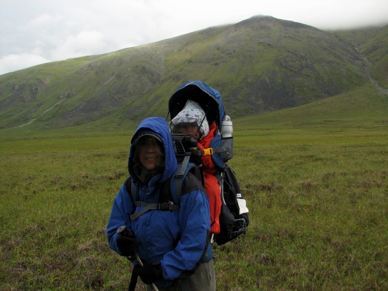
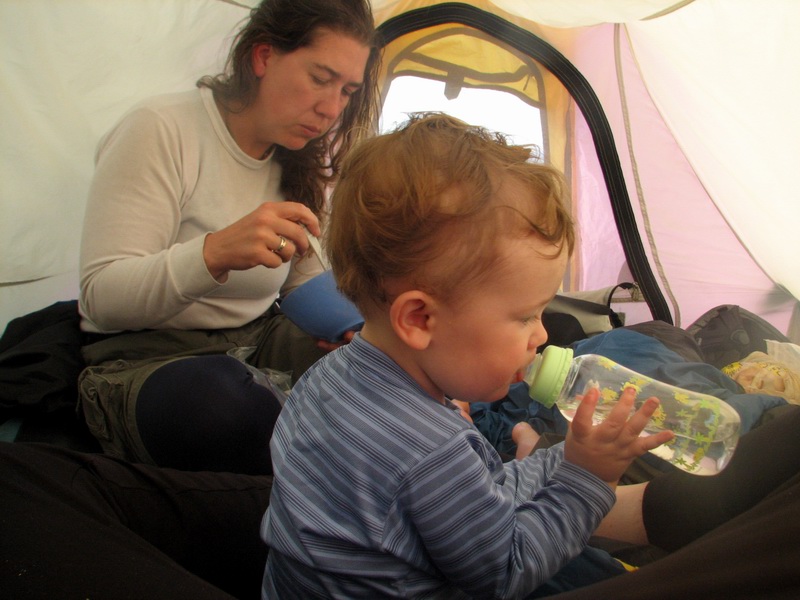
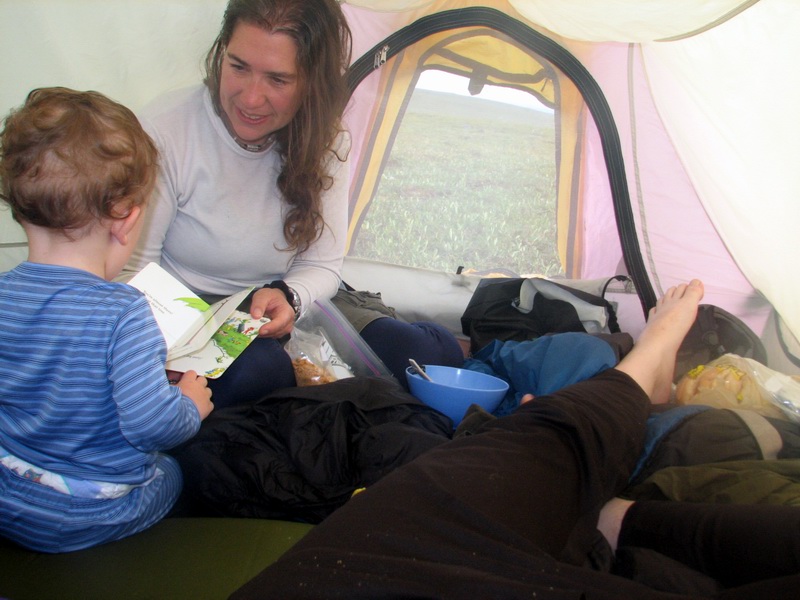
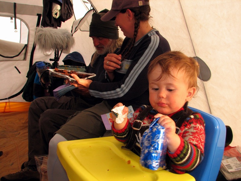
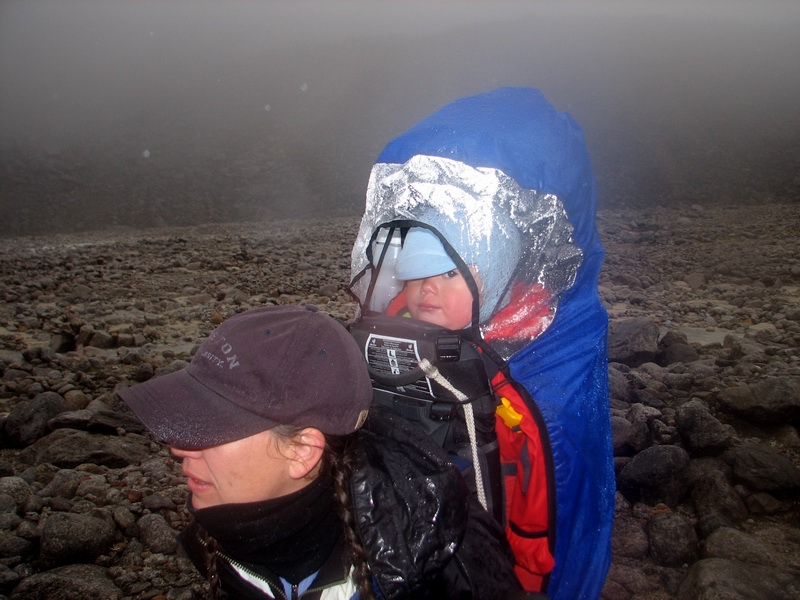
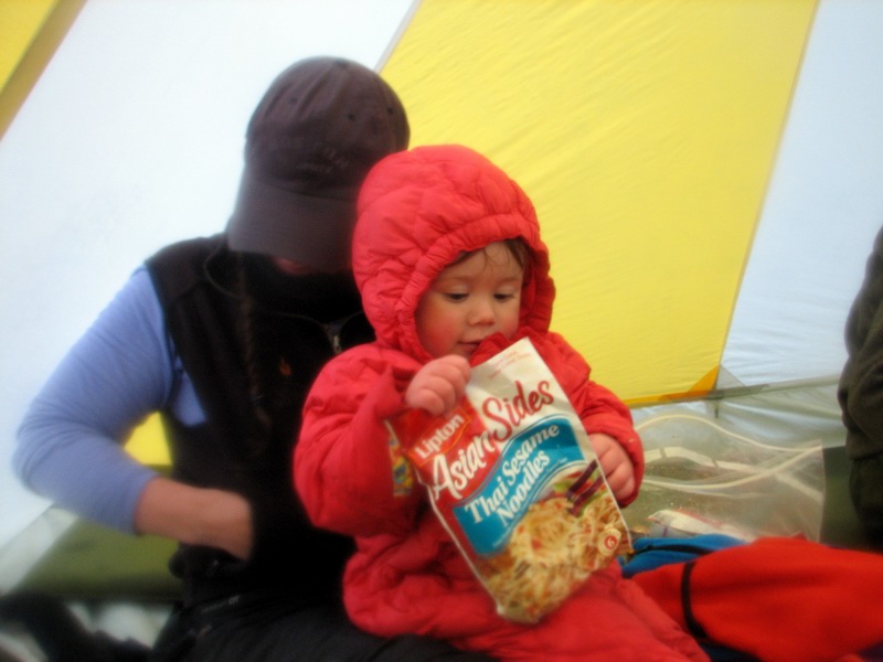
experiences with bringing an infant along for remote field work Over a two-week period, my wife Kristin, our son Turner, our friend Bernhard and I hiked from Okpilak Lake up to McCall Glacier and out to the Jago River, all located in the Arctic National Wildlife Refuge in northeastern Alaska. The purpose of the trip was to conduct some glaciological field work on the glacier as part of a project ongoing now for 50 years. The trip to the glacier took the better part of three days and two nights, the field work on the glacier lasted about 10 days, and the hike out to the river and subsequent camping lasted four days and three nights. The distances covered were about 75 km, and our average rate of speed while hiking was about 1.5 km/hour. Turner turned one year old on the trip. The complete story of the trip as it relates to taking an infant into the remote field can be found below, following a discussion on risks, benefits and gear (since we often get asked those questions). Risk/benefit analysis Kristin and I had been studying this glacier for 3 years already when we had Turner, and it seemed completely natural to us to bring him along with us after he was born. Having been born in August, he had already been to the glacier in utero in May, and we spent much of his early life testing gear with him in the cold, dark Fairbanks winters after he was born. It often took us by surprise how many sane people we knew thought that we were totally insane for planning this trip, but we still never fully saw their point of view. What seemed insane to us were the risks associated with living in a city -- things like drunk drivers, pedafiles, infectious disease or epidemics, terrorists, etc -- as the wilderness seemed so much easier to predict and plan for what could go wrong. So from our perspective, the risks actually decreased in the field and the only major obstacle was access to professional health care in an emergency. Here our thinking was that one could easily get carried away by such fears -- how close is close enough to such health care? Should we move next the hospital and never leave the house except to go there? Should we stop living our lives for fear we might die? Our thinking was that age was not the primary determinant of who should go into the field but temperament, experience, and personality, and we felt that Turner was ready for the obstacles he would face, else we would not have brought him. Our funding agency for the field work thought differently, however, which is why we hiked in using fixed wing support with independent funding. The benefits of taking Turner with us far outweighed our concerns. Kristin and I share a fondness for remote places and for this glacier in particular, and we want to continue to share this experience with each other and with Turner. For Turner, it's an opportunity to spend time with his family in a new environment and trips like this will give him something to look back on for the rest of his life as testaments to what he is capable of. In the broader sense, bringing our children with us lets other children know that glaciers and other remote places are accessible to children and are not evil and scary just because they are far away. Children eventually grow up into adults and take such predjudices with them, and this may be one reason why glacier research is so poorly funded and environmental protection is so weak in politics. For our hike in August, we had several concerns: mosquitos, hypothermia, bears, river crossings, burns, and colds/infections. The mosquito and hypothermia risks were largely solved through adequate gear, as described in the gear section below. We also brought 3 twelve hour chemical heat packs, which could be activated and placed into his clothes, but we never used them. The bear issue is not unique to having a child (though we did wonder how much different a teething Turner sounded from a wounded baby caribou) and we packed bear spray in liquid and lead forms. We did end up cooking and eating in the tent more often than we would have liked, but there is no practical way to avoid this and having a baby along may actually be a benefit, as any food smells were likely overridden by dirty diaper smells. River crossings we simply tried to avoid as much as possible. Our reason for landing initially at Okpilak Lake, even though it was much further away, was because we could not find a landing strip on the good side of the Jago River. In case we did have to cross a major river, we brought an Alpaca packraft, paddle, two life jackets, and a climbing rope, thinking that we could use the rope to set up a ferry system. Our other major river-safety feature was having three adults, as there would always be two adults free to assist the child/adult team, such as by having one on each side of the river, or one on the river bank and the other assisting in a foot crossing. As it turned out, our only river crossings were foot crossings, and none more than knee deep (which were still a bit of a challenge). Given that we were cooking on lightweight stoves inside of tents, we considered burns to be a realistic risk. Our doctor prescribed several goos to be used in this case, and we read up on treatments. Similarly, we had some concern that Turner could pick up a bug before entering the field. Our doctor also prescribed several different antibiotics and he already had flu shots. Here we also planned some sick-days, so that we had enough time for him to recover before hiking, though we figured that the more quickly we could get him out of civilization, the more quickly the chances of him catching something would drop to zero. We were also prepared to not take him, in case he developed something that seemed like it might worsen. We also brought liquid forms of advil and tylenol, which seemed to help quite a bit with teething, as four new molars popped through Turner's gums on this trip. Of course two of our most important pieces of safety gear were the satellite phone and air-to-ground aircraft radio. With this redundant system, we were able to contact the outside world in case of emergency at any time, and with GPS give our exact positions. We had no qualms about calling for help if it was needed. Baby gear The key aspect of gear selection and use is having it well tested on your child before going into the field. We made numerous shake-down trips in our neighborhood and 50 acre backyard to choose the best gear for Turner and get us all used to using it. This is especially necessary for the backpack, which needs to be comfortable for both wearer and rider, and hats and sunglasses, which are easily pulled off unless they become second nature to wear. The gear we used is of course not right for every child, but here is what we used with some comments on how well it worked. Backpack. A good baby backpack is essential to a successful and pleasant hiking trip. It should be comfortable for both the adult and the child, and preferably adjustable to be worn by different adults. Most important though is that the child can easily fall asleep in it and when awake be comfortable, as there are times in backcountry hiking when you can easily twist an ankle or worse without having a cranky 35 pounds on your back. We used the Deuter Kid Comfort III backpack for our trip and liked it, though it could be improved. We tried out several in various stores before purchasing this one. Our decision was based largely on how we thought Turner fit into it, how much extra gear space there was, what type of weather protection it offered, and how easy it was to take him in and out of it. Some models were an instant turn-off, with pieces that poked him in the face in the store or ones with pieces that could easily fall and get lost. The Deuter seemed to fit him well, offered good built-in weather protection, had a rain-fly that offered very good protection, and had adequate storage space, though the rain fly could be a bit more generous with fabric and the gear storage areas could be combined to provide even more cargo space. Our biggest turn-off was the hip-belt tightening system, which requires two hands for any adjustments. We also have the Deuter Kanga-Kid which we used when he was smaller and still use as a diaper bag; we took him downhill skiing in it many times, and it probably has more cargo space than the external frame pack, but it has no rain protection system. While there are a variety of packs out there, we didnt find any that were truly designed for a week of wilderness backpacking, so there is clearly room for improvement here. Clothing. We knew the weather on this trip could range from hot and sunny, to freezing rain, to bitter cold and snow, so we tried to plan accordingly. Kristin and I brought only the clothes on our backs to save weight, but we brought a variety of gear for Turner. Diaper blowouts, snow/rain, and river crossings were the situations we planned for in terms of spare clothes. We dressed him like we dress ourselves, in layers of long underwear, fleece and waterproof shells. The advantage here is that you can adjust easily for temperatures, for example by putting the shell over the long underwear without the fleece if it's warm and rainy. For the hike, from Patagonia, we brought two sets of long underwear and warm booties. From Mountain Sprouts, we brought two fleece body suits and a waterproof full-body shell, and a waterproof bib and jacket shell (the shells are no longer listed on their web site). From MoleHill, we used waterproof insulated overbooties to go over his Tevas or Patagonia booties. For gloves, we typically just used the hand flaps on the fleece and shells, but we brought dog booties too, as these go over the whole hand easily but have a velcro strap to keep them in place. We brought two pair of sunglasses from Julbo and a upper body bug suit from Gilley Gear, made by the wife of the guy that runs Overlander Sports in Yellowknife, who you have to call personally to order (be sure to ask what fabric she is using currently, ours came with "Batman" all over it). For headgear, we used a Patagonia fleece hat with under-chin velcro, a fleece hat with fleece face flap that velcros across, a thin balaclava, a mosquito repellent sun hat ("Buzz Off") from Ex Officio, and a gilligan's island sun hat to which we added an under-chin cinch strap. One issue to consider when choosing hats is how they will hold up to him sleeping or thowing his head back in the backpack and getting knocked off his head. For sleeping, we used a down body suit with hood and hand/feet flaps which we got second hand; it was large enough to go over the fleece if it was really cold, but we never needed to. Most of this clothing was carried in his backpack, but some was kept in another backpack in case of a wet river crossing. The combination of the orange gortex body suit over the fleece body suit proved to be sufficient for nearly any weather, except when it was hot, in which case the bug suit and fleece worked well. The bug suit was nice because he could not pull the netting off of his head, yet it could be unzipped for eating, and it did not seem to bother him much. He did get a few bites through the mesh where it was close to his skin. We did not use bug spray on him, though this likely would have helped a bit. The Teva/overbootie combination worked well. Tevas are easy to get his feet into, and the booties are easy to get over those. When it was raining hard, we sometimes put his feet into ziplocks as well. We did not need to use the dog booties much for his hands, as both the fleece and rain suits had hand flaps which were more convenient. We saved the down suit mostly for sleeping, as he does not like to have covers on him, and this suit allows him to roll around still stay warm. On the glacier camp, we also had some onzies, sweat pants, fleece tops, and a Mountain Sprouts bib and jacket as further backup and camp clothing. Total baby clothing weight was probably less than 10 pounds. Chariot. On the glacier we often used the Chariot Cougar 2. We bought a two-child model, since they were not much more expensive but could also carry a lot more gear besides a child. They are well-built and versatile, with the ability to quickly change from wheels to skiis. We did not bring the skiis with us this trip, but probably should have. For trekking, the front wheel detaches (we left it at home) and is replaced by two poles which extend to a hip belt around the adult, who then drags the unit like a rickshaw. We added and always used a safety strap to prevent a runaway child, a real fear on a smoothly sloping glacier with surface streams and crevasses. A great feature of the system is the rain shield, which must be purchased separately. Unlike the useless rain flap that comes with it, this one completely covers the opening and cinches down over the edge of the unit to prevent dripping. It can survive strong winds, and keep the rider warm and dry; it also effectively locks him into it while we are working on something else, such that we can let him out of the harness to climb around inside without fear of him escaping. We created our own sun shield which could completely block strong incoming sun and roll up from the bottom, as the one provided was again pretty useless. We left the rear handle bar attached while on the glacier, as it was useful in stream crossing to have a second person assisting. One of the unfortunate design flaws of the Chariot is the almost useless rear storage compartment, with a little more thought this could be much more functional and perhaps have a detachable cargo bag hung off of it for long trips like ours. But like the backpacks, I dont think the designers really thought anyone would take one of these for two weeks in the wilderness. Diapers. Planning for diapers involves understanding two things before the trip: how many diapers do you need in a day and which diapers fit best. We did not have a single diaper blow out on the entire trip, largely because we had already found a diaper that fit him well beforehand. We also had a good idea of how many diapers and wipes were needed in a day. We packed our diapers in several different ziplocks and distributed these amongst backpacks, just in case. Similarly, wipes were placed in ziplocks. An unusual backpacking item is dirty diapers, so some planning must occur on how and where to store these. Tents, stoves, misc. We brought two tents along, though we could all have crammed into one if needed. This allowed us a little more elbow room, as Turner can be restless at night. When it was nice outside, we ate outside, but otherwise cooked in the megamid when it was raining or snowing. We brought a water filter which we used for Turner's water, but the rest of drank directly from the streams. The filter was in the shape of a bicycle water bottle, and easily fit in the mesh pockets on the exterior of his backpack. Food. We brought mostly standard camping food, with an extra abundance of powdered milk for Turner's bottle. Cheerios were the breakfast food of choice, with plenty of granola and candy bars for snacking. For dinner he largely ate what we did.
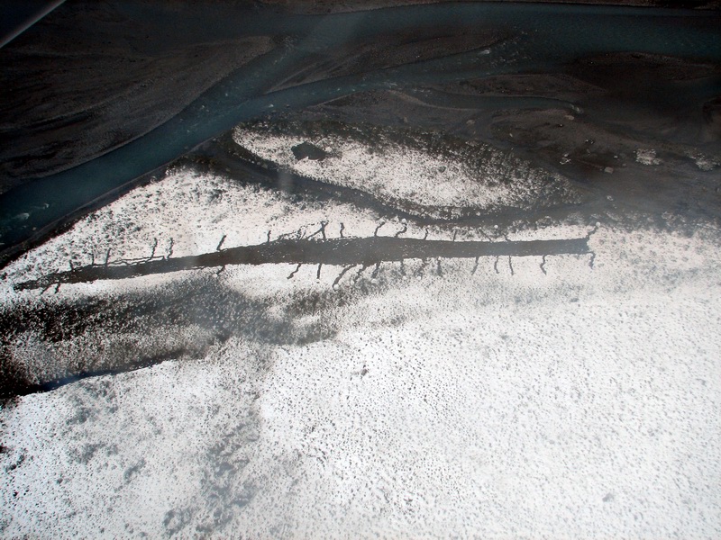
Trip Travelogue Note: This travelogue is excerpted from my personal notes on the entire trip, and I've edited out much of the content on the glacier research and details unrelated to Turner. I've also added in some images taken from the air at other times and some images from my EarthSLOT Virtual Globe to help describe the route better.
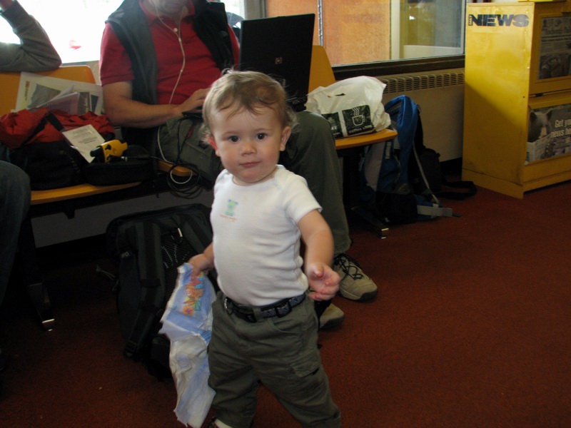
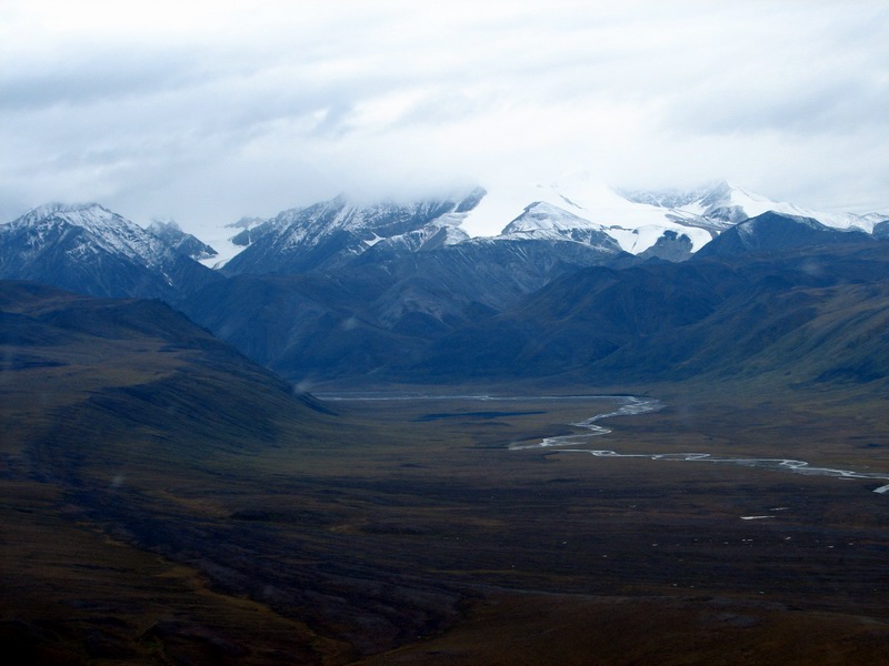
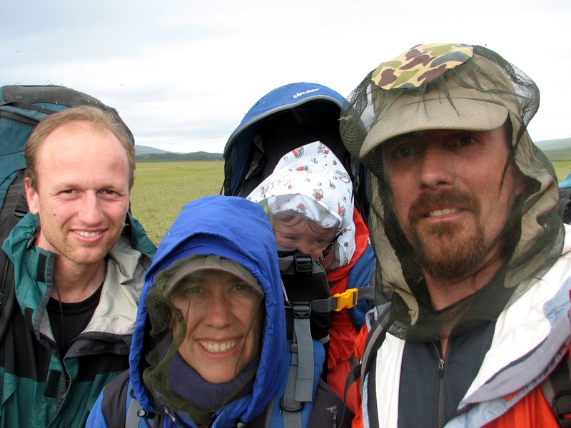
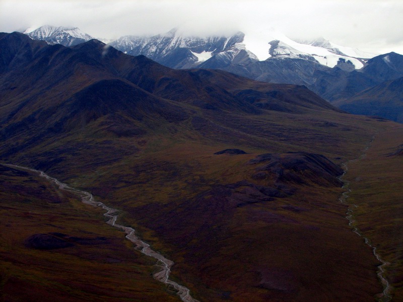
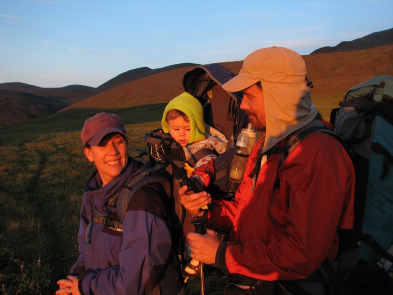
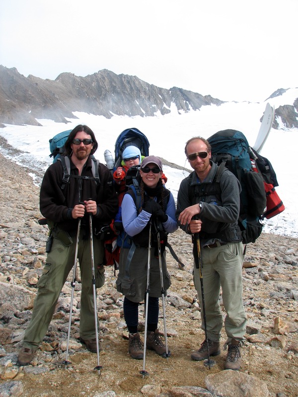
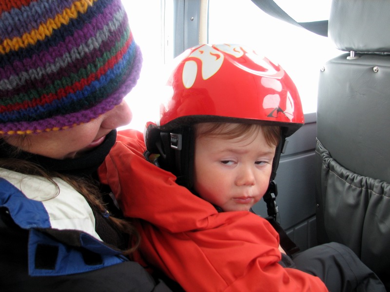
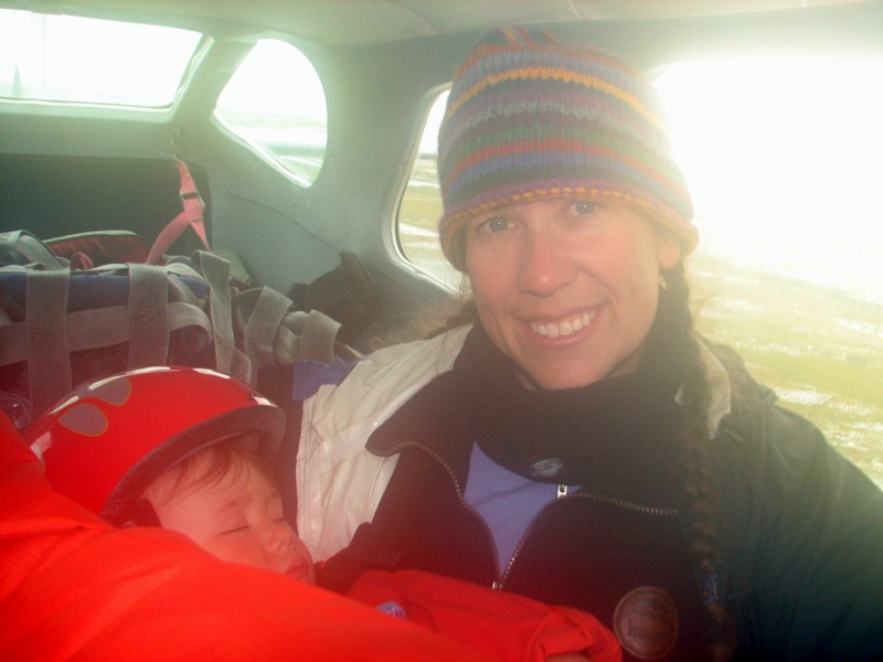
Chapter One: The hike to the glacier We left Fairbanks on Thursday 3 August 2006 and flew to Kaktovik on a 19 passenger Beech 1900 run by Frontier Flying. Kaktovik is a village of 300 people which sits on a barrier island on the coast of the Arctic Ocean. We arrived in beautiful weather, though fog is quite typical here. In all, seven of us including Turner arrived, with four intending to hike in and the other three intended to travel by helicopter directly to the glacier.
Baby's got places to go... 17MB
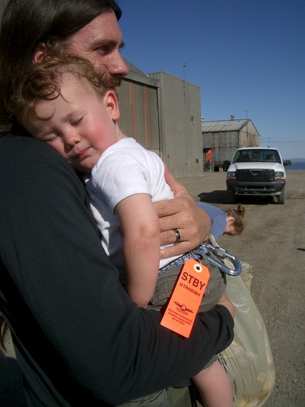
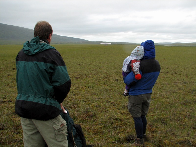
Once in Kaktovik, we met up with the local pilots, Walt and Tom. Throughout the summer we had been talking with them about them landing us on the tundra somewhere near the glacier. The main issue with this is that the most convenient airstrip is on the wrong side of the Jago River, requiring a major river crossing. So we brought a pack-raft with us in case we could not find a landing spot on the good side of the river, which was a good thing as no such place was found. But the recent rains made the option of a river crossing by foot or raft less palatable due to risks involved with falling into a cold, swollen river. So we made a command decision to land at Okpilak Lake, which was a much longer hike but involved no major river crossings, or at least so we thought. So we spent the morning organizing our gear for the hike, organizing helicopter loads for those flying directly to the glacier, and wondering how this would all work out in the end. By lunch time it seemed clear that the weather had broken enough to at least give it a try, so four of us loaded up in the Tom’s Cessna 206 and headed south.
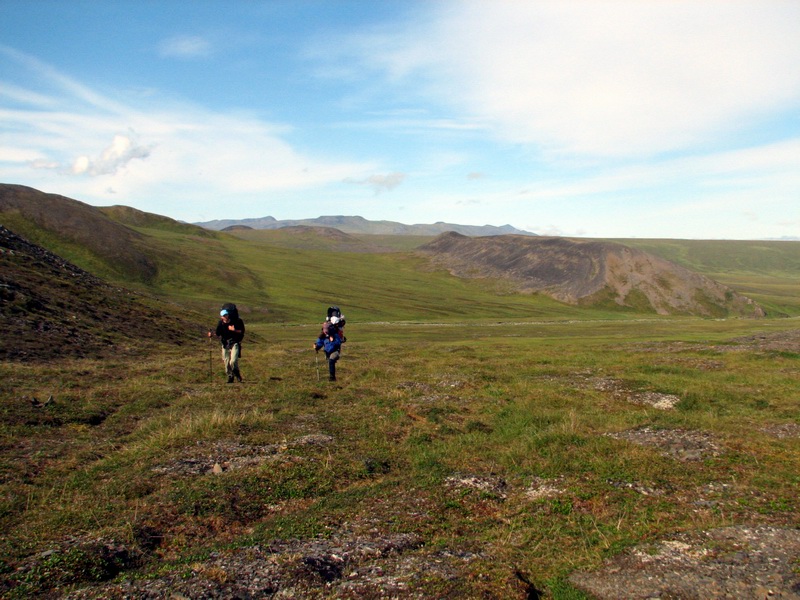
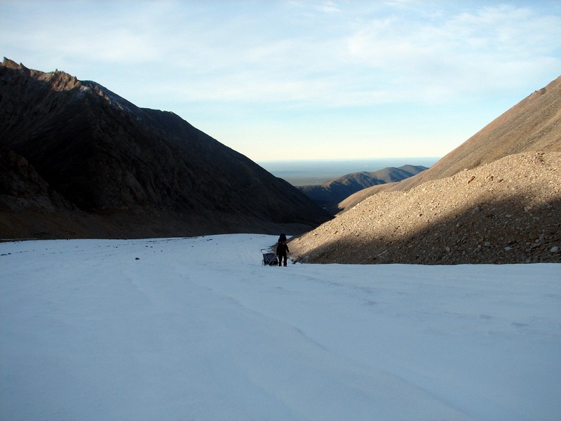
The flight was uneventful, and we soon landed on the open tundra near Okpilak Lake. Tom was not happy about how wet the tundra was and told us that he could not pick us back up here unless conditions improved substantially. As we watched him fly off, we donned our headnets and backpacks and began our 40 km hike to the glacier.
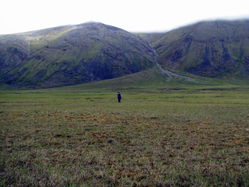
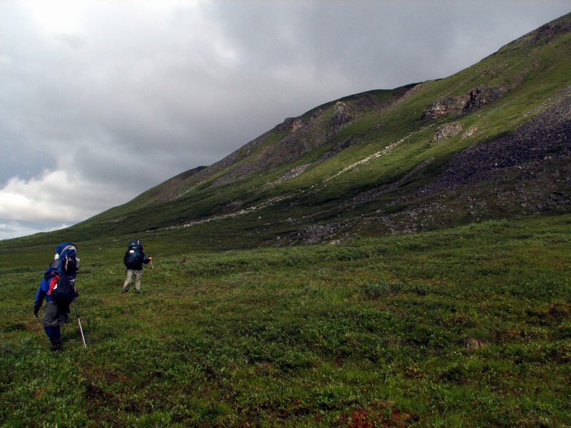
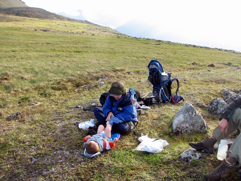
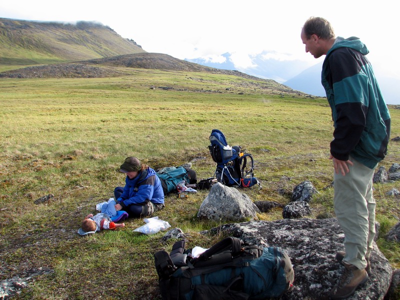
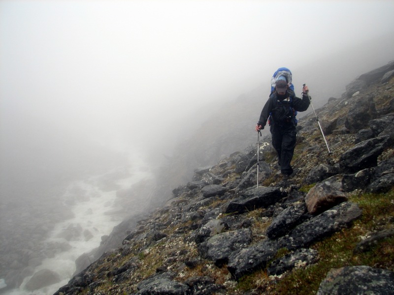
The first obstacle was to hike up and over the old moraine of the Okpilak Valley. This moraine had not seen ice for more than 10,000 years, and so had plenty of time to build a soil and grow some vegetation. The issue here is that trying to climb a fairly steep hill composed of angular rocks covered with wet moss and willows is a decent challenge even without a baby on your back. But we took our time and within a few hours had reached the top and took a nice break for snacks and a diaper change.
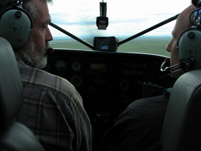
As we crested the top, we heard the helicopter flying around somewhere. Before Tom took off, I told him to tell Cal the helicopter pilot to give it a try as we had little lose at this point and the weather was showing some signs of clearing. This turned out to be a good decision, as the weather in foothills was fantastic, with clear skies all the way to the coast. I spoke to Cal on the Icom and he was already on his way back from the second trip. He was a little nervous about the fog growing again on the coast, but now had local weather reports on our end, which made the decisions more informed.
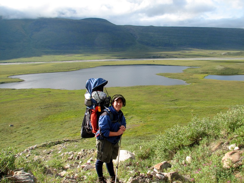
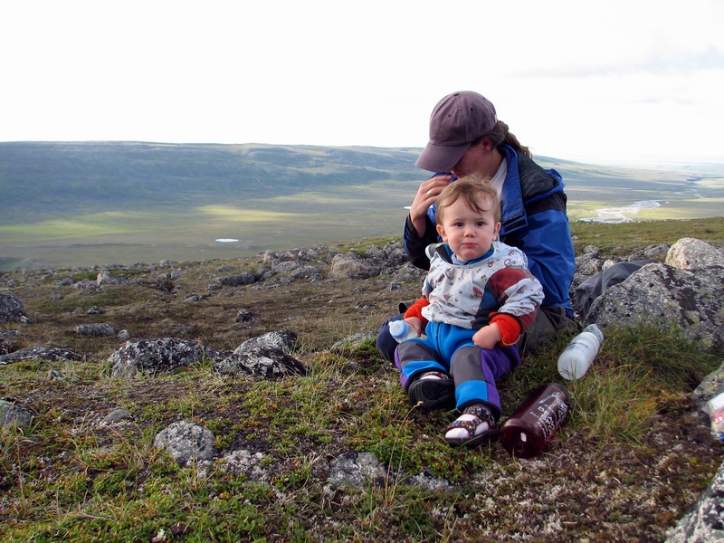
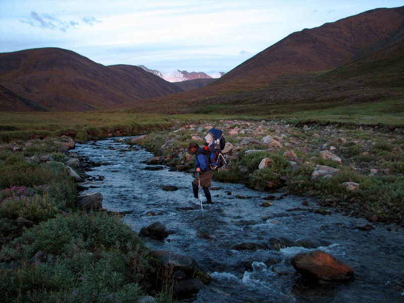
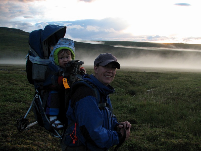
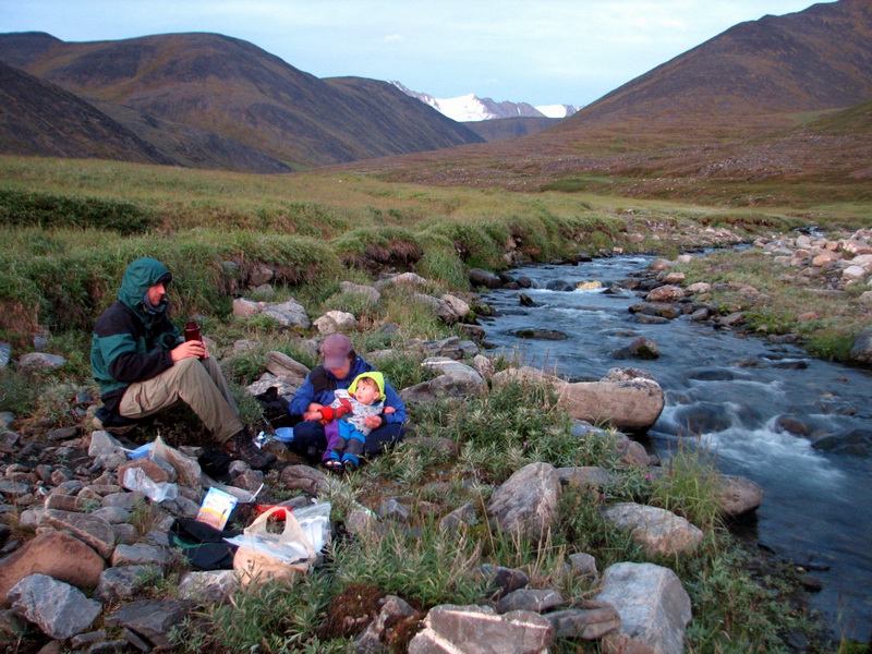
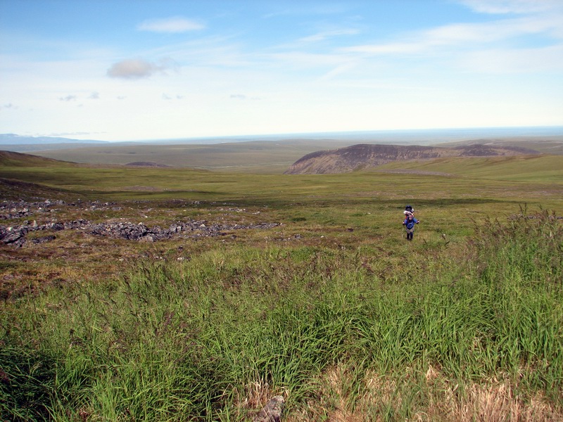
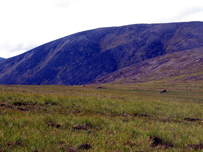
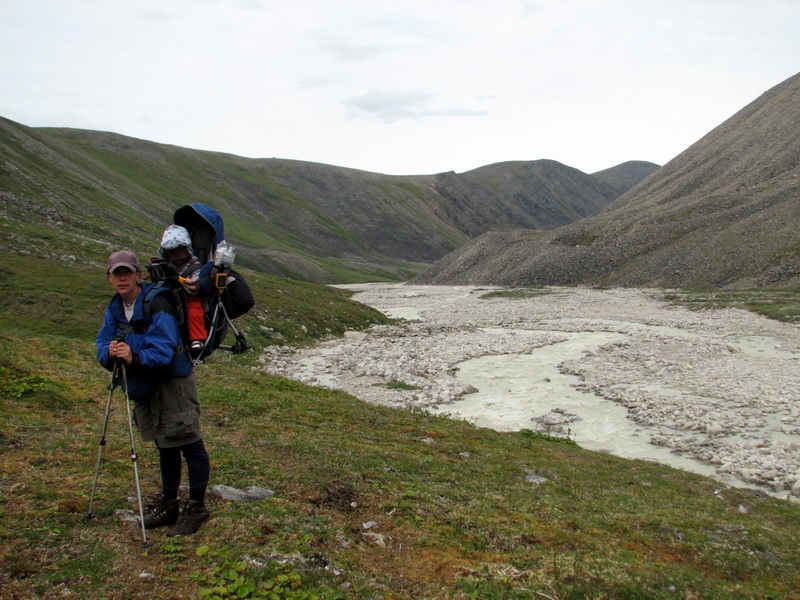
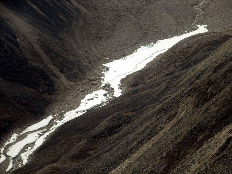
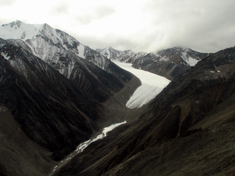
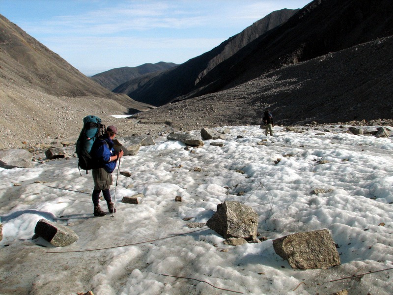
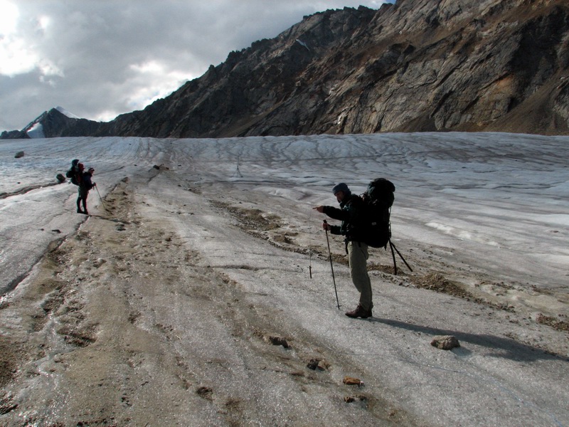
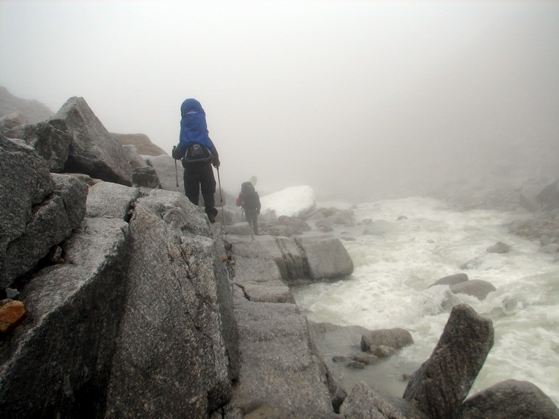
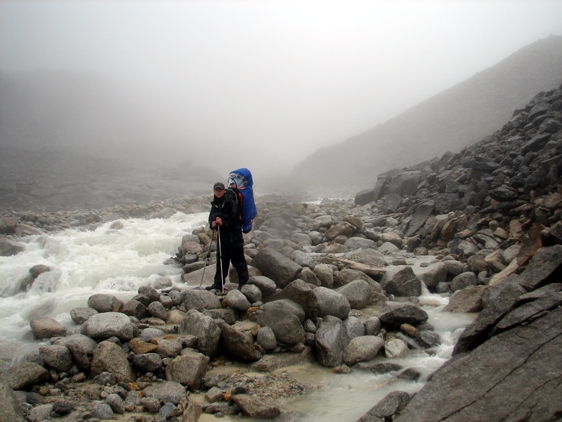
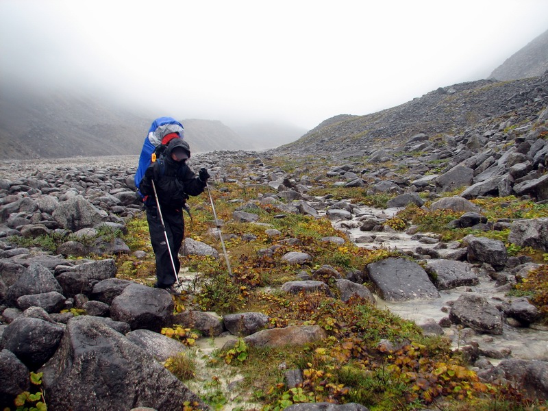
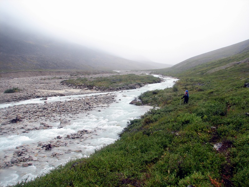
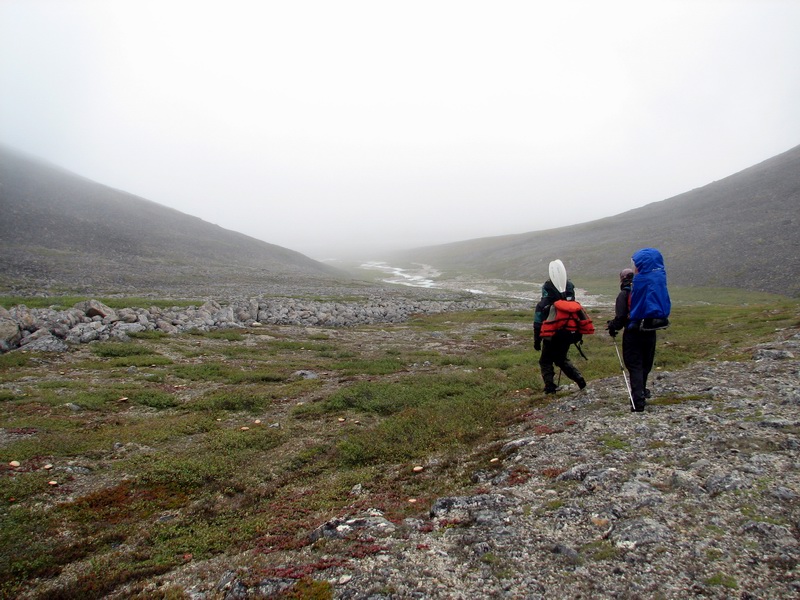
The tundra was pleasant to hike on, and substantially easier than the moraine. We saw caribou and falcons, as well as many smaller birds and lots of mosquitos. There was plenty of water available, so we didn’t have to pack much of it. We filtered some for Turner and mixed in some powdered milk for his bottle, but the rest of us just drank it straight from the streams. We continued on for several more hours, hoping to camp in view of the glacier on Jaeger Pass, but by 9PM we were all getting tired and hungry and in search of a camping spot. As we descended the Krisscott valley, however, we noticed a sizeable stream in our way, and decided to cross it that night so that we could start the next day with dry feet. It was swift enough that it was a true river crossing, taking just one careful step at a time, but it was not too deep and even in the event of a spill we would not get washed down very far. Fortunately, however, we were lucky and proceeded on as the fog rolled in and enveloped us. The fog didn’t last for long, and soon we came across a nice dry spot near a pretty stream that was in sight of the glacier-covered headwalls draining into McCall Valley. So in the end we got to camp in view of glaciers and the Arctic Ocean, which in retrospect is probably one of few places in Alaska where one can do this.
Spirits were high along the whole trip. Turner did great, and alternated largely between sleeping and make cute baby noises as he pointed out all the interesting things along the way. His patience was matched only by Bernhard’s, who was traveling at about half his normal speed without the slightest complaint. By the time we set up camp it was midnight, with dinner taking an hour more. Turner showed no sign of knowing the time, and was more interested in picking up the rocks and making mosquito noises than sleeping. As we ate our meal, we saw Cal return to Kaktovik after transporting all the people and gear to the glacier. So in the end, it was a long two days, but finally we were all deployed and on our own, a situation I feel much more in control of.
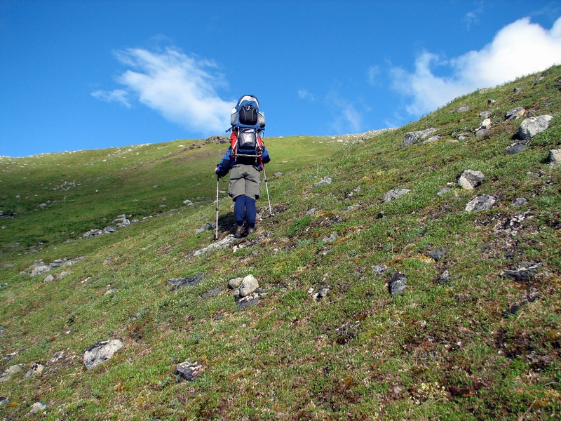
The next day proved to be even more challenging than the first. Getting to Jaeger Pass was still a four hour hike for us, and the route down from the pass was perhaps the low point of the trip. Here was another steep, willow and moss covered moraine, covered with hidden sic-sic holes. Kristin was having trouble keeping her footing, as the stress associated with the fear of falling and crushing Turner led her to take very careful steps, which adds greatly to the difficulty and energy required. Combined with having a cold in the first place, it was turning this 500 m descent into an epic challenge, physically and emotionally.
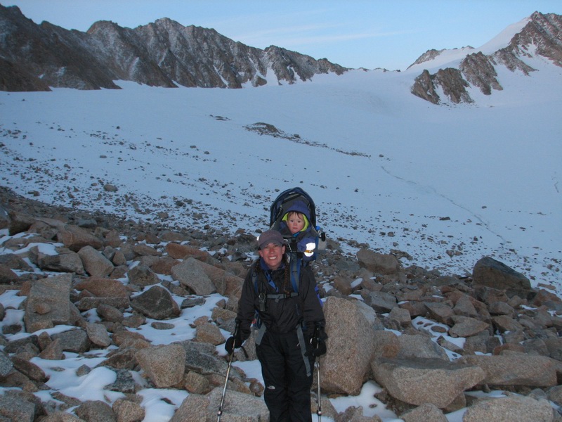
It's all uphill from here -- 12MB Once on the valley floor, we had to skirt the river on the rocks it had left behind. This was substantially easier walking, but still a challenge. As the river began pressing into the bank, we had to scramble back up on the ancient moraines. This time they were not covered with willows, but they also had no soil on them and so were just a jumble of fairly loose, large, angular lichen-covered rocks. So our travel time did not improve. At this point Kristin and I switched backpacks, as the stress of plotting each step for 8 hours was a bit too much, and there was no possibility of erecting a tent anywhere in sight, except perhaps on the huge aufeis deposits that covered the rushing McCall Creek. I was probably a bit rougher with Turner than was Kristin, but he largely slept through it all, with only the occasional moan as I hunched over forward to scramble over something and put his body weight on his chest. After a few hours of this, I was even more glad Kristin had carried him most of the way.
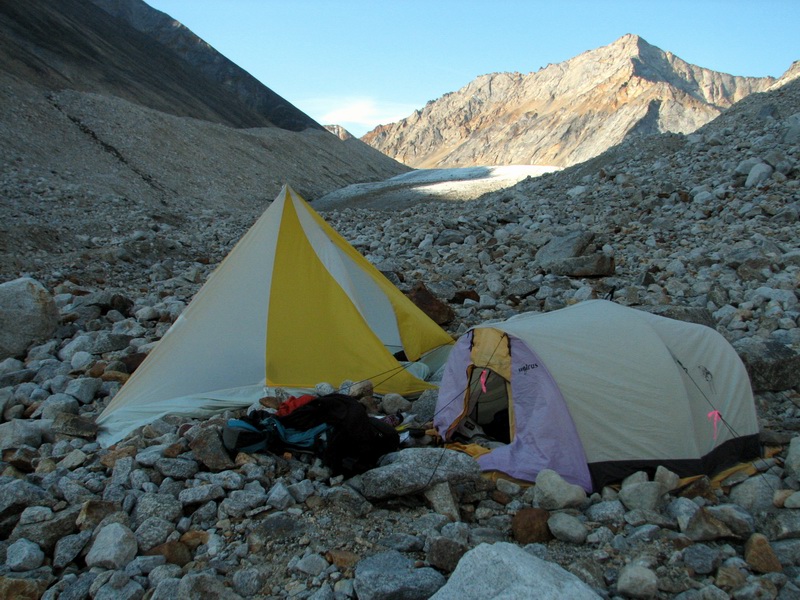
But after another few hours of this, it became clear that we needed to camp and give Turner a break. He had been amazingly good the whole trip, but he also had some large molars breaking through and had not eaten as much as normal along the way. So we made the decision to camp on the river gravels rather than hike up onto the glacier, which was now only a few hundred meters away. Though it was a bit rocky, it was nice to stretch out and get some food, and by midnight we were asleep.
Our great weather held yet another day, as we awoke to a brightly lit glacier, contrasting with our shadowed river valley. We had a quick bite for breakfast and headed off. Our spirits had returned again as we approached the terminus, and even though we still had to avoid a few substantial obstacles, we were soon hiking on ice.
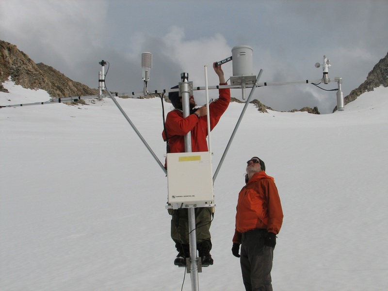
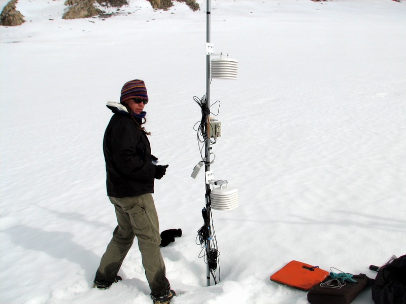
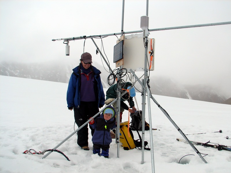
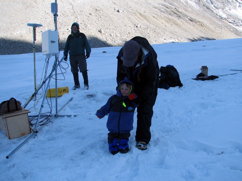
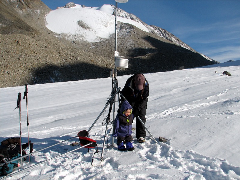
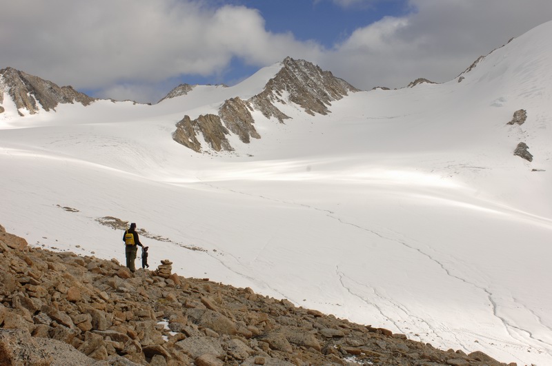
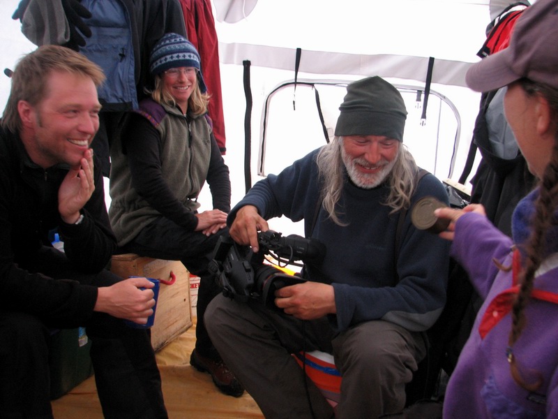
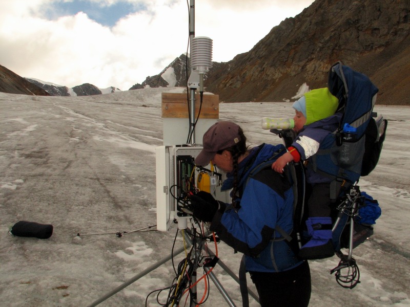
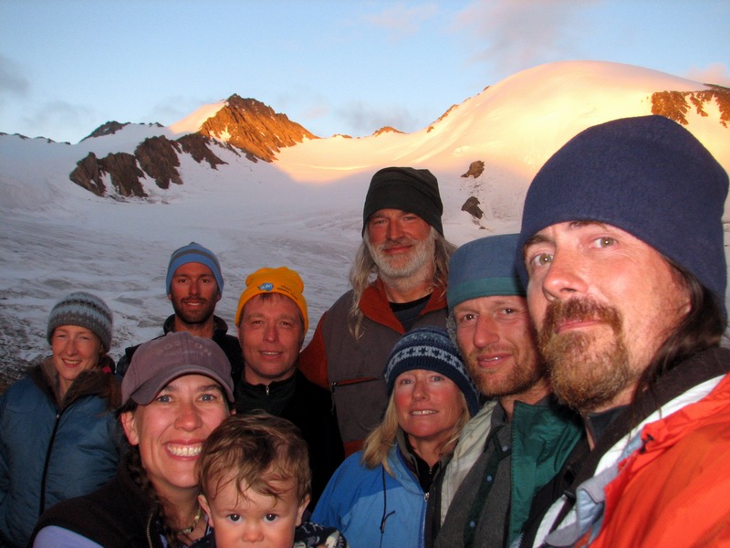
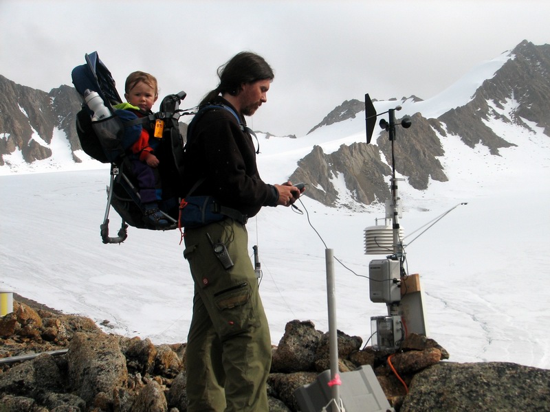
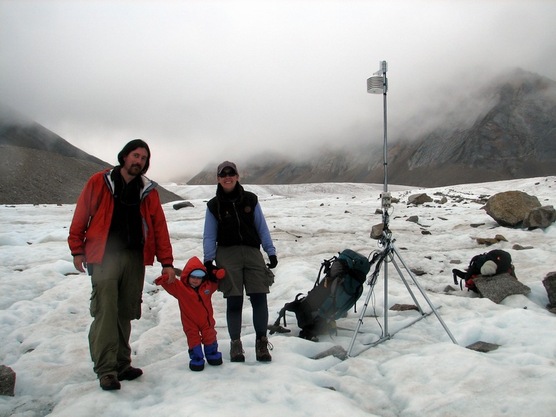
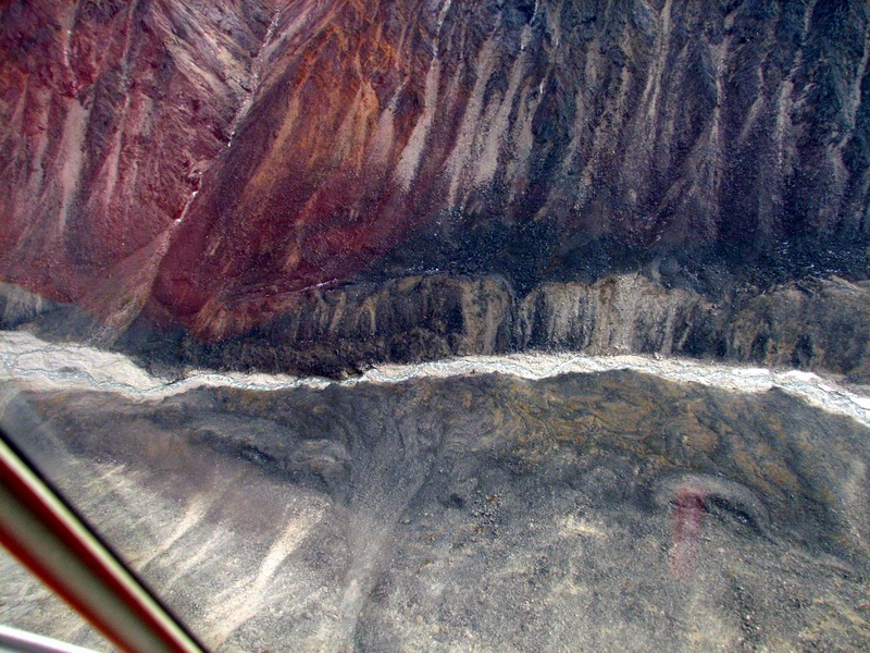
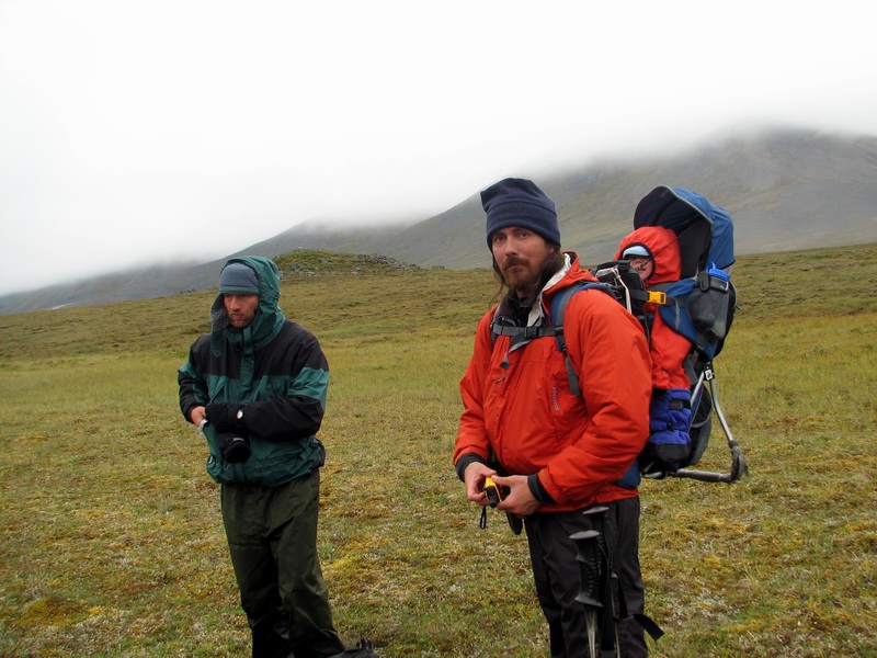
The terminus is largely rock covered, and in between the rocks on can often find debris from previous expeditions. We found debris from the 50’s, 70’s, and 90s, and unfortunately even a bit that looked like something that might have blown away from our camp. And strewn between the boulders were survey stakes from the past 50 years, some even with their labels still attached and visible. Eventually we came across one of my weather stations, which we downloaded and made a few manual measurements with, as I had packed some equipment for this. By the early afternoon, we were at the main weather station and pressing onwards. Kristin and Turner had gone a bit ahead as Bernhard and I worked, and our radio traffic was intercepted by others on the glacier who said hello. After a little while we bumped into Gretchen and Art, who were filming various ice things, as well as our ascent up the glacier. We arrived at camp about 4PM, for the first time not having to set it up ourselves.
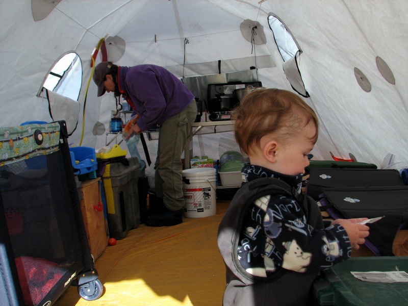
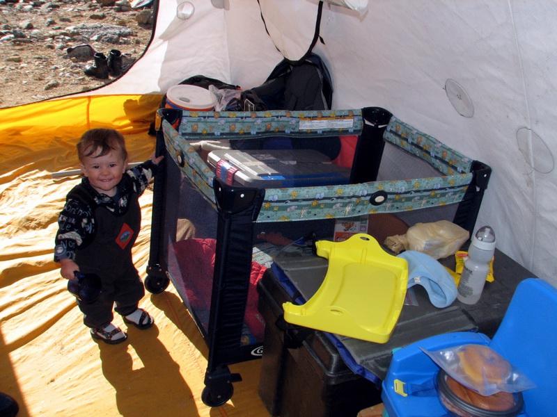
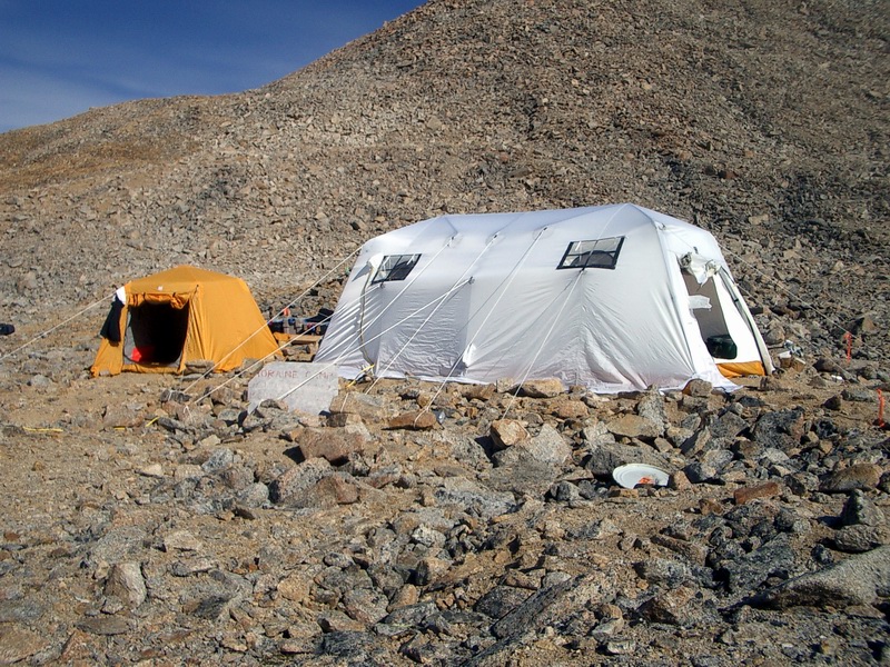
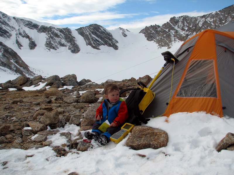
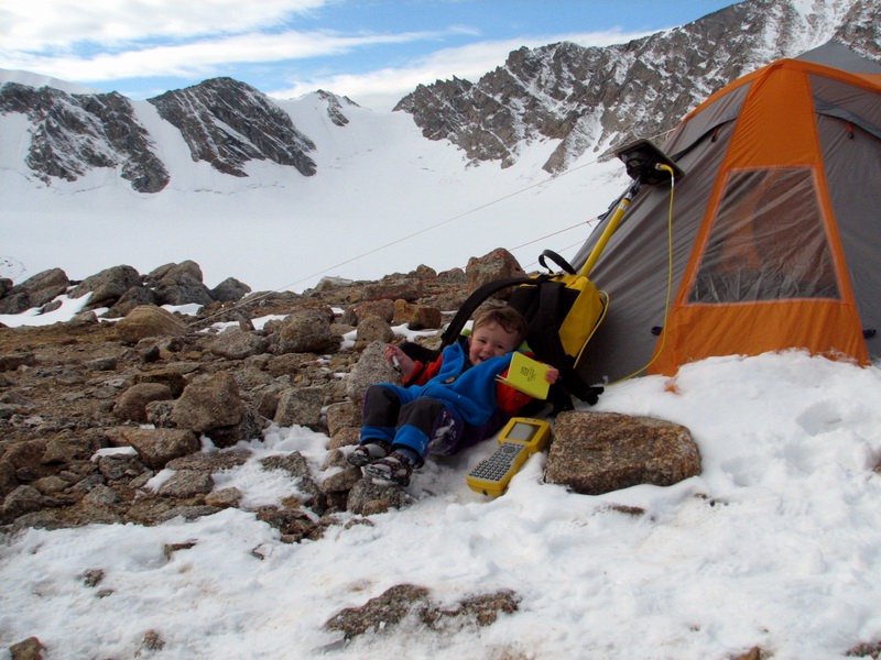
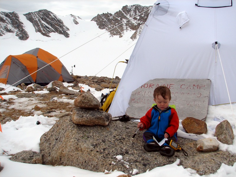
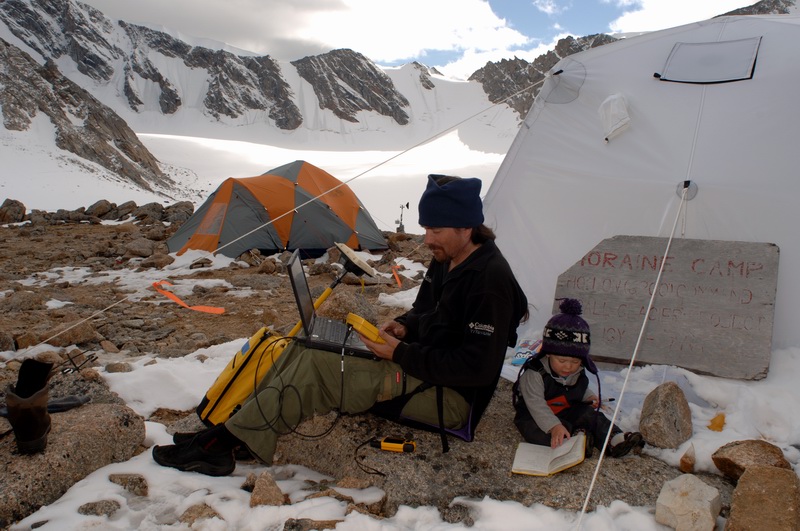
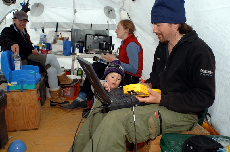
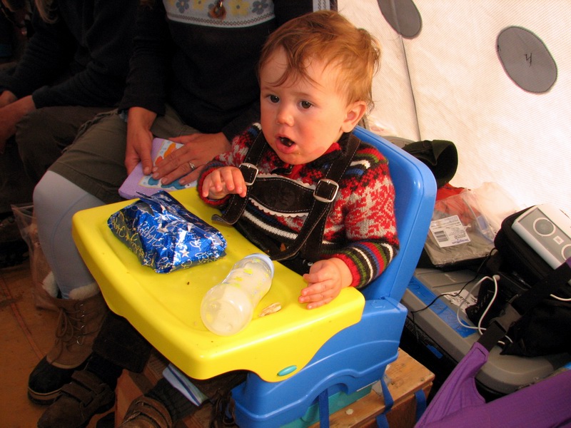
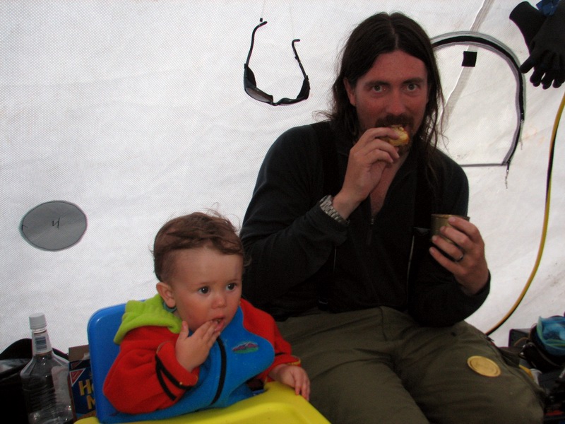
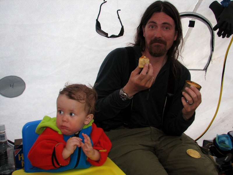
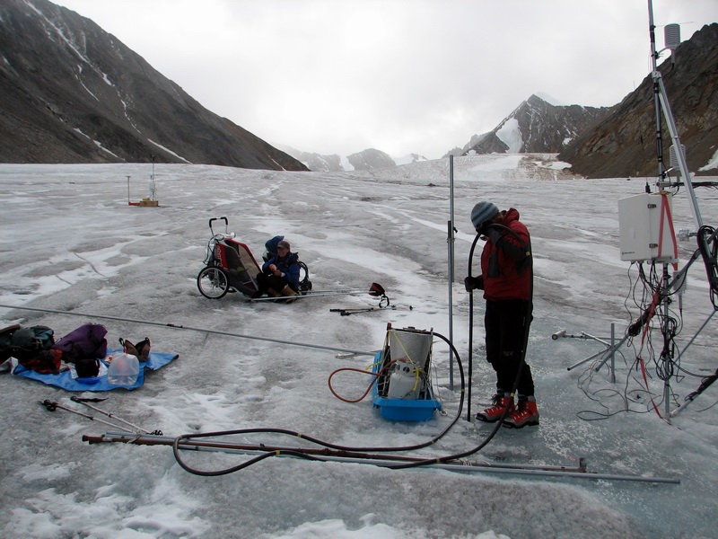
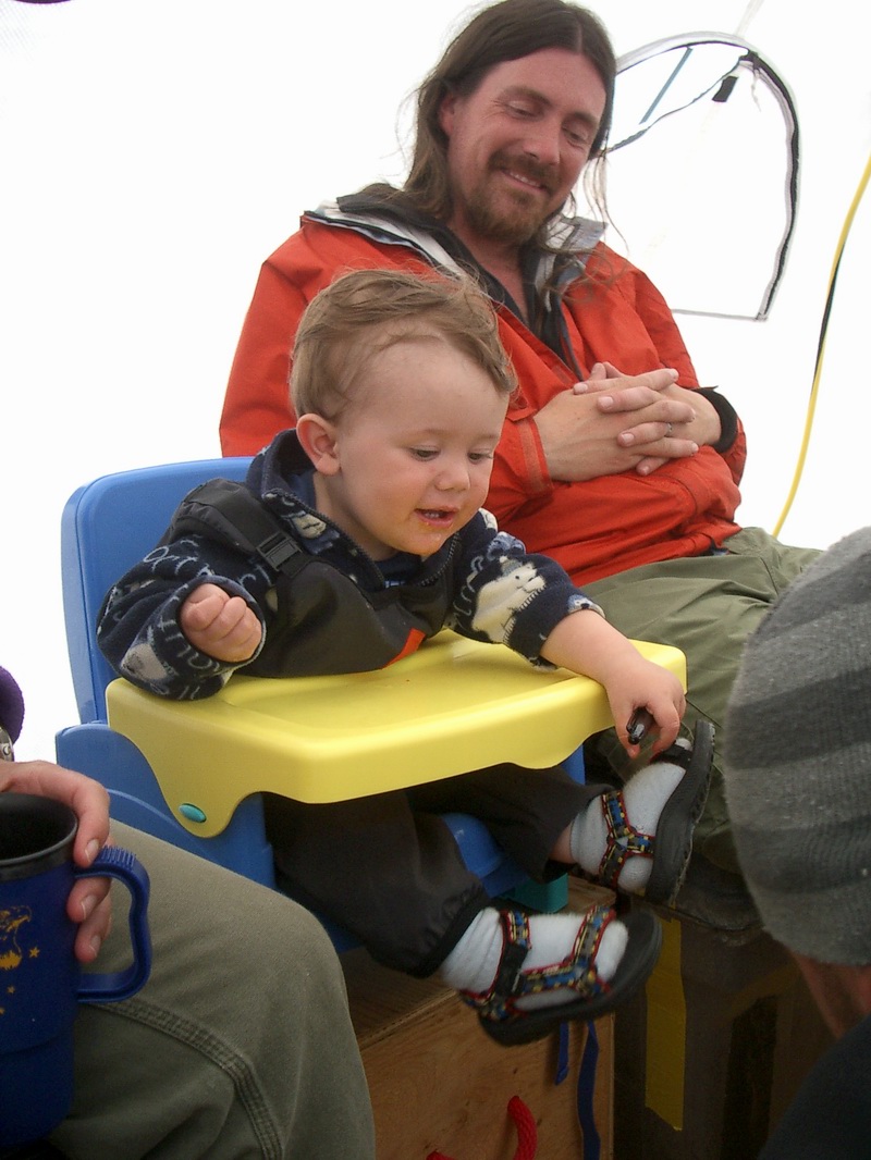
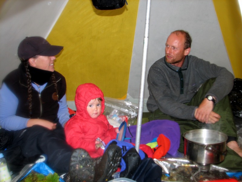
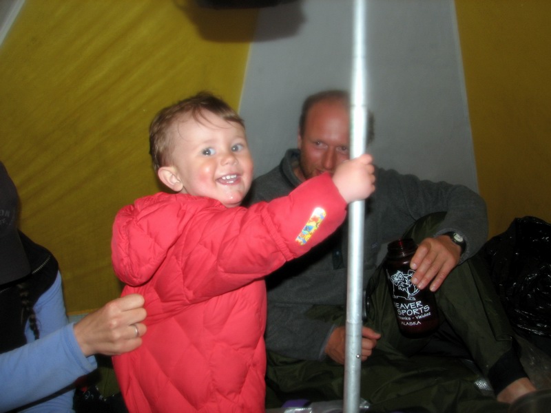
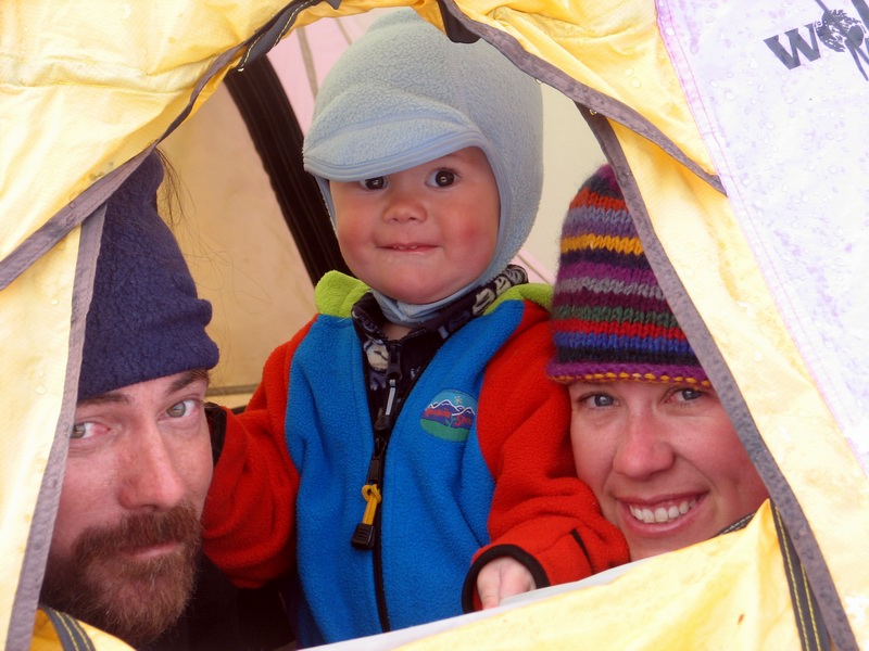
Chapter Two: Glacier field work One of our first tasks while at camp was to arrange the cook tent into a Turner-friendly zone. The only major hazard was the cook stove, which we attached to a table that was solidly tied down. The rocks under the floor also made a bit of a trip hazard, but he soon learned to avoid them.
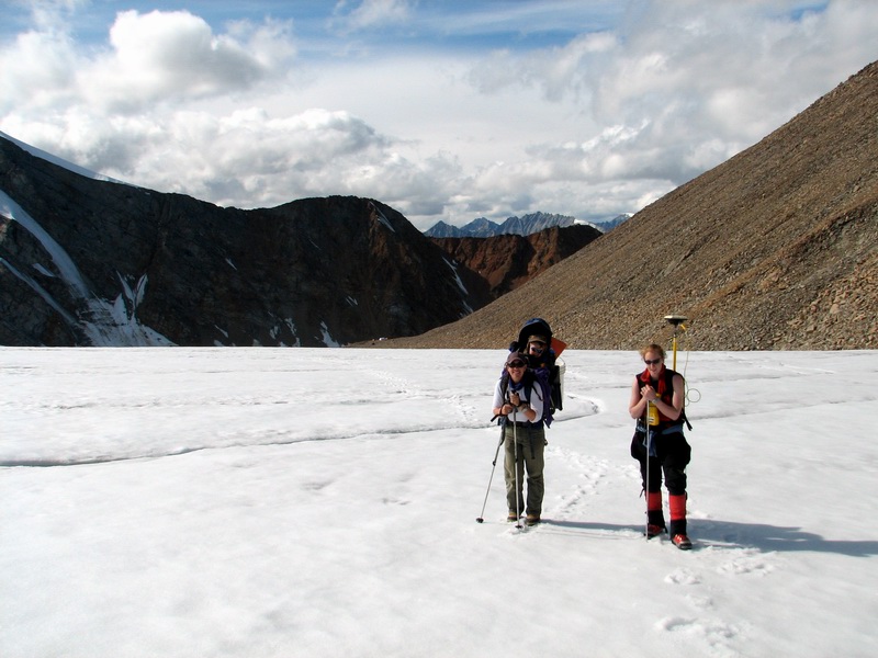
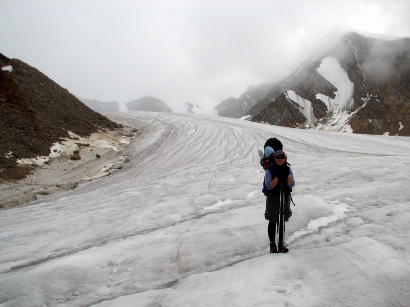
On the glacier, Turner became part of the field team, usually carried by mama, though we did switch off.
Well my broker says... -- 11MB
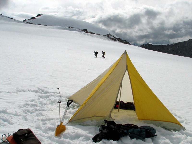
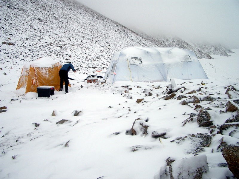
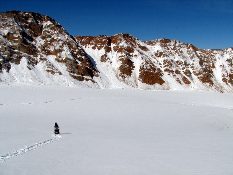
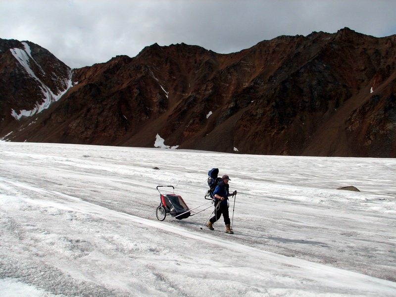
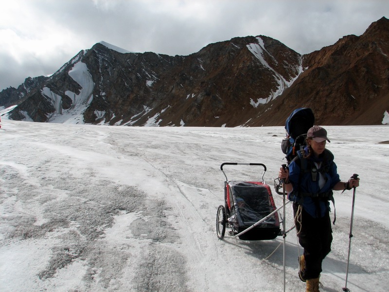
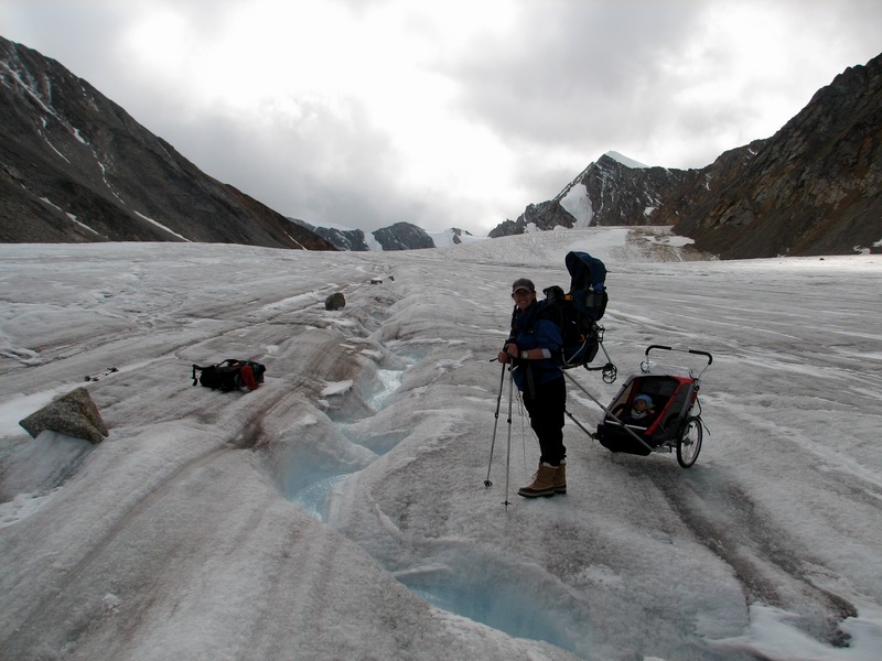
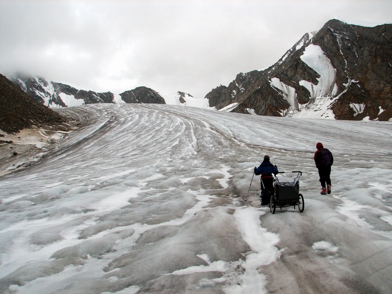
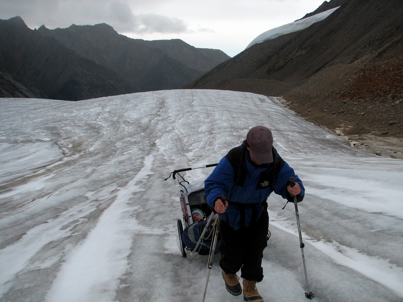
We had a number of long days of work, as well as some bad weather days, both being typical of our past experiences here. In general the weather is rarely bad enough that we cant work, it just slows things down quite a bit. In this case, an early snow fall meant dragging the chariot on wheels up to near its gunwales.
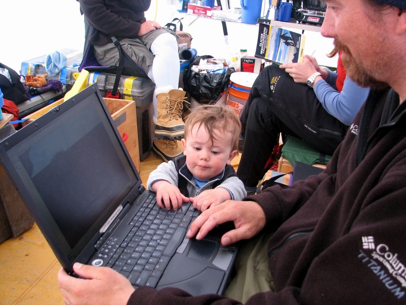
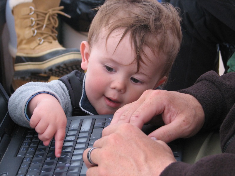
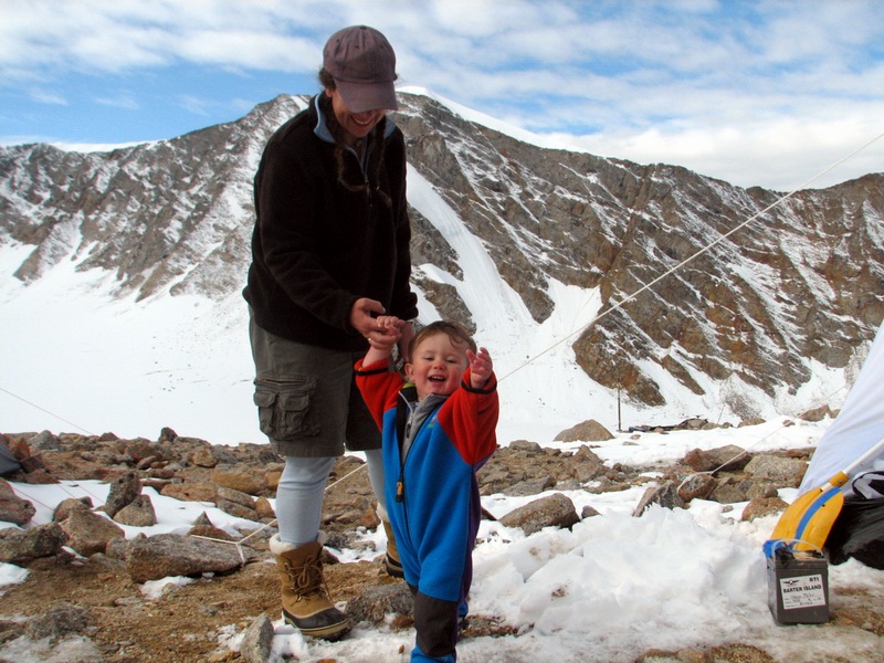
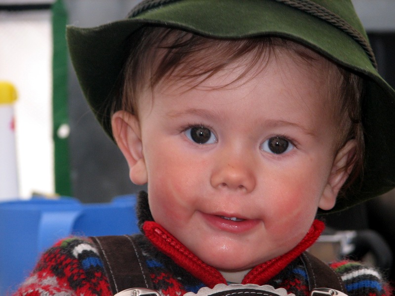
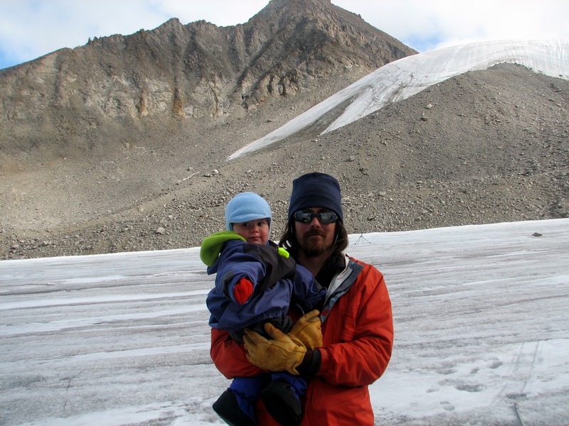
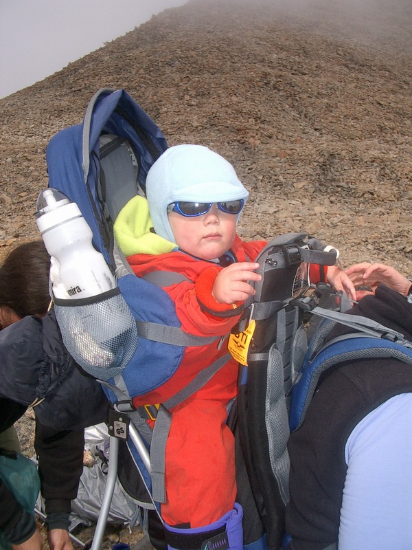
On one day, I worked with Art a bit to take some photos of Turner. What I had wanted to capture was something that would embrace the spirit of what the International Polar Year is looking for in terms of seducing the next generation of scientists into polar sciences. It turned out to be not so easy. We tried a variety of shots, some of which were quite cute, but none fully being something that could be widely reproduced, so we decided to think about it a bit more. Below is just a small selection of them.
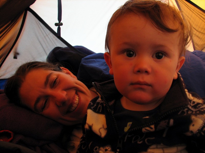
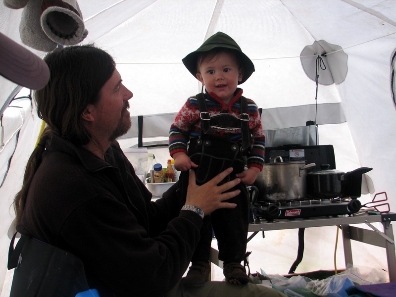
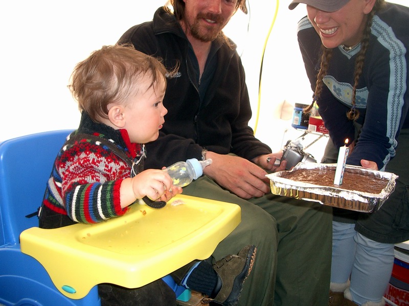
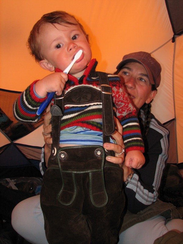
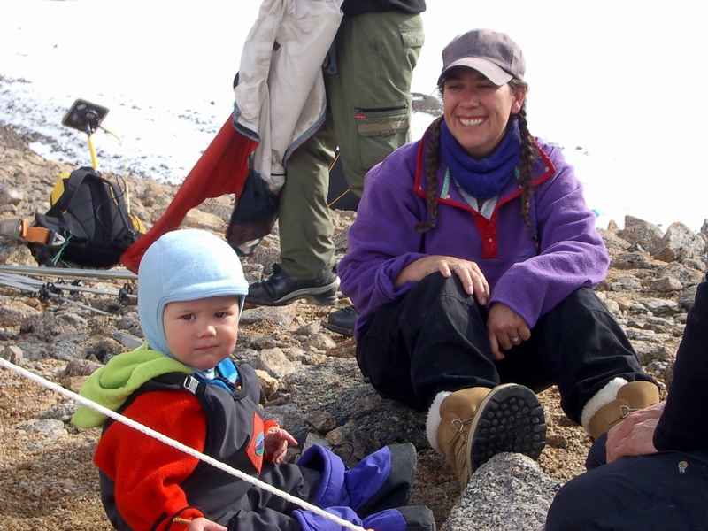
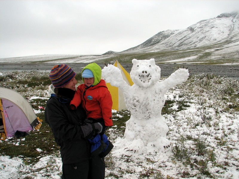
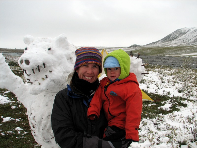
While on the trip, we had a small birthday party for Turner, who turned One. It’s hard to believe that he’s already a year old, but he certainly has gained an impressive set of communication and motor skills during that time. For the most part, I believe that everyone enjoyed his company and wasglad to have him here if for no other reason than entertainment. We never watched a DVD, for example, as watching him seemed to be entertainment enough. For the party, Turner dressed in his Austrian lederhosen outfit, and was the perfect alpine mascot for our expedition.
I get the biggest piece -- 14MB
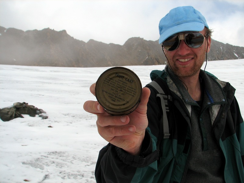
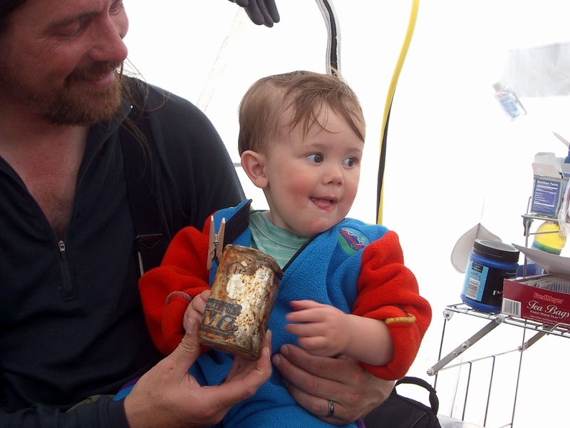
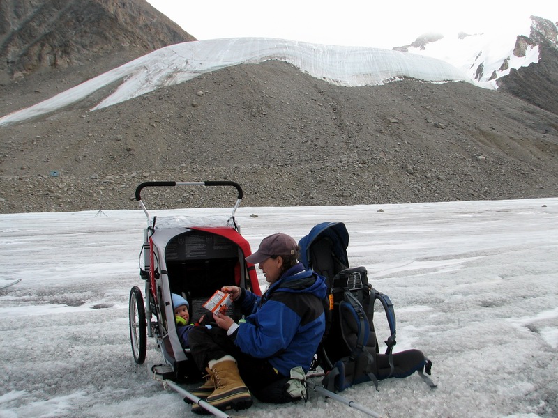
While out there, we found a cache of IGY C-rations that had melted out that summer, in approximately the same place that we had found similar debris melting out in previous years, within the ice fall from the upper cirque. We brought back a bunch of the cans for dinner that night.
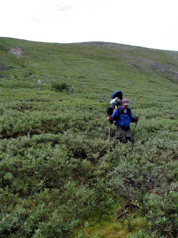
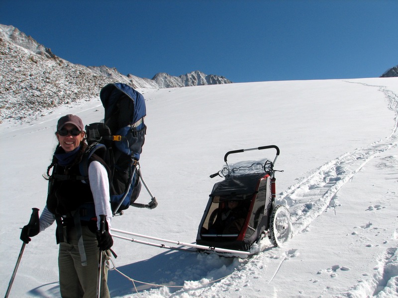
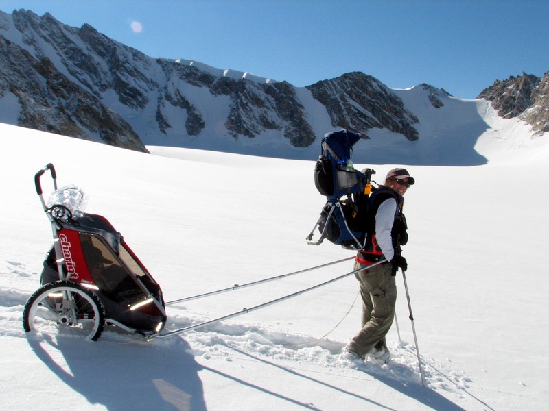
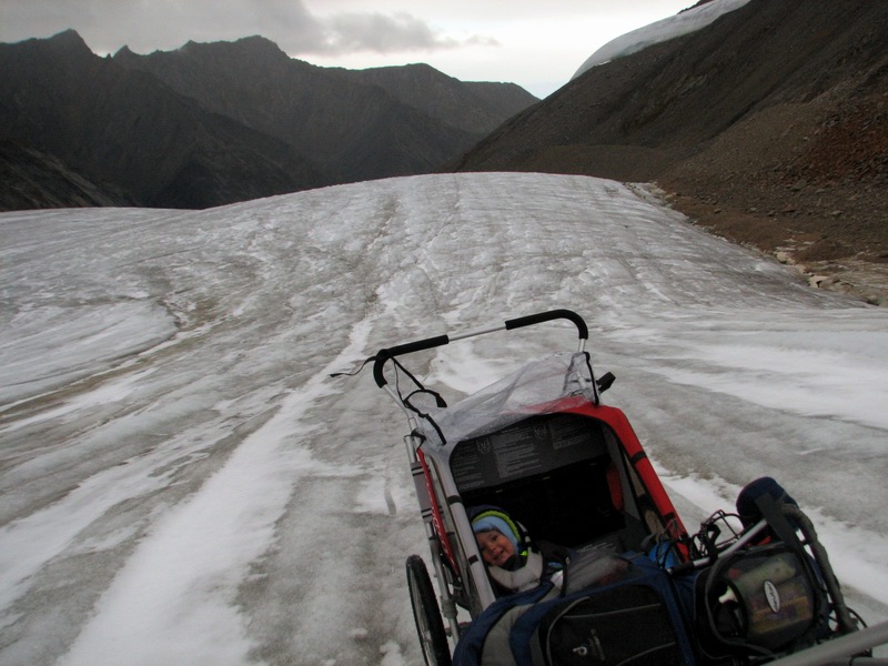
When we hike downglacier, we bring both the Deuter backpack and the Chariot. This lets us switch off between the two for transporting Turner, and also allows us to use the Chariot for hauling other gear. When using the Chariot for Turner, the backpack can be lashed to the hauling poles of the Chariot.
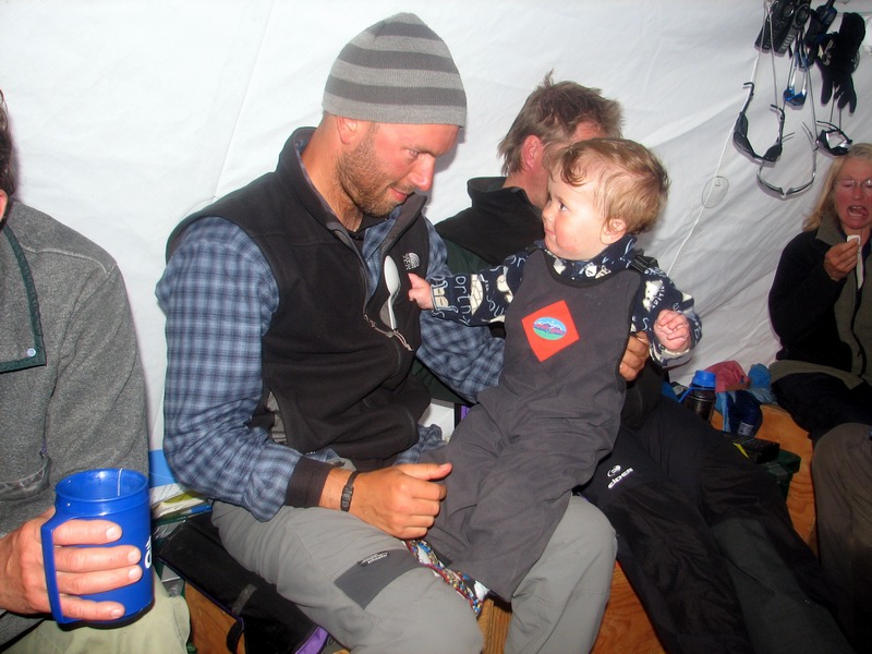
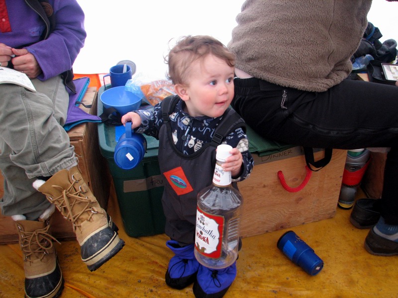
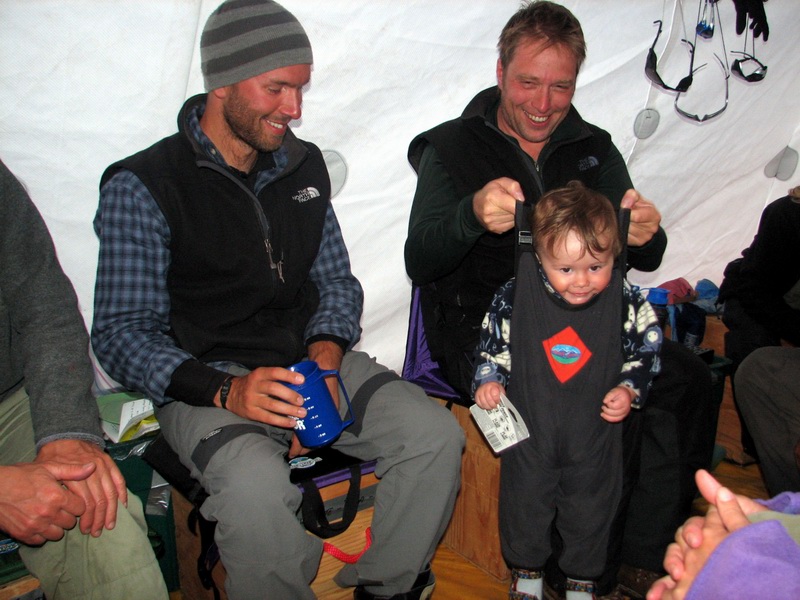
Turner was often the life of the party in the cook tent. He loved to walk around, see what everyone was up to, and try to be the center of attention.
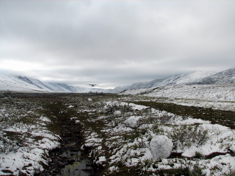
Chapter Three: The hike out The morning of our departure began with rain, though it gradually improved by the afternoon when we actually left. I had talked with Walt the night before and his suggestion was to hike to the Jago River strip, which is high and dry and landable in most conditions. While this makes for a shorter hike for us, it also means that we have to bring the raft and ropes for the river crossing. Hopefully the cool weather lately has reduced glacier runoff and the rain itself hasn’t been strong enough to swell the rivers, just make the tundra soggy. We began our hike in the late afternoon, delayed a bit as the sun had broke out briefly and we took a few more pictures and video. I had been wanting to get a picture of Turner that would capture the spirit of IPY’s future generation of scientist promotion, but lately the weather was too bad for it. But with Deni’s help I think we got a few that might suffice during a break in the weather just before we left. But before long we were packed and ready to go, anxious to begin. It felt great to be on our way.
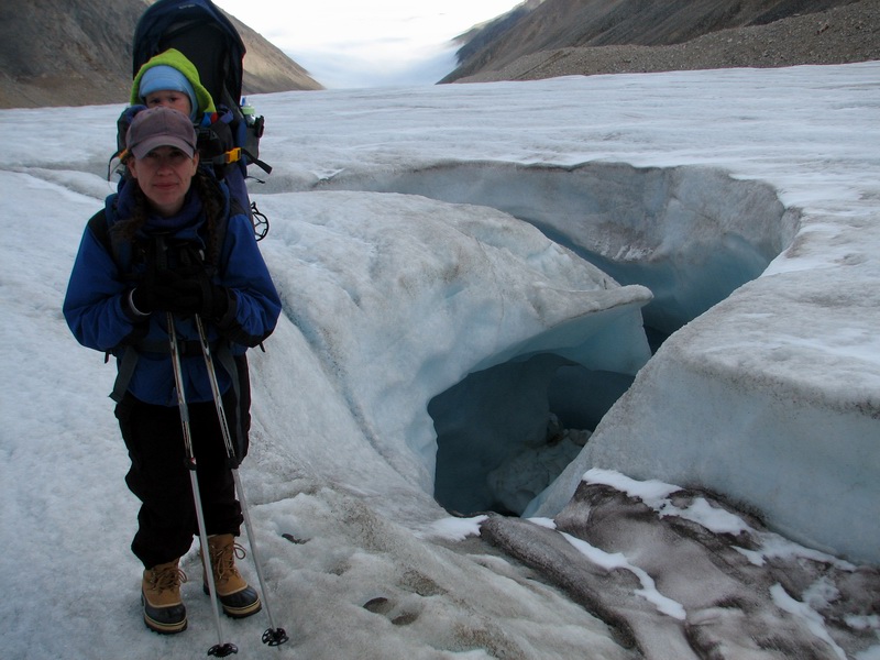
The glacier had changed considerably in the 10 days or so of our visit. The new snow and its subsequent melt had turned the surface into taffy, with lots of hummocky white ice. Walking was still fairly easy though, and we made good time towards the terminus. I stopped at my stations along the way to ensure that they were still operational, and changed the batteries on the furthest one downglacier. We stopped several times to check out what we believe are thrust faults, and also the nature and origin of some of the surficial stream channels.
As we approached the terminus, we discussed how we all felt a bit strange about our view. There’s something different about hiking down-glacier when you know that within a few hours that you will be hiking back up. Here we were leaving, and somehow this affected our perception of the scenery, like we were no longer in our own familiar little valley, but just transients passing through a spectacular patch of ground. And when it comes down to it, no one else before us had ever stood in this spot or seen the view from this angle, as the glacier surface is constantly changing in height and was only in this place once in the past 10,000 years, so we felt a bit special for just having stood here.
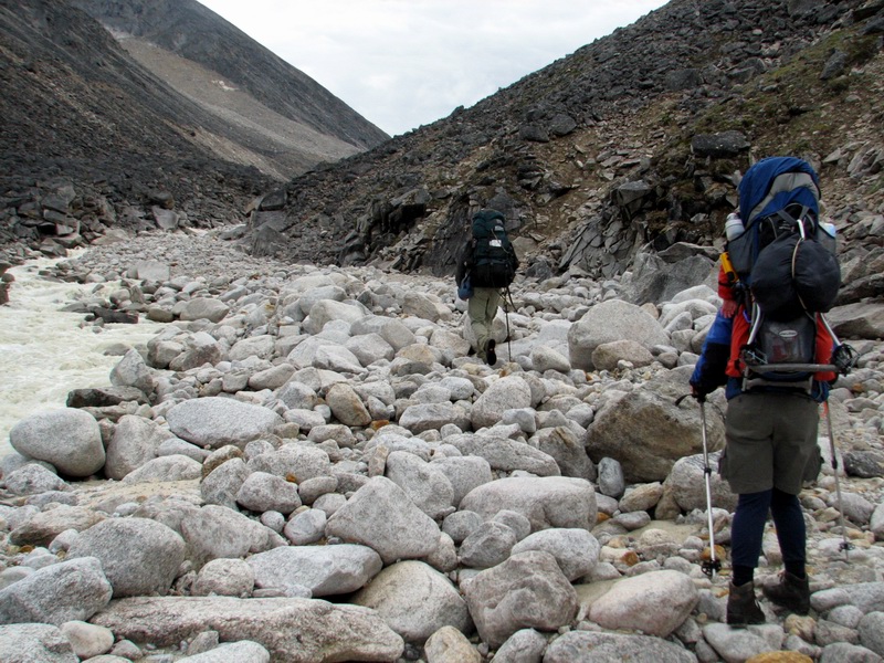
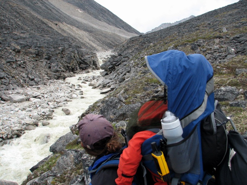
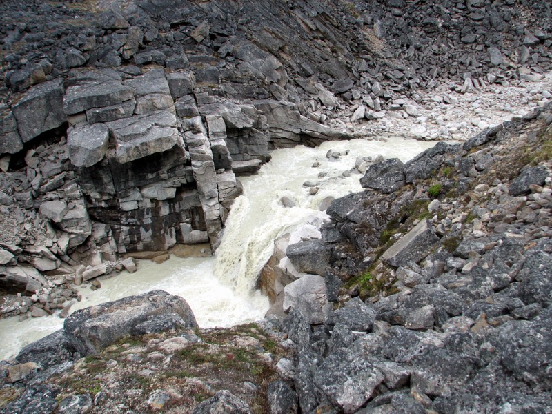
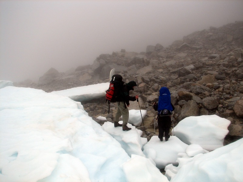
Once we reached the terminus, we began recalling our trip up here and retracing our steps. Getting past the main terminal stream required scrambling up an over a small ice cored moraine that had recently been stranded, just a warm up for the scrambling of the next few miles. Fortunately, the aufeis was still largely intact, and we were able to save some time by hiking on that for a little while, as well as hike along the stream valley bottom for a while as the water was lower than during our approach. But soon we came to the canyon and had to retreat up the hillside, side-hilling on rocks covered by 10,000 years of lichens and 3 days of rain. Here the hiking stopped, and we began choosing each step carefully. Though there is only a mile or so of terrain like this, it was the most challenging of the trip, as even without a baby on your back it is quite easy to lose your footing and break an ankle or worse. Fortunately we were taking this on while we were still fresh and energetic, and soon we were past it without mishap and once again walking along the stream bottom.
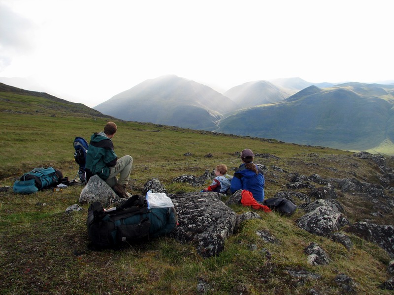
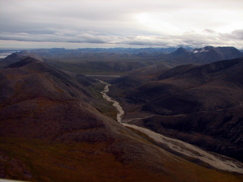
Walking next to the stream was not without its challenges either, and we laughed when we realized that we considered this the easy part. But the rocks here were largely dry and on level ground, and though we could not hike at full speed, we were at least walking rather than choosing each step. Being here in the valley also gave us a good chance to check out the moraines left behind by the retreating ice from the last glacial maximum, over 10,000 years ago. Since then, the largest advance of McCall Glacier began only about 500 years ago and ended about the time that my great-grandparents were born. So all of the moraines we saw were likely recessional moraines, formed at time when the glacier terminus was stable for a few hundred years, during the process of retreating back from the Jago River, which began something like 12,000 years ago probably.
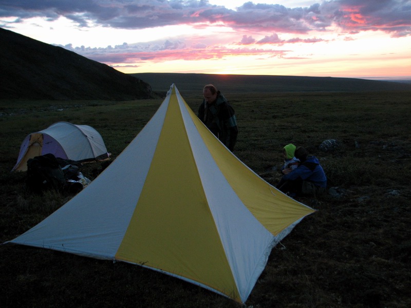
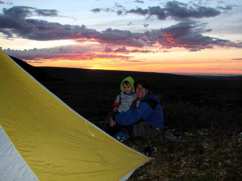
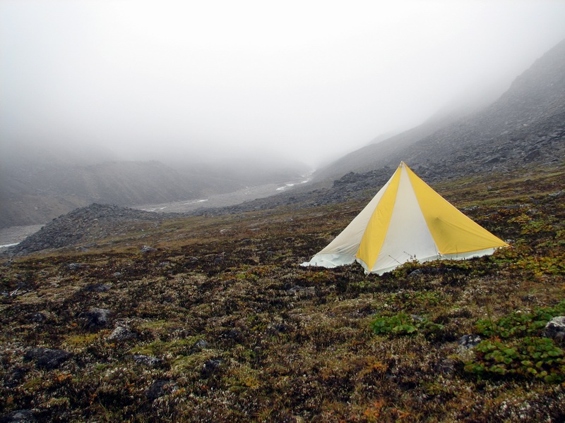
Bernhard, as always, led the way down the valley and had an idea in mind for where to camp. Turner, however, had other ideas. We had been hiking for about 8 hours or so in the rain and fog, stopping for snacks and water but not really a meal. So Turner hadn’t really had a full meal yet, and with his new teeth continuing to come in, was getting a bit fidgety and distrustful of Bernhard’s “fifteen minutes” to get somewhere. So we hiked up one of the recessional moraines and found a nice patch of tundra to camp on and let Bernhard know by radio. The location gave us a nice view of this part of the valley, and getting into our tents, taking off our wet boots, and eating some hot food were a welcomed change. With full stomachs and mostly dry clothes, we went to bed about midnight, hoping for a morning filled with sunshine.
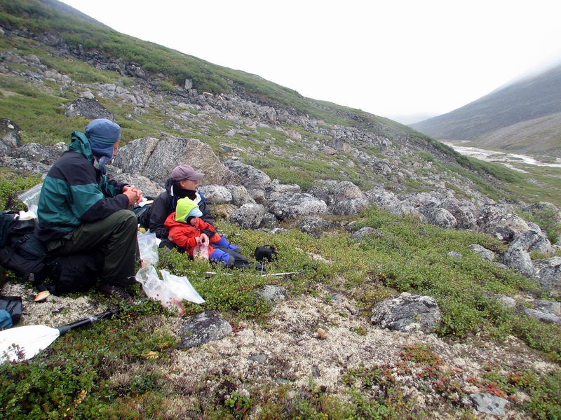
The hiking this day was considerably easier than the day before. Now we were mostly either on the river bed or tundra. The valley began to widen and the mountains became less rugged as we neared the Jago River, so there was ample room for tundra walking. Here we found our first upright willow tree and many mushrooms. Bernhard was familiar with a few of the edible ones, but none of us had the ambition to collect them or a suitable container. One of them was almost as big as Turner, but he also passed on eating them. We did find many blueberries, however, and I stopped many times as I heard Turner saying “More? More?”
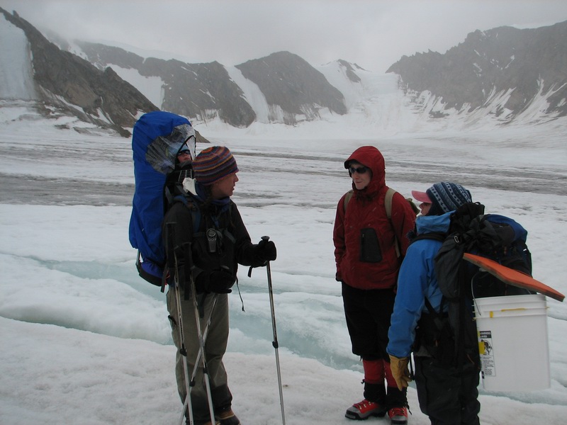
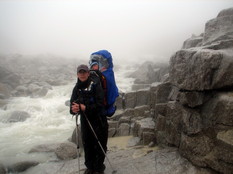
Soon the GPS said that we passed our last waypoint and soon after that the clouds lifted enough that we could see the Jago River valley. Though it was still several kilometers away, we hiked towards it enthusiastically. The walking was easy and the rain had let up, and we were eager to get a view of the open valley. We arrived at the river about 6PM, and set up a tent for Turner to get a diaper change, some food, and maybe a nap, while Bernhard and I went scouting for a suitable river crossing.
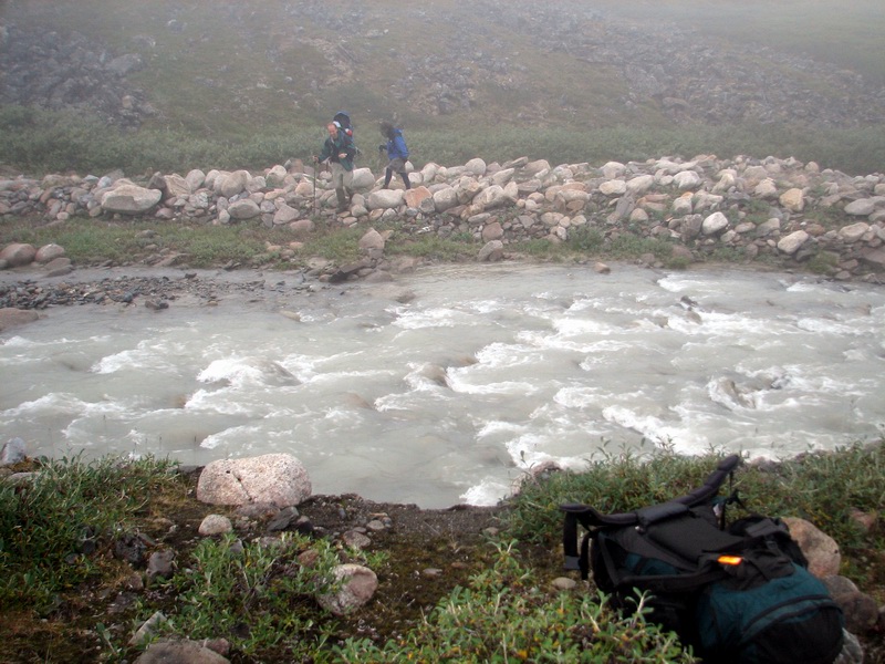
Crossing the river was the major challenge of this part of the trip. We only had one small raft, just big enough for a person and a backpack, and the river was too wide and deep for us to try to cross on foot, at least while carrying a baby. So we wandered around a bit, scouting for eddies and rocks. We had the impression that it was doable, but after some discussion we thought it best to hike to the point closest to Tom’s airstrip, which lay upstream of McCall Creek. So we broke down the tent and loaded up again to cross the creek. At the mouth where it entered the Jago River, it was braided and barely shin deep, so crossing it was no difficulty, it just soaked our feet again. Interestingly, we all had the impression of our feet getting warmer with the new water, an indication of how cold and numb they had gotten previously.
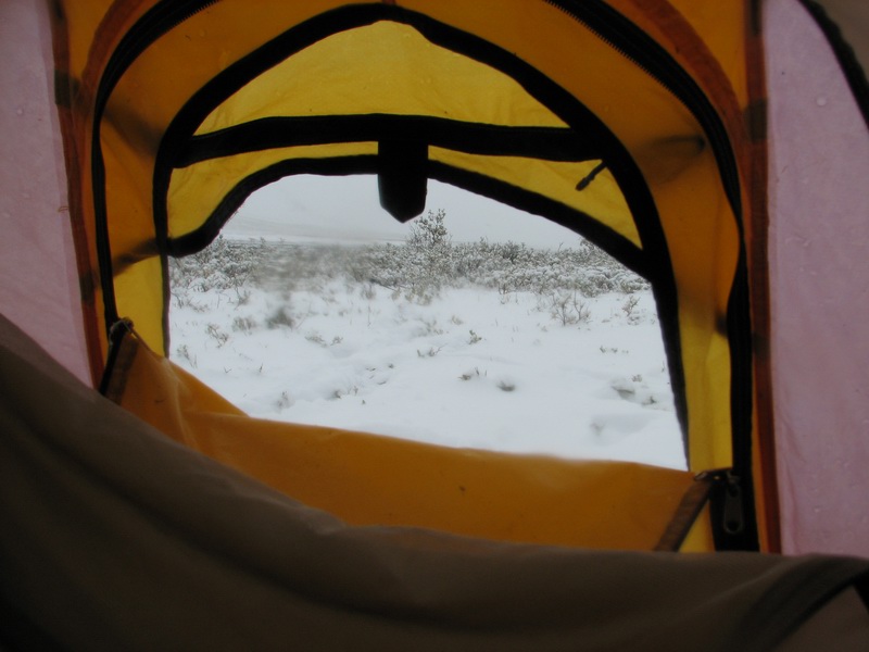
The GPS told us that the airstrip was only another kilometer away, and soon we were standing directly across from it. Along the way, we had found a very nice, flat, dry camping spot, and with now getting late in the day after a full day of hiking, we decided to wait until morning for the crossing when the river might be lower. We also measured out the length of this camping spot and found it just long enough to land a plane on, so we called in to Walt’s to report this and he confirmed that it might be a possibility. So we set up the tents and had a nice hot meal, this time in an old river channel rather than in the tents, to discourage Turner from becoming a midnight snack for the local bear population, of which there was plenty of evidence. We went to sleep hoping for a cold, dry night to shut off snow melt and a warm, sunny morning for our river crossing. We got about half of what we wished for. It was one of the coldest nights we had so far, but rather than being sunny, we woke up to several inches of snow. While I like snow in general, this snow posed several problems. The most significant of these is that small bush planes don’t land in snow very well, and our little airstrip was now way too short in these conditions. We called in to report our weather and found that a storm was now coating most of the central and western Brooks Range with snow, and we actually had the least. So we stayed in our tents, nibbling on a few cheerios, considering our options and our supplies.
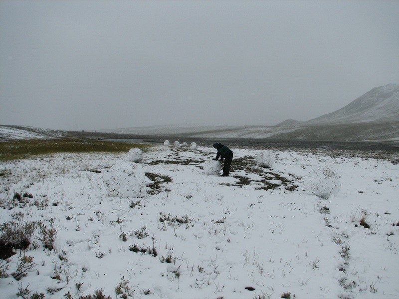
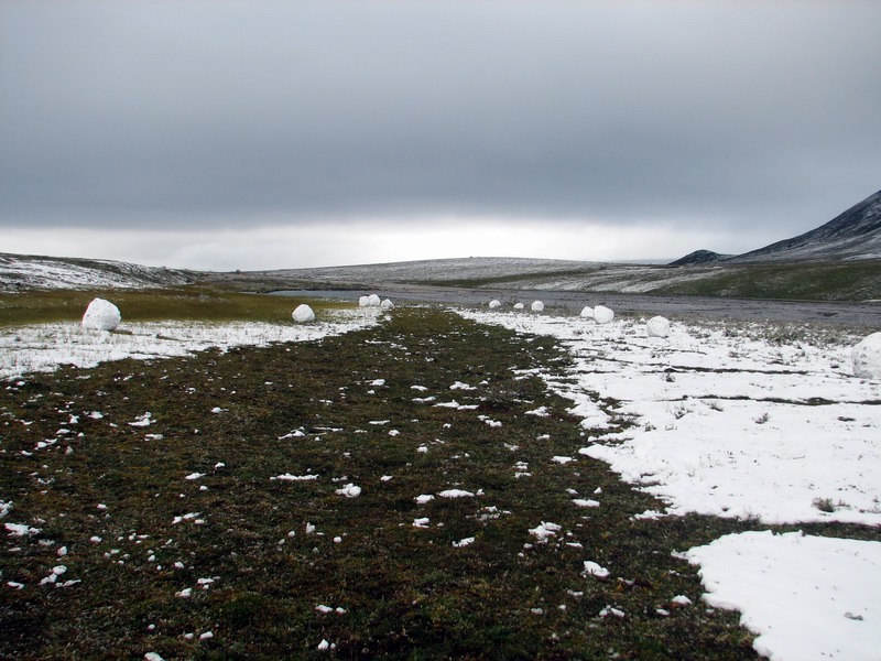
At this point, crossing the river seemed to make little sense, because we were not sure whether Tom’s strip would be any better than ours. Our options at this point were to sit tight and hope that the snow would melt, or to hike either up-valley or down-valley where larger strips might be accessible. Bernhard went for a morning hike and found that the snow seemed to get deeper up the valley. I calculated distances and hiking times towards the north using my GPS, and figured that it would take us about two days to hike to the Biddy strip out in the coastal plain, and about five days to hike all the way to Kaktovik. We had food for two more days, but with some rationing it could last at least four days, and there was of course plenty of water everywhere. We only had about four days of diapers though, so it seemed clear that a resupply of some kind would be necessary in the next few days. But given that the flying weather was fine and that the helicopter had arrived in Kaktovik to take out our friends on the glacier, such a resupply seemed quite possible. So, given the possibilities, I was quite ready to hike out all the way to Kaktovik. The past few days of hiking had been some of the most pleasurable I’d had in a long time. I don’t know exactly what it was, but the combination of the exercise, the scenery, the company, and the adventure was just so comfortable that I wanted it to continue for as long as possible. I think it was the adventure that really had most to do with it. Our glacier trips had become somewhat predictable, at least in the sense that we take the Colin Powell approach and go in with overwhelming might with clear exit strategies and its always only just a matter of waiting for the weather to break and a helicopter to take us from point to point, as we sit warm and dry and full of food. In such cases, adventure in my mind is not an acceptable option, as it implies that not enough planning has been done. But out here, on foot and with limited supplies, unanticipated obstacles are an inherent part of the trip and radical and creative changes in plan are a necessary part of their solutions. It doesn’t mean that no planning is necessary, just that the planning has its limits. So, having just camped for two weeks and hiked for 40 miles without mishap, we were fully geared up and just needing a bit more food, so hiking another 50 miles to Kaktovik seemed like a perfectly reasonable option. We decided to give the weather another day to settle down first though, hoping that the snow would melt and give us more options. In anticipation of this melt, Bernhard began clearing the snow around his tent so that the melt would not flow into it. His tent had no floor, so chores like this are necessary. The snow was perfect for snow balls, and Bernhard soon discovered that the easiest way to clear the snow was to roll large snow balls, like the kind one would make a snowman out of. By the time I joined him, he already had several large balls rolled up, so we began the process of stacking them on top of each other. Rather than the traditional form, however, we came up with something a bit more appropriate to the local fauna. Most importantly, however, we realized that this method was perhaps not only appropriate for clearing snow around tents, but also for runways. So went over to our would-be airstrip, marked out the edges, and began making snow men.
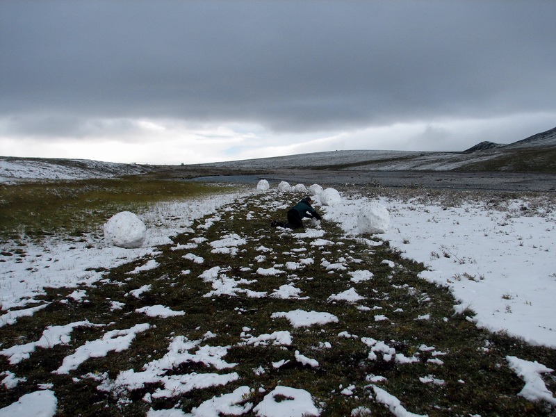
Within an hour or two, we had the makings of a tundra airstrip. We discovered several tricks to making the snow balls, and wondered whether they made their winter airstrips here like this in the stone age. By the time we were half-done, however, new snow was falling and we decided to abandon our efforts until morning, so that we would not have to do it again. But it seemed like a reasonable option to consider.
That night was colder than the one before. Turner was probably the warmest of all of us, as he was the only one with extra warm clothes, and he slept between us in our zipped-together sleeping bags. When we awoke, it was clear that the snow wasn’t going to melt anytime soon, and was now too cold to make snowballs, so we began considering our options again. We were not the only campers stuck in this winter wonderland, so we also had to factor in that Tom only had limited time to come get us in between dealing with the other dozen or so groups he had to deal with in a similar situation spread across the north slope. By mid-morning, the snow had softened up a bit and weather had improved considerably. Tom wanted to try to come get us first, so Bernhard and I went about further clearing the runway. At this point, the snow was again perfect for this, and we were able to get nearly complete snow removal where we wanted it. Clearing the snow in this way also made for the ideal runway markings, as it created a nice rectangle of tundra in an otherwise snow-covered landscape. Once we had the strip cleared, we rolled the large snow balls off to the side, to prevent the wings from hitting them, and the extra bit of snow removal this caused made nice distance markers perpendicular to the runway. At just about the time we were finished, Tom flew overhead and scoped it out. He lined up over it several times, and eventually landed without mishap. Soon afterwards, Cal flew past in the helicopter on his way to the glacier, and it seemed like everything was coming together. Once we dropped off Kristin and Turner, Bernhard and I tried to go for a little flightseeing trip to take some air photos, but in just the time it took for that, the weather had closed in again and neither the helicopter nor the plane was able to get back into the mountains. So, after another full day of excitement and uncertainty, Kristin, Turner, Bernhard and I were back in Kaktovik while all of the others spent another night on the glacier.
In the final analysis, we were very
glad to have trusted our instincts and gone on the trip. Turner did great,
and despite the four new molars that emerged through his gums, barely
complained a bit and was pleasure to hike with and have on the glacier.
Certainly the attention he needs while in the field detracts a bit from
the time that Kristin and I would have for work if it were just the two
of us, but at least on this trip the net contribution to the project was
the same if not better than if just the two of us, if for no other reason
than because if it were not for him, we not have gone on the hike. As
he gets older, presumably that as his ability to understand and predict
consequences improves, as well as his ability to communicate any discomfort
he may be having, then our ability to be scientifically productive as
a family will also increase. This type of trip is likely not for every
kid or every family, and not for every stage of life, but my general conclusion
is that any field scientist who is good at their job and believes that
they are capable of this probably is capable of it. Planning to have a
child along is not much different than any other type of field planning
-- it is largely a matter of anticipating the potential problems, planning
for them, testing them in non-critical environments, developing an infinite
string of backup plans, and then just going for it once you're satisfied
that your worst case scenario is within spec. For us the rewards of the
trip far outweighed the risks, and it was a learning experience not just
in terms of baby tech but in terms of life experiences. To wander through
the mountains, over the moraines, across the rivers, and on the tundra
-- to experience being part of the landscape, if only briefly, gave us
all a new appreciation for this area which we have studied for so long.
While we had no scientific agenda for the hike, we were still receptive
to developing a keener scientific understanding of the place, and this
we got -- whether it was watching glacial geology in action while slip-sliding
over the rocks above the river, witnessing the effects of caribou migration
on solifluction and hydrology, understanding the spatial gradients in
weather from glacier to valley bottom -- these are things that cannot
be fully appreciated from a book or a datalogger. These are processes
which can only be described and appropriately modeled based on personal
experiences, which are by nature somewhat seredipitously discovered. While
Turner is not old enough to verbally express what he learned on the trip,
I have to believe that similar learning processes were at work within
his own mind, that with all of the neurons in his brain waiting to specialize
on something new, that these experiences will form a unique and valuable
basis against which he compare and contrast what he comes across in the
future. And whether he becomes a scientist or an artist or a ditch digger,
my suspicion is that this ability will serve him well.
|
(c) 2003 Matt Nolan. If you find any broken links or other errors, please let me know. Thanks.