Dr. Matt Nolan
455
Duckering Bldg.
Water
and Environmental Research Center
Institute of Northern Engineering
University of Alaska Fairbanks
matt.nolan@uaf.edu
|
|
Dr. Matt Nolan 455
Duckering Bldg. |
|
|
Research
on Topography and Topographic Change
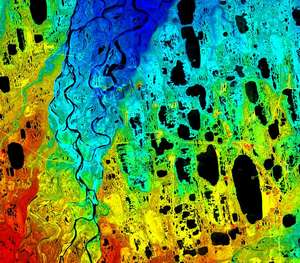
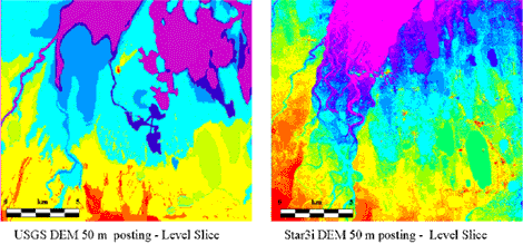
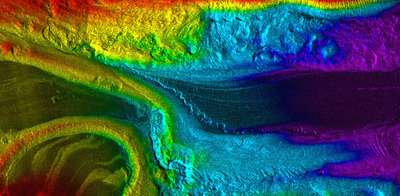
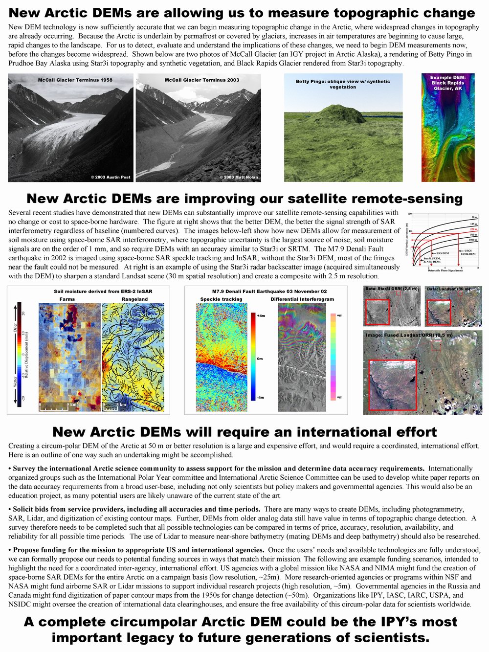
The surface elevation of the Arctic is about to undergo major changes due to global warming, as most of it is underlain by thermally unstable permafrost. This is disturbing to me scientifically because we know so little about the current surface that we can hardly hope to document the changes on a broad scale. So, I spend a fair amount of my time trying to add new elevation data to our archives by making new Digital Elevation Models (DEMs) and by detecting surface change by comparing DEMs or using SAR interferometry. DEMs play an important role in almost all research at the Water and Environmental Research Center. DEMs are central to our modeling , GIS , remote sensing efforts. Unfortunately, the currently available DEMs for Alaska are not as good as we would like them to be. Over the past few years, I have been working closely with data from Intermap Technologies Corporation's Star3i airborne interferometry system. Below is an example of the improvement of Star3i over the standard USGS data.
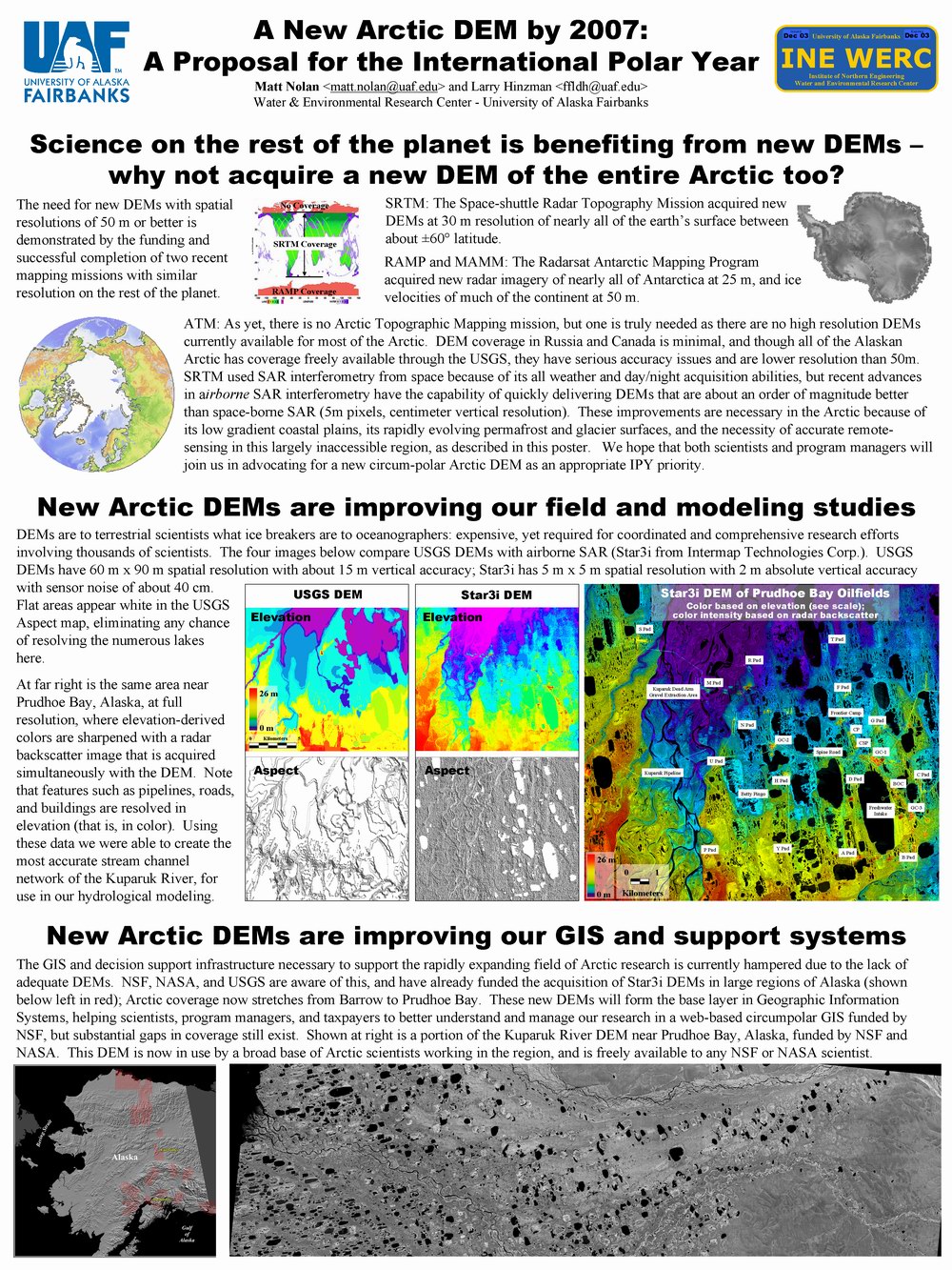
I have recently led several projects to acquire about 8000 km2 of new DEM of northern Alaska and prepare a distribution package for use by NSF scientists. You can view the html introduction for that package here. It contains lots of useful information on DEMs, the Star3i system, and the data itself. I often agitate for the acquistion of new DEMs for the Arctic at meetings and conferences. You can find a copy of an AGU poster presented at the International Polar Year session here: Page One (500kb) and Page Two (500kb). I recently submitted a proposal to IASC's ICARP II solicitation, for the creation a working group on an Arctic Topographic Mapping (ATM) mission, which you can find here. I am currently working on drafting a similar document as a white paper to the US IPY committee, and am soliciting signatures from any Arctic researchers that believe new Arctic DEMs are a good idea. Please email me with comments or to express support. I also need good DEMs for a new interferometric technique I've developed to measure soil moisture. You can learn more about his project here.
I am also currently in the process of making interferograms of the 2002 Denali Fault earthquake using these higher resolution DEMs. Results thus far are very promising, but are being kept off-line until the papers are submitted. |
(c) 2003 Matt Nolan. If you find any broken links or other errors, please let me know. Thanks.