Dr. Matt Nolan
Institute of Northern Engineering
University of Alaska Fairbanks
|
|
Dr. Matt Nolan
Institute of Northern Engineering |
|
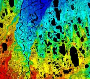
McCall Glacier IPY Lake El'gygytgyn IPY Virtual Globes IPY
|
01-02 July 08
(Day 71-72): The chaos begins
The weather seemed better further west, however, and Aerometric had another project lined up, so they took off in the afternoon to see if they could squeeze that project in. Unfortunately during that project, their laptop got fried somehow, and they then discovered that their backup laptop didn’t have all of the necessary software on it. Things got progressively worse, as this was a Canadian national holiday (no joke!), and the software they needed had to come from a Canadian company. So they spent the night in Deadhorse since they were closer to there and the internet was more reliable. Today they were able to download the software in Deadhorse, but the weather here was still not cooperating. They came back briefly to get their personal things, but decided to spend the next day in Deadhorse. Another Aerometric plane was there and it was broken, so a mechanic was coming in the next day to fix that and they figured this was a good opportunity to also take care of some routine timed maintenance on their plane so that they would not get caught needing to do it in the middle of good weather for our project. In the meantime here, we began settling into a routine in Kaktovik and sorting out other aspects of the project. Tom the pilot still had not returned, so one major task was to begin trying to line up other aircraft to help us with the aerial photography and GPS work we needed to do. Benny, a professional photography helping us out, is due to arrive in a few days so we wanted to be sure to have several options lined up. In any case, this is the type of chaos that we anticipated and the reason we were here.
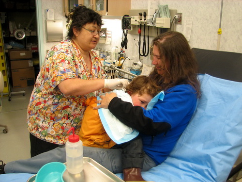
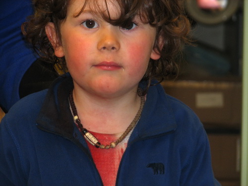
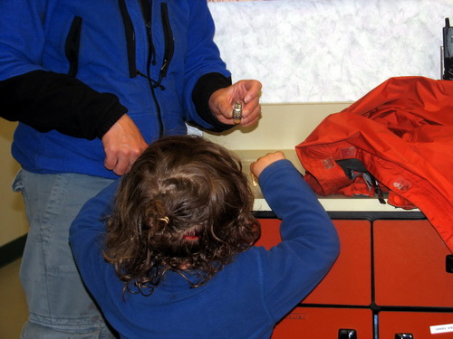
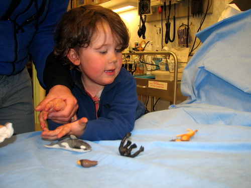
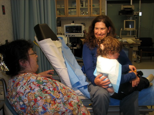
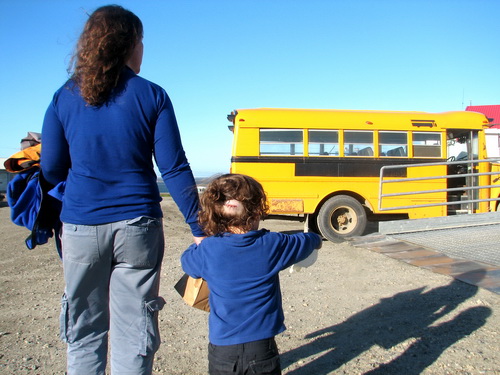
It was already 6PM, but the clinic crew and rescue squad showed up within a few minutes to open the clinic and help us out. By this time Turner was calm and quiet, but our dish towels and Kristin were soaked with blood. We had a look at this head, and there was a deep gash there about 2 inches long. The bleeding had nearly stopped by now, and we spent the next hour or so just flushing it with water. We dug up some toys for Turner, and soon he was running around again playing with them as we took care of some paperwork and let his anesthesia kicked in. Putting the stitches in went reasonably well. He didn’t feel the needle, but didn’t like being held still. To keep the bandages attached, we had to shave a circle around the cut, but his long hair mostly covered the gap. But the bald spot still looked a little like Frankenstein, but the local help was great and we were really glad of the help.
Soon enough we were on the chase though.
Injuries do happen, but I’ll be glad to get back into the field were I’m even more convinced that the risks are lower. What’s really different about the field is that there are no clinics or hospitals or rescue crews – to get such help requires a comparatively enormously larger logistical mobilization. But is this a risk? I don’t see it that way. The risks are the things that can hurt us, and in the field these are things we can largely identify and prepare for. What we cannot prepare for are humans -- the two leading causes of death for children are auto accidents and murder, for example. Fifty thousand people per year die from car accident, most with no fault assigned during commutes to work, yet somehow these kind of statistics somehow just become part of the background noise our society considered acceptable. Comparatively deaths and injuries in ANWR are rare, even on a percentage basis. There is simply much less opportunity for the risks that we take for granted in civilization, things essentially random as the goings-on for humans are essentially unpredicatable. Things like Turner’s red owwie are predictable, and had any of us got a gash like this in the field, we likely would have stitched it up ourselves using the medical supplies we brought for this, but much worse than this and we likely would have called in the calvalry using the arsenal of comms equipment we have with us. Being safe in the wild of course puts the burden on us to avert problems rather than counting on others to obey the laws set up for community safety, but in my mind this a worthwhile tradeoff, and our small and statistically invalid data set of the past few months confirms this. 04 July
08 (Day 74): Celebrating Independence Day and a bit of lidar success
It being July 4th, Kaktovik had some festivities lined up. No official fireworks, but lots of local color and kids for the games. So we spent some time in town and met with the locals. All of the hikers and tourists were shipped off yesterday, so we were the only outsiders there. I find it a bit interesting that it’s the tourists who take a real interest in our work. A conversation about glaciers with them can take several hours. Not so much the locals. The typical question of ‘So are the glaciers still melting?’ gets answered ‘Yep, faster every time we look’ and suffices in most cases. So it was kind of a day off for me, with no schpeeling and no lidar. I took a long nap with Turner in the afternoon, and started sorting some gear after a nice dinner.
As I was settling in for the evening, however, I got a call from Jessica. They were now in Bettles. On the way to Anchorage, they decided to stop in Bettles to attempt a small job there and see if any of the fiddling they were doing in the plane may have worked. As it turned out, it did – the system was now fully functional. Such things scare me a bit, as they had not clearly identified the problem. In my experience in geophysics the past 20 years, such intermittent problems are almost always caused by loose or bad connections with the cables. I don’t know if my jiggling of the GPS antenna cable solved the problem in the morning or not, but my guess is that it is something along these lines. In any case, the plane is that they are going to head over at 6AM tomorrow. The weather still seems stable here, so we’re keeping our fingers crossed, both for weather and for system stability. Benny also arrives tomorrow. He’s never been to Alaska before, let along the remote Arctic, so it’s shaping up to be a busy and interesting day. 05-07 July
08 (Day 75-77): Lidar success! The weather in the mountains has been troublesome, but at least sufficient for some work to get done. The dynamic there is what we’ve observed while in the mountains – by early morning on clear day, the sun evaporates moisture from the glaciers and rivers and lifts it high into the sky, creating clouds and sometimes thunderheads. So basically by about 10AM, we cant do any lidar in the mountains. So the first day back, Nick and Jessica flew the river corridors along the coastal plain, where it was still nice. The next day we were up at about 4AM -- when the clouds from the day before have settled down but the new ones have not yet started up – and were able to fly a square around McCall Glacier, our highest priority target, for a few hours. This morning we employed the same early-morning trick and were able to get 8 of the 35 long east-west flight lines done. So it seems that all we need is another 12 hours of clear weather and we could knock out the remaining work, but getting those 12 hours might take 12 weeks…
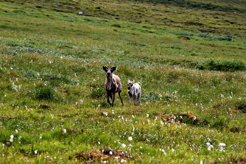
The locals do a lot of hunting. The caribou have been wandering around on the island lately, and it often sounds like Iraq around here. Lawrence had too much and was giving the meat away.
Benny and I took a walk one night down to the bonepile. The locals hunt whales in fall, then leave the carcasses on the beach for the bears to eat. It makes for interesting photos, but next time I want to use my tower mount to get a panoramic view looking down on the pile. 08 July
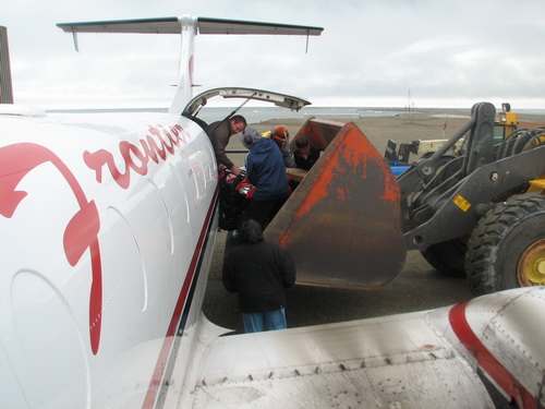
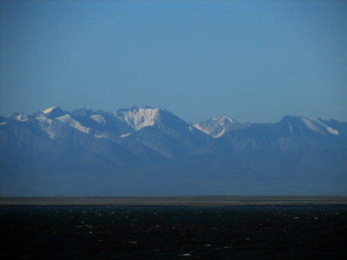
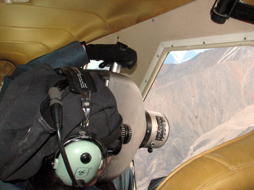
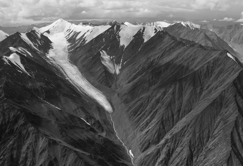
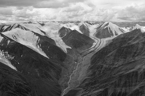
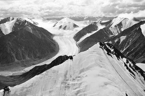
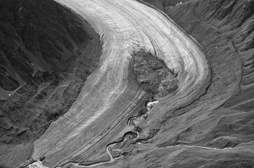
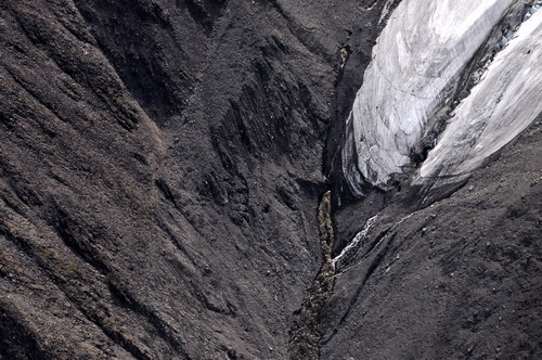
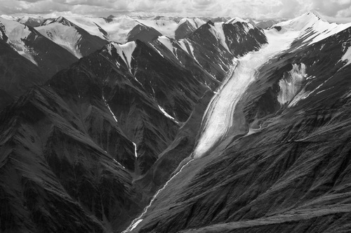
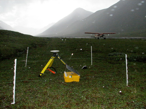
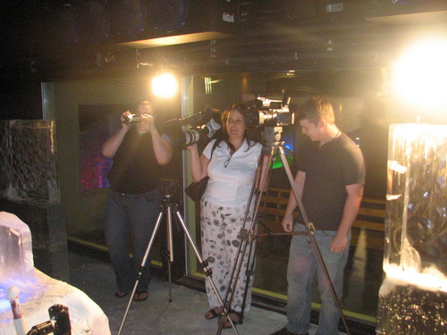
08 (Day 78): High-resolution aerial photography The weather today unfortunately took a turn for the worse. Unlike the previous several days, the clouds never settled down at night and it was a clear that a new weather system was moving in. So lidar was shut down. But we had already scheduled Dirk to come in from Coldfoot and really our primary focus of this trip was to collect some GPS ground control for the lidar, and this still seemed possible. So we loaded up the plane with camera and GPS gear and headed off. Our first stop was McCall Glacier. Before the weather got any worse, I wanted to see whether it would be possible to land there directly on the ice. Jason was ready on the ground to flag out the area he thought best. Unfortunately the snow hadn’t completely cleared and conditions weren’t suitable for landing. We still had some food and gear with us for the glacier crew, so we ended up dropping it to them. Most stuff survived, but we learned a few things about packaging. After this we headed off to take a few pictures. Though we traveled through a few showers, in general the weather was fine for photography and we spent some time in the upper Jago and Okpilak valleys. Benny sat in the back and shot out of the open door, while I was in front shooting out of the open window. Shooting with the 8x10 camera is a challenge. After each shot, the film has to be removed and replaced with another sheet. A few days earlier we had preloaded a bunch of film into holders, which must be done in complete darkness. Given the 24 hour daylight here, this required use of a “dark tent” specially made for this purpose. Another challenge in the air is that the wind wants to rip the film out of your hand; fortunately this never occurred here, but Benny had some stories about this from previous experience and came up with a system to prevent it from happening again. In any case, in about 30 minutes we saw a lot of nice scenery and were able to capture many glaciers. We didn’t linger too long here as the weather was threatening and we still had GPS work to do.
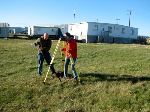
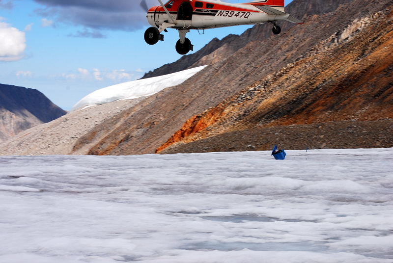
The GPS work went well, though I did get a bit wet. Our first stop was the mid-Jago strip where we deployed the base station a week earlier. The others decided to wait in the plane has a thunderstorm passed over us, also making me a little nervous walking around with an antenna on my back as lightening crackled within the valley. But I didn’t get fried while collecting the ground points and the base station was still in good shape. Next we went to the Bitty strip, where we began our hike last year. The weather here was better, but bugs were out in medium force, and I don’t think Benny believed us when we said that they get much worse that this. But within an hour we had collected a bunch of points and we were on our way back to Kaktovik having successfully completed our missions. I think Benny was happiest of all, as he had never been to Alaska or the Arctic before, and this was a pretty spectaclar up-close-and-personal visit to some of the most remote and beautiful scenery in the country. It remains to be seen whether any of our films exposed correctly or not, but the digital cameras seemed to hold out.
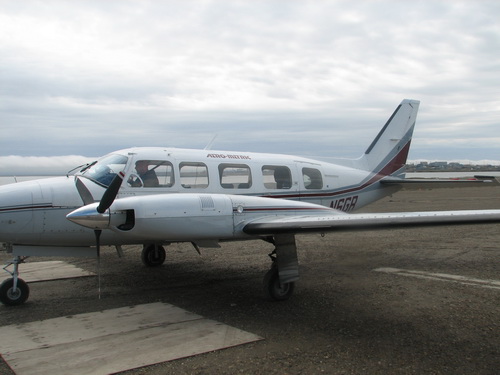
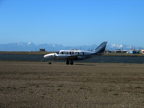
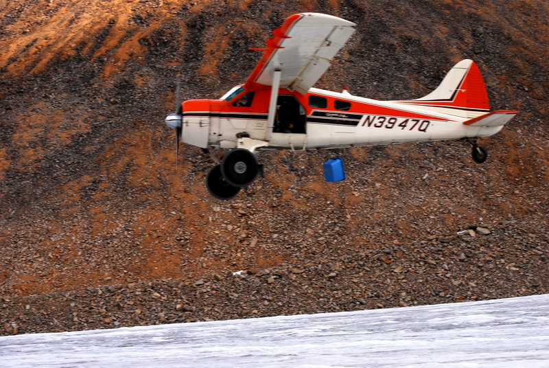
Dirk’s Beaver on the Bitty strip on the Jago River in the coastal plain. 09-11 July
2008 (Day 79-81): Return to civilization
Huge snowfences surround the infrastructure of Kaktovik. These fences slow down the blowing snow, helping it accumulate behind them rather than behind all of the buildings in town. Turner says goodbye to Jessica. Fairbanks hadn’t changed much, but there was a lot more green and trees around than we were used to. Our house survived, but had been inhabited by voles and ants during our absence, causing an unpleasant mess. We made the mistake of dropping off our stuff at the house before going out for dinner – Turner was very happy to find all of his toys here, but very unhappy to be taken away from them again 10 minutes later. But just as quickly he was happy again to be running around on the deck of the Pump House and throwing rocks in the river. A few hours later we were all asleep in our own beds again, for the first time in about 3 months. And it felt good.
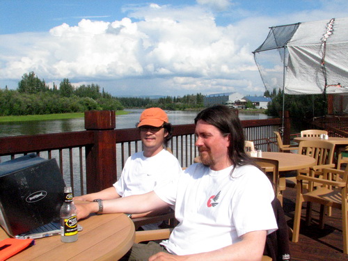
The next day, Friday, I spent with Benny, showing him the sights around the University and trying to explain the Fairbanks lifestyle to him. We toured the museum, showed him my office/closet, ate at Lemongrass, and took a look at Fairbanks architecture. Dinner was a simple pizza and beer meal at our house, eliminating the need for Kristin and I to play tag team chasing Turner around a restaurant. Next day we ate a nice lunch at Pikes before dropping Benny off at the airport. It was a great visit with him and I learned a lot about high-end photography and I think Benny learned a few things about Alaska too. I think we’re both looking forward to continued collaborations.
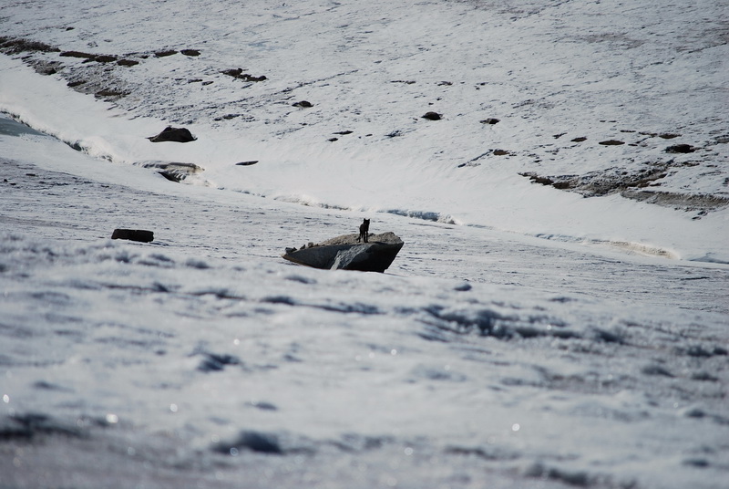
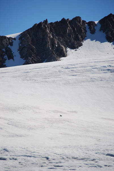
Turner: “What a concept – you can jump and land on something soft!”. Jason and Joey seem to be doing well on the glacier. They’ve been busy at the terminus and also on the glacier doing mass balance and velocity surveys. They also reported seeing a black wolf on the glacier. Jason was up early to take advantage of the hard snow, but noticed him loping up towards the lower cirque where he was planning to go. But rather than go up and over Bravo Pass, he turned around and found a nice big rock near the stream at the confluence to take a nap on. Apparently it was a bright sunny day, and he zonked out for several hours. Jason decided to leave him be until he woke up on his own, but eventually the need to get some work done was too great to ignore and they tried to sneak around him on their way to the lower cirque. Despite their care, the wolf detected them and attacked viciously. Jason’s left arm was nearly ripped off, and when Joey tried to help, he went for her jugular. Actually, the satellite phone call was a little garbled, and it could be that he just ran off, up and over the middle cirque. But then my new favorite TV show began and I had to hung up before I could clear the confusion.
14-16 July
2008 (Day 84-86): Press releases gives McCall Glacier another 15 minutes
of fame Much of the time related to this got soaked up getting photos ready. I had prepared a bunch the week before, but then I was told we needed model release forms from everyone in the photos. Of course nearly all my photos have people in them, and most of these people are hard to get hold off in summer. So then I had to sort through to find photos that didn’t have people in them. I also wanted to stitch a few more panoramas that were related to the drilling, and this took more time. Then we had a teleconference with the press which lasted several hours, after which many of them called me back to talk one on one, including a radio interview. The next day, this article appeared in the Anchorage paper: http://www.adn.com/626/story/465838.html. What I found most interesting about this article was actually the comments people left in the online version. Most of them were of the form “This is a waste of our tax money” and “This is just another attempt by evil scientists to convince of the hoax of climate change”. I was quite surprised. The next day the local TV station joined us at the Ice Museum where the cores are being stored. We found the boxes sitting in the cold room where they give carving demonstrations. Everything looked like it was in good shape fortunately, and the tourists milling about were excited to see the cores. The interviews went reasonably well I think, and later that night the story appeared on TV.
This morning, the entire Nolan family
made the front page of the Fairbanks paper, as well as the highlight story
of the IPY site, thanks to Stefan. The day before our press people had
given me a list of photos from my blog that they liked, and one of them
was a pretty picture taken from the Hut with Kristin and Turner overlooking
the glacier towards Bur Cirque. I never expected this picture to be used
since it has nothing to do with the drilling, but it appeared smack in
the middle of the front page, along with a smaller photo of me shpeeling
while holding a core in my hands in the museum. http://newsminer.com/news/2008/jul/16/ice-samples-anwr-glacier-give-scientists-look-arct/ What I found interesting is the differences and similarities between the two articles. Neither article overplayed the climate change angle or even mentioned the issue of whether the current changes were influenced by humans, despite the way many of the commenters read it, and neither took anything out of context or tried to steer the implications to suit their own agendas, which was nice. The big difference I found was that the Anchorage paper felt they needed a bigger hook than the real story itself – their lead was essentially ‘drilling has begun in ANWR’ – whereas the Fairbanks paper thought the cores were interesting on their own. After reading both stories and their comments, I was left wondering which came first – idiot readers or reporters that think their readers need shock-and-awe in every bit of news. Maybe it’s got something to do with the size difference between the cities, and their being more competition in a variety of ways in the larger and denser locations, and this process simply gets worse in real cities in the south. The Sitka newspaper, for example, just reprinted our press release verbatim http://www.sitnews.us/0708news/071608/071608_mccall.html. In any case, it seems to me that there is some relation between city size, what is considered news, and the type of people that read it, but I’m not exactly sure what that relationship is. PS If anyone comes across links to this story in your local newspaper or radio, please share them in the comment section of this blog – thanks. 17-18 July
2008 (Day 87-88): Same song, different station
Another thing that has been consuming a lot of my time are phone calls and meetings to keep the project moving forward. I had planned to do a bunch of repairs on the house while here, but I haven’t really come close to having this make it to the top of the list. My experience with field work has led me to believe that success in the field is really all about chasing the details and having contingency plans, and this simply requires a lot of time. I tend to take the Colin Powell approach in general – have a clear goal, go in with overwhelming power, and have a clear exit strategy. The real challenge comes in deciding which details are most important to chase first, because there’s simply not enough time to do everything and the logistical landscape shifts so much that you can waste a lot of time working one angle only to find that one of the elements not in your control has changed significantly. So flexibility is a key. Phone calls and meetings don’t
lend themselves well to photography, but I can paint a quick picture of
the issues with words: So in between vacuum sealing rice, wrapping Tang in bubble wrap, and playing dinosaur with Turner, we’re trying to sort out these logistics. But in a few hours we’re headed to Colorado for a week-long family reunion on Kristin’s mother’s side, and its time to begin thinking about packing for that… July 19-26
(Day 89-96): And now for something completely different
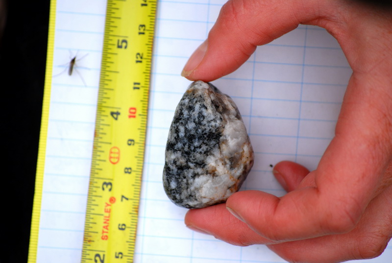
Meanwhile back on the glacier, Jason and Joey continued working at the ice, streams, and tundra. One task we wanted to try out was sampling the rocks for diatoms along various stream transects, as a means to assess water quality and variations in it. Diatoms come in many shapes and sizes, and each has it own preferred habitat. So by surveying what's living where, we can get a sense of how the conditions in the water vary. The basic idea behind sampling is to grab some suitable rocks and scrub off the diatoms, which are too small to see, with a toothbrush into a small jar for storage and later analysis. They also took a few days off for some hiking in the Jago River area, saw tons of caribou and even more mosquitos.
|
(c) 2003 Matt Nolan. If you find any broken links or other errors, please let me know. Thanks.