Dr. Matt Nolan
Institute of Northern Engineering
University of Alaska Fairbanks
|
|
Dr. Matt Nolan
Institute of Northern Engineering |
|
McCall Glacier IPY Lake El'gygytgyn IPY Virtual Globes IPY
|
July 27-Aug
3 (Day 97-104): Phase Four of the trip begins without me
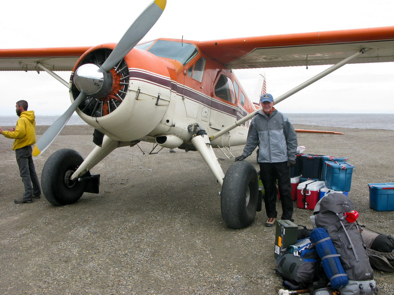
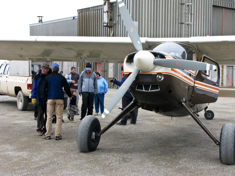
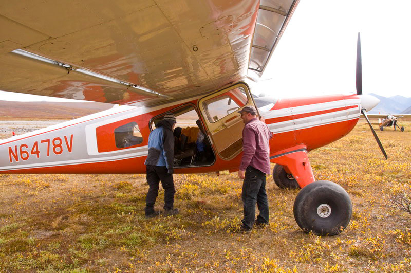
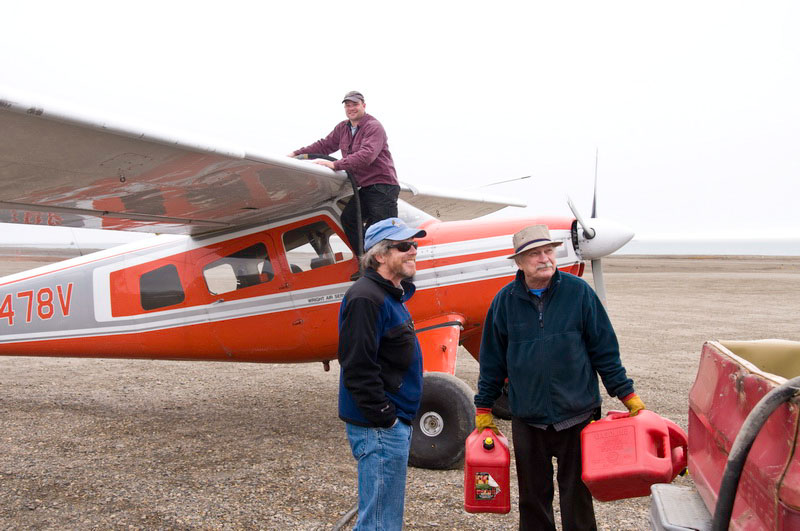
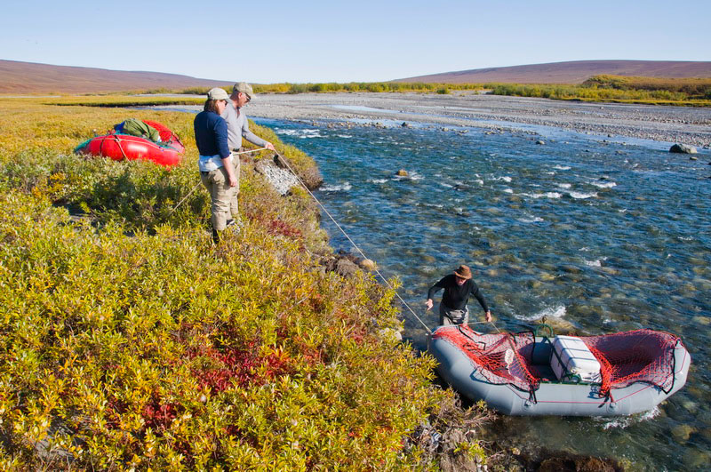
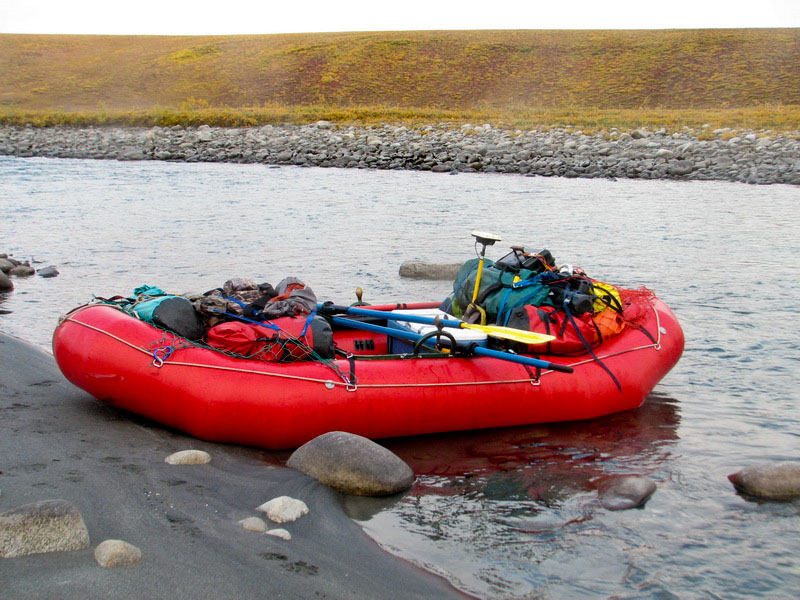
This otherwise tidy plan began getting complicated and stressful while we were in Colorado, where I learned that Aerometric’s GPS contractor was planning to service the remote base stations in our area at the same time we had planned for our put-in. He and Dirk are old friends, and apparently have a pretty casual relationship when it comes to scheduling. The trouble was that now the plane was getting pretty full and with competing dynamics, and Dirk was starting to get stressed about it. The night before we traveled to Kaktovik, he told me that he only had these two days available for our project, and if it didn’t happen in those days due to weather that he was not planning to come back. This was fairly ominous since he had 12 boxes filled with our food and gear, and the weather was marginal in the mountains and at the time as Jason was alone there in a blizzard. The next morning we arrived in Kaktovik on Frontier. It was windy in Kaktovik but the mountains were clear. I called Dirk and left a message that we had arrived and things looked good enough here. We repacked our things and ate some lunch while waiting for him. Soon enough he arrived and we all headed down to the airstrip. I was surprised to see him offloading some of our boxes, as I had thought these would have been air dropped already, but as it turned out he did not visit the glacier. The winds were apparently too strong in the mountains for him to try, though Jason had just called saying it was perfect where he was and wondering where we were. What was worse though, is that he said he could not come back tomorrow due to his 100 inspections being due, and that this was our only opportunity to do anything with him for the rest of the year. This put us on the spot, as we had no warning of needing to rearrange plans or make backup plans, since I learned yesterday that it was these two days or nothing and now it wasnt even two days. With Jason on the glacier by himself, I had no choice but to send someone in. With no backup plans in place, and Andy’s team here only for a week, I really wanted to get them in and so decided to send them first. This was a difficult decision as they had no satellite phone or Icom, but they were all experienced folks and were eager to go, and I gave them a GPS-walkie-talkie so Jason could find them. With minimal food on the glacier, however, someone had to stay behind and arrange for both the airdrop and the takeout, as it appeared to me that Dirk had something against me or our project at this point and could not be relied on to pull us out. I asked him about this, and he said he had nothing against us, he was just overwhelmed with the amount of work he had on the schedule, but I wasn’t left feeling very satisfied by that explanation considering we were being abandoned. He had been, up until the night before, nothing but stable and trustworthy and thought of getting abandoned here never occurred to me, but here we were now -- half of us stuck on the coast without a paddle and the other half in field with no extraction plan.
I spent the rest of the evening and the next few days on the phone, trying to make new arrangements. Walt was in Anchorage, complicating things a bit. The weather was marginal anyway, with substantial snow overnight and in the morning on the glacier. Jason was able to head down to the terminus in the afternoon, however, and soon enough reached the hiking team via radio. They were forced to double carry their load, since they had a bunch of tools and parts that we had planned to airdrop but now had to hike in. So having made contact, they turned around for their second load. In terms of food, we had cached a substantial amount of emergency food in metal barrels along the way, in case of just such unplanned events, so they were also carrying that (well, Keith wanted to carry the barrels, but the others convinced him to just carry the food...).
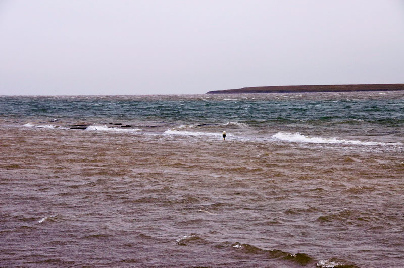
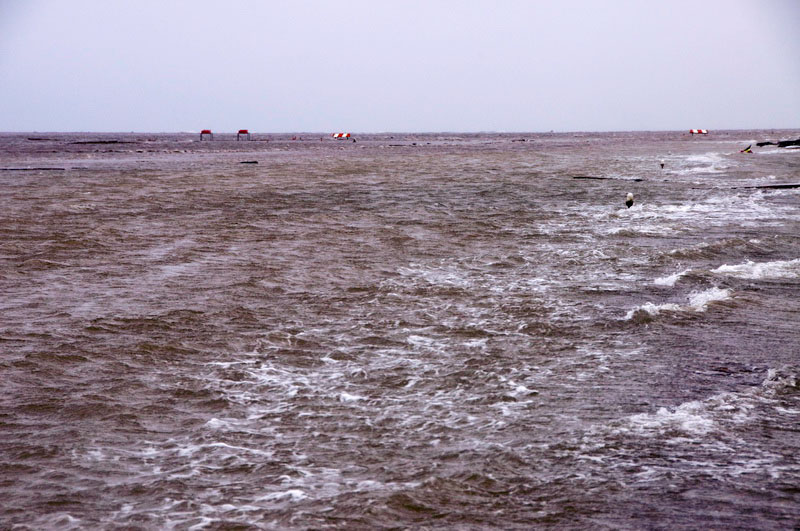
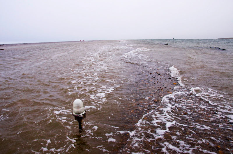
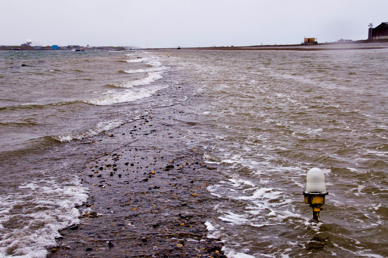
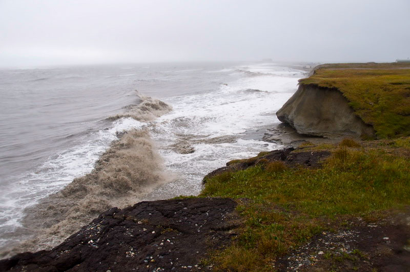
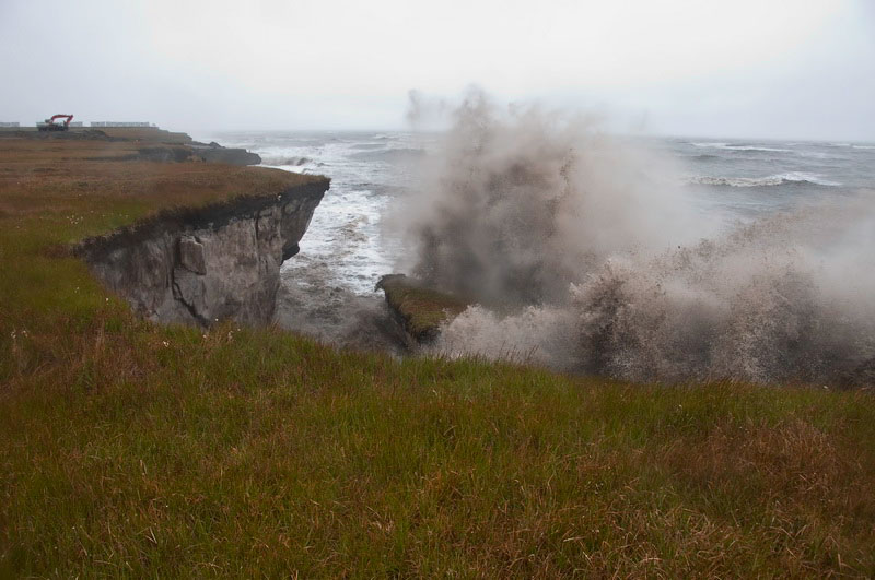
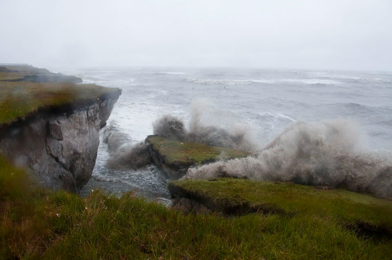
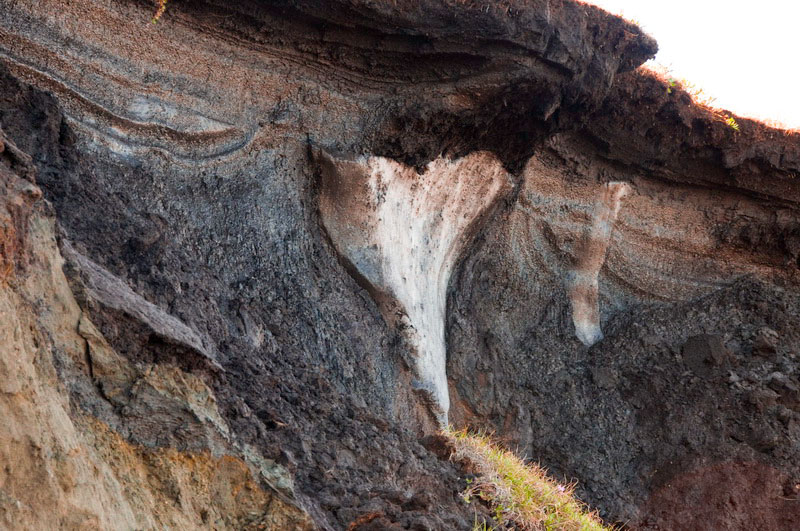
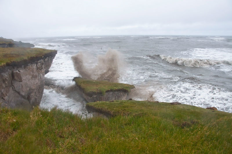
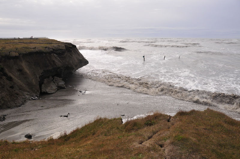
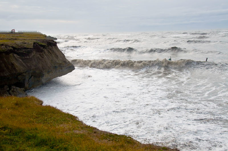
Meanwhile on the coast, a storm was brewing at sea and sending big waves onto the coast. It was impressive to see them crash into the bluffs and send huge blocks of dirt the size of houses into the sea, where the waves quickly smashed them into dust. The runway, being essentially at sea level, also disappeared for a few days, as did the big planes that needed to land there.
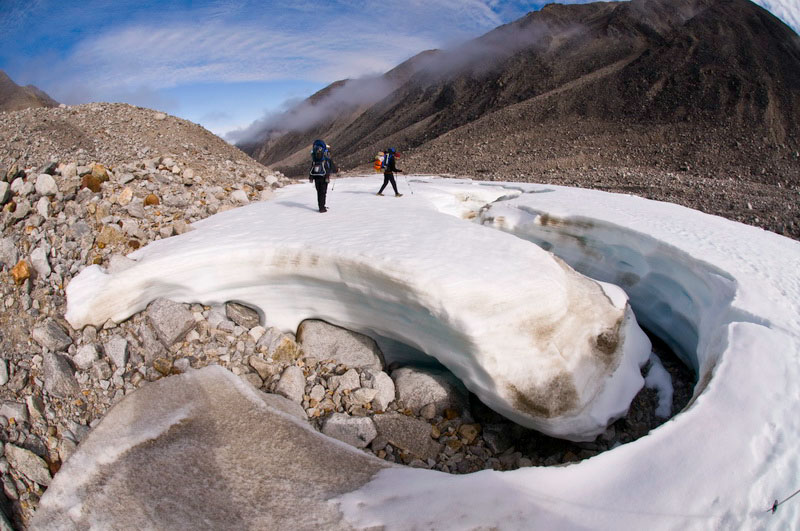
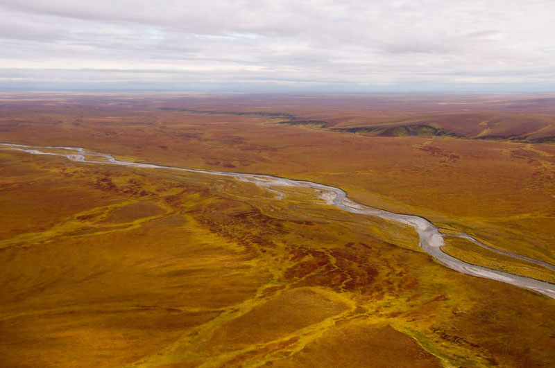
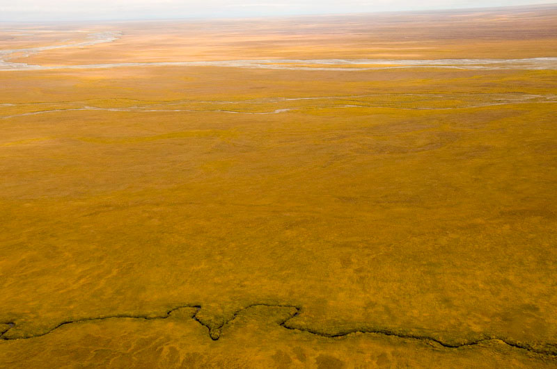
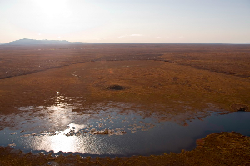
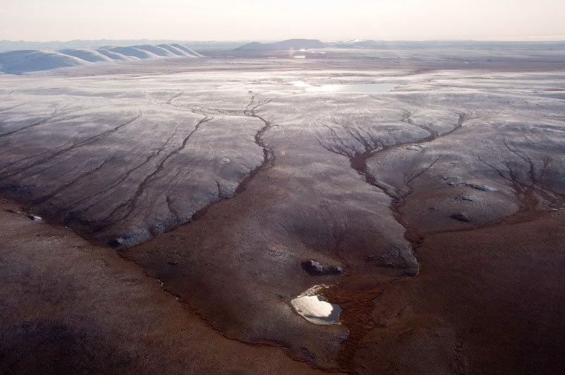
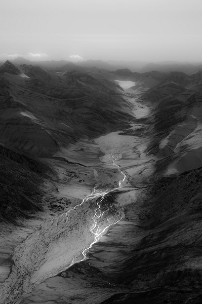
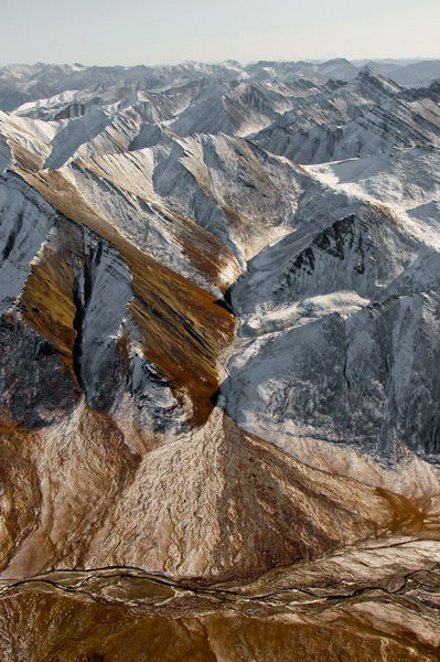
Erosion
in action -- 21MB
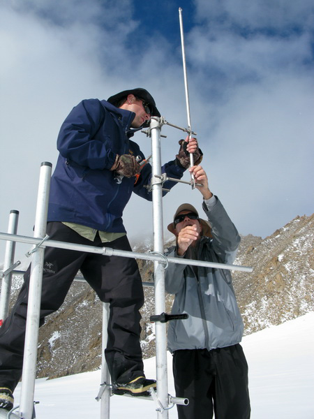
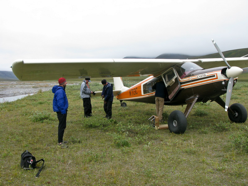
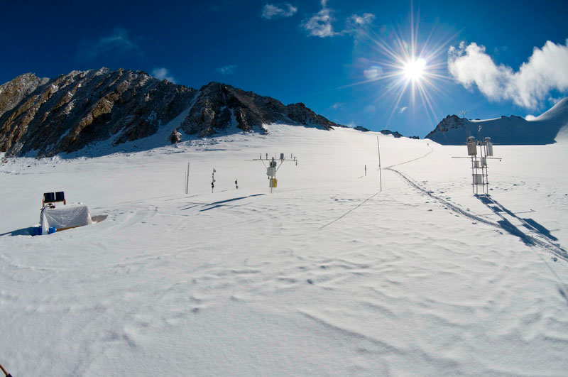
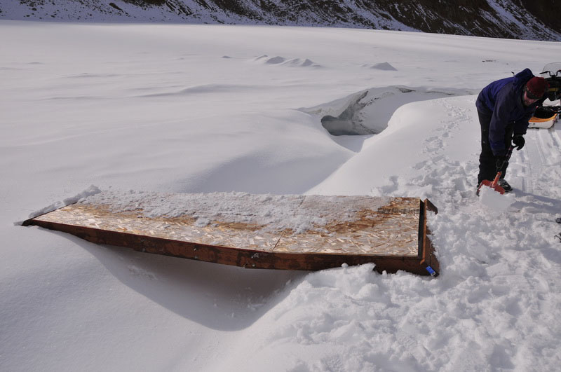
By the next day, the 1st, it seems like we had the start of a plan. Alaska Air Taxi has a 206 based in Deadhorse, but it’s pilot would not be available until the next day. The 206 is a little small for our needs, and even though our 500 pounds of air drop gear could easily be carried, the volume issues would likely require two trips, which was fine at this point. Back on the glacier, the crews were united and made it back to our main camp by evening. Not knowing the most efficient trails, they were pretty worn out but in good spirits. Only one bag of gear remained behind, just on the other side of weir, so at least some progress was being made. Walt made it back from Anchorage this morning, but the 206 did not. The plan at this point was that their Beaver would arrive in the afternoon. But the afternoon came and went, and the story was that it needed some maintenance and was waiting on a part. So we spent another day wandering around town, searching other options, and giving impromptu glacier lectures to tourists. Jason and Keith headed down to the terminus, where Jason conducted stream surveys while Keith headed down past the weir to retrieve the remaining gear. Andy and Dave headed up to the upper cirque to begin installation of the new weather station, and were able to get the structure more or less finished. All were back in camp by dinner time, and it was nice to know that progress was continuing to be made somewhere.
The next day we received word that the missing Beaver part didn’t arrive and it probably wouldn’t until evening. So predictably for the Arctic it showed up soon after hanging up the phone. Unfortunately at this time the mountains were clouded over. So the pilot took a load of rafters who were also stranded out to their put-in while we waited for an improvement. It was still marginal by the time he returned a few hours later, but we decided to go for it as the glacier crew said it looked great from their position. We got to the mouth of McCall Creek and circled around where we thought the glacier was, but the clouds were pretty thick. I knew that if we came in from south fairly high we could descend into the hole, but given that the pilot had never tried air dropping before and had never even been to the Arctic before a few days ago, I wasn’t in the mood to try anything that didn’t seem easy. The plan was that he would spend the night in Kaktovik so that we could try again as soon as the weather broke. But once back he had itchy feet to do the minor maintenance required back in Deadhorse, and swore he would return first thing in the morning. Of course as soon as he left, the clouds lifted from the mountains and we were treated to a gorgeous evening and we never saw him again. In the meantime, Dirk had apparently landed in Kaktovik to pick up another group and left without mentioning anything to us about it. I called the GPS subcontractor to see if he had made any progress. He had apparently just arrived back in Anchorage. After I said hello and asked him how things were going, he called me an asshole, told me he wanted nothing more to do with me or my project, and hung up on me. After a few moments of stunned silence, I called him back and told him I appreciated his honesty but I was just curious as to what caused all this. He told me that he was pissed that there was not enough room on our one and only flight for him, and that he had to spend another 2 days in Coldfoot after Dirk came to drop our stuff off and told me he was no longer doing any GPS for our project. I explained to him that my impression was that it was his showing up without making a reservation that got Dirk so worked up that he abandoned us, almost stranding one of our guys in the field alone forcing us into essentially rescue-mode decisions, and that while I feel for him having to wait another day and half for his flight after that and then using Dirk for the whole day in our area without helping us out, that a week later we were still stuck here and that in the future he should think about actually scheduling in advance rather than just try to mooch off my logistics. In the end he apologized, but given his initial attitude, my suspicions about not knowing the full story of what was being discussed in Coldfoot seemed confirmed, and now my impression is that it was this guy stirring the pot there that got Dirk going sideways with us and had I told him to find his own ride initially that we would have had no issues with our put-in as planned. Aug 4-6
(Day 105-107): “Bad news”
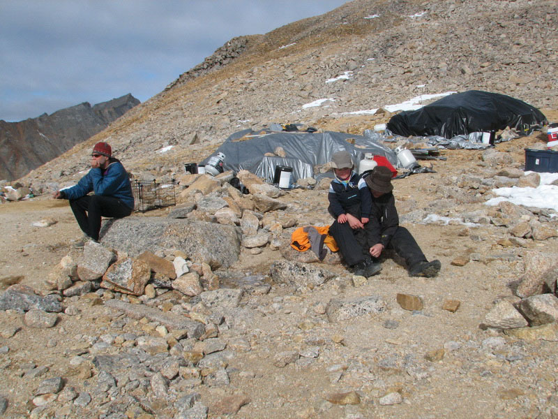
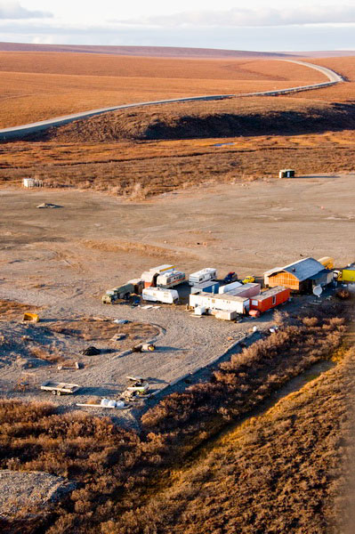
As I was heading back into town, I noticed an unusual amount of four-wheeler activity. Normally there is someone driving around almost any time of day or night, but here it seemed that half the town was heading down to the runway, similar to the way they do when Frontier shows up with mail or passengers. I bumped into Dave, who had bumped into Susan, who told him that some “bad news” came in over the CB channel that everyone keeps on in their house. As it turns out, two of the locals drowned a few days earlier during the storm after their boat capsized, some 20 or more miles away. It took this long for the wife and two small children to make it back to town. In a village of 300, where most people are related to each other in some way, any death is a tradgedy that affects the entire community, but these were two very well liked folks, so it was particularly tragic. The bodies still had not been found, so the North Slope Borough’s Search and Rescue department were alerted and heading over from Barrow. Fuel is always an issue in Kaktovik, so I went over and talked with Fish and Wildlife about using their fuel to support the helicopter and made sure we had the key and power for the fuel pumps so that when they arrived in the middle of the night there would be less confusion. Predictably, the SAR folks showed up, but Alaska Air Taxi did not. I don’t know what their issues really were, it was always difficult getting a straight answer from them about scheduling and things continued to go downhill. The phones in Deadhorse were on the fritz which didn’t help any, but basically the message was that their planes were all down for maintenance or didn’t have pilots or something. So we spent another few days in Kaktovik which, given the circumstances and SAR efforts was not in a very lively mood, so my birthday was celebrated quietly in the back room with a Merylin cake. At this point, my thoughts were concerned less with getting us and the air drop food and supplies in, than getting Andy, Dave and Keith out. They had wrapped up their installation and were eager to head back to the airstrip on the tundra so that they could wait there for any opportunities to head out. Jason hiked out with them this time, both to show them the easiest way but also so as not to get stuck there by himself, since we still had no real logistical plan.
Aug
7-9 (Day 108-110): Back on the ice
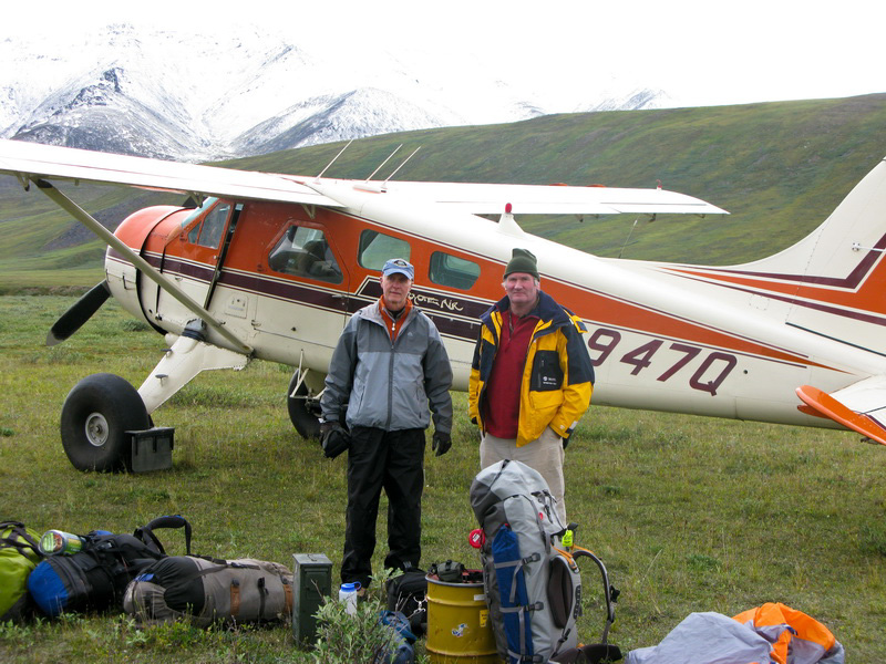
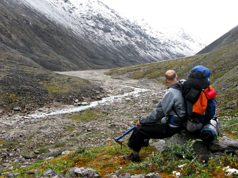
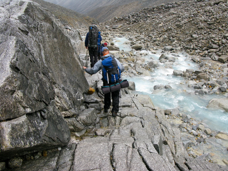
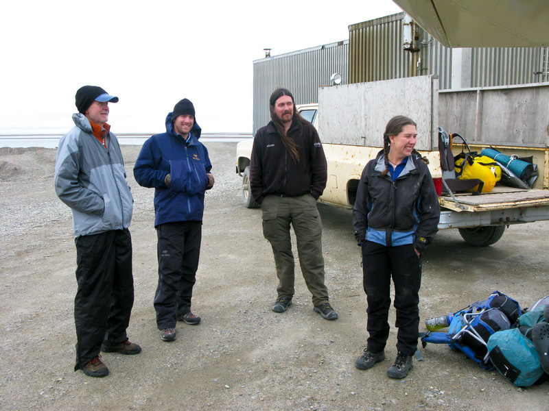
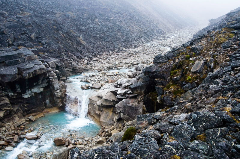
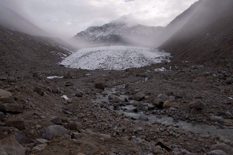
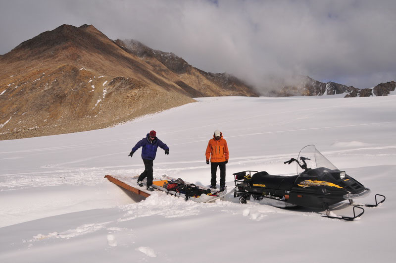
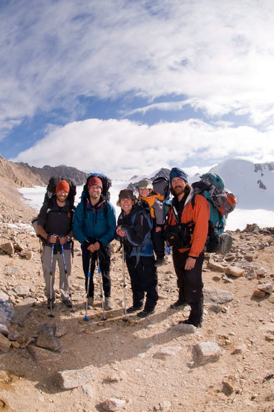
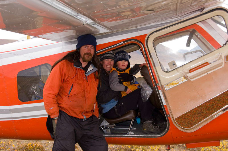
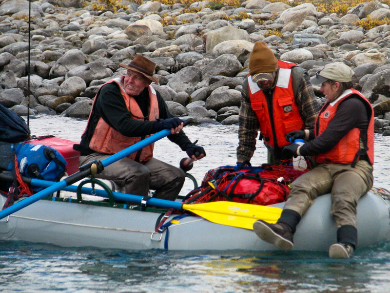
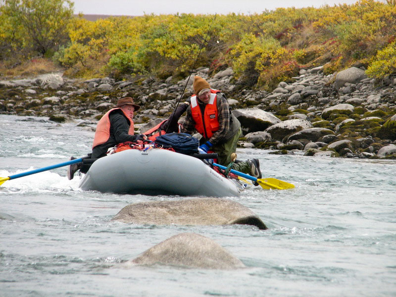
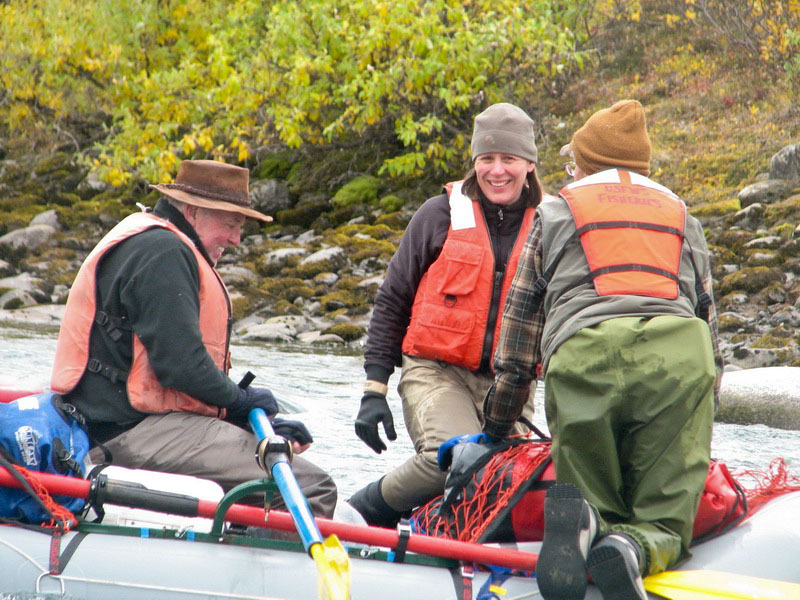
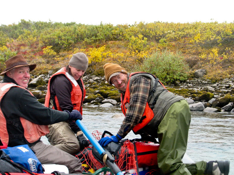
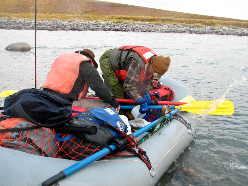
The weather was reasonably good, and we were eager to get going. "We" in this case was Kristin, Turner and I along with Jason and David Silverstone, a student from APU where Jason teaches. By this point Jason had hiked this route many times now, and already having great trail finding skills, was able to lead us into McCall Valley in only 3 hours. We camped at the base of the first ancient moraine, where we found flat ground and nearby water. The bugs were largely gone by this point and we were in great spirits, ready to get some of our own work done finally. The next morning we still had low clouds, but no rain, and we had a relatively uneventful hike to our terminus camp where we spent the night. Crossing the nasty rocks by the weir along the way was once again a stressful occurrence, but we were glad to be over it and still hopeful that this would be the last time for the season. We still had hopes that our air drop would materialize, but we restocked our emergency caches along the way and brought additional food with us.
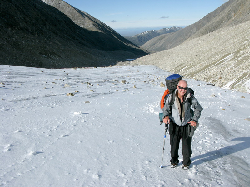
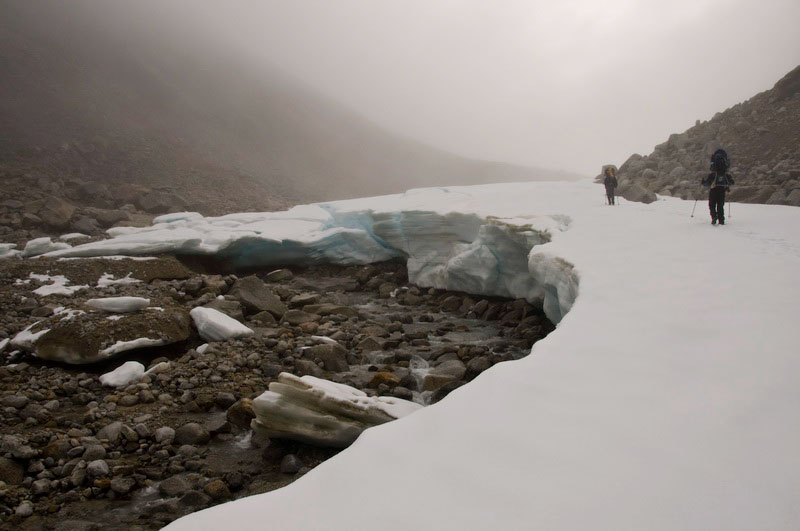
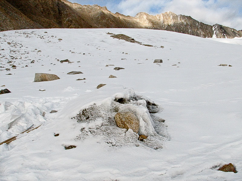
At this point we had pretty well written off the gear that was included in the air drop. This was just as well as much of it related to stream work and as it turned out the stream was really low due to the lack of melt on the glacier. The terminus stream was quite easy to cross and due to the lack of surface streams on the glacier it was clear that any sort of dye tracing would not be possible since there was little to no water running from the glacier surface to the base of the ice. The idea with the dye tracing was to insert some non-toxic dye into a stream on the surface of the glacier, just before it plunges to depth in a moulin, then see how long it takes to come out at the terminus. Depending on the nature of the basal hydrologic system, this could be hours to days. The early August snows had yet to melt from the surface, which was blanketed in pure white, even more so than in April when wind scour had exposed glacier ice. For me this was something of a disappointment as I had planned a bunch of repeat photography with an exposed ice surface. Taking photos now, it would appear as if it were still winter! The next morning we made the final push up to our moraine camp, downloading and maintaining weather stations along the way and determining what work remained to leave them for the winter. Camp appeared as Jason had left it, and it was nice to arrive and be fully functional so quickly. Aug 10-14
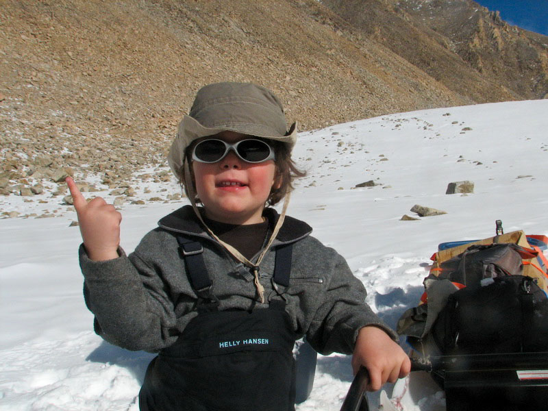
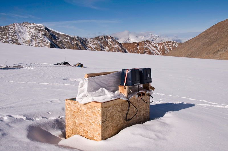
(Day 111-115): Weather station maintenance One thing I had hoped to accomplish this summer in all of our free time was to do some much needed overhauling of the programs in our data loggers. Typically I try to avoid making any changes to these programs because it risks messing them up and not catching it until after we leave, and usually our trips are so short that there isn’t sufficient time for double-checks. But here we were and it was time to update them. Most of the issues were related to instruments which had been removed or measurement rates that were too fast and therefore consuming more memory than was needed. In the past, we’ve had issues with the telemetry dying over the winter and there not being enough on-board storage to save all of the data until we returned. So first thing I spent the day diving into the 3 programs, modifying them appropriately, and uploading them remotely from camp via the telemetry – crossing my fingers that they would still work as hoped. Jason and Dave spent most of the afternoon breaking down the stream camp and bringing everything back up to the moraine camp while Kristin began the enormous chore of burning the mountain of garbage that had accumulated over the past 4 months, one bag at a time in our burn barrel. Turners birthday came and went with about as much fanfare as mine. We had packed a few small presents for him in our airdrop, but these boxes were still in Kaktovik. He is still young enough not to know which day is his actual birthday, so we put off the celebration for a later date.
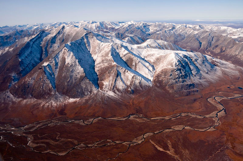
Taking
a tour of the glacier -- 30MB The next morning began with work in the upper cirque. It had snowed overnight, blanketing camp with about an inch of fresh powder, letting us know that winter was not far behind. While Jason and David began our end-of-summer mass balance measurements, I worked on the weather stations there and began digging out the cache left over from the spring drilling as well as demobilizing our ice-core freezer. It was a bit sad to take the freezer apart, as in general there was a lot of what seemed to be unnecessary heartache to get it funded, despite the huge cost savings and increased security it provided.
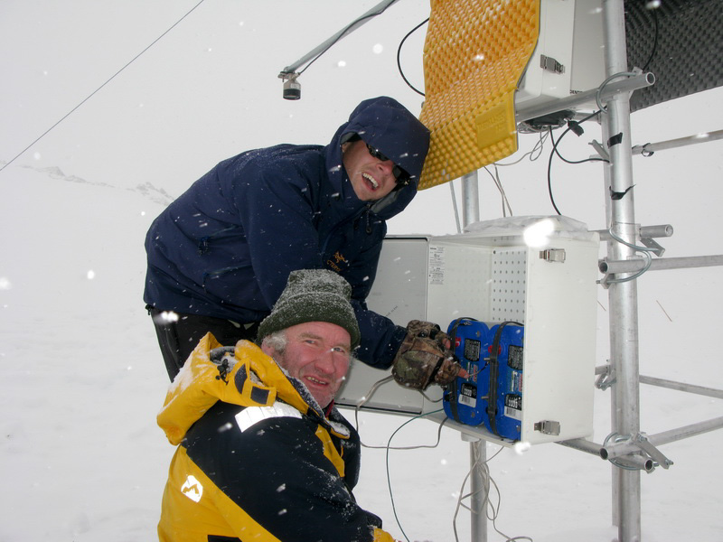
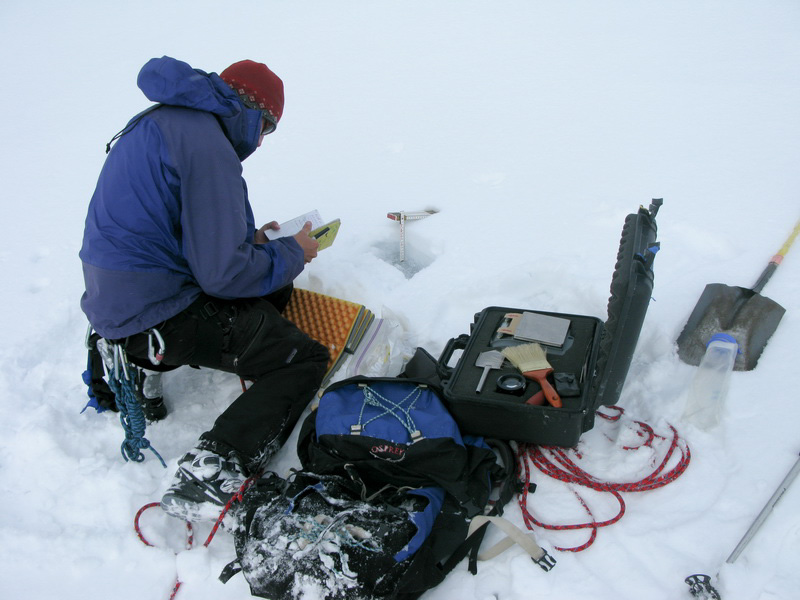
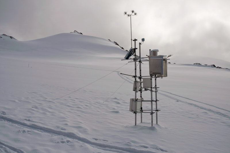
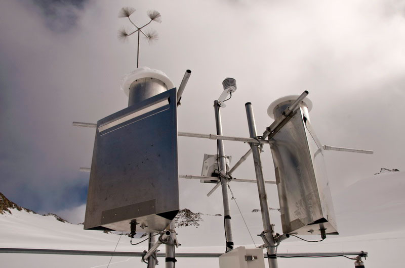
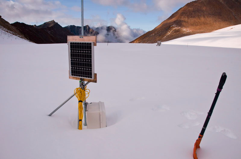
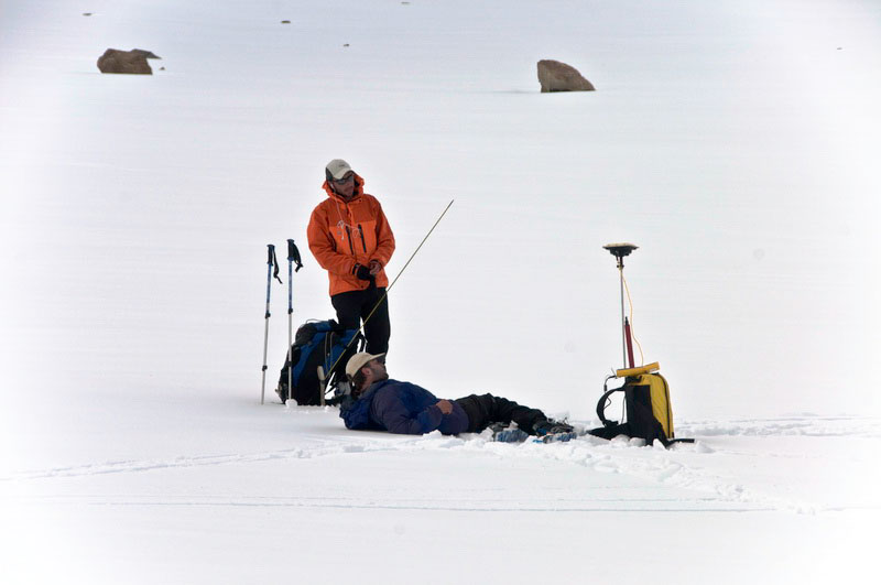
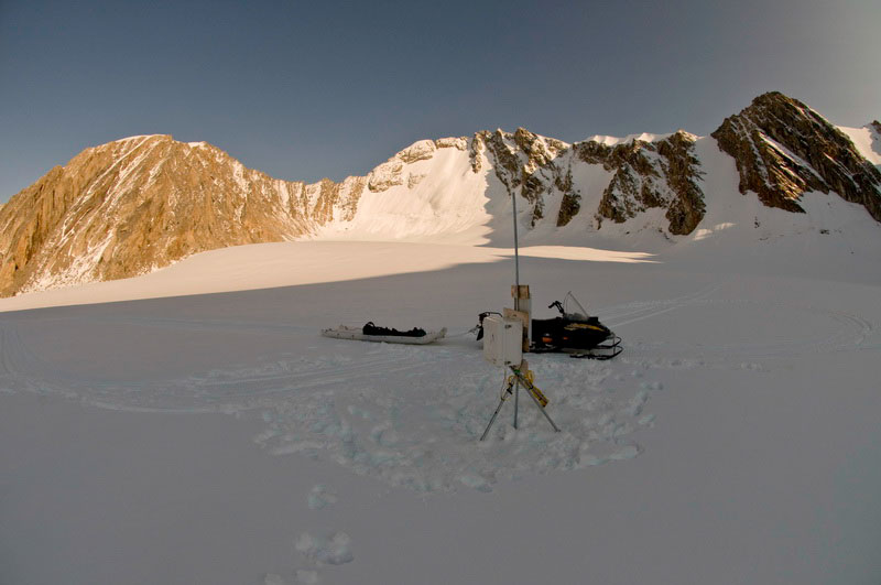
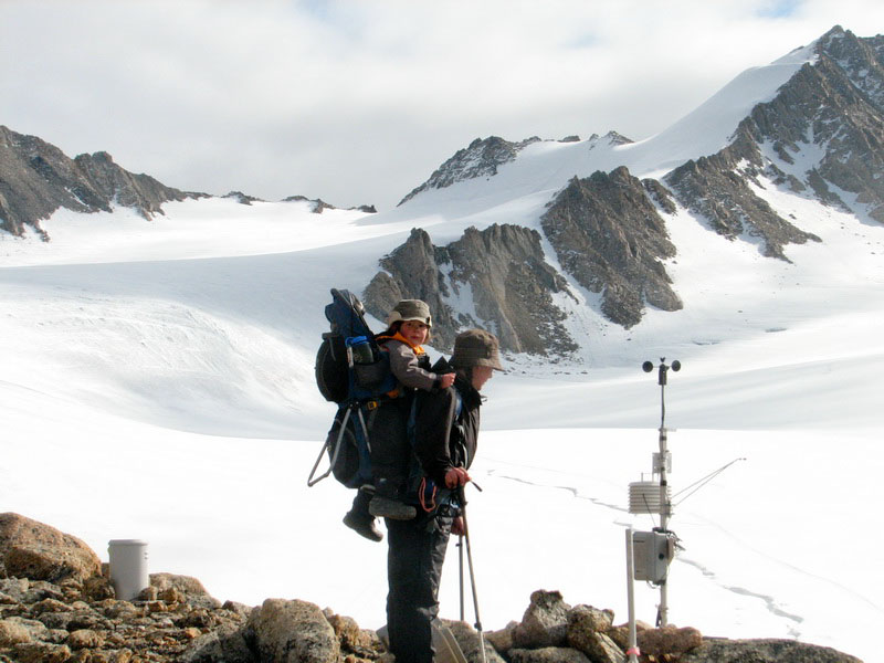
The next morning began with the usual few hours of phone calls. The current plan was to blow off the airdrop and just have the boxes come in on a helicopter that would take us out. While in Kaktovik during the Search and Rescue operation, I talked with one of the pilots who had a side business running a small helicopter. He seemed conducive to doing some work for us, so I got him on-board and the funding lined up for him. There were some issues about him still in the final stages of approval with FAA, but it seemed a pretty sure thing. I also needed to keep on Aerometric to continue with the lidar acquisition as well as begin lining up the logistics for the final phase of the trip in September, an extensive aerial photography campaign to inventory all of the glaciers in the Brooks Range, another thing I initially planned to do with Tom with Dirk as backup. Jason and Dave continued on with the mass balance and GPS measurements, and by about the time I was ready to throw the phones in a crevasse they called to say that the GPS was no longer working and it seemed related to a particular cable. So I brought the spare cable down to them by the hut, and then did some work on the weather station there. The most important physical maintenance that in general needs to be done on this one is making sure that the device that measures snow depth does not melt out so far that it tips over and also that the device that measures sunshine is more or less level. The final task of the day for me was checking on the weather station in the lower cirque. This was a new one that recorded ice temperature using the thermistor string that we dropped into our core hole in spring. The station tower was suffering some stability problems when I last visited it in June, when I moved the battery box to the base of the station to help keep it upright. In the meantime, the lower part of the cable had frozen into a pool of water (now ice) and needed to be carefully chipped out. Sometime during the summer, the connection between the logger and the main cable had shorted out (despite supposedly being waterproof) and it stopped recording. I couldn’t tell when, because there also seemed to be a problem with the logger program. This program was written in a new language that I was unfamiliar with so it was difficult for me to debug. In general the cables were well constructed, but despite my insistence on it, did not come with any user manuals or wiring diagrams, so I spent a lot of frustrated time trying reverse engineer things. In any case, it was after 8PM by this point, so we all headed back to camp for some much needed food and refreshments.
Aug 15
(Day 116): Last repeat photography
CAMP SURVEY GIGAPIX GOES HERE With that warm-up panorama out of the way, we headed down to the terminus for the last of the clean-up work there. While the others sorted and hauled the remaining gear back up to the snow machine, I hunted for the old photo site. This shot was taken in spring on the Little Ice Age moraine, looking back up towards the terminus. I narrowed in to the spot pretty quickly, but it was clear that the moraine had subsided substantially in the previous 50 years. I knew I was pretty close when I tripped over some old tin cans, which presumably were left behind when the original photo was taken. I was able to locate a number of the rocks in the original photo, and determined that they had indeed changed location. These moraines are often underlain by stranded ice, and when this ice melts it gives the rocks a chance to shift. Plus the rocks left behind in a recent moraine are fairly loose so it doesn’t take much to get them tumbling, often inadvertently. Due to the shifting, I may not have hit the location exactly, but it seemed like I was within a few meters spatially. Jason and David waited patiently for me to finish, and then it was a quick hike back to the terminus camp for a final check and inventory before snowmachine back up the hill to our moraine camp to begin breaking it down. REPEAT PHOTO AND PANO GIGAPIX GOES HERE
The weather was still great and I took the opportunity to pack for the next part of the trip before things got lost in boxes. One of my many morning calls was coordinating to join US Fish and Wildlife on a float trip down the Hula Hula River to visit their sonar camp. For me it was also a chance to get on the river and get a better feel for floating logistics, as we plan to do a lot of that next year. The basic idea is that we are trying to get a better sense of the ways that changing and disappearing glaciers may impact the downstream ecology. Along the way I also wanted to collect GPS data to ground truth our new lidar DEM, so in addition to personal packing I needed to sort some gear and make sure I had all of the cables and know-how to succeed at this. Given that Jason and I would be quickly parting company once we returned to Kaktovik, we also needed to debrief each other on other technology issues and make sure equipment was heading in the right directions. So it was a busy day, but a very productive one, and also a bit sad that it was our last day of real work on the glacier for the season. From here on out, it was sorting, packing, and leaving. Aug 16-18
(Day 117-119): Packing up camp, for the last time this year
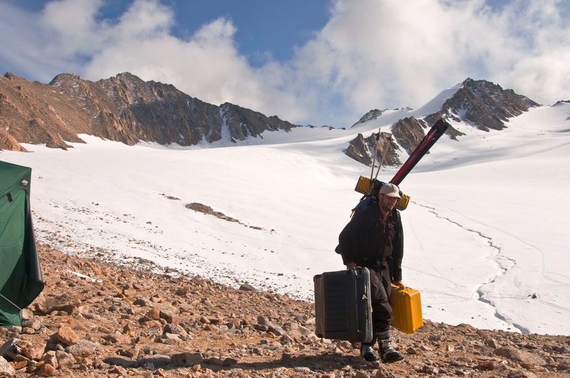
We had quite a mountain of gear. It was interesting sorting through it all, bringing up memories of April field work that now seemed years distant and coming across things that we thought we might need but didn’t end up using. The food situation was still pretty good. At this point we were eating mostly backpacking food that we had for a week or two of hiking that we had originally planned. Overall we had little wasted food and were still eating some of the lunch meats that we vacuum packed in April. Packing up by now had become a familiar process, with sorting and inventorying and trying to think one or two steps ahead of ourselves in terms of not packing things that we still might need or making sure boxes were labeled to end up in the right place. In the end, we added up about 2000 pounds of gear, requiring 3 to 4 trips with the helicopter. It sounds like a lot, but considering we were supporting 12 different people on the glacier over four months, it's really less than it might seem. Things started seeming serious when we finally broke down and dried the big cook tent, making the area look less like home and more like some outcrop we should leave soon.
Aug 19-21
(Day 120-122): Last hike to Hanoi
The next morning I was up early to get sneak in a nice panorama of the morning sunlight on another beautiful day, as well as make a few phone calls. I hiked across the river, which was easy to cross at this low stage, and found a nice spot to see the sunlit hillside we were camped on. Having never been on this side of the river before, I also wanted to explore the side valleys a little bit. We had a pretty late night, so I was able to get most of this done while the others caught up on rest, and by the time I returned Jason and David had packed and went for a hike on the other side too while we packed our things. VALLEY PANO GIGAPIX GOES HERE The remainder of the hike was under the same severe clear conditions and went by quickly. I chatted on the radio with pilots passing overhead, both to get a sense of the conditions and also to try to hitchhike a ride, since we still had no concrete plan for getting home. It turns out it was nearly perfect weather all over the state, so we probably could have gotten our helicopter ride in the end. But even though it was more work, I don’t think anyone had regrets about hiking under such great conditions. We arrived at our familiar camp site on the Jago River without incident and ate a big dinner. Jason was developing a serious case of get-home-itis and seriously considered getting on one plane we had talked with headed back to Happy Valley that afternoon and winging it from there. But in the end it didn’t return (or avoided us) and we spent a restful night knowing that we were now well past the crux of the trip and it was just the familiar waiting game from here on.
Personally I would have been happy to spend another week at our camp given the great conditions and lack of bugs, but the float trip was starting the next day and I did want to give that a try. As it turned out, Walt was able to arrange for Wrights to come get us with their Helio Couriers and soon after the typical mad dash going from waiting around to hearing an airplane on final approach, we were back in Kaktovik, putting an end to our glacier field work for the season.
Once back in town, we determined that there still were some seats on the next flight out on Frontier and after some quick goodbyes and frantic repacking, both Jason and David got on the plane and headed back towards civilization
Aug 22
(Day 123): A day off, sort of… Aug 23-26
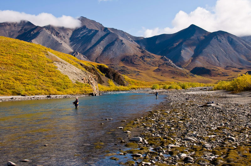
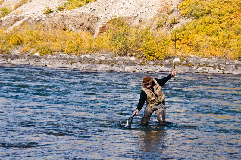
(Day 124-127): Floating the Hula Hula Jeff met me at the airstrip when I arrived. The others were all out fishing. It hadn’t occurred to me until then, but I guess that’s one reason why people go into the Fish and Wildlife Service – they’re into that sort of thing, the same way glaciologists like skiing or whatever. We shuttled some gear then hiked up the river to join the crowd. Everyone had chest waders and fly rods and were intently flicking little pieces of colored string in and out of the water. They offered me some gear, but I declined, preferring to take some photos. Given the weather, it seemed like I shouldn’t let the opportunity pass by.
I took a few sphericals along the river and of the fishing activities, but even while getting off the plane I had scouted my target for the evening – a nearby outcrop that overlooked the valley. The fall colors were at their peak. The only downside was the clouds were chasing the sun, just like they do on the glacier, creating large, moving shadows which make high-resolution panoramas nearly impossible. I hiked up anyway and spent some time considering camera angles and photo spots, when I heard Sean return with the remaining gear. I said hi over the radio and learned he had his fish too. My plan was to photograph the plane as it flew past me on the outcrop, and merge it into a panorama. I had forgotten how light his load was, so it only took him a few minutes to offload and I was caught offguard when I heard his engine spin up again. I still hadn’t unpacked my camera yet, and began fumbling with the buckles, getting it out, and hooked to my monopod. I didn’t even have time to check the exposure settings or focus, I just started clicking frames as he flew past me, right at my level, across the valley. Once he was past, I took the remaining photos for the panorama with the same settings and hoped for the best. Fortunately the controls were still set the same as at the river, so it turned out OK in the end.
The gorgeous weather tempted us into a late dinner, but was worth the wait. Jeff had organized quite the feast, with steaks and chicken and lots of snacks, inside of a huge single-pole tent. Unfortunately due to USFWS regulations, and the fact that most of participants were high up on the food chain, it was a dry trip. But given the amount we ate I’m not sure I had room for a beer anyway. The next morning I was up extra early to do some GPS work. The idea here is to measure the height of the ground while standing on the ground and then later compare this to the new map we made using airborne lidar. To get the needed accuracy, the GPS unit I use is the same one we use on the glacier. The accuracy of several centimeters comes by comparing the signals received by my unit to the signals received by other units nearby which are not moving. In this way, the distortions caused by the atmosphere and ionosphere which are common to these units can be corrected, making my measurements about 100 times more accurate than the type of units you can buy for $100 at the local outdoor store. While making my GPS measurements, I also took spherical panoramas. The idea here was to put these points into a local context, so that if discrepancies occurred when they were compared to the airborne data, one could assess whether this might have been due to the nature of the terrain – for example, were the points in error on gravel, as opposed to tundra, etc.
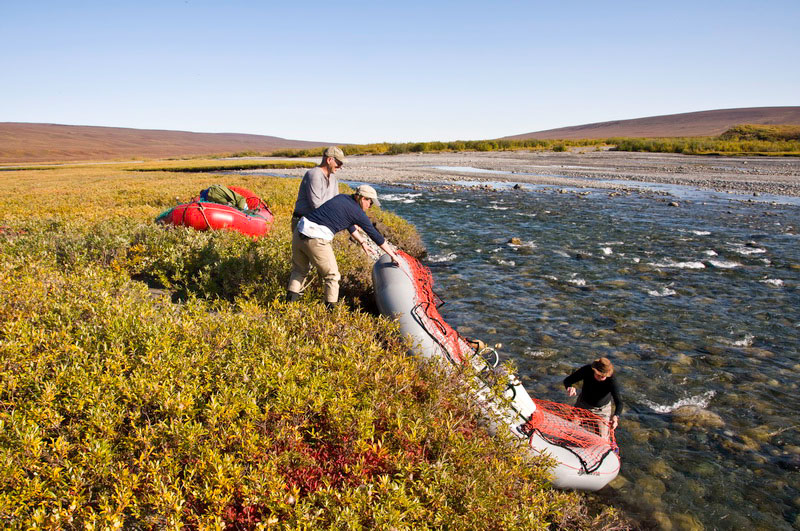
While I was doing that, the others began breaking down their tents and getting the boats ready. Having not done this in a long while, it was impressive to see the boats get loaded. Essentially all of the space where one would normally sit was filled with gear, such that the occupants simply rode on top of it all. I was also glad to see that my glacier trips are not the only ones with lots of stuff – this was deluxe camping, completely with tables, chair, BBQ grill, and lots of food -- and it was all mobile.
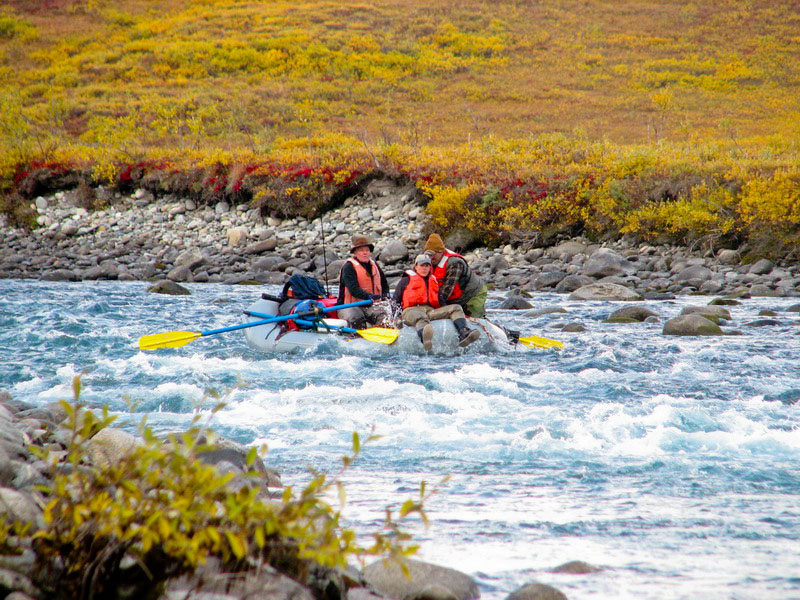
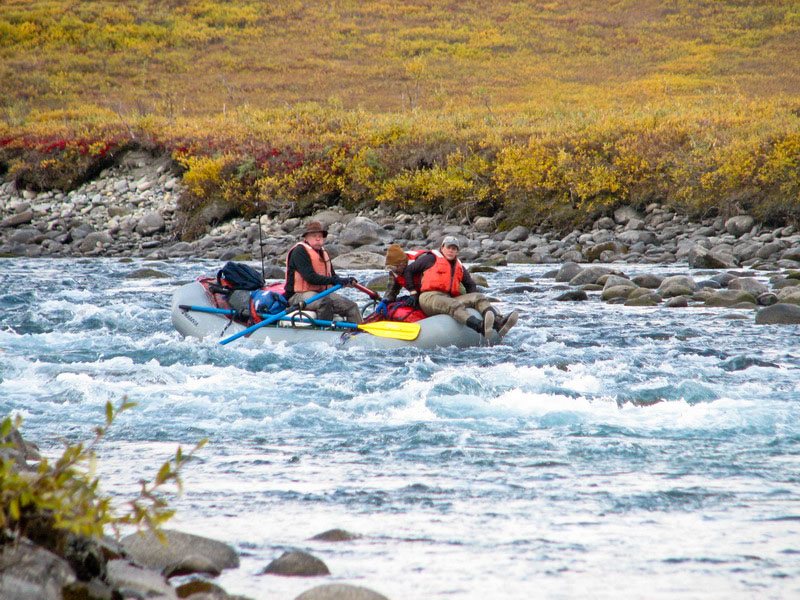
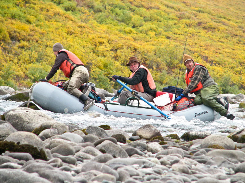
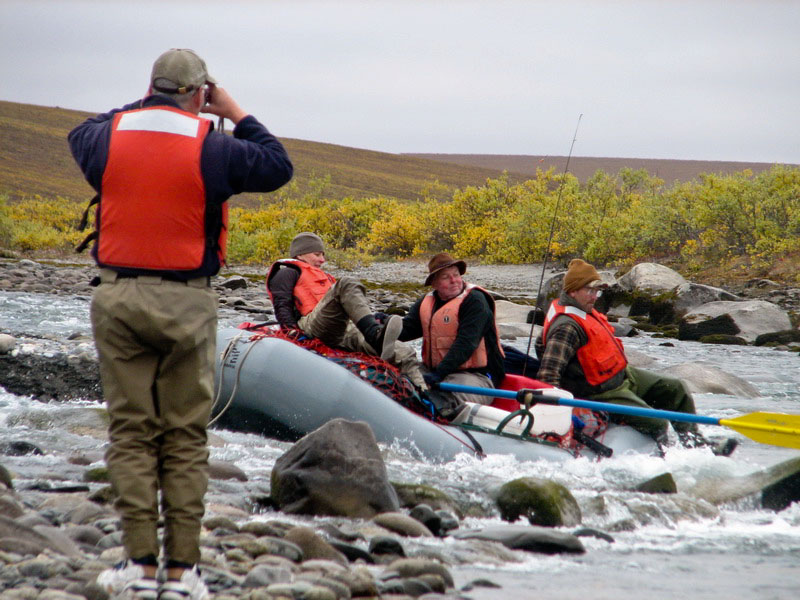
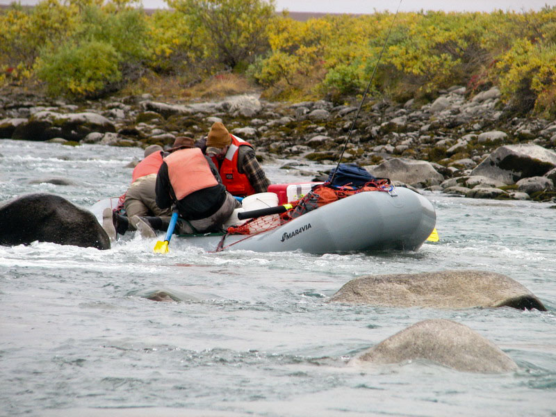
Once in the water and floating, it became clear that the water was indeed as low as it seemed. In many locations, there was simply not enough water to float the boats over. This river is braided, meaning that in many locations there are several channels, such that each channel has only a fraction of the total flow. So in locations where there was only one channel, it was reasonably easy to keep floating, but in the braids the rocks of the river bed were often above water level. So it was clear that a lot of pushing and pulling would be necessary.
Jeff, Tim, and I started out in the larger boat while Gary and Deb used the smaller one. These were inflatable rafts with oar locks, meaning that one person drove while the others tried not to fall out or get run over. As I was the only one without hip waders, I ended up driving the larger boat. We stuck together for the most part, but it soon became clear that the smaller boat was having a harder time getting over the rocks, so Jeff joined them, and spent most of his time in the water. I guess what I was most impressed with was the amount of work (and skill!) it took to work the oars. By the end of the day I was beat and quite looking forward to stopping to camp. It occurred to me that with glacier work, the majority of muscular activity was in the legs and back, and using the oars requires muscles that are not used to that level of work. Once we found a campsite, I peeled off again to take some photos while the beautiful light still lasted, and we went off to bed with full stomachs. SUNSET GIGAPIX PANO GOES HERE I began the next morning same as the first, by making GPS measurements and taking panoramic photos. The weather had held out through the night and I slept under the stars, but by the time we got underway in the morning a fog had rolled in and we lost the sun for the rest of the float.
For this part of the trip, having a little more familiarity with boat operations, I decided to hook up the GPS such that it would record while we were floating. This would give us the opportunity to collect many more points. Of course the water level in July when the airborne data were acquired was higher, but my thinking was that it should just be a constant offset, such that the slopes of both data would be the same and it would just be a matter of adjusting one of them. This all worked fine until the afternoon, when I leaned deeply back to get more power out of the oars in a tricky location, hitting the GPS antenna and breaking its mount. It still worked fine, but there was no way of fixing the mounting attachment in the field.
By about dinner time, we arrived at our destination. We began the trip on what the locals refer to as Fish Hole #2 and ended at Fish Hole #1. Here USFWS had setup a camp in late July to measure the number of Dolly Varden fish migrating upstream from the coast. These are a fairly large salmon/trout like thing, with pretty colors. They taste OK too, I learned that night. The crew at this camp currently consisted of only two folks, Ben and Dave, who had been there for the past month, with occasional volunteers coming for a week or so to help out. The primary equipment consisted mostly of a sonar unit, turned sideways across the river, which imaged the fish passing across its beam. These images were recorded and later analyzed to count the fish seen. The fish were somewhat funneled past the unit by a line of rocks they had put out. The other piece of equipment was a unit that measured water level, turbidity, pH, and conductivity. This was the same unit that we used on McCall Creek. They were having some trouble with theirs, and as it turns out they had ordered the wrong model which could not log values on its own – someone had to hook up a display to it and make the measurements manually. This they were doing 4 times per day to get a sense of daily fluctuations.
Despite the equipment problems, we had already learned some pretty interesting things. The most interesting of these was the observation that the day that McCall Glacier stopped melting was the same day that the Hula Hula River turned clear. Glacier streams are typically full of silt, with a murky texture that you cant see through more than an inch or two. The water we were floating on was crystal clear and drinkable without any grit. What this simple experiment confirms for us is that the vast majority of the silt in these rivers is coming from glaciers, since snow was continuing to melt off the mountains and drain from the permafrost tundra. The glaciated area of the Hula Hula River is only a few percent of its total watershed area, yet these few glaciers contribute most of the sediment and most of the water flow here. Despite how mucky the ground usually is in arctic Alaska, there isn’t much rain compared to global averages, and most of this rain never makes it to the streams because it gets hung up in the tundra (making it mucky…). Glacier melt, however, runs directly into a stream bed. A simple calculation shows that if 10% of the watershed is covered by glaciers which lose 1 meter of ice over their areas per summer, this equates to 10 cm of rain falling over the entire watershed with 100% of it going into the streams. But it only rains here about 10-20 cm in the summer, and probably only 10% of this makes it to the streams, meaning that the glacier contribution to streamflow could be as much as 10 times higher than rain. At the rate which glaciers are currently losing mass, within 50 years they could disappear nearly completely, and whatever is living in these streams will need to adapt to lower water and sediment levels. This morning we woke up to more overcast, wondering whether our planes would arrive given the weather. We called in, and they had indeed launched, so we packed up and made ready to leave. In theory, they would have arrived before noon. But lunch time came and went with no sign of them. As we all gradually filtered back into the large cooktent to snack, I found it interesting to listen to the conversations, with people thinking it so odd that a plane was two hours late and no one could tell us the status. I tried to explain that it’s tough to get status when a plane is two days late, but I don’t think it sunk in. In any event, a few hours later both Ken and Sean arrived in the Helios and carried us back to Kaktovik. Fortunately the Frontier flight still hadn’t arrived and there was still space left, so I took a quick shower and before I knew it I was back in Fairbanks. Aug 27-29
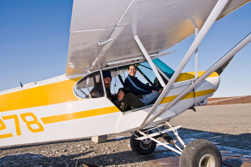
(Day 128-130): Fairbanks, finally, sort of. To conduct our air photo mission, Walt had signed up Kristin as the pilot of his air taxi operation so that she could legally fly his planes commercially. In this case, she wasn’t being paid so there was also no conflict with the University and its State rules. But of course this is all easier said then done, and substantial work remained to get this going. The biggest obstacle was to pass an FAA checkride in Walt’s supercub and get this paperwork through the system. Before this, she of course needed to become proficient in the aircraft up to commercial standards. And of course there are always the minor little annoyances of mechanical issues that crop of with planes that haven’t flown much in a while. So we had our hands full.
I estimated that we had about 4 loads of gear to haul off our moraine camp, and this turned out to be accurate. The pilot from Maritime Helicopters was superb, though he was a little hesitant to leave me on my own at the glacier. But this made the most sense as it allowed him to take larger loads out. The weather was warm and calm, and I enjoyed spending a beautiful afternoon there on my own, punctuated by a few frenzied minutes of packing the helo. The good weather held out for the rest of the day, and we were able to get our four flights in and out without a hitch. I think the pilot and mechanic were glad of it too, as they still had enough duty day left to head back to Deadhorse. As it turned out, a Frontier flight randomly showed up after they left, so I frantically jammed it full of our gear just returned from the glacier. I had the opportunity to get on the flight myself, but there was still a bunch of gear leftover that I had not had the opportunity to sort, label or package properly, so I opted to stay. The timing of helicopter availability was a bit unfortunate, as it was now Saturday night and there was not another scheduled Frontier flight until Tuesday, as Monday was a holiday. It was pretty late and I was exhausted at this point, so I got some sleep knowing I had a few days to finish up.
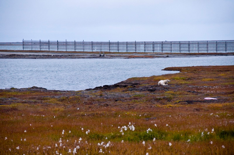
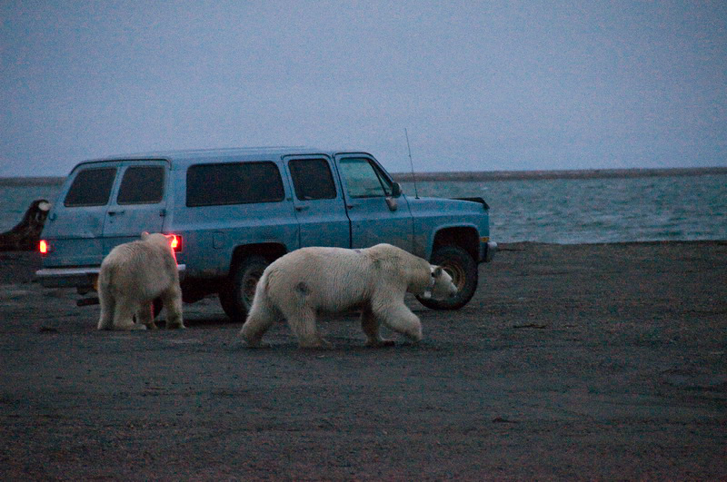
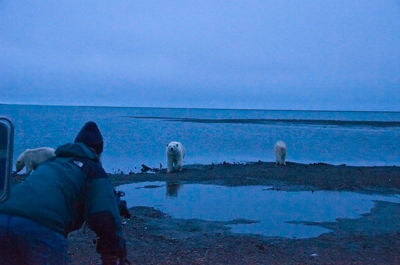
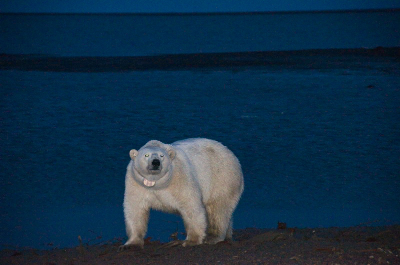
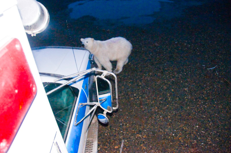
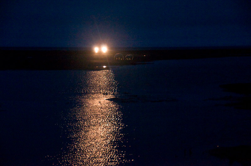
I guess it was a good thing in the end, being stuck in Kaktovik a few more days. I had the chance to hook up with Art and Jen, who had just barged in a new Mystery Machine to photograph from. It was an old ambulance, built like a tank, and we cruised the roads at night watching polar bears. They were out in force, even though the locals had not yet brought in any new whales for them to eat. Art and I talked cameras quite a bit, and we all spent some quality time in close proximity to the great white beasts.
Sept 3-7
(Day 135-139): Preparing for Phase 5 There are several needs for inventories like these. The basic idea is to keep track of how many glaciers exist, where they are, and how they may change over time. This effort is part of a global effort to do the same for all glaciers. Two separate inventories have been attempted in the past. Austin Post created one in the late 1950s, but unfortunately this was promptly lost by his superiors and never made it into circulation. The second effort was made in the 1990s by Suzanne Brown, and the results of this inventory are in the world database. Unfortunately, there is some confusion in this database, and most glacier coordinates do not actually line up with a glacier. There are also no glacier outlines in this database. An air survey of these glaciers is especially important because these glaciers are so small and often they are covered by rock debris, making it difficult to distinguish ice from rock by any satellite method. Several of the glaciers that Jason calculated a volume change for based on our new topographic mapping in 2002 appeared to be advancing, so we also wanted to check this out for ourselves to determine whether this was a calculation error or not. The issue here is that because the glaciers are so small and on such steep terrain, small errors in positioning between the two maps used for volume change calculation can lead to large errors. So the bulk of our time this week has been spent getting the airplane ready, refining on our photographic techniques, and packing for another week in the arctic. Today Kristin passed her check ride, so tomorrow we’ll be headed up to complete this final phase of the project. Sept 8-16
(Day 140-148): Fifth and final phase
Hells
Bells -- 6MB Before getting to Happy Valley, I pulled over at the Galbraith Lake runway to check it out, as this would likely be another place we would stop occasionally. It was a beautiful evening, and I was tempted to call Kristin on the satellite phone to go for a flight right then since the conditions were perfect for it. But we still had the issue of what to do with Turner while we were flying, so I figured it best to get settled in tonight and get an early start in the morning. Predictably, the weather was not so great in the morning. Turner had a blast playing with LuAnn, and it was arguable as to who was having more fun. In the afternoon it had cleared enough to go for a flight, but the mountains were still socked in on our side and we didn’t want to push things too much on our first attempt. But it was a good shakedown and we saw some pretty country.
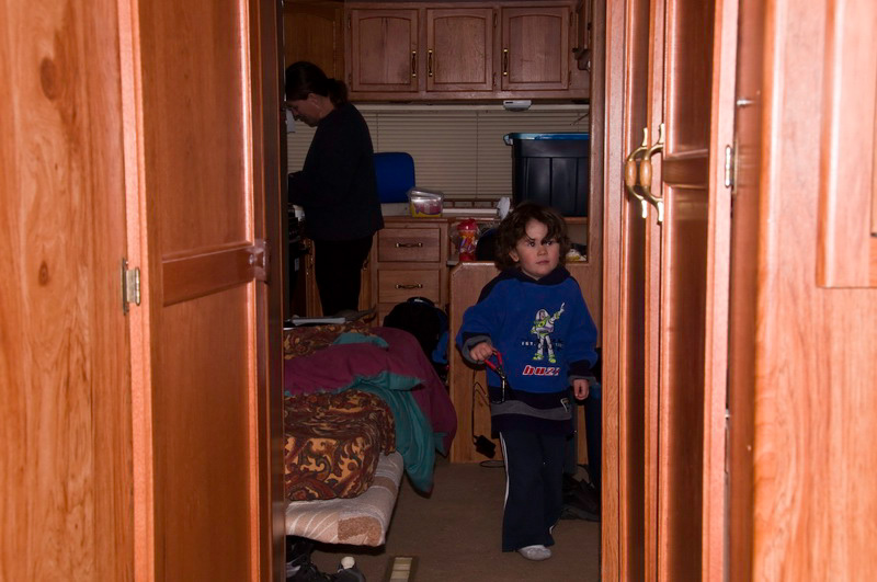
The weather deteriorated over the next few days, with low ceilings and snow. We explored a bit locally, but mostly hung out and enjoyed some rest in the trailer we were staying in. The pressure really hadn’t let up all summer, and it was nice to have some family time in a pretty location.
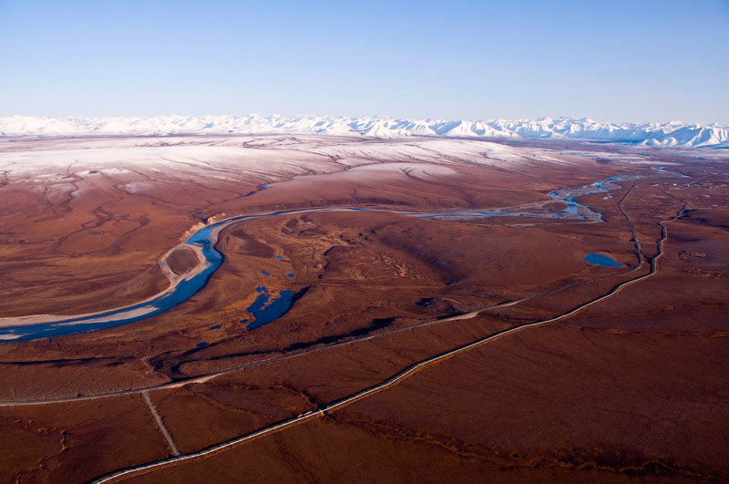
Finally we woke up to clear, calm skies and were ready for a full day of photography. Unfortunately, the recent weather had deposited several inches of snow all over the mountains. So what had been snow-free, beautifully-exposed glaciers on dark rock background, was now mostly white-on-white. That is, we had missed our window of perfect late-summer glacier landscapes and were now looking at white glaciers against a white background, making it difficult to distinguish where the glaciers ended and where the rock began. But we were here and geared up, so we decided to go for it and see what we could learn.
The weather remained perfect for the next few days – no clouds and no wind. We spent a couple days flying through the mountains and got the hang of the process. Though the weather was great for flying, it was still chilly sitting in the back of an essentially unheated plane at 9000 feet with a window open. But we got the kinks worked out of our flight planning system and got a number of nice photos, albeit not as nice as they would have been several days earlier. Before long though, we had maxed out the range of the supercub. To get any further would have meant multiple ferry flights with fuel and probably relocating to Anatuvuk Pass or Bettles, and we decided that given the conditions and our weariness from a long field season, that we had enough adventure for a while and that we should make use of the remaining good weather to get home. So we packed up, said our goodbyes, and headed for home for the last time this season.
Sept 17
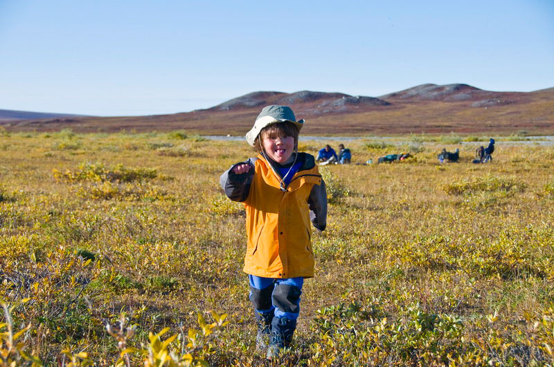
(Day 149): It’s over, sort of… Here is a brief list of our accomplishments: The most frustrating aspect of the experience for me was the logistics. I think we had five different logistical operators bail on us in one way or another. I’m a big fan of backup plans, but there is a limit to how much planning one can do. We’ve decided that our primary plan in the future needs to be depending on our own logistical resources, rather than on commercial operations who can make money in much easier ways than dealing with us. I’m not sure exactly how this will shake out in the future, but one option we are pursuing at the moment is Kristin’s continued work through Walt’s operation. Who knows, in the end it might be easier to fund my glacier research by running a commercial air taxi rather than trying to bring in glacier grant money to hire one. In looking through the blog, so much of it seems like a lifetime ago now. Though there were of course many minor annoyances along the way, in general I found it a great experience and probably the funnest trip I’ve had out there. For me it seemed like there was real adventure – a nice balance of pre-planning and making new plans on the fly, being prepared but not going in with such overwhelming might that it was boring. Plus there was some good photography opportunities, and some new experiences like working on the streams and floating them. And for as long as the trip was, I never really felt homesick. With my family with me the entire time, there wasn’t much to be homesick for and, on the contrary, the opportunity to spend so much time with Turner and watch him learn and develop in the field was priceless. There are two images of him that I have etched in my brain and didn’t get a photo of. First was watching him trying to enter our tent at one of the drill camps – I had just stepped out of the cook tent to find that he had got the zipper open partially from the top down, such that when I saw him his feet were sticking upwards out of the tent as he tried to get in head first. Second was at our first drill camp in the upper cirque. Near the start of the trip we were stretching out a tarp to cover some gear and he ran over and grabbed an edge saying “I help too papa”. In that instant, I saw him 25 years older, perhaps during the next IPY, helping to stretch a tarp in that same location and saying basically the same thing, only this time our roles were reversed and he was the one doing the real work and trying to keep me out of trouble. Only time will really tell what the glaciers will look like during the next IPY and who will be there to notice, but I am glad to have spent such a major part of my life there during this one. |
(c) 2003 Matt Nolan. If you find any broken links or other errors, please let me know. Thanks.