Dr. Matt Nolan
Institute of Northern Engineering
University of Alaska Fairbanks
|
|
Dr. Matt Nolan
Institute of Northern Engineering |
|
McCall Glacier IPY Lake El'gygytgyn IPY Virtual Globes IPY
|
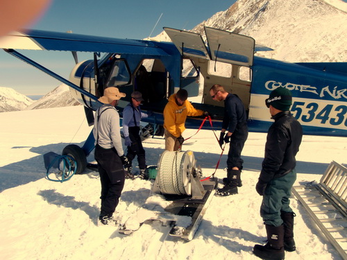
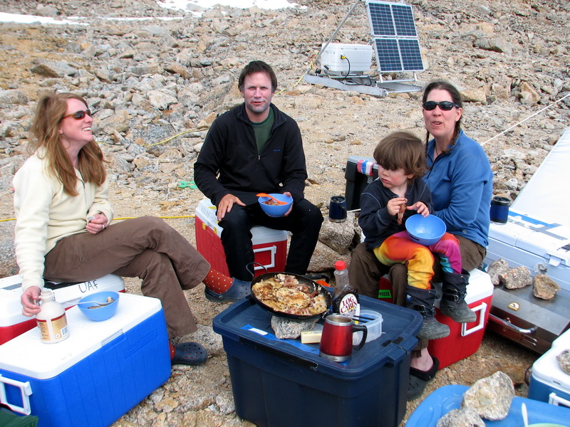
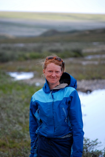
Like a switch was flipped, we changed from winter to spring, in several ways. A few feet of fresh snow had fallen during the last week of May and early June. Then we had 3 days of warm, mostly sunny weather, just long enough to get the drill gear and team out and the newest member of team in. By the time Dirk took off with our final load of gear, a serious rain had begun and spring was here – the snow was melting, the streams were running, and we began scrambling to catch up on all of the winter work we had wanted to get done in the past month but just didn’t have the time or weather. With this new weather also came a change in work dynamics, with just five us now and all focused on our process studies, we are a much leaner and more focused team, concentrated on supporting Jason’s process studies at the stream and upper cirque, as well as enjoying the surroundings and each others’ company.
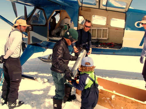
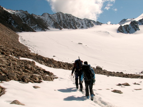
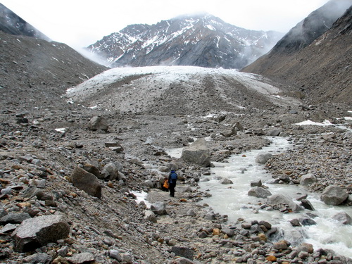
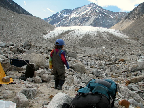
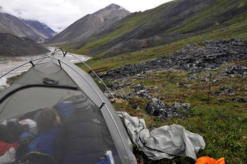
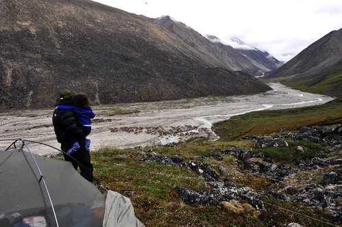
The next morning I had woken up about 6AM and saw that the snow was frozen solid and the weather was good, so I decided to head out right then and try to get some of our down-glacier work done. I was up early largely because I spent most of the day before sleeping in my tent. It’s really been a few months since I had a real day off with no work involved, and with my mind now off logistics finally, I think I just needed a day to reset my brain and get back into science mode. My plan was to be back about 9AM or so, so that we could still have a full day of something else once I was back. The conditions were fine, and I was able to change out our logger batteries, download all of the new thermistor strings, and haul a load of gear to our stream camp. It took a little longer than I anticipated as it turned out that one of our thermistors strings was miswired at the factory (it’s actually just someone’s garage…) and it was the one string that I was not able to test in Fairbanks before I left, but in the end I was back by 10AM and all of our equipment was functioning as expected. I then dropped off Jason and Joey near the terminus so that they could shuttle the loads the final part of the way on ski and foot, and hunt for a suitable camping spot there. Given all of the work we have planned down there, our plan is to keep tents and stoves down there for the summer. This deployment got held up a bit by the multiple camps used during the drilling effort, but the stream was not running high enough to make this too difficult yet and lack of snow made finding a camp spot much easier, as they were able to find some old tent pads leftover from the 1970s most likely. So now we have campsites on both sides of the river, almost directly across from each other, so we should have a good base to work from.
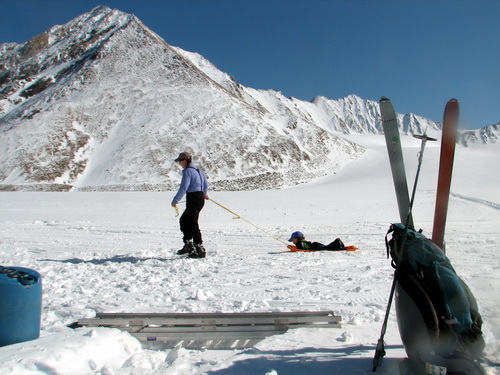
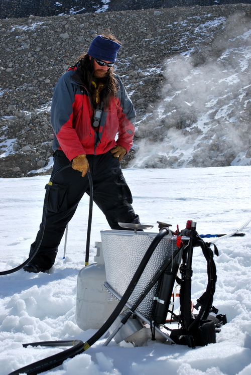
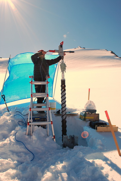
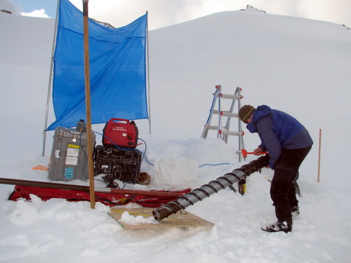
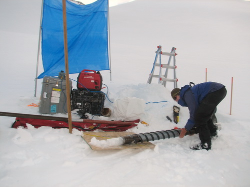
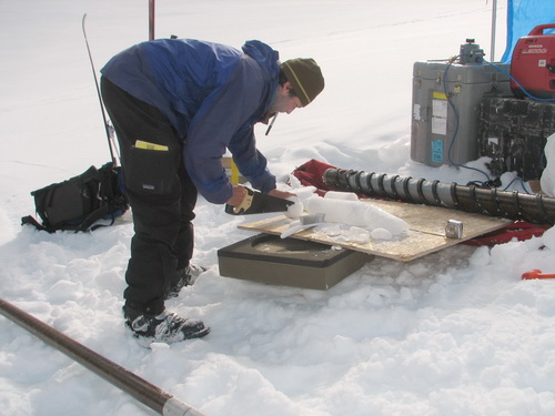
Today Jason and I were up at 5AM to head back down to the terminus to install some new ablation stakes. The snow is almost gone in the lower glacier, just like it was when we first arrived in April. The major difference now is that the exposed ice is no longer the zero-friction stuff we first encountered, as the sun has melted it a bit and made it crunchy and sticky. To install the stakes, we use a steam drill to melt a hole just large enough to drop the stakes into. The stakes are pieces of electrical conduit joined together by couplers we made for them. Once we stick them in the ice, we measure how much sticks out over time as a way to measure how much ice has melted. In the terminus area, we try to make the stakes as long as possible, because this is where the glacier melts the most and we’d like to have them last several years to minimize having to drag the drill back and forth. The drilling went fine, though slower than we expected, and we got back at noon instead of 9AM. About the time we got back, the weather had changed again, like it had yesterday afternoon, and we experienced intervals of rain, snow, fog, and sunshine throughout the rest of the day. But we’re staying cozy and dry in camp, and settling in to a new pattern that I think everyone is enjoying.
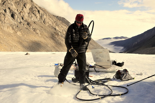
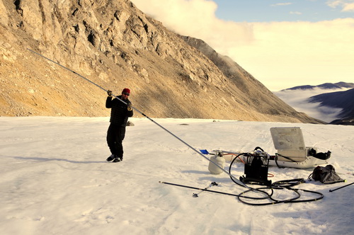
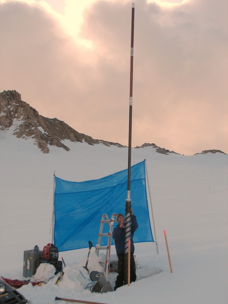
Trying to steam drill a hole before the snow turns to slush in the hot sun and we have to walk home because the snow machine will get stuck. Poledrop -- Jason lowers a 9 meter survey stake into the hole he just drilled. (These were handheld shots spliced into a movie) The surface of the ice melts about 3 meters per year here, so this stake will be completely exposed again in about 3 years. 08 June
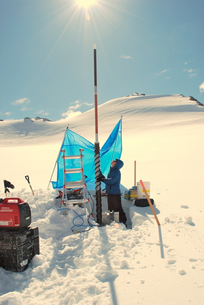
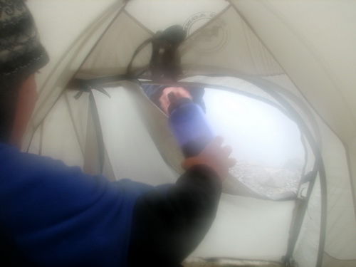
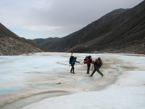
08 (Day 48): Installing survey stakes to measure index velocities
I like this panorama because it shows several things. The long pole laying in front of Jason is the one we are about to drop in the hole that Jason is drilling. It is 6 meters long, and if we sink it so that the top is flush with the surface, it will melt out completely within 3 summers. A little downglacier you can see the pole we installed at this same point in space last year. It now has a GPS antenna on it and we are measuring its position every 15 seconds. A little further downglacier, you can see the pole we installed 2 years ago. It will likely melt out completely this summer. 09-10 June
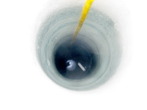
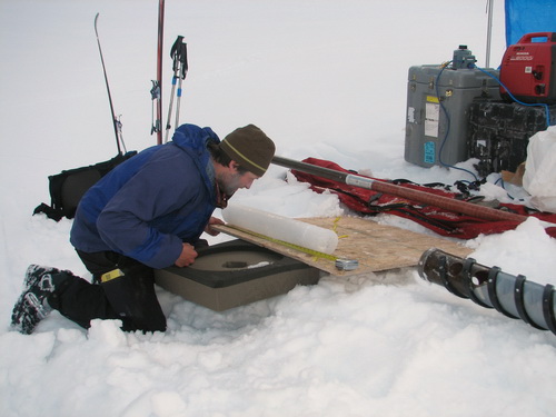
08 (Day 49-50): Jason sinks his teeth into the firn The weather pattern lately has been reasonably good weather in the mornings and poor weather in the afternoon, and we’ve adapted our schedule to that. Several days ago we had thunder and lightening nearby in the afternoon, and yesterday and today we had rain, snow, fog, and sunshine, often in the same hour. So Jason and Joey headed out at 5:30AM to get a jump on the weather and also drill while it was still cold, hoping to keep the drill from getting stuck. In the morning I had mostly been trying to catch up on phone calls to stay ahead on logistics for later parts of the trip and keep other projects moving along. In the afternoon today I went up to the upper cirque to check out Jason’s latest borehole, and drop the video camera into it. Unfortunately I don’t have the cable it takes to download the video to a computer, otherwise I would post it. It’s a neat area, with alternating layers of ice and firn beneath the surface. Our expectation is that the ice lenses are going to grow with time, due to the refreezing of surface meltwater. So the cores and measurements we’re making now are the baseline against which we can compare future accumulation. A major challenge in assessing these changes is simply getting a handle on the variability in the baseline measurements, which is substantial. That is, you cant drill a borehole in the same place twice (because the second time there is just a hole there), so you have to drill some distance to the side of the original, but without knowing the spatial variability (are two locations a meter apart identical?) in the measurements, you would have no way of knowing whether a temporal change (are two cores taken a month apart identical?) occurred or a spatial one. So by doing a lot of coring and pit digging now, we can get a better handle on these spatial variations so we have a better baseline to assess whether temporal changes occurred.
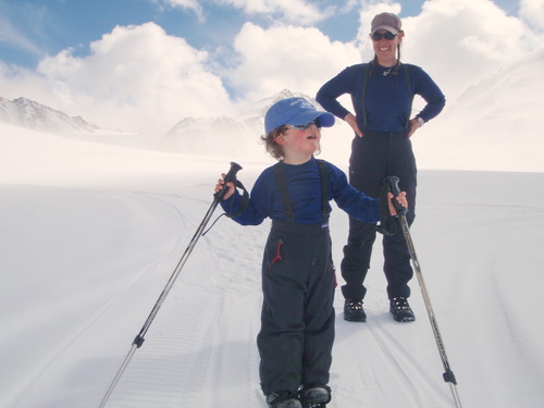
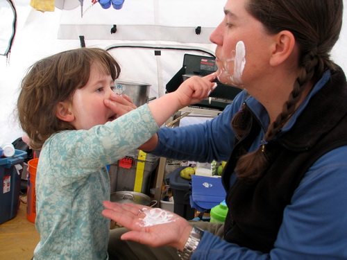
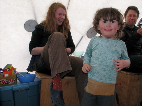
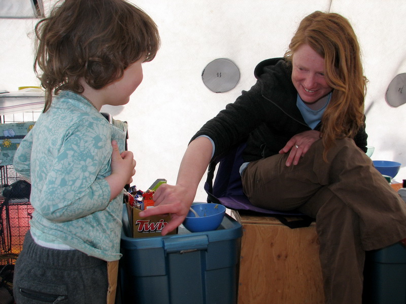
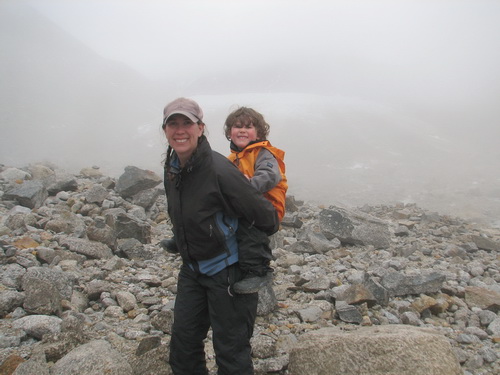
One of the more exciting accomplishments of the trip was the Turner learned to ski yesterday. We were done at the cache organizing some food and took the opportunity to help Turner carve. In the past, he has been reluctant to put on the skis, but today he said he wanted to try it. So we strapped them on and tried to give him the idea of how it works. He picked up amazingly quickly, and actually managed to slide downhill a few meters on his own without falling. Personally I think this ranks with learning to walk.
Turner’s
first time on skis.
11 June
08 (Day 51): Sun + Snow = Clouds, at least in summer
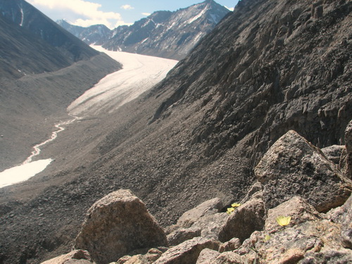
In between taking cloud panoramas, I went halfway up to the upper cirque and found a new photo spot. There are several ridges that descend to the ice surface, all of which used to hold small tributary glaciers 100 years ago. As the ridges become exposed, they become somewhat good places for photography. Apparently I wasn’t the first to discover this, as the one I hiked up to had been used as a survey station in the 1970s, as the mark and foil used to locate it on air-photos was still visible. Though it was not far above the current ice surface, it was a still a challenge to reach because of the large, loose rocks surrounding it. Here giant slabs of bedrock were detaching and sliding off the outcrop on their own. But once on top, it was a comfortable place to work, and I took several high resolution panoramas.
12-14 June
08 (Day 52-54): Studying lenses of ice and glass Ice lenses are layers of ice that form within the snow. The surface of the snow warms up from the sun, melts, then drips into snow beneath it. When this water hits colder snow, it tends to freeze. When it does, it prevents more meltwater from dripping down further, since the ice is too dense for water to flow through. So the additional water has to spread out to the sides, where it too will find colder snow and freeze. This goes on throughout the day (or spring), such that wide layers of ice form within the snow. We call these ice lenses. As the snow continues to warm up, many of these lenses melt again, forming new lenses even deeper within the snow. This process of creating deeper and deeper lenses continues until either there is no more meltwater or the snow and firn layers beneath it are all warmed to the melting point, preventing new ice from forming. Over the years, lenses as thick as a meter may form, and eventually all of the layers merge into one giant layer we call the glacier. This is the process that Jason is studying, by coring (to look at the layers and track their growth), by installing thermistor strings within the layers (to look at how much energy is available for freezing), and by digging pits on the surface (to track how much water is available to melt and drip down). Thus far he’s drilled 3 cores, installed 2 thermistor strings, and dug about a dozen snow pits, and he understands the process about 10 times better than he did last week, but has 100 times more questions about it, most of which have no answers yet.
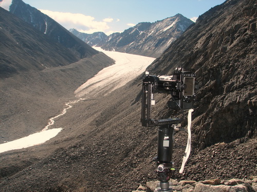
Glass lenses on a camera focus sunlight reflected off the glacier surface into a recognizable image. The light enters the lens and is bent to hit the digital sensor in my camera, where it is recorded. To create a seamless mosaic of hundreds of photos, the camera has to be rotated about a particular spot, which is dependent on the optical properties of the lens and how it bends the light to make an image. Each lens has a different such spot, and in the case of a zoom lens, the spot changes with the amount of zoom. To find this spot, a lot of testing has to be done, as even a millimeter of error in any of the three dimension can cause visible seams in the mosaic. So I’ve spent the past two days largely trying to determine the exact location of this spot on one of my lenses. It’s the Nikkor 18-200mm zoom lens which I used last year. This year I bought a bunch of nominally higher quality fixed focal lenses on ebay, as I wanted to take the best quality panoramas that I could this year. Unfortunately, higher quality typically means heavier (more glass) and thus more weight to carry around. So I made some comparisons in image quality between the lenses, and found that though some of them do create sharper and richer images, the differences are pretty slight, and I decided that for those times that I’m backpacking, my original zoom lens would be the best (and lightest!) choice. But it’s a complicated lens in terms of finding this magic spot and I spent the better part of a day finding it for various zoom settings, then the better part of the next day taking panoramas and stitching them to confirm that I found them. Fortunately we’ve had some great, clear sunny weather to facilitate this and even more fortunately it appears that my settings are pretty darn close, so I shouldn’t need to do this again. GIGAPANO west ridge goes here
In between testing and various other tasks (mostly phone calls and attempts at emails again to line up project components later in the summer), I took advantage of the weather to hike around our moraine here and take some spherical panoramas, documenting the transition between the true glacier moraine, and this weird knoll that we camp on. During the Little Ice Age peak, about 150 years ago, our camp site was not overlain by ice, but it was clearly affected by the glacier. I think what happened was that the glacier ice came up to nearly the same level and created a stream channel between the ice and mountain behind ice which was probably covered in a permanent snow field, and we are now camped on the remnants of that stream channel and snow field. We know that ice was not here because there is an outcrop of rock right next to us that is heavily covered by lichens, and these take hundreds of years to grow to this size. But behind this, where our tents are, there are various zones of lichen covered rock, non-lichen covered rock, and little gullies and runnels. Probably this was a snow field much of the year, and the snow melt from this hillslope and the ones further upglacier reworked a lot of the rock here in various ways, and subsequently various types of permafrost dynamics reworked it further. It would be nice to have someone out here with expertise in glacial geology to have a look at it and see what can be learned, but until then, I can have fun speculating, documenting it with panoramas, and sharing them with others who may have good ideas about them.
15 June
08 (Day 55): Slush flow announces the true start of summer! Summer arrived with a slush flow on this day. It’s tough to actually see the flow because it only takes a few frames near the end. The movie appears to slow down near the end because I began manually snapping pictures every second or so rather than automatic once per minute. The cloud motion appears jerky because I’m using the Microsoft movie maker, which apparently has no ability to make movies at the normal frame rate of 24 per second. I changed the camera angle and zoomed in on the active front of the slush flow. Note how the scene gets darker near the end, as thunderstorms approached. Today we spent mostly getting ready to spend a few days at the terminus, studying the outlet stream there. Our primary goal here is to track the amount of water leaving the glacier, but we also hope to study how water moves beneath the glacier by release of dye on the glacier surface. To facilitate this, we staged camp supplies there about two weeks ago so that we can avoid commuting 7 hours there and back to our main camp. In addition to this, we have a lot equipment to prep and lug down there too. For example, Jason has stream gaging and dye-tracing tools, and I have a bunch of time-lapse cameras. We had become settled here on our moraine camp, so some preparations were also needed to get a selection of personal gear and food ready to go. For Kristin, Turner and I, we hoped to use this trip as a shake-down for longer-distance hiking later in summer, so we had some organizational work to do for that too. It was a nice day overall. In the morning, Jason and Joey left early to drill another hole in the upper cirque while I made some final tests with my panoramic equipment and then continued to photographically survey our local area with its odd mix of glacial moraine, fluvial channels, and permafrost features. By about noon we were all back at camp and decided to have a Fathers’s Day brunch of bacon and pancakes. The rest of afternoon was spent packing and preparing, and capped off by the slush flow and storm. We joked that this weather was expected, for it seems that every time we’re at the terminus it’s rainy and nasty. Jason
and Joey avoiding the rush hour traffic. Since it’s Fathers’ Day, I thought I’d go heavy on what that means to me…
Turner
and his moose, now cleaned of orange stuff.
16-17 June
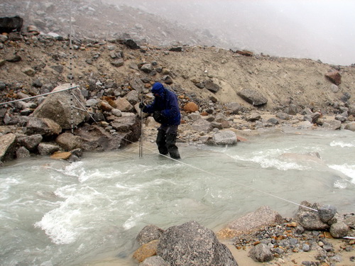
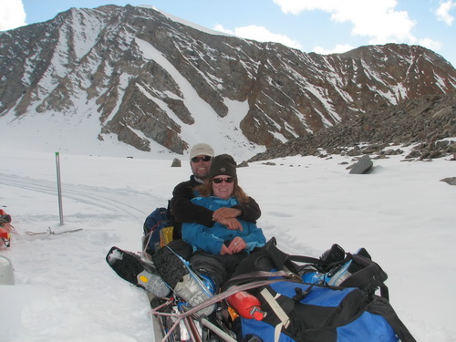
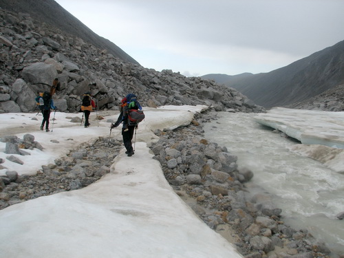
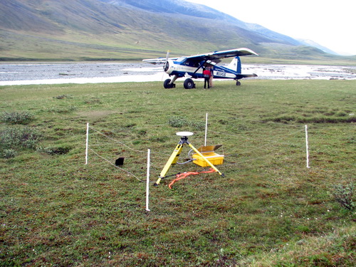
08 (Day 56-57): Typical weather for the terminus Jason and I were up at 6AM yesterday to begin staging equipment for our trip to the terminus, by shuttling a load with the snowmachine. It was a clear day at our camp, but the lower valley was choked with fog. We stopped at our old stream crossing spot, where there is now an active stream thanks to the slush flow. We followed the stream downglacier without crossing it, and eventually came to the site of our second borehole. There was little snow there, but the snow machine was doing fine on the ice. No longer were the ice hummocks the zero-friction bane of our previous travels, but rather now had a crunchy surface thanks to the action of the sun. We made it nearly down to the terminus riding on the ice and dropped off our gear, mainly dataloggers, tools, and hardware for automated monitoring of stream dynamics. On our way back, we crossed the stream to check out the runway. The snow machine made it fine over the water, but Jason got a bit wet as the stream bed was not as solid as it looked. The runway was still in good shape, still with 40 centimeters of snow beneath it.
By the time we returned, it was nearly 11AM, and the weather showed signs of change. I had a few phone calls to make before we left, as we would be gone most of the week, and in one of them Dirk told me that a large weather system was moving in from the west and would likely keep us wet for the next few days. Sure enough, by the time we were packed and ready to go, a heavy, wet snow began to fall and reduce visibility to nothing. We decided to wait a while rather than leave in such nasty weather. I think we all thought about staying in the comfort of our current camp until the blue skies returned. But after an hour or so, the snow and rain had stopped and we could see a bit of blue sky, so we decided to go for it. By the time we got suited up and down on the glacier, the fog had returned, but without the precipitation, so we headed off. The trip down was uneventful and mostly dry, and we soon found our new camp site. Jason and Joey had found this location a few weeks ago, on the other side of the stream from the site we had used the past few years, thankfully preventing a stream crossing. This site had two tent pad that had been cleared some time in the past. At first I thought they were from the 1970s, but having looked around further, I think this spot was under ice at that time, making them sites from the 1990s. Clearly this was a man-made clearing, as there was also a pile of charred survey stakes, leftover from some marshmallow roast. This site was also more centered in the valley, with a very pleasing and symmetrical view of the terminus. By the time we set up our tents, the rains had started again, so we called it a night as it was already quite late.
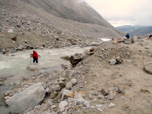
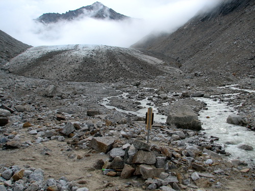
We arrived at the terminus in weather that seems typical for here, cold and foggy. Today we got our first taste of stream studying. It was foggy most of the time, with occasional rain, but it wasn’t nasty enough to slow us down too much. Right next to camp there is a place where all of the water from the glacier flows into a single channel, perfect for measuring discharge and water quality. After shuttling a few more loads of gear from the ice edge to camp, over about 300 meters are sharp, loose, slippery rocks, Jason spent most of the afternoon preparing dataloggers to put in the stream. I set up a few time-lapse cameras to provide a visual record of stream variations. We scoped out the river a bit more and try to think through how our studies should shape up, and dropped the instruments in the water before dinner to get a night’s worth of data to ensure they were operating properly. 18 June
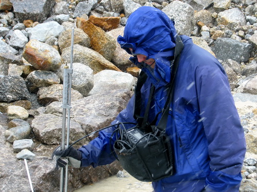
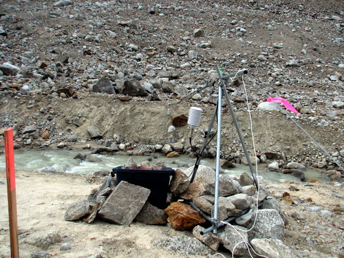
08 (Day 58): More wet field work One of our goals is to get a sense of how much water leaves the glaciers and flows towards the ocean, and then use this information to better understand how much water glaciers in this region contribute to the major rivers of this region. But this is tricky business. ‘Normally’ stream discharge is measured by attaching instruments to the pier of a bridge or by pouring a lot of concrete to make a gaging station that wont be damaged by the force of the moving water and the rocks it carries. These are not options for us, so we have to find work-around solutions. In our case, it is much easier to measure the height of the water than the amount of water flowing. We do this by putting pressure transducers under the water and by suspending a distance measuring device above the water, and hoping that at least one of them will survive. Then we can come back periodically and manually measure how much water is flowing by wading across the stream and measuring water thickness and velocity with a handheld instrument. If we do this when the stream is at various heights, we can determine the relationship between the continuous height measurements and the manual water discharge measurements, so that we can then estimate discharge throughout the summer using only the automated measurements. Later in the summer we will then visit some of the larger rivers in the area that receive water from many different glaciers and make similar measurements there, and scale up our local measurements to estimate the overall glacier contribution. So today we got a start on these measurements. Jason and Joey measured discharge at our natural wier (as opposed to a concrete one) formed where the river has cut through a moraine formed by the glacier about 30 years ago. We then suspended a cable across the river to hand our distance measurement device on. Jason also set up a pole on the river bank that will hopefully be photographed by our time-lapse cameras, such that as the river rises and falls it will obscure more or less of the pole and give us a back up to the other instruments. The precipitation didn’t let up until dinner time, and I think this was about the coldest we felt on the entire trip, even during the April storms. The cold, humid weather combined with a slight breeze from the terminus is bone-chilling, especially when you are up to your knees in ice cold water.
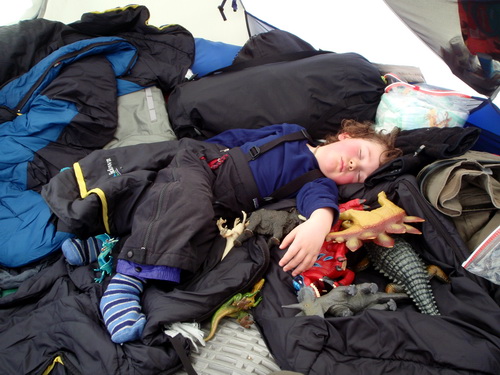
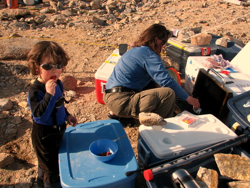
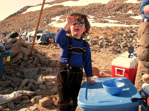
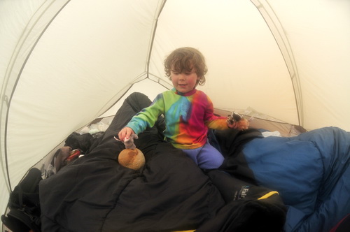
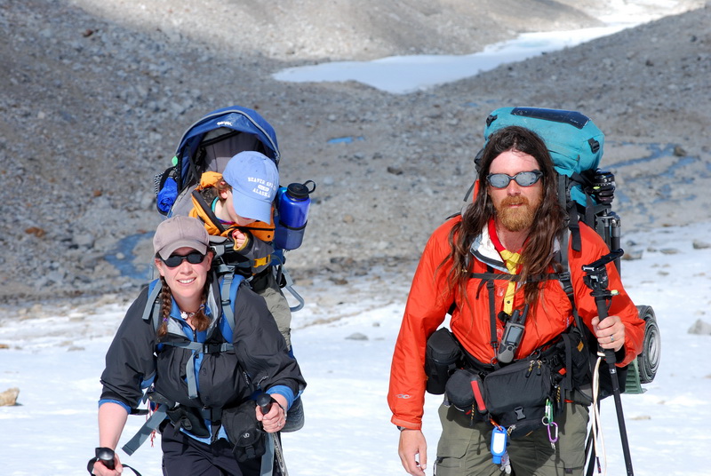
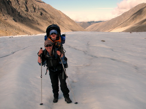
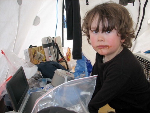
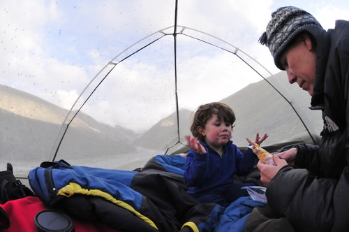
Unlike yesterday, Turner spent most of the day in the tent. He does an amazingly good job navigating the rocky terrain for a two year old, though I don’t have much basis for comparisons. Just when you think he’s about to miss a step and faceplant into a boulder, he plants his foot and hops to the next rock. It’s a little nerve wracking, and the many bumps and bruises on his legs and arms indicate that he doesn’t always succeed with his plans, but he’s never more than a few steps from us and so far his skills and judgement continue to improve. Having backpacked down here, we don’t have a lot of toys for him to play with, but his creativity seems to make up for that. Jason gave him a river rock on our first night here which is now his ‘dinosaur egg’, which he keeps warm and hatches about 60 times an hour. We also play swords with survey stakes, play jump over the instrument cables, chase the ‘rats’ (more rocks), and other invented activities. But today it was more fun to hatch the egg in the tent, out of the rain and snow and wind, and that seemed reasonable enough. So far tonight is dry and calm, so hopefully our hike back tomorrow will be pleasant and he can walk and ski on the ‘big ice’ and play with his other toys tomorrow night in ‘other home’.
19 June
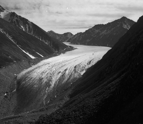
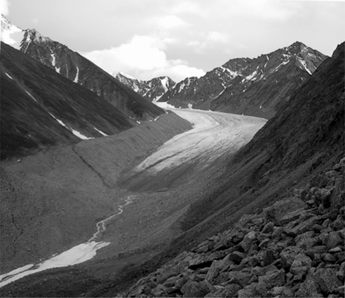
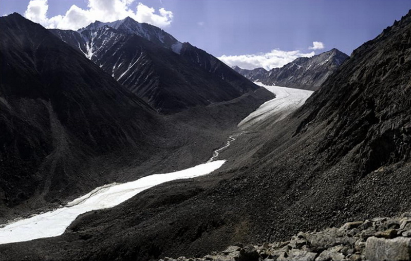
2008 (Day 59): Successful shakedown at the stream The weather today was also much nicer, and made for a pleasant trip back to our base camp. A disappointment for me was that the weather was not good enough for the high resolution repeat photography that I had planned. In 2003, I took a repeated a photo of the terminus taken by Austin Post in 1958, and this pair has been reproduced widely in many publications as it shows an impressive change in an arctic glacier that can only be caused by a change in climate. One of my major goals for this trip is to repeat that photo again, but this time using my new high resolution techniques. I also have several more photos of the terminus from other locations that I have yet to repeat. But it takes reasonably good weather for this, and we just didn’t have that yet. Fortunately there will be more opportunities for doing this later in the trip.
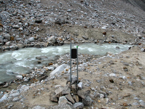
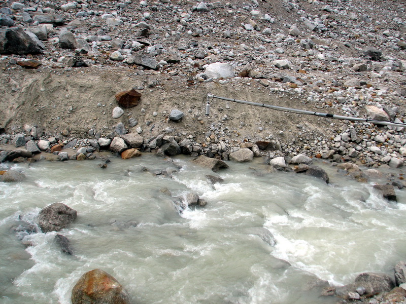
Jason’s makeshift staff gage can be seen directly across the stream. A timelapse camera is pointed at it, such that as the stream rises it will cover more pieces of tape on the pole and obscure them in the photos, allowing him to get a quantitative estimate of stream height from them.
We extended a cable across the stream and will return to install a device which will measure the distance from the cable to the stream, as another means to measure stream height. A final goal of this excursion was simply as a shakedown for the backpacking we plan later in the trip. We sometime catch ourselves talking about this as camping, as if we not camping already. But it is qualitatively different in that in our base camp we have many luxuries that we don’t have while we are backpacking. For instance, we pre-cooked and froze most of our dinners at our base camp, so that all we have to do is heat them up in hot water. But this system is too heavy for backpacking. Similarly with clothes, pads to sleep on, etc – only so much fits in a backpack and we still need space for science gear, so it’s a challenge to decide what to bring and what to leave. We got most things right, but it was nice to have the opportunity to practice before getting too far from camp.
20-23 June
08 (Day 60-63): Preparing for 6 trips at once We also had a lot of work to complete before leaving. Our first day back I headed up to the upper cirque with Jason to complete another core hole. Jason is really getting into drilling and has considerable expertise now doing it. What we’ve learned so far is that the firn area is actually quite small and thin – within 100 meters of our deep core site, the firn is less than 4 meters thick. A couple of hot summers could melt nearly all of this away. The coring continued the next few days at other sites, and hopefully tomorrow morning this part of the project will be wrapped up for a while as we spend a week or more at the terminus.
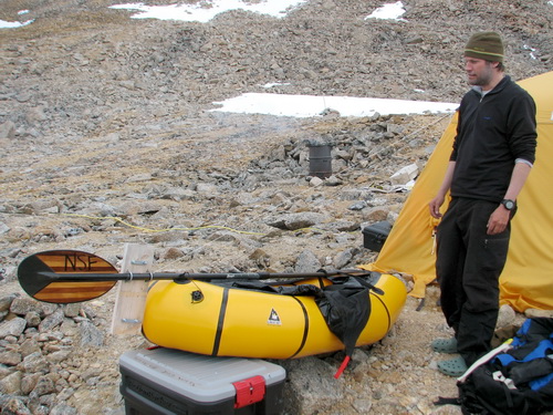
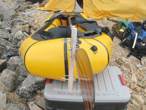
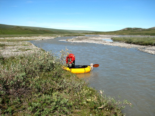
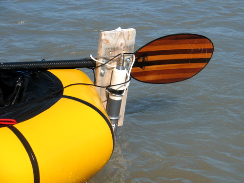
The idea is that by tethering the boat to shore, we can attach the instrument to the end of the paddle and it will stay vertical in the water above the bottom.
Exercising on the helipad, the only flat and level surface to run on.
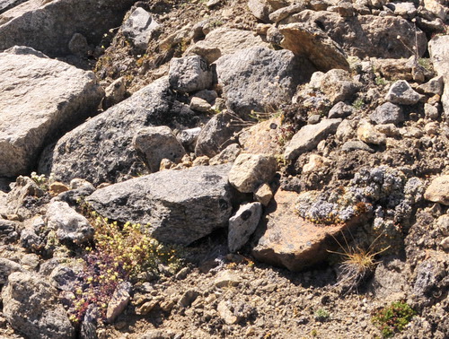
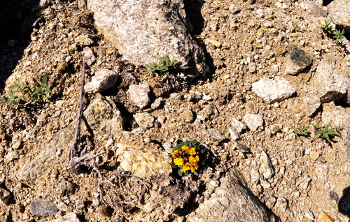
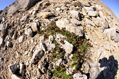
More flower photos from the trip back down the mountain. For some reason they seem to prefer the most dangerous places to stand.
25 June
08 (Day 65): A desperate camp move to the terminus I realize I’m biased, but I think I must have one of the heartiest wives in the world. I’m out here enduring the conditions because it’s part of my long-term career goals. Kristin is out here because of me. Yet even in the most desperate of conditions – getting soaked by hail, nearly fried by lightening, dragged through slush swamps on a sled, while holding on to our 2 year old son – there’s never a complaint or a whine. As we stood at the bottom of the hill with instantaneous thunder following lightening and I said “Let’s get thefuckoutta here”, she calmly and drippily said “Agreed”. When things are bad enough I don’t want to take the time to get a picture of it, it must be pretty bad. Conditions for snowmachining couldn’t have been worse either. Freezing rain on already slippery ice meant that I was just on the edge of being able to keep control of the machine and sled and left little margin for error. I drove within minor stream channels, as the walls of the streams provided sidewalls to keep us pointed in the right direction, but also meant I was continually flooding the sled with water. By the time we made it to the weather station, the hail had turned to rain and the lightening was no longer crackling around us. I made Kristin walk down the last hill in her crampons because I couldn’t be sure to be able to keep control of the sled on the slope, and the last stretch to the terminus after this was equally sketchy and wet. Soaked to the bone, she continued on with the hike onto the solid ground of the moraine after crossing an ice bridge over the now raging McCall Creek, all with a smile on her face. And not the smile of those ignorant of their predicament and how they got there, but the smile of those that grin and bear it because it was a result of deliberate decisions to choose this path. Turner was equally a trooper, sleeping through most of the trip, remarking only “My foot wet” when loaded into the backpack. How I’ve been so blessed I’ll probably never know.
By the time we reached the terminus camp, Jason and Joey had set up the tents and got the stove going. It was a welcome relief to warm up and dry off a bit. The rain subsided after a little while and we wore our wet clothes (the only ones we had) to dry them off in the cool breeze. Turner woke up and was eager to explore the surroundings after a Scooby snack, searching for new eggs to hatch and new dragons (which also resemble large boulders) to fly on. The river was huge compared to a few days ago, swollen with all of the rain run-off, as were all of the waterfalls in the valley and surface streams on the ice. It was a remarkable thing to see, especially from a tent on high ground. Turner drives the mystery machine.
27 June
08 (Day 67): First ten days of stream data record our flood Ten
days of timelapse camera data at our stream gaging site. Note how the
water rises in the afternoon of 25th, when we arrived there. Another ten days of timelapse camera data, looking up towards the terminus.
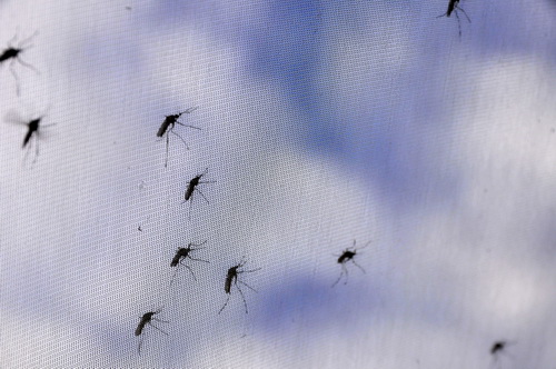
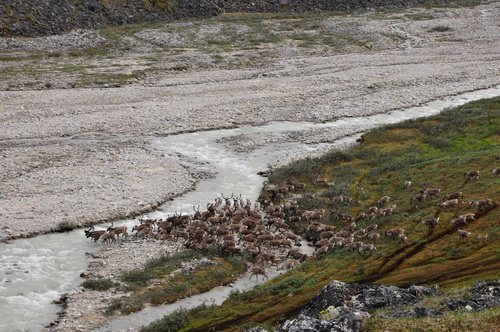
In general it was a foggy day today, and our energy level was pretty low. Jason and Joey hiked up to the glacier a little ways to install another time lapse camera that we had left there 10 days ago but didn’t have the chance to set up. I spent the morning on the phone dealing with the logistics of our airborne lidar campaign starting next week. Some chaos erupted with that over the past week as Tom, the pilot we used based in Kaktovik, had to return to civilization due to some medical issues, leaving Kaktovik without a plane. This also caused some concern with our take-out in a few days, but I think everything will work out. Jason also returned with some scrap conduit he found melted out from the glacier, so we beefed up our sonic ranger station a bit. The mosquitos have come out in full force here as well. I had never seen so many at our base camp before we came down here so we knew there would be lots here. Likely this is just a taste of what they are like down on the tundra. We even saw some caribou today, hanging out on the aufeis, trying to escape them. Likely we’ll see lots of those too in the next few days.
The light was nice when I rolled over, so I tried to capture it. 28 June
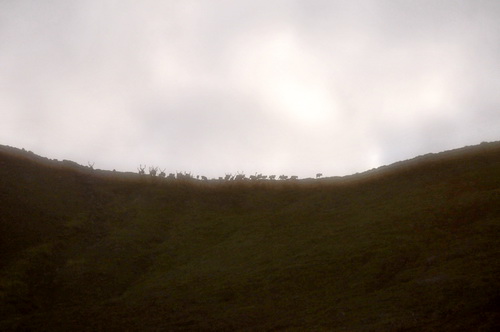
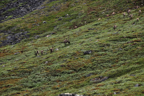
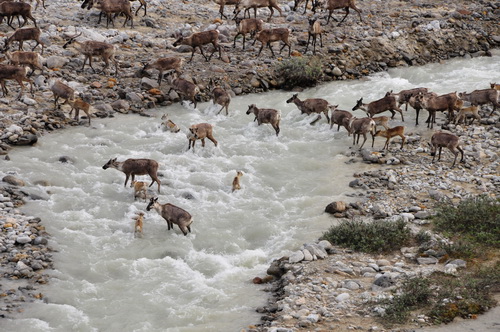
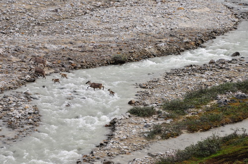
2008 (Day 68): Caribou stampede!
Turner
eating lunch without the mosquitos eating him.
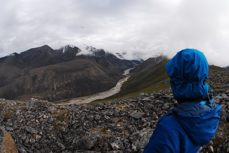
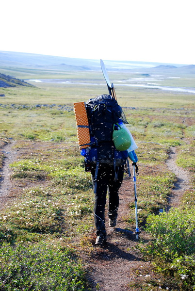
Once past the scary rocks, we descended back down to stream level and had relatively easy hiking to our campsite at Jaeger Pass. The bugs were a continued annoyance but not overly so, and before long we were heading up the pass to the flat spot our tents sit on. We have a nice view of the valley here, as it takes a bend here and we can see up to the glacier and out to the Jago River. After dinner, the Nolans hung out in our tent while Jason and Joey went for a hike up to the top of the pass – without packs! – to enjoy the view.of the coastal plain. Our tent is an interesting lightweight design, with an inner shell made completely of bug netting. So in nice weather we can leave off the rainfly and enjoy the view, sans bugs. I wish we had done more of this earlier on the trip. With a rainfly on, one really gets the sense of having a space separate from nature and surrounding environment. It’s almost like being in a house, and the philosophy that goes along with being in a house. But just being inside a nearly transparent net tent creates a much different mental feeling, which is apparently difficult to describe. In any case, it affords much better opportunities for wildlife viewing. We noticed a small caribou herd up on the ridge near Jason and Joey, no doubt finding a breeze there to escape the bugs. After they returned to camp and went inside their tent, which was out of shouting distance from ours, we noticed the caribou beginning to muster and head down the pass towards us. We watched from inside the tent for a while, but after a few minutes it became clear that this was not just a few isolated individuals, but a small herd led by bulls and followed by cows and calfs. Kristin ran over to wake the others, while I took some photos of the animals that were probably not more than 150 meters from our tent. It was a really neat experience. There is something about seeing packs of caribou out here that is invigorating and magical.
The main reason our trip to Kaktovik, and this hike to get us there, was to help manage the chaos of running a major airborne geophysical project out of Kaktovik. Though strictly speaking this is civilization, in the end it’s a village of 300 people on the edge of nowhere with a very limited infrastructure. Plans have a way of going awry here, and people who live or work here regularly accept this as situation normal, and the unspoken strategy for success here is the standard one of ‘if you want it done right, you better do it yourself’. So my role in Kaktovik is basically just to keep the project moving by solving problems as they arise. The first major problem arose about a week ago or more, when Tom decided to go back to Palmer due to medical reasons. He is the local fixed wing pilot and without him, Kaktovik has no local air taxi operator, greatly stressing a thin logistical network. This creates problems for us because we had planned to use him to deploy our GPS base stations throughout the tundra. So a new plan arose where Aerometric hired a consultant to help with this and to do this based out of Coldfoot, working with Dirk, the pilot that did all of our work with the Beaver in April and May. I had also already primed US Fish and Wildlife to help with this effort, and they also now ponied up with personnel and support. So now we had more personnel help than we needed with less air support, and I’m trying to coordinate this while hiking with a 90 pound pack and a 2 year old, down a caribou trail covered in grizzly tracks and half-eaten caribou carcasses.
Turner seems unimpressed with this diaper change, but doing it without turning him into mosquito bait is no minor feat. It took us a while to get there, but eventually we did, and so did Jason and Joey. We took a number of breaks, both to rest our backs and give Turner the chance to stretch his legs. Once we got onto the open tundra, all Turner wanted to do was run. He hadn’t been able to run for the past two and half months due to the terrain. Now, with no obstacles, sharp rocks, slippery ice, etc, he could run in any direction he chose and was incredibly happy about it, and so were we. After a final stretch of tussocks, we found our airstrip and old camp site, and within an hour and a half of our arrival, Jason and Joey did too, so we ate a quick dinner and were asleep by midnight. The clouds parted during this time, and we were treated to views of the sun sweeping across the northern horizon throughout the night in our bug net tent, warm enough that we didn’t need sleeping bags.
30 June
08 (Day 70): Phase Two of the project ends
For us, this represented the transition from one phase of the project to the next. Now back in Kaktovik, we were suddenly in civilization again. No more sleeping bags, no more thinking about how much food or fuel we had left, no more heavy packs, no more studying the earth in person. By evening I had told the story of our research to 10 different people and it wasn’t until 10PM that I had the opportunity to get a shower. Jason and Joey are still out there, continuing process studies and helping with lidar ground support. Jason had set up our instrument raft in the morning while I collected GPS ground control points. The mountains that were our home are now just outlines on the horizon, often obscured by clouds, and the tundra is just a memory. Our studies now are airborne – using a laser to measure the shape of the land, so that later we can better understand how the shape of the land has changed. As gadget geek, I’m excited to have gotten this lidar work funded and be a part of it now, but I already miss the simplicity and focus of field work and the beauty of our study area. |
(c) 2003 Matt Nolan. If you find any broken links or other errors, please let me know. Thanks.