Dr. Matt Nolan
Institute of Northern Engineering
University of Alaska Fairbanks
|
|
Dr. Matt Nolan
Institute of Northern Engineering |
|
McCall Glacier IPY Lake El'gygytgyn IPY Virtual Globes IPY
|
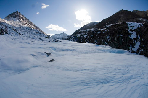
12 May 08 (Day
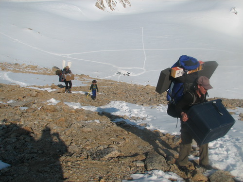
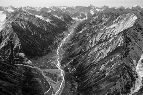
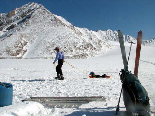
21): Wolf prints in the natural wier The snow cover was still quite thin on the way down, with lots of bare ice exposed and increasing numbers of rocks towards the terminus, so the skiing not much fun. On the way, however, we came across a set of wolf tracks, heading up-glacier towards our camp. They looked quite fresh, probably from the night before. We’ve seen fox tracks before on the glacier, and lots of caribou tracks in the valley below, but no wolf before, so this was something new. The tracks continued down to the terminus, and as we entered the frozen stream channel it was clear the wolf had come up from the valley below, traveling over the aufeis.
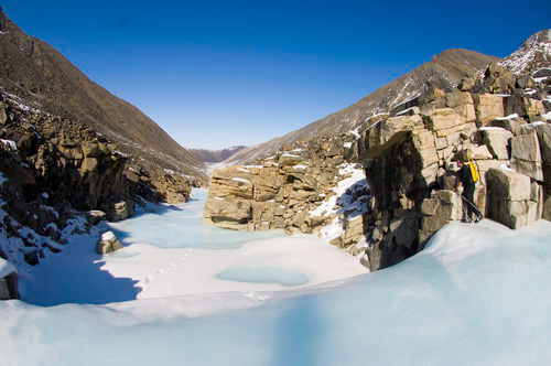
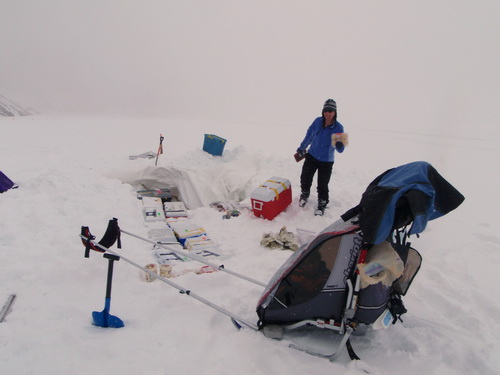
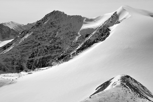
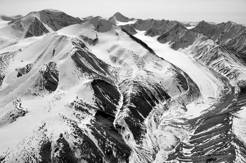
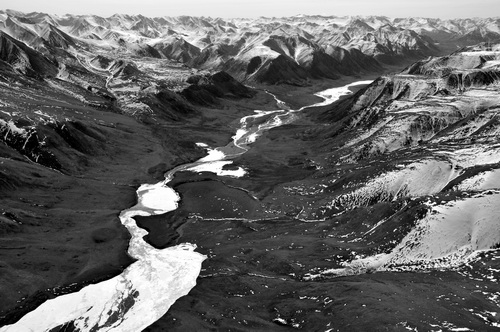
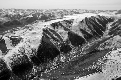
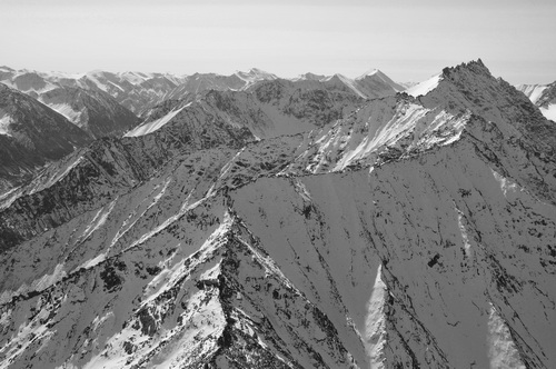
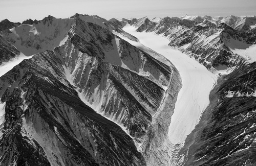
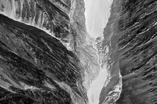
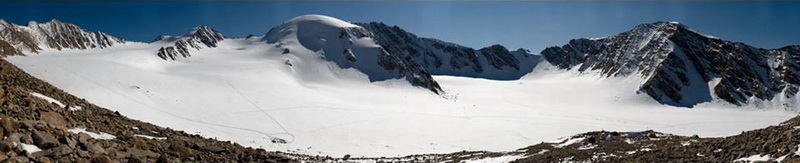
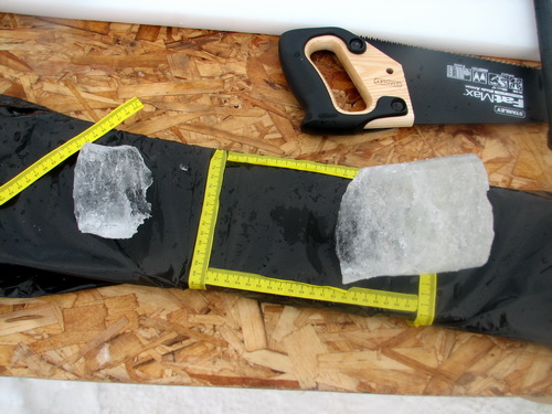
A field of aufeis coats the valley floor every winter. Aufeis is ice that forms when a spring continues to bubble up water through winter, and freezes as it flows downhill. In this case it flows for many kilometers, with a thickness reaching more than 4 meters in places. It makes a nice highway for traveling on foot, whether by two or four legs, as it smooths over the all of the rocks. It is thick enough that patches last throughout the summer, and we have hiked over this often as it much quicker than scrambling over valley wall rocks or trying to skirt the fast flowing stream. Today we hiked all the way down to the natural wier, a constriction formed as the stream erodes through solid bedrock. It turned into a blistering hot day, and the ice surface melted and run in sheet flow beneath our crampons. All along the way, we continued to see wolf prints in the snow patches, and at the wier, it was clear that he scaled the 2 meter ice cliff that becomes a raging waterfall in summer. In the 1970s, this site was used for stream gaging, but having scoped the valley to this point, we decided to use the spot not far from the terminus for our studies, where the stream forms a single channel through old basal till, conveniently located next to our camp site.
Though there is a two meter drop over this frozen waterfall, our local wolf seemed to have no trouble scaling it, as seen by his tracks. We turned around here, as we only had claws on two of our legs.
13 May
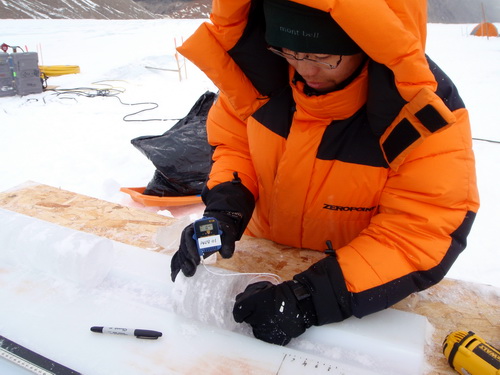
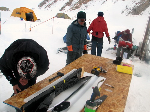
08 (Day 22): Fifty meters of core in one night By using some different tools and techniques, however, the drill team was able to core more than 50 meters in one night. Without the need to keep the cores pretty, they were able to drill faster using more brutal cutting tools. Apparently they had a store of older cutters which were considered more expendable, and these needed to be changed out several times through the course of the night as they got dulled by small rocks and grit. But by the end of the shift, we were nearly down the same spot as we got stopped on the first attempt, so by tomorrow we should know whether we’ll break on through to the other side.
14-16 May
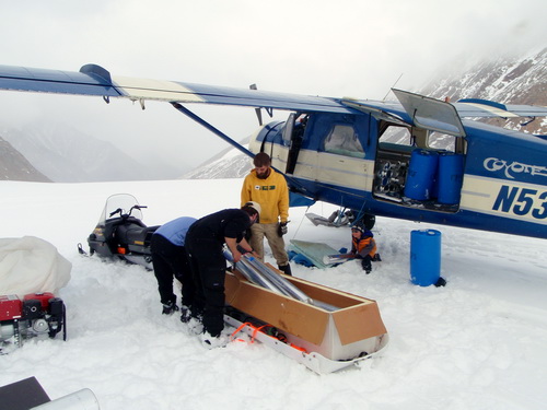
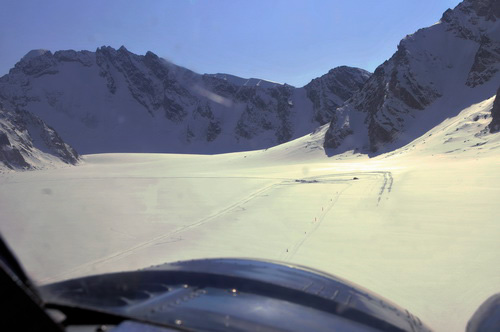
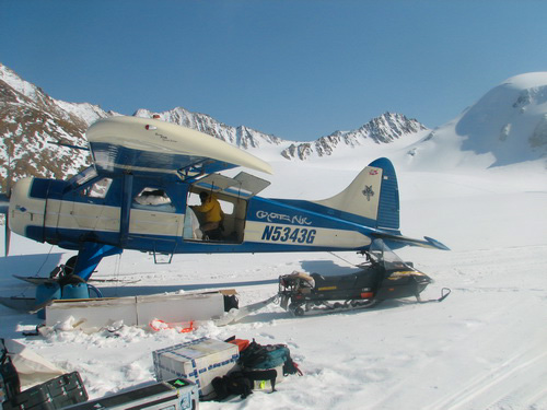
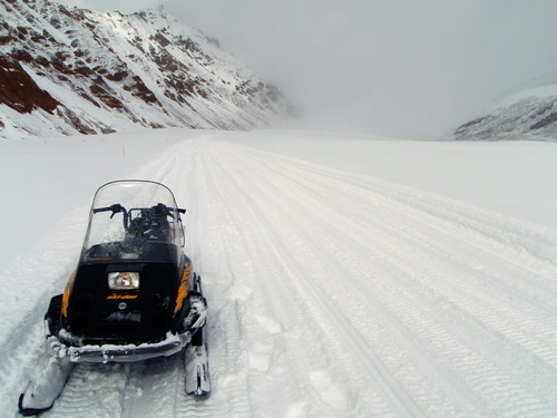
08 (Day 23-25): Ice cores make it to Fairbanks We began our first try on the 14th with a call to Dirk at 8AM to check weather. It was great here, but unfortunately seemed unstable to the south of us, according to weather satellites and reports. So we continued to make contact throughout the morning, but by 11:30AM we had to call it quits for the day because in civilization works stops around 5PM or so, and it would take at least 6 hours for Dirk to come here, load up the ice, and get back to Fairbanks, weather permitting. It had been a late night before, so we took it easy the rest of the day, staying around camp, and got ready to try it again in the morning. The next morning it was our turn for bad weather. We had light snow and clouds most of the morning, but by 11AM it appeared to be clearing, and the weather seemed great elsewhere along the route, so we decided to go for it. This time I had also set up a backup plan for temporary storage at UAF in case it got too late for the real place. So Jason, Kristin, Turner and I headed up to our Beaver cache at the skiway to begin making preparations. The new snow made travel quite difficult, as it completely covered our trail, as it had fallen with no wind and coated everything uniformly. The issue here was that bare, slick ice was only a few centimeters below the surface, and the snow machine has no traction on this. So we got stuck frequently along the way. Heading up the final hill with an empty sled was made substantially more difficult by the new snow due to a loss of traction, and heading down with a sled full of 350 pounds of ice was a bit treacherous as the chains acting as a brake under the sled didn’t grab the new snow as well as it used to grab the snow underneath it. But in the end we transferred about 700 pounds to the skiway, were Jason and Kristin labeled it and made it ready for final transfer. Dirk arrived right on time, and we loaded him up. He had brought some rigid foam insulation to make a crude box out of, and I had some blankets to drape over it too. The new snow was a little sticky, and with a full load required a little push from me to get him moving, and we watched as he took off with the first load of ice cores off the glacier. And we watched some more, and some more, and finally he got airborne. The sticky snow made definitely added to the pucker factor. His timing, however, was perfect, as about 20 minutes later the weather came in and a small blizzard picked up and lasted through the evening, dumping 6-8 inches of snow on us before it was through.
That night about 2AM I decided to get up and check on the drilling activities. By now they had reached more than 120 meters, so it seemed they had found a groove. It was a beautiful, warm night and I took the opportunity to take a few panoramas. The midnight sun was lighting up the clouds with pretty pinks and purples, and sunshine was glinting off water on the coastal plain, indicating that breakup was already occurring there. About the time the sun was rising again and the light going flat, the drill came up slushy and the inner barrel froze inside of it, indicating that it was time to start thermal drilling, which was a project for tomorrow. In bed at 4AM, I was up again a few hours later to talk with Dirk about our next load.
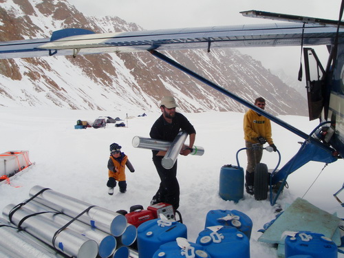
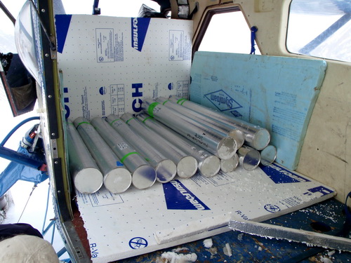
One advantage of working the night shift is to see the midnight sun. The weather this morning, the 16th, was great everywhere, and Dirk arrived about 11:30AM. The time between making the decision to go for it and Dirk actually arriving is about two and half hours. This may seem like a lot, but it is a frantic frenzy of activity to get the ice ready in this amount of time, at least for just Jason and I, as everyone else is asleep this early. The thick fresh snow made getting up and down the big hill a big chore, and getting the ice out of the freezer singlehandedly without breaking it is also a frustrating affair. Fortunately Dirk came loaded on this trip with a bunch of resupply for us, so the time it took to unload gave Jason more time to package the cores up. The bulk of plane was filled up with equipment we will deploy in August. A group from the University of Southern Mississippi is coming to install a new weather station with traps that will collect pollen throughout the year. Some of the pollen that blows onto the glacier from elsewhere gets trapped in the snow and eventually becomes part of the ice, such that we can use pollen that we find in our ice cores to determine how the climate changed over time, since the type of plants that grow (and release pollen) change with changing climates. So rather than fly the equipment in later in summer on its own flight, we took advantage of an otherwise empty plane on the way in now. Before Dirk took off, this time I tried to pack the skiway down with the snowmachine, but this didn’t seem to help too much as it took him almost the same distance to take off. It being Friday, and civilization expecting weekends off, we planned our next flight for Monday, and I vowed to keep packing the skiway down to help make it slicker for take-offs. Once again Dirks timing was perfect, as within an hour it would not have been possible to land.
17 May
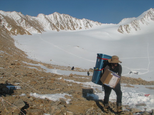
08 (Day 26): Almost to the bottom of our 2nd (3rd?) hole The ice had been getting progressively warmer with depth, but so far we haven’t hit any water. Based on nearly all the studies on ice motion and dynamics we’ve done here, we expected the bottom of the ice to be at the melting point, as this is what would allow for basal sliding to occur, facilitated by the presence of liquid water under high pressure. So the fact we haven’t hit water yet seems odd, though the ice temperature seems to be at or near the pressure melting point. Perhaps we’re drilling off the center of the valley bottom, or perhaps we’re too far down valley, or perhaps the water only exists in isolated pockets. In any case, we haven’t seen any liquid water yet or hit any conduit systems full of pressurized water like I would have expected at this location. Jason and I spent the day trying to organize some of our caches. Dealing with gear has become a major chore, exacerbated by all of the camp moves. Today we moved the ice we are saving from our current hole (only about 10 cm every 2 m or so) up to the freezer. Even this turned out to be quite a chore, as the fresh snow substantially reduced traction up the steep hill. Jason spent more than hour get stuck and unstuck trying to get the ice up, while I organized some things at our Beaver cache and took a few photos. It started out a crystal clear day, but quickly turned cloudy, though allowing for pretty lighting effects. We organized a few more things at the upper cirque cache, then Jason dealt with some GPS issues at our moraine camp base station. It seemed like nothing we had planned should have taken as long as it did, but it did, and productivity levels are only a fraction of what they have been in the past, due to a variety of issues.
I had hoped to take a high resolution panorama from here, but the fast moving clouds and highly variable surface lighting only allowed for low resolution ones. We returned shortly before dinner time, as Kristin and Turner were skiing back down from the Beaver cached with more food supplies, and I was surprised to hear the generator still running for the drill. Apparently great progress had been made during the day, with the mechanical drill penetrating beyond the limit of the thermal drill by another 10 meters or so. More small rocks were coming up, but during the heat of the day the slushy cutting were staying slushy and not freezing within the drill, allowing progress to continue until evening, when air temperatures dropped and freezing started occurring again.
18-19 May
08 (Day 27-28): Second hole finished, more cores make it to Fairbanks,
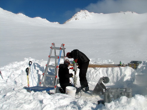
and final drill site selected A day or two earlier, Jason and I had uncoiled the thermistor string that goes in this hole to straighten it out and help it go down the hole easier, so dropping that down became the next project. I attached a couple large weights to the end to help it drop smoothly, and we got it all the way down without incident.
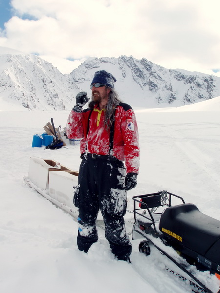
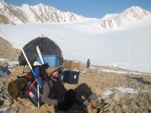
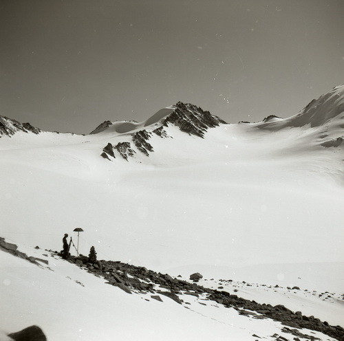
That afternoon we decided to have a BBQ while it was still sunny. We had tried this a few times in the past at dinner time, but it always managed to become snowy or cold by dinner time, so it wasn’t much fun for the cook. This afternoon was sunny and warm, and we outside, listening to a 70s mix on Terry boombox. By evening the drill was packed up and ready to go, and most were talking about taking the next day off to hike up to the Hanging Glacier and get a view. The next morning, a Monday, I called Dirk to check weather to see if we could arrange our third core flight. The weather elsewhere seemed fine, but on the glacier it was kind of marginal. Earlier in the morning it had been snowing, and there were still lots of clouds and overcast around. But Dirk said the satellite imagery showed mostly clear in our area, and everywhere else was great, so we decided to go for it. Once again it was a mad scramble to get a load ready for him. In the upper cirque, where the cores were stored, it was a blizzard, but at the ski-way it was sunny. Unfortunately by the time I brought the last load down the hill, the cloud level dropped to the ski-way level and put it in a solid fog. We heard Dirk buzzing around a short while later. It was still clear down at our camp, and after a conversation with Dirk on the air-to-ground radios, he decided to set down somewhere on the tundra to wait for our weather to clear. I also gave him my Iridium phone number so he could call back to check without having to lift off, since the radios did not have that kind of range. Though foggy, it was still warm, and I took a nap on the snow machine while Jason did the same on a snowbank. About an hour and half later, there were noticeable signs of improvement, and within an hour of that it was bright and sunny and Dirk was parked next to us. We loaded him up with a bit more ice than normal, as conditions seemed good and we wanted to be sure that the remaining ice would fit into a single load. This time he took off in about half the distance, reminding us how important and variable surface conditions are, and how different things are in civilization where the expectation is typically that everything should go according to a plan despite the vagaries of nature. By the time we returned to camp it was late afternoon, but we still wanted to get started on our next camp move. So we spent some time on Jason’s computer checking out the options for the final site. At our previous two locations, work had been done in either the 1950s or 1970s, so we had some idea of what to expect. The conditions of the new site were largely unknown. Until about 10-20 years ago, this lower cirque had been an accumulation area, much like the other cirques. Recently, however, it has been at or below the equilibrium line, and so has been losing mass. My hope is that a temperature profile from here will tell us something about this transition from accumulation to ablation area, as well as perhaps something about conditions 100 years ago when the glacier was still growing. The reason temperature comes into play is for the same reasons as in the upper cirque – when the surface melts within an accumulation area, the refreezing of meltwater in lower layers warms those layers. So, without having done any calculations to support this…, I expect that we will see a cold upper layer representing conditions of the past 10 years when no accumulation has been present, a warm inner layer representing conditions of much of the 20th century, and possibly a cold lower layer representing conditions during the 19th century when the area was accumulating snow but the surface was not melting as much as today. Once we had some coordinates selected from the computer, we headed up to the site with a light load to check conditions and pick the final spot. Though uphill all the way, it was a pretty gentle slope, and the snowmachine didn’t have much difficulty getting us where we wanted to go. Once near the site, we decided on a spot that seemed to be in the heart of what was once the accumulation area. It was on top of a broad, low dome. Here a weather station had been placed in the 1970s. It had subsequently been buried by accumulation, but in the last few years had melted out. So we picked a spot about 100 meters upglacier from that station, knowing that at least 30 years ago there had been accumulation there.
What was hurting our productivity and morale even more than having our stuff spread so widely, however, was the differences in philosophies and personalities between the ICDS drillers and the rest of us. Most drilling occurs on the ice sheets of Antarctica and Greenland, where there are huge infrastructures in place to supply camps, food, etc and apparently there drillers basically just drill and have everything else done for them. Such habits and other personality issues created tension to the point that the primary force motivating Jason and Kristin’s planning each day was not science or logistics, but rather just getting out of camp before the drill crew woke up and staying away from camp until they got to work drilling, and in the meantime hoping I could find a way to permanently solve this problem. Since our move to our current camp when a number of these ‘differences’ in philosophy became clear, we discussed many times the idea of camping separately from them, but I knew that trying to implement this would form the basis of a new set of complaints and caustic comments that I would have to listen to for the rest of the trip, and this sort of negative energy is one thing I come out here to escape from, creating a dilemma for me. I still hung to the belief that in general they meant well, but after a conversation about all this with Terry and Bella, my last straw broke as too. Fortunately the solution presented itself tidily during this final move. Perhaps they were having similar conversations on their own, but in any case Bella and Terry began advocating for their own separate camp next to the drill rig which they would setup and maintain on their own. They claimed to only want a very minimal camp set up and agreed if they did this they would take responsibility for camp management and safety. With the idea of splitting the camp now theirs and me objecting to it instead, I knew that they would freeze to death before complaining about this arrangement later in the trip and their perceived victory might actually keep them happy until the work was finished and I could get them on a plane. So I hesitantly agreed to their plan, and essentially everyone got what they wanted, albeit for different reasons than they likely thought. To diffuse the tension as quickly as possible, I decided to get them to their new camp as quickly as possible and so moved them and their stuff first. The move day, the 20th, started out with crystal clear skies, but by early afternoon the camp we were moving from was in the fog. By the time we made the last gear shuttle to their camp, we were in a whiteout with fairly heavy snow. The conditions were bad enough that I could only see a few feet ahead of me and couldn’t even tell if I was going uphill or downhill at times. Fortunately the winds were light, else this would have become a truly desperate situation. Even so, given the possibility of winds picking up at any moment, we tried to move as quickly as possible and prioritize essential camp gear for our new camp. An issue associated with our move when carrying a heavy load it was a ten minute walk up through the moraine to get from the glacier to our camp site. So between the 4 mile snowmachine trip and the hike, there was only a limited amount of stuff we could get in place per unit time. By about 7PM we had shuttled several sled loads to the bottom of the hill, a number of shuttles to the camp site, and had a good start on setting it up the large cook tent, when we got a call from Bella on the radio. Clearly calling from the warmth of her sleeping bag, she asked if we were getting all settled in for the night and whether we needed any help. Cold, tired, and hungry, coated with snow and knowing we had a few hours work ahead of us before we could unpack our sleeping bags, we looked at each other and smiled, wishing Bella a good night and thanking her for her offer, happy in our decisions and looking forward to the rest of the trip with renewed anticipation.
Today’s weather began like the yesterday’s, sunny and warm, but stayed that way throughout the night, allowing for a productive day. Darek helped prepare the cores for the final flight out, Dyo help move our food cache from the skiway to the base of the moraine camp, I shuttled loads and people between all of our caches in this consolidation process, Jason shuttled loads up the hill and did some more GPS surveying, and Kristin and Turner organized our new camp and made it comfortable. It was another long, exhausting day, but the sense of accomplishment and the prospects of the future sent us to bed content.
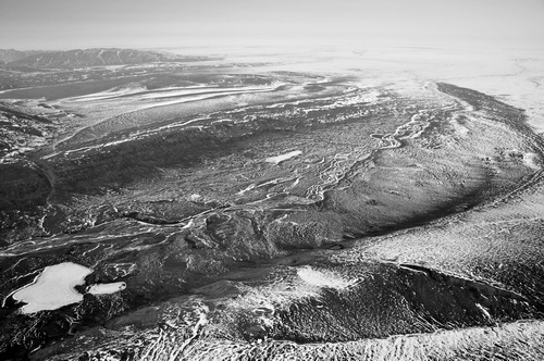
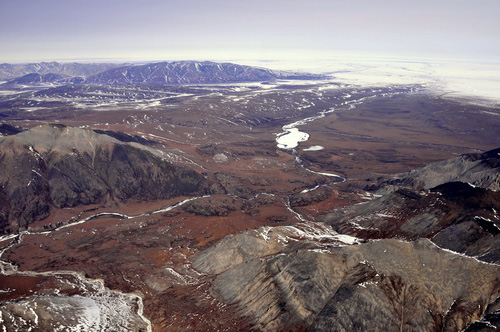
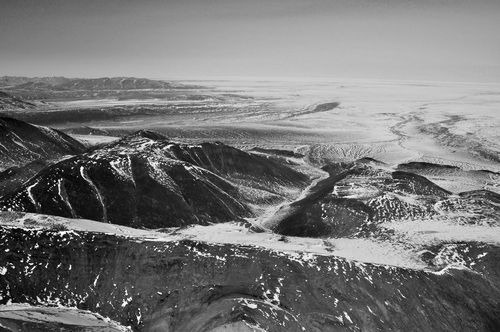
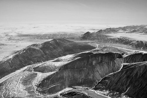
As we flew around, it became clear that snow in the foothills was melting earlier than in the mountains or coastal plain. It’s not really clear to me why, but I suspect it’s a combination of both the solar angle and darker rocks – basically snowmelt is driven by sunshine and its easier for the foothills to absorb the energy from sunshine than elsewhere. The impact that the sun has is clearly evident on the steeper hillslopes, with south-facing slopes being snow free but north-facing slopes being snow covered at the same elevations. The rivers here were already flowing to some degree, due to all of the snow melt converging on the valley bottoms, and many of the lakes had standing water above the thick lake ice. Dirk pointed out the lake he landed on in the Okpilak valley while waiting for our weather to clear the other day, and mentioned that it was a bit slushy on top but not as bad as some of the other lakes he checked out. We flew around Mt Chamberlin so that I could try a repeat photo of a glacier from 1958 then headed back across the front of the range and the glaciers that had become so familiar to me, before landing back on the glacier to get the remaining cores. Once Dirk had refueled a bit and loaded up, I watched the last of our cores head to civilization. After five years of planning, preparations, failures, and successes, we were now one very big step closer to analyzing an ice core from McCall Glacier.
23 May
08 (Day 32): First showers in a month
If current climate trends continue, 50 years from now the terminus of the glacier may be within view here and the ice hanging from the mountain slopes across the valley will be gone. With the photography out of the way, Kristin had arranged a tub and shower set up for us and already bathed Turner, who was reluctant to leave the water despite it now being cold water. So we took turns sitting in a plastic tote, using a little pump to spray warm water on us. I probably shed 10 pounds of dead skin, and it felt nice climbing into clean clothes and having real hair again rather than something approaching dreadlocks. It also gave me the chance to get a better look at the abuse my body was taking. My toenails, which I had thought were just dirty, were clearly bruised from walking up and down rocks wearing my telemark boots, my back was covered in a rash caused by abrasions from a pair of suspenders I was wearing, and my hands and face were clearly receiving more sunshine than they probably should have. But I was clean and it was a nice day, and easy to forget about the minor annoyances of field work. 24 May
08 (Day 33): Winter mass balance and surveys finished 25 May
08 (Day 34): Trying to save tents in the middle of the night
Great progress was being made by the drill team, however, despite the weather. By today they had reached over 190 meters depth, at a location which is likely no more than 210 meters deep. Their schedule had been kind of crazy given the weather and drilling conditions, but now were mostly on a day schedule. The ice had warmed to about the pressure melting point by this point, about -0.1C, and the best drilling approach seemed to be to keep everything warm to prevent freezing by drilling during the day.
This morning there seemed to be a break in the weather, so Jason and I scrambled to prepare for a day on the glacier, finishing the remaining surveying and mass balance tasks and getting equipment in place for summer. Unfortunately by the time we were ready to go, by lunch time, the weather had deteriotated again. We got down as far as our second camp in the ablation area, but by then there was zero visibility and fairly heavy snowfall. We sorted a few things there and tried dragging a load of miscellaneous gear still left-over from our last move, but the trail conditions were awful, with the new snow hiding the zero-friction ice just beneath it and causing the snowmachine to get stuck repeatedly. About this time, the drill crew announced that they had hit liquid water in the hole and that the mechanical drill was starting to get stuck. Probably what was going on was that the colder ice at its depressed pressure-melting point of -0.1C or so was trying to suck energy from the liquid water in the hole, with the standard freezing point of 0C, and so the hole was closing by re-freezing. We headed up there with the last thermistor string, just in case this spelled the end of drilling, but by the time we got there the thermal drill was attached and making further progress, only a meter or two away from 200 meters depth. So it seems likely that it will only be a day or two before we hit bottom or the drill hits something it cant penetrate, and time to draw the drilling part of the project to a close. 30-31 May
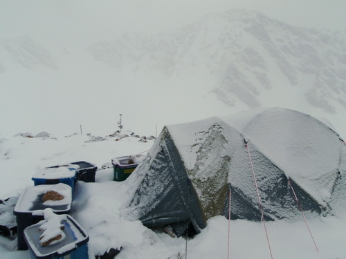
08 (Day 39-40): Final hole complete! Yesterday had been largely a bust in terms of drilling, as well as most other things. The weather continued to remain snowy and windy, and conditions on the glacier were poor for travel as the snow was deep, the trail drifted over, and visibility was frequently zero. I used one break in the weather to pack down the skiway, but that was the extent of my travel away from camp. The drill team tried to make the thermal drill do their bidding, but it was largely being uncooperative. Apparently slush at the bottom of the hole continued to form, and they were worried that they were starting multiple holes, where the 3” diameter thermal drill took over from the 6” diameter hole left behind by the mechanical drill. Some progress was made, but by the end of the day their bag of tricks was exhausted and the last hope was to poor a bunch of ethanol in the hole and let it sit over night, hoping to de-slush the hole and make the drilling easier in the morning. Most of the morning was similarly frustrating, but just before lunch they were able to pull up another meter of core. It was cold, clear ice, like from regelation at the bottom, with bubbles in small layers. So given that progress was continuing to be made, Jason and I headed downglacier to get our GPS station set up before summer began, probably tomorrow.
As it turns out, the lower 4-5 meters of ice was colder than the pressure-melting pont at that depth. At 200m depth, the melting point should be something like -0.1C or so (from memory), and that’s what it was for much of lower 30 meters or more. What I had hoped was that perhaps we would hit a cold layer near the bottom, but I would have expected it to be much thicker if it existed. This layer would have formed during the peak of the Little Ice Age when there was perhaps no surface melting of snow to warm the ice beneath. But to only find 3 or 4 meters worth of colder ice near the bottom makes me think it’s more likely to be due to some local subglacial process. For example, if there were a boulder nearby by, the higher pressures caused by the ice trying to flow past it would depress the freezing point of the ice further, creating supercooled water which would flow around the boulder and then refreeze when it feels the pressure drop on the lee side of the boulder. Perhaps we intercepted this water before it had a chance to refreeze, and that’s why the hole was freezing so quickly? Unfortunately I don’t have a book with the necessary charts with melting point as a function of pressure, so I don’t know whether its reasonably to be creating ice at -2.0C down there. That seems colder than I would have expected based on the the boulder theory, but perhaps the steep bedrock gradient here is adding to that. Or perhaps the warmer ice is overriding the colder ice (which formed cold at the surface 200 years ago)? Does this colder ice exist just here, or is it pervasive in this region? These are the sorts of questions that are easy to ask but hard to answer late at night in a tent in a storm in the arctic.
The drilling is finished, the thermistor
string has been lowered, and Terry is already beginning to dig out his
tent in preparation of leaving. 01-02 June
08 (Day 41-42): Final camp move, a little more coring, and the last of
the ice leaves Jason and Darek spent the day in the upper cirque, using the shallow coring tool provided to us by ICDS. Since our departure from that camp site, about 70 centimeters of snow had accumulated there, largely obscuring our former presence there. This of course means that a substantial amount of digging was required to find the equipment before it could be setup and operated. The weather was fortunately quite cooperative and work proceeded quickly once we got up there. Getting up there was no minor job, though, because the recent snows substantially reduced traction for the snow machine. Had we started deep drilling operations now, or had we not taken full advantage of the conditions of our put in, it is likely that we would not have been able to extract our core there because we would have been unable to get our gear into that location. Though weather and conditions are often worthy of a number of choice swear words, in the end I like the fact that our work is dependent on the weather. It feels good to be able to accommodate nature with minimal energy expenditure rather than insist on muscling through it just to prove something to idiots.
In between helping out (in a minor way) with the shallow drilling work, I spent much of my time moving drilling gear to the skiway and helping the drillers get home. The weather was clearly improving throughout the day, but it wasn’t until about 4PM that I felt comfortable calling Dirk to try to make an attempt to begin the pullout. In terms of gear, fortunately it was all downhill from our drill site in the lower cirque to the skiway, so the transport was largely uneventful. Transporting the personnel was somewhat more animated and though there were no tearful goodbyes, both Bella and Terry were soon on there way back to Fairbanks. By this point it was already late evening, and after wrapping up the shallow coring operations in the upper cirque, the rest of us enjoyed a good meal of homemade meatloaf and sauce and toasted our success with some sake that that Ryo had brought from Japan. It’s been six weeks since we arrived here and a long six weeks at that. Thanks to the dedication and experience of our drill team and the crew that supported their efforts, we had successfully reached the bottom of the glacier in three different locations. By any measure of success, this was has been a wildly successful expedition, and its really only just starting… Today we spent largely breaking down the camp in the lower cirque and preparing for the next phase of the expedition. The day began severely clear, so we decided to take advantage of this to send out another load of drill gear. Dirk arrived a little after 11AM and shuttled a load of gear down to the tundra and quickly returned for another. The idea here is that given our elevation and limited runway length, his load is limited to only about 700 pounds. But from a several mile long lake on the tundra, he can take off with more than 1200 pounds, so by combining loads there we can move gear more quickly and cheaply. On the return trip we decided to move the 550 pound winch. Fortunately we had many hands available to help. Turner also wanted to help, but when he saw his momma inside the plane (helping pull the winch in), he thought she was leaving with the plane and ran and hid in between the boxes in our cache and began to cry. Fortunately momma didn’t leave and all was soon well again, and Turner was able to help load the last of ice, six tubes worth taken from the last hole.
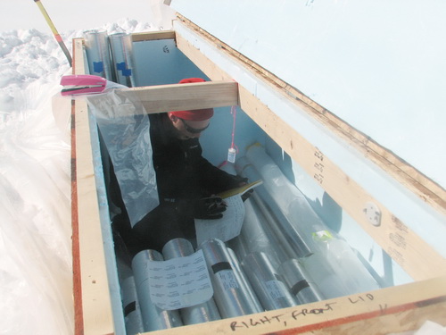
The last of drill gear waits to be taken home.
With a load of gear and the last of the ice gone, we decided to take advantage of the weather to break down the lower cirque camp take some panoramas there. It was a pretty straightforward move, just a 5 minute snowmachine trip with no major changes in topography. The panoramas went pretty well, though the wind grew strong enough to blow snow around while I was taking them , and by the end large lenticular clouds were starting to obscure the sun. Once finished with the move and photos, Jason and I set up the last of our thermistor string stations to begin logging ice temperature data. It all went smoothly and by 6PM or so we were back in camp and ready for dinner. Unfortunately I hadn’t eaten all day despite having packed a lunch (which happens a lot) and had drank even less, and so I was exhausted from prolonged sun exposure (forgot sun screen too) and dehydration. But after a few gallons of blue-powder water and a hot meal, we enjoyed a nice evening of discussions about the glacier and the science that’s gone on here the past 50 years.
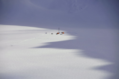
The lower cirque is one of the most spectacular locations on the glacier, and that’s saying a lot. 03-04 June
08 (Day 43-44): Meet the grad students (from Poland, Japan, and Alaska) Darek is from Poland and is a graduate student at the University of Silesia in Katowice, studying under Dr. Jacek Jania. His interests are broadly based but have an emphasis on surface energy and mass balance. His primary glacier field work has been in Svalbard, working on glaciers around the Polish Polar Station there. As a result of our field work this spring, we now plan to make some better comparisons between McCall Glacier and these Svalbard glaciers in terms of the processes of surface melt, internal accumulation, and ice temperature variations with climate. Ryo is a from Japan and is a student at the Kitami Institute of Technology. He has just finished his undergraduate work and will be starting graduate school there next year, studying under Dr. Shuhei Takahashi. Shuhei has been to McCall Glacier several times, studying near surface air temperatures, mass balance variations, mapping the firn area with ground penetrating radar, and ice coring. Ryo’s main interests at the moment are the study of the snow and ice crystals and the atmospheric conditions that control their shape and size, and surface mass balance. Jason is from Anchorage Alaska most recently, where he teaches GIS and environmental science at Alaska Pacific University. He is a graduate student at UAF, working with me on McCall Glacier. His primary interests are ice volume change in the Brooks Range, and the impacts of these changes on the aquatic ecology downstream on the coastal plain. Part of understanding these changes is studying the processes of snowmelt and how much of this water refreezes within the glacier and how much runs off. Darek and Ryo are flying out today, if all goes well, and will spend a few days in Fairbanks before heading back to their homes. It was a great pleasure working with them, and I hope they will come back often. Because our request for internet on the glacier were not supported by our funding agency, this will likely be the last blog posting until early July, when Kristin, Turner and I head back to Kaktovik to help with the mapping project, and can send out the next batch of posts from there. At that time we hope to create a new topographic map of all of the glaciers in the eastern Brooks Range (about 400 or so) using an airborne lidar system operated by AeroMetric from Anchorage. If all goes well, we will have that wrapped up in about two weeks, after a brief stint in civilization we will return for another six weeks of glacier and stream field studies. Joey Williams, a school teacher from Anchorage, will hopefully arrive today and help Jason with the process studies while we are away. She will fly out in early August, at the same time as another team from the University of Southern Mississippi will be leaving. They will be here about a week to install a new weather station and study airborne pollen and determine how much gets trapped in the snow, facilitating our paleoclimate analysis of the deep core from the upper cirque. So we have a busy summer planned, but we are all in good spirits and looking forward to the challenge and fun. |
(c) 2003 Matt Nolan. If you find any broken links or other errors, please let me know. Thanks.