Dr. Matt Nolan
Institute of Northern Engineering
University of Alaska Fairbanks
|
|
Dr. Matt Nolan
Institute of Northern Engineering |
|
McCall Glacier IPY Lake El'gygytgyn IPY Virtual Globes IPY
|
22
April 08 (Day 1): First stop – Kaktovik, the little village that
can
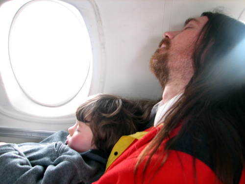
Our five month expedition to arctic Alaska began today with our first stop at Kaktovik, Alaska. Kaktovik is a village of about 300 people, mostly native Alaskans, on the coast of the Arctic Ocean. It’s actually located on an island, separated by a small strip of water from the mainland, but in winter it is all frozen so it is essentially connected.
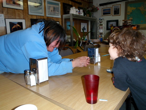
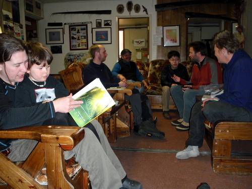
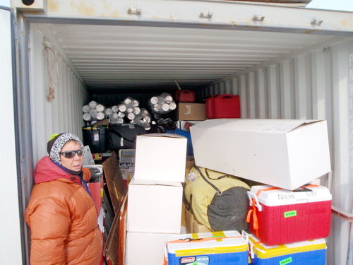
Kaktovik, being a small town, has its own small-town issues. These are exacerbated by not being on the road system and the next nearest village being several hundred miles away. Kristin has spent time in nearly every village in Alaska, and considers this her favorite. Drugs, domestic violence, and general unruliness are not at all uncommon in many villages in Alaska. Though Kaktovik has its share of problems, it is still a functional, somewhat thriving, and friendly village. It is unclear to me how a community gets on a particular trajectory on these terms, but clearly Kaktovik is on one of the best ones in the State. Kaktovik has become very familiar to us and, perhaps more importantly, we to them. We stay in regular contact with many of the locals throughout the winter and keep up on the news. Due to some cargo issues and lack of sleep over the past few days, we decided to spend the night there rather than try to start shuttling in to the glacier right away, giving us the rest of the afternoon to sort our mountain of gear and catch up with the locals at Waldo's. We had many visitors throughout the day, catching up with personal life or wanting to learn more about the glaciers. By evening we had discovered the location of most of our gear, totaling more than 2 tons, and after dinner most of us were ready for a good night's sleep.
23-24 April
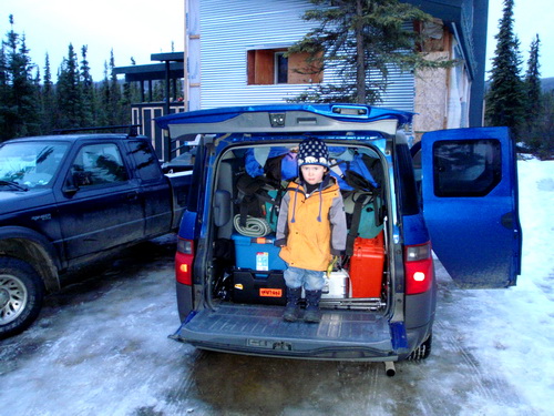
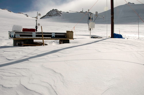
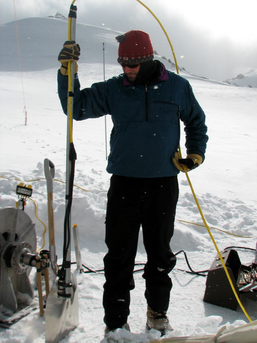
08 (Day 2-3): The put-in – we made it! The airport in Kaktovik is not like those found in most cities. There is no TSA, there are no parking meters, and there’s not even a building to wait around in. It’s just a runway on a gravel spit between the ocean and the mainland, with an old hangar and a few shacks around it. When a plane come in, everyone drives their pickup trucks right up to it to get their cargo or passengers. Despite the lack of armed guards and xray machines, we’ve never had a problem with leaving our tons of expensive gear on the side of the runway, sometimes for weeks at a time. Today was a little windy, so we staged our gear in between a large snow berm and an old, unused hangar. We weighed all of our pieces on a bathroom scale and arranged it in a line in more or less the priority in needed to go in.
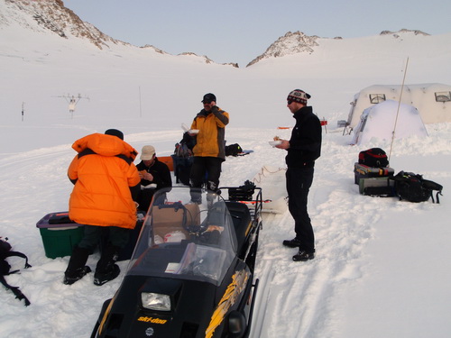
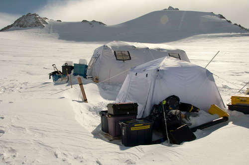
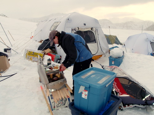
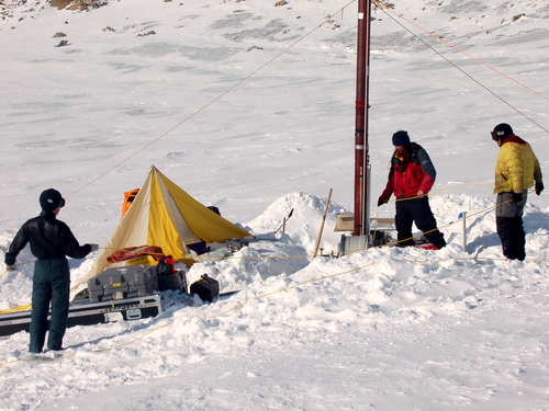
Dirk arrived as scheduled, and we lost little time in loading our first flight. Terry and I went in first, figuring that between us we could both set up camp and the coring drill, in case we got stuck in there for an extended period on our own. The flight in was uneventful and soon we were standing on the glacier, where it was warm and calm – perfect weather for sorting gear and getting camp setup. Once Dirk took off, we began sorting through the piles of cargo that we had deposited several weeks earlier and digging out what we needed first. The first order of business was getting the snow machine running. We have never used a snow machine here before, but without a helicopter to place our loads exactly where we needed them, we needed some mechanized way to transport the tons of material we had. It started up fine, and I drove it several kilometers away to first camp site to set a route and check the conditions. Everything seemed fine, so I returned for a load to haul up there. This time, however, the machine seemed to lose power on the way up, such that I had to dump part of the load. I returned back to our cache and changed the spark plug, which seemed to help, so I tried it again. This time I again lost so much power that I couldn’t even drive it downhill. Considering the amount of gear we had to move, and that we had no backup for the snowmachine, I began to feel a mild panic. I changed to my final spark plug and made it back to the cache. This time I pulled off the carburetor and changed to a smaller jet. This seemed to have solved the problem thankfully. It seems the thinner air was making the mixture too rich and fouling the plugs. I think it continued to run a little rich and lacked full power, but we were operating at 7000 feet so I guess some loss of power is to be expected, and for the most part it continued to perform well throughout the day. We got five loads in total with the Beaver on the first day of the put-in. Each load carried about a thousand pounds, and typically we ran them with one person in the front seat and the rear of the plane loaded with gear up to the roof. Beaver’s have a surprisingly high internal volume, and we were able to make fairly efficient use of the space. On the last flight of the day, the remaining crew in Kaktovik sent in five cheeseburgers from Waldo’s for us to snack on, which was greatly appreciated. By midnight we had a number of tents setup, dug some essential gear out of our over-winter cache, and had a fairly functional and secure camp.
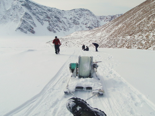
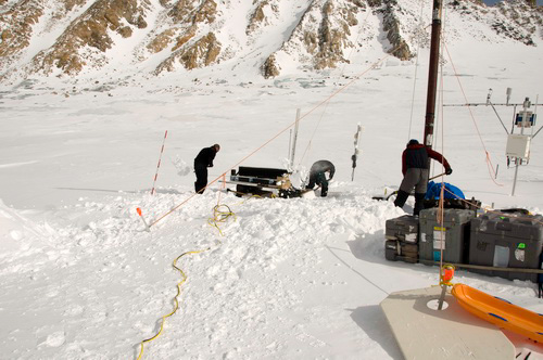
The weather held out the next day, and we got our final two flights in by 11AM. Now all of our gear and personnel were on the glacier, which was a great relief and a remarkable achievement. There were rumours of a change in weather coming, so the priority now was to get all of our camp gear and drilling gear up to our camp site. The major issue with transporting gear from our ski-way to our camp site is that there were several steep hills to climb to get the gear in place, and changing snow conditions throughout the day made this more or less difficult. Taking smaller loads in the sled was easy solution (though requiring more loads), but this was not a possibility for our winch sled which weighed 550 pounds as a single piece. I tried moving this early in the morning while the snow was still hard on the well packed trail, but could not make it up the final hill. Not being able to get that winch up the final hill was a fairly major cause of concern, since it is absolutely required for running the coring drill, which was the purpose of this part of the expedition. In the end, it took 4 people pulling with ropes along with the snow machine to make it up the final hill. I “drove” the machine, which basically meant I held the throttle wide open while putting my weight as far forward as I could to keep the skis on the ground, then bounced up and down to add traction to the drive track without letting it bury itself. Everyone else pulled (and occasionally ran when we made progress), but mostly tried to keep from getting run over. We took frequent rests. But with that done, the crux of the move had been past, and by that evening we had the drill more or less set-up and camp pretty cozy.
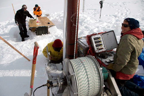
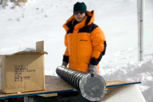
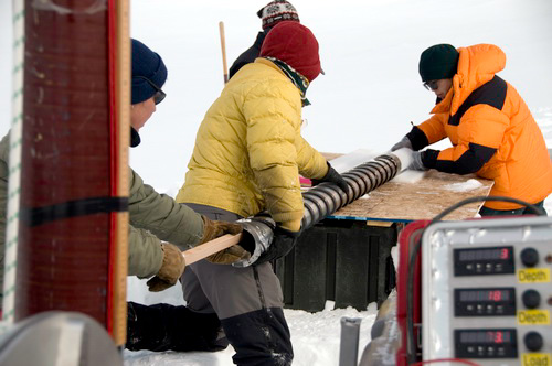
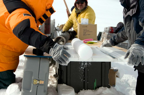
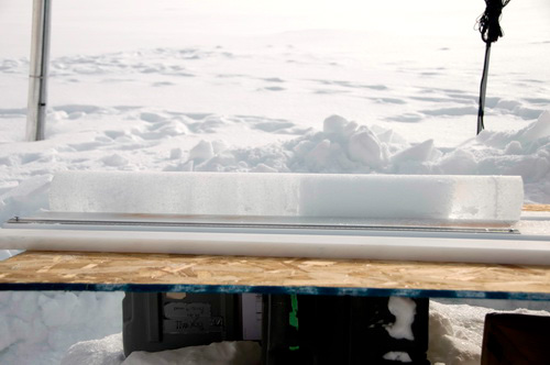
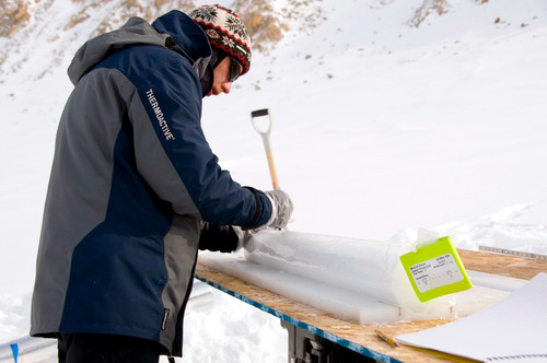
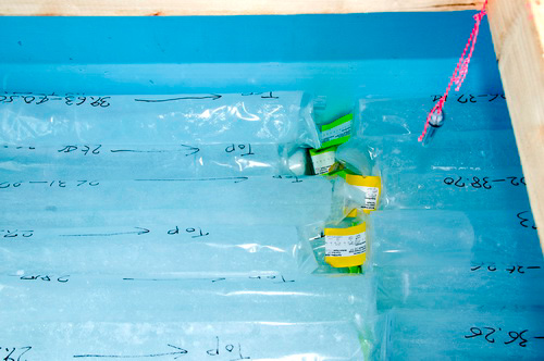
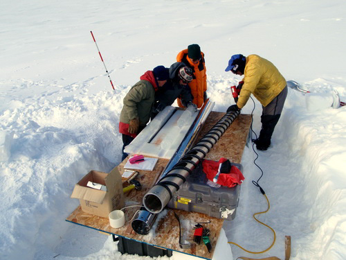
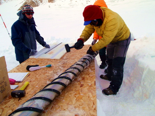
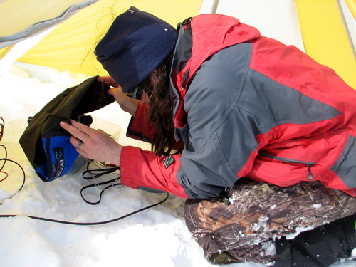
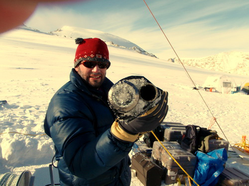
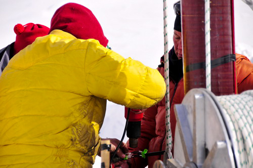
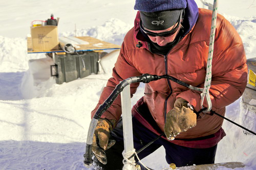
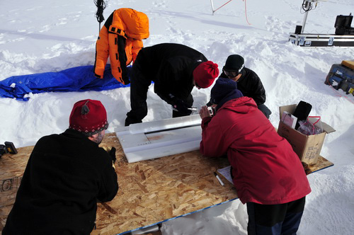
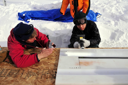
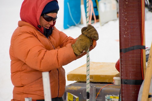
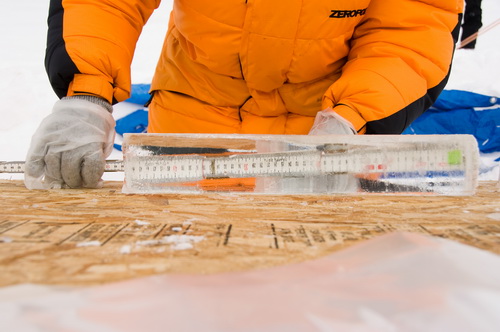
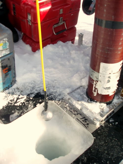
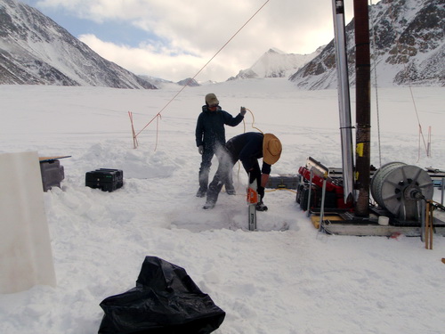
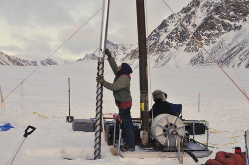
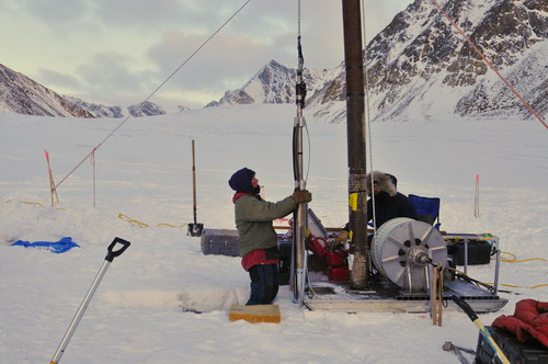
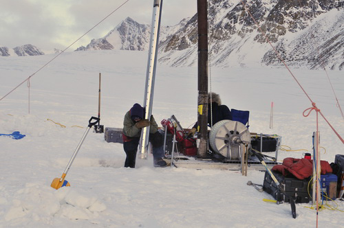
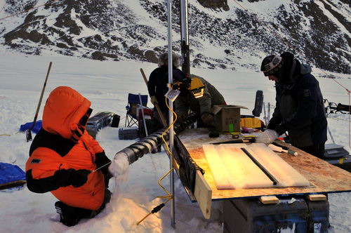
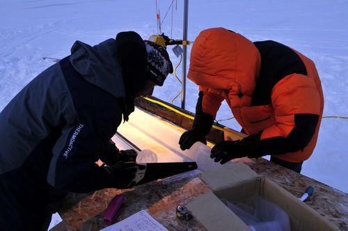
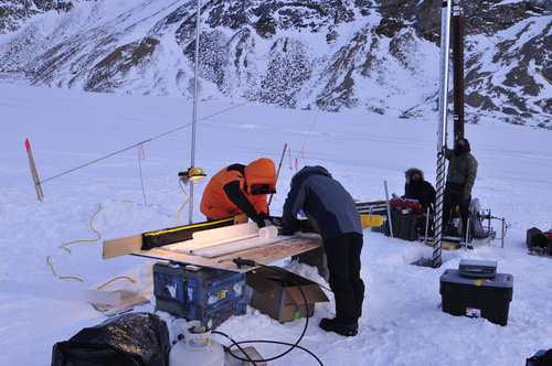
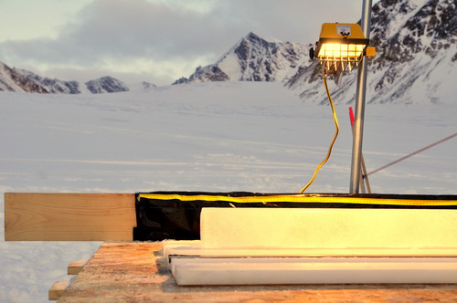
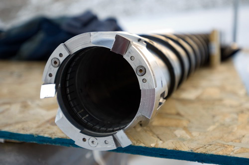
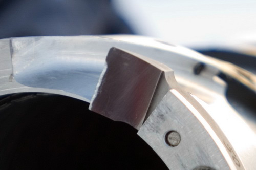
Our coring drill is owned and operated by the good folks at ICDS in Madison Wisconsin, who drill ice cores all around the world for academic purposes. Bella and Terry from ICDS have joined us for this expedition to operate the drill and extract the cores. The drill is an electro-mechanical drill, which operates by first lowering down a motor and core barrel into the hole using a large winch and thick cable. The cable carries current to power the motor, which spins the core barrel within the hole and drills down about a meter at a time. The motor and core barrel are then hauled up by the winch, and the core barrel removed from the motor section and placed on an analysis table where we take a look at it before placing it into a plastic bag. The bag is labeled with the depth, location, and which way is up, so they can be analyzed in detail later in the correct chronological order. It’s a pretty efficient process once everything is up and running.
So within 5 days of leaving Fairbanks, we had already extracted 27 meters of core. This was another remarkable achievement, and one that may be deceivingly simple on the surface considering how smoothly this trip has gone so far. Our first coring attempt was in 2004, with colleagues from Japan. Unfortunately, a helicopter accident destroyed this drill before we were able to use it, and on that trip we were only able to drill 20 meters using a hand auger. This ice was later destroyed by an earthquake which leveled the storage facility in Japan. That expedition took more than year of planning and preparation, and its taken another 4 years to recover from it, which entailed securing new funding, new drills, new personnel, etc etc. So to recover 27 meters of ice now represents the fruition of years of hard work and the payoff of years of heartache and heartburn. We can only go down from here!
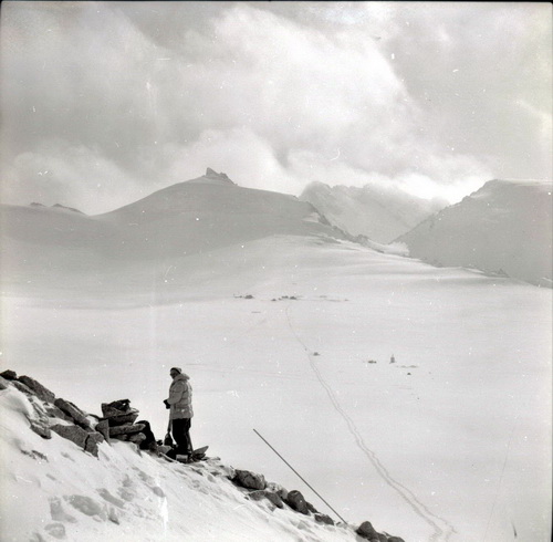
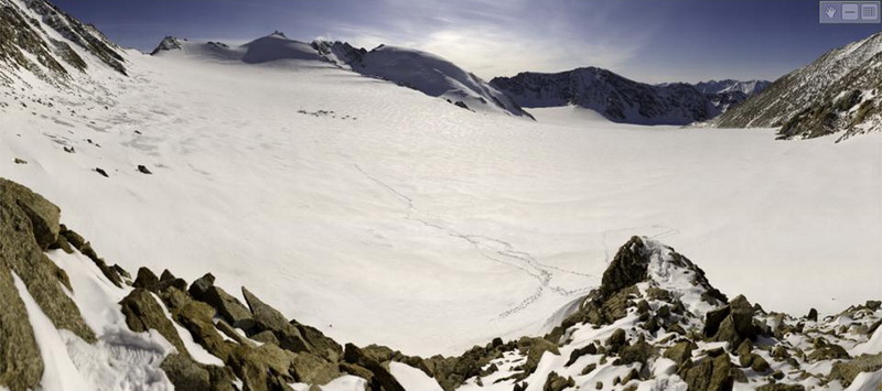
Outside. Despite the somewhat desperate circumstance (and reminder to secure camp before going to bed), it’s storms like these that form the glacier into the shape that its in. I had never seen the wind come from this direction before (from the north east, though it may actually be coming from the west aloft and being turned around within this part of the valley) but it does seem to explain the distribution of snow that we are familiar with here, with thin to zero snowpacks on the eastern side of the cirque, thickening to the west. Snow drifting and wind packed snow are likely dominant mechanisms of accumulation on this tiny glacier (similar to avalanche accumulation along the edges). In May 2003 we noticed a similar phenomenon, where strong 60mph+ winds come from the south and scoured the eastern side of the main valley down to ice and deposited it on the western side. Many have noted this distribution of snow throughout the years here, and most attributed it to the shading of the large western wall. But to the four of us who spent 5 hours skiing up glacier into that wind watching this process, it became clear that wind redistribution of snow is an important process on McCall Glacier.
We had gone to a night-time drilling schedule because of the problems the sun was creating by getting the core stuck due to melting snow. I say “we” in the royal sense, as it is really Bella, Terry, Darek, and Ryo that are doing all of the coring work. I walk over every once in a while and try to look official, but my time has been mostly occupied by sorting gear, finding tools or solutions to minor problems, etc, though I did have the chance to get some photography prep work done that I had to blow off in Fairbanks in the time crunch. Anyway, drilling commenced about 9PM after a nice spaghetti and meatball dinner, at which point I went to bed, and proceeded until 4AM when water was struck. Though water at this depth was unexpected, we are drilling at this location because we had some strong suspicions that things were going on here that we didn’t understand fully. In 1957, a hole was drilled not far from ours that showed the ice temperature was only about -1C, nearly to the bottom. This was surprising because the mean annual air temperature here is about -12C, and so the ice “should” be about this too. The difference arises because of surface meltwater. In summer, all of the snow surface of McCall Glacier melts somewhat, unlike the summit of Greenland or most of Antarctica which have no surface melt. This melting snow then either travels over the surface in small streams, or drips down into the snow pack. If the snow pack is below freezing, the meltwater may refreeze, typically forming layers of ice, which are easily seen in snow pits. But when water turns to ice – that is, when it changes from a high energy state to a lower energy state – it must release energy in the form of heat to do so. We call this release energy ‘latent’ heat because the temperature of the water/ice doesn’t change when it is released, unlike ‘sensible’ heat which can be sensed with a thermometer. This latent heat energy then warms the snow pack, such that by the end of summer all of the accumulated snow (as much as 30 years worth that has not yet been compressed to glacial ice) is no longer at the mean annual air temperature but rather somewhere near the freezing point. Thus all of the ice beneath this “thinks” that the surface temperature is near freezing too since it never gets a chance to feel the coldness of winter before the warming due to refreezing occurs.
Because of this prior work, we knew that the ice here would be fairly warm, but there is a big difference between ice at -1C and ice at 0C. Namely, ice at 0C can coexist with liquid water, whereas this is much more difficult to colder ice. So to find liquid water within the glacier at this location is both surprising and interesting to us, and gives us something to think about as we continue drilling. 30 April
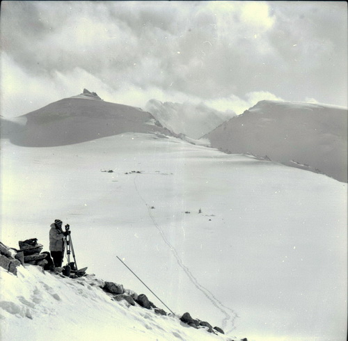
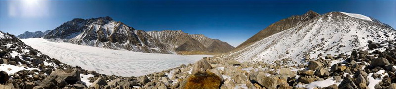
08 (Day 9): My first gigapixel panoramas of the trip – a 50 year
repeat with a twist For my first set of photos on this trip, I chose a 1958 photo location that I had located last year. Here Austin Post had photographed John Sater surveying glacier motion, with the IGY camp in the background. Old survey locations are also great for photography, because both require enough room to setup a tripod and have a good view. In this case, the survey spot was still in great shape, but the 1958 photo spot itself was now gone—Austin was standing on ice which is now more than 5 meters lower! I spent most of the afternoon at the site, taking panoramas with a variety of new lenses. I didn’t have the time I needed to work with these lenses in Fairbanks before we left for the trip, so this was also kind of a shake-down test for me. The main reason I chose this location first is because this was the first time we had camped in the upper cirque, near the IGY camp, and I wanted to get an exact 50 year repeat, down to the day, comparing not only the change in the glacier but the similarities between drilling camps 50 years apart. So in this case, unlike most other repeat photos I’ve made out here, there’s an element of some things changing but some things staying the same that I really like. I processed many of the images back in camp that night to confirm they worked, and was greatly relieved to see that not only did I have everything set up properly, but that the new lenses I had chosen really were worth the money (especially buying them used on ebay…).
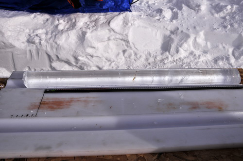
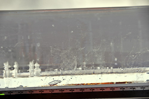
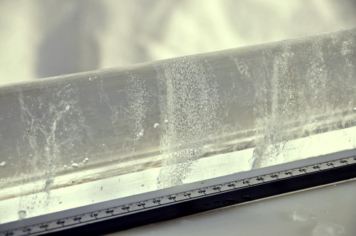
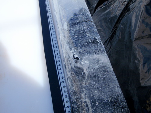
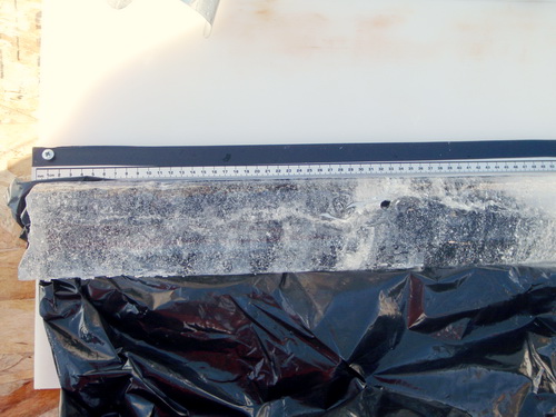
Drilling then proceeding smoothly throughout the day, do a depth of about 93 meters. At about 90 meters, we hit more than a meter of what seemed to be clear regelation ice. If true, this ice was not formed by compaction of snow layers, but rather the refreezing of liquid water, like the same way that ice cubes in your freezer form. That this type of ice exists here implies two things – that some time in the past liquid water existed here and that enough energy was available to refreeze it. The latter implies ice temperatures at that time that were below freezing, giving the heat energy released by freezing the liquid water a place to go. This could have happened 100 years ago, or yesterday, as far as we can tell just by looking at it. But there was also some debris in the core which may contain bacteria or other living things that can help us constrain the date.
The story gets even more interesting, as this morning we actually cored through a conduit! Since about 90 meters depth, we had been encountering sections of clear ice – that is, ice that seems formed by the refreezing of water, not true glacial ice that had been compressed by snow. Today in one of these sections we actually found a hole that extended completely through the core. Surrounding it were veins of bubbles within the clear ice, as if the hole had migrated and resealed over time. I’m not aware of anyone finding a water conduit within ice core before, though it may have happened. But in any case, it’s pretty exciting and interesting stuff.
During the next core run, the thermal drill shorted out again, so we had some time to lower the borehole camera. We could see the location where the rest of the conduit we intersected was, but we couldn’t detect any water flow through it. The water is exceptionally clear, containing no sediment, implying that perhaps it was never in contact with the rock underneath the glacier. Perhaps it is coming through crevasses at the surface? In any case, this puts a new twist on the internal accumulation of ice. Previously we had only been considering the refreezing of meltwater within the upper few meters, but our cores suggest that there may be much more significant accumulation of ice near the bottom of the glacier too. So we have a lot to think about.
05 May
08 (Day 14): Almost to the bottom of our first hole, despite weather delays
I spent most of the day trying to sort out an internet connection for us. I had hoped to piggy-back on the telemetry system we maintain for our weather stations, but there were a few issues we had yet to resolve in Fairbanks to accomplish this. So I worked with our satellite phone system. I was able to make a connection, but it was frustratingly slow. With connect times typically only last 5 minutes, and working at 9600 baud, you could barely log into a webmail system before you had to start over again and it took about 3 hours to send a short email. 06 May
08 (Day 15): We hit bottom! After a number of other odd jobs throughout the day, I was on the phone with Ken in Fairbanks trying to troubleshoot our internet problems when Terry shouted that we had hit the bottom. Apparently the thermal drill hadn’t moved in quite some time, indicating that it was no longer hitting ice. We pulled the drill out and lowered the camera down and, sure enough, 151.3 meters down the hole was rock! It is of course unclear whether this was a random rock or the actual bed of the glacier, but this was the depth I initially anticipated based on our radar measurements in the area, and in any case we had no means to drill further, so we called it good. After pulling out the camera, we installed the thermistor string into the hole. This process took about an hour, 55 minutes of which was spent untangling 160 meters of thermistor string cable.
These thermistors are 10 meters apart and record temperature. Once the hole freezes back over (if it does) we will then have some record of ice temperature versus depth, and hopefully these measurements will continue over many years. A somewhat counter-intuitive process we anticipate is that as climate warms, the ice in this region will actually get colder. The reason is that this region is now an accumulation area, but if climate continues to warm it will change to an ablation area and the firn which now keeps the deep ice warm through refreezing of surface meltwater will disappear. This process is likely already occurring in the lower cirque, where we plan to drill our third hole. 07-08 May
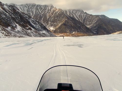
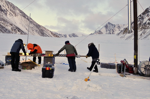
08 (Day 16-17): We move to our new home down glacier Once the drill was packed up, the drill team took a well-deserved afternoon off to explore the area while Jason and I went to pick the final spot and assess how difficult our move was going to be. For our first move, from the skiway to our current location, the big issue was getting cargo up the hill (and getting stuck a lot). This time the issue was getting down the hill without a large sled load, and preventing the sled from going faster than the snow machine and pushing it out of the way. I rigged up some chains in a U shape to ride under the sled, such that the heavy load would press the chains into the snow and slow it down. This system proved to work great, and we were able to shuttle several loads to the new location that evening without incident. What turned out to be perhaps more interesting was the low snow cover on the glacier, such that we had to pick our way through meter high ridges of exposed ice to keep going from snow patch to snow patch. Travelling on the ice itself was nearly impossible because it was so slippery, so we could only cross short sections perpendicularly to get to the next snow patch. Fortunately the ridges were mostly aligned in the direction we wanted to go, so Jason was able to show off his half-pipe moves while skiing in front of me. In any event, we found a nice gentle route and it proved to be a safe and effective one for the 20 or so loads we shuttled over the next few days.
The crux of the move was transporting the winch. The weather on our main move day was quite similar to the day before, with blue skies and light snow, so it did not slow us down much. We began by shuttling some more loads of drill gear downglacier while everyone packed their personal stuff and broke down their tents. Once I had Terry and Bella’s gear at the new site, we hooked up the winch sled with chains under the runners and ropes tied off the back end such that Jason and Terry could ski behind it and help steer or stop it. The chains were so effective at first that the snow machine could barely pull it. So we removed a few and headed downglacier. We put them back on for the steepest hill, and it seemed to work perfectly, with the sled neither pushing or dragging much. What was more problematic was for Jason and Terry keep from running into each other in their efforts to ski down a steep hill slowly enough to keep tension on the rear cables. But in any case, the move was relatively uneventful and by 10PM we were eating dinner in a reasonably well-formed camp.
09 May
08 (Day 18): The night crew drills core and takes names
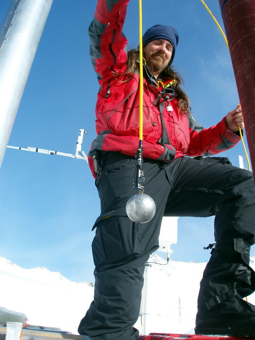
With most of the gear sorting out of the way, Jason and I then hiked a few loads up to our old moraine camp and continued on up to the weather station on the mountain behind it. The issue here was that our telemetry was not working so well, and we needed to determine whether it was a problem on our end or at the receiving station in Kaktovik. It took more than a hour to climb up to it, picking our way between loose rocks and snow up to our knees, and by the time we got up there our nice sunny day had turned to fog and wind. But it was dry enough to work with electronics and begin troubleshooting the problems. The problem turned out to be something to do with the antenna, though we didn’t spend the time to determine the actual problem with it. This antenna is a radomed yagi, meaning that it’s a yagi style antenna placed in a fiberglass box to keep ice from building up on it. I had it placed on the edge of a cliff and rocked down, so that it had a clear view of the horizon but the wind couldn’t catch it. Probably it somehow filled with spindrift and was packed with ice now. In any case, we hooked up the spare, non-radomed, yagi that we had carried up and found a way to secure it pointing in the right direction, and headed back down the hill.
The trip down the hill went much more quickly, partly because we found some better snow patches to slide down and partly because we were cold and hungry at 9PM. We still had some more GPS work to do and some more gear shuttling between caches, but by 10PM we were back in camp and eating a nice dinner of pasta and meatballs, with the aural ambience provided by the 5 KW generator powering the drill. 11 May 08 (Day 20): This time we hit a rock instead of water. Camp is on a bit of a funny schedule, with half the folks working at night and the rest during the day. It feels like the issue we face all the time in Alaska, with considering the 4 hour time difference in the east coast. So we leave notes for each other to read when we wake up. This morning we got a note saying that the drill had hit a rock at 70 m and it could not get past it to drill the remaining 60 meters or so of ice. Most drills working on ice are not designed to penetrate rock, and this is certainly the case with the two types of drills we have here. For holes 2 and 3, our main scientific interest is just the hole itself, so that we can install a thermistor string into it to measure temperature. In my initial request for support (and several times afterwards), I had recommended the use of a hot water drill here, which makes holes simply by spraying hot water into the hole and melting the ice. The main advantage is that it is much faster to make a hole (only takes a day once the drill is setup), meaning that if you hit a rock you don’t have spend a week on night-shift drilling another hole only to hit another rock. A secondary advantage is that one needs to create a hot tub to store the water being pumped, and this tub has other uses as well. But we have to make the best use of the equipment we have, and moving the drill a few meters over and starting again is basically our only option.
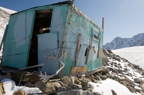
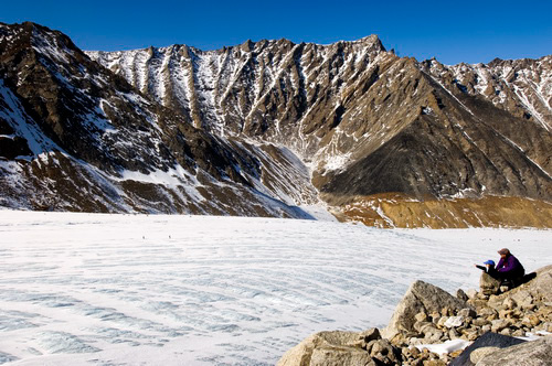
In any case, it was a another beautiful sunny day, so we planned our work accordingly. Kristin, Turner and I headed to the old hut on the moraine across from our current camp for some high resolution panoramic photography. Jason headed back up glacier to troubleshoot our ongoing GPS problems, which are exacerbated by not being able to camp next to the base station. I found a nice spot on the moraine and spent several hours taking a panoramas at a variety of resolutions. The hut was in even more in verge of collapse than last time I saw it, as its ‘foundation’ continues to shift and crack on the ice cored moraine it sits on. Probably this summer we will need to knock it down before someone is tempted to sleep in there and get crushed.
The drill crew had woken up by now and decided to spend the afternoon exploring as well. Darek and Bella hiked down to Bur Cirque, Terry wandered around the ice and visited the hut, and Ryo caught up on sleep and reading. By dinner time we were all back in camp and made a plan to begin moving the drill a few meters away and starting over. Given our limited amount of time, hitting another rock means that there will not be enough time left to try a third time here and succeed at our final location in the lower cirque. We’ll have to keep our fingers crossed for good weather and clean, dry ice.
|
(c) 2003 Matt Nolan. If you find any broken links or other errors, please let me know. Thanks.