Dr. Matt Nolan
455
Duckering Bldg.
Water
and Environmental Research Center
Institute of Northern Engineering
University of Alaska Fairbanks
matt.nolan@uaf.edu
|
|
Dr. Matt Nolan 455
Duckering Bldg. |
|
|
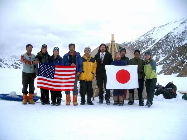
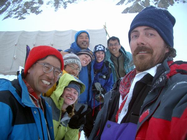
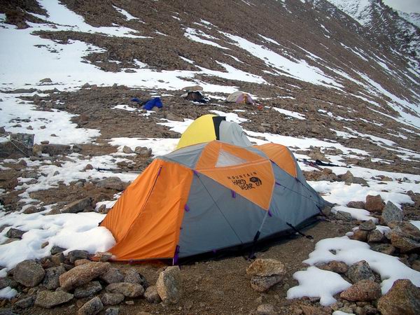
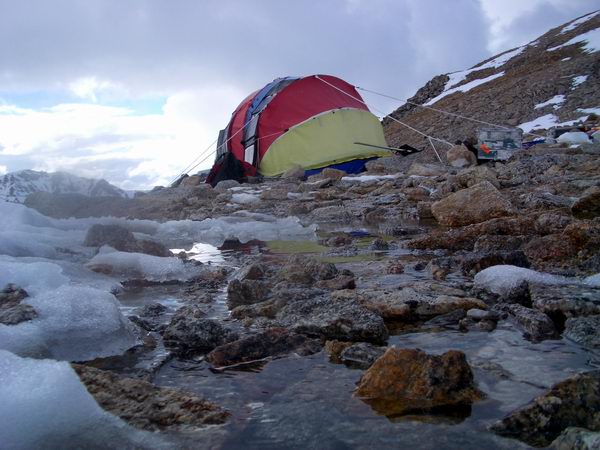
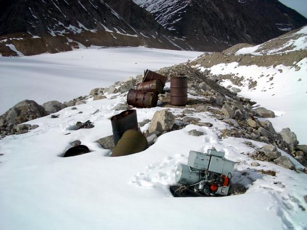
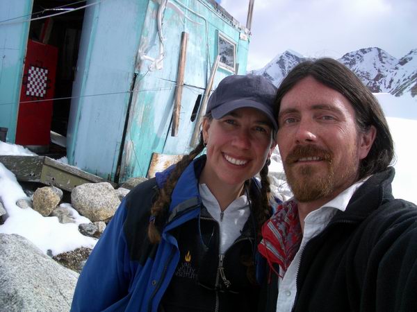
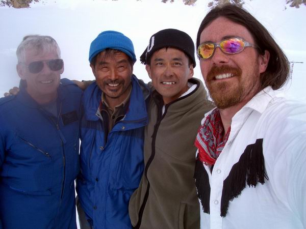
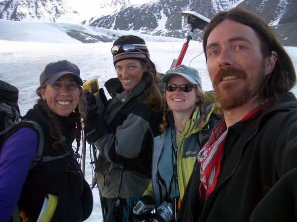
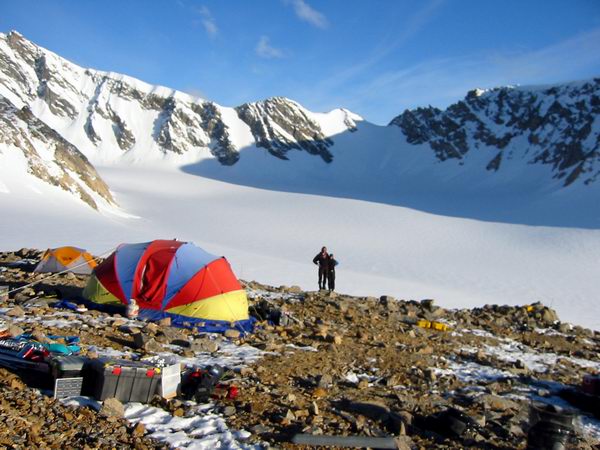
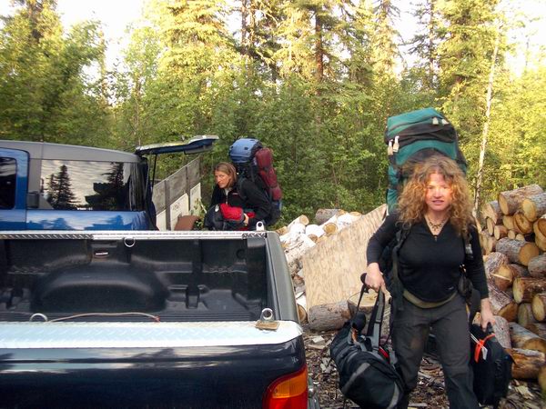
Wednesday, 12 May 04, Midnight, McCall Glacier I began doing nothing but preparing for this trip about a month ago after working part time on it for the last year. Still, it wasn’t really enough. The first major obstacle we had to overcome was getting permission from the US Fish and Wildlife Agency just to attempt the work. Because we are in the Wilderness region of an important wildlife refuge, we must follow standards that are much stricter than many other glacierized locations. Where our intended research came in greatest conflict with these standards is in the use of a generator to run the drilling rig. As drilling rigs go, this is a pretty low power one, less than 2000 watts, which can be run by a generator light enough to pick up with one hand and quiet enough to not be heard 10 feet away when the wind is blowing the other way. However, generators of any type are simply not allowed in the refuge, in general. To gain permission for this work, we needed to demonstrate to the refuge managers that our current research was important and fit into the general long-term plan of research on McCall Glacier, which has a history of research that predates the refuge and thus has leverage to escape the restrictions that generally apply. Generators have been used in support of research here since the first project in 1957, especially in support of several drilling efforts, and documentation of this went a long way towards gaining permission. Another thing that went a long way towards this was agreeing to remove the debris left behind from prior expeditions in the 1970s, but more about that later. The next major obstacle was dealing with the large amount of gear necessary for the research. To accomplish our goals this year, we have to move about 6000 pounds of gear and 11 people to the glacier. The main reason for the large size is to support an ice coring effort. The ice cores we hope to retrieve will be analyzed to yield what we hope is a record of climate variations over the past 300 to 1000 years. It is a challenging task with a lot of obstacles, not the least of which are the logistics – an obstacle we have not yet overcome. The coring is being done primarily by a Japanese research group that we have been collaborating with since last year, and it is primarily their equipment that we are using. About 3000 pounds of this equipment arrived in my driveway about two weeks ago, where it sat until we moved it to Frontier Flying’s warehouse shortly before they flew it to Kaktovik, where it next goes by helicopter to the glacier. Added to that were another 1500 pounds of lumber, equipment, food, and baggage for the Japanese team of seven, and another 2000 pounds for our team of four, all that not including body weights. The Japanese team included Shuhei Takahashi, Tetsu Yamasaki, Akiyoshi Takahashi, Kazuhide Satow, Kengo Satoh, Jun Uetake, and Kristin Scott Nolan; the UAF team included Ken Irving from UAF, Beth Bartel from Unavco in Boulder, Erin Pettit from the University of Washington in Seattle and myself. In total, that’s a lot of mass to move around in small aircraft.
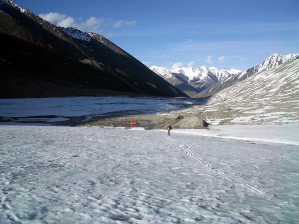
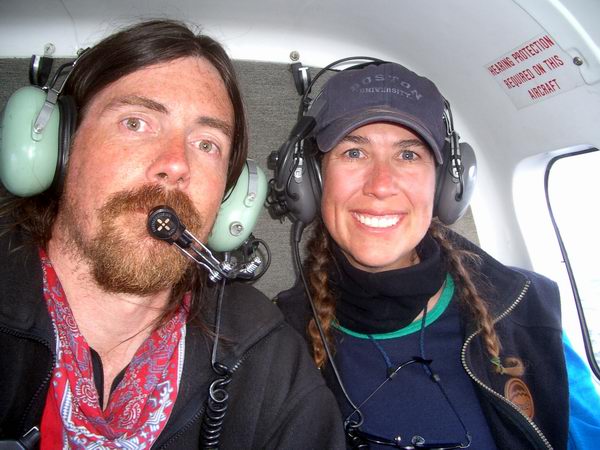
We sent up most of the gear Monday morning. We had arranged in advance to have a special cargo flight on this day, and sent up two people on the passenger flight to help unload and prioritize cargo for helicopter transport. The helicopter, a BO-105, also arrived on Monday. The remaining passengers flew up on Tuesday. Unfortunately, the amount of actual gear exceeded the estimates and more importantly exceeded the capacity of the airplanes being used. Thus some of it didn’t make it to Kaktovik with us. Once we all arrived in Kaktovik, we discussed our plans with the pilot, Merv, and began gearing up for the next phase of the logistics. The general idea was that Kristin and I would go in first with a light load and give Merv the general tour of the area and what needed to be done. After a bit of maneuvering, we landed at our camp site and unloaded. It was a beautiful day on the glacier, no wind, bright sun, and stunning views. With the helicopter turned off, it was as quiet as it probably gets in the world. After enjoying the view for a few minutes, Merv and I took off to check out the intended Japanese camping site, which was about a kilometer away in the upper glacier. We decided to have separate camps this year. The Japanese need to camp near their drilling site as they need to stay close to avoid the delay caused by traveling back and forth to our normal camp site. Because the UAF group is working all over the glacier, our spot is more convenient for us as it’s nearer to the middle. But we decided to have progressive dinners every so often to maintain a good neighborly feel to the projects. That is, if our dinners actually make it onto the glacier. We prioritized our equipment such that we could get a good selection of food and the full complement of GPS equipment to Kaktovik and onto the glacier first. This way, if the new weather station equipment and other equipment was delayed, we would be able to eat well and get some surveying done. This plan worked reasonably well, and with two more flights we were able to get nearly everything of ours that had arrived in Kaktovik to the glacier, including Erin and Beth. Ken stayed behind to help the Japanese with their gear and reduce what gets lost in translation, as well as help coordinate the receiving end of a backhaul of debris from expeditions in the 1970s. So with what we have now we should be able to get quite a bit of work done, though Erin and Beth are the only ones with both skiis and boots on the glacier, and we also have a fully functional camp that can also support any of the Japanese that might arrive, in case bad weather or flat light prevented landings at their location.
Merv was next able to transport Shuhei and Tetsu to their site, followed by one more flight of their food and equipment late in the evening. We talked to them by radio, and all seemed OK. One of the boxes of theirs that was still in Fairbanks as of last night contained their stoves, so we lent them one of ours. That night all of us slept well.
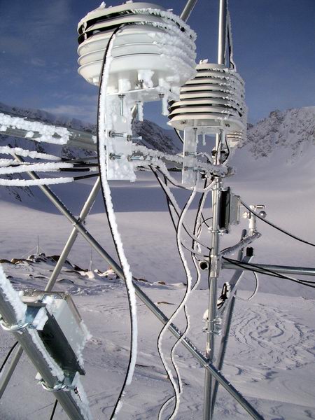
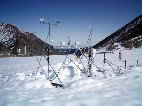
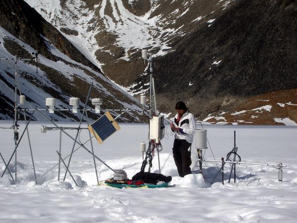
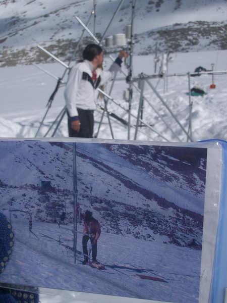
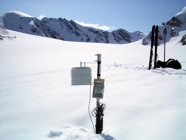
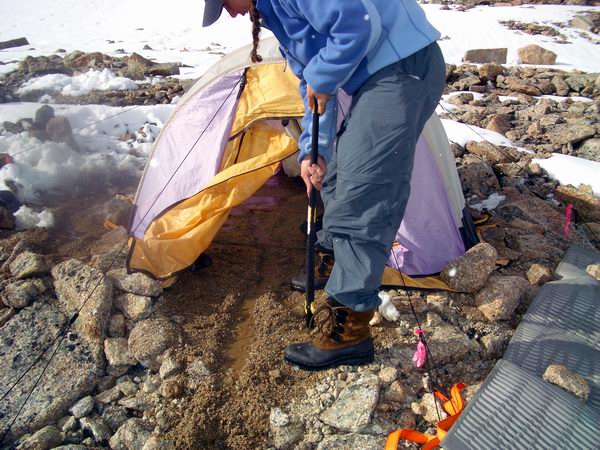
What goes up must come down, though the speed may vary uncontrolably… That next morning, Wednesday, we all slept in, I think even in Kaktovik. Few of us had been getting full nights for the past few days and the recharge did us good. The weather on the glacier wasn’t so great, and deteriorated throughout the day, so no flights were able to make it in from Kaktovik. Air temperatures were probably not far below freezing, as the snow that fell was fairly wet and melted quickly on the tents and rocks, making everything a bit soggy. We spent most of the day in the clouds and in no great hurry, organizing gear and figuring out what was still missing and how to work around it. We ended the day with a nice dinner and a DVD. We woke up Thursday morning to clear skies and beautiful views. I talked to Ken via Iridium and learned that Kaktovik was socked in. The fog was so thick, in fact, that the Frontier Flying flight could not even land. Fortunately we had enough equipment to begin getting real work done. We spent the morning mobilizing for the first GPS survey. I got the base station antenna and power situated while Beth and Erin got the important hardware sorted and programmed. Kristin began tearing apart the guts of the cook tent to make it more liveable. The general plan for the day was for Beth and Erin to survey the upper glacier while I worked on getting the weather station hardware sorted out and Kristin continued on the camp organization. The beautiful weather held out all day, and I could see Beth and Erin traveling from pole to pole in the distance. I was able to get a fair amount done on a new station. This station is going to replace an existing one on the glacier, the difference being that the current one is anchored into the glacier ice and this one will float on top of it, hopefully. The reason for the change is that anchored stations have to be continually re-anchored as the ice melts else it will fall over, whereas this one should simply ride the ice as it melts beneath it. This one will also accommodate a number of new instruments, including numerous air temperature sensors, several anemometers, and a four component radiometer. Most of the new air temperature sensors are part of a comparison test to see if different sensors perform as rated and yield the same results.
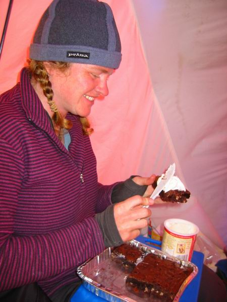
Assembling met station components on a sunny day - 2 MB. For a first day of work, it was reasonably successful. The GPS surveying went well (and Shuhei and Tetsu were glad for the company in the upper cirque), the weather station construction hit no major snags, and the cook tent ended up being quite civilized. The weather on Barter Island improved enough for Merv to get a flight in, consisting of some our remaining gear that missed the intended flight to Kaktovik and some more gear for Shuhei. Unfortunately by the time he returned to Kaktovik, the fog had closed back in and that remained the only flight for the past two days. We gave Shuhei a call on the radio to let him know, and practiced our Japanese conversational skills over the radio using my pocket translator. This morning we were treated to another spectacular sunrise, with not a cloud in the sky. I think this is probably an unusually early spring on McCall Glacier. Our camping spot last May was covered in snow and the ground was frozen solid. This year, there is little snow and the surface is fairly thawed, making it easy to move an annoying rock out of the way if need be. Beth and Erin got an early start on the surveying, while Kristin and I continued on weather station construction. An early morning call to Ken confirmed that conditions had not improved much in Kaktovik, but everyone was still hopefully for a break later in the day. About 10 AM we got a call the Merv was going to give it a shot, and sure enough about an hour later one more Japanese arrived on the glacier along with more equipment for them. Until now, I think Shuhei and Tetsu had been fairly bored, as all they had no science equipment to keep them busy only shovels, so things were looking up. I talked with Ken after Merv departed, and it appeared that they were preparing a sling load containing some of the heavier Japanese equipment and the lumber needed for their drilling platform.
About 1PM I got a call from Ken saying that shortly after takeoff the sling load got out of control in the air and had to be dropped. This load contained two of the most critical pieces of the drill rig. Unfortunately the sudden stop after the 500 foot free fall turned them into several hundred useless pieces of drill rig, ending any hope of recovering a deep core from the glacier this year. Also on board was some of the ice radar system we hoped to use measure ice thickness, ice stratigraphy, and look for the old IGY camp. On the bright side, the load was dropped not far from the dump, making disposal convenient.
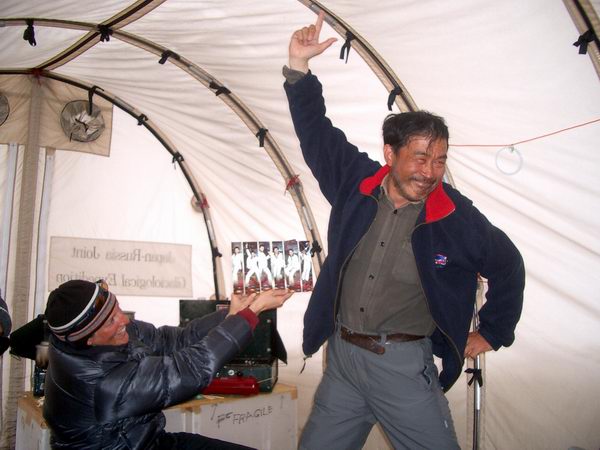
I passed this news on to Shuhei via radio. It is a complement to everyone involved that no one was even remotely irate, and the second thing on most people’s mind was wondering what could still be accomplished with the remaining equipment. The first thing on most people’s minds was that Merv made the right decision, as from his description of the events had he tried to fight for control any longer a much more serious accident would certainly have occurred. Given WERC’s recent experiences in the field, the loss of a drill is hardly something to give a second thought to. I wrote a poem for Quinton the day of his service, and this is as good a place as any to share it. It took a few hours to get things sorted out in Kaktovik and in the meantime the weather closed in again. By about 5PM, clouds began filling the sky here and it showed every sign of turning into something best watched from the inside of tent. Beth and Erin returned from a successful day of surveying, our met station got larger and filled with more instruments, and we discussed the day’s successes and failures over a fantastic bacon-covered-meatloaf followed by key lime pie. So as things go, it could be better, it could be worse, but everyone is in good spirits and the spirits are still in good supply.
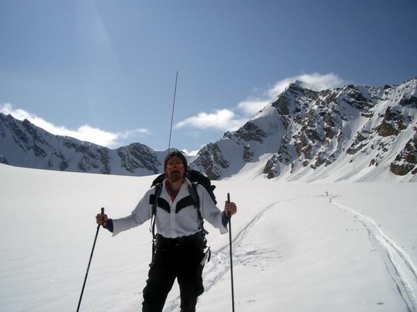
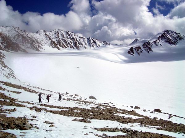
Sunday, 16 May 04, 10AM, McCall Glacier Will Harrison used to have a cartoon hanging on his door (and maybe still does) that had a guy walking down the street in field gear with a beautiful woman on either side of him, and a cop clearing people from the path in front of them saying ‘Out of the way you swine, a glaciologist is coming!’ That cartoon captured what I imagine is Will’s idea of heaven on earth; he should have come with us. With only about three more flights to go, we hoped that we could finish them all off Saturday morning. At 7AM, the weather in Kaktovik was good, but the ceiling here was pretty low, almost at the level of the Japanese camp. For whatever reasons it took several hours for the first flight to launch, by which time the ceiling here had dropped even lower, but by the time Merv headed up the valley there were little holes in the clouds that allowed beams of sunshine to light up the glacier surface. By noon, it showed every sign of breaking up completely and turning into a stunning day, which it did. Beth and Erin once again got an early start on the surveying, hopefully to finish up the pole surveys, mass balance, and isotope snow-sampling. The general idea here is that we have about 65 poles stuck into the ice (as of last May), and we measure the location of these as often as possible with GPS. Such measurements allow us to get a good idea of how fast the surface of the glacier is moving, which then allows us to better understand the processes beneath the surface that control the rate of flow. For example, some glaciers slide along the bottom over part of their length, and such sliding affects our interpretations of volume change and the relationship between climate and glacier dynamics. As another example, the temperature of the ice in many high-latitutde glaciers varies considerably, and colder ice deforms more slowly. On McCall Glacier, we believe that there is both some sliding and a layer of warm ice at the bed that both allow the glacier to move faster than it would otherwise.
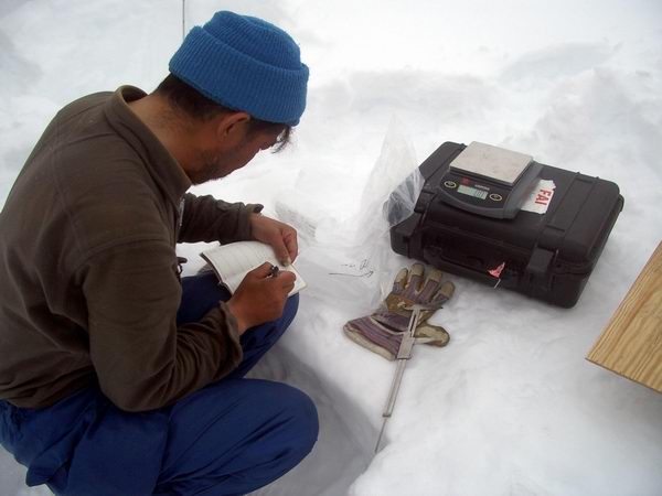
At each pole we measure how much of the pole is sticking out above the snow or ice and how much snow fell over the winter. This gives us an idea of how much snow accumulated at that location, or how much melted away. For example, if we drilled the pole into the ice such that 1 meter was sticking out of the ice and come back a year later to find that 2 meters are now sticking up, we know that about 1 meter of ice melted away at this location. Generally speaking, lower elevations tend to lose ice while higher elevations tend to gain ice, and the surface slope between the two drives the flow of ice from higher elevations to lower elevations. If the glacier is in equilibrium with its local climate, this transport of ice from higher to lower elevations exactly balances the loss of ice due to melting at lower elevations, keeping the surface slopes and elevations nearly constant. From our GPS surveys, we know that the surface elevations are dropping, indicating that this glacier is still responding to climate warming. The rate of surface elevation drop varies along the length of the glacier, however, and much of this variation seems to be due the sliding region we found by measuring pole positions over time.
Another measurement we make at each pole is the isotopic ratio of the oxygen within the water molecule. Isotopes are a major proxy for climate reconstructions from ice cores. The general reason is that this isotopic ratio varies based on temperature and source area, so that if one measures the variations in oxygen isotopes down the length of a core, one can get a reasonably good idea of how air temperatures varied over the time that the snow in that core was deposited, over any time scale. For example, if you take a snow sample during every snow storm over a year, you will see variations in those isotopes based on where the moisture in those snow storms came from and the air temperature there; in practice it is a tricky business, but one can then develop a transfer function that given an isotopic ratio you can get an estimate of where the moisture came from and what temperature it was. The same thing can be done in an ice core at longer time scales, using modern transfer functions or other modeled ones to create a local record of climate variations. Our most detailed knowledge of climate over the past 100,000 years comes from ice cores studied in this way. For our work of the past few days, measuring isotopic variation of the snow from the same storm (last Wednesday) over the entire glacier gives us an idea of the degree of background variations against which we can compare the core values with and get an idea of the significance of changes within the core. The final measurement we make at each location is temperature at the snow/ice interface. The general idea here is that we get some idea of how winter temperatures and snow depths combine to drive the temperature of the ice beneath it. On McCall Glacier, strange temperature dynamics are afoot, and unless we can get a handle on these, our ability to understand the relationship between climate and glacier dynamics will be limited. For example, in the accumulation area in the higher elevations, summer snow melt at the surface creates water which drips down into the snow pack and often refreezes there because it is still cold from the previous winter. This refreezing releases heat, allowing the water to turn to ice, and warming the snow. So much refreezing occurs in fact, that the entire thickness of snow and ice in the accumulation area is only a few degrees below freezing rather than –10C as is the mean annual air temperature; we learned this through a drilling project in 1957-58. Similarly, it seems that geothermal heat flow, from the molten core of the earth, is strong enough in some parts of the glacier to warm it from below, making it flow faster there. To properly account for these dynamics, we need measurements of surface temperature and thermistor strings within the ice to depth at a variety of locations so that we can drive our models with realistic data.
So while Erin and Beth were collecting these data, Merv was able to fly in the remaining passengers and gear to the Japanese camp. We said goodbye to him about 5 PM and all felt a relief that whatever was going to make it here was now here, and we could fully focus on the work at hand. Our workload here increased a bit because Ken did not join us on the glacier. He had been in the field quite a bit lately with our other projects and another 3 weeks in the field was starting to put a strain on life outside of work. So with a reduced workload here due to the demise of the drill and the willingness of everyone else to get so much done during the prolonged logistics of the put-in, we decided that we could accomplish the core projects on our own and let Ken off the hook. Thus I’m now stuck in a well-stocked camp with three beautiful women in a stunning physical setting. Kristin and I spent the day finishing up the new floating met station, and by the time we got all of the instruments attached and working, it was about 9PM, just in time to get dinner ready for Erin and Beth on their return from the terminus. We ate a great dinner, jammed once again to the camel toe song, and passed out with the intention of not waking up until we were fully rested.
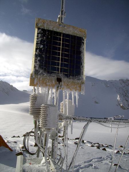
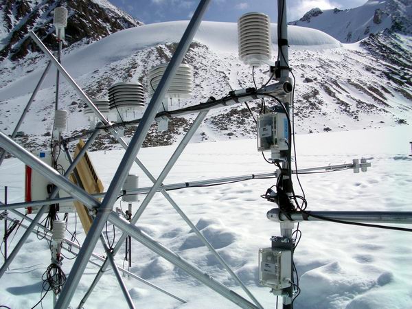
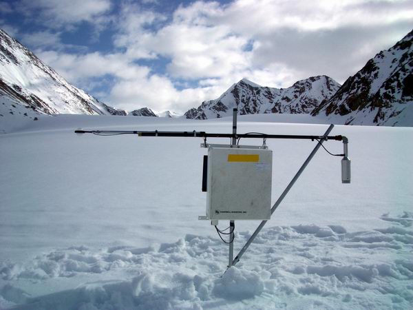
Harrrgh. The new floating met station now seems to be fully functional, including a telemetry system that allows me to monitor it from inside my tent. The basic idea behind a floating met station is that it needs less maintenance than a regular station. A regular station in the ablation area, where the ice is melting, needs to be anchored into the ice, but the anchors have to be deeper into the ice than the ice will melt in the summer. For example, where our station is, the ice melts about 1.5 meters per year. If the met station is placed on poles that are drilled into the ice about 3 meters, then it needs to be reset at least every two years, lest it topple over. A floating met station, in contrast, has a wide base that is naturally stable such that it can just sit on the ice surface as it melts and just ride it down. It is not a perfectly smooth operation, as the ice melt is not completely uniform across the base, so it wobbles a bit day to day, but it seems to work ok in general. I learned of this technique at a meeting in Switzerland a few months ago, and visited one such station on a glacier there. My design is kind of the poor man’s Home Depot version, but I think it will hold up.
Another reason for this design relates to instrument performance testing. At this same meeting in Switzerland, I learned that not all radiation shields work as specified by the manufacturer. Radiation shields are used to block air temperature sensors from the sun, essentially keeping them in the shade. If sun hits the sensors, the sensors will absorb solar energy via radiation and warm up higher than air temperature in the shade. It’s the same principle that makes darker things get hotter in the sun than lighter things. At this meeting I learned that there is a design flaw with most shields in that they are intended to block radiation coming from the sun from above, not radiation bouncing off the snow from below. Because snow is such a white shiny surface, most of the sunshine bounces off of it, and in that case bounces straight into the sensors inside the shields. Onset Computer Corporation gave me a bunch of equipment to modify and test to see if we could reduce this problem, so much of the new met station is devoted to measuring air temperature using a variety of sensors inside of a variety of shields. I’m also comparing Onset’s wind and incoming solar radiation sensors to those made by other manufacturers; Onset equipment is much cheaper than most, so it would be great if it worked just as well. One drawback of Onset equipment is that it is not compatible with our telemetry system, which now works for this new station as well. This telemetry system is based on radio links, which we now have established between the glacier and Kaktovik, and in Kaktovik we connect to the schools internet. With Ken’s help over the satellite phone, I now have the new station telemetering back to the internet hourly along with the rest of the stations, and I have a spare radio in the tent with which I can connect to this telemetry and monitor the stations or modify the programs in relative comfort. I should say that I could connect to all of the other stations, if I hadn’t forgotten to plug the radio back into our repeater site after some maintenance on it. This station is located on a ridge high above our camp. Winds here can get quite strong, over 100 mph, and this can shake apart both instruments and towers. Sometime last summer my wind vane blew off. I replaced it and tried to connect it more firmly, and found that the part that I connected was still there yesterday, but the rest of it had broken off this time. Also missing was the solar panel that charged the batteries and the net radiometer that measures sunshine that was attached to the solar panel. I was going to remove the net radiometer anyway, and I always hated that solar panel as it was way to large and not the one I had specified for the station. I use batteries that are large enough to power the station for a year just in case the solar panel does crap out. I replaced it with one less than a quarter of the size. To check the equipment, however, I had to unplug the radio so that I could plug in my reader, and apparently I forgot to plug the radio back in when I was done.
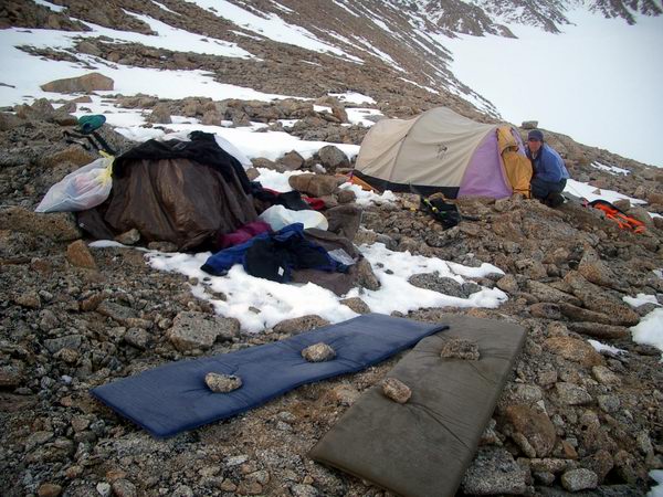
Today we spent in camp, though that was not the initial plan. We took the day off from glacier travel yesterday so that everyone could catch up on sleep and on computer house keeping the GPS data already collected. Erin began working on her tilt-meters, which arrived by just-in-time delivery to Kaktovik before the last flight in, after missing her in Seattle and Fairbanks. Kristin got our Onset thermistor strings organized and ready to install. By the time I returned from the met station on the ridge, it had been decided that tonight’s dinner would be matched to watching the Pirates of the Carribean on DVD, including Rum drinks. To complete the mood, we dressed as pirates ourselves, including eye-patches held on with alligator clips, earings made from hose-clamps and eye-bolts, hook-arms made from bailing wire, and peg-legs made of lathe. Harrrgh.
Due to the festivities, we did not get as early of a start as we had hoped for our RTK GPS survey, but by 9 AM we were more-or-less ready to go; unfortunately, the GPS was not. The RTK system is a variant on the regular GPS system. Both require two GPS station running simultaneously (a base station that sits still and a roving system that you carry around to measure things), but the RTK system uses a radio link between the two to broadcast corrections to the roving system such that you can navigate to within a few centimeters. This accuracy is required when trying to repeat measurements of a location to check for changes in elevation. In this case, we travel to the exact same spot on the glacier using the RTK system, then measure the elevation there. We have about 150 spots on the glacier that have been measured in this or a similar manner using the now old-fashioned theodolites, so that we can accurately track how the glacier is thinning over time. It’s best to do these measurements in a single day or even quicker to avoid complications due to the ice motion, so we tried to get an early start on it, but a variety of complications kept us in camp the entire day and it was not until late this evening that we think we resolved them all. It wouldn’t surprise me if new problems arose tomorrow, but for now we’re on track for another early start tomorrow. Or a really late start today, depending on your point of view. In any case, the extra time in camp gave me a chance to figure out the telemetry and tinker with the met station some more, such that now it is ready to be disassembled and transported whenever we’re ready to do it. Thursday, 20 May 2004, 1PM, McCall Glacier Slogging through shin deep snow in a blizzard for 14 hours makes one realize why graduate students were invented. Tuesday morning we woke up to a raging blizzard rather than an early start. By 9AM, though, the snow had stopped and crystal clear skies had emerged, transitioning from winter to summer in the space of an hour or so. Such direct sunshine, even when air temperatures are still below freezing, cause skiers to drop down to a single layer of clothing and still be hot. We started out by skiing up to the Japanese camp to begin RTK surveying the upper cirque. They had been quite busy over the past few days, having dug several large pits, started coring with a hand auger, and set up a subterranean laboratory for ice core analysis. By the time we arrived, they had cored down about 5 meters. I was very surprised to see that the glacier ice started only 2.5 meters below the snow surface. On typical glaciers, you might expect 10 or more meters of snow before you hit ice, as it takes a substantial amount of snow to create the pressure (caused by the snow thickness) needed to turn snow to ice. Apparently a different process is at work here, where melt water from the surface refreezes at the base of the snowpack and directly forms ice. I’ve never heard of that as the dominant ice forming mechanism, so it could well be wrong, but in any case they drilled another 15 meters and never hit snow again.
Kristin and Beth continued on to the top of the cirque while Erin and I spent some time talking with Shuhei and the gang. Aki and Tetsu were doing most of the actual drilling, at the bottom of a snow pit they had dug which placed them onto the ice. Jun and Kaz were working in the lab, photographing, cutting and packaging the cores. Shuhei and Kengo were making some ground penetrating radar measurements when we arrived, using high frequency antennas because their lower frequency antennas were destroyed in the sling load, with Kengo pulling the sled while Shuhei cracked the whip from behind. The difference between these antennas relates to how deeply the waves can penetrate to measure things beneath the surface; in this case, their antennas are probably only penetrating 5 to 10 meters. If they’re lucky, they will be able to see snow/ice interface and maybe some ice lenses within the snow.
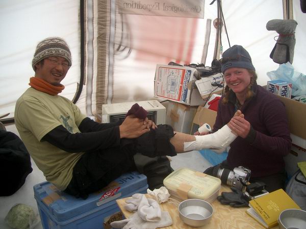
By this time, winter had returned and new snow was being deposited once again in poor visibility conditions. When Beth and Kristin returned, we had a bite to eat in the Japanese camp, then continued on towards our own. We surveyed on until about the confluence area, then decided to head back to camp and double check that the measurements we had made so far were working the way we had intended. GPS is a great tool and can give very high resolution results (measuring your position down to millimeters), but there is always a fear that some blunder has occurred that has made the whole works be hundreds of meters off without realizing it. As it turned out, our test cases showed that everything seemed to be working as we expected, though as usual it took several hours of going in circles to determine that. The snow continued through the night. The next morning, Wednesday, we actually did get our early start. The weather was reasonable, with no snow for a change. We had gotten significant accumulation at camp over the past several days, changing our rocky landscape into what seemed like a snow field until you tried walking down over it, twisting your ankles with each step on the just-buried rocks. We had figure that it would only take about 3 minutes between measurements, and with about 60 to go, the survey should take about 3 hours, which was convenient because there were poor satellite windows starting in the early afternoon. Things went well to start, but the thick new snow made skiing nearly impossible. That is, instead of cruising down hill, we had to break trail through the shin deep snow and slog forward step-by-step even in the steeper sections, as the snow stuck to our skiis and ruined any chance of gliding on them. By the time we had gone about 2 kilometers in this way, we were all fairly grumpy about it. Slogging downhill like this forces your toes against the inside of your boots and makes then tender. Beth’s big toenail actually turned purple from the pressure.
By the time the poor satellite window came around, we were only about half-finished. The snow had started again about an hour into the survey, and we had been working in a blizzard since then. Kristin and I decided to slog down to the terminus during the poor window, hoping that once the satellites returned we could continue to make the measurements on the way back up. Beth returned to camp to give her toes a break rather than risk really hurting them with the additional skiing. The going was fairly slow on the way down, but about halfway there were we able to start working again. We had sat down on a rock to have a snack and check our toes, when the GPS indicated that that it had enough satellites to start working again, so we hurried to start again before it changed its mind. From this point on, though, it is was a constant struggle between having enough satellites and maintaining a radio link to the base station through the storm. Here we were being screwed by several things. The steepness of the valley here cut off much of the sky-view of the satellites, the distance from camp and the descending valley made the radio link weak, and all of the water in the air from the wet snow weakened the signal further. So rather than 3 minutes per measurement, it was often a frustrating fifteen. Eventually, however, we made it to the terminus and were relieved to finish that portion of the survey. A typical ski back from the terminus might take three and a half hours; it took us seven. Part of that time was taken up by completing the survey in that portion we had skipped, but most of it was just the slow slog through the deep snow on the ground and the blowing snow in our face. The snow continued to fall, and I didn’t even have to put my skins on to climb up the hill as the snow that stuck to the bottom of my skis provided sufficient friction to walk uphill. We hadn’t really planned to be out so long, so we were rationing our food on the way up, and the longer we were out, the slower we got. Fortunately it was not particularly cold, but we were both soaked both from sweat and being covered in melting snow. From time to time I would catch myself realizing that it was still snowing, as after about 5 hours of walking in it I was beginning to tune it out. The last few hours I’m sure we were both thinking about how nice it would be to have a snow machine, or a tent that we could pitch, but instead we just kept putting one foot in front of the other and inching our way back to camp. We were able to finish up most everything we had intended to, however, so it seemed worth spending the extra time so that we wouldn’t have to spend another day finishing it later. We made it back to camp just after midnight, and Erin met us at the bottom of the hill and took our backpacks up for us. Hot drinks and lasagna were waiting for us when we made it into the cook tent, and we were very glad to sit down out of the snow and wind and have a hot meal. That night we slept well, and were in no rush to wake up this morning.
Monday, 24 May 04, 4:30PM, McCall Glacier That day we spent mostly catching up on data. We checked the mass balance data out and found that it agreed well with what we expected based on last summer’s data. We also compared the RTK laser profile to last years, and found some surprising results. It would appear that over the past year, the upper half of the glacier has gotten thicker, whereas the lower part has gotten thinner. Based on all the records thus far, the glacier has always gotten thinner with time – that is, it has always been losing mass, and doing so at an increasing rate. Last year was nearly a positive balance year, meaning that the amount of snow and ice that melted on the glacier was nearly the same as the amount that accumulated higher up. These new measurements provide an independent means to measure mass balance; I’ve never heard of anyone trying this particular technique to do it (repeat longitudinal RTK D-GPS), but it certainly possible. In any case, with a few years of comparison data, we might eventually be able to rely on this method for most of the mass balance work, as it is substantially easier in many respects.
The next day, Erin and I stayed in camp while Kristin and Beth went to complete more surveys in the lower cirque. Here we are repeating another laser profile from 1993 and 2003, just as in the past few days. They were also in search of several poles that had been buried over the winter. These poles are located in an area that is normally melting, so we did not make them too high, but now it appears it would have been a good idea. They searched for several of them by starting at their last known location using the RTK GPS and then measuring out where they should have moved to based on their speeds from last summer. Unfortunately they were not able to find any of them. I guess next time we need to bring a metal detector. Erin spent the day constructing her strain gages and tilt meters. The idea here is that she can test out some designs before taking them to Antarctica. Based on what we learned when visting Shuhei, we decided to place these instruments near the interface of the snow and ice at their drilling site. Others have found that the snow above glacier ice deforms almost as much as the ice itself, so placing these instruments only a few meters deep at this snow/ice interface facilitates placement and as well as explores an interesting and the little studied phenomena of snow deformation. We’re going to place some of both instruments right at the interface to see if may be the snow is sliding over the ice. I don’t believe that anyone has described such a phenomena before, but who knows. It should yield some interesting results.
I spent the day fussing with the new met station, debugging problems with it, and preparing some thermistor strings for deployment in the ablation area. During that time, the cook tent turned into an advertisement for the anarchist’s cookbook, with wires and instruments and soldering and heat shrinking and batteries strewn in piles with no seeming plan but all seeming like we were up to no good. It was a pretty full day, getting Beth and Kristin out the door by 11 AM after several hours of preparation and our work taking us until about 11 PM, when we saw them heading back, and frantically cleaned up and began making dinner. It was a pretty nice dinner of Thai peanut chicken, followed by peanut butter cheesecake. We got to bed by about two.
Next morning I spoke to Shuhei at 9AM and confirmed that I would spend the afternoon at their camp checking things out and taking some samples. I slept for another hour afterwards, then frantically got my gear ready while giving Kristin ideas for what needed to be done that day. One of the major problems that has affected every trip here thus far is working too late one day has a ripple effect into the next several days. Much of this has to do with the travel times involved with skiing to locations on the glacier, which often takes up more time during the day than the actual work. Thus work has to be arranged such that on those days we sleep late due to a late night that there is something useful to do during the remainder of the day at camp, because there is not enough time to ski somewhere without returning after midnight again. Fortunately there is usually no shortage of things to do. In this case, the idea was to prepare for a day down-glacier and begin steam drilling holes to install the thermistor strings and the GPS stations that will remain here over the summer recording ice motion. It was a very interesting day for me in the Japanese camp. It began with a nice lunch of noodles and seaweed soup, and then a discussion of their results thus far. Their GPR and drilling seems to have confirmed that the snow of the upper cirque is rarely deeper than about 3.5 meters, which is much shallower than I or anyone else expected. In several holes they confirmed that the ice they are hitting is not just an ice lens, but the actual glacier ice surface. We talked for quite a while about the possible processes involved and how to possibly measure them. If things are in a steady state up there, which it seems like they may be, then nearly as much ice must form at the bottom of the snow pack than snow accumulates at the surface, else the total snow layer must get thicker or thinner. Given that it is consistently between 2.2 and 3.5 meters nearly everywhere there, and that this accounts for about three years worth of accumulation, something like 50 centimeters or more of ice may well form there per year. This ice is formed by snow melt water refreezing at the base of the snow pack, which should be directly measureable by placing a stake there and digging it up each year or by using a thermistor string to measure how the temperature gradients may change over time. Hopefully I can get some of those measurements started this season.
By the time I returned the women had things more or less under control for the next day, and we were able to get just about our target 9AM start. The snow had consolidated a little, making it easier to ski on, but it slowed the sleds down just enough that they were manageable. Hauling steel pipes, steam drills, GPS equipment, and solar panels several miles via ski makes an interesting picture, but fortunately it went very well. Beth’s toes seemed to be doing much better from their injuries a few days earlier, and everyone was in pretty good spirits. On sunny days like that, with the mountains jutting nearly vertically from the glacier margin, capped by white cornices framed by deep blue skies, it’s really hard to have a bad attitude about anything. I’m probably the grumpiest one of the bunch, as I remain in a general level of high stress constantly trying to adjust plans to make the most of the current conditions such that we accomplish everything as successfully as possible, but I think that we all get along pretty well. Certainly the women all are one happy family; sometimes I feel like an outsider in my own camp, but that’s my own fault, as I’ve just never developed the knack of a simple conversation. The only things I know how to talk about are science (or pseudo-science), engineering (mostly outhouse design), and drinking (or the trouble that it leads to), with crude jokes from the peanut gallery to fill the space in between. In any case, the trip downglacier was very successful. Kristin and Beth led the drilling effort, and I stuck around long enough to make sure that they wouldn’t get mad at me later for not doing things the way I would have done them if I was doing it myself. The initial plan was that I would take off after we had completed one each of a thermistor string and a GPS site, such that I could then begin dismantling the met station at camp so that it could be transported and re-erected to replace the one we installed last year, but I ended up going down the old station anyway to help remove the larger solar panel that would be used for the GPS station (a smaller one will be used for the new met station). So by the time I got back to camp it was about 7:30PM, at which point I began the dismantling with Erin’s help. By about 11PM, Kristin and Beth made it back, and we had a nice dinner of breakfast burritos, which had apparently been pre-arranged by the women, probably in code during breakfast that morning.
Once again, after midnight, we were faced with the decision of what to do the next day – is it worth going down-glacier after a late start, or should we spend the day at camp catching up and get an early start the following day? Beth and Kristin were all for getting an early start and going for it, given the good weather. Because I had gotten back so late, I had somewhat resigned myself to spending the next day at camp knowing how much work it work take to mobilize the met station and that it would be a late night under the best of circumstances. I think what was on my mind most was my experience at the Japanese camp the day before. They work basically a 9 to 5 schedule, with planned lunch and dinner times. Very civilized. Field work for me is a love-hate experience, I love the problem solving under time pressure but I hate the problems and the time pressure they cause. Between my 7:30 PM arrival and our intended 9AM departure the next day, I had at least 16 hours of civilized-style work to do. Why is it that I want to cram this into 6 hours of frantic, stress-inducing, sleep-depriving effort? Maybe it had something to do with the lack of testosterone in my immediate vicinity, but I couldn’t really think of a good reason to. I felt like I had been hit by a two by four, with fieldwork part of my brain temporarily damaged. I mean, here I was, Mr. We’ve Got To Get This Done Now So That We Can Start On This Next Thing thinking “let’s get some sleep and deal with it later” while my overworked colleagues who are more or less here for the ride are saying “we’ve got to get this done now so that we can start on this next thing”. Maybe I’m ovulating. In any case, I woke up this morning at seven, wondering what to do. Do I wake everyone up and cram the remaining day of preparation work into two hours, or do I go back to sleep and hope that I wake up Japanese? The Japanese style is so much better in many senses. What I really need to do is take a picture of the difference between the Japanese GPS and the Nolan GPS. Their GPS system can be carried in a coat pocket and duct taped onto a pole in about 10 minutes. The Nolan GPS system requires a 45 watt solar panel, a 40 amp hour battery, three poles, a suitcase full of GPS equipment, a bunch of cables, an antenna, and about 8 hours of field work. Their accuracy is about 5.0 meters, mine is about 0.01 meters, but in terms of trends both probably provide reasonably the same information. In terms of field work, one means eating dinner at 6 PM followed by a movie or two and the other dinner at 1AM and wacky dreams induced by fatigue. There’s a balance somewhere in between the two, but I haven’t found it yet. I decided to sleep on it until later in the day.
So today was spent doing stuff. Everyone more or less had their own stuff to do and we just went about it. I learned how to insert a bit into a rock drill the hard way. Kristin learned how fragile ears are in the glacier sunshine the hard way. Erin learned how replace a wind vane at the top of met tower the hard way. Beth learned how to epoxy bolts without an epoxy gun the hard way. And we all got done about 6PM, which was the plan. At least I think we all got done. I’m hiding in our tent to get some personal time to write this, and I can hear the laughter and conversation from the cook tent, though I can’t make out the words. The plan was to have an early dinner with a movie, such that we can get an early start in the morning. No doubt the sisterhood has improved upon this plan in my absence, but it could be worse. I’m not sure it could be better though…
Saturday, 29 May 04, 2:30PM, McCall Glacier We're on the home stretch now. We got a reasonably early start the next day, after a reasonably early night of dinner and a movie. Our sled loads were pretty large, as we transported all of the pieces of the met station downglacier. Fortunately the snow surface had dramatically improved over the past few days and we were actually able to ski downglacier as opposed to slog, and it took less than an hour to travel the several miles necessary. Kristin and Beth once again led the drilling effort for the new thermistor strings, traveling down towards the terminus to finish the two of them up. Erin and I stayed at the met site to put the new station together.
It was a warm, calm day, though the fog gave it a somewhat surreal feeling. When the clouds touch the snow surface, it becomes hard to see where one starts and the other ends, but it doesn’t really slow work down, except when trying to navigate somewhere. The assembly went reasonably well, though of course slower than expected. After about 8 hours of work, most everything was up and running and Kristin and Beth had returned from their drilling, which also went well but slower than expected. We drilled the last remaining poles so that we could move the steam drill back up glacier, and got another met station more or less situated. This last station is just an instrument to measure snow depth and one to measure sunshine, for comparisons of local effects across the width of the glacier. We finished by 9:30PM, and started our slog back up the hill. This also went much better than previously given the improved snow conditions, taking about half the time as it had a few days earlier.
We slept in the next day given our late return and made preparations for the next big effort of working in the upper cirque where the Japanese camp is located. Here we will install another met station, two thermistor strings, and several tiltmeters and strain gages. The weather was pleasant and made preparations easier. It still took a while though, but we got to bed at a reasonable hour to prepare for an early start. Here early start mean 9AM, but they never quite seem to come off. The only really friction I have with others in camp is getting started in the morning, as two of our members intentionally brought no means to wake themselves up in the morning, depending on someone else to give them wake up calls, which of course means that either Kristin and I have to do it, as well as all of the morning chores necessary to get camp going in the morning like melting snow, resetting the outhouse tent, getting lunch foods out, etc. I’ve expressed my dissatisfaction at this several times, but it has not seemed to have any effect except making me grumpier in the mornings. The trip to the Japanese camp with the new met station was a chore. Fortunately most of our heavy loads end up going down glacier, but this time we had to go up. The snow was still reasonably good, but nonetheless hauling 100 pound sled loads in any condition is slow going. We got to their camp in time for lunch, and had several hours of conversation regarding our mutual efforts and how to spend the remaining time. I wish I had had more time to spend up there working with them, but given our problems with weather and snow, and being one field hand short, it just wasn’t possible. Nonetheless it was a pleasure working with the Japanese that day and getting our new met station in place. Kristin and Beth spent much of the time surveying a transect for elevation change, while Erin and I installed the instruments. Aki and Tetsu drilled a few shallow holes for our instruments, and in general everything went as well as could be expected. Erin’s instruments were the real concern, as this was a practice run for her work this winter in Antarctica, but we came up with a reasonable plan and it seemed to work ok.
One of the more important things I learned since my last trip to their camp is that there is in fact a deep snow pocket on the glacier where snow likely gets compressed into ice in the standard way. Apparently the radar work wasn’t the last word, as a series of shallow cores confirmed that in at least one location the snow is over 7 meters thick. The Japanese weighing balance wasn’t working quite right, so they could not measure this densification with their initial core, so we made a plan to use my balance and drill another core here the next day. This work would confirm that at least some of the ice, and probably most, was formed by compaction. We also made a plan to install some poles in the ice and measure any internal accumulation of ice directly by digging the poles up the next year and directly measure the change in exposed pole height, the same way we do standard snow mass balance with our network of 65 poles. Here we also learned that Kengo had spent the last three days in his tent due to snow blindness and that Jun had twisted his ankle skiing; both were recovering fine, and glad to have had an excuse not to haul the GPR sled down to the terminus and back. By dinner time, 6PM in the Japanese camp, we had the transect finished and the met station more or less operational. We had a very nice traditional Japanese meal prepared by Jun, and all ate to excess. I brought my laptop and spare telemetry radio with me and showed off a little by connecting remotely to the new met station as well as the others to demonstrate our ability to watch the weather remotely. After our good time, we skied back to our camp, anticipating making a few nice turns with light loads, but the crust that had formed on the snow made it an embarrassing effort for us all. Nonetheless, no injuries resulted and we looked forward to another day in the upper cirque tomorrow.
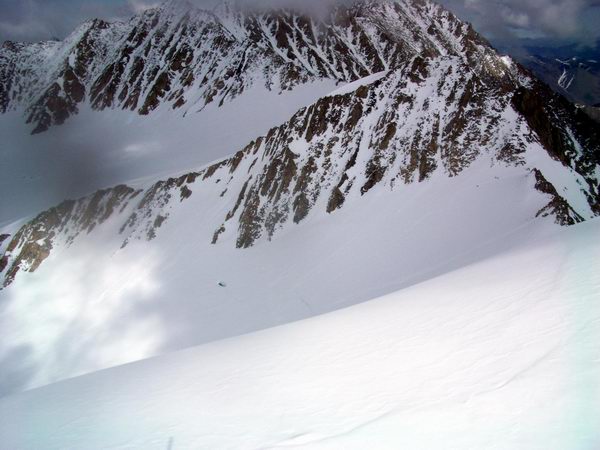
Getting closer to camp -- 2.7MB I had set out another fairly ambitious plan of GPS surveys for Beth and Kristin for that day, but lost my resolve as I began to contemplate our success thus far and think about how much is enough. There is much more cool stuff that can be done, but we’ve really have accomplished a huge amount given our circumstances and already we had come away with more than all of the most important stuff. So Kristin and Beth spent the day at camp while Erin and I returned to the Japanese camp in the morning to finish the met station and measure snow densities. With a much lighter load we made the trip much quicker and began right away. Aki, Tetsu, Koz, Kengo, Shuhei and I drilled the new core, measured its bulk densities, and took more isotope samples. I was really glad to have seen their operation at work first hand, and was surprised how many hands were required to do the job well. It was somewhat frantic work keeping up the core analyses as new pieces came up, and even more hands could have been used. I was surprised how easy it was to mislabel or mis-oriented core pieces despite being as careful as I could, so I was very impressed with the Japanese team’s ability to keep things straight.
While I was working on that, Erin was studying snow stratigraphy in the 2.5 meter pit that Shuhei and Tetsu had dug on their first days and later used for their main 20 meter ice core. We all finished at roughly the same time and broke for a nice lunch of noodles prepared by Jun, who had I think become the cook by default as he had injured his ankle skiing a few days earlier. After lunch Erin and I frantically began trying to finish packaging up the met station and drilling the remaining holes so that we could finish before dinner and free up the steam drill for the next day. This met station was not my best effort, but I think should hold up for a few years anyway. All went reasonably well, and Kristin and Beth arrived around 5PM bearing the night’s dinner American-style and helped us wrap things up. By 7PM, we had essentially accomplished the last of our major goals for the trip and I was able to relax during dinner. Everyone was in good spirits and I think the Japanese enjoyed learning about our cooking system as much as we had learned about their's the previous night. Kristin had pre-made most of our meals, and for tonight had prepared a Mexican theme, with boil-a-bag burritos, margaritas, and chips and salsa. Afterwards we watched Saturday Night Fever on DVD to complete the cultural exchange. I’m not sure how much of the content came through, but the subtitles included lyrics to the music, which was about half the movie, so I think the Karaoke-esque result got most of the crowd into it. After the enjoyable evening, we returned home by about 12:30, and all chose discretion as the better part of valor and wore their skins down the hill rather than repeat the past night’s tumbling performance in the crust. By the time we went to bed, the reasonably pleasant weather had turned to full-on blizzard, with inches per hour accumulation.
Getting back to camp, take two -- 2.5 MB We woke up this morning to camp, tents included, encased in about 20 centimeters of snow, which combined with our late start eliminated any chance of getting work done on the glacier. So the plan became to catch up on any remaining data reduction and planning for the last big push tomorrow, which is really our last chance for any serious work or making up for any mistakes thus far.
The day after tomorrow, the helicopter should arrive. Our plan at this point is to get the ice out first and safely stored. Originally the plan was to take it straight to Fairbanks on this day, but it turns out to be Memorial Day, and there are no flights from Kaktovik. Fortunately Walt has lined up some freezer space for us, which can use to store the ice until the plane does arrive. Depending on the weather and how things go, we will then either fly the rest of the Japanese camp out or take ourselves to another glacier for a day trip of GPS surveying and photography. Tuesday, 01 June 04, 7PM, McCall Glacier We’ve had several very successful days of work in beautiful weather. Similar to last year, the weather turned very warm for our last few days of work. Almost like a switch being flipped, we’ve gone from –5 to 0 days to 0 to +5C. The difference may not sound like much, but it is almost too hot to work in. The heavy snows that landed on us a few days ago are gone, and melt water streams and waterfalls have emerged on the warm rocky slopes. The snow which had been –7 to –10C is now almost everywhere near zero, with melt water reaching the ice surface below and accumulating there. Parkas are no longer needed, in the calm air we’re down to just single layers of clothes and still sweating.
On Sunday, Kristin and I skied down to the lower met station and tidied things up there, while Beth and Erin took some time off to hike and then finish up some steam drilling. On the way, we installed several more air temperature sensors and downloaded the thermistor strings we had installed last week. Everything seemed to be working fine and we got some interesting and useful data to begin working with. The met station was still in good shape, and we clean up the wiring and added a few more braces to hopefully help keep it steady and strong for the next several years. We also got the smaller station nearby working, which will give us a comparison of snow accumulation and ablation across the valley.
Afterwards we climbed up the moraine to check out the old hut and assess how we could be remove the junk that accumulated there during the 1970s. We developed a plan which seemed reasonable to remove the barrels one at a time to the glacier surface by barrel sling, then create several larger sling loads there for transport back to Kaktovik. We roamed around a bit and found various odds and end that have been laying dormant there for years, and had a nice lunch at 5PM before heading back. We dug a snow pit along the way to measure density and isotopes, and returned to a nice dinner by about 10 PM.
The next morning we learned that the helicopter was in Kaktovik, but that the weather there was bad for flying. So we spent the day organizing our gear so that we would be better prepared to leave once the helicopter did show up. It was pleasant weather, which made sorting gear a much easier task.
I forgot to ask myself a question before coming on this trip, but I think I found a few answers anyway. I’ve never been the easiest person to get along with, and despite my efforts to be otherwise, they never seem long lasting. Working in the field, and often at home, generally tends to consume any neurons that would otherwise be available for remembering that people can’t read my mind and would otherwise have no way of knowing that my general lack of attention to the way my actions may be perceived is not a hidden slight but just the way I am. When I'm on a mission, it seems you're either with me or in my way. After a fruitful discussion of this, I think everyone was much relieved to learn that I wasn’t angry at them, I’m just an insensitive jerk in general and that I don't need to be voted off the island yet. Sunday, 06 June 04, 3PM, Fairbanks The helicopter made it in that day. Our initial plan was to fly a few loads out of the Japanese camp, including the ice, then possibly fly us to Okpilak Glacier where we would do some more surveying and picture taking, depending on weather. After the first few loads were taken out, we decided to just concentrate on removing the entire Japanese camp so that they would not be split up between the glacier, Kaktovik and Fairbanks, as it seemed like everything could be removed in a single day at the time. So Kristin, Beth, and Erin went for a ski up to the middle cirque to practice crevasse rescue and skiing roped, while I took care of a few things at camp and then headed up to the upper cirque to clean up the new met station there.
I caught a ride with the helicopter on the way up, and visited with Shuhei and Tetsu for a while. They had broken down all of their tents and were sitting around on their boxes waiting for the next load to go. It was a very nice day and the snow was pleasurable to ski on there. We chatted a while, then I downloaded our Onset thermistor string and dealt with the main station. The ice temperature at the upper location was only about –1C, confirming the 1957 results near here. Such warm ice temperatures at 12 meters depth indicate that the refreezing of melt water within the snow pack is a significant process and releases enough latent heat to overcome the cold deficit caused by the winter cold months. Only 150 meters downglacier, however, the ice temperatures are about –6C, indicating that this process is localized. The difference between these two sites is that at the upper one, snow is likely being compacted to ice through the 8 meter firn layer, whereas at the lower one it is quite possible that this ice was exposed to the air about 3 years ago, allowing it to chill, as there are only about three annual snow layers above it and not nearly thick enough to densify to snow. We installed a pole in the ice here, and over the next few years we will measure the ice level relative to the pole to determine whether any significant refreezing occurs. Given the cold ice temperatures, it seems unlikely.
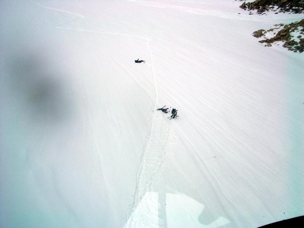
On the way to the upper cirque, Merv buzzed the middle cirque to check on the girls, and we found Kristin laying flat in the snow, pretending to have fallen in a crevasse so that the other could rescue her. They seemed to have an enjoyable time up there, and we’re glad for the refresher course. I watched their progress down the slope as I skiid back to camp, and could hear them talking even though they were a mile away. That night we were all back fairly early by our normal standards, and had time to relax and watch the cartoon movie Ice Age, and critique its many flaws. It was a nice time and we were glad for the relaxation. Racing the helicopter back -- 2.6MB
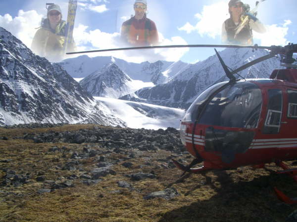
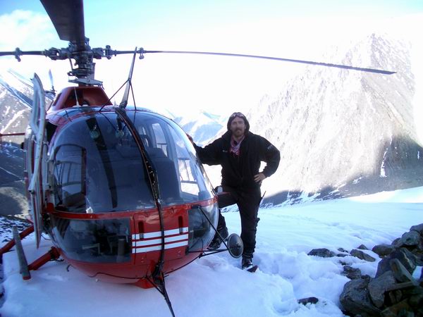
The next morning proved worse weather in Kaktovik, and Merv was not able to take off until later in the day, even though we had nice weather on the glacier. It was a high, cloudy overcast, and by the time he arrived about 2PM, it was questionable whether we would be able to do our work on Okpilak Glacier. But we decided to go for it anyway, as this was our last practical opportunity for it this year, and were very glad we did. The BO-105 helicopter is very strong and was capable of flying the four of us to Okpilak, where we flew up and down the length a few times scoping out the route and making our final plans.
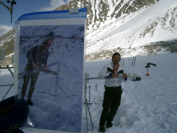
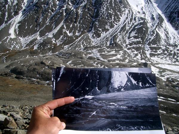
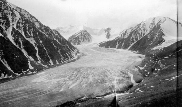
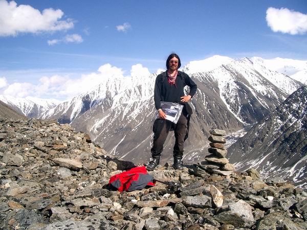
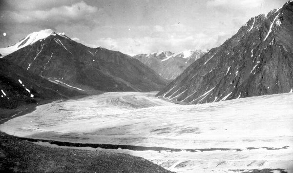
By the time we had gotten there, the weather had improved substantially, with most of the overcast gone and only a few puffy clouds remaining. Merv dropped me off near the terminus so that I could begin hunting for the 1907 photo locations used by Leffingwell while he dropped the girls off at the top of the glacier. It was beautiful day for a walk, and after a short while I had to remove my long underwear because it was so hot. I scrambled across the streams and up the moraines in good spirits, and was pleasantly surprised to find wildflowers, meadows, and butterflies along the way. With the old photos in hand, I checked the perspectives on the way up to guide myself towards the photos spots. On the way in with the helicopter, I had offhandedly remarked that one knoll along the slopes could well be the spot, though it looked much too high at the time. However, as I progressed up the slopes, it seemed more and more like that prediction might be true. It took probably an hour of steady climbing to reach the knoll, and just as I crested the last rise I spied a cairn and nearly shouted with joy. To find an actual sign from some unknown friend saying, ‘you have arrived’ was a great pleasure, and created a connection to the past that was very satisfying. I reached the cairn and stood at THE spot, taking in the beautiful view for quite a while before actually pulling out the cameras. It was a commanding prominence that allowed one to see the entire lower glacier and valley, and a perfect location for picture taking. I saw immediately why Leffingwell thought it worth the effort to climb up there after having already walked 80 miles from the coast.
I brought three cameras with me, two digital and one film, so as to be sure to come away with something. I took probably a hundred photos from variously different subtle angles, with the intention of sorting through them later to find the closest match to the original. Merv returned in the meantime and radio’d up to me whether there was a landing spot there for him or whether I’d have to scramble back down. As it turned out, the spot was big enough to land several Chinooks, so he joined me a few minutes later and we enjoyed the view together. He really seemed to be enjoying himself on this trip, as I think for him it is a bit different than his typical work of flying grumpy oil field laborers to and from platforms. There was little wind, and the silence and beauty was inspiring. The knoll that we were on turned out to be a recent moraine from a tributary glacier along the valley wall, which likely at one time held a small lake that filled with sediments which have since turned into a flat meadow. Later on our way out, this prominence was the last bit of hillside to remain in the sun, like something out of an Indiana Jones movie, beckoning explorers to probe there for treasurers. No doubt this is what inspired Leffingwell well to check it out. Though at the time, there may well have been a glacier there too, adding to the allure.
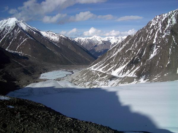
After leaving a present in the cairn for future explorers, we headed off to the next photo site. I had used some visualization software I’ve been working with to help narrow down the possible locations for the site, so we began our search there. By this time, Merv had caught the repeat-photography bug, and he was eager to get us as close to the spot as possible. We hovered over a side moraine while checking out the photo perspectives, and realized that we were essentially right on the spot. It was a steep-side moraine with not much of a flat top, but Merv touched skiis at a few spot to see if was landable. On our second or third attempt, the skiis settled deeply and resoundingly into the snow, and as I looked over at Merv with a smirk and eyebrows raised, he confidently announced that the beagle had landed. We got out to find that the tail of the helicopter was extended over air, but the skiis were firmly and flatly on solid ground, so began our search for the exact spot.
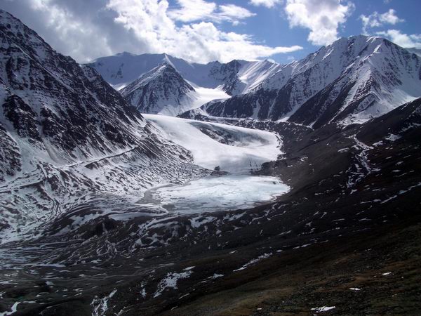
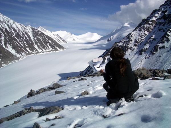
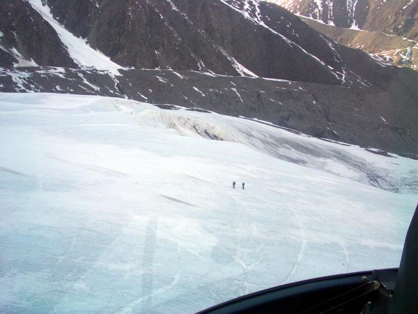
We could see the skiers off in the distance, and talked to them via radio to learn that everything was going fine, though slowly, so we had plenty of time to enjoy the view and find the spots. It was another nice vantage point, which provide views of the entire glacier valley, as it was located on the outside of the only major bend in the glacier. Two photos were taken from here, one looking up glacier, and the other downglacier. I took probably several hundred more photographs as Merv and I discussed the meaning of life and how this slope intersected with this other one and how this meant we needed to more three meters this other way. In the end I concluded that the moraine we were standing on must be ice cored and have experience some subsidence over the past 100 years, as there was no way to match the original photo’s perspectives exactly. Nonetheless, we were pretty damned close and only those who have a lot of time to spend will notice the difference.
We waited there for the rest of the afternoon, which was already about 7PM by this point, as the girls skiid past us. On their way, three very large avalanches occurred on the eastern slopes which were being warmed by the direct sunshine, providing some great up close views of this dramatic process. Fortunately, the little ice age moraines of a hundred years ago trapped most of the snow behind them, so little made it to the glacier itself, except for the sound and visual fury. Once they got to the ice fall at the bend, Merv and I took off and headed to the terminus to wait and pick them all up. It was getting late in the day and Merv was beginning to approach the limits of his legal crew day, so it was time to get going. We gathered everything into the helicopter and took off for camp, with everyone wishing the dying glacier well and taking back fond memories of a great day.
Once we landed back at camp, we loaded up Erin, Beth, their personal stuff, and anything else that would fit into the helicopter and waved goodbye to them, hoping to see them the next day. Kristin and I remained on the glacier to begin breaking down camp, packaging it for transport, and preparing our small cache of camp equipment for its over-summer sleep. We boiled on of our last boil-a-bag meals and ate it outside as the sun set on our camp.
The next morning we learned that the weather was good in Kaktovik and that it was likely that we would make it out this day, so we frantically began tearing down tents and packing up boxes. By the time Merv arrived around 11AM, we had a load of boxes ready for him. It was another beautiful, warm day -- perfect for drying tents and packing. The next load out would be us and the remaining gear, so we worked quickly to get everything ready before Merv’s return. Everything was going well until about 1:30, when a sudden storm came in and turned our nice sunny day into a wet, windy blizzard, soaking everything that had just dried nicely and scattering our loose items in various directions. A few minutes after this began, Merv arrived and quickly landed at our small helipad, which was about the only thing still visible to him, further scattering our gear in his rotorwash. We began an even more frantic effort of just throwing things into boxes to keep them dry or from blowing away, but within minutes everything, us included, was covered in a wet slush, turning what might have been 15 minutes more work into more than another hour of miserable, desperate toil. Added to all this was the added complication of needing to do a bit more science. As often happens in the field, especially at the end, the wrong combination of opportunities conspired to nearly ruin a lot of hard work. In our rush to get Merv home before his flying time expired, we sent out the GPS base station that was recording the stationary part of our Okpilak GPS data because it was taking too long to download. The idea was that Beth would download it back in Kaktovik, and send it back in to us to reinstall for it’s summer occupation to measure ice velocities. Unfortunately, Beth’s computer power cable remained in the work tent, so she did not have enough battery power in Kaktovik to download the receiver there. So she sent her computer back to us with the receiver for us to download at camp, then reprogram for the summer work, along with some instructions on how to do all of this. So in the middle of the blizzard that was soaking our gear, I sat in the helicopter, rigging up a temporary power station with an extra battery and inverter, getting the download going. Fortunately, after some frustration it started and I was able to leave it running inside the helicopter while I returned to the weather and packing. After a while the snows stopped and we were able to get the last of the boxes loaded into the helicopter and begin the flight back. Fortunately the weather was reasonable all the way back so we made good time. The snow had nearly completely melted from the tundra during our stay, and we saw many water birds, caribou and bear on our trip. We arrived back shortly before 4PM, and once again frantically began repacking our gear in the dry weather for transport on the Frontier plane that would be landing in minutes. We managed to get everything boxed up, weighed and onto the plane by about 4:45, and the four of us settled into our seats, amazed that we were on our way home.
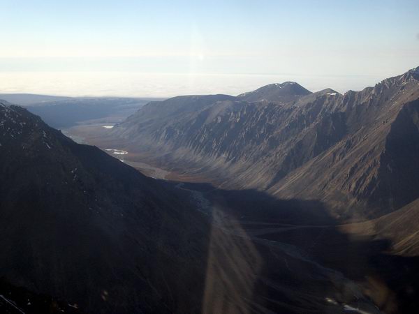
The plane trip home was not without its excitement either. Apparently the air pressurization system was not operational, so we flew most of the way back less than 1000 feet above ground level, giving us a fantastic low-altitude tour of the Brooks Range. We passed beneath dozens of mountain peaks, and could see the interesting folds and shapes of the rocks that composed the mountains. Once we crossed to the south side, I fell asleep and awoke shortly before reaching Fairbanks. Flying below the mountains -- 1 MB As we were entering the terminal, I remember discussing some of the events of that day and thinking how odd it seemed that they actually happened today (actually several hours ago), and not several days ago, as the hot Fairbanks weather and lush greenery began to overwhelm my recent mind-set of white snow on brown rock. Ken met us at the airport after dropping off one of our cars, and we loaded up and headed straight for the laundrymat where hot showers would hopefully be awaiting us. In our dreams of earlier that day, we had hope to get to Kaktovik early enough in the day to get a shower at Waldo’s, but as it was we were just happy to get back home. After our showers we walked over to the local pizzeria for some well-deserved pizza and beer, and toasted our good fortune. We got home a short while later and collapsed into bed.
Monday, 07 June 04, 9AM, Fairbanks Though we were back in town, the expedition was still not over. Shuhei and gang came by Friday morning to discuss cargo, pick up some of the gear that they had left at the house, and forumulate a plan for the day. They wanted to meet with Syun Akasofu, who is the director of the International Arctic Research Center at UAF, so I set something up for them and we spent the rest of the morning at UAF touring our labs, visiting the ice cores, and meeting other faculty and staff at UAF. We bumped into Carl Benson, and though we didn’t seriously hurt him it still took about an hour out of our schedule for introductions and discussions. Our visit with Syun was typical, and everyone came away smiling. Next we visited the map office, where many bought topo maps of Alaska and the McCall area, then we parted ways planning to meet up for dinner at the Pump House. The Japanese went to the Frontier warehouse where they sorted through some of their gear, while Erin, Beth and I toured the GI a little longer visiting with volcanologists, earthquakeologists, and glaciologists.
At six PM, we all met on the deck of the Pump House for some refreshments and celebrations. It was a beautiful day, though very hot. Perhaps the biggest shock in coming back to Fairbanks was how tropical it felt, with the hot sticky weather and lush, greenery in every direction. But it was nice to soak in the rays on the deck without worrying about whether a change in the weather would mean a 3 mile hike back to camp in a blizzard. As had been happening nearly every place we went, I came across friends from Fairbanks and chatted a bit. One of the nice things about Fairbanks is that there are enough people so that it feels like there are still a lot more to meet, but few enough that nearly everywhere you go you see someone you know. As the party broke up after a trip to Hot Licks, we made plans for the following night to have a barbeque at our house. During the day on Friday, Kristin had learned that she was needed for work on Sunday night, which was problematic since her flight medical had expired on our trip and her appointment was not scheduled until Monday morning. So she found a doctor that would see her on Saturday, but this doctor was in Anchorage, requiring most of the day for the commute there and back. While Kristin was away with that, Beth and Erin took one of the cars for some sight-seeing, while I began preparations for the barbeque. The house was quite a mess, as we really did not clean up before leaving for the trip, and now we had covered it with boxes, tents, sleeping bags, etc. We were also largely out of food, other than several boxes of bagels and some moldy meat. So the day ahead was largely spent shopping, cleaning and cooking. Erin and Beth picked up Kristin at the airport and returned about 5PM, and before our guests arrived that night we exchanged some gifts and thank you’s for the past few weeks efforts.
Wednesday, 09 June 04, 4PM, Fairbanks Shuhei, Koz, Aki, Tetsu and Kengo arrived shortly after 6, and by about 7 Jun had arrived with a few members of the recently finished Mt. Wrangell expedition, which was also a US-Japanese collaboration for ice core drilling. Ken and Janlee also showed up, just in time for the disco party that erupted. By the time the lights went dim in the flashlight shining on the disco ball, we were all fairly tuckered out and adjourned to the roof for some more refreshments, toasts, and fireworks. No major injuries resulted and a good time was had by all. I woke up on the couch next to Kristin, Beth and Erin about 3AM to find everyone else gone and an episode of the original Charlie’s Angels just ending on DVD. Fortunately the next morning there was no rush to wake up, as Beth had changed her ticket to after noon. We said our goodbyes to Beth and dropped her off, by which time Kristin had already begun work. Erin and I hung out in the house discussing some of the interesting things we had learned on the trip, and it was nice to just relax indoors out of the hot sun. That night Erin and I visited some friends in Ester and ate homemade pizza with tadpoles. Monday was Erin’s turn to leave. In the morning I met Shuhei and company at the Frontier warehouse and assisted with packing their gear. After saying goodbye to Erin and dropping her at the airport, I returned to Frontier with Shuhei to settle up our cargo bills. That night, with Kristin away working, was the first night I had to myself in quite a while. I checked my email for the first time to learn that I had received 896 new emails while away. About 75 of these had viruses, and less than 30 required a response from me. After sifting through those, I fell asleep on the couch watching TV. The next morning I made my official return to the office, picking up my mail and catching up with the latest gossip. Not much new had happened there, and with it being summer many people were away in the field. As I was about to leave after noon to wake Kristin up and hang out a while with her before she left again for the evening flights, Shuhei and company showed up and wanted to label their ice core boxes for shipping. So we visited the cold room and got the boxes labeled, glad to be able to step back into summer without needing to wait for a helicopter.
Packing in the cold room -- 1.2 MB Why is everyone moving so fast? That night the Japanese crew met me at my house and we all went out to dinner at the Turtle Club. Kengo and Tetsu were brave enough to order the Miner’s Cut, a steak about 3 inches thick and as big as a dinner plate, and were actually men enough to each finish the entire meal in about the same time as the rest of us – plus eat a dessert on top of it. After dinner we said our final goodbyes and restated our intentions to continue to work together and attempt another drilling effort as early as next year, funding permitting. Everyone seemed to have a positive memory of the experience, and all encouraged me to visit Japan in November for their annual science meeting, which I hope to do. And then they were all gone, and the trip more or less officially over. Even now I have not yet begun to unpack, sort gear, returned borrowed equipment, clean-up from our disco party, and all of the little things required in a demobilization like this. I have to take care of this soon, as I am leaving for another trip on Sunday, for which I have not yet begun to prepare. Other projects are also beginning to demand time, and already this past trip seems feels like something from the past. It was a very good trip though, and one with lots of good memories. Scientifically we accomplished all of our major goals except for the deep drilling, which was somewhat beyond our control. And I came away with many new friends and opportunities for future fun and excitement. So I really can’t complain, as I feel like all of the work that went in to making the trip happen was worth it, and that just about defines success to me.
(Photos are a compilation from Beth, Ken, and Matt) |
(c) 2003 Matt Nolan. If you find any broken links or other errors, please let me know. Thanks.
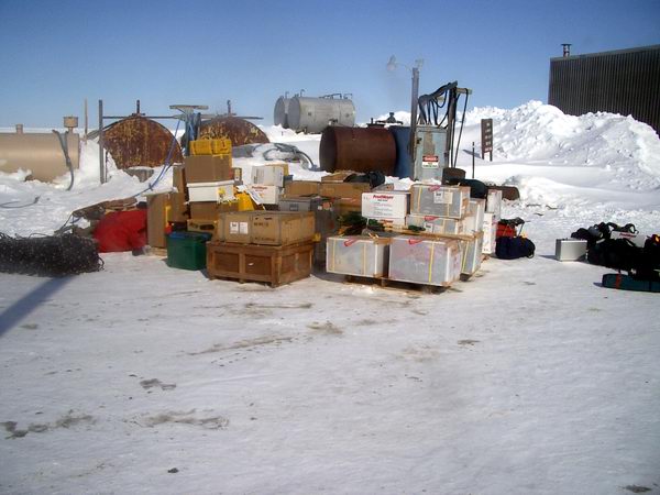
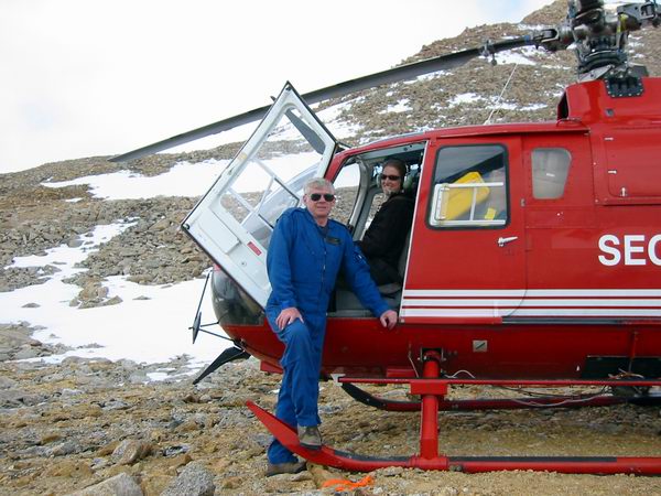
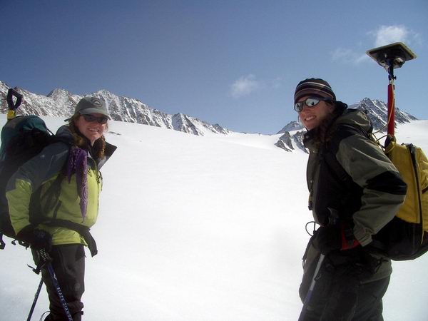
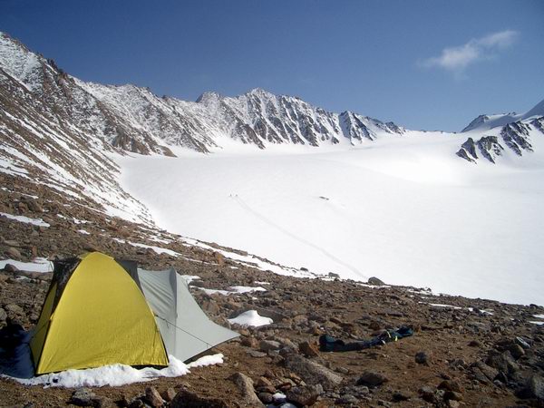
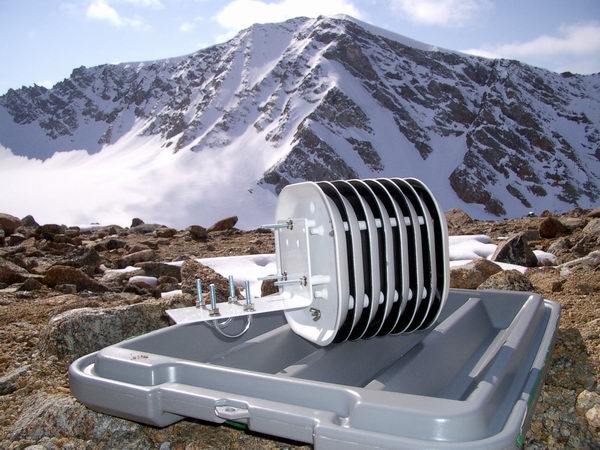
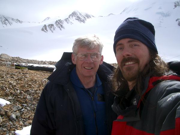
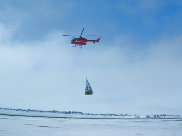
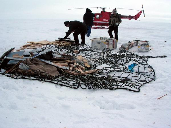
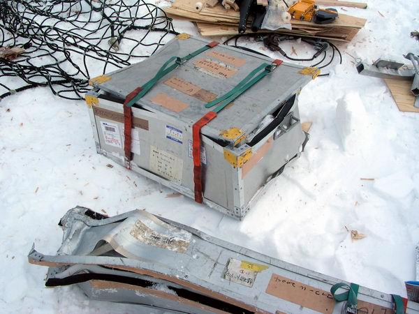
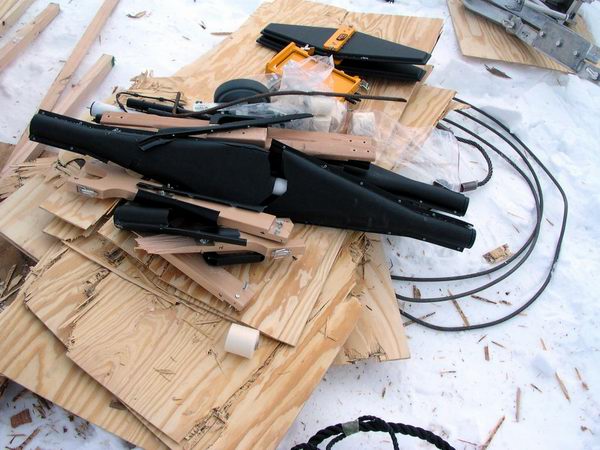
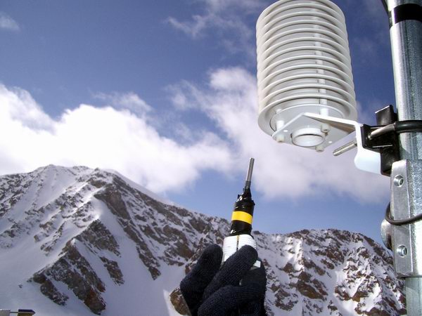
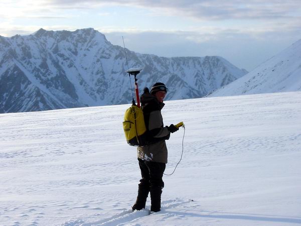
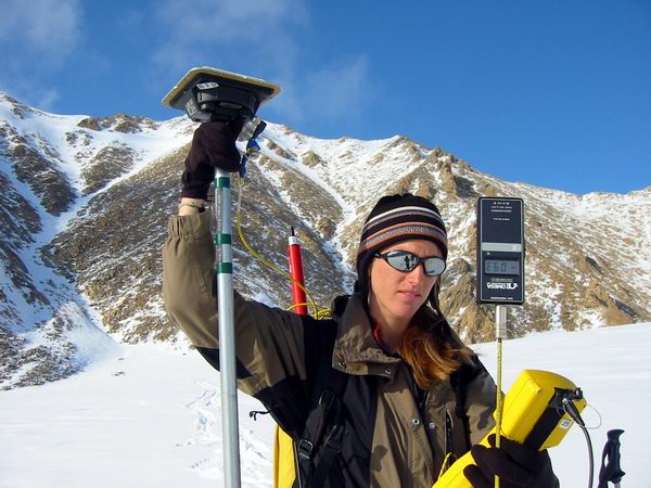
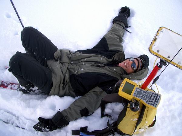
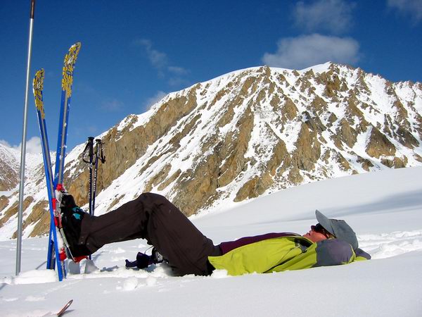
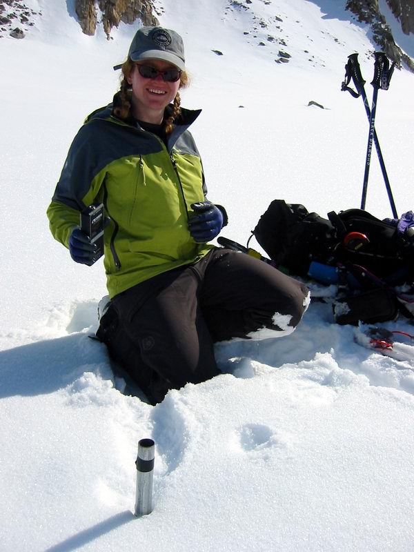
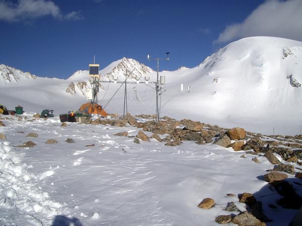
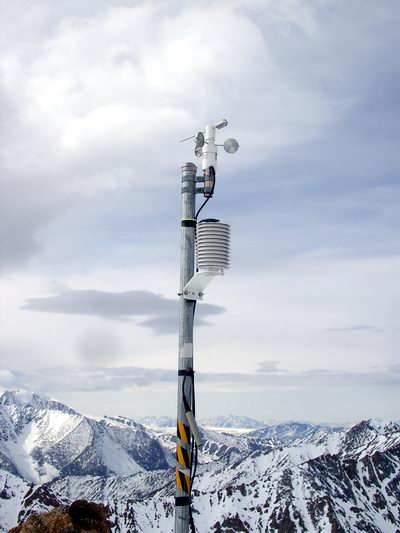
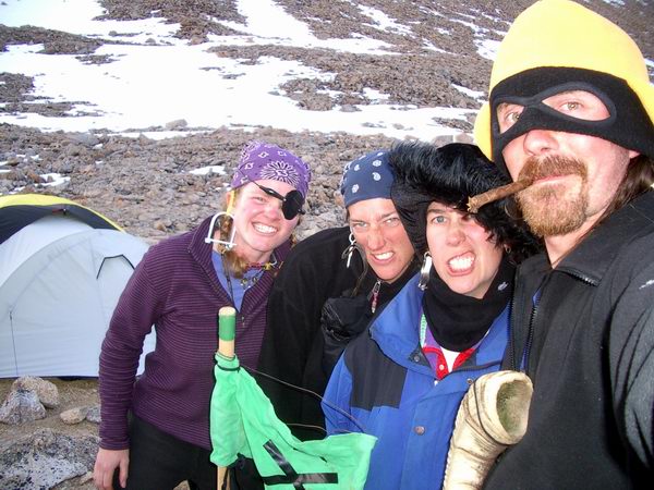
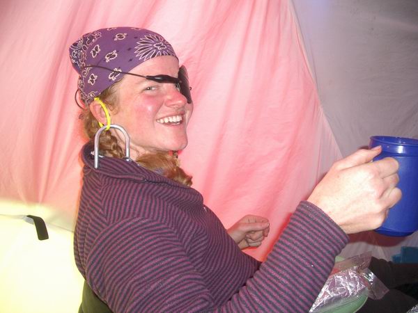
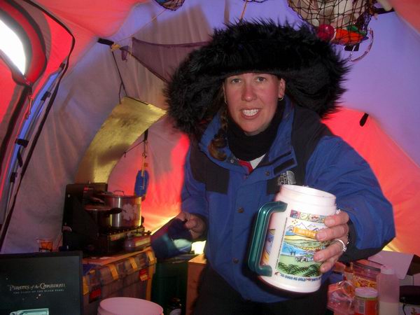
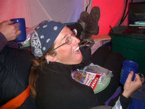
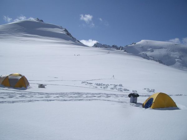
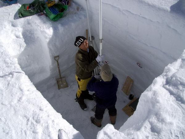
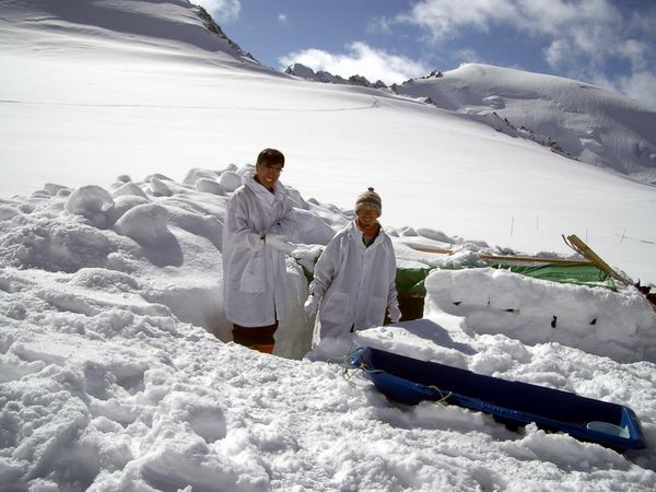
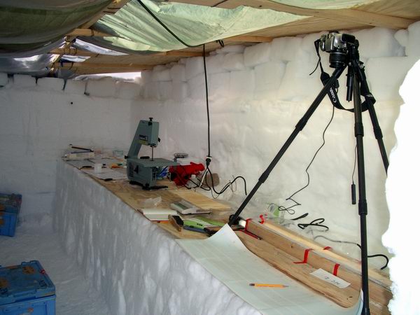
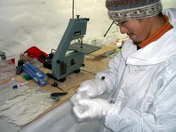

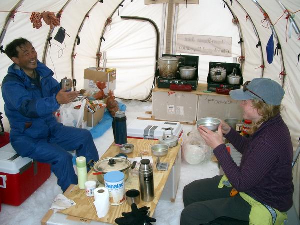
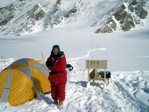
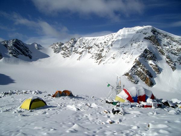
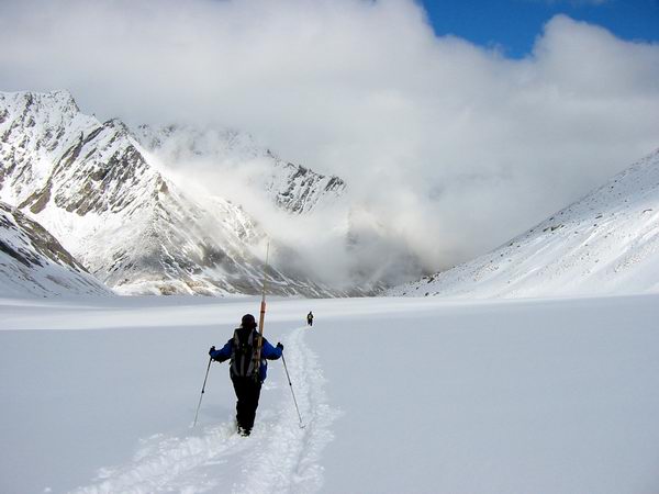
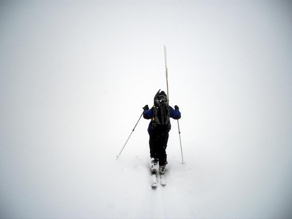
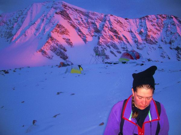
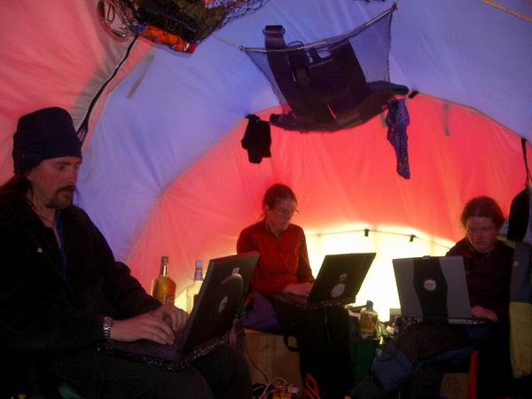
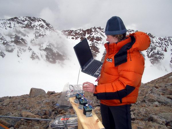
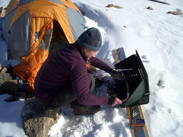
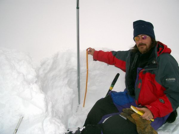
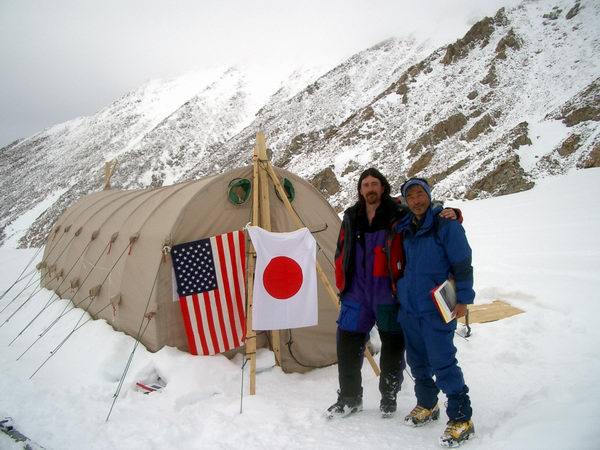
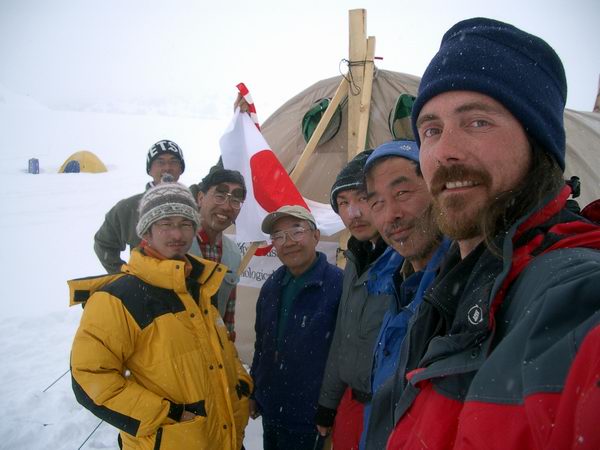
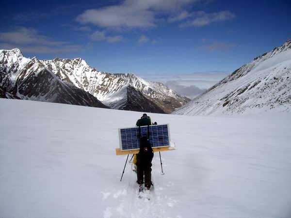
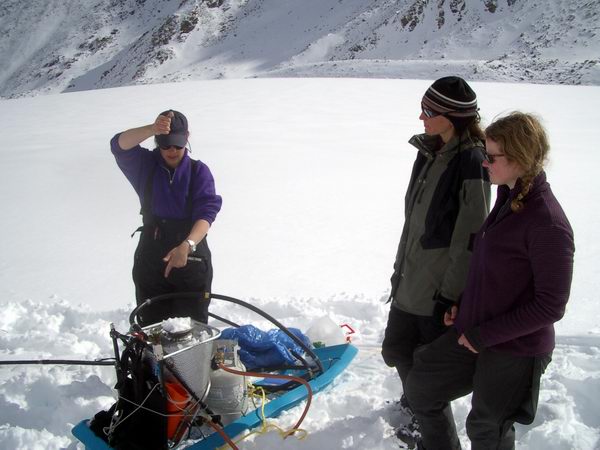
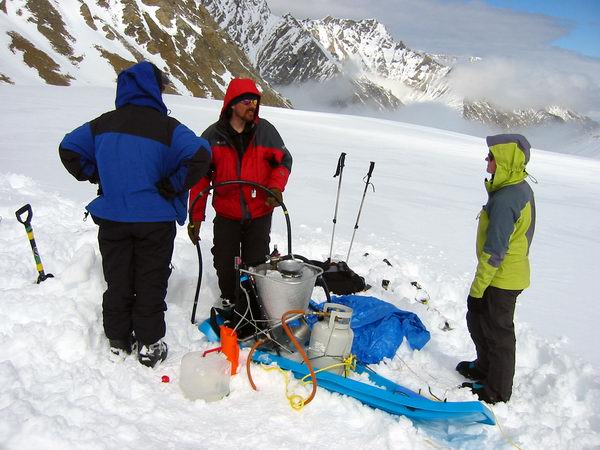
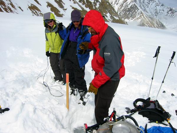
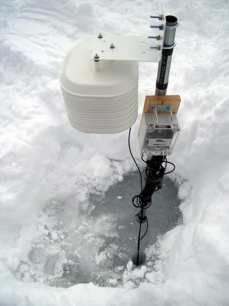
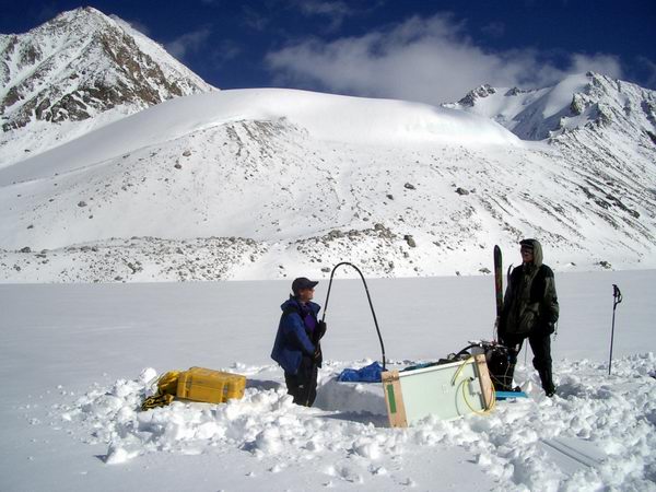
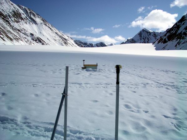
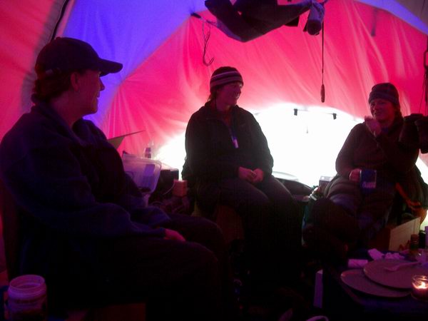
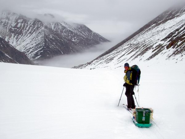
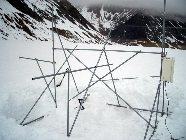
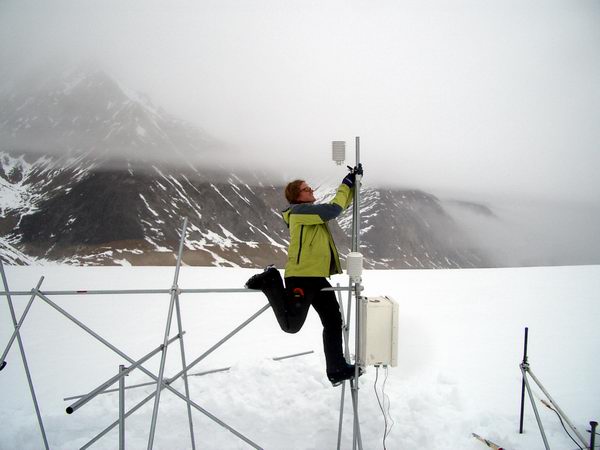
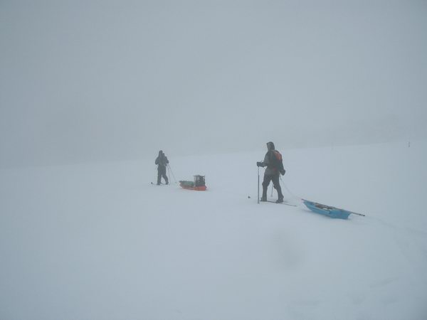
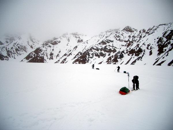
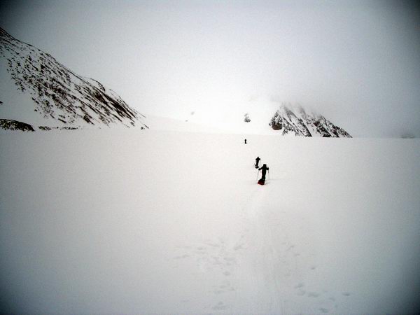
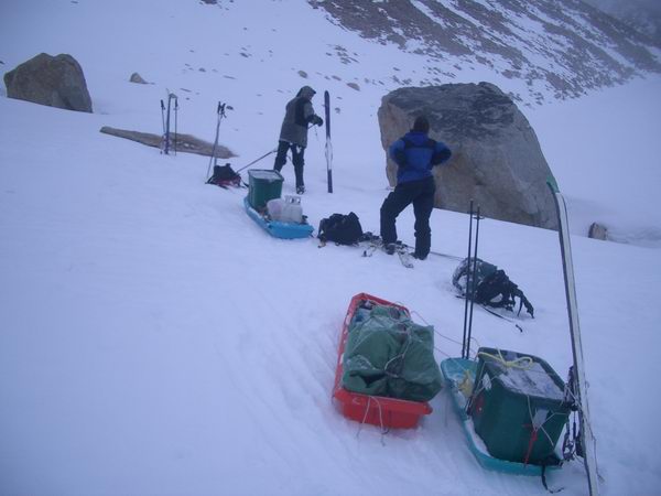
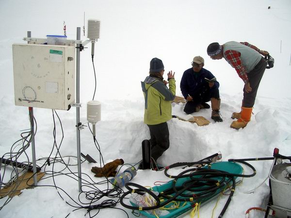
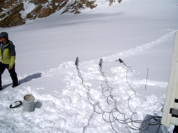
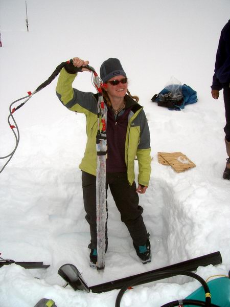
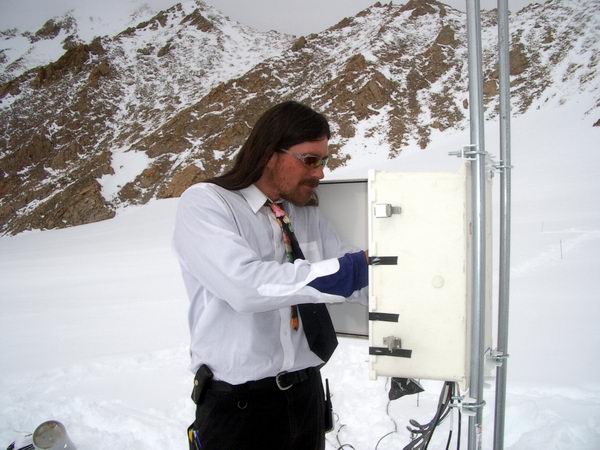
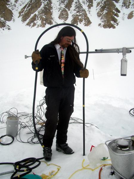
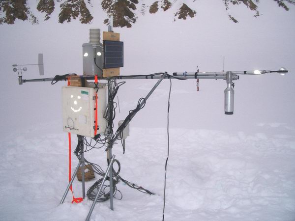
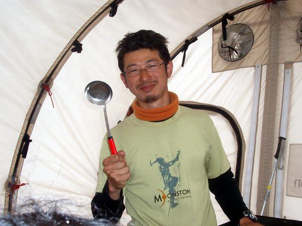
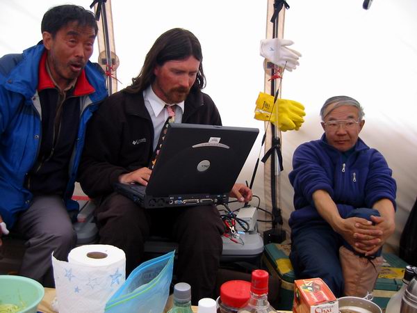 Checking
out our telemetry of weather data. Or was that the OuthouseCam?
Checking
out our telemetry of weather data. Or was that the OuthouseCam?