Dr. Matt Nolan
455
Duckering Bldg.
Water
and Environmental Research Center
Institute of Northern Engineering
University of Alaska Fairbanks
matt.nolan@uaf.edu
|
|
Dr. Matt Nolan 455
Duckering Bldg. |
|
|
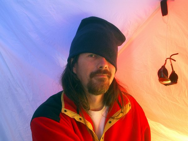
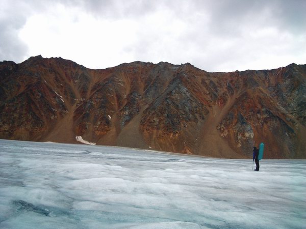
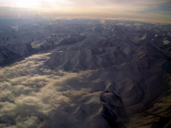
Saturday, 07 Aug 04, 10PM, McCall Glacier
Sling, slang, slung, I'm glad that work is mostly done. We woke at 5AM on Thursday, my birthday, to catch the 8:30AM flight from Fairbanks to Kaktovik on Frontier Flying. We hadn’t gotten too much sleep the past few nights getting things ready, but it was not as frantic as in some previous trips. I was deliberately trying to keep the goals of this trip simple, as it is all too easy to over commit time. So preparations were mainly food, camp gear, GPS, and some miscellaneous science projects. Still it was full time work (meaning every waking moment) for a week and part time for several weeks before that.
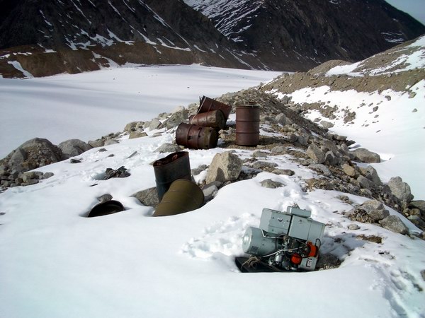
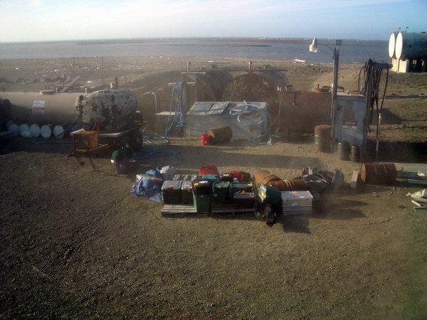
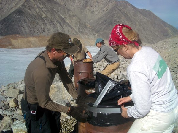
Our first major goal of the trip was to take out the trash. Not our trash, but the accumulated junk of the past 50 years of science here. The projects from the 1950s and 1970s had much of their gear air-dropped in, apparently with no clear plan of removal. I still haven’t gotten the full story on it all, but in any case there were numerous old fuel barrels and other debris on the moraines and glacier surface, just rotting in place. Several efforts at consolidating this debris had been made over the years, but nothing had materialized in terms of actually removing it from the glacier. Last year I proposed to the NSF and the US Fish and Wildlife Service to coordinate such a debris removal project and received generous support from both: the NSF agreed to pay for the helicopter time and the USFWS agreed to deal with (and pay for) the actual disposal of the debris once it left the glacier.
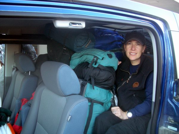
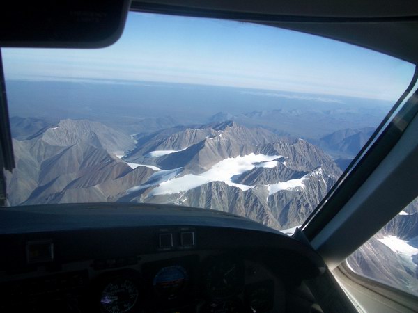
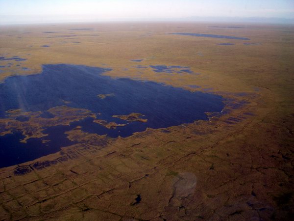
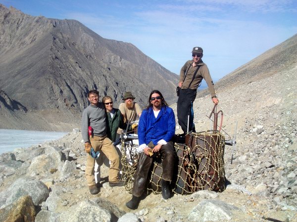
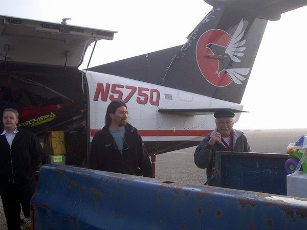
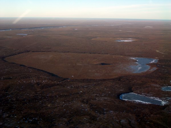
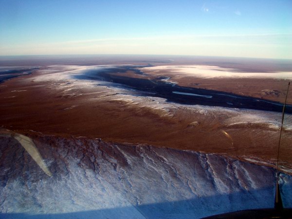
For this project, we invited a few volunteers to help us out. Marin Kuizenga works for the current NSF logistics provider and has handled the helicopter contracting for all of our trips thus far. Marin also handled much of the interagency cooperation necessary for the trash hauling. She was joined here by her husband Jeff, a UAF volunteer, and my wife Kristin, a USFWS volunteer. Bernhard once again burned some of his vacation time to join us, and Ken actually made it to the glacier this time, rather than just Kaktovik like last May. But before we could actually begin hauling out the trash, we had to deal with hauling the mail. I had dropped off about half of our gear several days earlier at Frontier, trying to avoid the space crunch that comes with showing up at the ticket counter with 2000 pounds of boxes, bags, and equipment. Unfortunately there was a backlog of other cargo to Kaktovik from the past week, and none of our stuff made it out early, meaning we could get there before our stuff. This backlog included 600 pounds of US Priority Mail, which takes precedence over cargo such as ours, by contract. To make matters worse, heavy fog in Kaktovik forced them to take on more fuel to safely divert to alternate airports, further reducing payload. Working with Frontier the night before, we devised an alternate scheme to prevent catastrophe, whereby our cargo would fly to Deadhorse via Kotzebue this morning, where a later flight from Barrow would pick it up and take it to Kaktovik in the afternoon. As it turned out, getting gear to Kaktovik was the least of our problems. The past week had been quite foggy in Kaktovik, and this day turned out to be no different. In contrast to the mountains where skies were crystal clear and we had great views of the glaciers during our flight from Fairbanks, the coast was carpeted with a thick white shag with not a polygon in sight. We circled for a while, vainly hoping for a break, and then had to divert to Deadhorse. Here we found our other cargo, which had arrived not via Kotzebue but on a charter flight from Fairbanks to Deadhorse. So we and all of our stuff had made it to the coast of the Arctic Ocean, just the wrong town.
It was a nice enough day in Deadhorse, and it being lunch time we headed over to the Prudhoe Bay Hotel for a little all-you-can-eat buffet. We bumped into several friends there – who had planned to be there – and spent most of the afternoon milling about or sleeping in the airport. About 3PM we had some hope that the cargo plane coming from Nuiquisit would be able to make the short hop from Deadhorse to Kaktovik with our gear, but later learned that they had already flown too much this day and had to return home, despite the weather in Kaktovik being flyable at this point. About 4PM our plane from the morning arrived back from its trip to Barrow and we pled our case to get us and all of our stuff to where we wanted it to be. The problem here was that all of our stuff and the Kaktovik Priority Mail (that was also diverted with us) could not make it in a single load. After a little more flight swapping, we were able to get all our stuff onto a single plane. So, by about 6PM we and all our stuff arrived in Kaktovik.
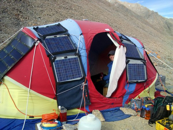
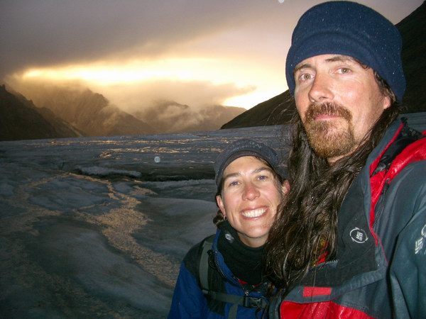
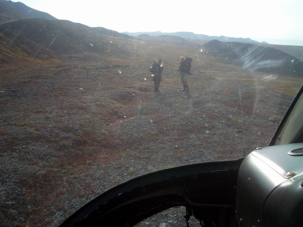
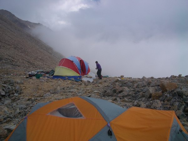
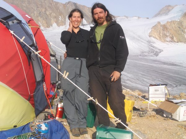
Walt and the helicopter pilot Dave met us on the runway and we began eagerly sorting our gear to get on our way, despite the late start. This trip we were using a Bell 407 helicopter, which I had never seen before. It turned out to be a great unit, able to seat 6 passengers or haul over a thousand pounds, with reasonable volume internally. Kristin and I made the first flight in to show Dave around and get camp set up. It turned out to be lovely weather the whole way in, with the light just perfect on the rocks and glaciers. Bernhard came in on the next flight, along with a bunch of our science gear. By this time it was about 11 PM and we decided to let Dave get some sleep and try to get an early start in the morning. Camp set up went reasonably well, and were treated to sunny skies and warm temperatures well into evening. A full day with lots of twists and turns, but successful nonetheless. Because of the day's chaos, we officially postponed my birthday until tomorrow.
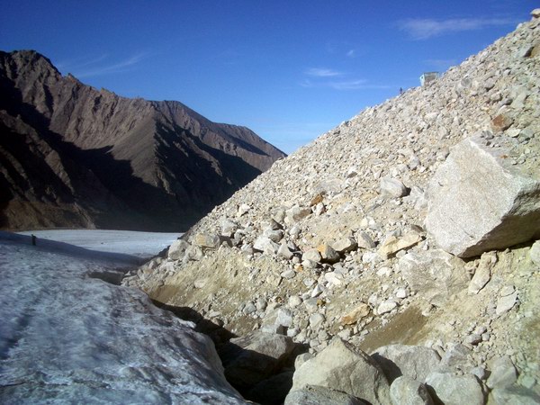
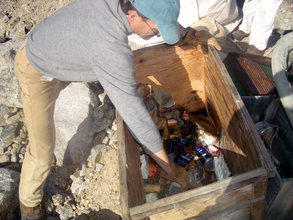
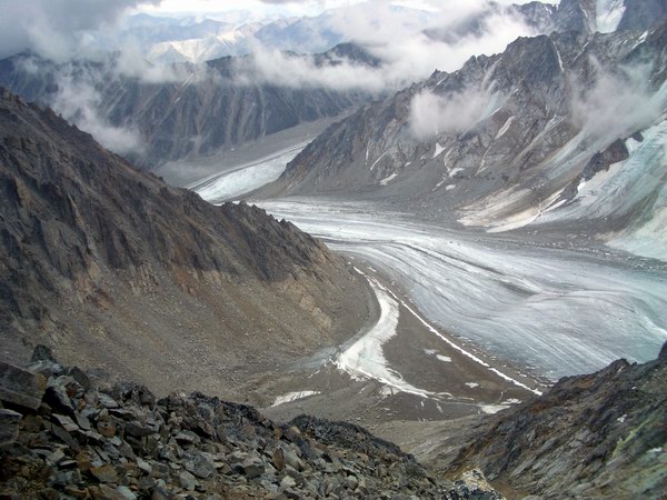
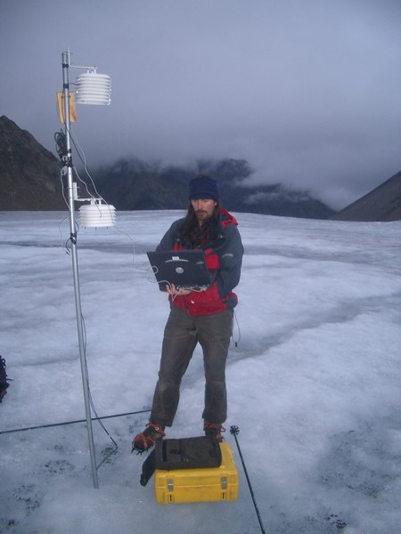
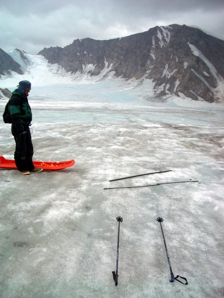
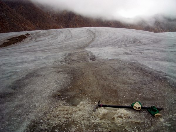
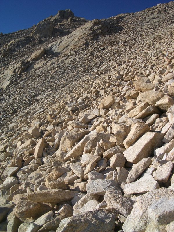
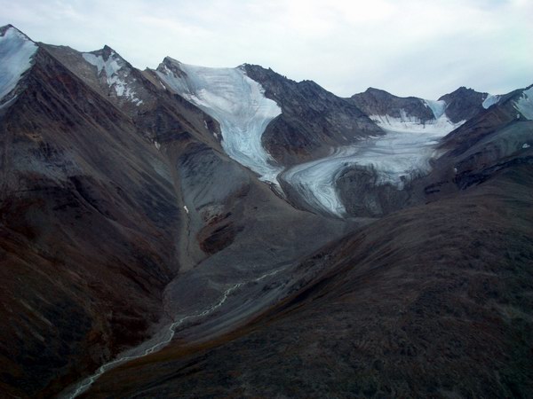
The next morning turned out to be just as lovely and, amazingly enough, fog-free in Kaktovik. So the next flight brought Ken, Marin, and Jeff and a bit more gear. The idea was to head down glacier next, after getting settled into camp a bit more and organizing a plan for the day. My original plan was to have Marin, Jeff, Bernhard and I work on debris removal, while Ken organized the GPS and Kristin organized camp using each other’s help. Unfortunately, I did not get the GPS gear from Unavco in time to figure it out and show Ken before arriving to the glacier, and any hope I had of getting it going on the first day wash dashed when we landed in Deadhorse. And it quickly became apparent that it was futile to try to explain in ten minutes what is often taught in a week long course, even to Ken, so Ken joined the debris group. Kristin had caught a bad cold the week before that wasn’t getting any better, so she stayed in camp alone and got things organized there. So we sent Dave back empty to pick up the mechanic, Rich, and the cargo net slings. Dave returned shortly and shuttled us down to the Hut. The Hut was erected in 1969, on top of a platform which held a Jamesway in 1957. Since that time, this area has been accumulating debris, not only because of its long-term use but also because it is at the top of a steep, rocky moraine that is treacherous to walk on (so its just easier to leave things there once there). Since 1957, this moraine has essentially gotten larger and larger as the ice get thinner and thinner. In 1957 it might have only taken a minute or two to get from the glacier to this Hut, but it now takes 20 minutes of scrambling over loose rock underlain by ice. During this 20 minutes, it is not uncommon to see boulders the size of car tires rolling down the hill, getting hung up on boulders the size of school buses, occasionally kicking those loose as well. Despite these hazards, if you watched your step and paid attention to what was above you it was more annoying then dangerous, especially carrying heavy loads of cargo slings, ice chippers, and other implements of destruction.
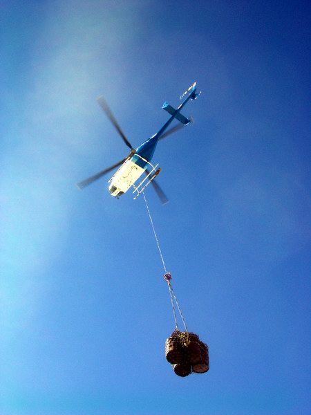
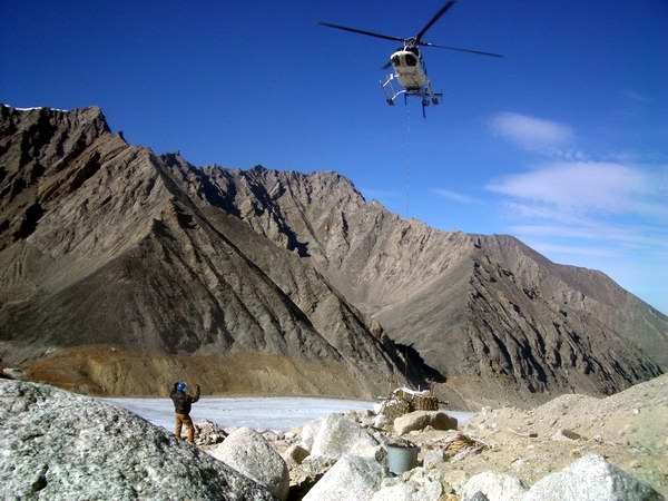
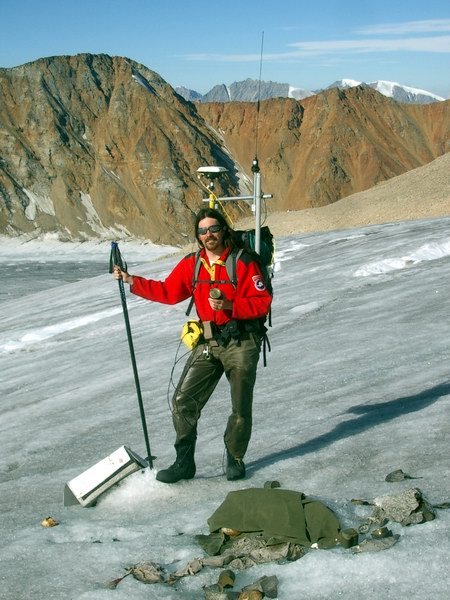
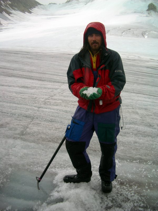
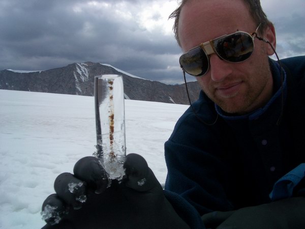
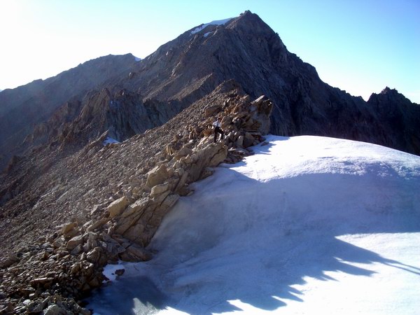
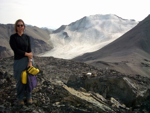
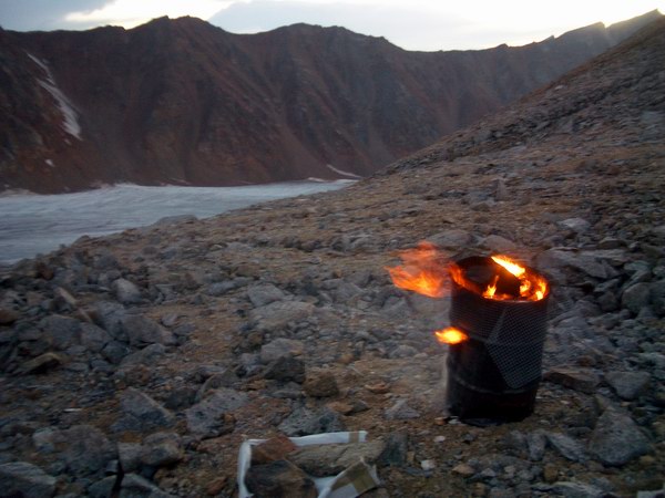
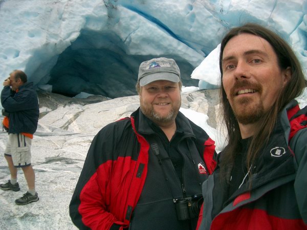
Once at the Hut, we began assessing how to arrange our sling loads. Rich joined us while Dave waited on the ice surface with helicopter, which had no decent landing spot on the moraine. We began lifting objects, such as old fuel barrels filled with metal debris, batteries, and unidentifiable junk, to guess at their weight. Most such objects took several people to lift them up, indicating that they were not light in any case. We had two net slings and two SuperSacks, which are like gigantic plastic shopping bags. We decided to try the four fullest barrels first as a single load, and rounded them up and rolled them onto the first sling. We estimated they were about 900 to 1000 pounds in total. After some maneuvering, we got the sling cinch up around them and gave Dave the high sign to come and get them. He had attached a long cable to the bottom of the helicopter which Rich grabbed and hooked onto the sling as the helicopter hovered overhead. Slowly the line went taught and the moment of truth had arrived – two years of discussion and planning on my part (following 30 years of such by others) were about to be tested. Fortunately the 407 kept right on climbing, lifting the load off the ground and right over our heads as it turned and started flying down glacier. We watched the load fly out of sight high above the tundra well past the terminus (and the end of our responsibility) and breathed a sigh of relief as we reclined back onto the rocks in the hot sun. A long chapter in McCall Glacier history was finally coming to and end
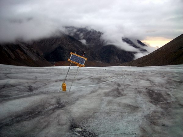
Beefing
barrels into place #1 -- 640kb
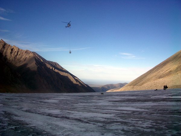
The majority of the larger items remaining were not nearly as dense, and after some discussions with Rich we decided to attach two slings together so that we could maximize the capacity of the helicopter on the next load. There were several empty barrels and several crushed barrels that added a lot of bulk. But there were also several generators that were quite heavy, and the combined load was reasonably heavy. Added to this were several plastic totes we filled with old lead acid batteries that were decayed into many pieces, lots of miscellaneous metal debris, and lots of junk from inside the hut. The SuperSacks were great for this, since there were no holes for small items to slip through. Thus we could take boxes full of smaller junk and just dump them into it. Dave returned less than two hours later with his long line still attached and so flew straight to the moraine where we hooked him up once again. We had estimated this load to be a little lighter, but it turned out to be a little heavier. This weight, combined with the ugliness of the net sling attached to the SuperSack, resulted in some settling as it got airborne. This got our attention very quickly, but the 407 continued to obey its master and yet another load faded into the distance.
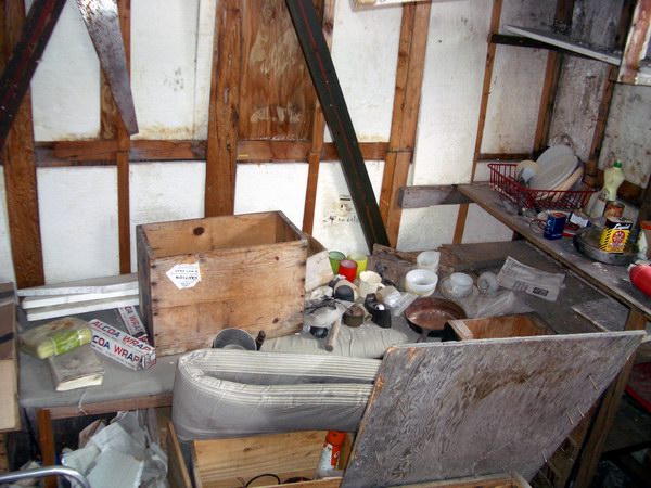
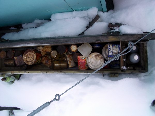
With only one SuperSack left, we made the most of it. We cleared out the hut right down to the kitchen sink, leaving only wood debris behind. The sack was filled to capacity with the contents of the hut and could hardly fit another can of Spam by the time the hut was emptied. The idea this time was to lift this load off of the moraine and temporarily set it down on the glacier, so that we could do a bit more work with the helicopter elsewhere before sending Dave and Rich home for the night with it. This shuttle worked successfully, and by 6PM we were completely finished with the Hut cleanup and on to other things.
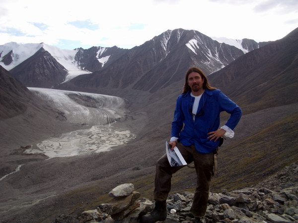
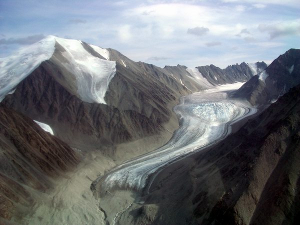
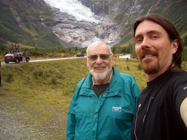
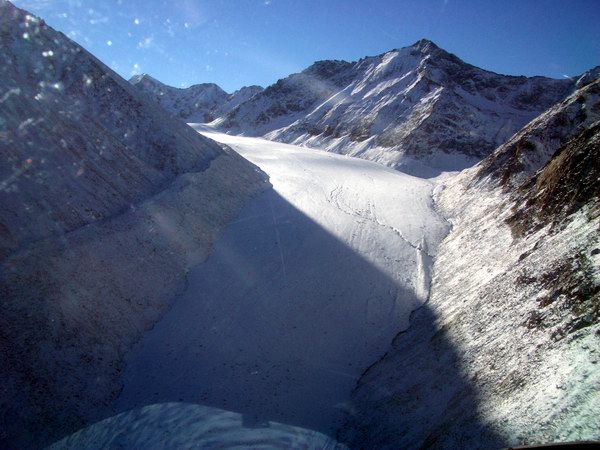
It being such a beautiful sunny day, I wanted to get some photographs of the nearby glaciers. In particular, I wanted to repeat a photograph I had taken during the spring trip of Okpilak Glacier, at a site where a photo had been taken in 1907. When I took the photo in spring, it had unfortunately just snowed a few days before, making it hard to distinguish the glacier from the moraines. This time however, the contrast was more clear, and I knew exactly where to go. Bernhard and Ken joined me as we landed on what may have been an old kame terrace leftover from a previous ice age. It is a beautiful spot with commanding views of the glacier valley below it and a great location for repeat photos. We lingered long enough to get the photos and take in the impressive view, before heading back to camp and letting Dave and Rich go home and get some dinner.
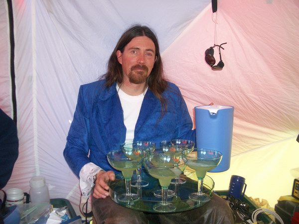
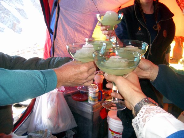
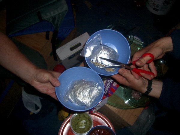
Chasing our shadow back to camp -- 5Mb It being an incredibly successful day, we decided it was time for a little celebration. The greatest success of course was an event that had occurred 38 years previously – that being my day of birth – but clearing out the Hut debris today was also no minor accomplishment. The evening had a Mexican theme, complete with burritos, margheritas, margherita glasses and a birthday cake with candles. We toasted our good fortune, ate to excess, and were mostly asleep by 9PM. This was perhaps the earliest I’ve ever been to bed here, but I was very glad for the first full night’s sleep in a while.
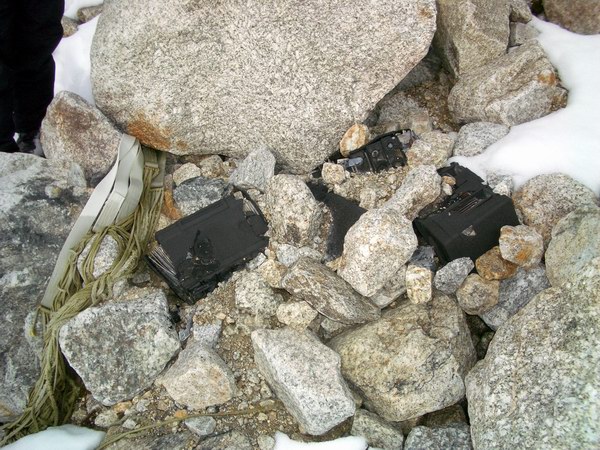
But it's still my birthday -- 4Mb The next morning we woke up to another beautiful, sunny, warm day. Dave and Rich showed up about 10AM with the slings, in preparation for our last debris removal project. In the Upper Cirque we had found several fuel drums that had been air dropped and were still attached to the parachute. My best guess was that they were dropped in the 1970s but were so far off target from the Hut that they were abandoned and slowly buried by snow, only to be re-exposed 30 years later by a combination of climate warming and ice flow. Also nearby and exposed for similar reasons were some parachutes and debris from the 1950s, including a tent made in 1950, complete with instructions for setting it up. Bernhard and Jeff hiked up earlier in the morning to begin prying things loose, such that by the time the rest of crew got a ride up it was ready to be slung. Less than an hour later, the final sling load of the trip passed over our heads and out of sight.
Kristin and I remained at camp during this episode. Kristin was still feeling pretty sick and I had somehow injured my eye the day before. It had been bothering me for several days, but yesterday I could barely see out of it because it stung so much, probably from some sunscreen irritating an already disturbed area. By the end of the day it was puffy and oozing something white, and by this morning it was nearly swollen shut. So I made myself an eyepatch and decided to hang around camp and give it a rest before it got worse. Fortunately it steadily improved throughout the day, such that by about 1PM, when the crew returned from the hike back from the Upper Cirque, it was feeling almost normal. So Bernhard, Kristin and I headed out for one last reconnaissance flight.
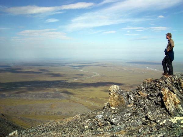
About 15 years ago, Keri and Keith had installed some GPS benchmarks in the bedrock in this region such that plate tectonic motion in this area could be measured over time. Since we are nearby and have the right equipment, we thought it would be a good idea to remeasure them as it does relate to glacier dynamics, so we took this opportunity to find the sites and work out a measurement plan. One of the sites was located beyond the terminus of McCall Glacier on an outcrop that gave great views of the foothills and the coastal plain. We found the site without too great difficultly and had some discussions about what the areas would have looked like during the last glacial maximum before heading off for the second site.
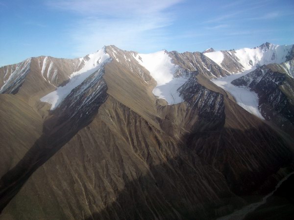
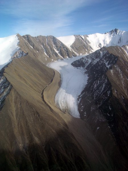
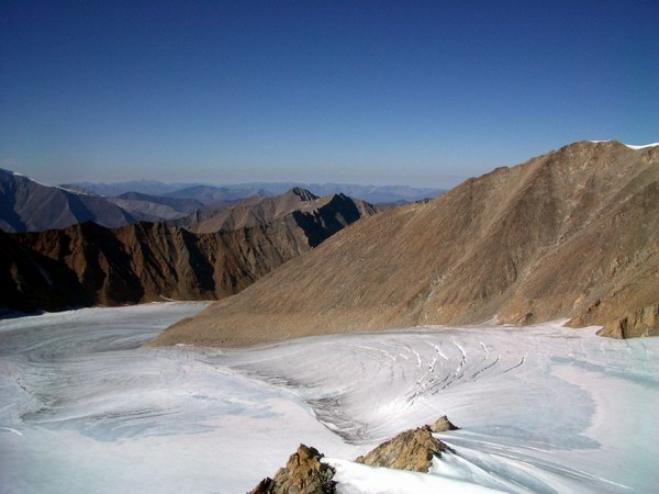
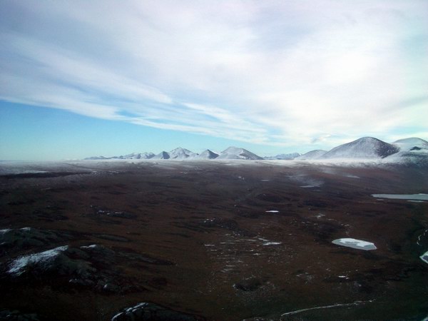
This next site was located all the way up the Jago River valley at the top of a tall mountain. It was the first time I was back there, and I was surprised to see how few glaciers there were left back here. As it was getting late in the day, we did not land at this site but hovered around long enough to determine that there was a suitable landing spot near the summit, thankfully eliminating the need for a several thousand foot slog up the scree covered mountain. The largest glaciers in the area were located on either side of this mountain, and had a different character than the larger ones we were used to like McCall and Okpilak. There were somehow more like the ice veneers but with slopes somewhat between the steep headwalls of McCall Glacier and the main trunk glacier. On our way back, we flew over some equally interesting glaciers and it became clear that we must return here when we had more time. Essentially it seemed that the equilibrium line between ice melt and ice accumulation here had moved above the highest elevations of these glaciers and that most of them were no longer accumulating any ice.
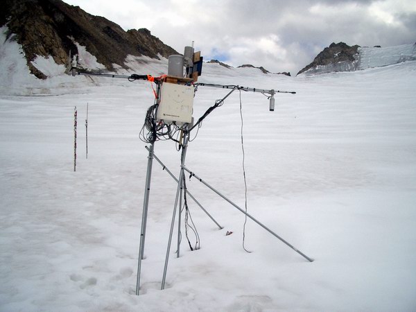
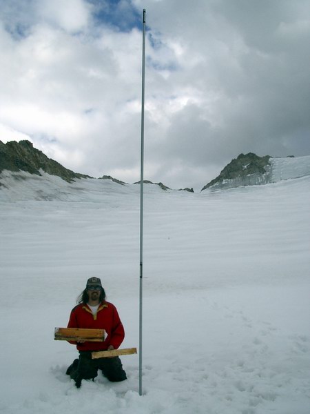
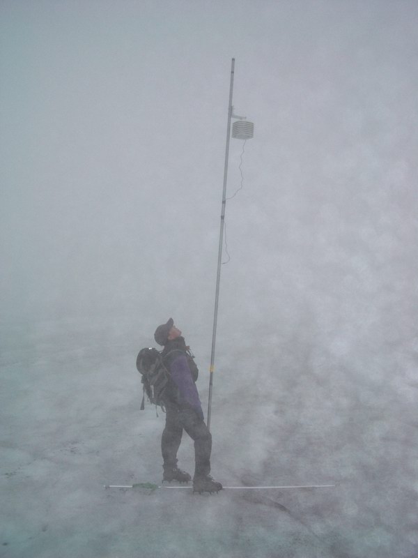
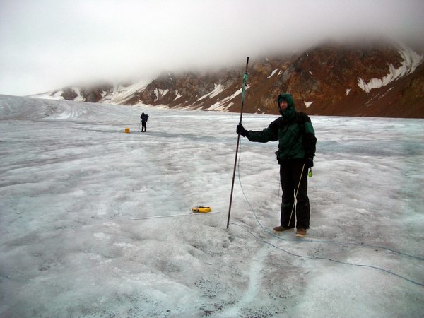
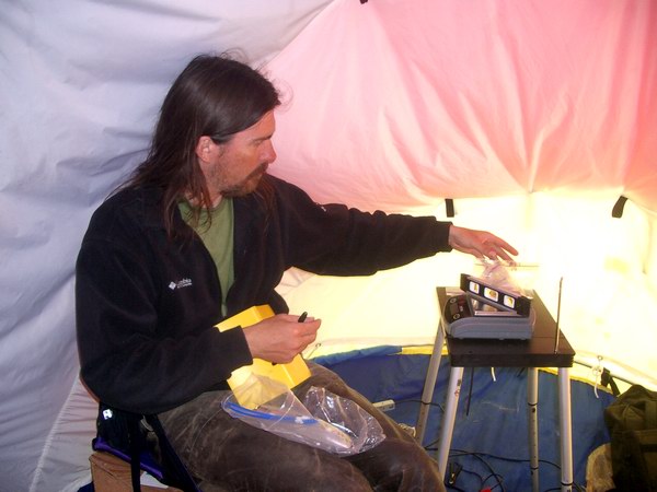
The reason for our hurry back was to make sure that Marin and Jeff made it back to Kaktovik before the Frontier Flight left at 4:30PM. Dave didn’t shut down as we got off and they got on, so we said our quick goodbyes and thank you’s before waving to them as they flew away. This would likely be the last we would see of the helicopter during the put in, but Kristin, our USFWS clean-up volunteer, stayed behind anyway to continue the debris clean-up efforts and stage loads for other debris removal flights later in the course of the project. Despite that some more debris remains on the glacier, were able to remove more than two tons of it in as many days and everyone involved considered this to be a tremendous success. Finally it was just down to the four of us and we decided to try to get some science preparations done to prepare for measurements tomorrow. Getting the GPS ready was the first task, and this turned out to be a bigger job than anticipated. The central problem was caused by the poor design of the older GPS receivers. These we had left running on the glacier taking measurements 6 times per day, but each of these measurements must be downloaded individually and then renamed. This process takes several hours of tedious work, after which all will to continue working is lost. But in the end we were able to download two of the receivers, allowing us to delete the data and reprogram them for use tomorrow, as well as get a bunch of general camp maintenance and organization completed. So all that being said, it was a very productive and successful way to begin my fourth trip to McCall Glacier. Wednesday, 11 August 2004, McCall Glacier Through rain and snow and flashes bright… The next day, Sunday, we began our first GPS surveys after several hours of frustrating effort. This year we have two receivers that we can use such that we can divide into two groups and get things finished more quickly. However, getting the equipment set up and tested can take a while, especially when you haven’t done it in a year. The important thing here is to find a way to verify that it is working correctly, and not just giving you some coordinates that are just close. So we have some poles set up around camp that we survey to make sure that we’re getting the correct answers. Anyway, we got one system going by about 1PM and Ken and Bernhard took this out to survey the poles in the lower cirque and the confluence. Kristin and I continued to try to get the second system to work, and after about 3 hours banging my head against the computer figured out that a buried setting needed to be changed, then all was fine. By that time though, it was after 5PM and too late to go out without coming back late, so we stayed around camp and prepared for the next day. That night we ate some of Kristin’s pre-made Thai peanut chicken while reducing data from the day. The past two trips, Kristin has pre-cooked all of our dinners, vacuum sealed them, and froze them, such that all one has to do to cook dinner is drop the bags into hot water for a few minutes. So not only does it mean we can work late and still eat well, but there are few dishes to clean up. It wasn’t until after 10PM that we began reducing the GPS data that Ken and Bernhard collected, and it turned out there were still some processing issues to work out. We stumbled around with settings and got it to work, but we were still a little concerned that perhaps something wasn’t quite right.
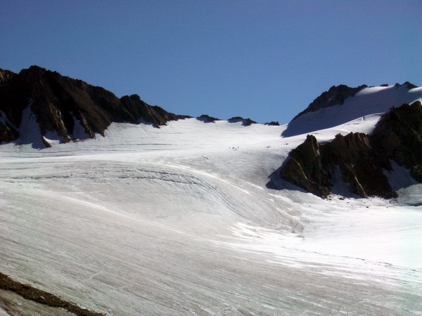
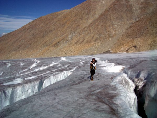
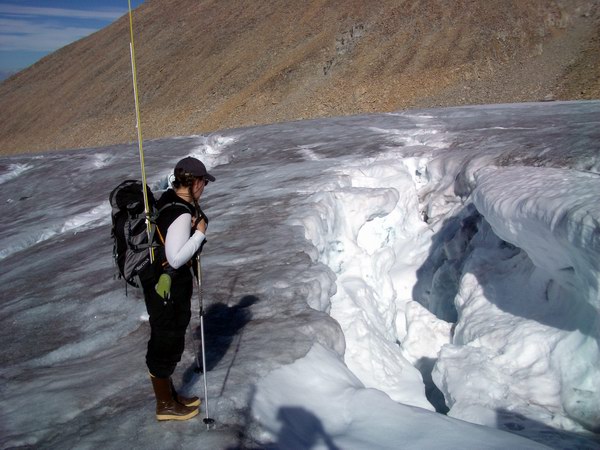
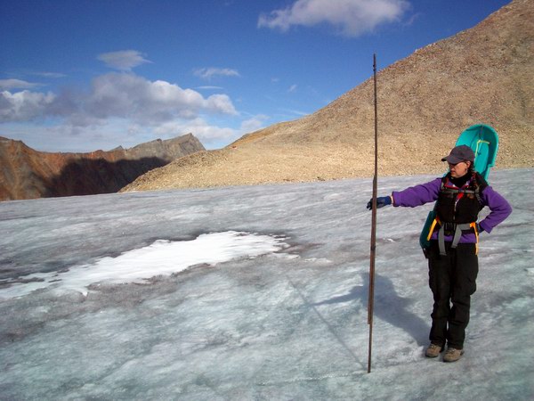
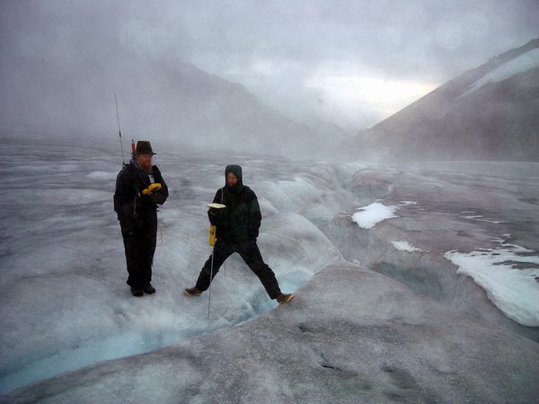
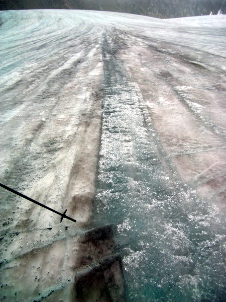
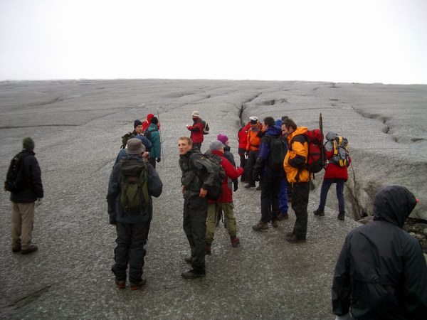
The next morning we prepared for an early start with two teams of surveyors. The idea was that we could finish all the surveying in a single day. I have that idea every time, so I’m not sure why I still maintain that fantasy, but it always seems like it should work that well. Ken and Bernhard started out by surveying a few poles in the middle cirque while Kristin and I headed up to the upper cirque. There have been unusually high melt rates this year, so most of the snow on the glacier is gone and the ice surface is exposed, so there is no mystery about where the crevasses are. From Bernhard’s recollection, the crevasses now are significantly more numerous and wider than from his thesis work in the 1990s. It’s not really clear to me what could cause that and what the implications are, but it is clear that they are fairly numerous, wide and deep. So making our way to the poles took a little zig-zagging, slowing progress down. And of course it is impossible to be around these things without spending some time looking down inside.
It started out a beautifully sunny day, and we enjoyed our walk up. Kristin and I were using the RTK system to measure surface elevations originally measured by Keith using his airborne laser altimetry system. In the airplane, you can just fly over crevasses, but on foot a little more care is required. By the time we got to the upper col to look down into the Hubley Glacier valley, it was already after 2PM, despite our reasonably early start at 9AM. We ate some lunch there and took a few photos. I have a panorama from 1958 from near to this spot, but unfortunately forgot to bring the pictures up with me, so I could not exactly repeat them. What I did learn though, was that at the peak of glaciation during the Little Ice Age about 150 years ago, the rocks near the col were not covered by ice, as indicated by the large lichen growth on the rocks. It is even more interesting because the rocks on the south side of the col were glaciated during this time, as indicated by the absence of lichens there. So these rocks were nunataks then, and the ice from the south side has completed disappeared in the past 100 years.
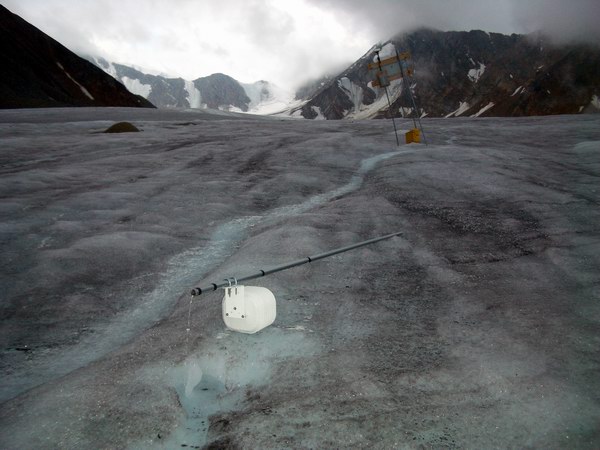
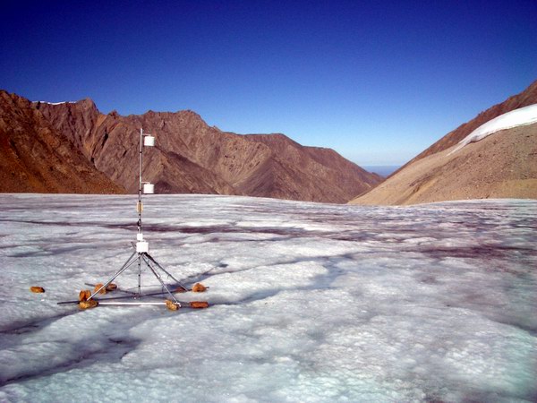
On our way down we download a thermistor string I placed in spring and checked out the met station I built at the Japanese coring site. This site stopped transmitting about a week after we left in June. Ken and Peter visited it for a day-trip from Toolik Lake about 3 weeks ago and got it running again. Apparently one of the instruments shorted and drained the battery over time, but it kept logging long after the radio stopped transmitting, for unknown reasons. When they visited, the whole station had started tilting due to the stronger than expected melting, so they stood it back up and tried to rebrace it temporarily until our return on this trip. When we found it today, it was still listing a bit, but all seemed working. Perhaps the most interesting thing we learned at this site was that the ablation from this summer melted down through two previous years’ worth of accumulation. We know this because in May of this year we placed wooden stakes horizontally within a pit at depths from each summer surface that we found. When we arrived on this day, two of those stakes were at the surface, indicating that both years accumulation had melted away. This confirms our suspicion from spring that this site is just on the edge of the current accumulation zone, and that about 4 years ago this site had completely melted to the ice. It could also indicate that our interpretations of annual layers is mistaken, because one or more layers could be missing, just as these last two vanished.
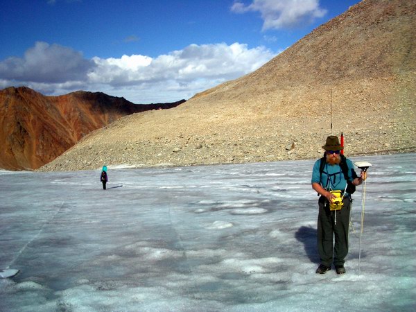
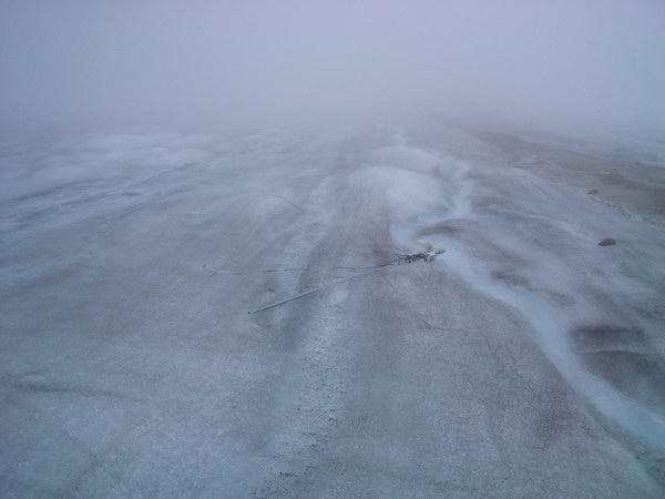
By the time we got down from the upper cirque, it was already after 6PM, so we decided to head back to camp. Bernhard and Ken had spent the day down glacier after finishing with the middle cirque, but were running out of batteries in the GPS, so decided to turn around near the Hut. They were able to complete all of the measurements down to there though, so all in all it was still a very successful day. One of the things that they learned is that many of our poles had melted out and completely fallen over. We had noticed this happening to many of the poles near the Hut when we were removing the debris, but the full extent had not yet been realized. We have essentially gotten an extra meter or so of melt compared to normal, and what I had hoped would last until spring is largely lying flat on the ground now. So we have some thinking to do regarding what type of stake network we want to maintain in the future; the current one is too large to maintain sanity over the long term. So we began discussions of this over lasagna and boxed wine. The weather had deteriorated in the afternoon on that day, and largely did not improve yesterday. The morning was pleasant enough however, and we decided to split into several groups again. Bernhard hiked up to Fox Point to repeat some old photos and find a good route there for future traveling. This point is high above the glacier with commanding views of not only McCall Glacier, but the surrounding valleys as well, reaching as far out as the ocean. Unfortunately, thick fog blanketed the tundra all the way from the coast and continued inland about half way up the glacier. Ken led the remaining GPS effort, and we decided to travel all the way to the terminus first and survey on the way back, just in case the battery ran out before getting down there and necessitating another long trip just for a few points. Kristin and I concentrated on downloading dataloggers from the thermistor and air temperature sites that are not telemetered. This slowed us down such that Ken reached the terminus and was working his way back by the time we reached him. Just below the Hut, we entered fog so thick that we could not see 50 feet (as measured by GPS), making finding fallen poles that much more difficult. The thick fog also led one to believe the glacier was much wider than it actually is, as when it occasionally cleared (like during a driving rain) all of a sudden you realized you were in a tight, steep valley that was no more than 600 m across. The fog was so thick we had a difficult time even finding Ken, and we both had to navigate to a common waypoint using our GPS units, even though we would have been able to see each other for miles on a clear day.
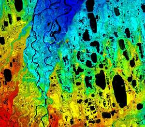
Not long after we met up with Ken, Bernhard returned down from his hike and met up with us in the rain. The rest of the way back, we were treated to rain, fog, and sunshine, sometimes individually or all at once. We split up once again, with Kristin and I continuing to download dataloggers and Bernhard and Ken finishing the survey. They caught up to us at the Ethl GPS site, which had been running all summer, hopefully measuring ice motion. Getting to this site proved a little bit of a challenged, as a wide, deep, and fast moving river carrying melt water separates the glacier into two halves longitudinally. This river is considerably more scary than most of the crevasses here – a 5 meter fall is bad enough, but getting washed down a tightly twisting water-slide for several kilometers before going down a Moulin to the bottom of the glacier is worse. Fortunately, there are places along the stream where the margins are close enough together to jump across, even for cowards like me. At this site, we dismantled the GPS and brought some of it back with us. From here we all kept pace together, even though we had another logger to download on this side of the river. Apparently the radio for the GPS was acting pretty flaky, so that the normally speedy pair were kept down to our slower pace.
As we got within site of camp and finishing the survey, what had been rain and fog turned into lightening. At this point I calmly suggested to Ken that he get the fucking antennas off his back before he exploded and made a mess on the rest of us, which he gladly agreed to. We continued on up the hill, wondering whether our camp had burned to the ground, but after a few more flashes of light, the skies largely cleared and we were treated to a nice sunset on our way up the last hill. It was after 11PM by the time the last of us made it back (Kristin and I decided to take a short cut, with anticipatable results), and were treated to homemade meatloaf by Bernhard. We were all soaked to the bone and changed clothes first, and by the time we began eating it was midnight and fairly dark in the tent. Regardless, we were all glad to be back and had a successful, if drippy, day to look back on. We decided to sleep in the next day, today, and finish up with the surveying in the afternoon.
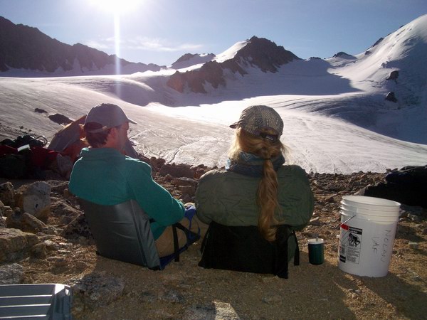
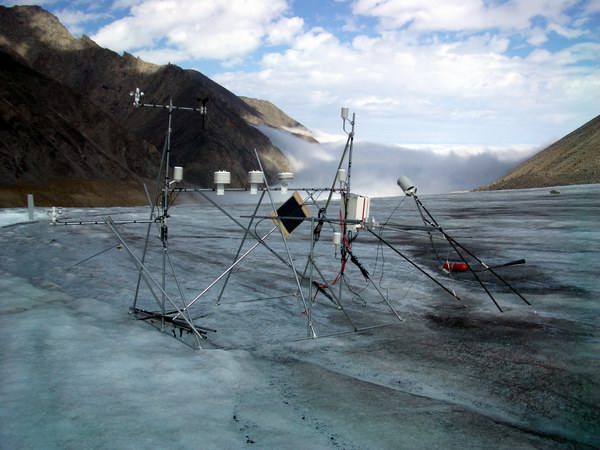
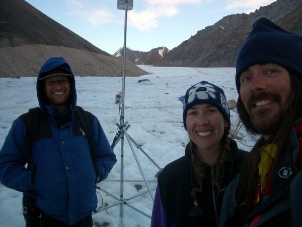
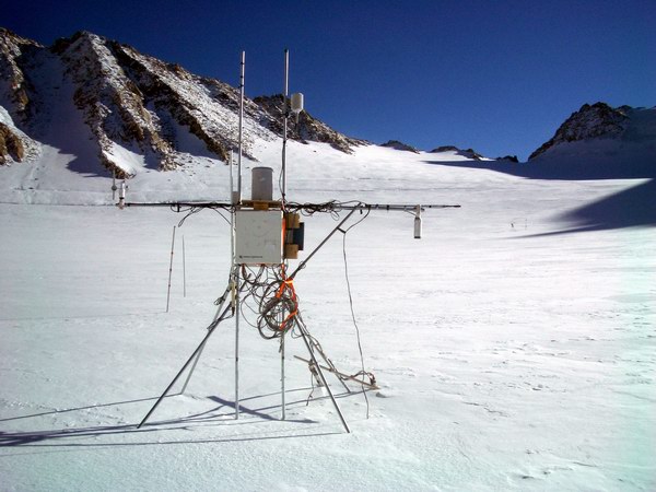
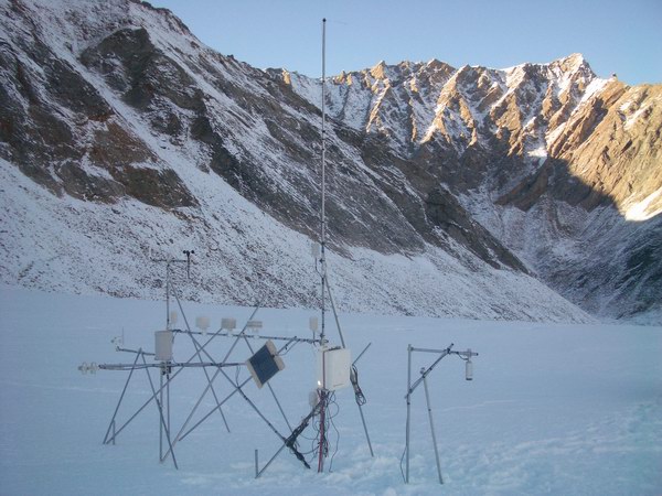
This morning was a beautifully sunny day at camp, with clouds beneath us. It was, however, substantially colder. We all slept in and took care of our own projects in the morning, and by noon began talking more seriously about future plans. We’re already half way through with the trip, even though it seems like we just getting started. I began making a list of things to do and stopped when I filled a page up just to avoid panicking. Fortunately there was still some margaritas still left in the pitcher from my birthday party, and finishing this allowed me to both free up a pitcher and continue making my list. We’ve been very successful thus far and if we did nothing else we would still have accomplished our major goals. However, there are a lot of little projects now that would be very good to complete. The primary of these is getting all of the poles upright that hold the air temperature and ice temperature loggers, else we could not find them next spring. I had in mind to make these floating stations like I had done with our main ice station last spring, but I had thought that I could wait until next spring to do that, so I did not come prepared with supplies. So my goal for the day was to assess what materials we had available for this and come up with a plan. While I did this, Bernhard and Ken went off to finish up the surveying. Bernhard split off from Ken once they were most of the way through to retrieve a small met station that had fallen over near the Hut so that we could redeploy it in this funny area in the upper cirque which appears to be the sweet spot of accumulation on the glacier. This spot will likely be the location of a future ice coring effort, so it seems like a good idea to understand it better. Kristin spent the day inventorying our supplies with me and helping erect the floating stations. It’s 9PM now, and we’re all almost done. Ken just got back, the floating site structure seems sound, Kristin is finishing up the last of the new radiation shields, and Bernhard has been spotted on his way up with the sled load of met station. So now it’s time to button up camp, get dinner going, and make a plan for tomorrow.
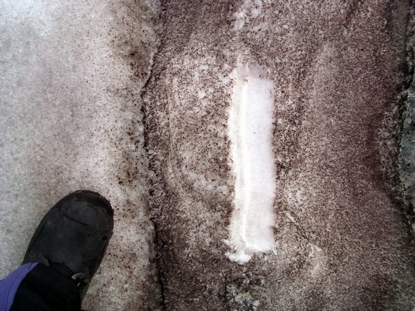
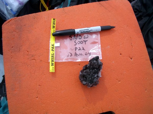
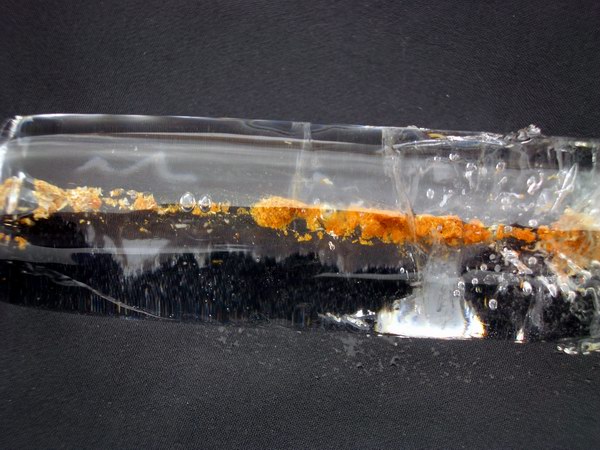
Monday, 16 August 04, McCall Glacier The rollercoaster of life, field work, weather, and productivity continues. Our trip to the upper cirque the next day proved frustrating for me, but hopefully instructive. I’ve spent several months on this glacier now, but have rarely had the chance to go exploring or do many of the qualitative or relaxing things that many others have. But what really frustrates me is not that the work takes longer than expected and soaks up all waking moments, but that I’m working at full capacity while others are doing many of things that I’d rather be doing. In most cases this is because I’m the only one that can actually do the work, so it’s not like I’m surrounded by slackers – the buck simply stops with me. Regardless, after several unexpected hours of preparations for our work in the upper cirque, I was feeling increasingly grumpy while slogging my heavy sled up slippery the hill. Our route took us past some interesting deposits of what appeared to be ash from the forest fires this summer in Alaska. It was distinctly different in color and texture than the normal dust one finds here, having a black, oily appearance. This ash may be partially responsible for the higher than normal melt this year, as the dark color catches the sun better and heats up the snow more quickly. I decided not to ignore it in my rush to get to the met station, and took some samples and pictures to study it better later. It accumulates at the bottom of slopes where the superimposed ice forms from melt water above. Checking out things like this is the type of thing that I wish I had more time for and having to skip over it to maintain weather stations is frustrating. So spending some time here made me feel a little better, as it was a conscious decision to do otherwise.
However, spending time there put me quite a bit behind Bernhard, who travels much faster than I do anyway. I caught up to Kristin and we watched Bernhard drop his load at the met station and go for a hike up one of the ice veneers that I was very interested in studying. This was probably the most productive use of his time, but it renewed my frustration because that was what I wanted to do too, and it being so late in the day I knew that I couldn’t do that and rebuild the listing met station. So I gritted my teeth and tried to figure out how to improve my situation. I have complete confidence in being able to overcoming external forces such as the weather or the whims of fortune, but internal forcings are another story. In any case, after several hours we had re-erected the Core met station, located at the site of the Japanese 20m ice core. We found that snow depth here was much less than anticipated, and in fact that several years’ worth of accumulation at this location had melted away this summer. Erin’s instruments, which had been placed at the bottom of a 2 meter hole, were now sticking up out of the snow. Bare ice was exposed less than 50 meters downhill, and steadily making its way towards the met station. The lack of snow also revealed the numerous crevasses in the upper cirque, that extended entirely across its width and spaced about every 20 meters down the length. The spot of the Japanese cook tent was placed right over one. These crevasses are only a few inches across in this location and so are no danger, except when handling small nuts and bolts with cold hands, but it was still an eye-opening sight. This transitional zone between accumulation and ablation makes low-budget met station design a bit of challenge, because you must plan for either a meter of loss or gain or both, but this one should hang in there for at least a year or two. Ultimately I believe a more serious station based on a single large pole planted deep into the ice is necessary solution here, but my experience hasn’t reached that stage yet.
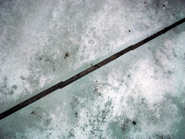
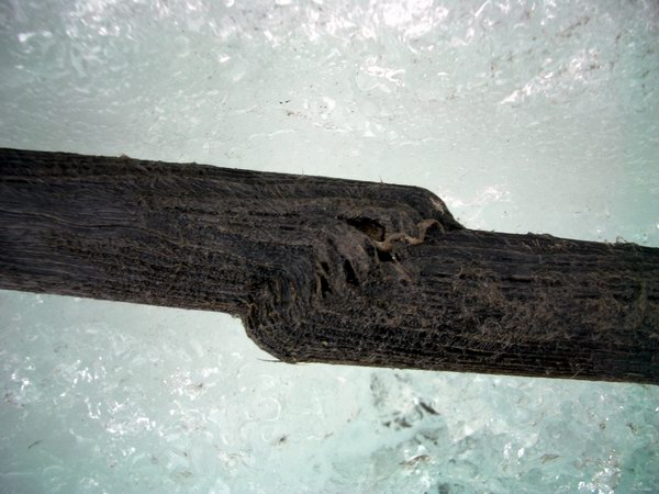
Rewiring the station and buttoning it up is really only a one or two person job, and one of those two must be me. So Bernhard took off again to our study veneer to plant a pole that we will use to measure ice loss or gain. This once again renewed my frustration, which hopefully I was concealing below the surface, where on the one hand I enjoy building weather stations but I don’t want to spend all of my time doing it when there are other interesting projects like these veneers to work on. It was already getting late in the day by the time we finished with these projects and I wasn’t in much mood to launch into erecting the new weather station at the sweet spot of accumulation, so we headed back downhill. On the way down, we came across two sticks of wood that had been used as survey poles in the 1950s and 1970s. These sticks were laying about a meter apart and not quite parallel. What was really interesting about them was that they had partially sheared in numerous places, but not all the way through. What was more, the shears zones lined up between the sticks. The implications of this are potentially important. Glaciers motion is typically modeled as a continuous motion caused by microscopic creep along ice crystal boundaries, where the weight of the ice above the crystals is driving the creep. At the surface, there is no weight above, so one would expect no creep there. Further, I would imagine creep to bend a piece of wood, not shear it. So here seems to be direct evidence of localized slip motion at the surface, which is a departure from conventional theory. Crevasses are another form of non-creep motion near the surface, but these sticks were sheared in the direction of ice motion and on spatial scales smaller than one thinks of for crevasses. Other evidence for non-conventional motion here are thrust faults across the length of the glacier, which Bernhard had observed previously near the terminus. These forms of brittle motion are poorly described in the literature and even more poorly believed by most glaciologist, so it seems there is room for advancement here.
Spending an hour or so photographing these sticks and their setting and discussing these implications was a great pleasure to me. It’s random discovery like this that makes science fun as opposed to a chore. Regardless of whether anything comes of it, the process of deducing (or trying to deduce) processes like the ones that caused such odd deformations of wood on a glacier is a truly a special one, and having the opportunity to work with Bernhard on such things is even more special, as his knowledge and enthusiasm fuel many interesting discussions and tangents. In some ways this day encapsulated both my frustrations and joys with science, and made me remember the question I hoped to answer on this trip. There are many ways to be a scientist. Some focus on one theme and hammer it their whole life, some like to jump from project to project, some treat it like a hobby and only do what they please, some like the proposal writing, some like leading or being a part of a research machine, etc., etc. On this trip, I hope to come to some resolution on my own direction. I like writing proposals and I like studying many different things, but at some point the overhead of it all becomes all-consuming. As a graduate student, I worked a single project, learned a lot, got the right answer, and still had a lot of time to pursue hobby science in completely different fields. I’d like to get back to that. I already knew the answer to this question before I got here. I need to value my time and the quality of my research more than how things look on my resume for a promotion review. I could easily spend several years full-time working on data that I’ve already acquired here, and any time I spend on projects or proposals that can’t be tied closely to this project are a distraction that I don’t believe will make me any happier in the end. This is a great place to work and study, with tremendous opportunity for making solid contributions to our understanding of how the world works, as well as enjoying some of the most spectacular scenery earth has to offer. Why not make the most of it?
The next day we woke up to wind and rain. Working with steam drills and with met stations in bad weather is not pleasant and can even be counterproductive. With our work in the upper cirque not yet finished, we were kind of stuck because we needed the steam drill lower down for much of what we needed to do there. With only a few days left in the trip, it was becoming increasingly clear that time was running out for what we wanted to accomplish. We decided to wait out the weather a little while. I worked on reducing our GPS data to make sure that we actually got all of the measurements that we hoped we had. Ken had started this job the day before, and to actually finish it up and verify that our sanity checks actually came out positive was a satisfying feeling. The weather still hadn’t improved much by lunch time, so we decided to just stay around camp and pursue tasks of our own inclination. I wish we had more days like this. Ken decided to work on erecting the wind power station he had brought in last May, to provide us with power during the occasionally long spells of cloudy weather. Bernhard and I decided to take a walk on the ice below camp and check out the patterns there some more. This strong melt season revealed many surface features that are normally covered by snow or superimposed ice, giving us a rare opportunity for random discovery. We constructed a crude “dip-meter” to look at how the stripes we noticed on the surface angle downwards through the ice at locations where the streams cut across them. It was very much like being a structural geologist. We had spent many hours earlier in the week coming up with explanations for these surface stripes, but still nothing seemed to make sense in a complete picture. We soon discovered that our dip-meter was useless. Not only was it extremely difficult to get close enough to the streams due to the slick rain-soaked-ice, but we quickly found that there was no consistent patterns to the dip. We had hoped that as we walked across the width of the ice that we would see a progression from dip one way, to horizontal, to dip the other way, sort of like cutting an onion on edge. But the quickly changed to vertical and stayed that way. What makes vertical planes in the direction of flow on glaciers? Medial moraines, basal crevasses, rotation of bedding planes, refreezing crevasses, and much more was discussed. We spent several hours roaming around checking things out. Eventually we came up with a comprehensive theory. Or at somewhat comprehensive any way.
Something I noticed beginning with our first trip was how aspect and ice cover were so strongly correlated: south slopes have less ice on them than north facing slopes. This makes some sense, considering how much energy the sun delivers to a south facing slope. What is really curious, however, is that 150 years ago south facing slopes had much more ice on them than today. I haven’t tried to model this yet, but it seems like more than colder air temperatures are required to explain this. Bernhard’s idea is that it was simply cloudier, equalizing the difference caused by aspect, since clouds diffuse the sunshine and provide largely equal amounts of radiated energy in all directions. On McCall Glacier, it is clear that large areas of non-north facing slopes have become deglaciated in the past 100 years. This must have an affect on the glacier flow, and in this case it might be that the ice flux from the upper cirque has significantly decreased due to its substantial south facing slopes, whereas the flux from the middle cirque (mostly north facing) has largely stayed the same. The result is that the middle cirque is now pushing the ice from the upper cirque towards the south, bending the flow stripes. Further, what appear to be refrozen crevasses in arcuate shapes further down-glacier can be traced back to the upper cirque, but with a gap of about a kilometer where no such stripes exist. With an average flow here of about 10 meters per year, this means these crevasses stopped forming about 100 years ago, about the time of the major climate shift that began this period of glacier retreat. This provides more evidence that the ice flux from the upper cirque has decreased. Where we found the two sticks is in the middle of the competitions from the two cirques, providing some evidence for strange compressional flows and shearing motions that would account for the sheared wood. It would seem that the ridge that separates the two cirques likely runs beneath the ice, further limiting flow from a thinning upper cirque and aiding in the middle cirque’s quest to dominate ice flux here. This general picture tends to explain much of things we found here, but is by no means the last word. But the process of trying to figure it all out was highly rewarding.
We capped off the day with dinner and a movie. It being Friday the 13th and that we were studying a glacier first explored in the 1950s, we decided to watch Plan Nine from Outer Space. It was a fun movie, made the more exciting by the increasingly high winds and the fact that we lost the cap to a bottle of Bushmills. We measured peak winds over 80 mph at the met station on the ridge behind us, and my little hand held wind meter was measuring 50 mph outside the tent. The solar panels tied to the outside of the tent provide the most dramatic sound effects, as they reached a resonance and repeatedly slammed against tent, as if some outer space beings with poor manners were trying to enter but couldn’t quite figure it out. I eventually had to cut one particularly ornery panel loose. The winds continued throughout the night, increasing in speed and flattening our tents from time to time. It was a south wind though, bringing with it warm air and smoke. Popcorn
and a movie -- 4Mb The next morning we all awoke to shaking tents and thoughts of another day in camp. However, the skies had largely cleared and by 10AM the winds had died down to nearly calm. By the time we were on our way to the upper cirque to complete our work, it was a scorchingly blue sky day. By this time I had my fill of random discovery and was largely over my frustrations, so sent Bernhard to the top of Mt Suki to repeat a panoramic photo I had from 1957. Kristin and I completed the new met station and freed up the steam drill, such that by the time Bernhard returned, after a slightly harrowing climb, he could take it down-glacier to several locations that Ken was surveying with the D-GPS for new poles. Ken was also surveying the upper ice limits of the upper cirques as a function of elevation, so that we could both monitor its change over time and model it better in the meantime. Once we finished with the new station, Kristin and I hiked up the ice veneer that Bernhard had several days earlier and caught the view down the other side into Wolverine glacier. It was neat walking up over rocks that had been covered with ice only 50 years earlier and seeing the transitions denoted from percentage of lichen cover on the rocks. Wolverine Glacier sets in a very steep side valley, and the only reason it is still there is likely due to the extreme shading it gets from these valley walls. The weather held out all day long, and I was glad to have not let myself get swept away with just the necessary chores here.
By the time we made it down the veneer, it was after 8 PM, and the sun ducked behind the mountains, reducing apparent air temperatures considerably. I dug a few snow pits as Kristin tried to stay warm, then took a quick look at the Core met station, which had a broken air temperature sensor. We fooled around a little longer, then decided to finish up the next day. The clear skies literally suck the heat from the ground, and one feels almost if the departing longwave radiation could lift you off your feet. The way down, which had been a nice crunchy surface of melting ice, had in minutes turned back into slick ice. It proved to a late night in the end, but it was a nice day with productive results.
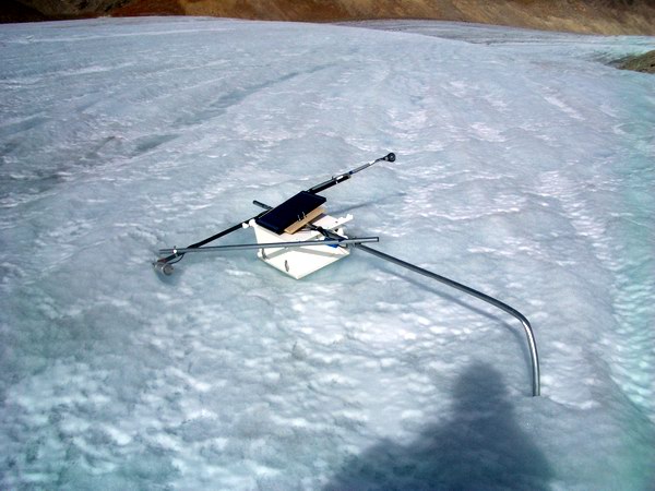
The great weather held out the next day as well. Though we had a late night, we tried to get going early this day so that we could make it to the terminus and back without it getting too late again. Our challenge for this day was to construct four floating stations on the ice to hold up the loggers that measure air and ice temperature which had fallen over already. To do this, we made a base out of two crossed poles, like a big plus sign, then stood up another at the cross, braced by four short poles, one each from the legs of the plus sign. On each leg we tied some rocks and we let the center poles and the cross pieces descend below the plus sign to dig into the ice, with the general idea to prevent the floating stations from floating away. The major advantage to this system is to reduce long-term maintenance – because the pole cannot melt out, there is no need to steam drill a new hole to reset it. And the deep thermistor string at each location gives us a record not only of ice temperature, but how much melts based on how much wire is exposed at the top. Heading
down glacier -- 2.5Mb
Work on these stations went well and got better throughout the day. The first station took us about an hour and a half, but the last only about 45 minutes. Unfortunately, by the time we had finished the last, it was after 8PM and we were nearly at the terminus of the glacier, which is more than a 3 hour walk from camp. Nonetheless, it was a beautiful day and beautiful night, and the entire process relatively pleasant. On the way down, we also drilled a new hole for our sonic ranger, which cannot be placed on a floating station. The sonic ranger measures the distance from the device to the ice surface, measuring the amount of snow that falls or ice that melts. During summer, if it were on a floating station, it would always read roughly the same distance because it would be riding on the lowering surface and remain a fixed distance away. As yet we haven’t figured out a slick way to avoid drilling a hole for this device, but no doubt some clever means may be developed in the future.
On the way back up the hill, we paused at several locations to check things out. On the way down, while searching for a fallen over pole, Bernhard came across a cache of old barrels and the infamous snow machine. This junk was located not far from the hut, but none of us had seen it before. It was all precariously perched over a series of significantly sized moulins, where the marginal stream disappeared beneath the glacier. There were also quite a few large boulders covering some of it, indicating that this was also an area of active rock slides. Bernhard clambered around on the junk and peered into the hole, getting a better idea of what it would take to remove it all, and we put it on our list for things to do next year.
The remainder of the walk home was pleasant, though tiring, at least for me. It was a nice night, with cool katabatic winds occasionally breezing past, and we pondered the nature of the side moraines, flow stripes, and history of the glacier along the way. By the time we made it back it was after midnight, and we ate a nice dinner of lasagna while discussing the plan for the next day. We had talked several times during the trip about spending a few days outside of camp, hiking down past the terminus and out onto the tundra. Unfortunately work kept getting in the way, and the trip was now almost over. I still wanted to try to measure the GPS points in the area for tectonic and rebound motion, as well as do a photo survey of the area’s glacier duing this rare opportunity to see them with so little snow cover. I also wanted to sleep in the next day. Benhard and Ken, however, opted for a shorter hike during our last two days, leaving early in the morning. I woke up to the sounds of pipes clanking and work being done. Bernhard and Ken had in fact woken up early (earlier than any day of regular work!), and after getting their bags packed for the trip decided to get the wind generator assembled and running before their departure. We had flown in this wind generator in May, with the hopes that it would supply us power during those times when we had many days without direct sunshine, which typically correlated with days when it was windy. However it took until now before we made the opportunity to actually get it going. By about noon or so, it was more or less assembled, but it was another beautiful day with little wind so we were all a little disappointed to see it just sit there. On the bright side, our solar panels were keeping us fully charged, so there was no real need for it to work at the moment.
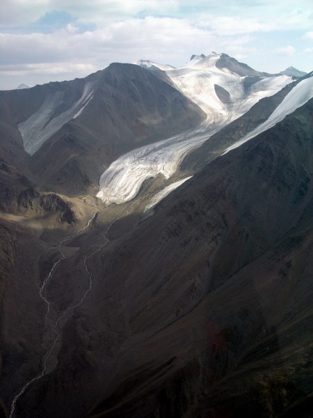
Once the hikers took off, Kristin and I began working on demobilizing the camp and finishing up our last chores. I headed up to the upper cirque to install a new air temperature sensor which had broken and to download the new station there that has no telemetry. The weather remained sunny and warm, and it was a pleasant hike there and satisfying to get the measurement working again. By the time I returned, Kristin had organized most of our remaining foods into things to be cached and things to be returned to Fairbanks. Having the place to ourselves, we decided to wash our hair, take baths, and put on the last of our clean clothes, before eating dinner and watching a movie. As we decadently ate guacamole and drank margheritas in our clean clothes, we wondered how Ken and Bernhard were enjoying their hike, without regretting our decision to stay at camp. Once again, the next morning brought beautiful weather. We spent the morning continuing to sort our gear and make preparations for the day’s flying. We expected the helicopter to arrive around 2PM, which seemed like enough time to prepare, but it was just barely. After getting most of the scientific equipment out of the cook tent and sorted into various piles, we conducted a short GPS survey that I hope will be neat. Using one of the old photos from the 1950s, we identified rocks that had been transported by the glacier during this time and surveyed both their current locations and approximately where they had been 50 years ago. Not only had these rocks moved downglacier, they had also dropped vertically on the thinning ice. So we traced vectors with the GPS that will hopefully allow us to determine both the amount of ice motion and the rate of surface drop. Once we finished with this, I hurried to prepare the GPS units for the tectonic survey. I had never done this type of survey before, and I had really no instructions on how it was supposed to be done, so I had a little bit of scrambling to do to figure it all out in time. This project is a little bit of an aside to the main focus of our work here, but it will help answer some questions about how this mountains formed and what processes are still at work, which relates back to the project. For example, are the mountains here uplifting as a result of a decrease glacier load, like they are in Glacier Bay? Why is this part of the Brooks Range so far north compared to the rest of it? The basic idea here is that by repeating measurements to the millimeter scale over time of a benchmark attached to bedrock that one can answer questions like these. In this case, Keith and Keri had placed bolts into two bedrock outcrops about 13 years ago, and these outcrops were nearby to glaciers that I wanted to visit anyway, and because I had the necessary equipment it makes a lot of sense to combine the tasks. Ed showed up on time and we headed out to explore the surrounding glaciers and measure the motion of the plate that they rest on. It was nearly a perfect day for photos, with no clouds to obscure the view. Kristin tried to keep track of route on the map as I took literally hundreds of photos, documenting not just terminus photos but also the locations of ice veneers relative to solar aspect. My observations in the McCall Glacier area was that aspect plays a key role in the determining whether ice can survive on a particular slope, and I wanted to see if that was just something peculiar to this area. In general, we found that this was true everywhere, though we did find one glacier that seemed to defy the hypothesis completely. I wish we had more time to spend at each of the glaciers in the area, but as it was I tried to take as many photos as possible of what I saw such that I could visit them for much longer periods via the computer screen. Helicopter time is expensive and they only carry so much fuel, so little lingering was possible. Our first GPS site was location on a small peak that was surrounding by interesting looking glaciers. All of the glaciers around here looked so thin and sickly compared to McCall Glacier, and few had any substantial snow fields to help make them grow. We found the bedrock monument easily and set up our station above it. I was a little disappointed to learn that the bolt that was placed in this bedrock was of a different diameter than the GPS antenna threads, as I only had one mounting system for such a set-up to use for two sites, but decided to use it at this site since it was the more difficult to get to of the two of them. We took a few panoramas while here, then got back into the helicopter for more glacier viewing.
It was a very interesting trip and we were able to get a close look at lots of ice. We flew towards the Okpilak Glacier, were I had repeated the photos from 1907, visiting many of the smaller tributary glaciers along the way. Once back in the Okpilak River valley, we headed directly for our next GPS site. Here we set up a much hokier mounting system for the antenna and hoped for the best. The skies were still clear and we could see the ice age moraines clearly within the fall colors of the tundra.
Once back at camp, Kristin decided to check the messages on our satellite phone in case the hikers had tried to contact us. Apparently their progress had been slower than expected, and while the helicopter was still around we thought to check in on them. By coincidence, Ken had just turned on his phone and we were able to make contact. They figured that there was no way that they were going to make it back to camp that night, as a variety of obstacles served to slow down their progress, so we decided to pick them up, as by air they were only a few minutes away. Though it was a bit of a challenge to actually find them in the tundra, soon we were all reunited at camp and we sent Ed on his way back to Kaktovik with a last load of glacier debris, mostly old parachutes from the air drops in the 1950s and 1970s. After listening to several of the apparently many epic adventures of the past two days, we got back to work.
Now the pressure of imminent departure began to be felt in earnest, and we spent most of the rest of the evening demobilizing everything we could. I worked on the GPS base station, while Ken and Bernhard worked on the wind generator and Kristin on the food and kitchen details. It was still almost midnight by the time we went to bed, on possibly the warmest night thus far, and we resolved to wake up early again in preparation for a 10AM helicopter arrival.
We woke up in the early morning to rain and thunder. Most of us just rolled over thinking about how miserable the morning was going to be, but by 7AM the rain had stopped and clearish skies had returned and it turned out to be a perfect morning for sorting and packing gear. Our plan was to fly one person out at a time, leaving the rear of the helicopter to be piled full of gear. This method proved very successful, as by the second load, we were nearly out of things to load in. The only major question mark here was the weather. After Bernhard’s departure on the first flight, a fog rolled in that covered the entire glacier and much of our camp. But just as quickly as it came in it left, and shortly thereafter Ed returned, having never known of the poor conditions just 30 minutes earlier. Ken left on the second load, giving Kristin and I about 90 minutes to finish with packing. It turned out to take about 60 minutes longer than this, even with Ed’s help towards the end. It started to get a bit stressful, as the weather continued to show signs of deterioration. Had the day remained as clear as it was yesterday, one plan we discussed was Ed and I going to retrieve the GPS equipment while Kristin continued to pack, which would have saved us an hour. However, I was uncomfortable with this as it seemed quite possible that we might not be able to make it back into the glacier in an hour. So we worked as quickly as we could to get things together and jam as much onto the helicopter as possible.
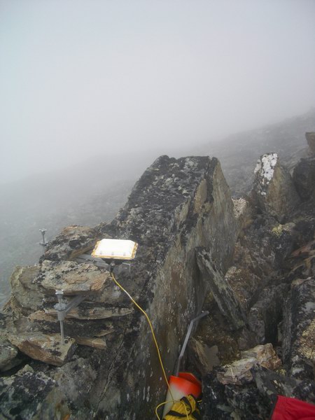
When deciding to set out the GPS receivers the day before, my biggest fear was that the weather would deteriorate such that we could not retrieve them. What happens in this case? I am supposed to leave for a meeting in Norway in a few days, and I can’t just hang out here indefinitely. The helicopter also has better things to do than wait around as well. Thoughts like this filled my head as we poked our way around clouds up the Jago River valley. We caught sight of the mountain were our first site was located, and found it largely obscured by clouds. We circled around it and found a way up the backside that got us reasonably close to the top. The danger here is that though we could land this high at this moment, that since we were generally above cloud level that once we got out that we would not be able to take off again due to zero visibility. We took the risk, and Kristin and I hiked the rest of the way up the mountain. With the receiver now safely in hand, I felt substantially more relieved and not particularly concerned about potentially having to spend the night camped on a small knoll half-way up a mountain.
Fortunately, the clouds never closed in completely and we took off with a clear view of the valley below. Once down there and on our way out of the valley, we found that the weather on the coastal plain had substantially improved and that we could easily have gotten back to the glacier. We stopped at the last GPS site and picked up that equipment and headed back to Kaktovik. By this time it was already after 5PM and we had heard the air traffic on the radio as the Frontier Flight back to Fairbanks took off. So we looked forward to our first night at Waldo Arms, which is where we are now. Here we found that Bernhard had stayed behind to hang out with us, and after sorting our gear some more at the runway, headed to hotel for hot showers and food that someone else cooks. The shower lived up to expectations, as did the food, and after some nice conversations with the passers-by, we headed to bed early. It was a beautiful night in town, and we were glad to be here. Already we found that we have a reputation in this small town of 300, and it was no surprise that much of the debris from both our wrecked sling load in spring and the backhauling this trip had been hijacked on its way to the dump and found its way into the community. We found the heavy diesel generator from the 1970s in front of Walt’s place, apparently already back in working order, and we found some pieces of the Japanese drill reworking into table decoration. We’ll see what tomorrow brings, but I’m looking forward to hanging out in town and seeing what goes on here, especially in such beautiful and pleasantly warm weather.
Saturday, 21 August 2004, 10000m above the Atlantic The rollercoaster ride has stopped, but I’m hoping for one more ride. We spent a pleasant evening and morning in Kaktovik. Bernhard went for a long walk to the end of the island, while Kristin and I hung around Waldo’s and poked around town. The fog was in and out all day, and several pilots were hanging around Waldo’s waiting for the right break. Everything looked good for us until about 3PM, when the fog started getting thicker and not varying in density so much. We had already been to the runway, sorting and prioritizing our gear, just in case we had to move quickly. But it was so bad at 4:30 that Walt decided not to even go out to meet the plane, because he knew it was too thick for it to land. We began resigning ourselves to another night in Kaktovik. I looked up my itinerary to learn that my ticket to Norway began late the next night, meaning that if Frontier didn’t make it in today that I would have only about 6 hours to unpack and repack. More likely it would just be moving my bags from the Frontier carousel to the Alaska counter, and hope that they had washing machines in Norway. Fortunately, just as Frontier called in saying that they were 10 minutes out, the fog showed signs of lifting. While it still looked pretty thick to us, Walt seemed very excited about the possibilities, so we hopped in his broken down truck and headed out for the airport, which was just visible through the fog. Before the plane can attempt a landing, however, an automated weather station near the runway must broadcast that there is at least a mile visibility. Unfortunately, this machine was broken, such that it no longer broadcast the information over the radio but someone on the ground had to call a phone number to get the data and radio it up manually. As we bounced along the bumpy road to the runway, Walt tried dialing this number on his Nokia cell phone with a cracked screen, which he was apparently having trouble doing. So I pulled out my phone and got the number from him and tried simultaneously. It was quite the desperate moment, praying that the machine would spit out the correct number. The first time I dialed I got a recording saying that the number was disconnected, but when I tried again I got a computerized voice speaking in pilot-ese, so I handed the phone over to Walt, who was still trying to dial and drive. He listened intently as we sped along and suddenly shouted out ‘a mile and a quarter’, and Kristin immediately radioed this up to the plane overhead using our handheld air to ground radio. A few minutes later, despite our pessimism 10 minutes earlier, the plane was on the ground and we began loading. My backpack is usually the heaviest in the crowd, but those occasional moments when you need instant access to a cell phone and air-to-ground radio to create an opportunity make the lower-back strain seem worth it.
The flight home was relatively uneventful. Kristin stayed with the plane once we landed to get a ride to her car at the hangar, while Bernhard and I gathered up the gear. Ken showed up about then with a truck to help haul gear. It turned out that Kristin’s car could handle everything that made it back thus far, and we decided to all meet at Pikes for some dinner. It was another smoky night in Fairbanks, but we enjoyed a few cold beers on the deck along with some food that didn’t come out of a bag. It was after midnight before I made it to bed, and I was not particularly looking forward to the next day. I had to unpack, repack, prepare a presentation for the meeting, download a bunch of GPS receivers, and take care of all the little things that normally take many days associated with either returning from or leaving for a trip. Somehow or another it all got done, and in the process I learned that there possibility for getting the helicopter for a day in late September. By midnight, Kristin and I were headed for the airport once again. It was sad parting, as this would be the longest we would be apart since I left for Antarctica about two years ago. I was strongly tempted not to go, but managed to say goodbye and get on the plane before changing my mind. Looking back on the trip and on the
past five years, it’s clear to me now that there is something special
about glaciers that grabs my interest and begs my attention. This project
on McCall Glacier is especially appealing because I have the opportunity
to explore it from many aspects, not just one or two as is commonly the
case due to resources. So it’s like being able to apply an entire
textbook worth of knowledge and study, as opposed to just one or two chapters.
I’m looking forward to the meeting in Norway now, as I hope this
will allow me to put what I’ve learned here into the context of
glaciers around the Arctic, as well as becoming more a part of the scientific
community that feels similarly about the glaciers that they study. When
it comes down to it, I think science for its own sake would hardly be
worth the trouble. Much of the real fun comes with sharing the discoveries
made and working with like-minded people who can appreciate them fully.
Another thing that I’ve found is that not only is there something
appealing about glaciers, but glaciologists as well. I can’t describe
what that is, but generally speaking glaciologists are just fun to be
around. So I suppose the answer to my question on this trip is pretty
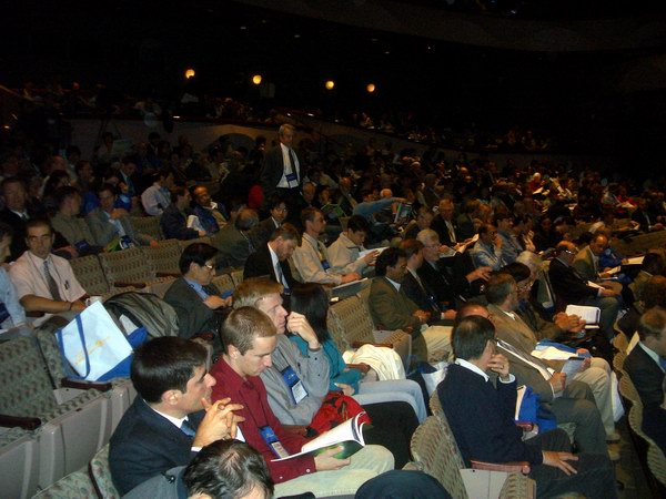
clear. No really, this time we’re done for the year. After we returned from the glacier in August, I learned that a helicopter was coming up to Toolik Lake in late September to support another research group. I enquired as to whether it would be possible to borrow it for a day, and the answer came up yes. The idea was that two of us would fly up to Kaktovik, which costs us nothing due to Kristin’s flight passes, and meet the helicopter there for a day trip. It was just penciled in as a possibility at first, but after returning from Norway it seemed assured. The trip to Norway was fun and interesting. I learned a lot at the meeting and met a lot of people doing similar things. There were about a hundred scientists, from 20 or so countries, and everyone I met seemed very nice. I bumped into a few old friends and more recent friends too, and everyone seemed to enjoy themselves. It was kind of rainy much of the time, but we were also still able to get out and visit some glaciers nearby.
After returning from Norway, I had a week or so in town then went a meeting in Anchorage. This was a large, international meeting that happens every year, somewhere in the world, for people using satellites. It was just as international as the Norway meeting, with over 1000 people from nearly 50 countries, but had a very different flavor. Many, if not most, of the people wore suits. Most were not field scientists and many seemed more like politicians than scientists. Everyone seemed very nice, but I always felt a bit out of place and never felt terribly compelled to become a tighter part of this community. So once again I had some confirmation that I’m doing the right thing by hanging out on glaciers and with glaciologists.
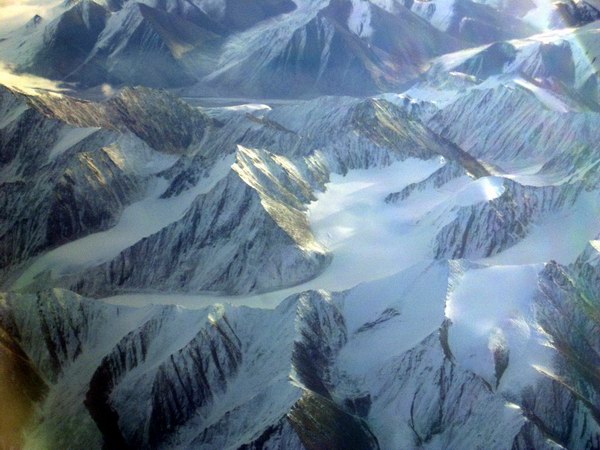
While I was at the meeting, I got a note saying that the helicopter would be available a day early. I had been planning on leaving Anchorage Thursday evening, so that I would have Friday to prepare for a Saturday departure to Kaktovik, but I had gotten most things ready before I left so I though there was some chance of making it on Friday. But Thursday morning about 10 I got a call from Kristin saying that the flight I hoped to catch back was full and that the next one didn’t leave until 9PM or so. I asked her to check on earlier ones, and there was one leaving in 45 minutes. Fortunately I was still in the hotel room, as I had caught a cold a couple days earlier and was feeling pretty sluggish. So I opened my suitcase and threw everything I owned into it and was out the door in about 5 minutes. Fortunately the airport shuttle was out front, and I was able to get to the airport just in time to catch the plane. It was a good thing too, as we spent the rest of the day getting packed until we went to bed at 10PM. Even though we were prepared, it was still unclear whether we would make it off. The weather on the coast was down pretty hard, and neither the Frontier flight nor the helicopter were able to get into Kaktovik on Thursday. What’s worse, the passengers that couldn’t make it on Thursday wanted to go on Friday, and because we’re standby passengers, we could get bumped. Which was just as well, as I could probably have slept all of Friday due to my cold. We woke at 6AM and checked weather. Both Kaktovik and the glacier weather seemed fine for flying, so now it was mostly a matter of finding a seat on the plane. We got to the airport around 8, and things looked good. Forty-five minutes later, we were on the plane and headed towards the coast. I asked Jim, the pilot, if he wouldn’t mind flying past the glacier on the way in, which he did. I slept until we got close to the mountains, then stood in the cockpit and pointed the way. The weather on the glacier looked beautiful, with some clouds near the terminus, and I was able to get a few pictures.
The weather at Kaktovik was also beautiful, with hardly a cloud in the sky towards the west, giving a great view of the mountains protruding up from the coastal plain as far as the eye could see. The helicopter still hadn’t arrived yet, so we headed in to town to visit with Walt and Merylin at Waldos. Things hadn’t changed much there, and the place was as usual a hub of visitors and locals. The big news was the heavy polar bear activity, with 30 to 40 of them being seen on a daily basis just minutes from town. After an hour or so, we heard Ed on the radio, saying that he was a few minutes away with the helicopter, so we headed out to the airport to meet him. He was flying one of the smaller helicopters, which was fine as we didn’t have much stuff and too much to do. The general plan was to replace a few sensors on the met stations and move a few instruments around. We loaded up and were headed towards the ice a little after noon.
The whole process of getting to and from the glacier is starting to get familiar. We’re no longer going to just some dots on the map, but to places we know and like. All along the way, whether at the gates of Frontier or at Waldo’s, we bump into friendly faces that already know what we’re up to and help us out or wish us well. There’s always something new to learn or someone new to meet, but now there is also some prior experience to compare to. The little thank you notes and photos I send to Waldo’s are hanging up in their hotel, and it’s not surprising to bump into someone that says “oh, you’re the guys doing the glacier work…”. So that sort of thing is beginning to add a new dimension to the project, and on a clear day it’s reasonably easy for me to pick out the route through the mountains to the glacier, even from a distance.
The weather on the glacier was substantially colder than when we left, with air temperatures of about –15C and steady winds. But it was clear, and when not in the shadows was reasonably pleasant. We stopped first at the upper station to exchange a relative humidity sensor that was not working. Unfortunately, the relative humidity was very low that day, so it was not clear to me whether the new one was working or not either. We tinkered with a few other things and headed to camp to pick up some supplies from the cache. The cache seemed still in tact, and fortunately what I needed was outside of it, so I did not need to open it up. All I took was a length of conduit and a connector, so that I could increase the height of the lower met station and add some temperature sensors to it. This work went fairly well, though it was certainly more of a challenge working with tiny screws with bare hands in wind chills of –40. But we’re now measuring air temperatures continuously to a height of 6 meters, which should yield some interesting results. Air temperatures are funny on a glacier because the surface is never more than 0C, while the air at eye level can be +15C or more, so there are strong vertical gradients. With instruments at multiple heights, we hope to better understand these gradients and how they vary over time.
On the way to lower site we stopped off quickly without shutting down the helicopter to retrieve an instrument that was on a pole in the ice, down from camp. We had noticed on our last day in August that this pole was beginning to melt out of the ice and tilt, but there was no time to do anything about it. When I looked from camp while picking up the conduit, it was clear that that pole had fallen over and been buried by snow. So we landed nearby to where I thought it should be, and Kristin and I walked parallel to each other kicking through the snow, hoping to trip across it. I was just about to give up, when my foot got caught on something. It turned out to be our treasure, and we quickly removed the sensor attached to it and brought it with us into the helicopter.
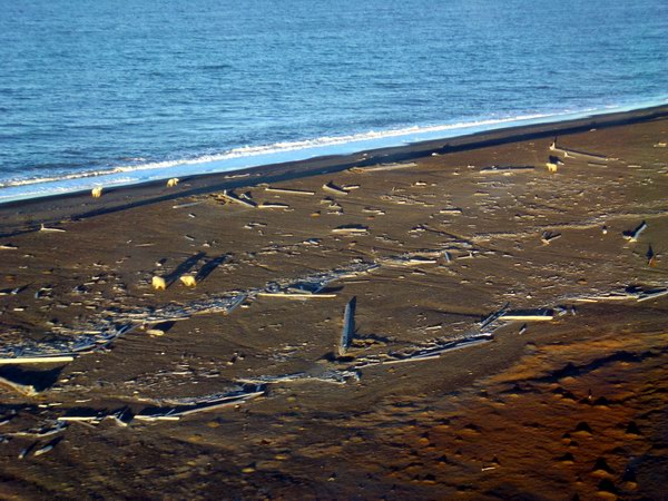
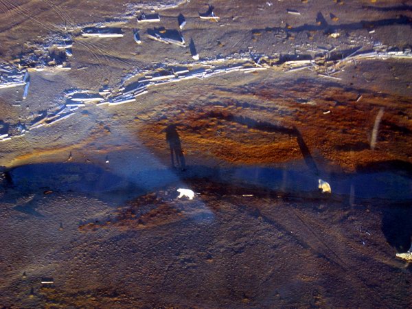
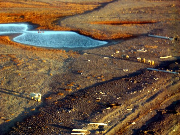
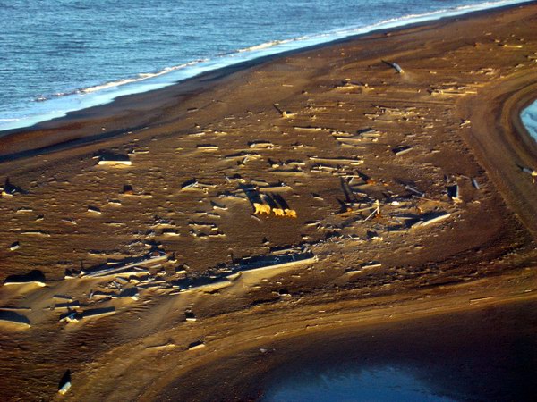
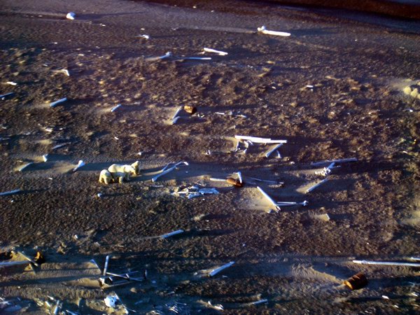
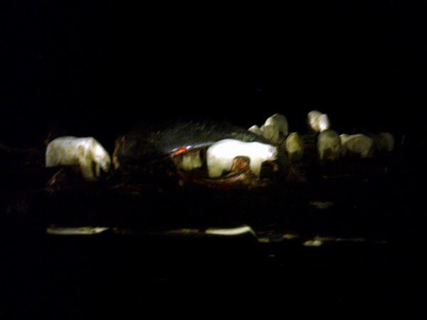
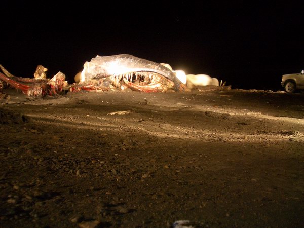
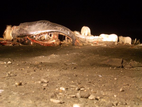
Once done at the lower site, we had a choice. The next major thing I wanted to accomplish was to replace the wind vane that had blown off our mountain site high above camp. However, this is about a 2 hour commitment, because the helicopter cant land there and one has to hike up and back. The winds up high, however, were fairly strong, if the longs wisps of snow flying off of them were any indication. Not feeling terribly well and beginning to run out of daylight, I decided to continue some projects on the lower glacier. So we headed for our lowermost measurement site near the terminus, a tripod that we had constructed last August that had an air temperature sensor, a snow temperature sensor, and two temperature sensors in the ice. To this I added the instrument we had just pulled off the fallen over pole, which has to air temperature sensors. So now we are measuring air temperature at 3 heights, which should give a pretty good measure of the vertical profile over time. It was now getting late, and we headed back to camp one last time to pick up some debris we cached there from August which we couldn’t fit on the last flight out then. With the helicopter loaded up, we headed back to town for dinner and showers. On the way in, we swung around the airport to the spit and found probably 40 or so polar bears sleeping on the beach. They were typically in groups of 2 to 5, and as well as solitary mothers with cubs. Some took no notice of the helicopter, some ran into the ocean in a panic. I had never seen a polar bear before except at the zoo, so it was quite a site. Apparently they sleep and lounge about during the day, and feed on whale during the night. The town had taken a few whales a few weeks earlier, and their carcasses sit a few hundred meters from the end of the runway. This is what draws the bears in from hell knows where and how.
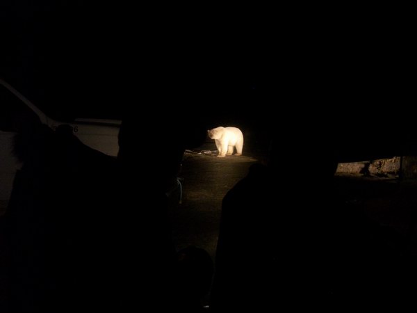
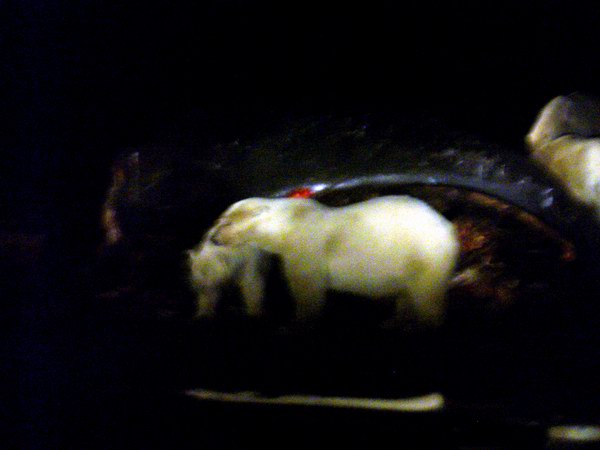
We spent an enjoyable evening in Waldo’s, warming up and filling our stomachs. I backed up our data and tried unsuccessfully to tap into our telemetry network to make sure I hadn’t screwed anything up out there, making me a little nervous, but not enough to do anything about it. Just as we were about to head to bed, Ed and Trevis came in and said that they had just been out to see the polar bears and found more than 20 of them gnawing the whale carcasses. So we headed back out with them to the site.
Having gone from never seeing a polar bear before to standing not more than 10 meters away from 20 of them was quite a switch. I have seen many TV shows about them and heard lots of stories of course, but never really felt like I was missing anything, given how predatory they are. Unlike regular bears, polar bears will stalk and eat humans. These bears, however, barely took any notice of us. They looked up occasionally, growled at each other occasionally, but mostly just stuck their heads inside the carcasses and ate. A brown bear with cubs also showed up and joined the feast. From time to time a new truck would show up, adding more light to the scene, and some of them brought enormous flashlights to spotlight where they wanted. Kids on four wheelers rode up too, stopping not more than 20 feet from the action. I ventured out of the truck from time to time to get a better picture, but my head was always on a swivel, making sure none were coming up behind me. It was a dark night, and outside of the headlights little could be seen, except when one of the floodlights was turned to the side and you realized that the entire beach was crawling with bears. Fortunately most were apparently in a food coma already. It was really a spectacular scene, and one which I wasn’t really prepared for. It took a while for me to figure out how to take pictures in such darkness, and by the time I did many of the bears had been scared off by some kids, who were driving their trucks right up to the carcasses and throwing rocks and cigarette butts at the bears, just for kicks. The week before some of them had shot up one of the cubs with a 22, just wounding it so that it could only use its front legs. The next day, the cub was killed by one of the adults to end its misery, but apparently the mother also had to be shot to get close enough, and so too the second cub, now motherless. There are a lot of contradictions between native propaganda and actual native culture. We got back around midnight and planned a not-too-early start. We had to make a decision in the morning as to whether to return to the glacier or call it quits. I was hoping that the wind might die down and we could put up the wind vane, which was the major task remaining. I also needed to know whether what we did yesterday broke anything new. I got hold of Ken in Fairbanks, and he checked out the data, confirming that everything was still up and running. However, the wind had not died down any, and the relative humidity sensor I replaced also was not working. So we decided to head back in and give it another try. It was another beautiful day, but the increased winds made it feel even chillier the day before. The trouble with the sensor turned out to be quite difficult to diagnose, and after an hour or so we just had to give up. I replaced everything back and forth enough ways to know that it was not the sensors themselves but something either with the program or the datalogger. We headed back into the helicopter to get out of the wind and check a few things on the computer, and learned that the engine was quite cool and just barely started again. To try to do anymore troubleshooting at this point would be fairly time consuming, as I would have to make some structural changes to the program or replace the data logger with a new one, rewiring several dozen connections to it. So I just rewired the instrument to a different port and figured I could change the program using the telemetry network at some later date in a more comfortable environment. So we headed back to Kaktovik.
Once there, we acted through the same dramas as normal, with first there being plenty of room on the plane, then it being overbooked, then finally there were two seats left for us. But for once we didn’t have to leave cargo behind, which felt a little odd. In the end, we said our goodbyes and got home around 7PM, started a fire, ate a little food, watched a little TV, and slept until 10AM the next day, today. Without the focus of a mission and the associated adrenaline rush, my body has rebelled and I’ve spent the day on the couch, sleeping, sorting pictures from the past few months, and writing this. Tonight we’re going to have a Scottish night, as we bought a 10 year old Scotch variety pack at the store a few days before we left and have some Scottish food recipes. I was too sluggish to go out to the movie store for a Scottish movie though, so we’re taking our chances with the TV. Tomorrow, or at least sometime before next May, I should begin the task of unpacking from the last few trips and getting serious about data reduction and organization. Already though, other projects are demanding time and attention, which greatly slows down the process. But things are well underway now with 21st century McCall Glacier research, and I’m confident that it’s all going to work out well in the end. If nothing else, we'll have a good time giving it our best shot.
|
(c) 2003 Matt Nolan. If you find any broken links or other errors, please let me know. Thanks.