Dr. Matt Nolan
455
Duckering Bldg.
Water
and Environmental Research Center
Institute of Northern Engineering
University of Alaska Fairbanks
matt.nolan@uaf.edu
|
|
Dr. Matt Nolan 455
Duckering Bldg. |
|
McCall Glacier IPY Lake El'gygytgyn IPY Virtual Globes IPY
|
03 August 2007, McCall Glacier NOTE: This is Page 2 of the trip log. Click here to return to Page 1. The next morning I called in to Waldos to let them know that the weather here was fine and that we excited to get started with shuttling our equipment and supplies with the helicopter, only to learn that the pilot was still asleep despite the good weather in Kaktovik. This left me quite frustrated, as from previous experience I knew that such windows of good weather on both ends of the trip were rare. And as fate would have it, by the time they got their act together in Kaktovik and launched, the weather had turned sour and the helicopter had to turn back. So rather than completing our 2 or 3 flights in this window, we only got one flight in that day, late in the evening. This occurred after we had been told that they were giving up for the evening, so Bernhard, who was to be an outbound passenger, went for a hike and missed his ride, as there was apparently an issue with the helicopter’s starter so it could not be shut down to wait for him. He made an impressive attempt to get back though, traveling from the lower cirque to camp in less than 30 minutes.
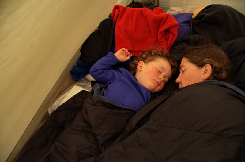
It’s now two days later, and we only had one more load from the helicopter. The fog in Kaktovik has been quite thick, and even the Frontier plane has been unable to land. There’s not much that can be done about the weather, and it is notoriously unfavorable to getting us in and out, which is why we always plan for several days on each side of the trip for such delays. By now both Joey and Bernhard have made it out (and are stuck in Kaktovik due to the lack of Frontier aircraft) and Regine has made it in, so we’ve begun settling in and getting used to a new team. With only part of gear here, we’ve been unable to get any real work done, and having to stay near camp ready to get to our other glaciers with the helicopter also prevents us from the minor tasks we could do out on the glacier here, so we’ve pretty much just been on standby. We’ve made the best of it by organizing the camp, discussing glaciology, and enjoying the company. Turner of course is our main source of entertainment, and he enjoys the attention greatly. His verbal skills have come a long way on the trip, and he now speaks in little sentences and treats us to new observations and connections that only an almost-two-year-old can make. His physical skills have also improved considerably, and though he falls quite a bit on the rocky terrain, he’s good at protecting himself and trying again. Now that he is able to communicate to us better, he is also obviously learning to express himself and delights in the little conversations he can have with us all.
I'll just keep practicing -- 18 MB
06 August 07, McCall Glacier Finally our first real day of field work. We woke up to great weather here on the next day, and I when I made my 7:30AM call into Waldo’s I found the weather was great there as well. When the helicopter landed we learned the issue with the starter still had not been fixed, so we made a plan for her to drop Ken and I off at Okpilak Glacier, and then return to Kaktovik where she would refuel and return to pick us up and conduct some other research. Soon enough we landed without issue at our site and began working, glad to be safe on the ground. We were at the photo site of Ernest Leffingwell’s 1907 photo of the Okpilak Glacier terminus. Here I had planned a 100 year repeat photo, using high resolution gigapixel imaging techniques. As we began exploring the site, I became momentarily panicked that we had landed at the wrong spot, because I could not find the cairn he left that marked his photo spot; I knew that one existed because I had been here a few years earlier. As it turned out, the cairn had fallen off the edge of the small cliff, which had subsided. Looking over the edge we could see clumps of moss and lichen covered rock fallen over the edge. So it would seem that my 2004 photo from this site was the last true repeat photograph, and we were now free to choose another site. I had thought to put the new spot further back from the edge, but the edge was still the best spot to get the downward view, so we crossed our fingers that the slope would remain stable for some time, and in any case migrating the spot a few meters backwards every 20 years doesn’t really detract from the photos themselves. I began with some low resolution panoramas, following the protocols I had developed earlier, such that if the weather turned sour or my camera failed I would still come away with something. Fortunately the weather was nearly perfect for this type of work, with a high overcast that allow for even and steady lighting, albeit not the greatest for artistic or dramatic imagery. The idea here that we take several hundred images which are later stitched together to form one enormous image, and it is important that the exposures remain relatively constant in all of the images during the 30 minutes or so it takes to capture them. I decided to go for the highest resolution possible, using my 200 mm lens, over 180 degrees field of view. This required 42 images per row and about 10 rows, totaling around 400 images. The resolution is good enough to see lichens on the rocks on the other side of the valley, though just barely.
At just about the time we finished up with this, the helicopter returned. I decided to fly to the thickest part of the recently deglaciated moraine, to take another high resolution partial panorama of the unstable slope, both to track its progress over time and to demonstrate the scale of the deglaciation by showing grass in the foreground up to the top of the moraine about 90 m above us. Here even the smallest pebbles were resolved. I think the combination of the two images will go along way towards understanding the changes that have occurred, documenting the current status for future comparisons, and helping explain and reveal the impacts of climate change on the landscape. I had some other repeat and new photo sites in the area, but they were at much more challenging landing sites, and though the pilot probably could have handled it, given the communication and judgment issues we had been having I decided to stick with just aerial photography. Ken had dug up some air photos of tributary glaciers in this area from the 1950s which we sought out. Unfortunately the cloud ceiling was a little too low to get back to the original spots, but still high enough to assess the changes. Afterwards we headed down the Okpilak valley to Okpilak Lake, where I had an air photo from 1958 showing the site of the IGY camp there and the vegetation surrounding it. We found the spot and got I think a good view of it, though it was difficult to assess vegetation change. This is a problem that Ken had described to me previously, and one of the reasons for our panoramic photography on the hike in, where one can get close enough to the vegetation to actually see leaves and branches. But we have to make the best of what older information we have. By this point, we were apparently low on fuel, so we could not get to our last major photo site on west side of Mt Michelson, so we took the scenic route home and photographed snow lines, or the lack thereof, of the glaciers in the area. This has apparently a warm summer in the region, with very little snow remaining on the glaciers here. This is a problem for glaciers, since if there is no snow left at the end of summer, they have no new water to store and gradually will melt away if this happens over many summers. This is a trend that we’ve noticed here over the past 50 years, and our modeling indicates that they all may well disappear in the next 50 years. I also had some other work I wanted to do on McCall Glacier with the helicopter, but again I was in no mood to get into an arm wrestling match while airborne, so we just landed at camp and called it quits. I had a long chat with the pilot with the engine running, trying to get her perspective on all of the inconsistencies in her behavior and decision-making that we had noted over the past few days, but did not come away with a warm fuzzy feeling. Anyway, by lunch time we were back at camp with all of our gear, the helicopter gone, the group in great spirits, and all looking forward to my birthday celebration that night. In the afternoon we did our first shakedown of the GPS surveying. Jason had been working on getting it up and running after it arrived while Ken and I went to Okpilak. We hiked out below camp and surveyed a few poles and a few points of our virtual transect, before heading up to the Upper Cirque. Along the way we found some more C-rations melting out of the ice, dating back to the 1950s. We checked out the crevasse field and discussed our newly funded project that will focus on internal accumulation of ice. Internal accumulation is ice that forms below the surface, when water drips there and refreezes. Most of the work on this focuses on the firn (or accumulation) area, where layers of annual snow pack gradually get buried, but have sufficient porosity for water to drip into and refreeze. But crevasses are potentially another place for water to drip and refreeze, and judging by the number of stalactites, accumulation here seems to be significant. We went on further to weather station and noted that a large stream had formed under one corner of it. There were numerous streams in the area which were incised by 30 cm or more into the ice, something which I had never noted before. The ice surface was also a bit strange, with what seemed to be thick accumulations of superimposed ice, no doubt caused by the previous week of cloudy and rainy weather. We returned about dinner time, where we enjoyed a great Mexican meal complete with margheritas and chips, a birthday cake, and a movie (Airplane).
This morning was a bit rainy and foggy, and none of us were enthused about heading out and getting soaked. Fortunately it cleared in the afternoon, and Regine and Jason headed out for some more surveying. I mostly puttered around and organized all of the work gear. I had the chance to do a test stitch on our Okpilak photo, and found that it was nearly perfect without any fussing around, so I was quite happy, and glad that I had the chance to screw up earlier on less important panoramas. I also downloaded one of the time lapse cameras near camp to find that it had amazingly stayed functional throughout the summer. The images are only 3 megapixels, but still sharp enough to watch ablation occur throughout the summer. Later that night, Ken and I stayed up to watch the most amazing cloud display I had ever seen. I set up the D2xs in timelapse mode to try to capture some of it. Lenticular clouds were actually forming right over the glacier on the eastern ridge of the Upper Cirque, with several other sets of lenticulars forming at various locations over the horizon. The display continued for several hours, and I was quickly filling up 8 GB cards and downloading them to continue shooting. By midnight it was mostly over, and unfortunately the sun was too far behind the clouds to the north to color our local ones, but it really didn’t detract from the spectacularness of display.
10 August 07, McCall Glacier We woke up the next morning to a bit of snow and colder temperatures. The pressure continued to rise, and we had the impression that a cold front was pushing its way into our neighborhood. Ken and I decided to head into the Upper Cirque to do some steam drilling and surveying, so we loaded up the Chariot with all of the gear and headed up the hill. We used wheels on the Chariot, but after getting most of the way there it was clear that skiis would have been a better option. The ice surface was quite lumpy this year, and the glacier ice was covered by a mixture of superimposed ice and slush. The skies had largely cleared by afternoon and the winds were fairly calm, so the steam drilling went smoothly and I was able to download the weather stations and do some minor repairs. Jason and Regine wandered around the lower cirque surveying poles and transects with GPS, and eventually worked their way about halfway down the glacier. We all ended up back at camp about the same time, and once again enjoyed a hearty dinner and lively conversation. That night I also called Bernhard to make sure he found his way home, which he did, but he also told me some disturbing stories about our helicopter pilot while in Kaktovik. Afterwards we discussed our experiences with her and came to a group decision that none of us felt comfortable with using her during our take-out and felt that we needed a different pilot for this.
There wasn’t a cloud in the sky the next morning as we got together for breakfast to discuss our day’s plan. Jason and Regine wanted to finish the surveying, while Ken, Kristin, Turner and I serviced weather stations downglacier. This was Turner’s first adventure on the glacier since arriving at camp, as the weather of the past two days started out poorly and before that we were all pretty much hamstrung in camp waiting for the helicopter. Amazingly given all of the preparations necessary, we were headed out by 10AM and enjoying the beautiful views along the way to the ablation area. I took numerous low resolution panoramas along the way, trying to capture interesting features on the ice and mountains. The surface was still pretty white from the recent snow, so the scenes no doubt will have a touch of winter about them, but the shapes and patterns of the summer’s damage to the ice were nonetheless clear beneath it.
Work on the weather stations went well, facilitated by the nice weather. The main station had apparently been subject to a slush flow or something powerful enough to slide it a bit, so the three of us lifted in back into place while Turner took a nap in the little tent I carry for working out of the elements. We replaced some sensors that were out of calibration and changed batteries in some of the smaller loggers. I took a partial high resolution panorama of the terminus of the Hanging Glacier and its recently exposed moraine. By this time, Jason and Regine had returned from surveying at the terminus, and Kristin and Turner tagged along with them back up to camp while Ken and I continued down the Bur Cirque to repeat some photos from the 1950s.
We eventually found the photo spots and were amazed by the changes we found. Only fifty years ago, the glacier was enormously larger here, damming a lake along its margins. Today that lake is much smaller and separated from the glacier by the moraine the glacier left behind when it shrank. My impression is that the glacier was so much thicker here due to accumulation of snow and ice along the large western wall that borders the glacier. Here there are no moraines, indicating that ice was actively being transferred from the steep wall to the glacier, transporting a distinctive red-colored rock which is now accumulated in the moraine in front of Bur Cirque a few kilometers away. As climate began changing 100 years ago, this accumulation decreased and therefore also the tributary glaciers it fed. This process is continuing today, as each year we can see more and more rock exposed beneath the thin veneers of ice that still cling to the north facing rock walls further upglacier. It is exactly these sorts of processes that repeat photos help us understand, as without them our ability to understand the changes occurring here would be quite limited. Unfortunately we were not able to get the best repeats of the older photos, as a cloud lingered for more than an hour above the Hanging Glacier before we gave up, so we’ll have to return to get a better shot. Once again the weather was spectacular in the morning. Having now finished most of the weather station maintenance, Ken and I headed to the Upper Cirque to repeat some panoramas that Austin Post took on some of the peaks overlooking it. We began with Mt Suki, on the western side of the cirque. As we got higher along the ridge, both of us began questioning whether we wanted to continue to the top, as it was looking a little steep and scary. We stopped about midway along the ridge where I had a photo from the early 1970s, at the site of a survey marker. The changes here over 30 years were also amazing, and without such a photo it would be very difficult to reconstruct the time-scales of change. Here it was clear that there were sizeable glaciers that flowed from the Upper Cirque to the Middle Cirque, and that these lichen-free gullies that we were looking down into were filled with ice not so long along. I stopped at that spot for quite a while to take a 175mm panorama of the Upper Cirque, capturing the recently deglaciated terrain at fairly high resolution. Ken sat patiently out of view while I fumbled with setting and took these several hundred photos. Only after I was finished did I notice that I had messed up one of the settings on the panoramic rig, but I think that it will still stitch ok, as high focal lengths and distant subjects are pretty forgiving in this technique.
After I finished up, Ken began exploring the route ahead of us, mentioning that at any time he was happy to turn around. I was also happy to turn around, but I felt compelled to get to the top and repeat the photo, and visit this peak that I had looked at so many times from camp that it is etched in my memory. As it turned out, the route was not so difficult, with just a couple of spots which required a bit of mixed rock and ice climbing for a few steps. I put on my crampons, and was able to simply walk up the ice here, while Ken struggled a bit more with foot and handholds. I took some quick panoramas and photos along the way, but eventually met Ken at the top. Or at least quite near the top. As it turned out, the photo spot was on a rock that was perched out on a knife edge ridge the dropped probably 1000 feet in each direction into other glaciers. Having gone this far, I could not resist at least trying to reach that rock, since from anywhere else that rock would block a significant part of the scene behind it. There was a narrow, flat step that was just wide enough for my feet to sit comfortably on, though it required stepping over air to get to. Once I was standing there, I suddenly became aware of the perilous nature of my position, and decided once again that mountain peak photography was not a career path I should pursue as my full time job. It was also clear that there was no way I was going to change lenses here, as my white knuckled hands refused to let go of their grip on the rock. As my face was pressed quite close to it, while trying to convince my heart to not explode from beating so fast I had the opportunity to discover that this rock had not been glaciated in a really long time, as it was thickly covered by black lichen, but clearly the ice nearly reached this level from all directions not more than 100 years ago. In fact, the photos we have clearly show ice here only 30 years ago. How Austin managed to take this photo at that time is beyond me, but some people simply have no fear of heights or exposure I guess.
In any case, having reached this point I was determined to take some photos, and Ken patiently handed me what I needed from across the gap. I finally had the chance to put my Gitzo tripod to the test, by pulling the stops that allow the legs to open fully. I was able to find a reasonably stable position for it, but it was clear that I would have to hold on to it to keep it steady. Ken had already attached the Seitz motordrive to the tripod, so all I had to do was attach the camera and set the exposure without falling backwards. This proved to be not too difficult, but as the camera spun around it became clear that there was no way I could out of the picture. Austin, and Berhard after him, must have just sat on this rock and spun around on their butts, or maybe they even stood on it. There was no way I was going to do that, so I just sat there and smiled as the camera spun past me. By this time, Ken had descended a bit to get some other photos, but hustled back up to help extract me. The issue here was that I was a bit more frightened than when I went out, and that I had the camera bag slung around my neck and blocking the view of my feet. So I crawled over the rock a bit and wormed my way closer to Ken, as he leaned over and placed my feet in safe spots. We were both quite glad to get a few meters lower onto the relative safety of the north face. We celebrated our success and soon headed back down to camp, where Jason and Regine had just arrived after finishing the last remaining surveying. Kristin and Turner had also made it back by that point from their investigations of rock transport within supraglacial streams. So, within a few a days of having all of our gear and with the help of decent weather, we had finished most of our core work, and were glad of it.
This morning we slept in a bit to recuperate from the long day. Jason spent most of the day reducing the survey and mass balance data, to ensure that it was done properly and all completed. Ken and Regine headed to the lower cirque to steam drill in a few new poles and enjoy the view from there. I spent most of the day on the satellite phone dealing with a variety of issues, including what to do for our take out. Apparently there was not a lot of support from NSF for us getting a new helicopter pilot, despite our safety concerns. Though I could have pressed the point further, the simplest option appeared to be all of us hiking out and getting a ride with Tom in his fixed wing from the tundra somewhere. Most of us were planning to do this anyway, but Regine has a tight schedule following this field work, needing to catch a once-per-week flight from Fairbanks to Europe soon after returning, and did not bring hiking boots or a tent. We all still had concerns about the gear that we needed to leave behind, and the fact that we were all actively participating in a conversation to determine safeguards that some of this gear would not mysteriously go missing or get dropped from altitude or something similar reinforced to me that it was not just my imagination dreaming up this issues – either we were all delusional or we were all right. So we spent the day considering the options for later discussion and decision making.
Today was also Turner’s 2nd birthday. It’s amazing how far he has come, even just on this trip. He’s really gotten the hang of walking over uneven terrain, whether tussoks or moraine. He still falls quite a bit, but he’s pretty well mastered how to do that without injury, and clearly deliberately bails on occasion when he knows he’s not going to successfully make his next move. His verbal skills have also increased significantly. I don’t know whether its just that time for him, or whether the constant contact with so many adults over the past few weeks has stimulated it, but he’s now having little conversations with everyone and enjoys taking turns doing so amongst us. Fortunately everyone else seems to genuinely enjoy his company, and he’s not treated as just the Nolan’s kid tagging along, but as a real member of the group who’s trying to learn new things just like we are. For his birthday we had the obligatory cake with 2 candles, and he managed to blow them out himself, and enjoyed the small presents we had packed in our gear.
Happy Birthday to You! -- 16 MB
We also discussed a bit about the remainder of the trip. Regine was enthusiastic about hiking out, with the caveat of still catching her plane. This meant pushing up our schedules a bit, leaving tomorrow as the last real full work day before needing to break down the camp and get everything sorted into the right piles to stay here, go with the helicopter, or hike out with us. We decided that it would be required that someone from our logistics contractor accompany the pilot in Kaktovik and helping load the helicopter here, and that this would likely be sufficient to ensure that no major screwups occurred. I had called Waldos earlier in the day to find a suitable landing spot within range of our hiking requirements and check on availability, but Tom was gone over night, no doubt trying to cash in on the beautiful and rare weather to get people where they need to go. But it seemed like we had the beginnings of a workable plan. Though it would have been nice to have more time here, with a day of good weather tomorrow we could finish up our most important tasks, and with another day of good weather we could get most everything packed up in camp. It’s clear that we’re going to have a lot of extra food, as our original plan included Bernhard to stay for the glacier work then later for Art to take his place but neither made it in the end, but at least we’ll have something to eat on the hike out.
12 August 07, McCall Glacier We’re just about ready for the next phase of our adventure. Once again we awoke to great weather, so Ken and I prepared for a day of repeat photography. The first step in this process however, was cleaning the sensor on my camera. With film photography, each picture is exposed on a separate piece of film, which is dragged in front of the camera’s shutter with each picture. With digital photography, the ‘film’ is the same sensor each time. This sensor is fixed at the back of camera, and is therefore subject to the accumulation of dust and debris which finds its way inside the camera, especially when the lens is changed. This accumulation of dust then finds its way onto each picture taken. Glaciers, on their quest to erode their valleys deeper and deeper, create dust which becomes airborne with the wind, seeking a nice place to land, like a camera sensor. So before our day of shooting, we decided to clean the sensor. The camera manual does not offer much help on this, stating that the proper method to clean the sensor is to send the camera back to Nikon. Given that the nearest post office is 60 miles away, we had no choice but to do it ourselves. I had purchased some fancy sensor cleaning tools before I left for the trip, for just this eventuality, but had never actually tried it before for fear of damaging the sensor and thus the camera itself. So we approached the project with great trepidation. We holed up in the work tent, set the camera up on the tripod, took a deep breath, then locked the mirror up and took of the lens to expose the sensor. At the back of the camera, deep inside the body, sat a colorful piece of expensive looking shiny substance which we assumed was the sensor. I removed one of the cleaning swabs from its plastic case, dribbled a little bit of the expensive cleaning solution on it, and gently rubbed it over this piece of electronics that cost more than $4000. The problem with cleaning the sensor is that the debris that sits on it is too small to see by eye. So we put the lens back on and took a picture of the blue sky. By magnifying the image using the viewfinder, we could see that we had indeed been ‘cleaning’ the sensor, but rather than actually cleaning it we had simply moved the dust into new positions. So we repeated the process with a new swab, this time with a bit more force and a few more swipes. After examining a new photo, it seemed that we were making process, but largely were pushing the dust into the corners rather than removing it. After two or three more attempts, we were happy to find that the dust was largely gone and the camera was still functional. We decided to quit while we were ahead and get out on the glacier before the weather changed.
Our first stop after downloading a weather station on the west side of the glacier was a photo spot from the 1970s. As we approached the location we thought it was from, we spied a survey stake mounted in some bedrock along the valley wall, and it became clear that this was the photo spot. We scouted the rocky slope that led to it, and decided on a route which had the smallest boulders, minimizing our chances of being crushed by loose rock. I decided to head up first, and once at a nice place for resting, let Ken come up behind me, so as not to kick rocks onto his head. The problem here was that in the 30 years since this photo was taken that the glacier had thinned considerably, leaving behind an extremely loose set of rocks. Even the route that I had chosen, with its smaller sized boulders, was quite unstable, and as I climbed up it, rocks all around would creak and slide and sometime tumble. I got perhaps about halfway up when I realized that everything around me was moving a bit, and decided that perhaps this was a good enough location for a photo. As I took my camera out, the entire slope around me began sliding, and I decided that perhaps it was best to put my camera away and find something stable to stand on instead, preferably near camp with a margherita in my hand. I turned around and tried walking down, cutting back and forth across the slope so as not to walk in my own fall line, where the rocks liked to follow me. I came to a big rock, and quickly took a handheld panorama, then continued the process of trotting across the slope keeping my eyes on what was coming down behind me, and eventually made it onto the ice, where Ken was waiting. I suggested that it was his turn to try, and he suggested that perhaps we should focus on finding new photo locations for others to repeat.
As we headed down glacier, we followed the meandering stream, which is deeply incised into the ice surface. Jason and Regine were already finished with the last of the steam drilling by this time, and waiting for us to catch up with them at the lower weather stations. On the radio I mentioned we were only 10 minutes away, but I could not resist taking many panoramas on the way down, slowing our progress. The stream was fascinating, with its many twists and turns and 3D swirls. We approached the edge as close as we dared at many locations, to watch the rushing water several meters below us course over waterfalls, through pools, and plunge into holes of unknown depth. The blue skies, dramatic mountains, and hanging ice only added to the beauty and spectacularness of the scenes.
Once at the weather station, we made some final repairs and maintenance attempts, and then headed on to the Bur Cirque to get the repeat photos that were thwarted by clouds a few days before. The cirque itself was comparatively hot to the glacier, being protected from the cold downglacier wind. I was able to not only get the shot we were after, but a high resolution panorama of it. Ken worked on some more creative imagery near the large sandpile left behind as the glacier retreated, and soon we were on to finding our next photo site nearby. The glacier thinning here was really amazing, with the red rock moraine probably more than 50 meters higher than the current ice surface. It was clear that our next set of photos was taken from just downstream of the Bur Cirque entrance, so we began scrambling up the lichen-covered rock to find it. About halfway up, I decided to turn around to establish a new, lower photo site while Ken climbed higher to find the old one. As we began climbing I noticed that the red rock moraine had a bench on it, and as I climbed down to it, I found a flat boulder that looked ideal for a photo site, as it overlooked nearly the entire lower glacier. As I climbed on it, I began to realize that I was not the first to realize this, and discovered that this rock had been used previously as a survey location. As I moved the loose rocks on it, many were underlain by aluminum foil which had apparently been used as markers for air photos, and under one rock was a painted circle which was used to establish the theodolite location. So I set up over this circle, and took another high resolution panorama. By this time, it was late afternoon, and most of the glacier was covered in shadow, but I was happy to get a shot here as I knew that this site was easy to get to, reasonably stable, and that the terminus would move past this site in the next 20 years or so, making it an excellent location for annual repeating. Meanwhile, Ken had scrambled up to the upper site, another old survey location, and repeated that photo. By the time we were finished, it was about 7PM, and we decided to quit while we were ahead and head back to camp where the others were already waiting for dinner.
This was our last full day of work on the glacier. We had accomplished our most important objectives of surveying, mass balance, weather station maintenance, and photo taking, and we were all glad to be a part of it and start moving on to our next phase of the trip. There are always more things that could be done, but given that we know had good reason to believe that we had another 3 years of funding here, and that IPY will last at least another year, we were not too disappointed to begin packing up. We enjoyed another great dinner and the last of our margheritas, and began making plans for the next day.
Regine, Jason, and Ken were up at 5AM to reclimb Mt Suki to catch the early morning light that makes the glaciers look so pretty. The Nolans stayed behind with a radio on, catching up on sleep and enjoying the relative warmth. By the time we got up at 8AM, the others had returned, full of stories and good cheer. The rest of the morning was spent packing gear for our hike, packing gear to be shipped out, and making plans for were to go and when to get there. The weather had changed considerably, with a high overcast and chilly winds, but the rain that threatened us nearly all day never came, and we made good progress with our packing. Ken and I made some final panoramas near camp, as the final boxes were sealed up and cached, and we enjoyed dinner and a movie on our last night at camp. Tomorrow we break down the tents, cache them provided it doesn’t rain on us tonight, and head downglacier for a week of hiking and exploration.
21 August 2007, Kaktovik That night it rained of course, soaking the tents. The rain continued throughout the day, and we opted to stay at camp rather than try to leave. We were leaving several days ahead of schedule, just so that we had time to wait out bad weather if needed, and it seemed much nicer to wait in a nice big tent where we all could gather, rather than huddle in small backpacking tents away from our luxuries. The general idea for the hike was that we would first find a close spot for Regine to fly out of, then Ken and Jason would hike and pack raft back to Kaktovik, and Kristin, Turner and I would spend a few days day hiking on our own and get flown out early the next week. So we had some flexibility in leaving, though I had hoped to leave earlier so that we could spend a day or two near the terminus to help plan out the next field season.
It continued to rain on and off throughout the next night, but by mid morning the sun was peeking out, so we made the final preparations for our hike and broke down the camp. Another hour of real sunshine and we probably could have dried everything completely, but the occasional sprinkle and threatening storm steered us into packing the tents up for return to Fairbanks where they could be dried completely and returned the next year. We prepared a cache for gear that would be flown out on the helicopter, and made a thorough list of what was there to ensure nothing got left behind. Once everything was covered and securely rocked down, we headed down the hill with our backpacks and said goodbye to our home of the past 10 days or so.
Fog covered most of the lower glacier, and we walked along in our own white bubble down past the weather stations and stakes that would stay behind to give us some indication of what happened over the winter. The ice on the lower part of the glacier was fairly treacherous, with freezing rain and fog coating the glacier ice and making it quite slick. I wished I had brought a pair of creepers for Kristin to help with her footing, as even the rest of us were having trouble keeping upright. But slowly, with lots of little half-steps and keeping close to rocks, we made our way to the terminus. Here we were faced with the same choice as on the way up – whether to ford the stream or skirt close the valley wall with its huge unstable rocks. Regine and Ken opted for the wall, while the rest of us crossed the stream. It was much lower than on our way up, but still a little intimidating. Jason crossed first and dropped his pack, then poked around for a shallow spot for us, and the three of us crossed together, bracing each other. It being close to dinner time, we camped at our now familiar spot just a few hundred meters away, which was under 50 meters of ice 50 years ago. We ate some of boil-a-bag meals cooked in Fairbanks, since we had a bunch leftover, so we slept with full stomachs and wet feet.
Turner likes cheese and bread -- 10 MB The next morning the weather was a little nicer, though still a bit foggy and not suitable for the repeat photography I was hoping to do. I did scramble around little looking for a photo site I hadn’t previously found, and got pretty close to it, so next year I should be able to zoom in pretty quickly and find it exactly. This morning would be the crux of the hike, crossing over the slippery rocks above the natural wier of the river that we have to go around. Jason led the way, with Kristin behind him, and me behind her, such that there was always one of us to brace her and Turner over the treacherous footing. Everyone was slipping and I was much relieved when we got past it without incident. If not for that section of a mile or so, the hike to the glacier would hardly be stressful at all.
Once back down on river level again, our pace improved considerably. No longer did we have to place one foot in front of the other and wedge it into stability, we could more or less walk normally. The terrain continued to improve, as the river rocks gradually led to longer and longer patches of tundra, which led into established caribou trails. There was still the occasional scramble around a cut bank or other obstacle, but these were fairly limited in extent. Soon we were past Jaeger pass and in site of our first camping site within the valley from the trip in. We opted to bypass this and get out to the Jago River for psychological lift. Unfortunately, the weather had deteriorated, and by the time we reached the river, we were in freezing rain which was not conducive to a leisurely dinner outdoors. The goal of the next day was to locate the air strip Walt had told us about, which was only a few miles from our campsite. We got an early start in pretty good weather, and began hiking in good spirits. We crossed a long tussock field which we had all blocked from our memory on the way in, and eventually got to the broad plain in front of Jago Lake which promised to be a good landing spot. Our goal was to find more than 200 meters of level, flat terrain with a minimum of shrubs and rocks. Jason, Ken and I wander around for a while scoping out the possibilities and eventually found a likely candidate. Walt had said that the strip was marked by some caribou antlers, but of course there were antlers everywhere so this was of little help. But we used the GPS to measure out a strip of about the right length, and used stuff sacks to mark it out. We called in to Waldos to let them know we were ready, then let Turner entertain us while waiting for the plane to show up.
The cloud ceiling was not very high, and didn’t improved much during the day. It was reasonably warm and with little wind, so it was reasonably comfortable to sit outside. Tom was having a busy day with flying, and by seven oclock was pretty beat and not in mood to scope out a new site in marginal conditions, so we set up the tents and made a small fire on the river bank with dead willows. It was a pleasant evening, and we went to bed looking forward to the next day.
We awoke to a bit of fog, but it quickly burned off as the sun rose. By the time Frontier flew over around 10:30, we could clearly see the mountains beneath a high overcast. We passed on a message through them that it was good weather for both the helicopter coming to take our equipment from the glacier and the airplane coming to take Regine to civilization, and began making some plans. The general idea was that once Regine was gone, that Jason and Ken would hike to Bitty doing a bit more vegetation work then packraft out to Kaktovik. Kristin, Turner and I would stay at Jago Lake for the next few days, so that I could continue to document the region through panoramic photography, as this was an interesting transitional area between moraines of different ages. A little after 11 the helicopter flew over, and a short time later it flew back with our skiis attached to the skids and presumably a load of our stuff inside. I kept the Icom on to communicate with Tom once he came in with the plane, but we never saw him. However, I could hear him talking with the helicopter pilot, and understood why. The pilot told Tom that she had trouble getting in beneath a small fog bank to the south. What she didn’t say was that this fog bank was only a few hundred feet high and that there was 8000 feet of clear sky above it and that Tom could easily go over, the same as other planes which were currently landing further up the river. Tom therefore decided to see whether conditions would improve here and left to take care of some other flying in the meantime. I called in to Waldos to let them no that this fog bank was no issue, but Tom was already gone for the afternoon. By the time he returned around dinner time, the weather in Kaktovik and our location had deteriorated and we had to call it quits for another night.
By this time Regine was starting to get anxious about leaving. She was hoping to catch an earlier flight home so that she could prepare for a conference she was putting on in Austria the next week. As it turned out, the weather in Kaktovik was poor enough that even Frontier couldn’t land by 5PM, so she wouldn’t have made it home even if she had got out this day. But nonetheless it was clear that the wheels were turning in her head about all of the options and making her wonder about tomorrow’s flight and what would happen if she missed that.
As it turned out, we had another nice day, though a bit cooler and windier, but early that morning Tom’s plane lost its alternator. They quickly organized a replacement, which was due in on the 4:30PM flight, but this meant that there was no way for Regine to make that flight, and it being Saturday, it further meant that she would be stuck in Kaktovik until at least Monday night. So we had the afternoon to fool around a bit, which was nice. I took a few pictures, Jason and Ken explored a bit, Kristin and Turner found ways to make toys out of just about everything, and Regine slept, trying to stay calm about the situation. At 4:30 Kristin and I listened in on the radio and learned that Frontier once again could not land at Kaktovik and were headed back to Fairbanks, presumably with our alternator. We joked about it with them as they flew overhead, and Walt in Kaktovik overheard this and explained that in anticipation of them not being able to land, they had the alternator pulled off the plane and left it in Deadhorse, where Tom was now headed after charging up his battery manually. So we shared our news with the others, and made some dinner and new plans. While we had plenty of food, we didn’t really have plenty to continue with our trip as planned. Jason and Ken needed a few days’ worth for their part of the trip once we split up, and they were having to dig into that now; they decided not to leave us, partly to help in case of problems and partly because it would be quite a squeeze for Regine to sleep in our tent. Regine had only planned on a few days food since she had intended to leave by now. The Nolans had planned for another 5 days or so, but with sharing tonight and possibility another night or two, that also would get consumed by the larger group eating on it. So it seemed that if we were here much longer, that we would all have to go out by plane, or have more food brought in. Turner trying to cook -- 13 MB
Sunday also came and went with no airplane visits. It turned out that the alternator in Deadhorse was not the right type, so another had to be flown up from Anchorage or Fairbanks to Deadhorse. Several attempts at this were apparently made during the day, but a variety of screwups and weekend casualties prevented it from working out. The group mood seemed to shift with the weather, which was warm and sunny in the morning but cooler and windier in the afternoon. Regine was started to burst from the seems seeking more information, rehashing every decision, and waiting for other planes to fly overhead so that she could hitchhike a ride. Nearly all of the news we learned during the day was bad for her, and I gradually grew shy of sharing it. The next morning, when the promised alternator was definitely to be on the morning flight to Deadhorse, I could tell that Walt felt the same way and was not telling me the whole truth about the latest troubles that morning. But in any case, whatever the trouble, it was surmounted and Tom was back in business by lunch time. The weather on our end was pretty good, with clear skies above and a brisk headwind on the runway, and by 2PM or so he flew over and checked us out. Fortunately he liked the spot well enough to give it a try, and once landed he declared it a great landing site and we were all much relieved, especially Regine who had an enormous smile and was standing ready with her backpack on before Tom turned off the engine.
As the others flew away, Kristin, Turner and I began packing our own gear and getting ready to leave. Turner didn’t have much of a nap that afternoon with all of the excitement, so he was uncharacteristically fussy and grumpy and quickly passed out in his mother’s arms once the plane was gone. I broke down the tent and consolidated our stuff, as well as dug into some food rations that Merlyn had sent in – I was amazed how good potato chips could taste. I hadn’t been eating lunches or snacks much over the past few days just in case we had an extended stay here, and the fat and oils in the chips was simply addicting. Anyway, apparently the caribou thought so too, as about this time a small herd of about 75 crossed our runway on their way to the river. I stalked them a bit with my camera and took a few shots, but they were mostly in a hurry and headed across the river and up and over the moraine on the other side. Tom came in about then and took the three of us back to Kaktovik. Our hike was over.
27 August 2007, Fairbanks Kaktovik and its residents were of course by now quite familiar to us. We had the hotel mostly to ourselves, except for a few hunters Tom brought in that would rather have gotten a seat on the full Frontier flight that left with Jason, Ken and Regine. It was nice relaxing there, though it was still several hours before I was able to get a shower. It was clear after removing a month of grime that I had lost a noticeable amount of weight, though I was quickly gaining it back via an irresistible urge to eat potato chips and multiple bacon-cheeseburger orders. Turner was also enjoying the new food choices, as well as the attention of a new group of adults. It was clear that he too had changed physically on the trip, not necessarily in weight but in strength and dexterity. He now had no problems heading out the door, going down the steps, climbing onto the picnic tables, etc. We all also had the chance to catch up with our friends, since this was the first time we stayed overnight this year. The kids brought their younger siblings that we had watched grow up from babies, and Turner was now old enough to appreciate their existence. He has grown remarkably gentle with babies, where ‘baby’ is defined by him as anyone his size or smaller. He seems more mature in many other ways too, though hard to describe. He was able to overcome his fear of helicopters (while perhaps ironically mine have increased) and now ‘choppa’ is one of his favorite words and toys. Here's what Turner wants to watch all the time; here's what I want for our next field trip. The fact that he seemed to have no issues with such a dramatic change in routine or make friends with such a diverse group of folks speaks to his maturity in dealing with change. It also reminds me a bit about how our preconceptions about children should be raised taint our perspectives – when it comes down to it, modern civilized child-rearing is really the anomaly since the vast majority of human children since our species began were raised on the backs of their mommas as they traveled through the wilderness. In any case, it is clear to Kristin and I that we were exceptionally lucky to have been blessed with a child that is so accommodating of our lifestyles. Once Frontier learned that Kristin was back near civilization, they convinced her to head back to begin flying right away. So after a morning of sorting and arranging gear and several bags of potato chips, she and Turner got strapped into the jump seat of the cargo plane and headed back to Fairbanks, leaving me behind. I probably could have got a seat on the passenger plane later that evening, but I wanted to hang around for a few days in case we had some exceptionally good weather for aerial photography. It was clear enough this day, but the winds were quite strong and Tom had spent the day fighting them to catch up on the backlog created by his alternator issues. So we hung out that night and had a nice steak dinner to keep the potato chips company. The next morning the winds had died down to nothing but the skies remain crystal clear. There was some hesitation at first regarding Tom’s scheduling, as the original plan was for him to pick a few folks up further west, but they didn’t call in and I was ready to go, so headed down to the runway to get going. Tom pulled the door off of his plane to give me more room to shoot out of, and flipped the seat around so that I was facing the rear. This arrangement worked really well, as I was able to get a really clear field of view without getting buffeted by the wind. Generally speaking I’m not much for heights, but being strapped in securely left me feeling quite comfortable, and I was able to stretch out my legs fully and shoot from a stable position with no feeling of imminent freefalls. The fact that the air was so calm no doubt enhance the experience further, and after few hours and about 1500 pictures, I was thinking seriously about buying a plane and doing a lot more of this. Tom was also a great pilot to have for this, as he understood what was going on photographically and could position the plane in the right locations with a minimum of communication. For example, I had some repeat photos to find, and once we got in the area it was simpler to just give him the photo to line up, leaving me to take the pictures. Once that was finished the repeats, the major objective was to document both the late summer snow lines and the state of the glaciers. This was the first time I had tried this with a serious camera, and generally speaking I was pretty happy with the results. The time of day wasn’t necessarily the best for this, and I think a high overcast would have improved the result a little, but it was a great experience and I learned a few tricks that will help the next time I think.
With that work out of the way, I decided it was time to head home. Most of our gear had already made it back to Fairbanks on the cargo plane the day before, so it was just my own stuff that needed packing. But of course I wanted to back up my photos and give some of my timelapse photos to Art, and this took quite some time due to slow download speeds on my equipment. But with the usual mad scramble at the end, we made it down to the runway about the same time as the plane landed, and within a few minutes I was on my way home. Kristin was already back at work, so we had arranged things such that I would pick up Turner at Shawna’s. Hayden was glad he was back in town, and Shawna remarked at how much he had changed in the past month. It was clear that he was a little boy now, and though he still has a way to go with talking, he was clearly communicating with Hayden and they were able to have some little adventures together. They gave each other a hug and a kiss as we left, and it reminded me that I think a big part of his sweetness with other kids is based on his growing up with Hayden as a friendly big brother. The next fews days were a blur of unpacking, sorting and cleaning. I avoided checking my emails until Sunday, a few days later, and was pleasantly surprised to find less than 1000 waiting for me. More than half of these were easily sorted and deleted and within a few hours I had them reduced to the 100 or so that actually needed some response from me. I also spent a few hours backing up and sifting through my photos, and learned that I had taken 18,032 of them on this trip, totaling just under 150 gigabytes. I stitched a few panoramas to relieve my anxiety about whether any of the hundreds of panoramas I took would actually work, and found that while it may take a while that I should have some good results. It was also nice spending some time with Turner over the weekend, because even though we had just spent the past month together, I was not giving him my full attention as much as I wanted to. So we spent a lot of time at the park on the slides (‘wees’) or at Creamer’s Field watching the geese and cranes (‘big big tweet-tweets’) practice their touch-and-go’s. One of the refreshing things about Fairbanks is that even though it’s a big enough town to remain anonymous in if you want to, it’s also small enough that you can go to nearly any common gathering place and bump into friends. So I was able to catch up with a few folks and share a few stories from our summer adventures.
Now it’s more or less back to regular Fairbanks life, though I feel a bit changed by this trip, more so than the others. One of the things that I had been missing on most of our previous expeditions was any sense I was part of an adventure. This is of course by design, as somehow to me by definition if your expedition contains adventure then you didn’t plan well enough. The dictionary defines adventure as a hazardous undertaking with uncertain outcome. But to me, this is misleading. I think of adventure as an undertaking with a clear outcome but an uncertain path; whether it's hazardous or not is not so important. In a trip to install a weather station with helicopter support, there should be no doubt regarding the success of the outcome or how to get there, but when hiking for a week across trail-less wilderness to seek out the impacts of ptarmigan browsing on willows or assess the relative stability of moraines of different ages, the outcome is far from certain given our level of logistical resource and the plan of how to get there is quite flexible by design. The latter is bound to posses adventure, but the former hopefully not. Having been a glaciologist for so long, the tundra and vegetation came to represent that green stuff you have to pass through or over to get to the ice, because our plans do not allow for any time spent doing anything but studying the ice. But the diversity of interesting things going on there gets completely overlooked in that case, and perhaps more importantly its much harder to develop a personal connection with the region, since the currently glaciated areas are only a tiny fraction of the total. For some reason, hiking through it and having to exert a fair amount of energy and expertise to moving forward results in some sense of shared adversity with the landscape. Even the simple act of catching your breath and easing the pain of your backpack by bending over to rest on your ski pole here can result in interesting ‘discoveries’, such as finding a wooly caterpillar or a grasshopper nearly perfectly camouflaged with its environment. And to learn completely unexpected things, like the influence of the small ptarmigan on willow growth over the entire landscape or that massive numbers of caribou have tried and failed to go up and over side valleys of McCall Creek valley, just adds to the excitement and novelty of the situation, which in turn lead to a better appreciation of, interest in, and commitment to the region itself. Likewise on the glacier, the process of taking the time to find old photo sites or to locate new ones, slows down the pace of life enough that I can better appreciate the evolution of the dynamics responsible for past and future change. With blitzkrieg missions to install or download or grab some thing, there simply isnt opportunity for enough serendipity to encourage good science, largely because the plans to do so is not flexible enough to accomodate adventures with uncertain paths or outcomes. As much as anything, perhaps it is also the absence of civilized distractions and the pleasure of traveling and living with a small group of people that create a new state of mind that allows a new set of ideas and hypotheses to have room to grow, or the simple act of lying down on the tundra to drink directly from a spring that touches something simple and primeval, some part of the brain that we forget we still have yet likely underlies nearly all of our actions. In any case, I was sad to leave and it became clear to me that anyone who wishes to have what scientists call a ‘systems view’ of the arctic simply has to spend time living in the arctic, and not in a town or village, but out in the landscape, as part of the landscape, where the flow of matter and energy is not just measured but experienced. All that may sound a bit New Age, but its clear to me that a Campbell datalogger or a statistically-based sampling of vegetation conceived in an office are not a substitute for human experience or exploration, but this is the direction that our limited funding, other job commitments, and our peer-reviewers tend to push us as scientists. That is, it’s nearly impossible to be funded to spend six months or a year living and working remotely here, and I’d bet most remote field trips last less than a week for most scientists here. Thus while advances in logistics make shorter trips a possibility, this does not necessarily improve the science being conducted because the limited time available on these trips is pre-allocated for existing scientific goals. I shudder to think what we are missing by 'saving' all that time with 'better' logistics. Worse, the pressure to ‘succeed’ on such trips leans towards a tendency of finding what you’re looking for even if its not really there. While dataloggers can fill some gaps between trips, in the simplest terms, dataloggers simply have no capacity to record adventure, to make the serendipitous discoveries it may lead to, or to feel the commitment to place that comes along with those abilities. And it seems to me now that these are necessary components of a successful scientific process here, where success is defined not just by writing a peer-reviewed paper but by creating an understanding of the dynamics here that is actually used to prevent political blunders. It seems to me that the challenge for polar scientists at this point are to turn the tables on our lifestyle, pushing the balance back towards spending more of our lives in the field and taking those blitzkreig missions to come to town for a week or two per year, rather than shrinking our field seasons further to accomodate more time spent writing emails or filling out paperwork. From my perspective, an important obstacle towards this means not having to choose between being in the field and being with my family, and I suspect the same is true for many other folks. Along similar lines, I've thought a bit about the connections between art, science, and adventure. Both art and science share the challenge of the unknown, to make things clear that were not clear before, and in that sense have the attributes of an adventure. Both can share attributes of beauty and elegance as well, both on the technical and aesthetic sides, and both are very personal in the sense that it takes a special person with a special commitment to succeed or even attempt much of what's being done. But for the most part, we tend to think of these things as being very different and typified by very different personalities. When I first started getting into photography, less than a year ago, the first books I read were written by Ansel Adams. These were not picture books, but technique books, and from them I learned that he was as much of a scientist as any scientist I know, at least in the sense that he took a very scientific approach to understanding his equipment, more so than any photographer I have met or other book I have read. From the other side, it's a bit harder to find scientists that are artists, I think not because they dont exists but more because their venues -- journal papers and scientific meetings -- are lacking in a means to convey the aesthetic qualities of their work, especially to non-specialists. And here I mean that many scientists posses a technical artistry, an ability to elegantly make transitions in knowledge but without the artistic quality of these transition being evaluated or appreciated in artistic terms that most people can understand. Show someone a nice picture and they might remark "Oh, you must have a nice camera", not really understanding the effort it took to take that nice picture had more to do with the photographer than then equipment, but show someone output from a finite element flow model and they will likely be unable to appreciate output or the artistry that went into it. So, I've come to think of the type of photography that I'm trying to do as collecting photographic data. Data where its artistic value can be appreciated without necessarily understanding its full scientific value. Conversely, I hope it is data where its scientific value can be appreciate without understanding (or being turned off by) its artistic value. From the acquisition side, panoramic photography gives me the opportunity to sink my teeth into a challenge that is both technically and artistically rich in a field which is wide open for exploiting its scientific potential in new ways. And succeeding here requires spending more time exploring the secrets of the landscape through human experience, rather than relying on dataloggers or satellites, which I find appealing and hope to encourage others to agree with. Just as with time spent in the field, I think the balance needs to be shifted a bit back towards appreciating the qualitative aspects of science to provide better context for the quantitative aspects. Perhaps some of the best news I received after our return is that the next phase of this project has been funded. We had rumors to this effect before we left, but now it seems official. Fortunately I think the goals of this project are well-timed with my own interests, in that the project seeks to better understand the role of changing glaciers within the arctic landscape and ecosystems of Alaska. So we have lots of hiking and river trips to look forward to in addition to the glaciology, where hopefully the combination of good company, good conversation, and good adventure will combine to stimulate new and timely discoveries about this fascinating, and quickly changing, region of the world.
|
(c) 2003 Matt Nolan. If you find any broken links or other errors, please let me know. Thanks.