Dr. Matt Nolan
455
Duckering Bldg.
Water
and Environmental Research Center
Institute of Northern Engineering
University of Alaska Fairbanks
matt.nolan@uaf.edu
|
|
Dr. Matt Nolan 455
Duckering Bldg. |
|
McCall Glacier IPY Lake El'gygytgyn IPY Virtual Globes IPY
|
03 Aug 07, McCall Glacier
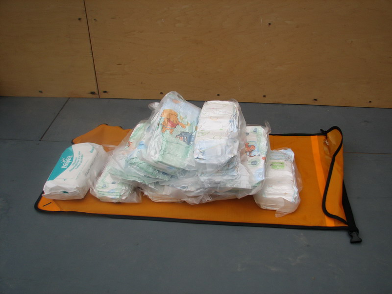
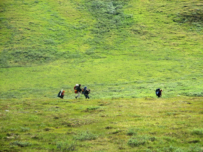
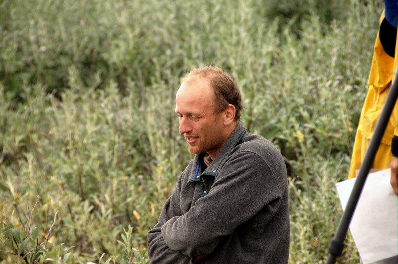
The first phase of our trip is over, and we are slowly transitioning into the second. About two weeks ago, we began a nine day, 50 kilometer backpacking trip from the coastal plain of the Arctic National Wildlife Refuge south to the mountains where McCall Glacier is located. The primary scientific goal of this hike was to understand the role that changes in glacier ice storage play in local hydrology and to document their landcover impacts through panoramic photography, both to capture the spatial transitions that occur across our route as well as the temporal changes that may occur over the next 50 years. This effort was a contribution to the 4th International Polar Year, so we planned to repeat many photographs taken during the 3rd IPY 50 years ago as well as lay the foundations for similar efforts 50 years from now. Thus in addition to 9 days of food, fuel, diapers, and other supplies for camping, we carried 20 pounds of digital camera equipment, including camera bodies, lenses, tripods, computers, and backup hard disks. Now that the hike is over, we have about two weeks of glacier field work to do, followed by another hike out. The trip began, as many do, with a variety of logistical problems, largely to do with coordinating the busy schedules of all involved and getting us all in the same spot at the same time to begin the hike. Perhaps the most interesting difficulties had to do with Ken Tape, a graduate student focusing on vegetation changes in the Arctic. Though he lives in Fairbanks, he had to fly directly from his brother’s wedding in Wisconsin to Kaktovik, a coastal village in the Arctic where our trip really begins. Unfortunately the plane he originally boarded in Seattle had to turn around mid-flight due to mechanical problems. While they didn’t get to ride the slide down to the tarmac, they were nonetheless greeted by a variety of emergency vehicles and a ticket agent who informed them that they had also missed the last flight of the night to Alaska. So when we showed up to the Fairbanks airport to board our plane to Kaktovik, Ken was no where to be found, and though we held the plane for as long as we could, we had to leave without him not knowing what had happened or how this would affect the rest of the trip.
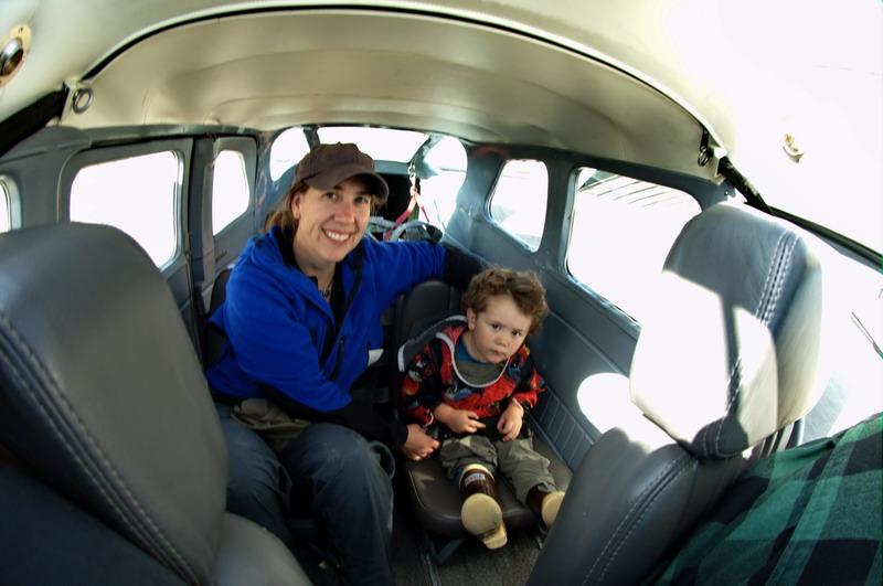
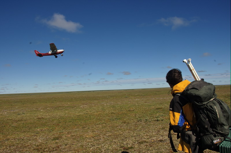
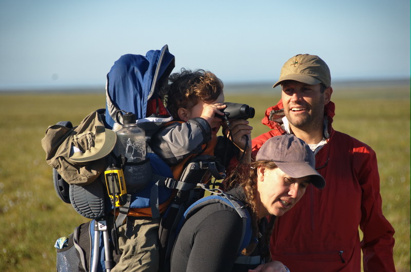
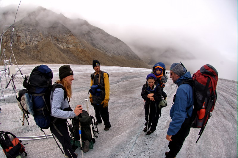
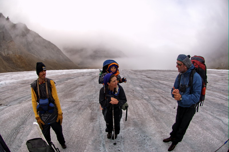
When we arrived in Kaktovik, we were met by Jason Geck, a graduate student working with me on glacier studies in the Arctic, and Joey Williams, a school teacher in Anchorage interested in integrating arctic studies into her classroom. The weather was great and we were all excited to get started, but still had no word from Ken. Given the rare break in the weather, we had no choice but to proceed as if he would not join us, and so began repacking our food and sorting out a new plan. The bush plane we used could hold 3 people per load, and I had budgeted one flight for myself and the two grad students Jason and Ken, and through personal funds one flight for my son Turner and wife Kristin, which would also take Joey and Bernhard Rabus. Bernhard did his PhD thesis work on this glacier 10 years ago and, like me, had never had much opportunity to spend time in the coastal plain and foothills below the glacier to better understand how these glaciers fit into the broader context of the arctic ecosystems and its dynamics, and so was excited to join our expedition. The original plan was for him to join us on the entire trip, but other logistical issues limited his participation to the hike in. Kristin and I have been studying glaciers in this region for five years now, and have recently been joined by Turner on several of these trips. The trip could certainly be done with just the five and half of us, but without Ken we not only lost his company but his expertise in vegetation and ecosystem dynamics. Fortunately I was able to reach Ken at his cabin before we departed. He explained his ordeal, and we made a tentative plan to unite again. The main issue was that there is only one flight per day to Kaktovik, and it is often full, as we learned it was the next day. So he planned to get to the airport at 5AM, which is the earliest the ticket agents show up, so that he could be the first standby passenger in case a seat opened up. In the event that he made it, we would remain near the airstrip on the tundra where our hike would begin, and I lined up some extra funding to get him there. As things worked out, his bags didn’t show up until 1AM that morning, leading to some frantic repacking and essentially two days without sleep, but he made it onto the plane to Katkovik and the weather held out enough for his flight to reach our first camping spot; that both of these planets aligned was a minor miracle. So, though a day later than expected, we were all together and ready to begin our trip to the mountains.
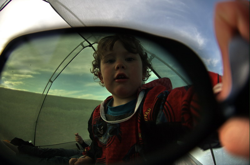
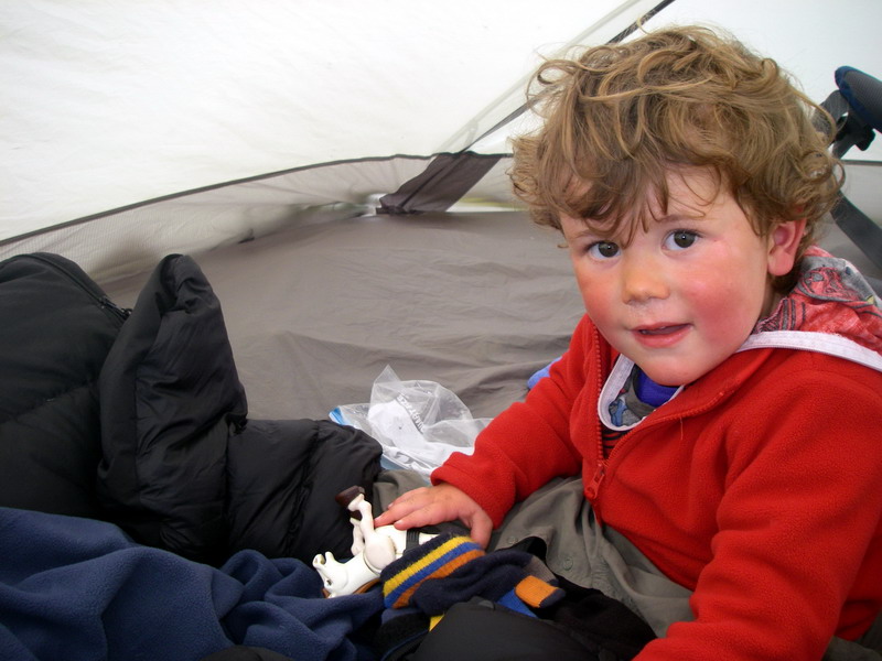
Have finger puppets will travel -- 10 MB
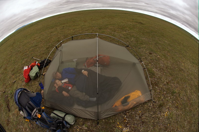
The first evening out before Ken arrived was a pleasant one. We landed at the “Bitty” strip, which was really just a patch of tundra that you would otherwise not recognize as a landing site, except for a few old fuel barrels abandoned nearby. There was a slight breeze, so the mosquitos were quite tolerable. The ground was remarkably dry, which is surprising for tundra like this. We found a nice camping spot not far away, not really knowing whether Ken would make it in the next day, and set up our tents and began working out a system for cooking and eating. It was a beautiful evening and we were all glad of the rest, especially me. I had not had any sleep in 36 hours due to all of the preparations, not just for our hiking trip, but for the glacier field work that would follow.
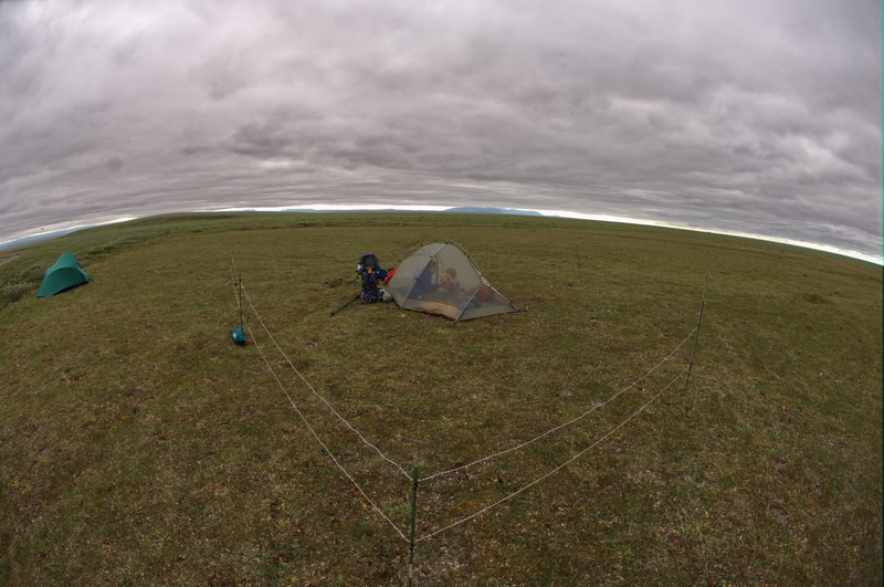
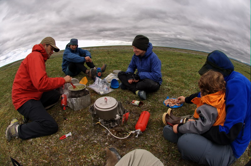
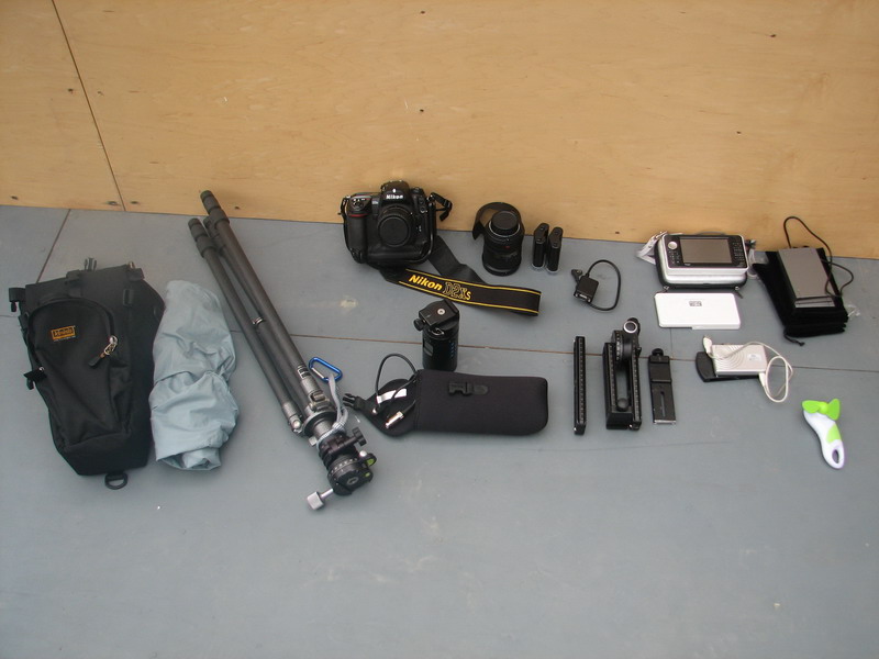
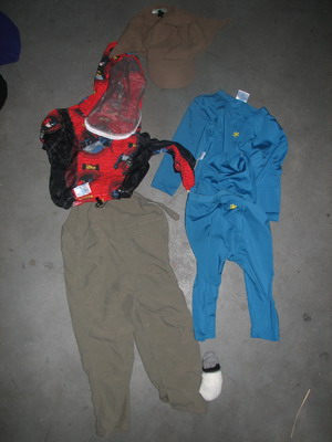
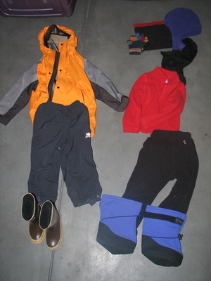
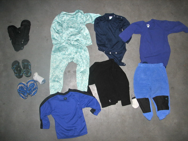
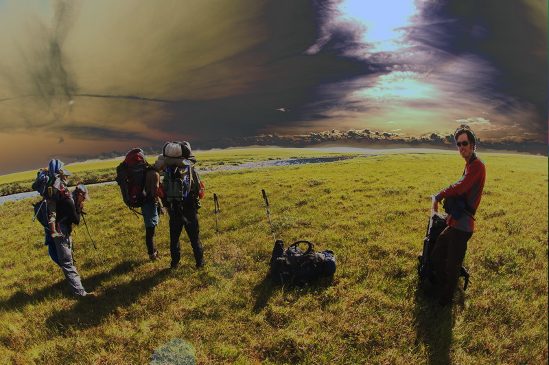
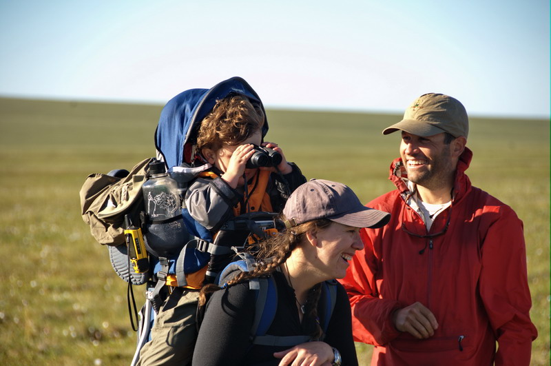
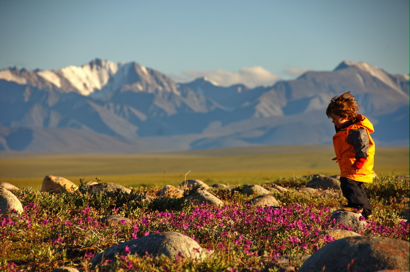
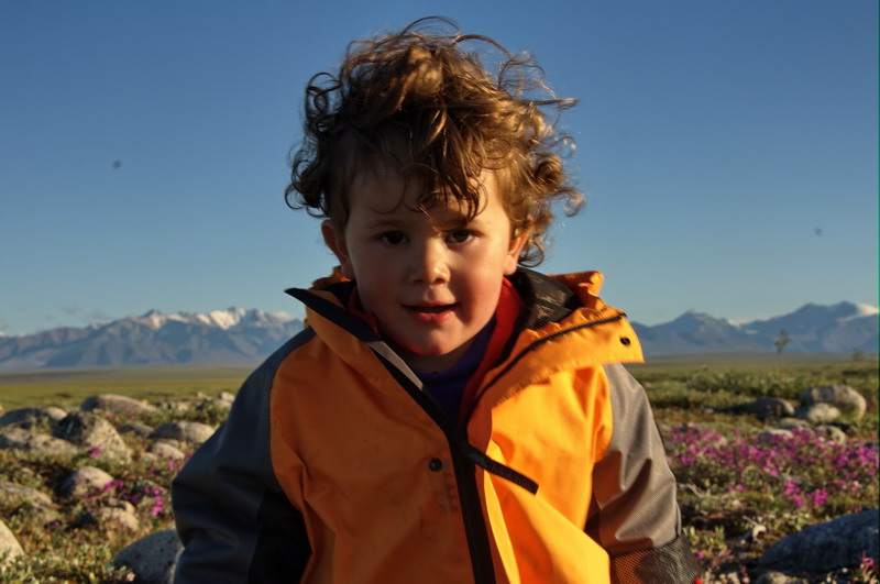
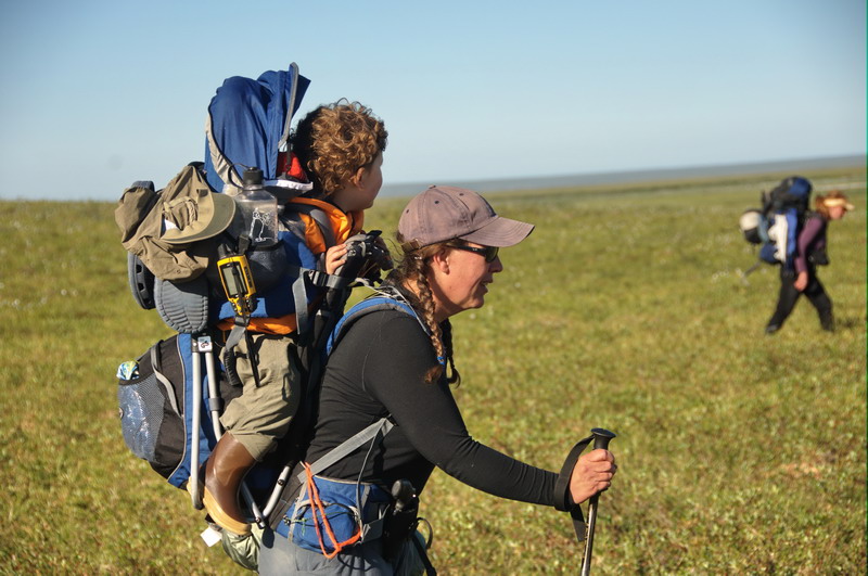
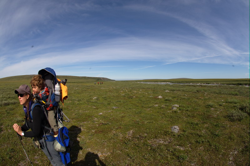
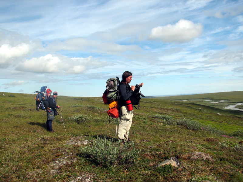
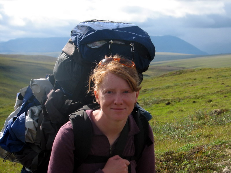
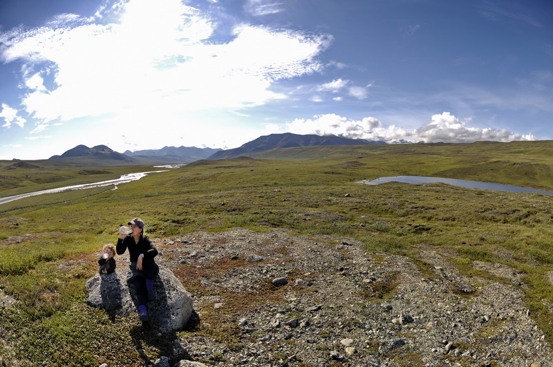
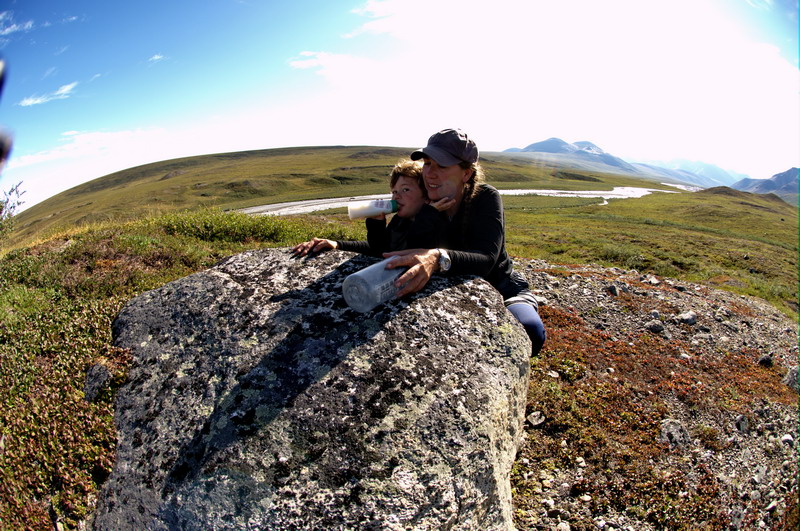
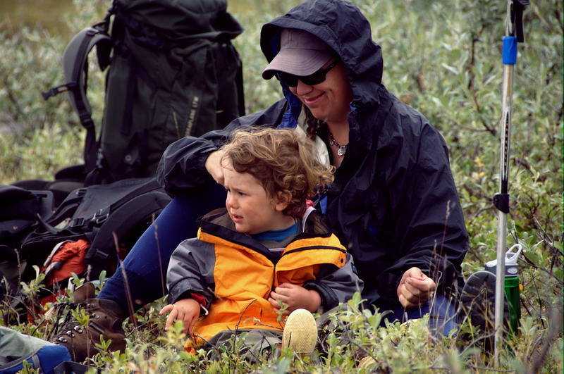
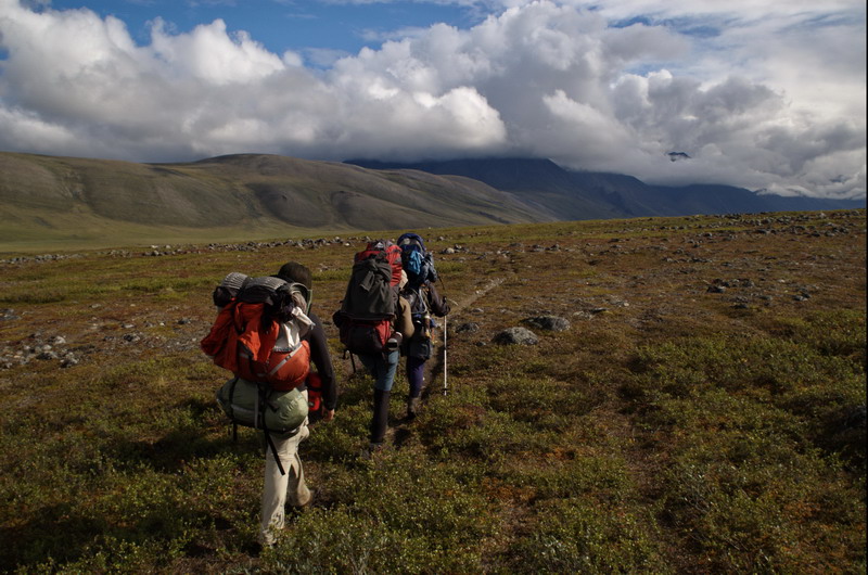
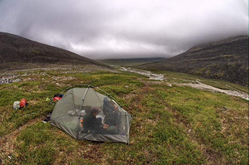
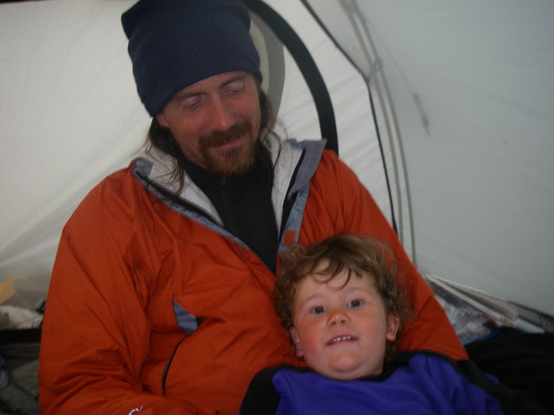
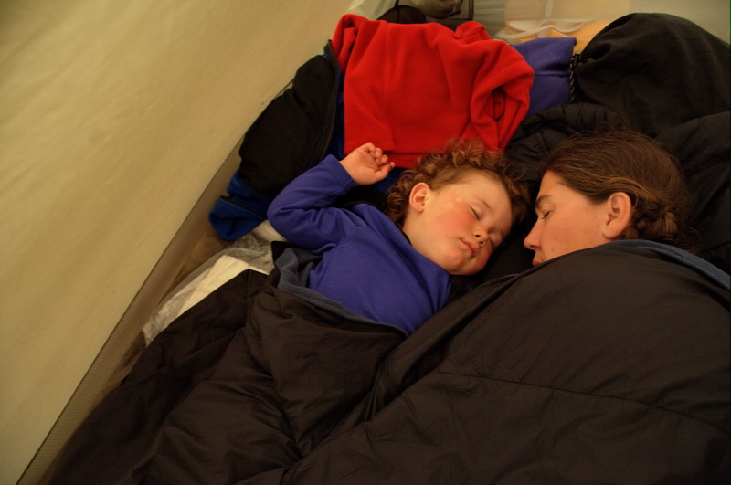
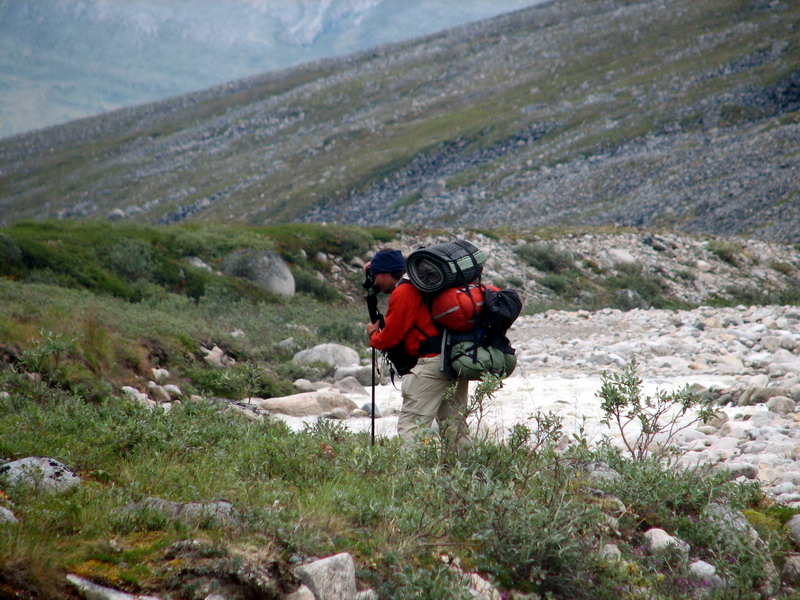
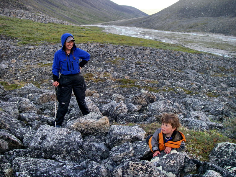
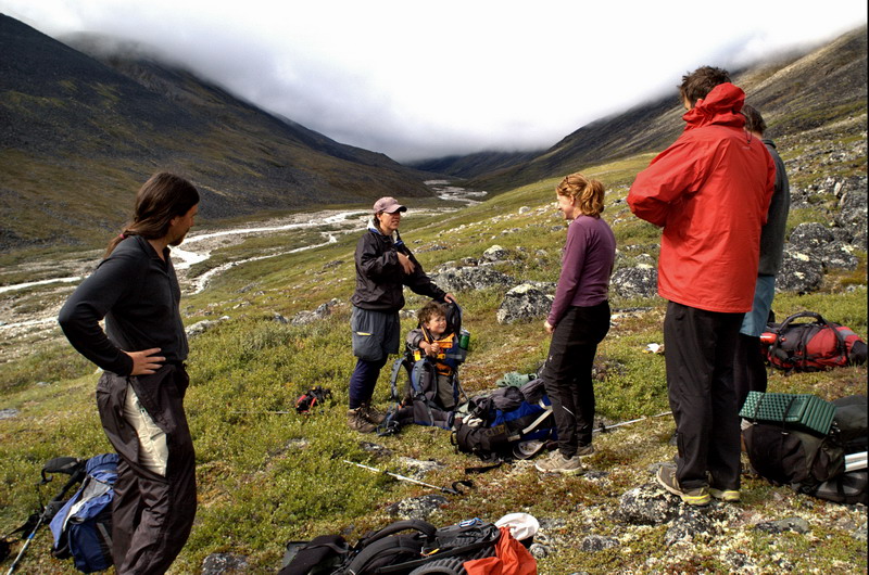
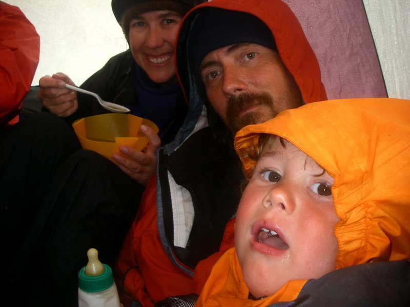
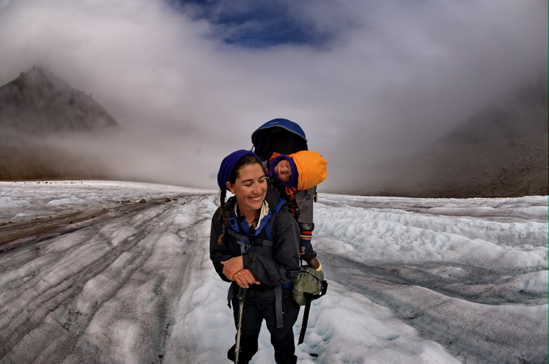
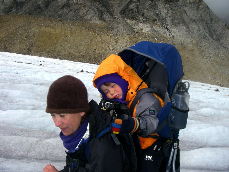
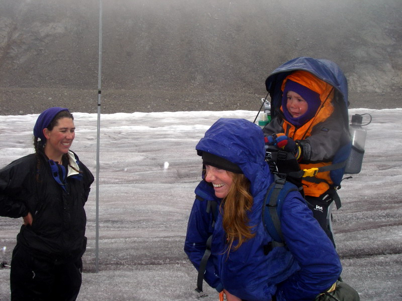
Considering I was carrying a 70 pound backpack, it may seem odd to say that we were following principles of ultralightweight backpacking, but we were. To accomplish our photographic mission, I had nearly exactly 20 pounds of camera equipment. I was also carrying all of the camping and sleeping gear for both Kristin and Turner, which weighed in at about 20 pounds as well. Add to this another 20 pounds of lunch food for the three of us and two weeks of diapers and wipes, it adds up quickly. We had spent some time trying to reduce our sleeping and clothing gear to the minimum, using a tent that weighed only 4 pounds, no sleeping bags, and only taking a pair of spare socks each and one pair of extra long underwear bottoms for either Kristin and I in case we got soaked in a river. For Turner, we had several sets of spare clothes, in case they got wet from the inside or outside, as well as spare boots and gloves in case they got dropped or left behind accidentally. To reduce weight further, I brought a light-weight frame pack, and this proved to be a disaster, as it was not designed to carry such a heavy load comfortably. Previously I had tested it quite a bit with 40-50 pounds which was manageable, but now I was not looking forward to adding even more weight with dirty diapers. Kristin’s load was over 60 pounds, carrying a 40 pound 2 year old and all of the clothing and supplies needed to survive in case we got separated for an evening or night. The main issue with her load was that it moves and kicks, sometimes at inopportune times. The others were all carrying similarly heavy loads, since they took our share of the breakfast and dinner foods, as well stoves and fuel. But overall, we were fairly mobile and looking forward to the trip.
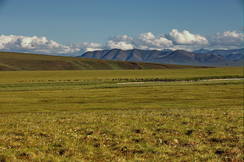
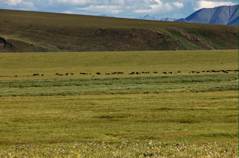
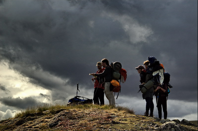
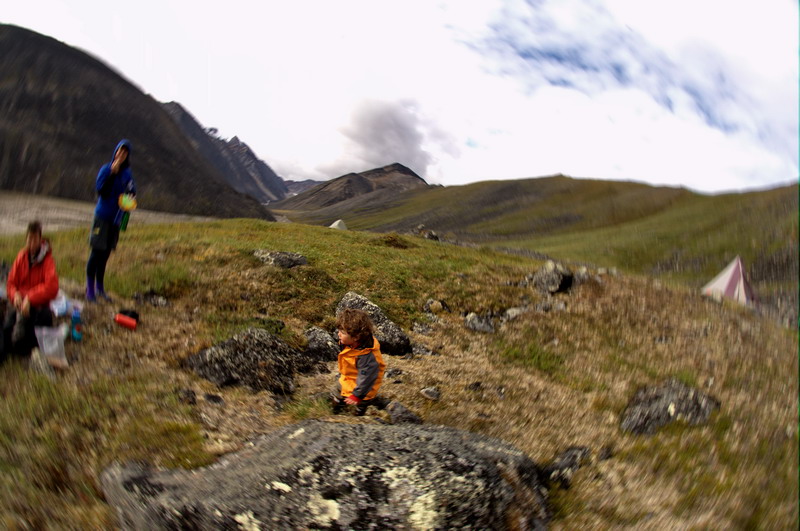
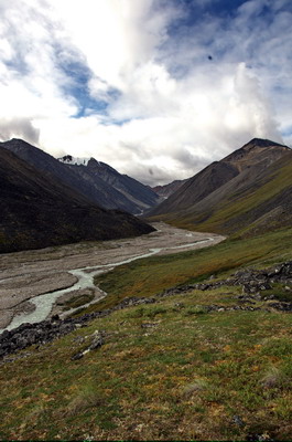
After breakfast we called in with our satellite phones and learned that Ken had indeed made it on the Frontier flight and that Tom in Kaktovik was ready to fly him in, and shortly after lunch he arrived. Though exhausted from lack of sleep, and not really sure what gear he had with him, Ken was still in good enough spirits to put in a few hours of hiking before dinner. The weather held out for the rest of the day with almost no bugs, and we had our first taste of hiking with our heavy loads. We walked mostly along the river, in old stream channels that had only a thin, dry vegetative cover, so we were happy about the conditions. After a while we tried taking a short cut away from the river that led us through a tussock field, which severely reduced our speed, especially for Kristin and I. Turner was fairly patient with us, but it was clear that he felt a bit nervous about all of this new surroundings and traveling, and occasionally cried for the airplane to come back and take him home. Fortunately, just as we were all getting a bit worn out, we came across a small herd of a few hundred caribou crossing the river in front of us. We stopped and watched for about 30 minutes as they traveled out of sight, and I think the experience left us all more energized and excited about our trip. We decided to camp near the spot where the caribou crossed, both because it was getting to be dinner time and in case more caribou showed up. Again with great weather, we could clearly see McCall Glacier and the mountains surrounding it, though it seemed quite a ways in the distance. Could we really hike that far with these loads?
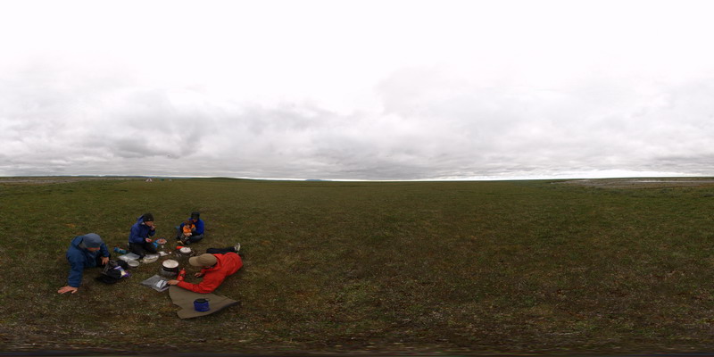
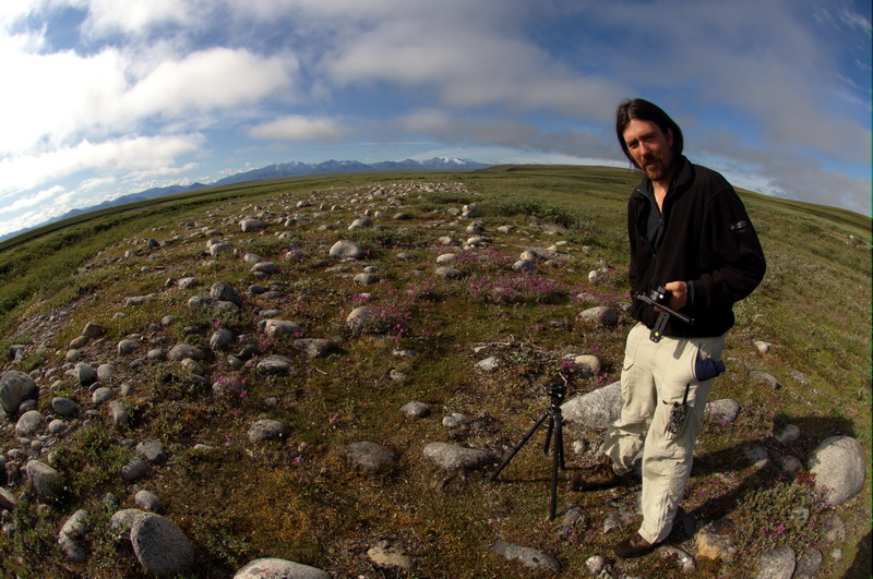
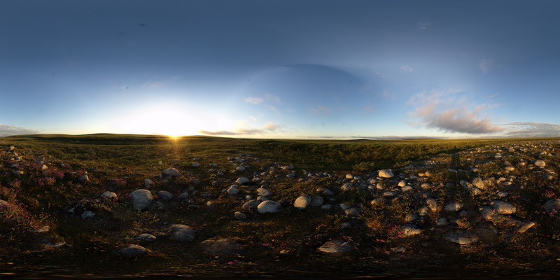
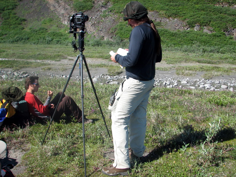
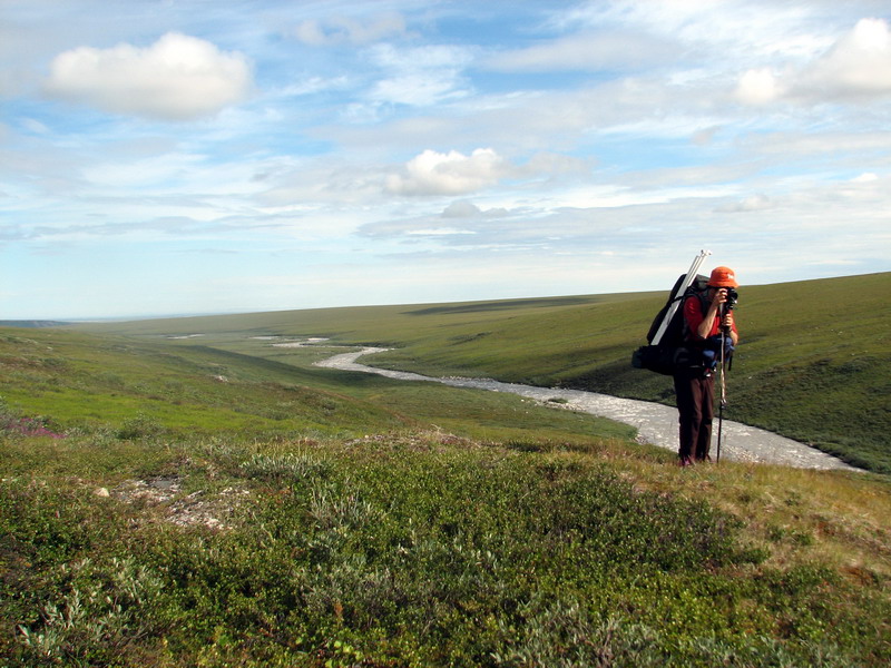
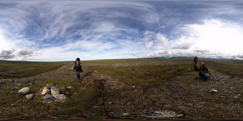
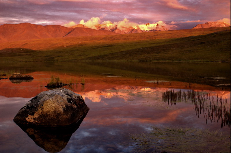
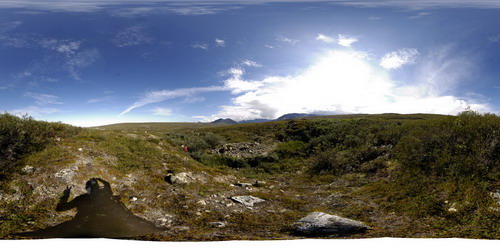
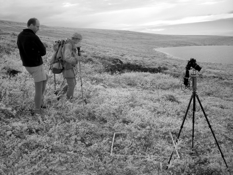
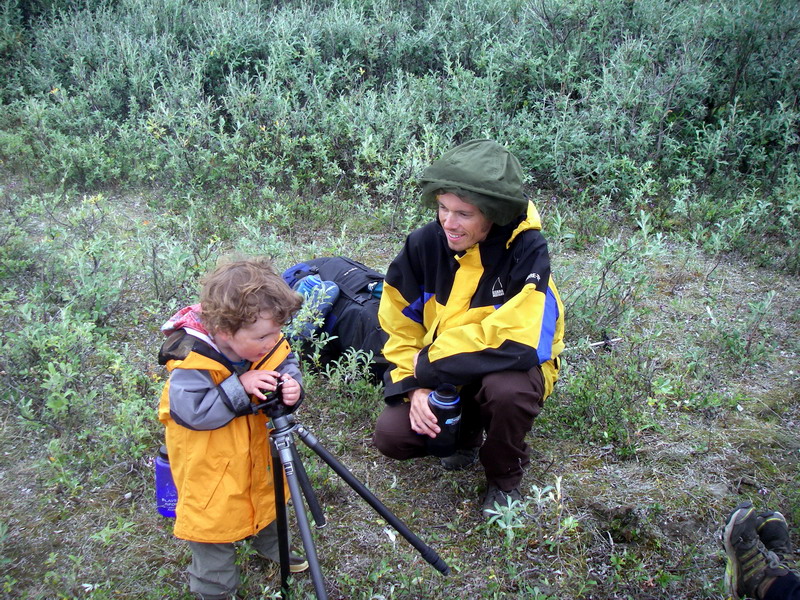
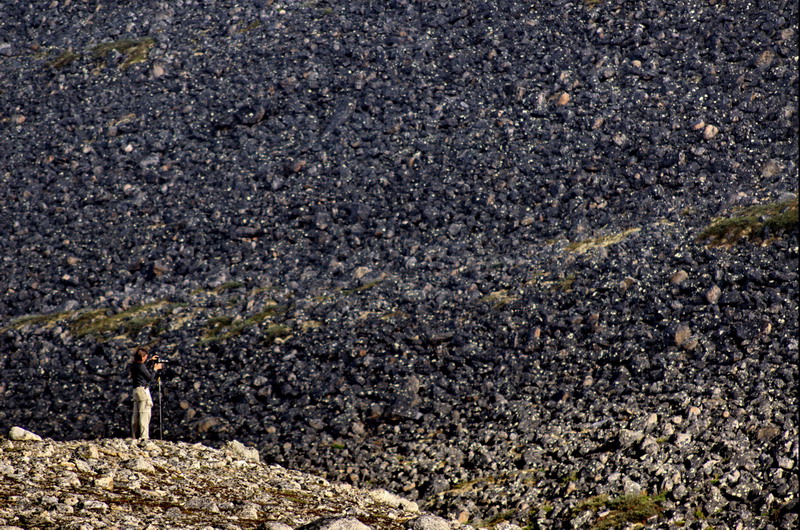
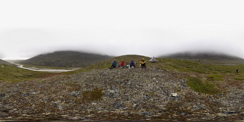
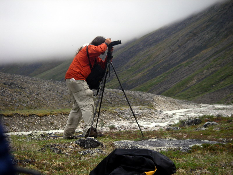
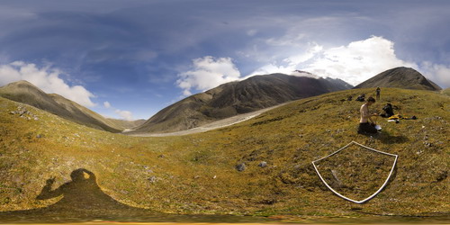
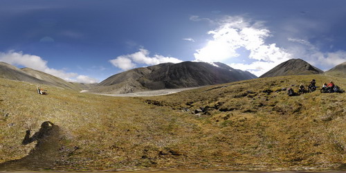
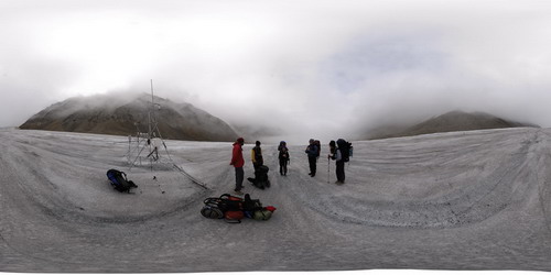
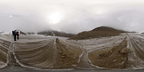
I broke out some of my more sophisticated camera gear after dinner. The primary type of photography I was planning was panoramic. Here we spin the camera to take mutltiple images and later stitch those images together using the computer to create a single, seamless high resolution image. To facilitate this, I brought along a motor drive that turns the camera at precise angles and takes a picture at each stop. After each row of photos is completed, I can tilt the camera up or down and take another row of images, and do this until I have enough photos to capture every angle in 360 x180 degrees. Using computer software, one can then ‘spin’ the image around you, as if you were standing there and turning your head around. Unfortunately, there are a lot at least 30 different settings that one needs to think about when pulling this off successfully, and I had really only figured out the basics of this before coming on the trip, so this first setup in the field took some time to get figured out. By then, the clouds had moved in began obscuring the mountains, and the nice light of earlier that evening was lost. I stayed up until about midnight hoping for a break in the clouds, but by then also the wind had died down and the bugs had come out, so I went to bed a bit disappointed about not capturing such a pretty picture but nonetheless glad to be here.
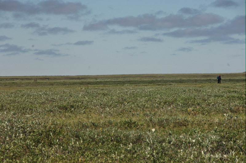
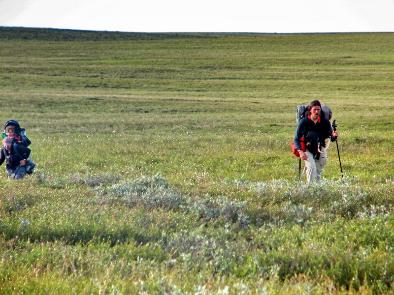
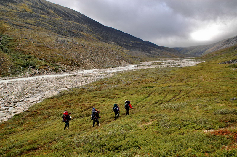
The next morning we woke up to fog, but by the time we ate and got packed, it had lifted and turned quite hot. I returned to my photo site of the night before and finally pulled off a few nice pictures before we left. Once hiking, we were mostly down to a single layer of clothes. The walking stayed fairly good as we stayed near the river, but without the wind it was quite a bit buggier. Kristin and I trailed in the rear, both because we were in general slower but also Kristin due to Turner and me due to taking panoramas fairly often. It’s a bit frustrating always being behind, as the others can all take long breaks waiting for us to catch up, but soon as we get close enough to talk they pack up and start hiking again, leaving us little time to rest ourselves. Slow hiking further compounds the weight issues, because it means wearing the heavy backpacks for a longer time. Our progress was further delayed when I realized I had dropped my walkie-talkie, and Jason and I tried to retrace our steps for the previous mile or two but in the end could not find it; being the genius I am, I purchased camouflaged walkie-talkies... By now Turner had fully adapted to the new environment, especially after having seen the caribou the night before, and had made a new best friend in Joey, for whom he would call for often.
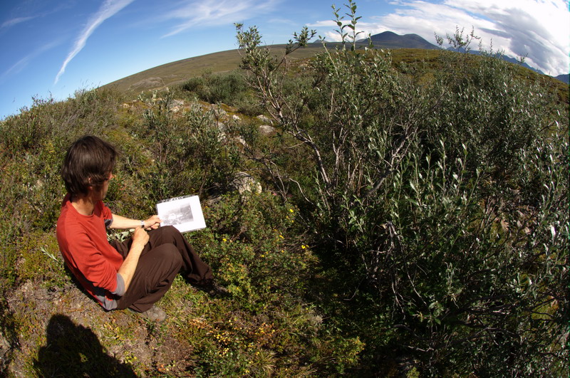
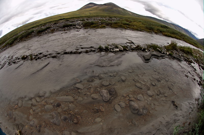
We took a nice long lunch where the river cuts close to the Bitty bluff, giving me some time to setup the high resolution panoramic gear and take a nice image of the eroding hillside. Ken also had a chance to do some vegetation surveys. So this felt like the first real day of the scientific expedition, where our mission was to document various features of the landscape and ecosystem that might likely change over time, whether due to climate change or other mechanisms. Erosion is one process which is difficult to measure over short timescales, as often this occurs episodically. Photo documentation helps us capture the state of a landform and something to compare future changes to. A variety of issues need to be considered when choosing photolocations, basically trying to ensure that one gets a representative sampling over areas in different conditions and locations, and with enough resolution to make some comparisons. Similarly, the work that Ken was doing has a lot of subtle considerations to make. But in the end, given how sparse measurements are out here, nearly any measurements are useful to future studies. The great advantage of combining panoramic photography with vegetation study plots is that future researchers may derive information from other parts of the photos which we hadn’t originally noticed. That is, by conducting ‘blanket coverage’ with photography through use of closely space panoramas, we attempt to create something like a continuous transect of photodocumentation which can be used for a variety of purposes, many of which we have not even imagined yet.
See it spin on it's own -- 11 MB
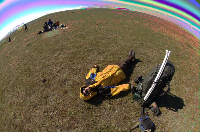
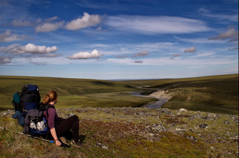
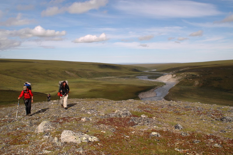
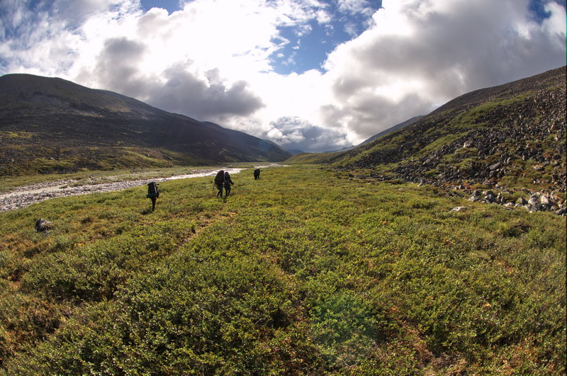
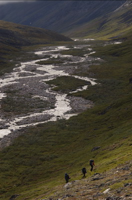
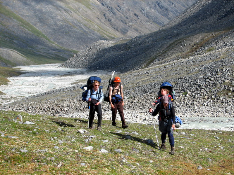
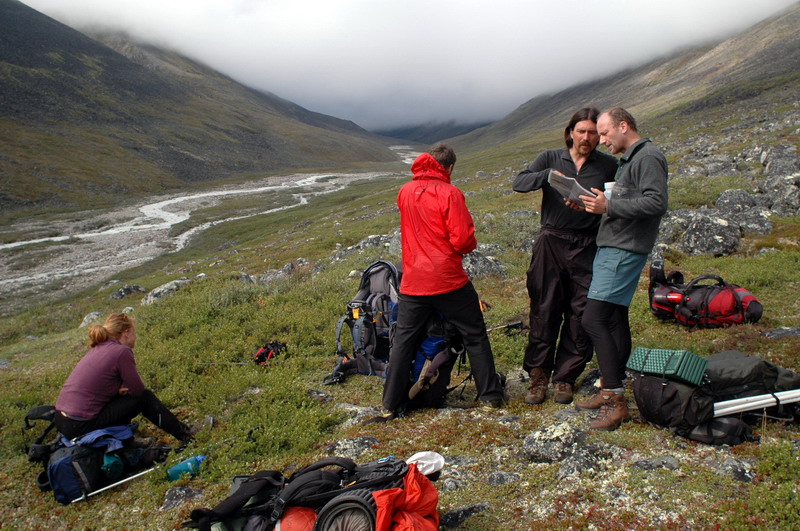
I felt like the next day led us through the crux of our group dynamics, less from individuals hiking together and more to a team sharing a great experience. It started off on a frustrating note for me, as I discovered that a somewhat scary stream crossing we made the night before was unnecessary, and required us to cross it again to continue hiking today. We found another crossing point which was calmer, but wetter, though it was another hot sunny day with almost no bugs and we quickly dried off and were overheating wearing as little as we could. Our route took us through the entrance of the ancient moraines of Pleistoscene glaciers which made their way halfway to the coast from the mountains we were approaching. We decided to stay near the river where we knew the walking was good, but Bernhard wanted to hike the moraine ridge to check them out a bit, so he took a walkie-talkie and said he’d remain in sight and radio contact. We stopped for lunch at a nice bend in the river where a bank was eroding, shrubs were growing, and Ken had some interesting vegetation to examine. For the previous two hours, Bernhard was no where to be seen and was out of radio contact, so I was getting fairly frustrated about that too as I began realizing that he caused more me more stress than Turner, who barely causes any on his own. His disappearance was especially frustrating as Joey was feeling poorly with enough good reason to suspect that something really bad was happening that we decided to divert our route so that she could be flown out before her condition worsened. We eventually linked up several hours later on top of the moraine, and continued hiking along its spine towards the mountains. Our plan was to split up at the point where the moraine from the Okpilak valley came closest to the Jago valley moraines, so that Jason and Joey could then drop down to Okpilak Lake, which was the closest airstrip.
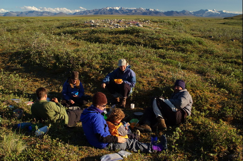
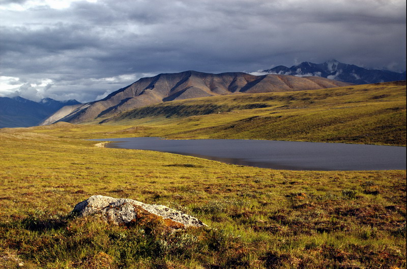
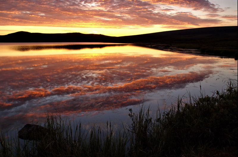
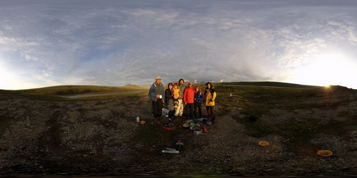
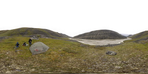
As we continued on, the plan evolved so that we would all press on to Jago Lake and camp there for the night, with most of spending the next day there, such that Jason could return from the airstrip after Joey took off and we could all continue with the hike. The moraine was interesting to walk on, with good views of the foothills and mountains. The bugs continued to be minimal and the weather and terrain great for hiking for the most part. As we approached the lake, we dropped back down into the river valley and weaved our way through tussock fields until finding better routes along the valley bottom. Tussocks slow forward progress down considerably, and at least for Kristin and I in the rear it seemed like it was taking forever to go the last kilometer. But finally the lake emerged from within a hollow, and we were quite glad to have pressed onwards to find such a beautiful location to spend some time. We got our tents set up, and Jason and Joey got dinner going, as per usual, and by 10PM we were relaxed, well fed, and enjoying the outstanding view. Due to somewhat crazy logistics and issues of the past week, we had never really had a chance to talk together as a group and discuss the trip and our relative roles in it, so after dinner we did this and I think it went a long way towards focusing our efforts. Joey was also able to get hold of a doctor via the satellite phone and determined that she should have no problem continuing on with the trip. About this same time, the low sun angle lit up the mountains and clouds surrounding us with a beautiful light. For the next few hours we hung out and watched the show, took pictures, and hiked around, and I think everyone went to bed feeling glad to have been in this place at this time, as well as be part of this group.
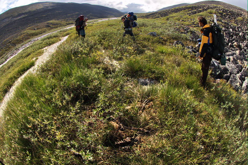
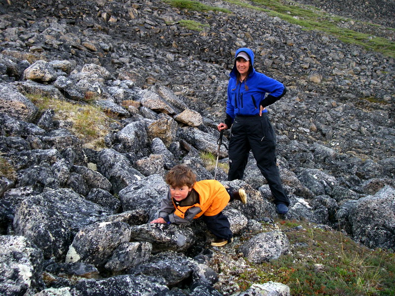
We slept in a bit the next day, but were still off earlier than normal because we did not have to break down the tents and pack up. Our plan was to work in this area with day hikes, as there were a number of old photo locations in the area and this was a nice transitional zone between glaciation events. Jago Lake was used as a base camp during IGY in 1957-58, and we were able to track down a number of old photos from around here that should help us understand how vegetation has changed over the past 50 years. So Ken and I focused on finding these sites, which was somewhat challenging since they were not marked and one has to use clues to from the photos to determine their location, and often this is just a rock in the foreground. Bernhard and Jason joined us for a while on our easter egg hunt, and then hiked up Mt Marie to check out the moraines and glacial history. For Ken and I, it was a real treat. One of Ken’s old photos was taken in a small gully we located about a mile from camp and the changes over the past 50 years were impressive. Erosion in the gully was severe, with the original photo location subsided into the bottom of it, and the vegetation had changed from just mosses to willows more than 3 meters high. We spent quite a bit of time here investigating the geomorphology of the region and taking repeat photos from various angles. In terms of the scientific importance of these photos, it seemed to us that these were the vegetation equivalent of the terminus retreat repeat photos I have been taking further in the mountains, as it is undeniable even to a non-specialist that significant change has occurred here. One of the issues in the arctic, especially this region of the arctic, is that there are very few surviving ground photos which are relocatable for this type of work, so it was quite exciting to find the exact spot and note such large changes.
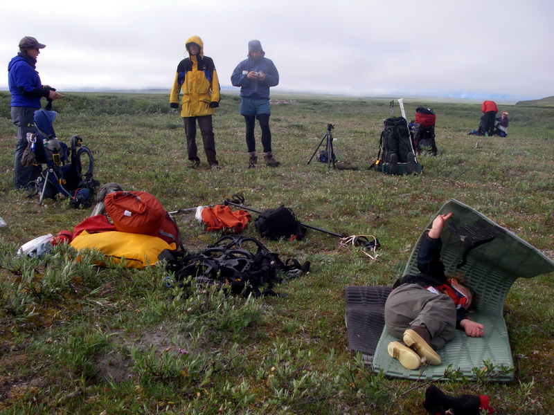
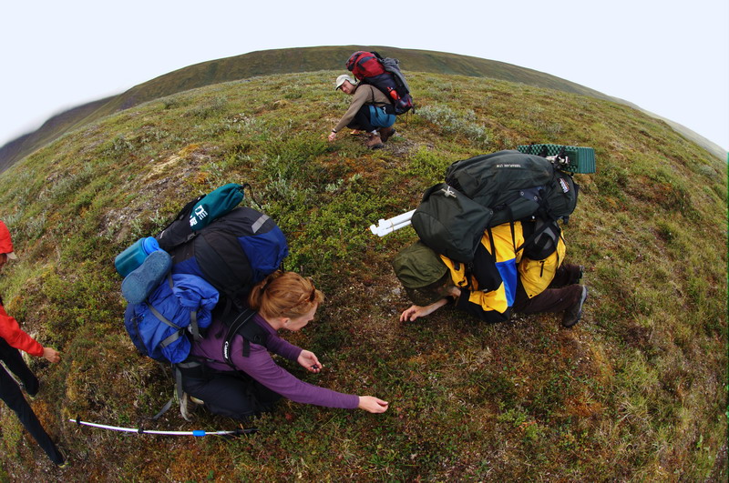
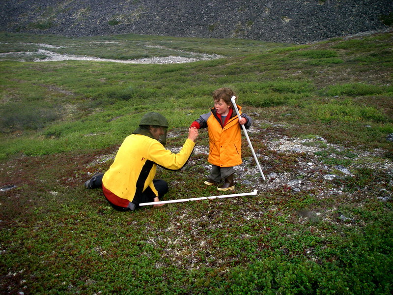
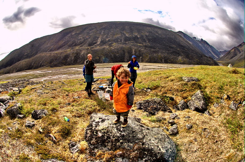
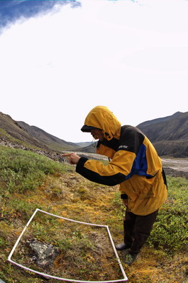
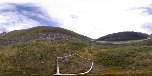
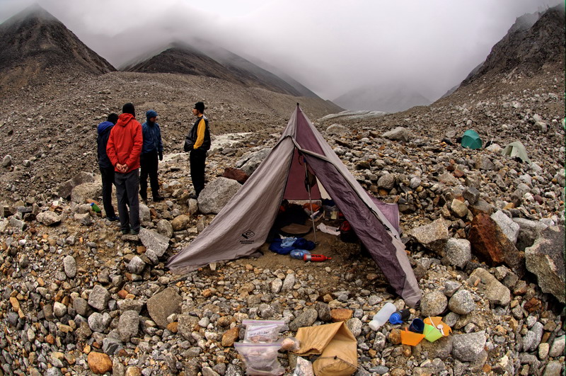
We continued on up the moraine to find several other old photo sites, and quite miraculously found them all. The changes in these sites were not nearly as dramatic as the gully shots but still interesting. The weather remained beautiful and the bugs not too bad, so we had a pleasant time hiking along the moraine crest and taking it all in. By now I had taken probably over 100 panoramas of our route, and I was getting excited about processing them all and linking them together, as well as making some higher resolution ones. On our way back to camp, we stopped to do a vegetation plot. Here Ken lays down a PVC framework that is a meter square, and then identifies all of the types of vegetation within that framework and its relative abundance. He also takes pictures of the site and a GPS measurement, so that he or someone can return periodically to assess change. My idea was to combine this work with high resolution panoramas, so that one could see the vegetation within the framework well enough to see the tiniest features, but then also have this seamlessly linked to the rest of the landscape in every direction. So while he finished up the vegetation identification, I set up the tripod and more sophisticated panorama gear. It took several hours before I was finished. There are so many settings that its easy to forget something, which I did several times. In the end, I think I got a good one, totaling several gigabytes of data. It wont be a month or more until I have the time and processing power to assemble the images and know whether it worked or not. All along the trip I kept reminding myself that this is really just a shakedown trip for this type of technology, and kept my fingers crossed.
The next day, I felt a noticeable shift in the dynamics of the group. We hiked together for the entire day, close enough that we could carry on conversations either as a group or in variably-sized groups. Perhaps it was just getting to know each other better, or perhaps more likely that our loads were more equalized as the others took pity on us and carried increasingly more of our gear (notably, dirty diapers and camera equipment) as the group food and fuel got consumed. The hiking terrain was also quite conducive to walking together as a group, as the old river channels were quite wide and flat. Of course the weather had a lot to do with facilitating a great atmosphere, as we couldn’t ask for anything better.
We stopped for lunch along the river, at an interesting grove of willows. One of Ken’s current studies is the impact of ptarmigan browsing on willow growth. Here it looked like someone had taken a hedgeclipper and trimmed the willows to an even height of about a meter. This trimming is done by the birds who eat the willows during winter, but they can only access these shrubs above the winter snow pack. So they get trimmed to that level. But occasionally a fast growing branch will grow higher than the ptarmigan can eat it, and then it will begin to branch out at a level beyond the birds’ reach. So this grove had a bimodal height structure—the hedge trimmed to the snowpack height and those branches that escaped the browsing. I found a nice place inside of the grove to take a panorama, which will hopefully not only make it clear what this structure is all about, but have high enough resolution that it can be repeated to determine which individual branches have changed over time.
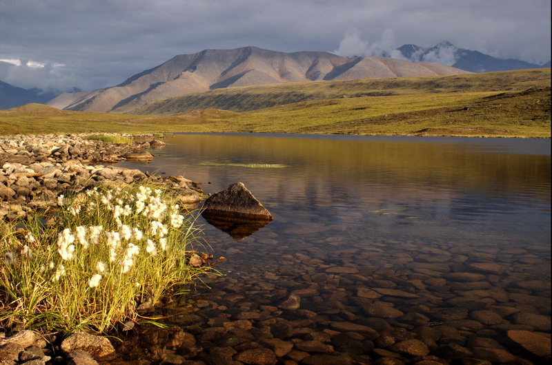
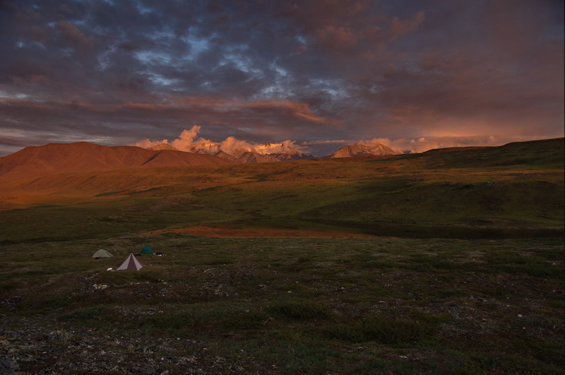
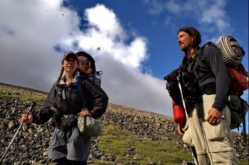
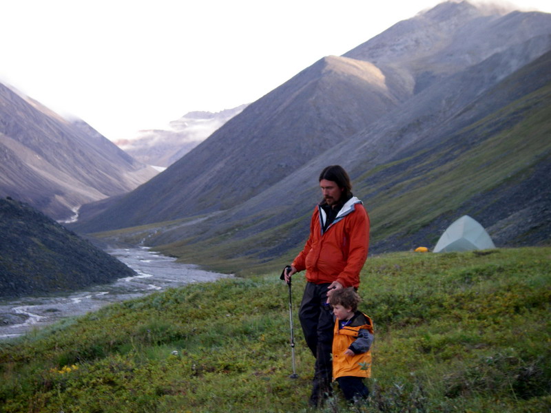
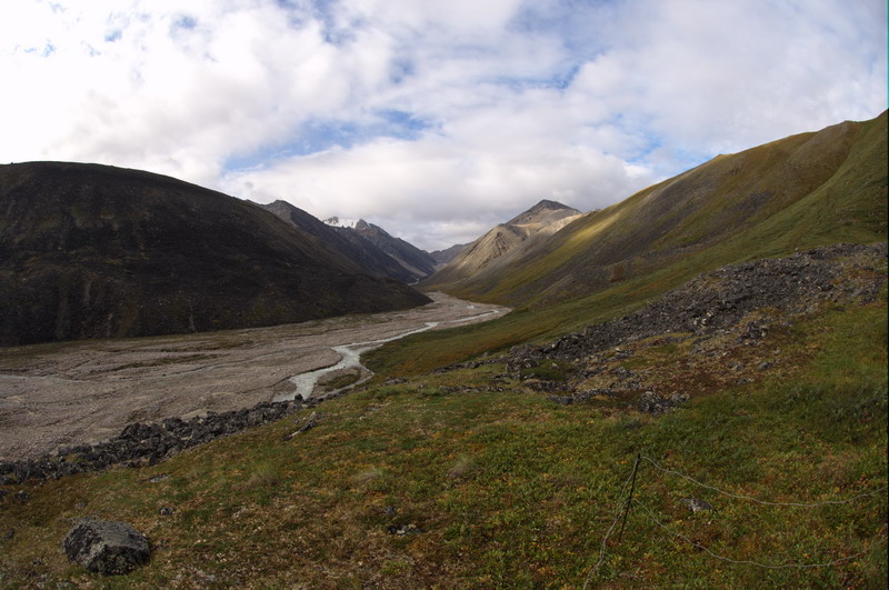
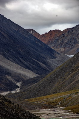
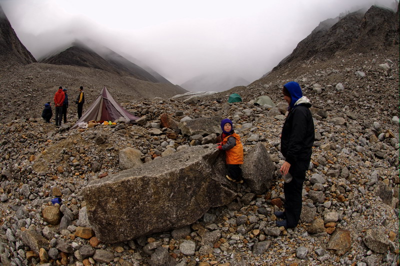
It was also an exciting day because we finally reached the McCall valley and began hiking into terrains that had much more recently been covered with ice. We found a nice camping spot on a not-too-old moraine, with a nice view of the entrance of the valley and up to the first major corner at Jaeger Pass. I spent some time taking more high resolution panoramas, screwing up a bunch of them, but still getting a few good pictures I hope. As I began to learn more about the process of acquiring the images, I decided that perhaps the best plan in terms of speed and data storage would be to acquire a medium resolution image in every direction for a spherical result, but then choose one or two narrow views to do very high resolution partial panoramas. By high resolution, the idea is to be able to see lichens on individual rocks across the valley and determine their rates of motion as they gradually tumble down to the valley floor or get consumed by vegetation and become part of the subsurface. My goal was to document hillslopes throughout the valley so as to assess relative rates of erosion based on how long it’s been since they were covered with ice.
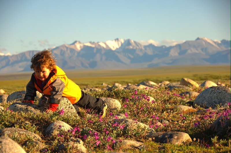
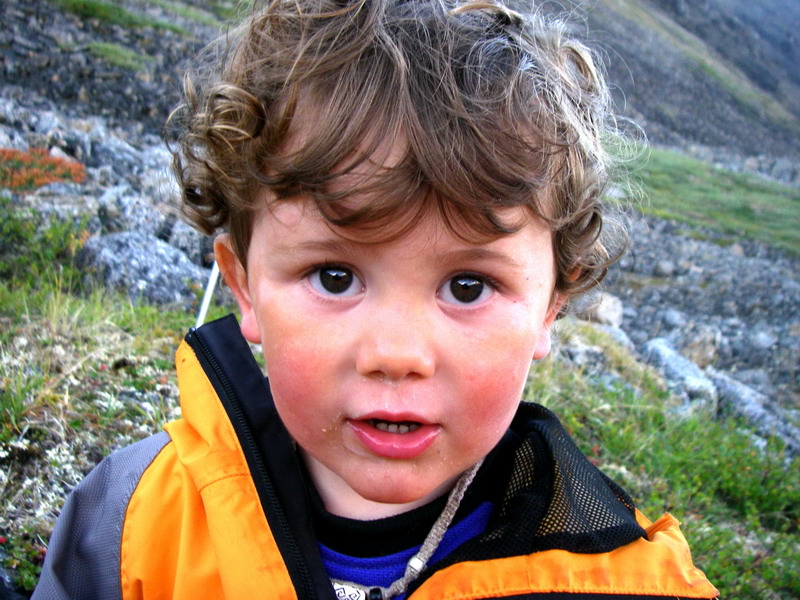
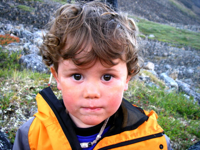
The next day we hiked to Jaeger Pass and camped just below it. It was a nice short hike, mostly along caribou trails. Turner was by this point quite accustomed to our travel routine, and enjoyed pointing things out along the trail and singing his little camping song when he realized we were looking for a place to set up the tents. Once unloaded, he would find the biggest rock and begin his ascents and descents along every possible route. The weather was again perfect for hiking and walking and picture taking, though the clouds were typically below the mountain tops. We had some old photos from the pass that we spent several hours trying to find. We were unable to find the site of one of them due to the poor quality of the image I had brought along, but there was still plenty of scenery to explore and discover. While at the top of the pass the clouds lifted a bit and we were treated to nice views in all directions. I took several high resolution panoramas along the way, and was amazed that after taking several thousand photos that I was still only on my second camera battery. At each photo location, I had a GPS hooked up to the camera so that the photo location was embedded into the digital metadata associated with the photo. I wished a bit that I had more battery power for the tiny computer that I used to backup the photos, so that I could examine the exposures and improve my technique, but I think in any case they were pretty close. After dinner, most everyone went on more hikes to enjoy the nice views. Bernhard and Ken hiked up a small mountain near the pass where Ken had another old photo of a tributary glacier entering the valley, and by then the light was even nicer and the clouds a bit higher. It would be nice to spend several weeks exploring this valley, and really getting a better handle on the various glaciation events that carved it and left such interesting landforms behind.
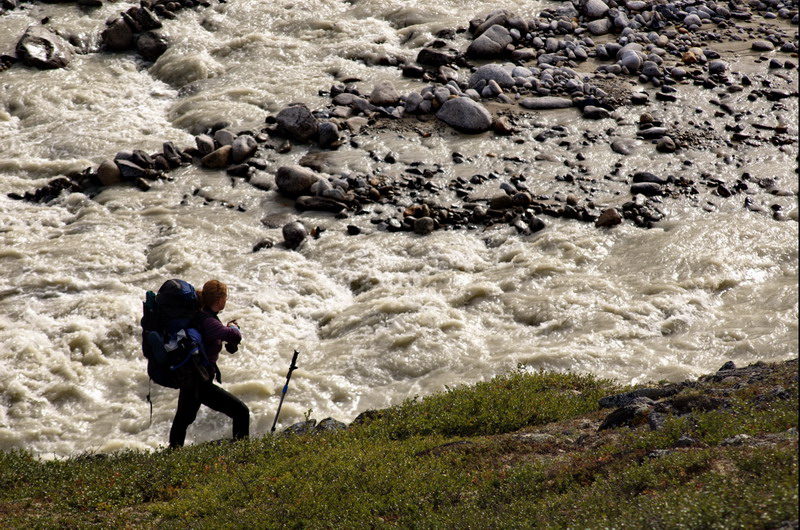
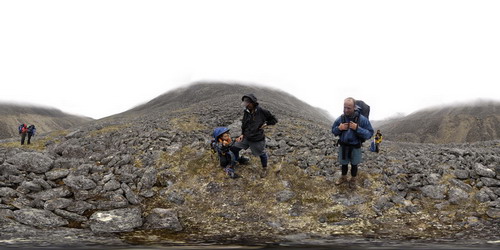
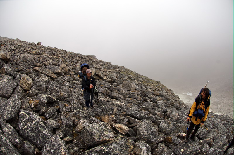
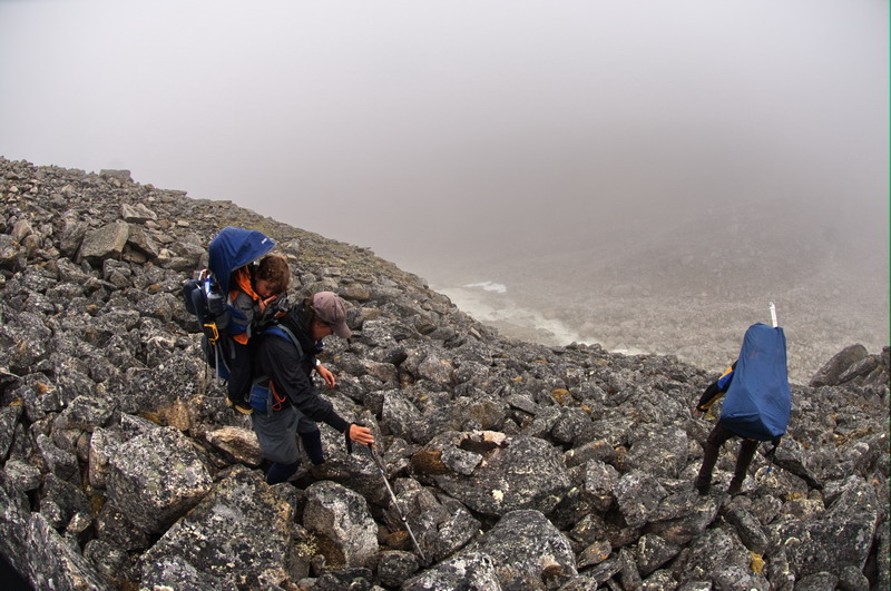
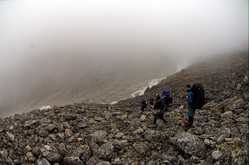
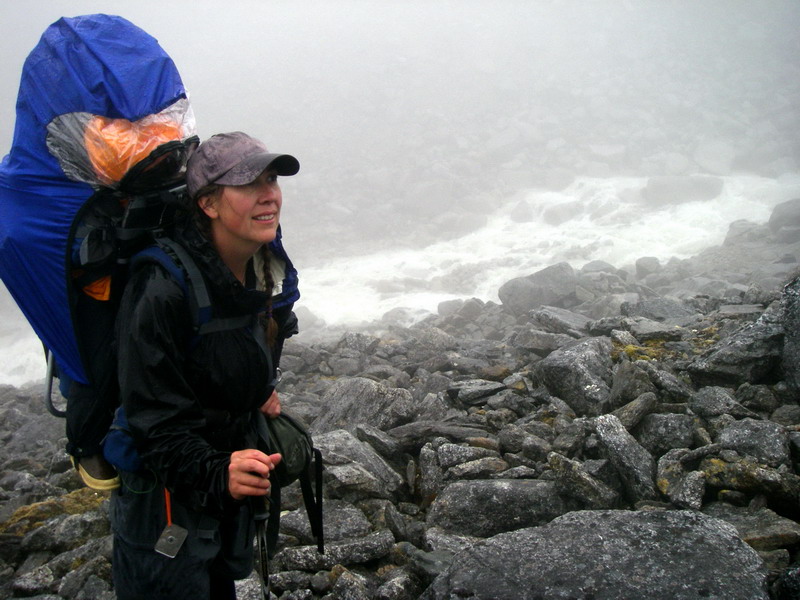
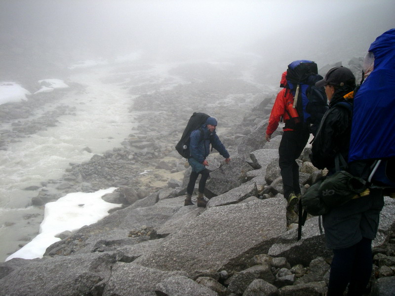
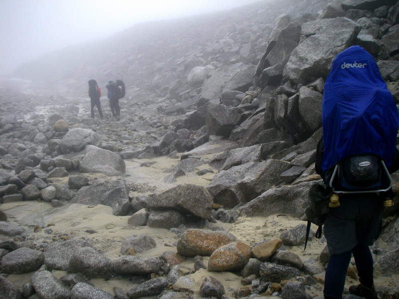
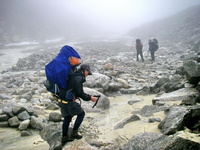
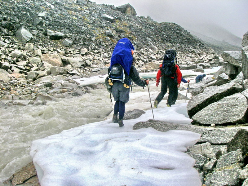
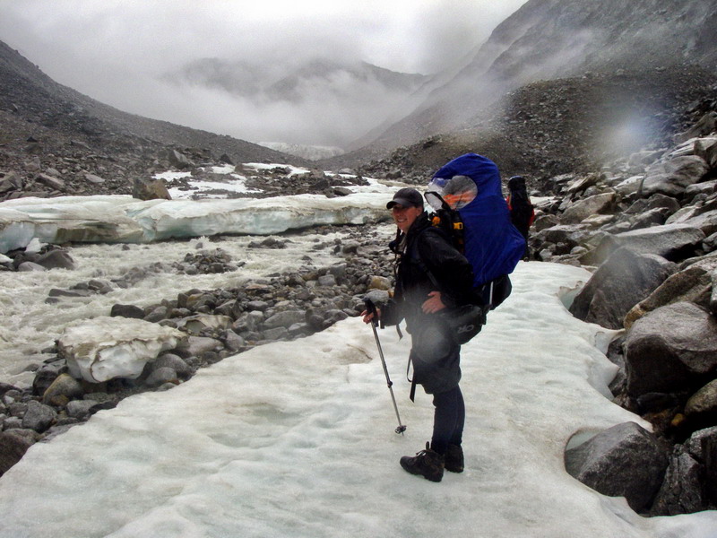
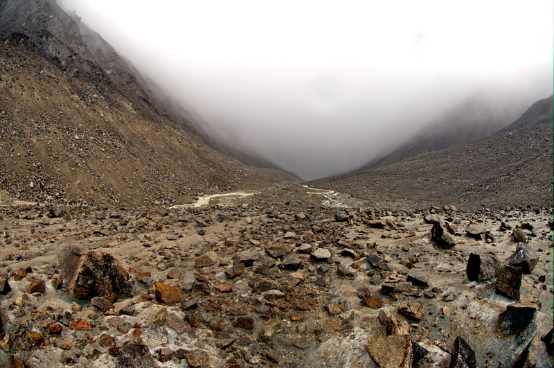
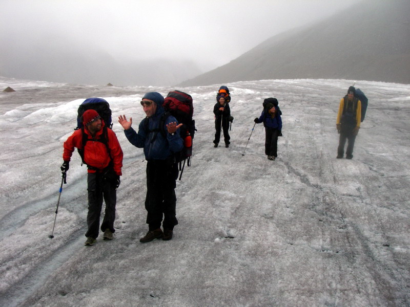
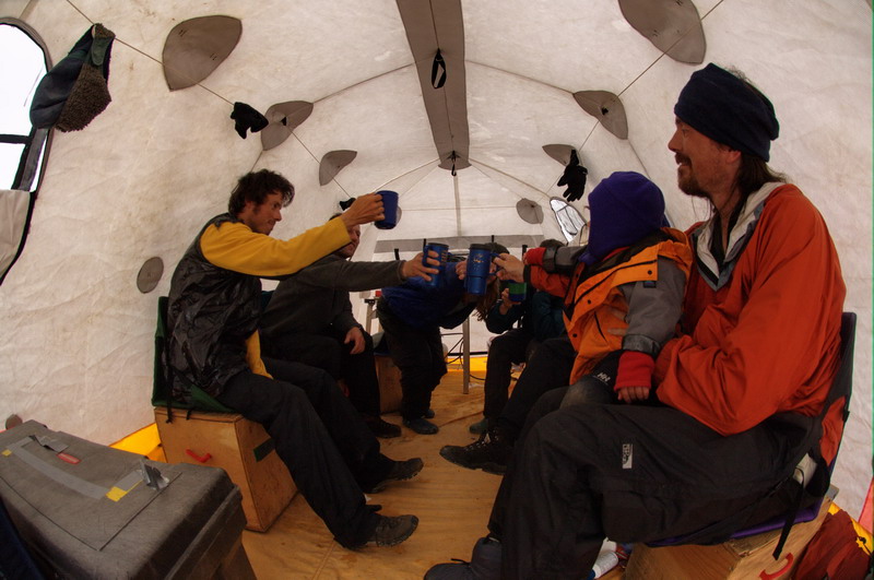
In the morning, the clouds lifted again briefly and I quickly fumbled for another high resolution panorama looking upvalley where McCall Glacier came in and out of view behind the drifting fog. Again I think I screwed it up a little, this time with the focus (which is more difficult than it may sound to get right), but hopefully it will still make a nice image. As we began our hike to the terminus, our final camping stop before reaching our main camp on the glacier, the clouds got lower and it began to rain on us for the first time on the trip. This was a bit unfortunate as this was by far the most treacherous region of hiking of the whole trip as well. The river emanating from the glacier carves deeply into the bedrock here, forcing hikers to sidehill across the loose, rocky moraines. These rocks are not only loose, but covered with lichens that get very slick when wet. Kristin did an excellent job of keeping her footing with Turner on her back, even when others were slipping. On several occasions there was no choice but to do some scrambling up or down steeper sections, but everyone crowded around to assist and make sure no major tumbles occurred. Turner fortunately slept through most of the nastiest sections of this, staying warm and dry under his rain cover and no doubt lulled to sleep by the rocking motion of uneven footing. Unfortunately the aufeis was quite melted and dissected, so we could not use it as much as in the previous year as a quick highway to the terminus. By the time we reached our camping spot from a year ago, we were all fairly soaked and chilled from the cold glacial breeze, and made a hasty attempt to get our tents set up and into some dry clothes. Up until now, we had always been able to cook and eat outside, but this was just not a possibility here, so Jason and Joey cleared space in their teepee-like tent and we all crowded in around the camp stoves and warmed up with a nice meal and some hot drinks. After dinner we crawled into our tent, striving to keep the water out and our bodies warm, and feeling a little less desperate about this situation than a few hours before.
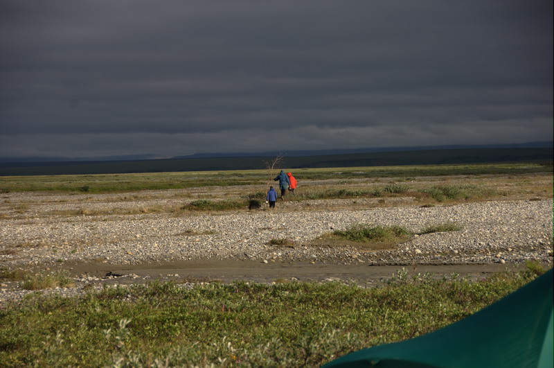
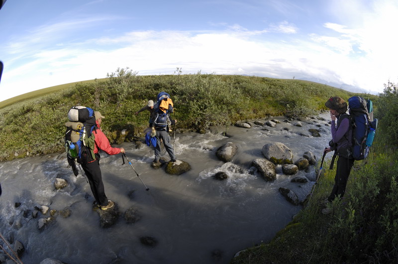
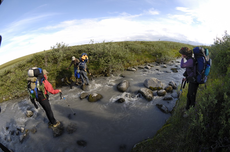
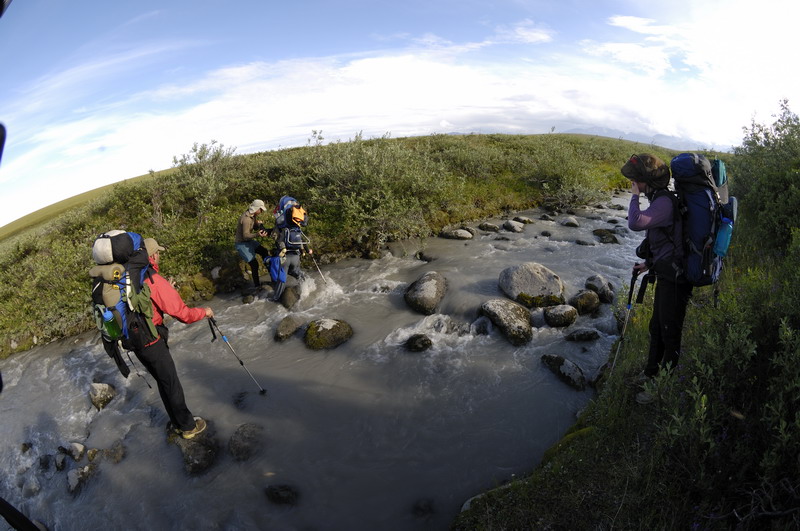
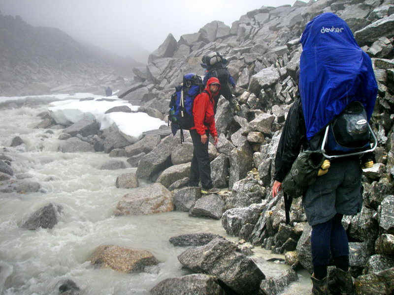
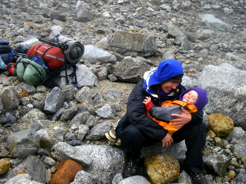
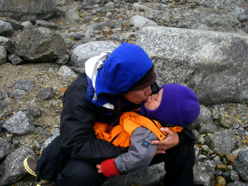
We woke up to a light drizzle, but by the time we packed up it was fairly dry and we were ready for our last day of hiking and to finally ascend the glacier. The only remaining obstacle was getting up onto the glacier itself, which was complicated by the fact the river coming from the glacier cut quite close the ice-cored moraine at its edge. So our choice became to scramble along the edge of the river along huge loose boulders that clearly were actively falling into the river, or cross the river itself. We opted to cross the river. Jason went across first at the widest and slowest spot to check it out, then came back without his pack to help the rest of us. Jason teaches at a University in Anchorage, and is apparently quite comfortable not only with stream crossings like this, but also with helping others across, and was a great friend to have on this trip, especially considering our special family needs. Joey and Ken went next, with their arms locked together to help brace each other against the swift current. Next Kristin and Turner went across, with Jason and I on either side. I’m not a big fan of river crossings, but we just kept putting one foot in front of the other as the water splashed up to our knees trying to knock us down as we searched for footholds beneath the murky cold water. Turner was wide awake at this point and apparently sensed the stress we all felt, and for the first time on the trip got scared and began to cry, heightening the tension. Fortunately the stream was not very wide, and we were soon across without incident, and safely on the glacier ice eager to begin hiking again to warm our feet.
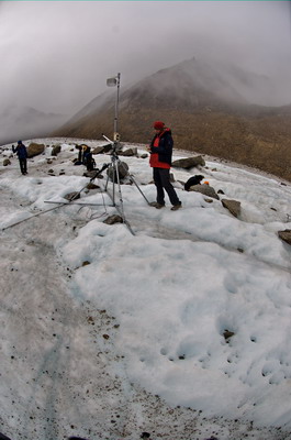
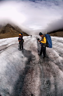
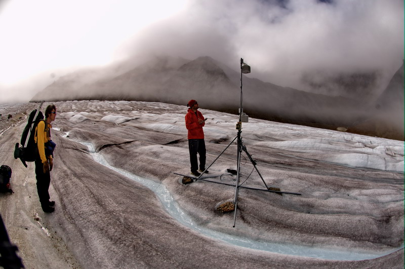
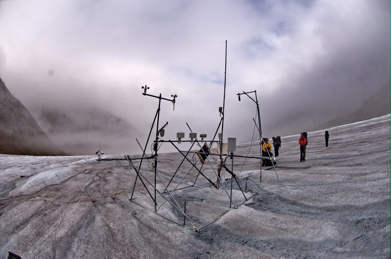
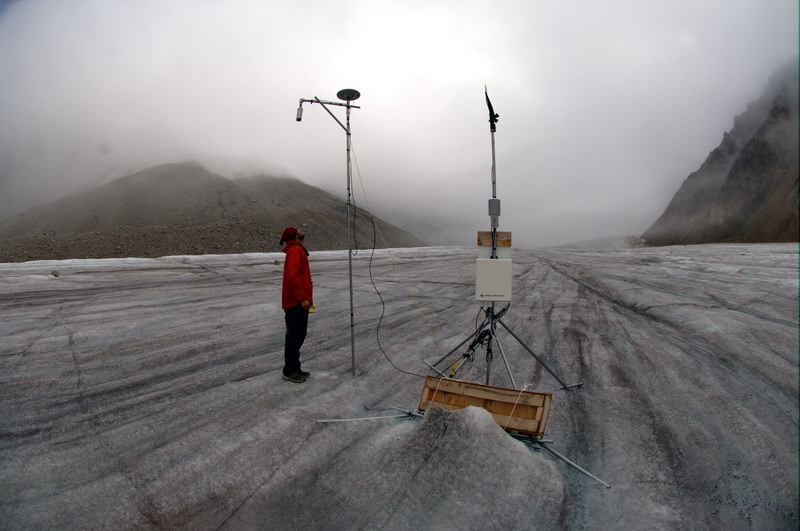
The glacier surface was a bit slicker than normal due to the recent rain, and is steepest at the terminus, so we walked slowly, but comfortably knowing the worst was behind us. Soon we began coming across various forms of debris left behind from 50 years of research. Wooden poles from the 1970s, thermocouple wires from the 1990s, and even some metal survey poles from the start of my research here. Soon we came across the first of my weather stations, still happily chugging away logging air and ice temperature. Jason had hauled a tape measure along with him so that we could make our mass balance measurements on the way up, so we stopped at each pole for a snack, some measurements, and conversation about the interesting things we found along the way.
I continued to take panoramas on the way up. Along the trip, for the most part I made no special efforts to keep my hiking companions out of the frames, taking a mixture with and without. But at this point, I had a much clearer view that I wanted to use these photos to document not only the landscapes, but also our trip through it. I wish I had spent a bit more time taking them explicitly with trip documentation in mind, especially since I did not carry a point and shoot with me to catch key moments of the action as I normally try to. Since I normally hiked with the fisheye lens attached to make quick low resolution panoramas, it was cumbersome to change lenses to something that could better capture the action. But I hope that the sense of exploration and comradery we felt will still come through in the panoramas I did shoot.
I'll give you anything -- 12 MB
By dinner time we reached our camp and began unpacking our cache left from May. Fortunately I had left our large cooktent there, so we now had a nice place to sit together out of the elements. I called Waldos and learned the helicopter had made it to Kaktovik at about that same time, so it seemed that everything was beginning to fall into place for the next portion of our month-long trip, the last campaign of our current funding here. So that night we enjoyed a big meal of the last remnants of camping food, and toasted with a few drinks from supplies cached in May, just in case an occasion like this arose.
Click here to continue to Page 2
|
(c) 2003 Matt Nolan. If you find any broken links or other errors, please let me know. Thanks.