Kuparuk River watershed DEM
| Kuparuk River watershed DEM |
|
MPG Movies You will need a media player that supports MPEG-1 playback. Most all media players for the various operating systems support MPEG-1 playback by default.
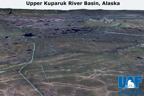
Upper Kuparuk River Basin - Click the above image to view a short animation of a circular flight path around Toolik Lake located in the upper Kuparuk basin. The ORRI-Landsat fused image was used as landcover for this animation. The animation will open in your default media player, if you wish to play the animation manually you can locate file kupdem_upper.mpg in the /movies directory of this DVD. For some slower computers it is advisable not to use Quicktime for MPG playback, but ot use either Windows Media Player or some other player that supports MPG playback instead.
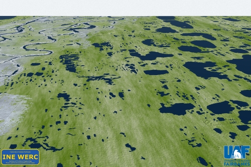
Lower Kuparuk River Basin - Click the above image to view an animation of a circular flight path around parts of the lower Kuparuk river basin in the vicinity of the BP Exploration Kuparuk oil field. The landcover used is a synthetic texture. The animation will open in your default media player, if you wish to play the animation manually you can locate file kupdem_lower.mpg in the /movies directory of this DVD. For some slower computers it is advisable not to use Quicktime for MPG playback, but ot use either Windows Media Player or some other player that supports MPG playback instead.
3D Interactive Visualization The following visualizations ultilized Skylinesoft's TerraExplorer application. This application is currently only available for the Windows operating system and can be installed by following this link, or by downloading directly from www.skylinesoft.com, clicking on Go3D then Full Motion Flight.
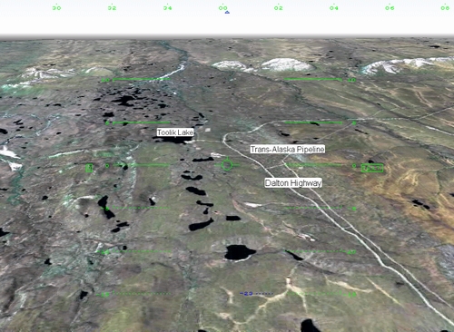
Upper Kuparuk River Basin - By downloading the file and clicking on the .fly file, you will start an interactive 3D fly-though application. You will be able to control your flight using the a, s, w, d, z, x, and space keys on your keyboard. Please refer to the TerraExplorer help file for further control options. Using the ctrl+l key combination you will be able to bring up a menu of available shapefile overlays. You can activate the overlay by simply clicking on the listed shapefile, and deactivate the overlay by clicking the same listed shapefile again. The shapefiles were obtained from the Arctic System Science (ARCSS) Data Coordination Center at the National Snow and Ice Data Center (NSIDC). Follow this link for more information about the shapefile source. Entire Kuparuk River Basin. This application run identically to the upper Kuparuk basin. Here we have applied a 5x vertical exageration. Color denotes elevation, and the intensity of color is derived from the ORRI. Features as small as pingos can be seen on coastal plain.
Vector Data We have included the computer generated stream channel networks for the Kuparuk and the Putuligayuk in this distribution. The files are located on DVD-01 in the /shapefiles directory. These data are projected in UTM Zone 5 WGS84.
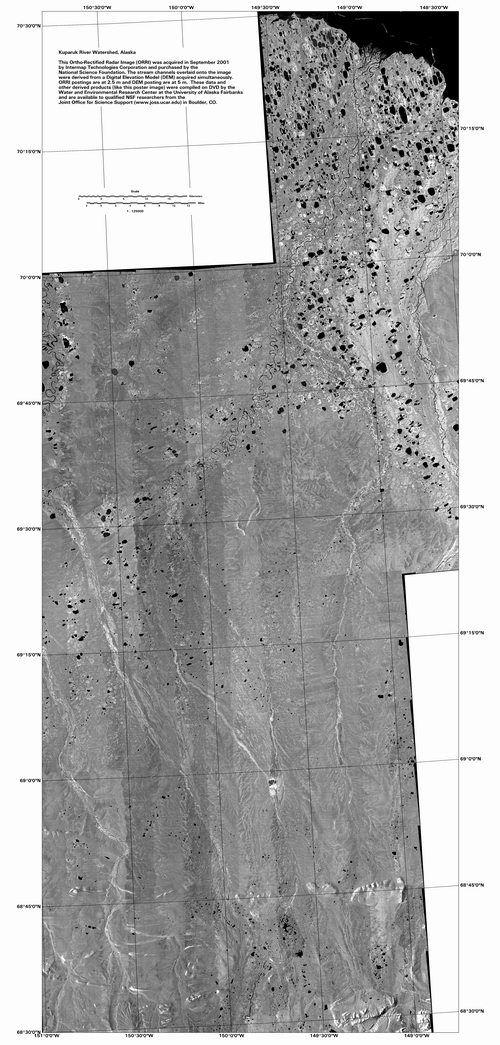
36" ORRI Poster A poster made from the ORRI in 1:125,000 scale is provided on this DVD within the /kuparuk_poster directory. The poster is provided in Imagine and TIFF format. See low resolution preview below.
|