Dr. Matt Nolan
Institute of Northern Engineering
University of Alaska Fairbanks
|
Dr. Matt Nolan
Institute of Northern Engineering |
|
|
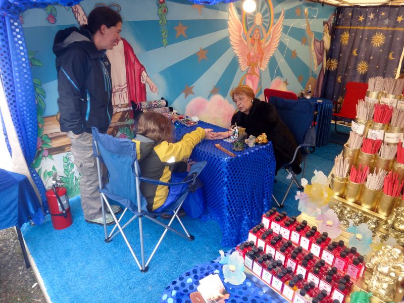
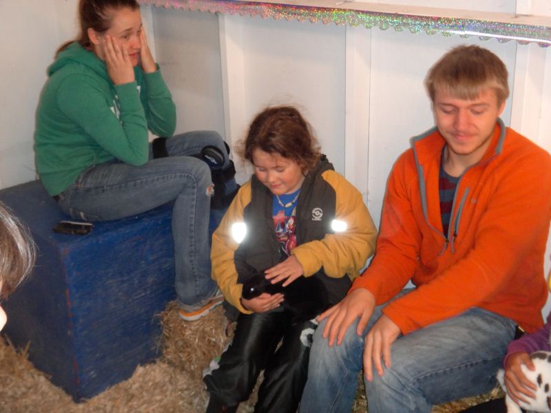
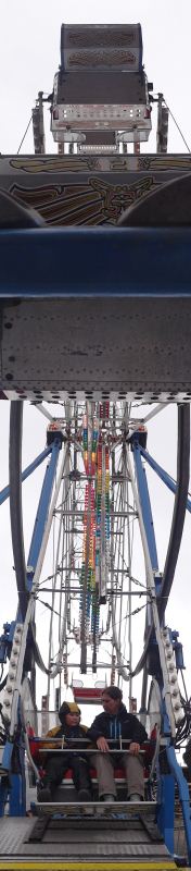
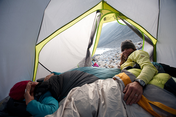
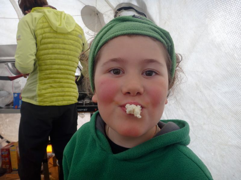
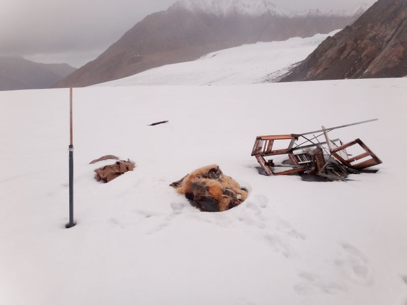
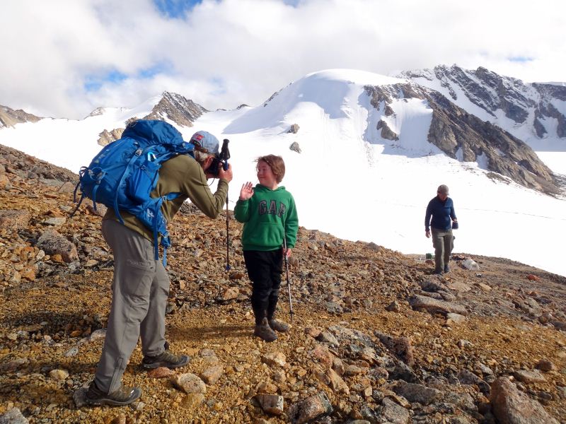
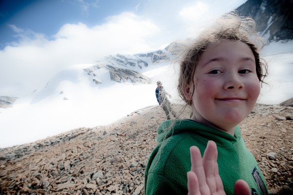
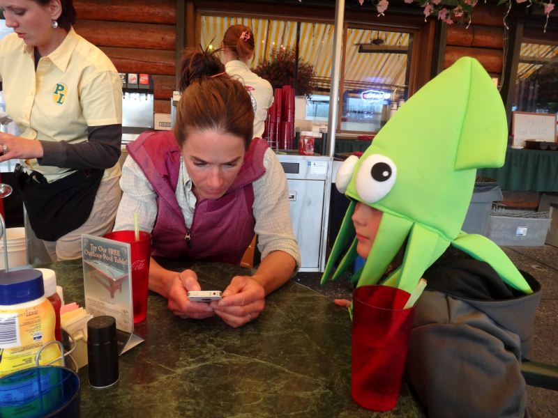
Note: The photos here are a mixture of mine and Ace Kvale's. Ace is a professional photographer and you can find his website here: http://www.acekvale.com/ You can distinguish his photos from mine by the quality (and the slightly smaller size). 10 August 12 McCall Glacier A week into our August trip and we're sitting in snow. We began this trip a little later than we had been the past few years so that we could spend a day at the fair in Fairbanks, something we hadn’t done in 10 years. Turner had never been to it, and didn’t even know what it was. So I timed our trip so that we could go the day it opened and leave the following day. He had been mostly out of his wheelchair for about 2 weeks, though using it any time we had a lot of walking to do, and for this event we didn’t bring it at all. We gorged ourselves on funnel cakes and fair food, rode the rides, pet the bunnies and goats, window shopped in the booths, watched jugglers and comedians, and generally had a good time. But soon it was time to go and get a good night sleep before starting our trip.
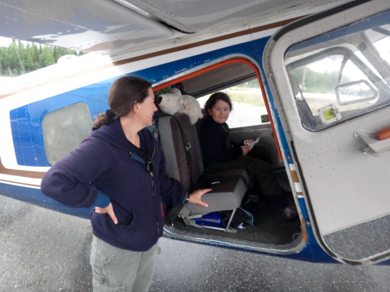
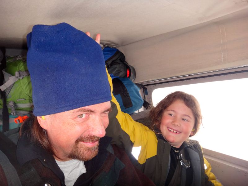
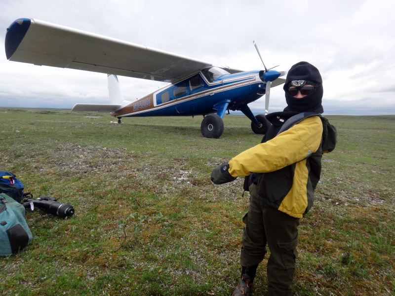
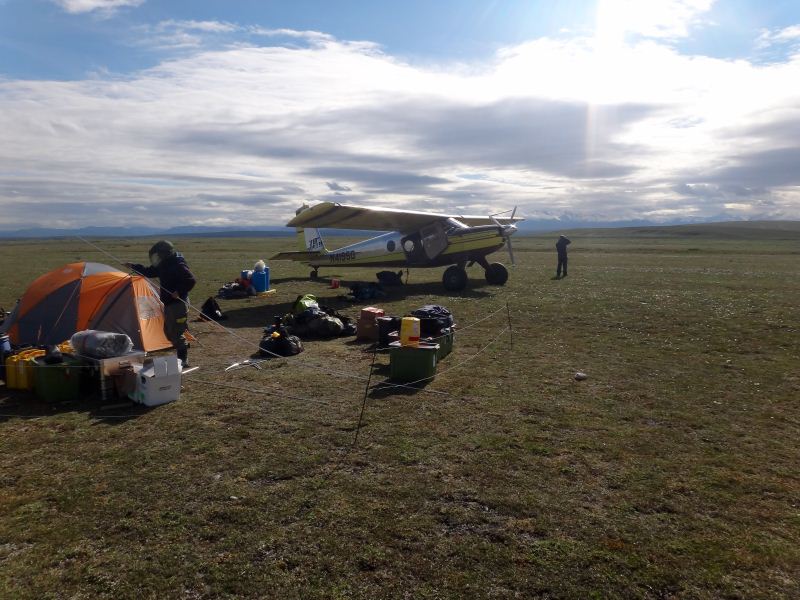
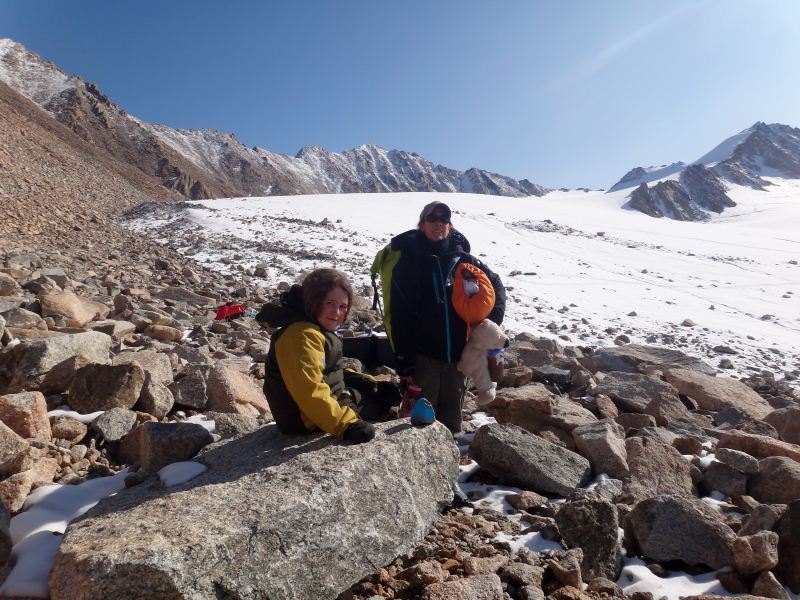
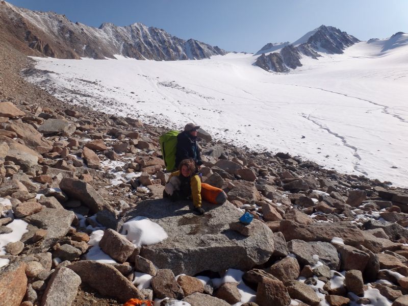
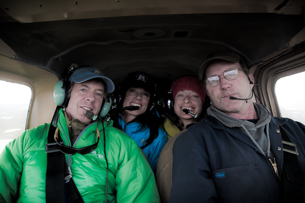
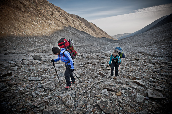
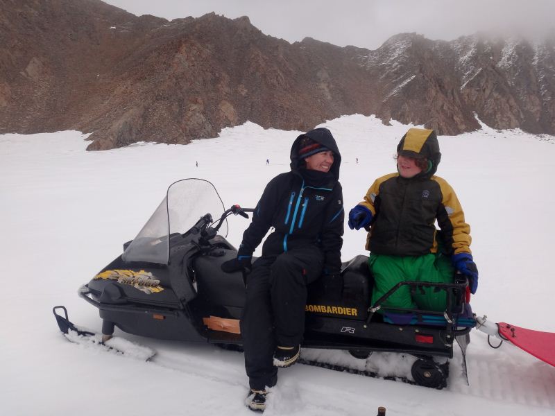
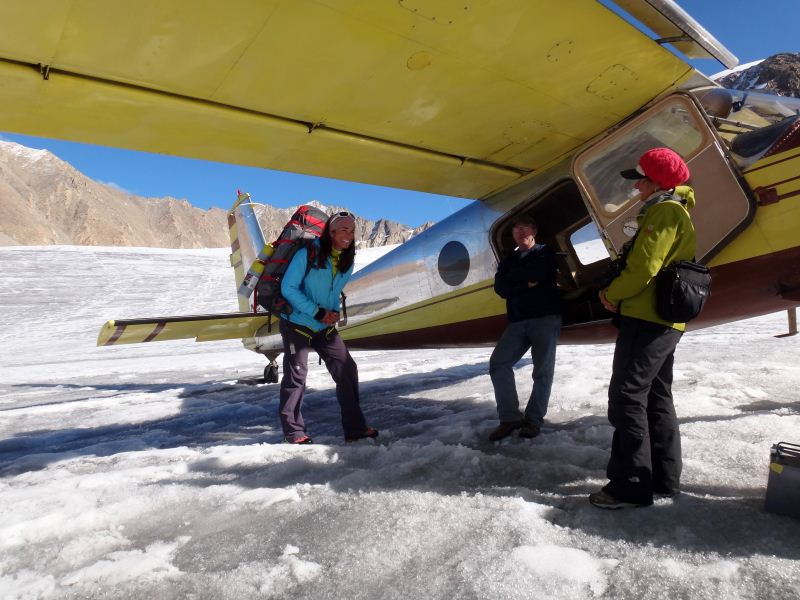
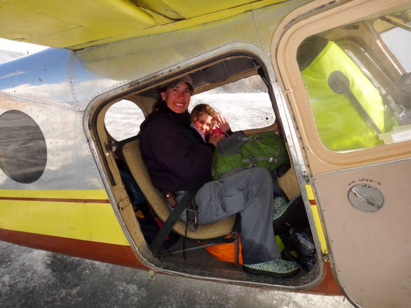
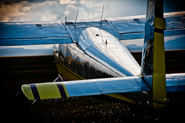
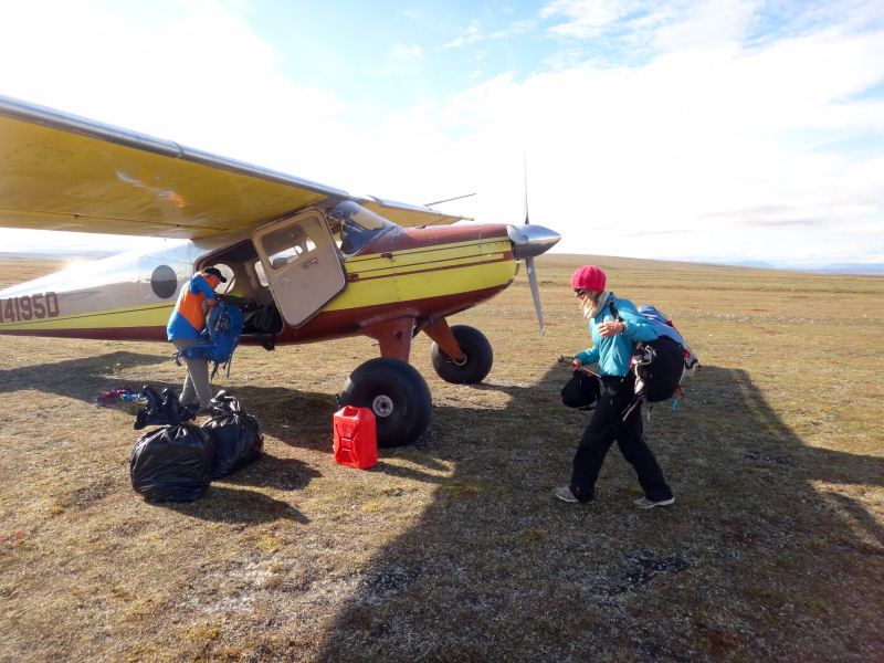
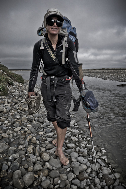
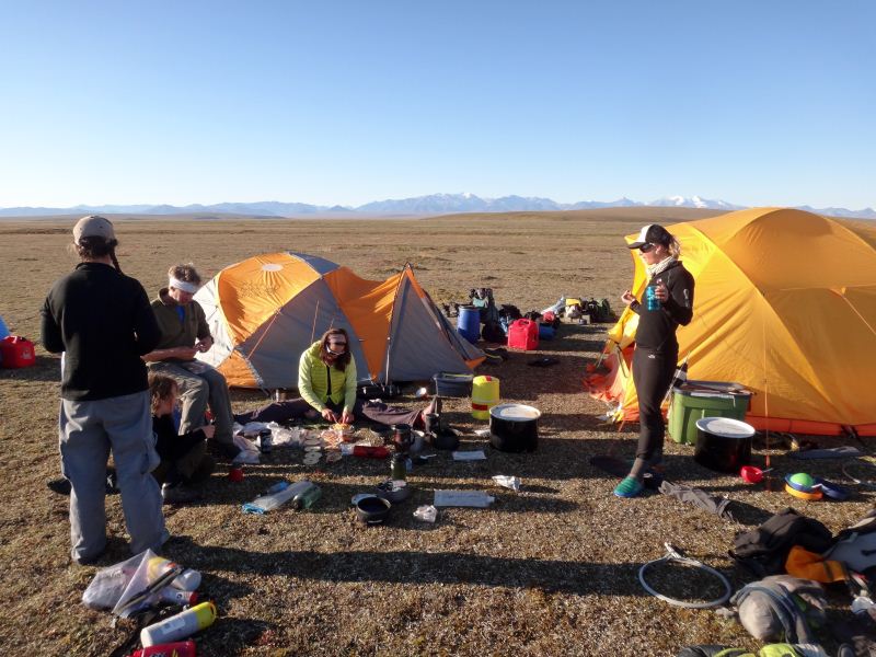
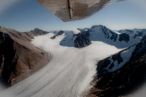
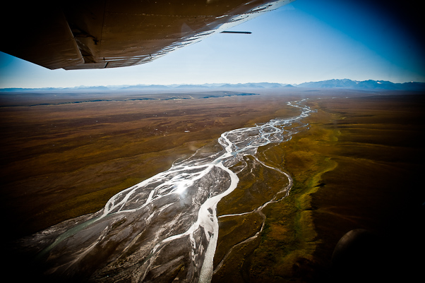
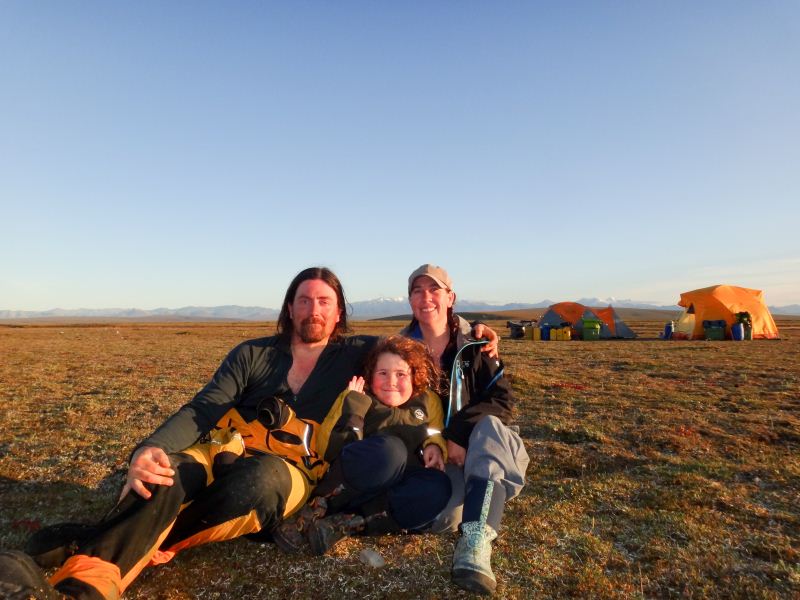
This year's logistics were different yet again from years past. Our trip began about 7:30 AM at Wrights Air Service in Fairbanks on Saturday the 4th. This was the first time we had actually scheduled a flight with Wrights, though we had used them several times for unplanned shuttles in the field throughout the years. Turner, Kristin and I loaded up in one of their Helio Couriers piloted by Daniel, and by 9AM or so were on our way to the tundra. After making a stop for fuel in Fort Yukon, we were safely at our stream gaging site on the Jago River at the strip known as Bitty, named after a nearby USGS survey monument. Turner was a bit nervous at the start of the flight, this being his first flight in a small plane since our accident in June, but in general did great and was in good spirits.
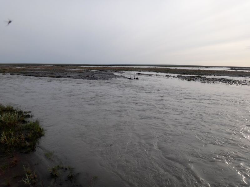
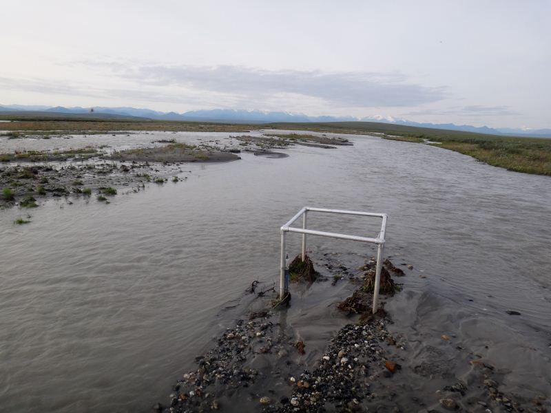
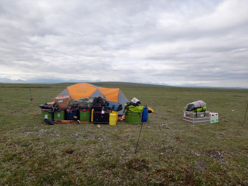
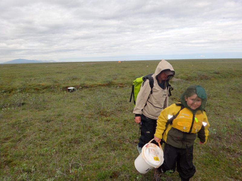
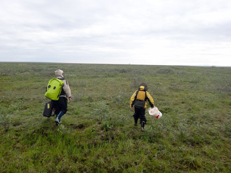
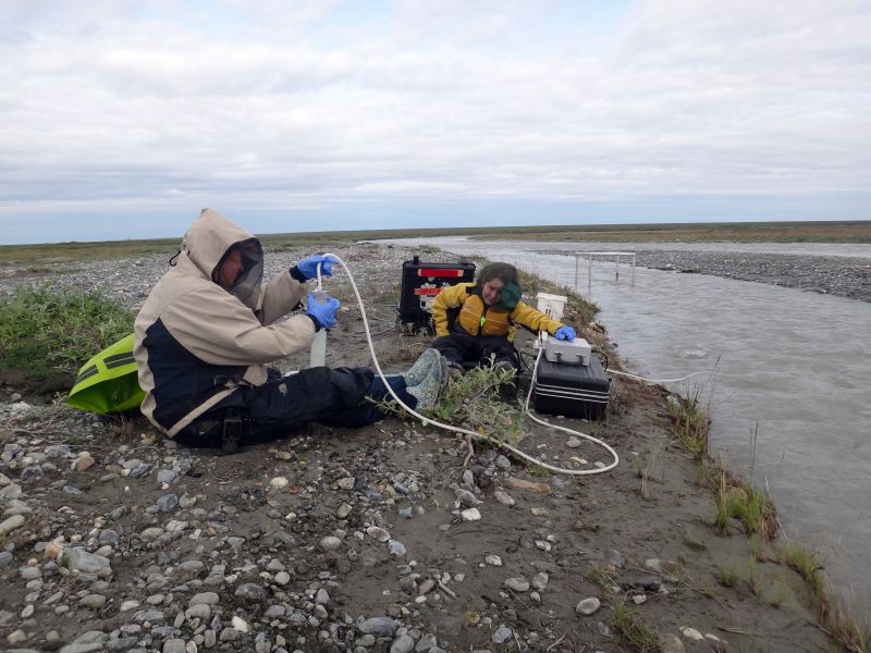
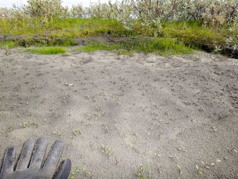
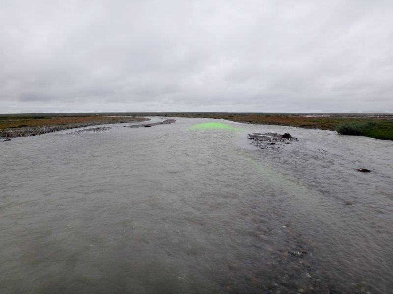
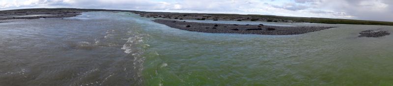
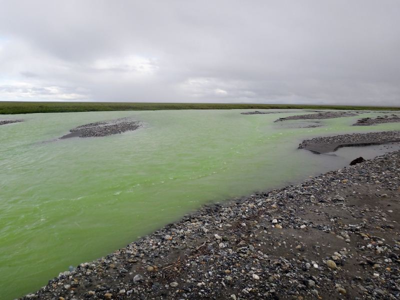
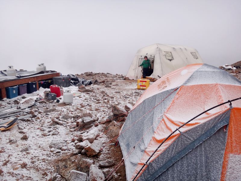
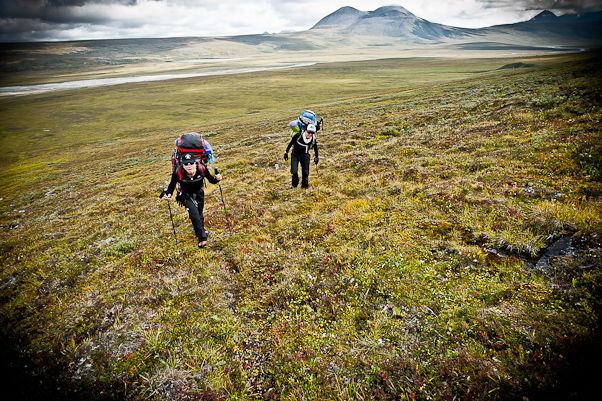
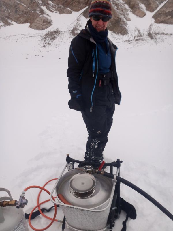
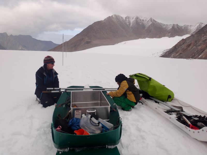
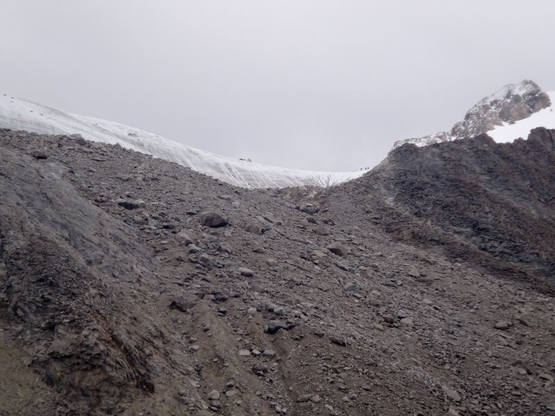
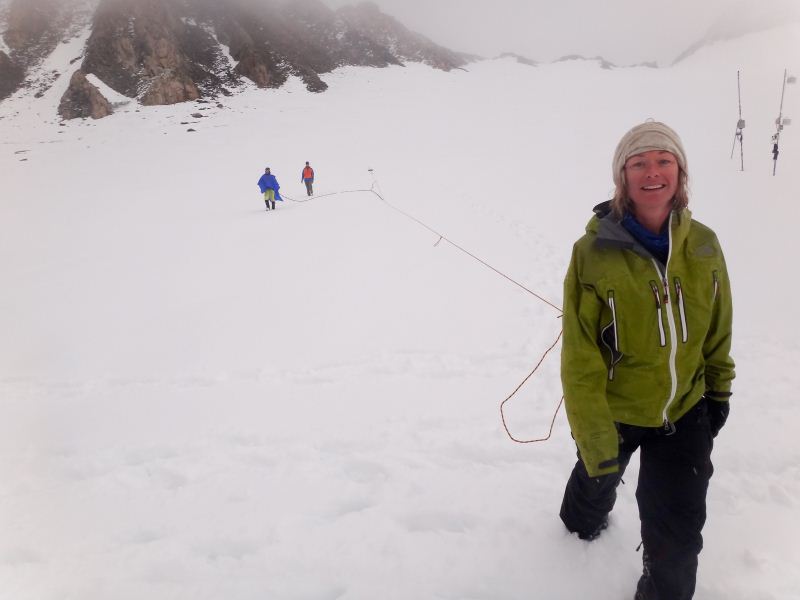
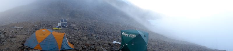
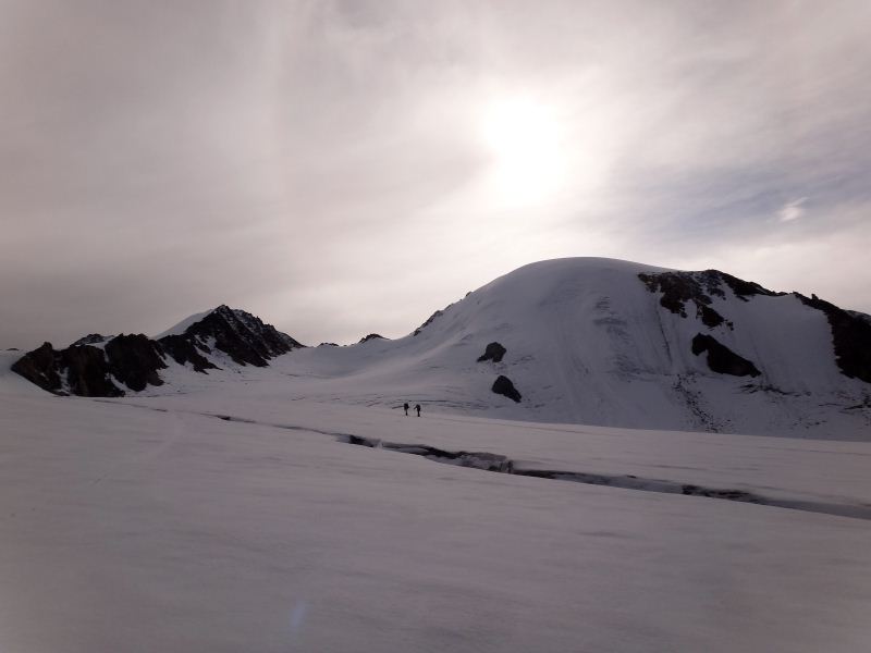
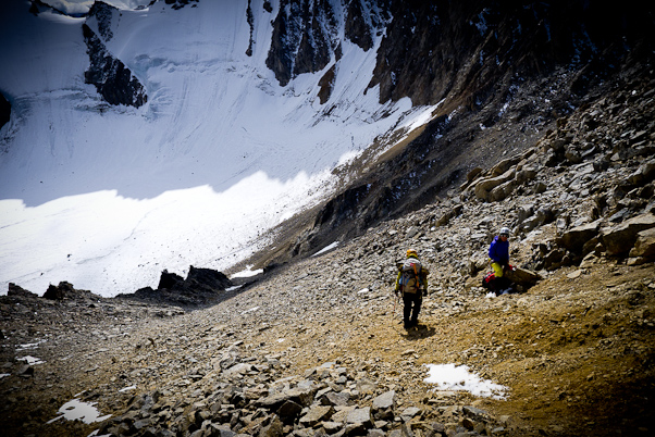
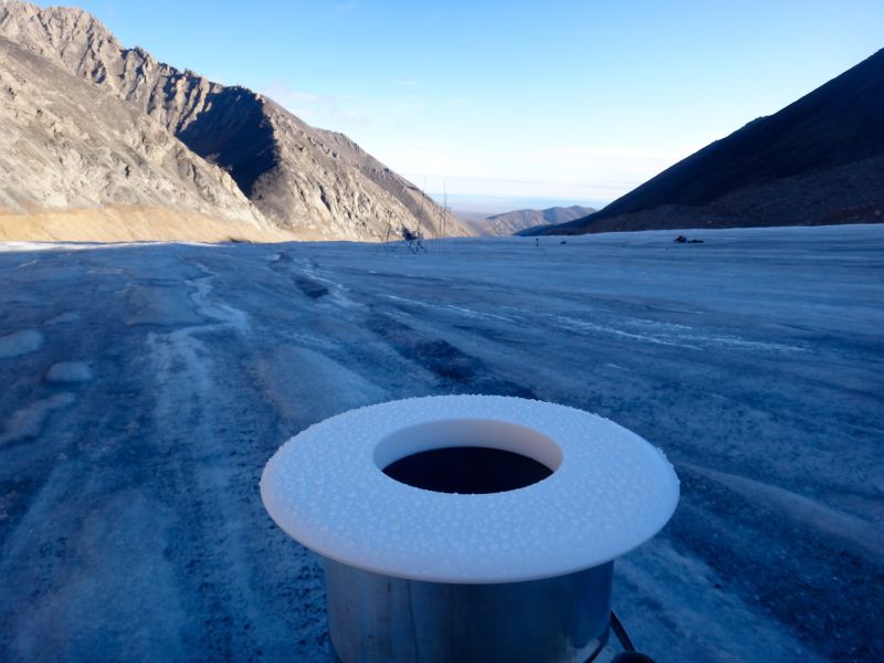
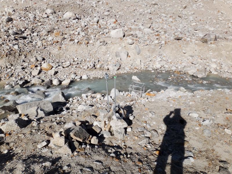
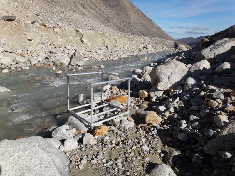
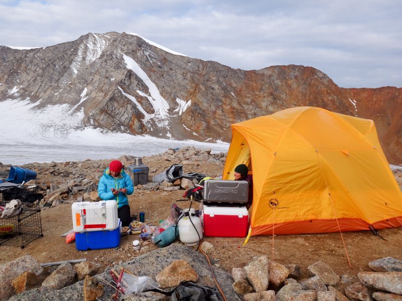
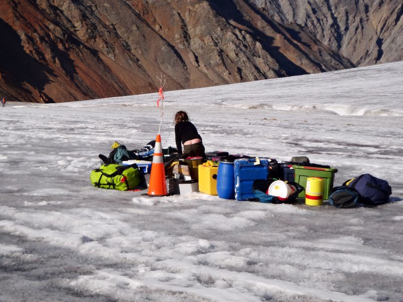
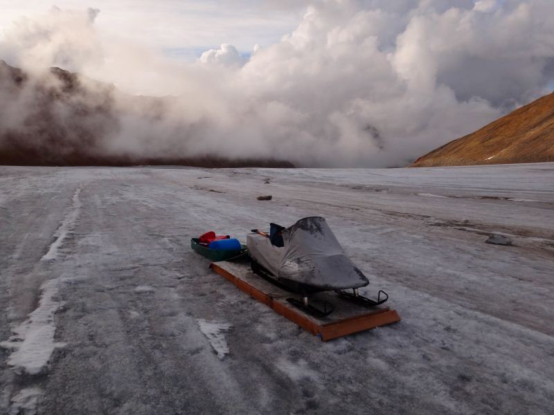
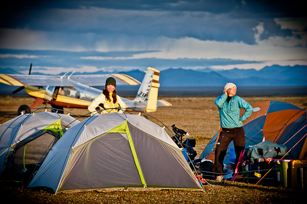
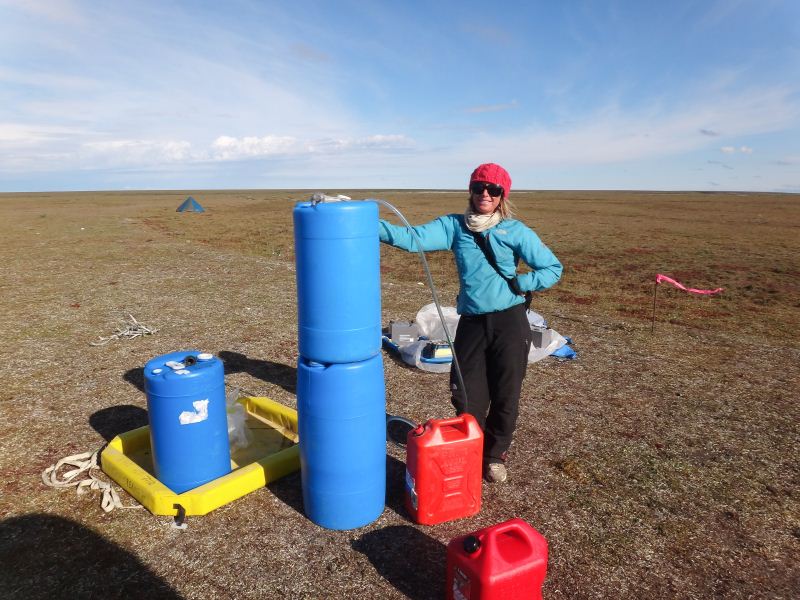
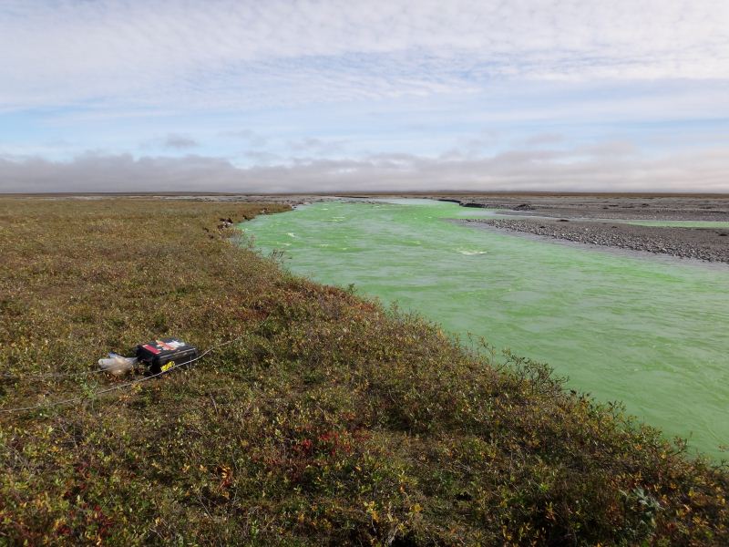
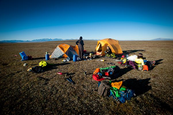
It was a bit breezy and there was rain storms on the horizon, so quickly got our tent set up and everything secured just in time for the rains to meet us. It having been a long week of packing and preparations, we all took a nap while the storms blew past. The goal of this part of trip is the same as our work here in June, to get a better sense of the amount of water and sediment flowing in the river here. In June, I used two methods to measure water discharge, one where I walk across the river with a gage and another where I dump dye upstream and measure how much it gets diluted. Both methods gave essentially the same results, so this trip I was just using the dye method, as I could then avoid having to wade across the river, which ranges from problematic to impossible during high flows. I took a long walk downstream after our nap to see if there was a better location for the work than near the air strip. The problem with our location here is the that river is quite braided, and all measurement methods work better where the river is in a single channel. The logistical problem is that there is no place to land an airplane where the river is in a single channel, as all of the good strips are located on old river braids which have become vegetated, as this is where the ground is flat and hard. It was clear that several miles downstream would be a better gaging location, but it was simply too inconvenient for this trip. Besides my ribs not liking it when I carried heavy backpacks, the time it took to walk there and back every day, or worse having to troubleshoot problems so far from camp, was just too much for such a short trip. So, I gaged right where we did in June, treating the two main branches of the river as separate rivers. The next morning I headed downstream to retrieve one of my instruments, which measures turbidity among other things. Turbidity gives us an indication of how much glacier silt is in the water. We filter river water in the field and weigh the filters in the lab to determine the actual amount silt in the water when did the filtering, and then relate this to the continuous turbidity measurements to make estimates of annual sediment flux. I mounted the instrument on a cage that sits in the water, so that the unit stays upright in the water because the cage does. I had developed and used this design for several years without issue, but this time the entire works got washed about a kilometer downstream, though still upright. So I dragged it back, brought the instrument into the tent, revived it, and brought it back out to the river for redeployment.
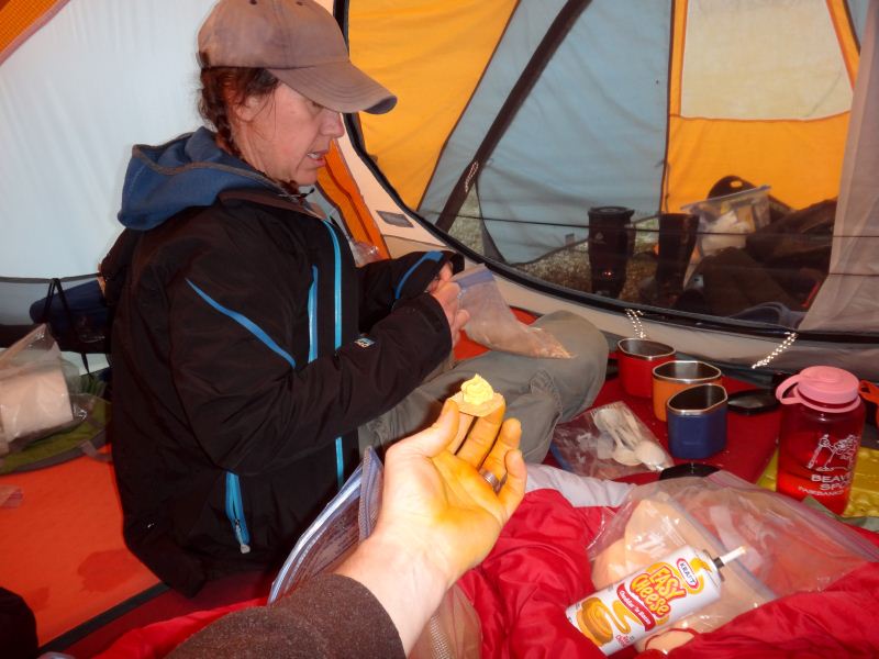
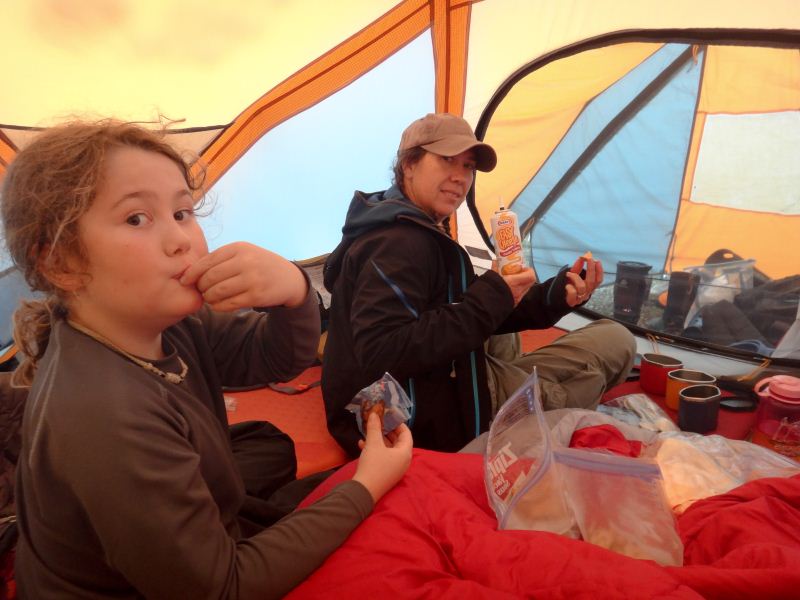
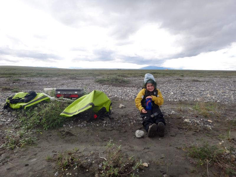
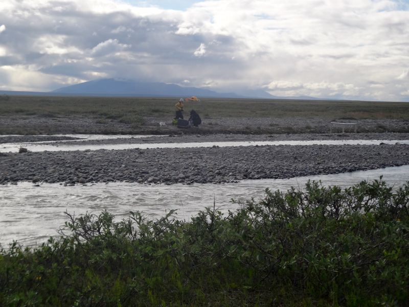
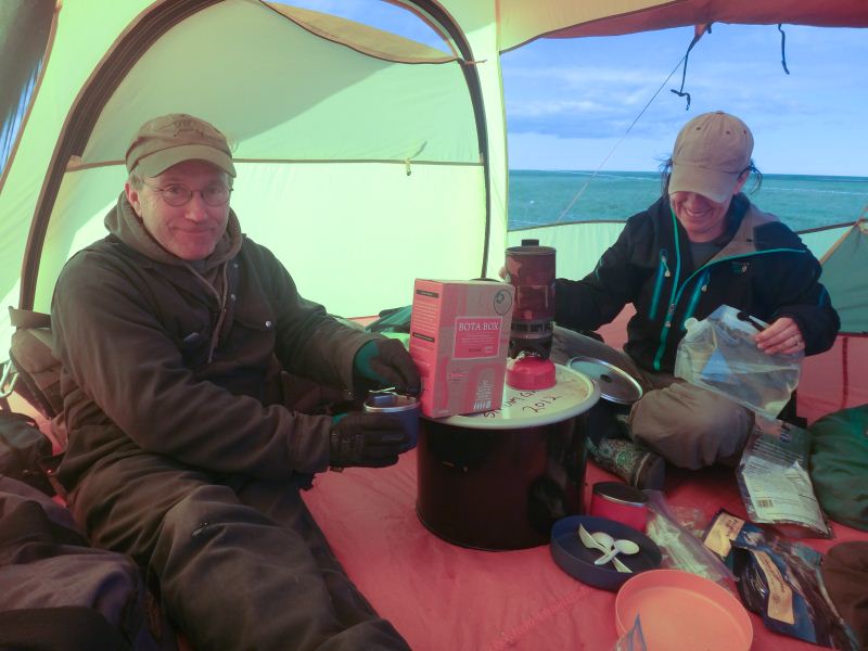
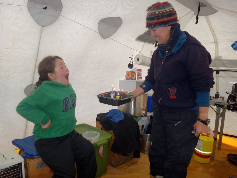
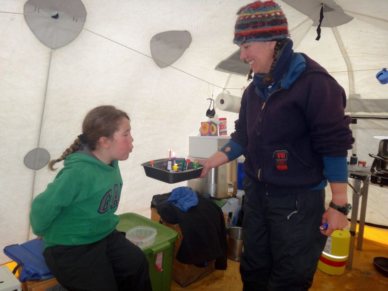
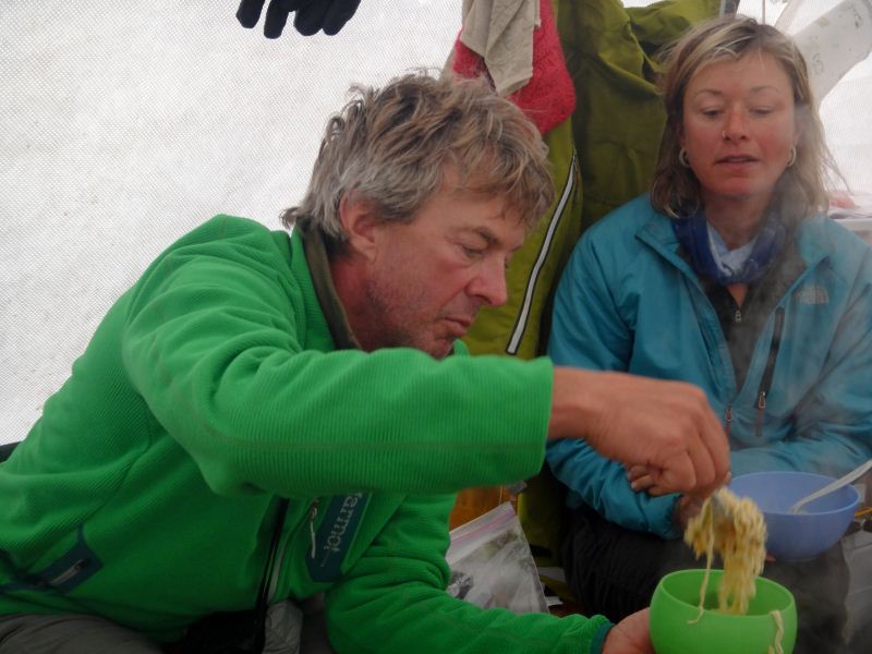
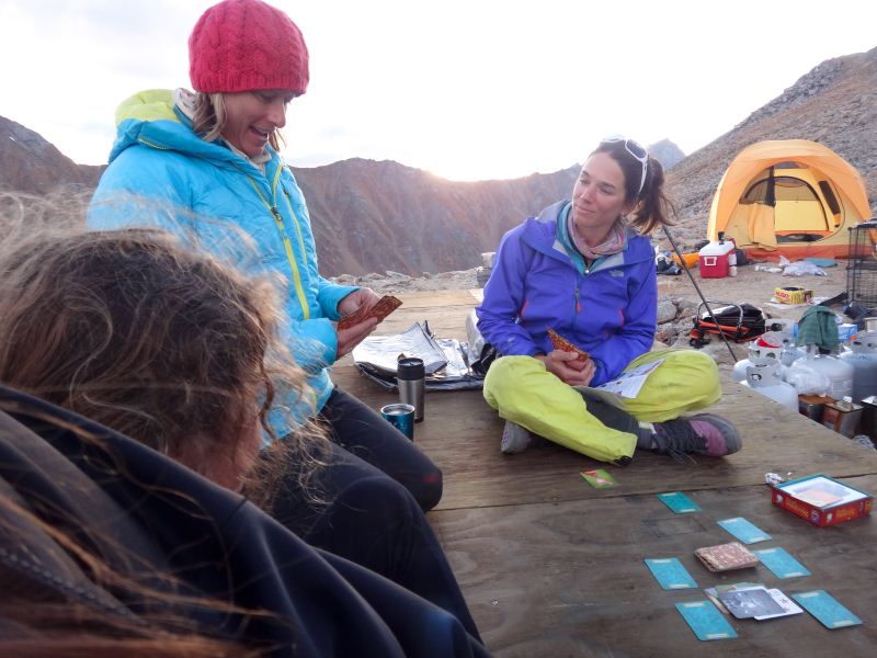
It was after lunch by the time I started stream gaging. In June, I used dye in liquid form which was easy to throw into the river. This time, the technician that prepared those solutions decided to leave it powder form and mix in the field, and this turned out to be quite problematic. The trouble was that the powder clumped and didn’t mix well, and the method depends on the dye being completely mixed in the river. I tried what I could while out there, but it was unsatisfying and I knew the results would be poor. I was in a grumpy mood in general and by the time I got back to camp about 5PM I felt like I had largely wasted a day. There were two planes at camp as I approached. Mike had landed in the 206 with a couple of hunters and was airborne again by the time I reached there, and Bob had landed in the Helio with a load of our gear. The general idea was that when Wrights dropped us off, they were going to go to Deadhorse to bring it to us that day, but unfortunately several days of delay at Alaska Airlines had caused it not to arrive there yet. This was largely glacier gear for the next phase of our trip, but there were a few things for the river trip that we wanted but couldn’t take with us due to weight limitations on our flight. Before taking off my dry suit, I located the booze box in cargo pile and dug in. It was my birthday after all. I offered to the others, but they were eager to get on their way to kill sheep so soon enough it was just the three of us again. After blowing out a candle on a Hostess cupcake, we enjoyed playing some new card games before calling it an early evening and looking forward to a more productive day. I spent most of the next morning working to calibrate the fluorometer that measures the dye concentration in the water. The general idea is that the turbidity of the water can affect the measurement of concentration, so by putting a known concentration of dye in a bucket with a known concentration of river water, we can determine the confounding influence of the sediment. I had trouble with in June because the calibration solution was mis-measured in the lab. It seemed that something similar had been done this time too, and it took several hours of troubleshooting to get to the point of giving up. The error induced is not large, and I collected enough info that I could still apply it after some lab work, so we just moved on. Kristin and Turner had by this time finished all of the water sampling, so they headed back to camp while I headed upstream to dump the dye. I had developed a better method of mixing the powder at this point, and felt like it was likely to yield better measurements than the day before, so I got back to camp feeling more satisfied about it. It was mid-afternoon by now and I thought to do a second measurement after dinner, but the rains started again and were fairly intense, so I couldn’t develop much enthusiasm for getting suited up again and after a few more card games we called it an early evening.
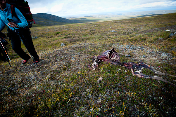
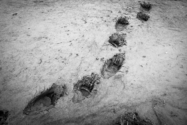
The rains didn’t let up overnight, but by early morning were down to a drizzle again. I had processed the data from the fluorometer to discover that there was something wrong with yesterday’s measurement of the smaller stream channel, as if the fluorometer was stuck in the mud and the water didn’t flow through it, so as yet I still had not made a complete and accurate measurement of discharge. So I chose a slightly different location for the fluorometer in this channel. The work went well and I was back to camp before lunch, and the rains had stopped too so we went exploring for caribou antlers and whatever else we might find. We saw a bear, perhaps the same one that visited us in June, a fox, who watched us curiously for quite a long time, a variety of birds, and of course the ever-present sik-siks who were likely plotting to invade our camp while away. We made another set of discharge measurements and water sampling before dinner, brought all of the equipment back to camp, and began turning our attention to the next phase of the trip – going to the glacier.
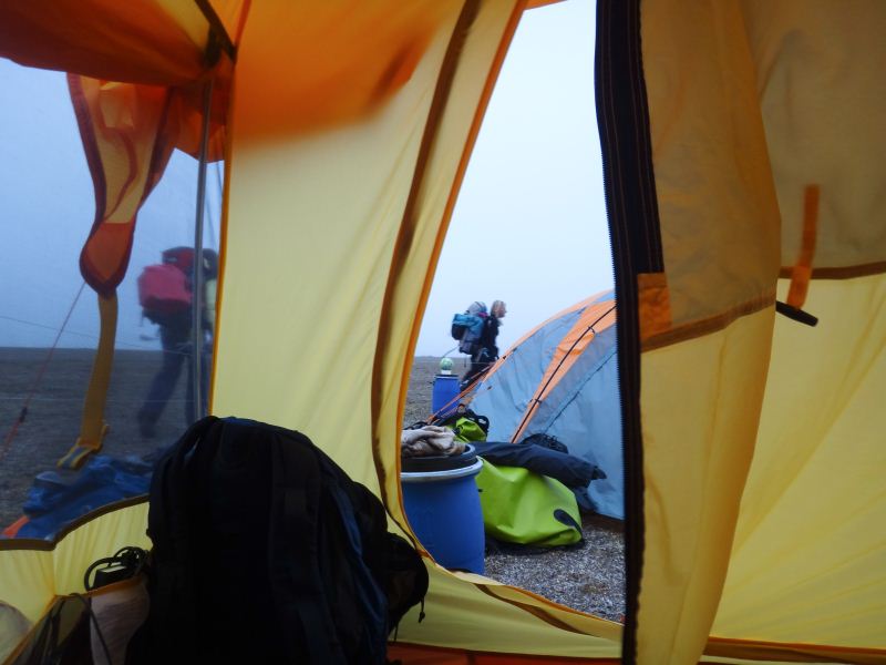
We had arranged the night before to call Bob at 9AM for a weather check, as apparently he had a late night planned and needed some sleep. The weather this day, the 8th, was great on the tundra and glacier, and Bob anticipated leaving shortly. As we waited, we watched the close slowly converge around the glacier and by noon, when he arrived, it was totally socked in. We unloaded the plane and watched as things began improving through the early afternoon, and it seemed doable again. The issue now was that we really wanted to have the entire put-in done on the same day, as leaving gear sitting on the tundra is generally a bad idea due to animal predation, plus it takes half a day to get camp set up and reliable and we don’t want to start that after dinner. So we decided to risk calling it a day and hoping for good weather the next morning, and with Bob staying the night with us we could potentially leave quite early. So set the cook tent back up, had an early dinner, and chatted about airplanes and life before calling it an early night.
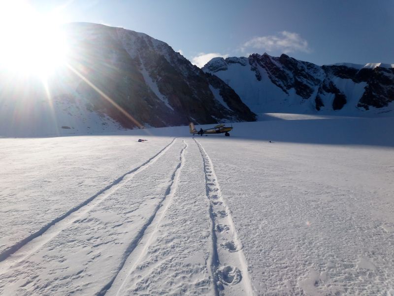
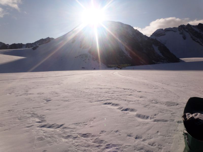
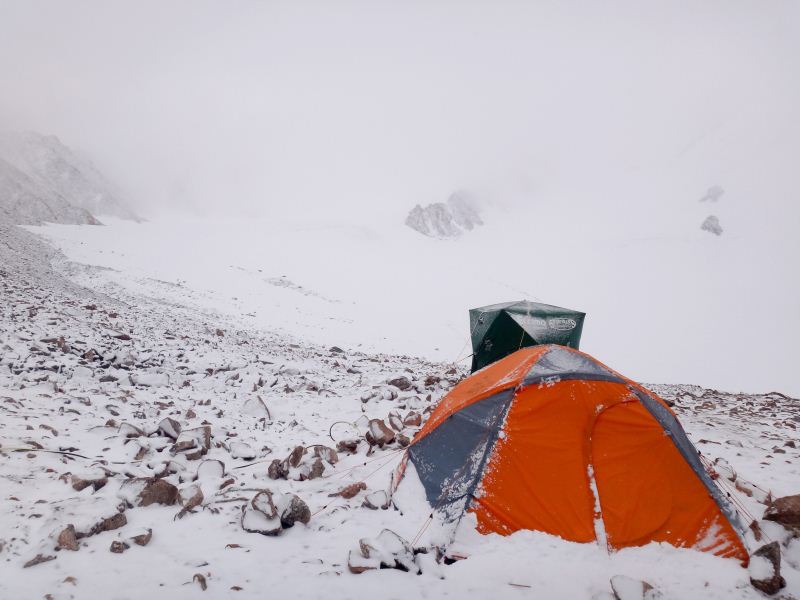
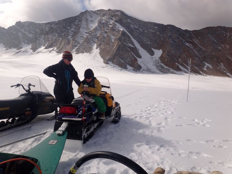
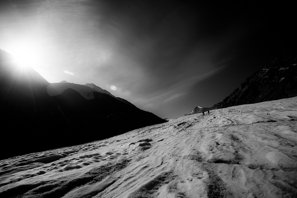
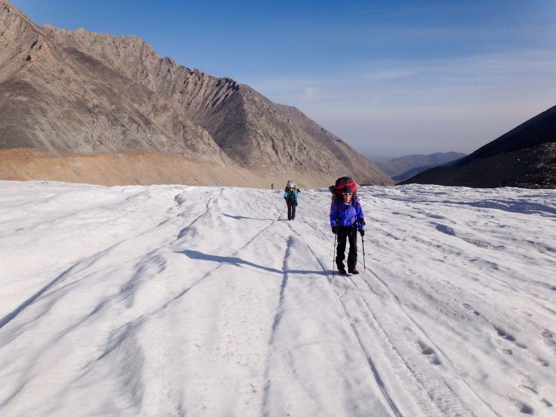
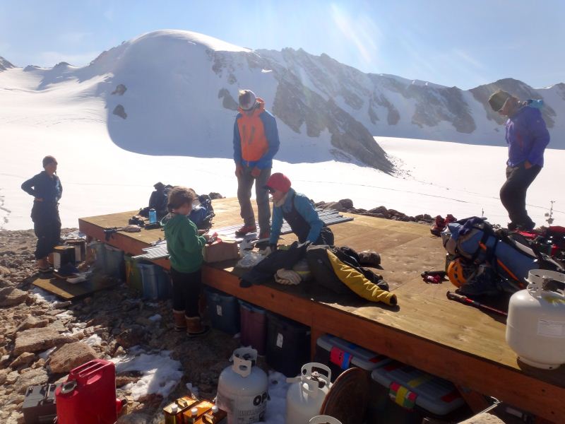
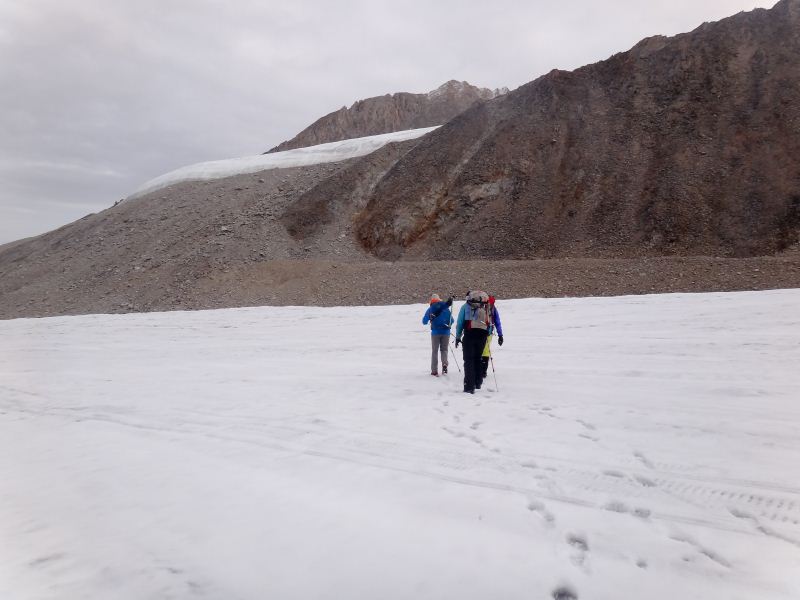
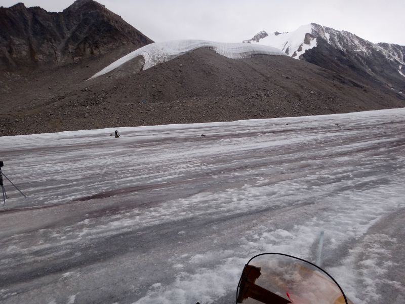
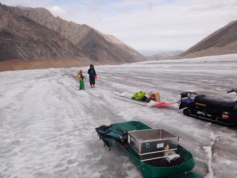
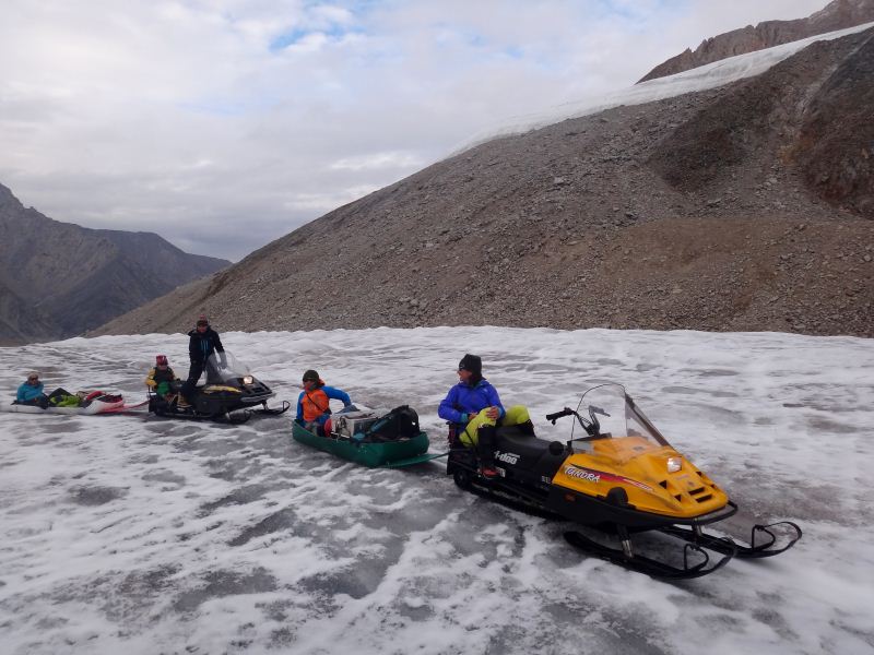
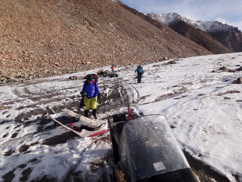
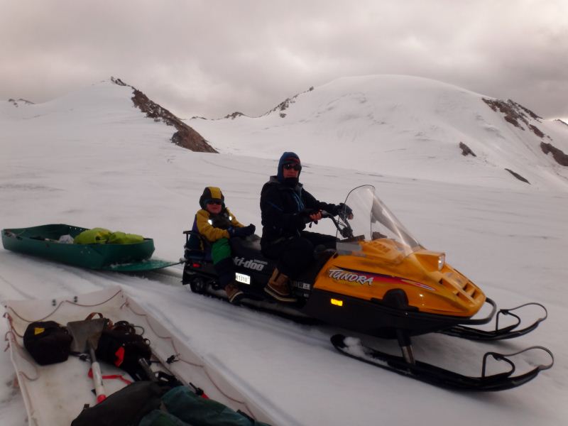
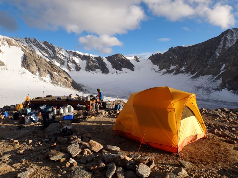
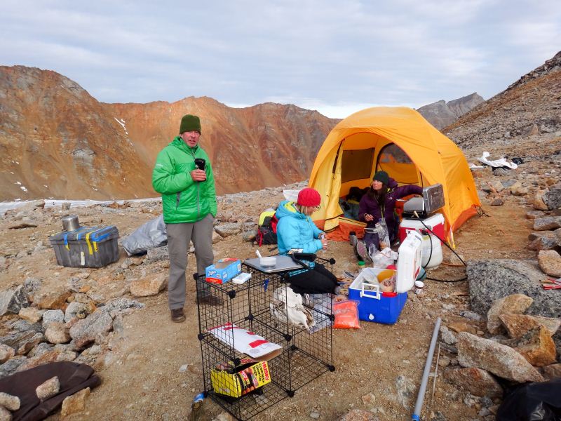
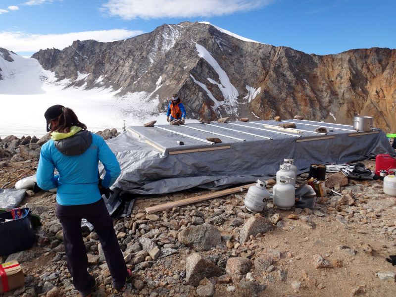
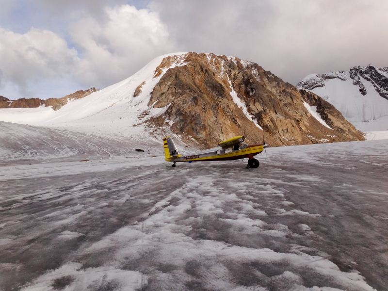
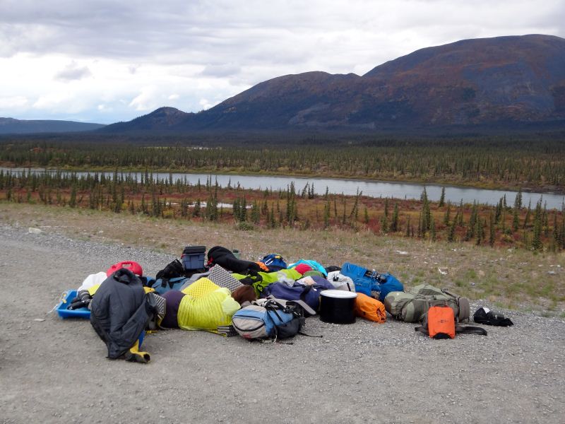
Fortunately our gamble paid off and at 6AM the mountains were clear and calm. We packed our gear, re-sorted our piles, and woke Bob up with a cup of coffee at 7AM. We launched before 8, with just me and personal gear to stay as light as possible. It was a short flight to the glacier, and generally calm, though with some burbles and downdrafts once inside the valley. The heavy rains earlier in the trip had dumped snow on the glacier, but our cones were still clearly visible and we lined up on them as we made our final approach. We touched down just past the lower threshold and quickly came to a stop in the new snow, then fortunately were able to taxi to the top of the strip before coming to a stop. I went straight away to get the snow machine started to potentially pack down the snow, but in the end we decided it wasn’t worth the effort. Bob took off to get the next load, and I went to check out the route to camp and check on the other snow machine. Fortunately it started right up too, and it wasn’t long before I got back to the skyway that Bob had returned with Kristin and Turner. It was now only about 11AM, so we were in good shape for the rest of the day and weather seemed to be holding. While Bob went for the next load, we went up to camp and began getting tents up and gear dug out of the cache. It was 3 more plane loads, after roughly 300 pounds each, with just enough time between each for me to haul a load upglacier with the snowmachine, hike one load up the hill to camp, and help with camp set up a bit before returning to meet Bob again. By 6PM, I made my last trip up the hill to camp and we were finished with our put-in. We got camp secured in case the weather changed, ate a simple dinner, and crawled into our sleeping bags to watch an episode of Gilligan’s Island before falling asleep.
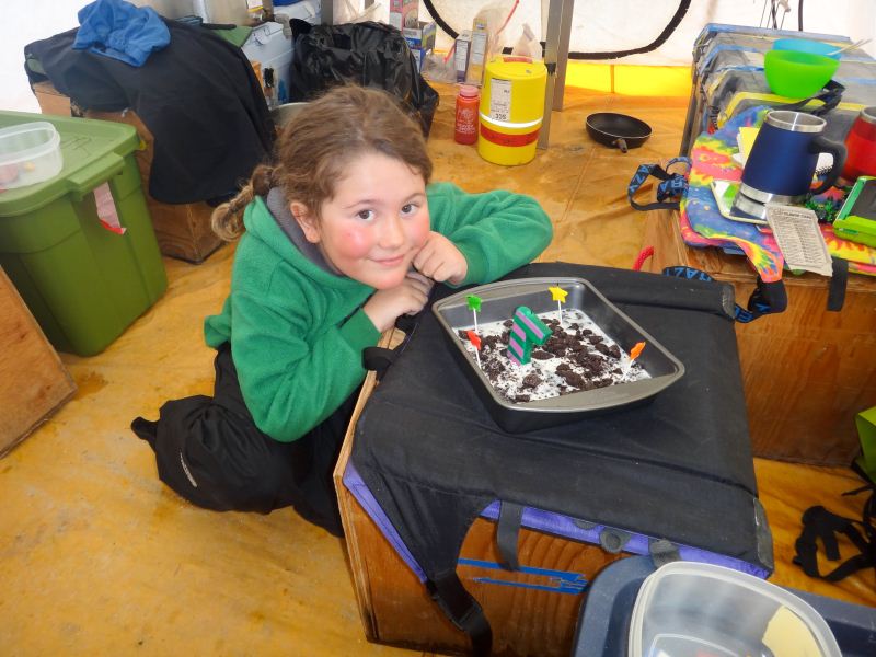
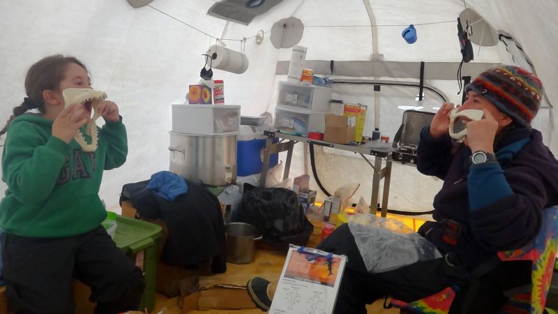
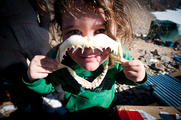
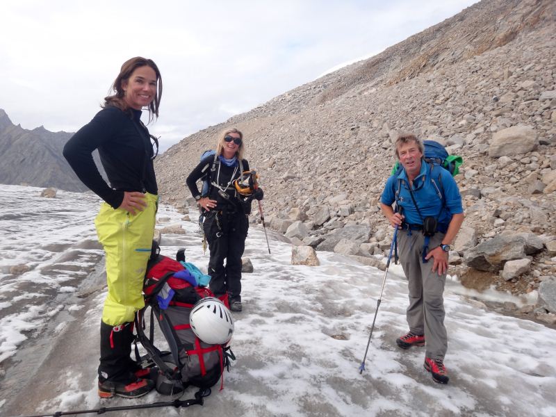
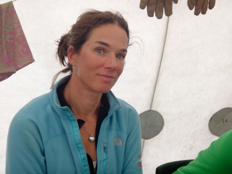
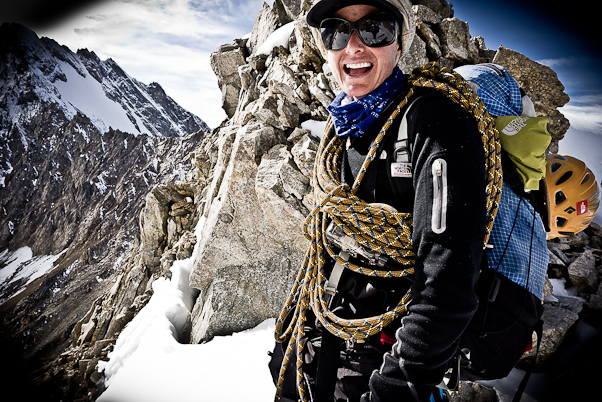
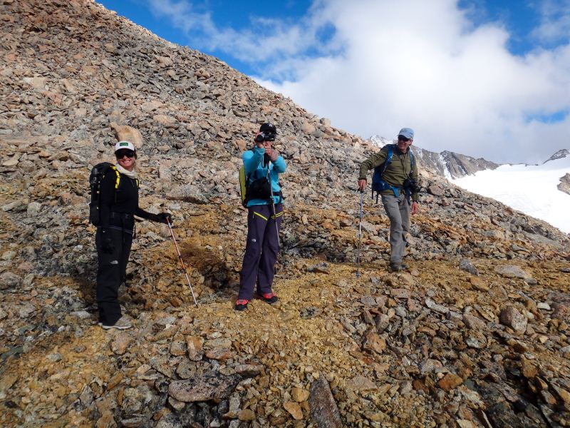
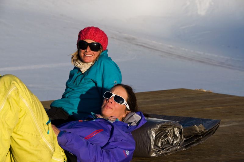
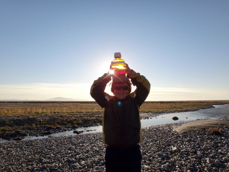
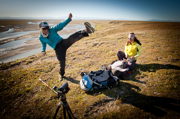
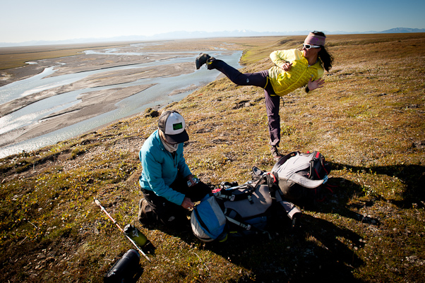
Now it’s the 10th, Turner’s birthday. It began snowing overnight and it hasn’t let up since, it now being after noon. Today the remaining members of our trip are due to arrive, but given the weather it’s not clear that this will happen. The general plan is that they would arrive in Deadhorse about 1PM, then Bob would fly them to the glacier. We’ve been in a cloud most of the day and weather on the coast doesn’t seem much better. Our backup plan was that they would hike in from our strip on the tundra, but hiking up the glacier in a whiteout having never been here before is also not the greatest of ideas... 15 August 2012 McCall Glacier The weather never improved on the 10th, but we enjoyed a nice birthday anyway. The rest of the team did arrive in Deadhorse, but spent the night there. This part of the team includes Kit Deslauriers and Kasha Rigby, who are professional athletes with the North Face, and Ace Kvale, a climber and professional photographer for TNF and Marmot among other things. Their primary contribution to the project was to climb/hike to a variety of nearby glaciers and use the ice radar system to measure how thick these glaciers are, so that we can make better estimates of how much glacier ice there is in Arctic Alaska. I initially met Kit 2 years earlier, when she and Kasha and several others were heading out of Coldfoot in April for a 2 week climbing trip in this area. We stayed in touch afterwards, and she expressed interest in finding a way to assist our project in some way. After having such difficulty with my previous attempts at radar, I thought this might be the opportunity. I've never been much for walking knife edge ridges or leading steep ice climbs, but there was something about this area that always struck me as being sketchier. The few times I've ventured up along the walls to repeat a photo have usually resulted in some form of mild terror. Not just because of the height and exposure, but the recently deglaciated rock just seems so loose and perched and every step just seems like its going to be my last. But these guys know the area and are literally the world's leading experts at this sort of thing, so it seemed the perfect approach. At first I was thinking just to tag along, with them leading and me running the lidar, and then after the accident in June I tried to line another radar type to join in so as not to overstress my remaining bones, but it was already too late to organize. So the current plan is to give them a crash course in running home-made radars and turn them loose. The other side benefit of their participation is that their own outreach efforts may reach different communties than our other efforts, for mutual benefit. Unfortunately the snow that we were getting on the glacier was fog and rain on the coastal plain, so there wasn’t much hope of them getting in that day. There wasn’t much for us to do either except shuttle loads up from the glacier and get camp settled in better, until it was time for cake and presents. Turner was very happy to get some new shark jaws and a new superhero figurine, and we were happy to get a good night’s sleep.
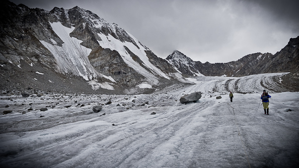
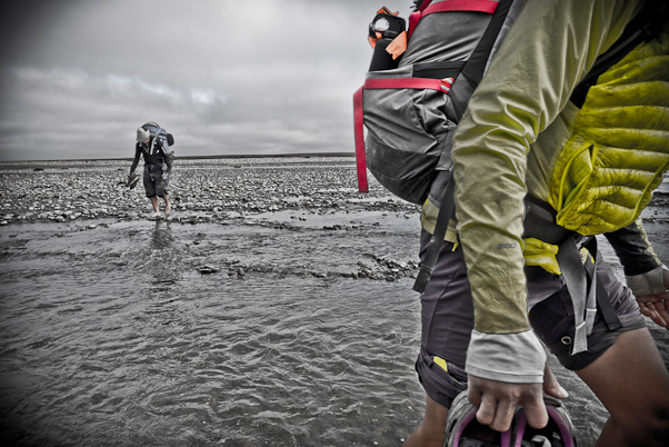
Overnight the snow stuck and coated our knoll with about an inch of snow. This made the trail quite slick and visibility on the glacier was still nearly zero. So we spent the morning cutting survey poles down from 10 foot to 3 meters, which requires removing about 4.8 cm. So each took turns using the pipe cutter inside the cook tent, and Turner invented a new game he was excited about using the small scrap pieces, so was eager to keep cutting. We also folded up the large tarps that had protected our floor and gear over the summer, which was another chore in the wind and rain. By late afternoon it seemed there was an improving trend in the weather, so Bob decided to launch from Deadhorse with the rest of the team. Unfortunately shortly afterwards the weather deteriorated again. The basic plan was that if they couldn’t land directly on the glacier then they would get dropped off on our strip on the Jago river and hike in from there. They got about 5 miles away before having to turn around due to weather, and landed out on the Bitty strip where we had been doing our stream gaging the week before, waiting and watching for a break in the weather. The weather never really improved, and we ate a nice dinner of salmon and rice and watched X-Men 1st Class while the others camped on the tundra and got to know each other better. The weather the next morning, the 12th, had improved considerably in that there was no snow and good visibility, but the ceiling was low and clouds moving fast. Bob waited for a break, but launched about 11AM to drop the others at our strip near Jago Lake. We stayed in touch with the hiking crew as they progressed towards us throughout the day, and about an hour after they started the weather had gotten considerably better and was probably landable, but at this point they were committed. Plus by now there was 5 inches of snow on the glacier, and this wasn’t the greatest for landing.
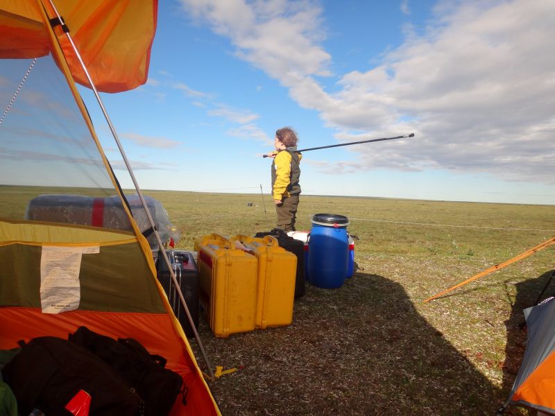
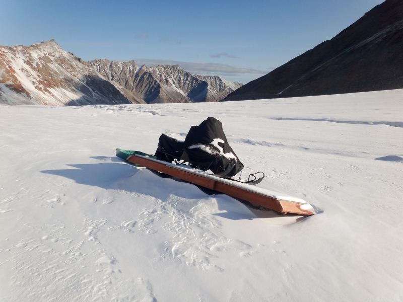
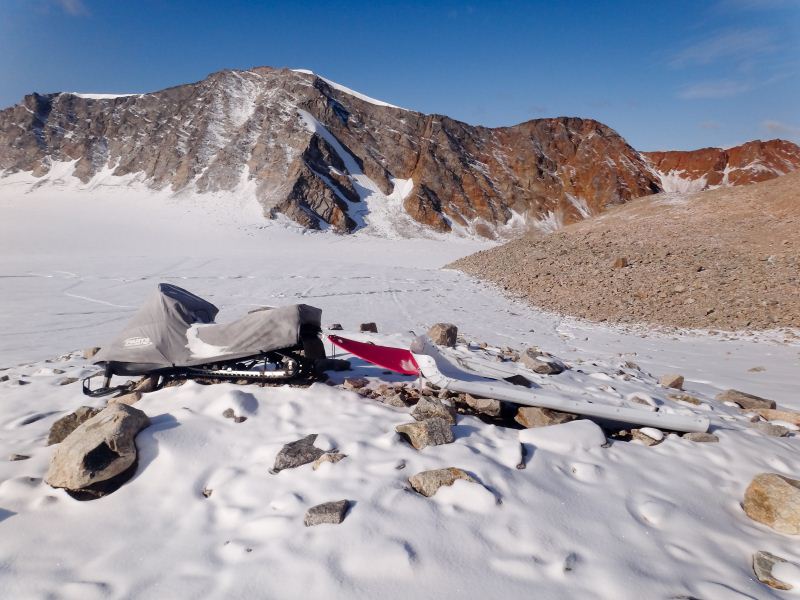
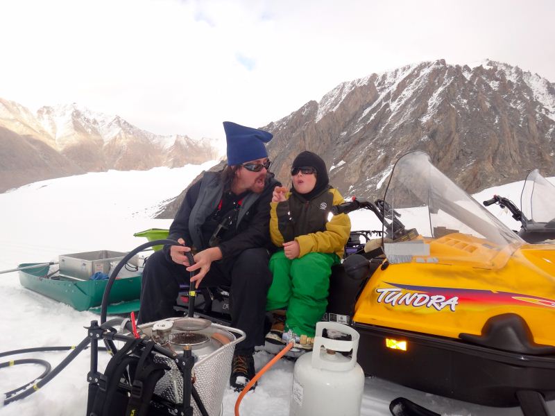
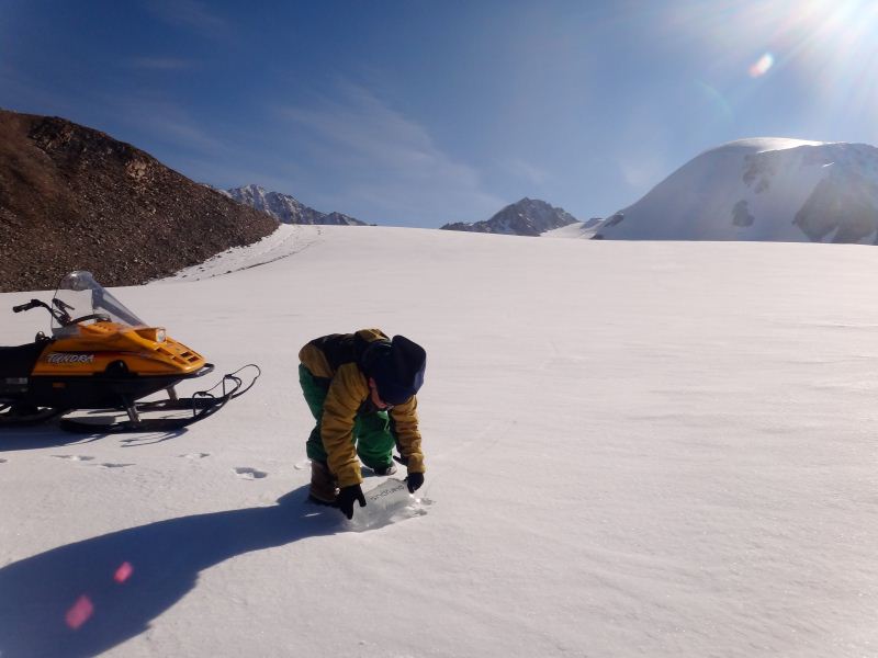
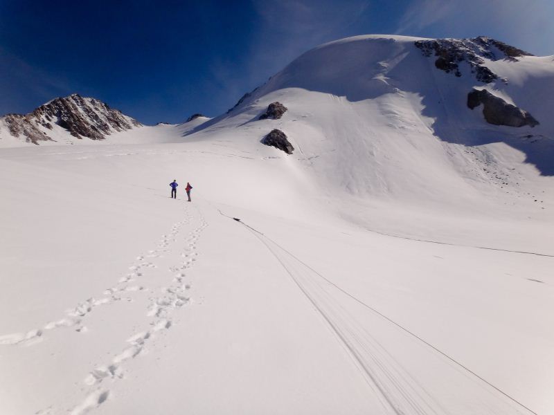
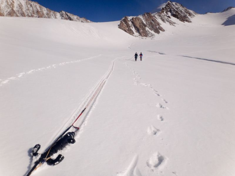
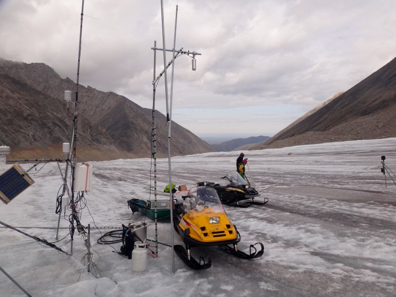
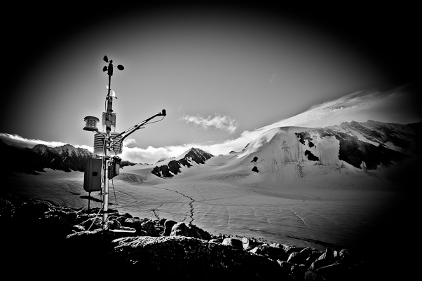
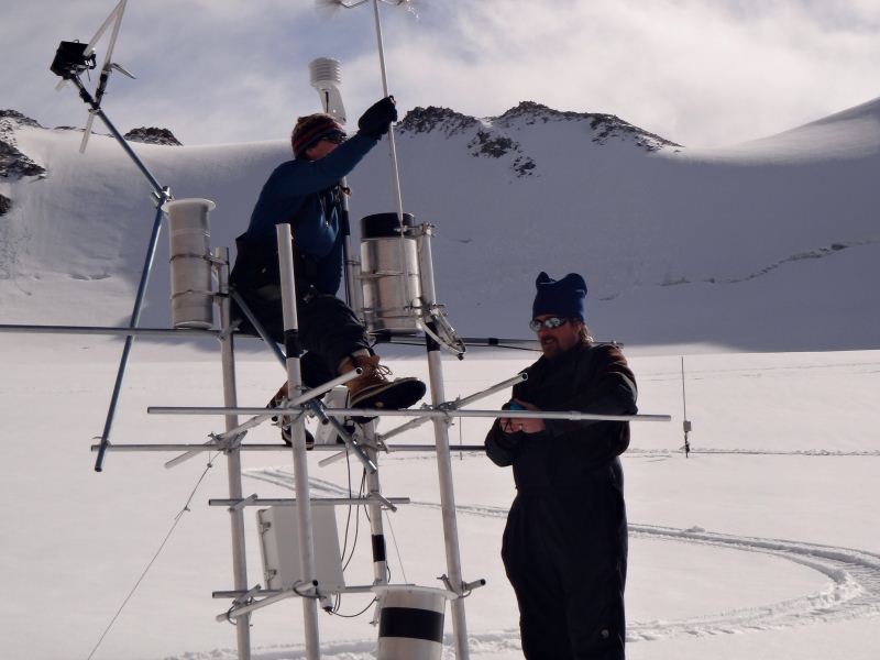
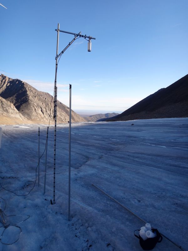
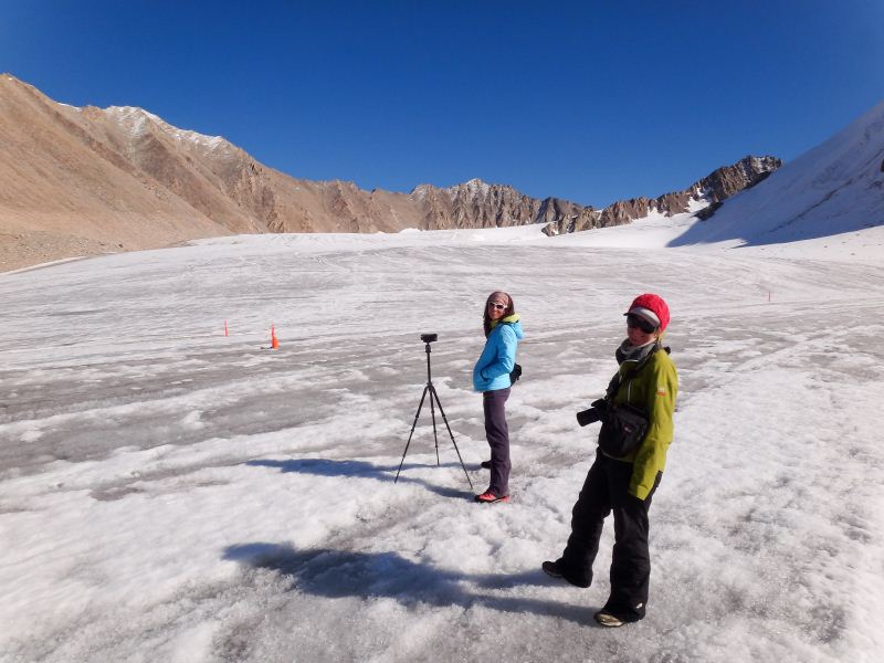
But it was fine for snow machining, so we headed out to install some new survey poles. I put in a new set of poles every 2 years. These poles are what allow us to measure how much snow accumulates or ice melts on the glacier, because we drill them in 5-8 meters into the ice and can watch them melt out or get buried with time. Mostly they all melt out, which is why I need to put new ones in. By putting them in every 2 years, at each of my stations I have at least 2 poles installed at any given time, which gives me some redundancy in measurement to help sort out mistakes. We also use these poles to measure ice velocity, and by having two poles at each location we assess gradients in velocity over short distances. In 2003, we installed poles at over 60 locations, but this was hard to manage and measure. Now I have reduced the locations to about 10, or about 1 every kilometer down the glacier’s two main branches, and about 35 poles total.
We finished up our work around 5PM, by which time the TNF crew was almost to the natural wier, making good time. We decided to have dinner then, as it would still be several hours before they arrived, and then head down afterwards to pick them up once we set up some tents for them at camp. I took a short nap to prepare for a long night, but as it turns out they decided to camp near the terminus as by 10PM they still hadn’t reach it. So we once again had the glacier to ourselves and looked forward to a full day tomorrow.
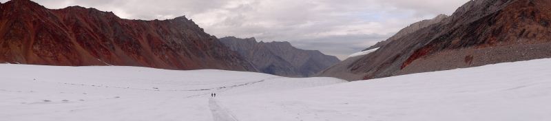
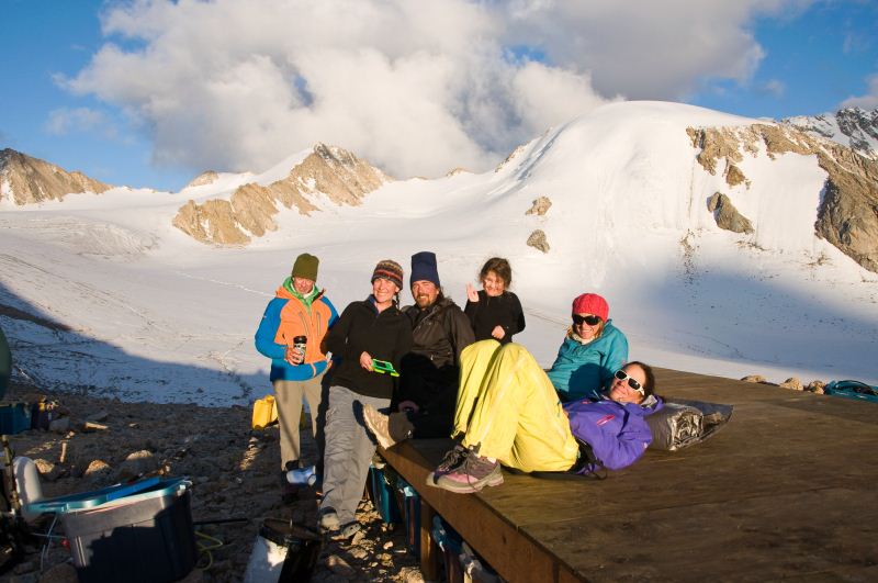
The weather was stunning the next morning, with no clouds or wind. We checked in early and the crew had indeed made it to the terminus and were getting an early start on hiking. So we packed up as well and headed down glacier to rendevous. We met up around our lower weather station, and shared some stories from our respective trips before starting the tour of McCall Glacier and the research going on here. It was nearly noon by the time we made it back to camp, so we enjoyed a nice picnic on the floor, enjoying the panoramic view and our first day of warm sunshine.
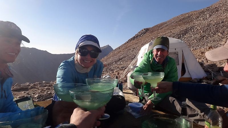
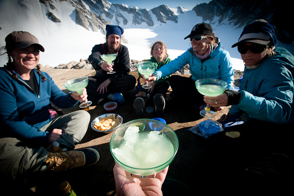
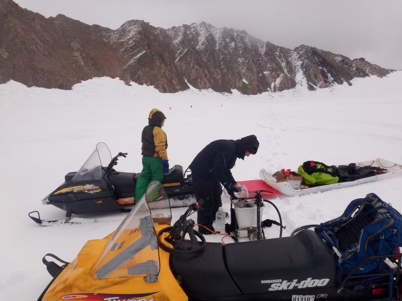
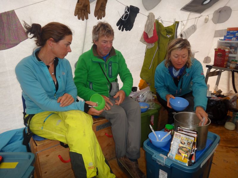
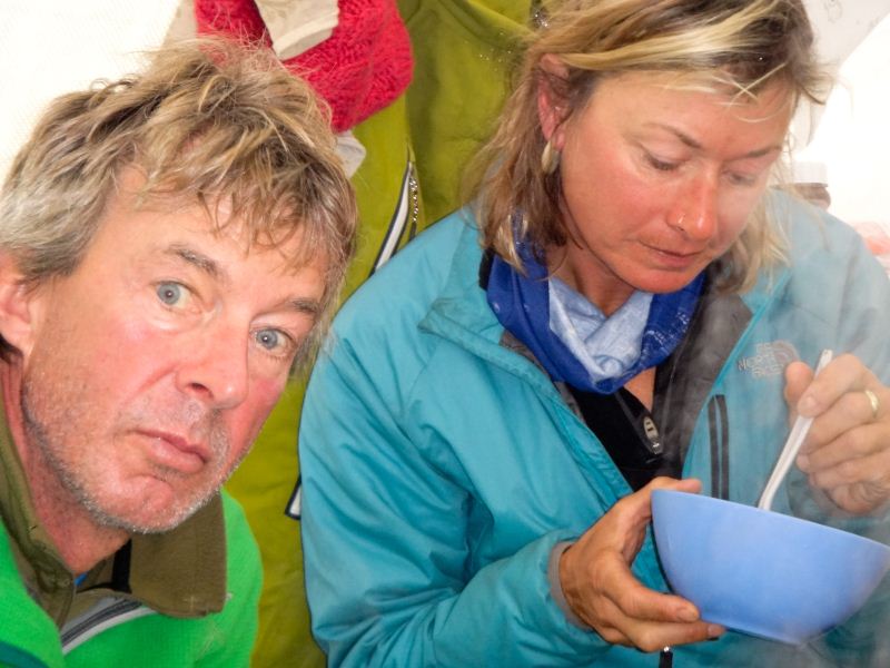
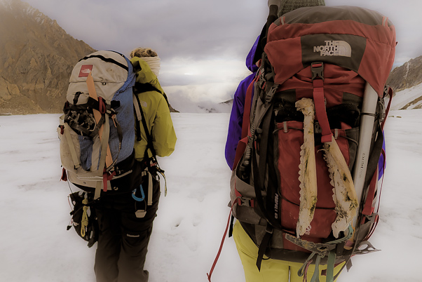
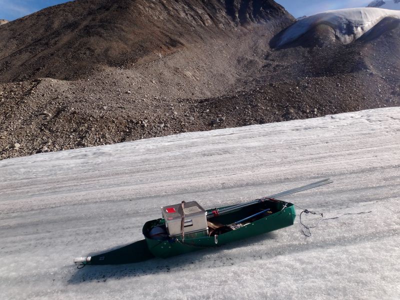
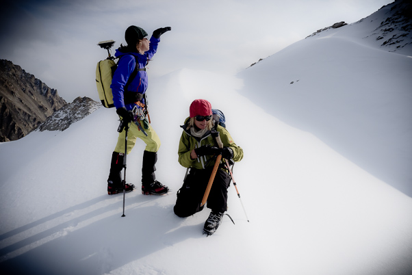
After the others dropped off their gear in their tents, we headed down to the ice to have a shake down of the ice radar system. I’ve been slowly developing this system over the past few years in anticipation of this project. The main pieces I bought from others, but integrating it into a useable system takes some creativity. It has also always been a bit flaky in terms of all of the pieces, particularly the software, communicating properly. But the general idea is that a transmitter send out electromagnetic waves at a particular frequency which is determined by the length of the antenna, with a longer antenna creating alonger wavelength and lower frequency waves. The longer the wavelength, the deeper into the ice the waves can penetrate, but the more cumbersome they become. The 10MHz antennas we most commonly use are each about 8 meters long and need to be separated by about 15 meters. I’ve tried to make the system as lightweight and portable as possible, so that it can be packed into a backpack with other gear and taken to remote glaciers. Ideally we would measure thickness of all of the glaciers, but this is logistically and economically impractical. So the fallback is by measuring the ice thickness of several glaciers nearby here with a variety of shapes and sizes, we will be better able to estimate the thickness of all of the glacier here which share roughly the same range of shapes and sizes. Our shake down went well and I think the others got some sense of how everything goes together, which was our main goal. So after a brief tour of the upper cirque we headed back to camp at dinner time for Mexican night and some celebratory margheritas and spent the evening getting to know each other and discuss options for the rest of the trip.
Our beautiful sunny weather didn’t last, but the next morning it was still decent so we decided to head to the Hanging Glacier so the team could make their first measurements on their own, but close enough to me so that I could help troubleshoot. They made another shakedown on their own just below camp, while we packed up for more steam drilling, then we all headed down together. We stopped at our pole LPU4300 and got the steam drill going while we watched the others head up the moraine to the glacier. The steam drilling went well enough, but radar was apparently having significant issues. Once deployed, the software kept locking up, requiring a full restart of the computer and associated delays and frustrations. I tried to troubleshoot as I could over radio, but there wasn’t much I could do and I didn’t send them out with a lot of extra gear, like spare laptops or cables, as things were working well beforehand and I didn’t want to bog them down with weight and additional complexity. By about 5PM we were done with our drilling and they had completed a transect down the length of the glacier, so we all met up again on main glacier and headed back to camp. There I discovered that our primary suspicion was correct, that the usb cable connecting the oscilloscope to the laptop was flaky, and this intermittent contact with the oscilloscope was causing the software to freeze. By now it was after 8PM and I was feeling the effects of a cold I had developed over the past day or two and called it an early night. It’s now about 7AM on the 15th and while there is good visibility outside, small rain showers are sweeping through, so it’s not clear what we’ll get done today. We’re already a few days behind schedule, and we still have a lot of work to do, so hopefully we’ll get some good weather to help speed things along.
20 Aug 2012 McCall Glacier Today was our take out. The good news is that all of our loads but the last one made it off the glacier and back to Bitty. The bad news is that I was that last load. So as I sit here in the fog on the runway and I thought I’d catch up on our blog. The weather never really improved on the 15th, but we pressed on anyway. We ran some radar tests down the hill from camp and it turned out the usb cable was the culprit from the day before. Unfortunately the rain and clouds meant that travel to other glaciers was not advisable, so we decided that the radar team would do some more shakedowns in the upper cirque while the Nolans drilled in some new poles there, such that I would be available for tech support while allowing them to run the show as if on another glacier. Despite the rain, the radar worked and a bottom was seen, and we finished drilling about the same time as they radared their way back to camp.
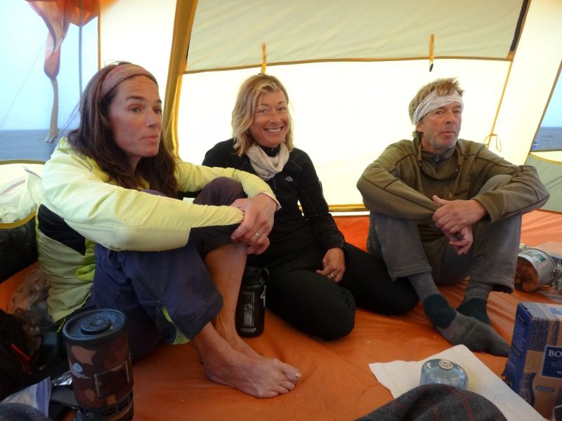
Even though our productivity had not been great thus far due to technical and weather issues, having spent the better part of a week together it was great getting to know everyone. Kit, Kasha and Ace had all known each other a long time and had gone on many expeditions together. There is always a chance that too many cliques within a group can lead to problems, but in this case it was obvious early on that this would not be the case. Their positive attitude and willingness to help was almost overwhelming, but nevertheless quite refreshing. Always the optimists, never complaining, hard working and excited, always polite, it is these traits in field scientists that initially kept me coming back for more expeditions. Though not scientists themselves, those same traits are important to any remote expeditions. Also a bit disappointing, as it became clear to me that I had lost my way a bit in terms of those qualities, if indeed ever had them, but inspiring nonetheless and worth their price of admission even if the science doesnt work out as well as hoped for. My favorite quote from the trip from Kasha was something like "Is there another 70 pound battery I can hike up some mountain today?" We had a lot of rain overnight and woke up to more. Again there was no hope of travelling to other glaciers and now little point in risking the radar equipment for more testing, so we idled about in the morning a bit before I decided to do the mass balance and gps surveys, as this was something that could (and has) be done in almost any weather. Fortunately visibility was pretty good and I didn’t have to navigate the fog. I launched about noon and headed to the furthest down glacier poles first, figuring that the weather would likely get worse there first and the closer poles would be easier to access in the future if I had to give up this day. The strategy worked and soon I was working my way back up towards camp. Like last May, I left the sketchiest poles until last, and though the rain intensified and diminished numerous times, visibility never went down. The pole that turned out to be the greatest challenge was in the middle cirque. Here I came across a crevasse I had never seen before. The recent snow was largely turning to slush, but had previously managed to bridge and hide many of the smaller crevasses and was now making snow machining uphill a struggle. As I sidehilled obliquely up to the pole, I came across a gaping crevasse that could easily swallow the machine and me. Given the sluggish conditions, I didn’t feel that I would have enough power to jump it further uphill, where I could see that it was trending narrower. So I got and probed my way to the stake, which was no big deal, except for the lingering wonderment about how long that crevasse had been there and how many times I had driven over it in the past. In any case, I was back to camp by 5PM, setting a new record for me for completing these surveys.
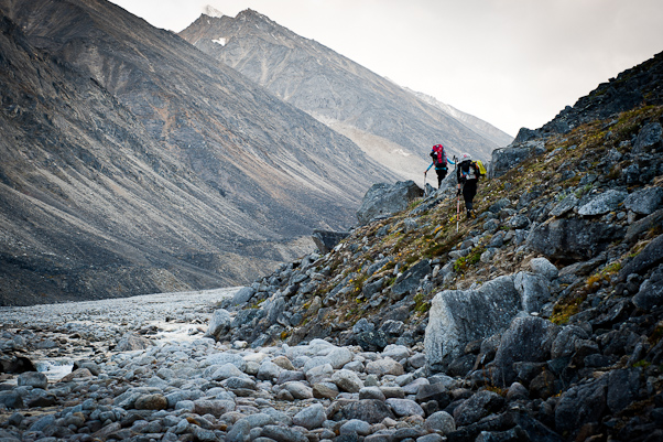
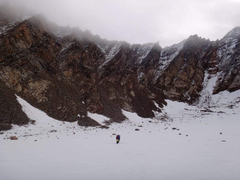
The next morning the weather was substantially better and we made plans for a radar survey on Hubley Glacier. In the early morning, the entire valley was choked with fog, but it was clear that it was thin and from prior experience I knew that once the sun came over the ridge it would create interesting swirling patterns as it burned off, so we set some cameras on timelapse as we packed. I had never hiked to Hubley before, so I wasn't entirely sure which way was the best. I remembered in years past Bernhard getting into a fight with his wife (now ex-wife) on the sat phone one afternoon and him going for a walk to blow off some steam. Of course he didn’t take a radio or tell anyone where he was going, or where he had been, but a few days later we surveyed Hubley Glacier’s surface elevation via helicopter and saw his foot steps leading down from it’s ridge with lower cirque of McCall Glacier to the first crevasse then turning around and heading back. So I drove everyone to the top of the lower cirque, where they all independently selected the same route (I would have picked another, validating my decision to bring in the experts...) and I headed off to pick up Kristin and Turner to download data loggers in the upper cirque and dig some snow pits. Before we had started up there, we got a call on the radio saying they were turning around, so we headed back to pick them up.
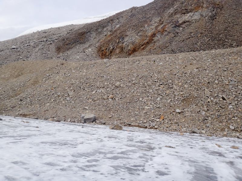
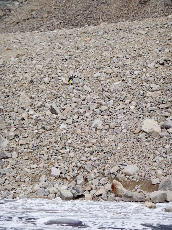
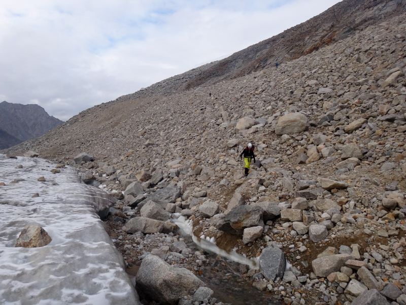
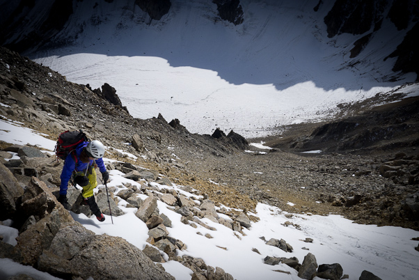
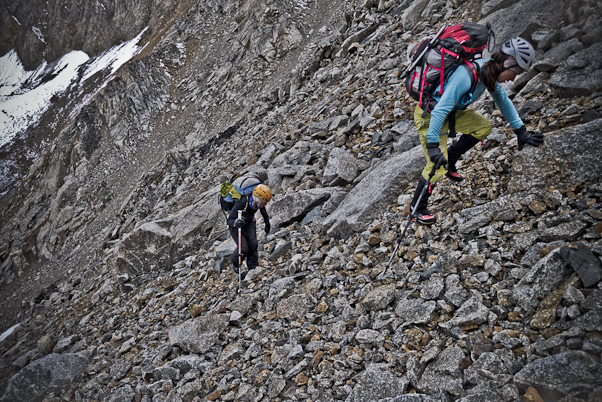
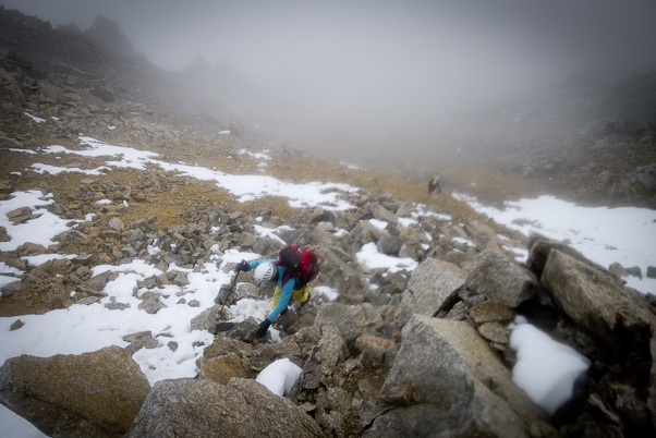
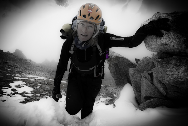
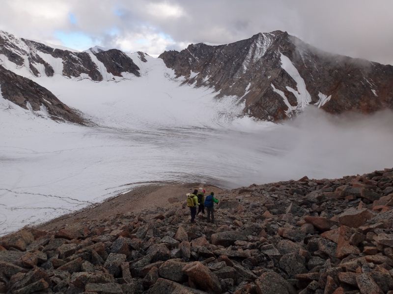
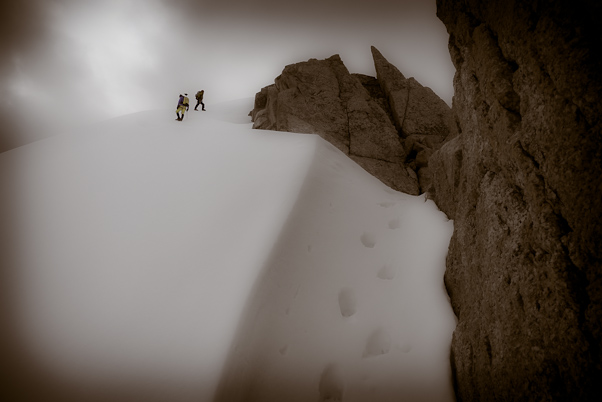
On their trip to Hanging Glacier, they had experienced some of the extreme sketchiness of our ice-cored moraines, but in general they remained unphased by it. This time they were quite phased. The rock in these gullies is quite loose and in general quite perched across large distances. This situation is repeated across all of valley, where thin ice has retreated from the steep slopes, leaving behind large, loose rocks, which serenade us constantly with their tumblings. The result is huge piles covering the lower part of the slopes that are still trying to reach the valley floor. As the main glacier continues to melt and lower in elevation, the carpet is essentially continually pulled out from under the bottom of the rock pile and so they tumble down further. Stepping on one rock may cause another rock 10 meters away to move, and that rock may be the size of a car, so a rock helmet is of questionable utility. Fortunately they were all intelligent enough climbers to recognize random death when they saw it and came back down before something untoward occurred. I found their comments about the nature of climbing in this region, as well as the vigor and colorfulness of those comments, quite satisfying, as I’ve been terrified more than once scrambling up such slopes and was never really sure whether my assessment of the objective hazard was accurate or not until then. My favorite comment about this was from Kit, who has literally climbed and then skiid down the tallest mountain on every continent on earth (the first person to have done so), who said something to the effect "This was the first time I thought I might never see my kids again..." as well as a few disparaging comments about Bernhard's sanity. So, we went to Plan B and dropped them off at the middle cirque so that they could try from there before we headed up further to finish our work in the upper cirque. Things went fairly smoothly, as Kristin and Turner worked on decanting Andy’s pollen traps and I downloaded dataloggers from our shallow thermistor strings and changed batteries. The pollen traps have been there since 2008 and capture airborne pollen, so that we can get a sense of the types and amounts of pollen that fall on the surface and get trapped in the ice. This information is useful in interpreting changes in pollen abundance over time when analyzing pollen in our deep ice core. The thermistor strings I was working on measure the temperature of the snow and ice down to depths of about 8 meters. They tell us when meltwater drips downwards and refreezes, as the freezing process releases a lot of heat. We compare this information to our shallow coring done in springs since 2008, where we are directly measuring the density changes caused by the formation of ice lenses from this meltwater. By the time we started it was noon, but we were finished by about 2:30 and had hopes of going downglacier to finish nearly all of the remaining work there too. By this point the radar team had made it to Hubley Glacier safely and were beginning to start their surveys. Things apparently went well until the cables got hung up during a stream crossing and some connections pulled apart irreparably. We had intermittent radio contact and sat phone contact for troubleshooting, but this was quite sporadic and annoying due to the complications of being in separate valleys. By now it was 5PM. Our plan was to head down glacier to the lowermost pole locations and drill those in, then download the remaining dataloggers and decant the remaining pollen traps on the way back up. As we descended to the lower glacier, however, we could see thick, dark clouds choking the lower valley. With half our team in another valley and hard to contact, the thought of having being caught in a lightening storm or slick ice this late at night was not appealing, as having been there and done that before there seemed no reason to get the t-shirt. So the plan that made sense at 3PM no longer did at 5PM, so we limited ourselves to decanting the pollen trap at the lower cirque and heading back to camp. We didn’t hear back from the others, so we assumed all was going OK until we got a message about 8PM that they were heading back.
I took a brief nap so that I could hear the stories with more alertness when they arrived, and by 10PM they were back in camp with smiles on their faces, as usual. I checked out the data while they changed clothes and got some hot drinks. The data from the first hour was great, with a clear bottom signal descending to about 150 meters. After the stream-crossing incident, however, none of the attempts to regain the signal seemed to work and all I could find was coherent ringing throughout the record. At that moment I knew that this was the end of our experiment. Tomorrow was our last full work day, and I had too much to do to spend the morning troubleshooting the system, dropping them at some location to start their climb, and then likely deal with awkward comms throughout the day for more remote tech support. Even though we didn’t come close to our objective of surveying 10 or more glaciers, we did learn some valuable lessons. The idea of accessing many other glaciers while starting from the top of one is simply infeasible, at least in this region of the arctic. There is not enough ice to climb safely and the rock routes are simply too sketchy, except for one or two locations. The only rational way to access these glaciers on foot with such equipment is from the valley floors, and this would be better in spring when skis could be used; else use a helicopter. This was the primary difference between what they were able to accomplish on their climbing trip in 2010 and now, that then there were starting from the valley floors and able to pick routes up whereas now we started up and had limited options for crossing laterally. Radar is also a bit too complicated and fragile for novices to master in a few days. Had we the full 10 days of beautiful weather we hoped for, and had we had a bit better luck with cable and connection breakages, I think we might have gotten a few more glaciers surveyed. But I’m reminded of the saying from a doctor to a student, “I can teach you how to remove an appendix in a day, but it will take me 4 years to teach you what to do if something goes wrong”. There is simply too much that can go wrong with a radar of this garage build-quality to expect too much. Initially the plan was for me or some other scientist to lead the radar the effort and have Kit join mainly for her extensive climbing experience, but the hectic preparations for our May and June field work, followed by our accident simply caused these plans to take a lower priority. But since I had already set them in motion and when Kasha and Ace took an interest I figured I had little to lose except some money and the possibility was still there to learn something, so why not. At least we now have a much better idea of what sort of team and logistics are required for success. I didn’t say anything about this then or the lack of opportunities for more work this trip, figuring that bad weather would likely make the latter point moot, but rather we stayed up another few hours, drinking and telling stories until it was dim in the tent. The weather in the morning was actually quite pleasant and I decided to get an early start to finish my remaining work and get down the hill before the others woke up and perhaps be back before they knew I was gone. I was nearly ready to go at 7:30AM when Kit and Kasha both entered the cook tent, ready for work. I was quite surprised, both because we had such a late night before and as normally they hang out in their tent until 8 or so. In any case, I explained that I wanted to get my work finished early, and in the meantime they could either play with the radar, go for a hike, relax etc, and by 8AM I was headed down glacier. Kit looked a bit at me like I had two heads, but said nothing, but that wasn't too unusual as I dont think she had quite decided yet whether I was nuts or not. Most of the glacier was still in shadow at this point, and apparently it was a pretty clear night, as the ice was still quite slick. My thought was to start with installing the new poles at our lower sites near the terminus first, as bad weather usually starts low and works its way up, but it was clear the ice was still too slippery to head down the last hill with a heavy sled and hope to survive. So I decanted the pollen trap at our main weather station, reset the sonic ranger, and did a few miscellaneous repairs to kill some time. By the time I was done, the hill was in sun for about half an hour and I thought that might be enough. I tied a rope on to the back of the sled in case either I had to bail and stop a runaway, or if I needed to tie the sled to an ice screw and ditch it. I started cautiously down the hill and felt in control at first, but as it got a bit steeper, it was clear I was about to go in circles at increasing rates of speed (again been there done that), so I managed to hang the machine up on a small rock to stop it, and then set a screw behind the sled to ditch it. I had my ice creepers on my feet, which allowed me to walk there at all, and once I had what I needed for data logger downloading on the machine, I started downhill again, this time using my feet for additional braking and steering power. This worked marginally well and was quite exciting at times, but soon as I was at the bottom of the hill and happy to come to rest. I wasn’t quite decided whether to go all the way to the terminus when I began the trip, but since it was clear I wasn’t going to get the steam drill and poles down the hill any time soon, I decided to go for it.
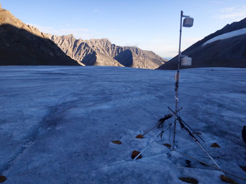
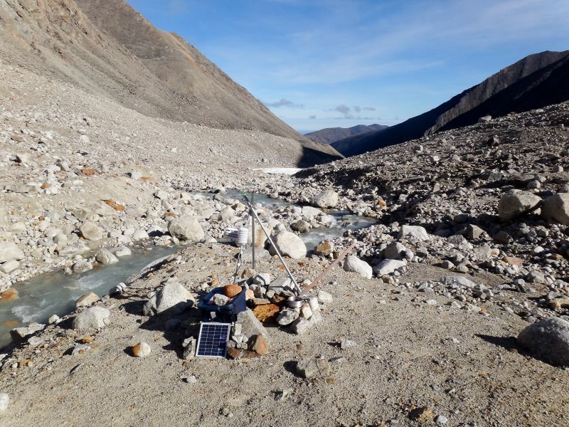
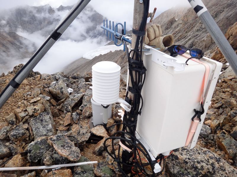
I downloaded the loggers on the lower glacier then head to the stream to decant the final pollen trap and retrieve the stream equipment I had placed there in May. When we left from Fairbanks, I had visions of spending a night or two at the stream so we could do a lot of work there. This included taking water and sediment samples, downloading some data loggers we had glued to rocks last year, and measuring water flow using the fluorometer. But with all of the bad weather and delays with the radar, there simply wasn’t time for any of this. In any case, work here went well and soon I was headed back up the hill. The ice by this time was fine for driving, but on the walk back I decided to give up on the drilling. The poles here were still long enough to last another season, plus I had another 2-3 years of thermistor string embedded at this same location. It was turning into a beautiful day, and I thought my time was better spent taking my gigapixel panorama from camp. So I did a little more work on our main weather station that I had forgotten previously, swapping out air temperature sensors for freshly calibrated ones, and tried to make it back to camp before the clouds built up.
It was nearly 2PM by the time I got back, and the clouds were just starting to form. I met Kit and Kasha on the way up the hill, as they were headed out for a little hike. I still hadn’t eaten lunch yet, but took a few bites of sandwhich at camp and hung out a few minutes with Kristin and Turner before heading up to the photo site. Half an hour earlier and I could have worked cloud free, but it was still doable. The issue with clouds is that the cast shadows on the landscape. If I was just taking a single picture, this would not be an problem and might even be desirable. But for my photo here I take 400-500 photos and stitch them together, and this takes 30 minutes or more. If there are moving shadows during this time, it takes away from the quality of the final stitched image. Ace joined me while I was working and we talked about photography and other topics, and near the end Kit and Kasha also came up. Apparently they had been down by the stream washing and sunbathing, though it wasn’t clear to me yet whether I captured this in my photos…
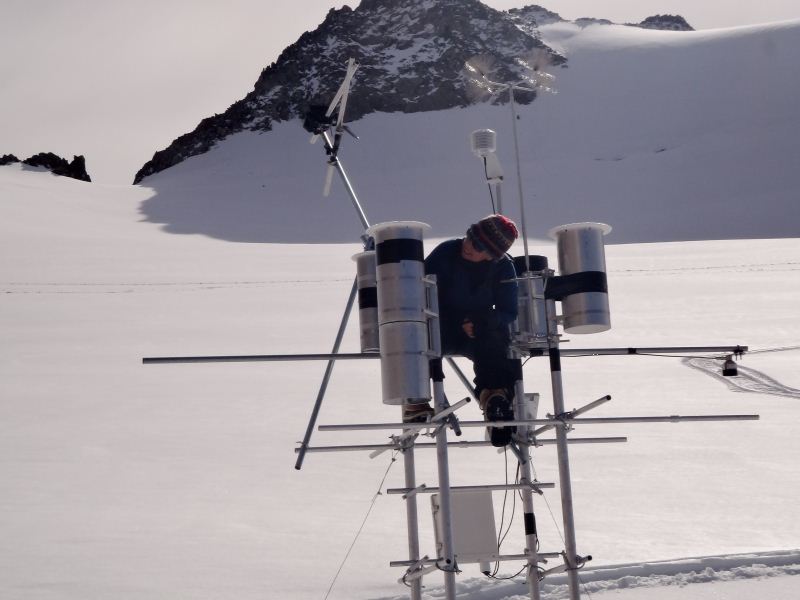
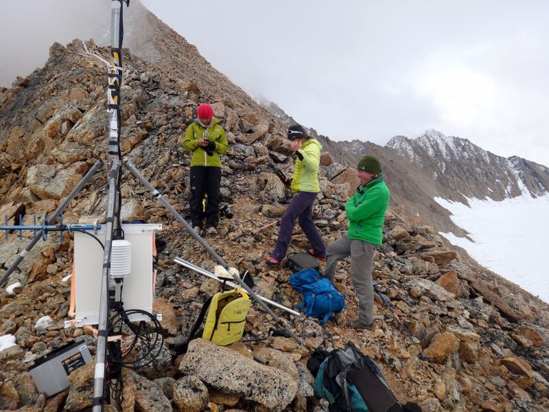
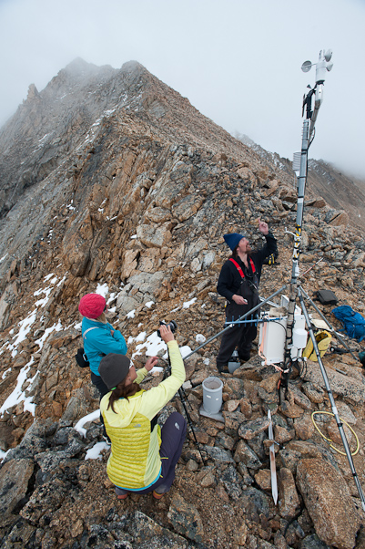
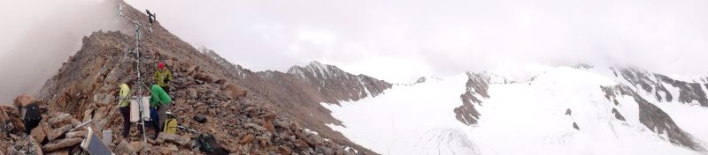
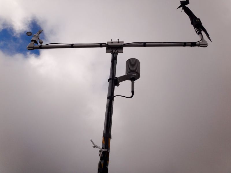
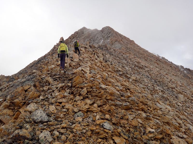
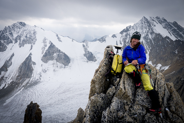
Once done with this, we decided to head up to Ahab. Kit and Kasha had been there two days earlier hauling a new battery to the station and hauling the an old one down, but this was also done in the rain and snow so the trip and view weren’t as pleasant as possible. I’m still not entirely sure why the battery failed over winter, but we changed the program on this trip to reduce power consumption further. My hope is to get the station running again with no power issues for the next 4-5 years, just in case I don’t get any more funding to return here. We had an enjoyable hike upwards. Turner and Kristin joined us for the first part, so that Turner could get to the ridge he said he wanted to climb to. It was the first time I had the chance to join Kit, Kasha and Ace in something besides trying to explain how radar works, so we had opportunities to discuss other subjects. It was clear how strong everyone was, although I was almost keeping up I was huffing and puffing and they were clearly hiking at a leasurely pace for them. Soon enough we were at the top and got the work done. Kit had carried up the GPS so that we could survey the exact location of the station as well as some nearby peaks for ground truthing our airborne remote sensing. She also brought her video camera, the same model as the one I have been using, and did some interviewing about the project, the weather station, etc. By the time we had returned back to camp, I had actually gotten her to laugh at two of my jokes, so I considered the trip a success. We also discovered that her watch somehow reset itself the night before, so when we met in the cook tent that morning she thought it was almost lunch time and thus found it odd that I was heading out so late.
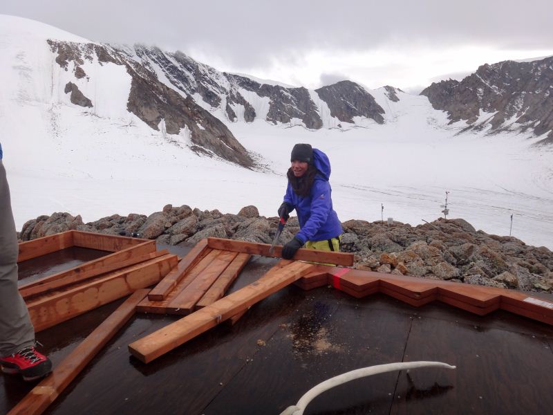
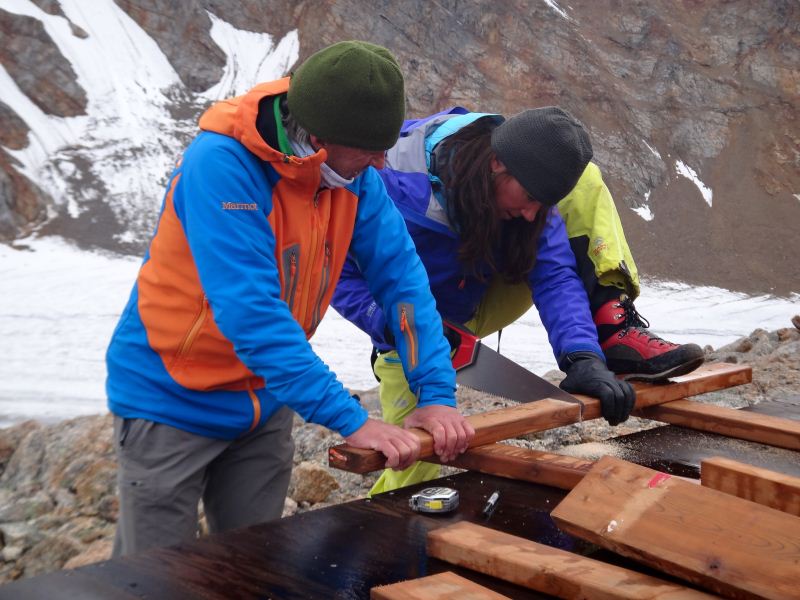
The good weather held out the next day. Since the GPS work from the previous day worked out so well, I figured a good project for the professional athletes might be to climb some of the nearby ridges and measure elevations of the peaks along it. The idea here is that I want to know how accurate the maps we have been making the past few years are, and to do this we can compare GPS measurements made on the ground to the same spots on the map. Peaks are convenient for this, because you can also get a sense of any lateral shifts in addition to vertical errors. So the crew headed up to Mount Suki and planned to hike around the rim of the upper cirque until mid-afternoon when we would have camp largely broken down and were ready for sloshing gear up and down the hill in preparation for our pull-out the next day. By the time I got them sorted out and on their way, Kristin had already cleared out much of the cook tent. She had largely inventoried and packed boxes the day before, and now it was mostly a matter of getting my stuff cleared out and boxed up, breaking down the main tent in the good weather while it was dry, and caching everything safely and reliably for winter. This all proceeded smoothly enough and soon we were all together again, running loads up and down the hill as needed and breaking down the tent. The weather turned threatening just as we took it down, but the looming storm didn’t materialize and by late evening it was fairly pleasant and we ate our dinner while working outside. We set up our tundra cook tent in place of the white one, since it didn’t matter if it got wet since it was coming with us, and Kit and Kasha broke their sleeping tent down and moved into it for the night. We got to bed having accomplished nearly all of the demobilization, and hoped for good weather in the morning.
The weather this morning was great. We all woke up early and began our final demobilization chores. Kit cooked up bagels for everyone while we shuttled final gear loads around and tucked miscellaneous extra items into boxes. We finally heard from Bob about 9:30, and he told us to expect him at noon. By about 11:30 we had most of the gear at the runway, had the caches largely built, and were just down to some final packing. The general idea was that Kit and Kasha would fly out first, followed by Kristin and Turner, then a gear load, then Ace, and finally me. It was nearly 1:30 by the time Bob arrived, but the weather was still clear and calm. Once the first load was off, I ran back up the hill to put the finishing touches on the cache and help with the final load down the hill. By the time I got back to the runway, Bob was on final, in just under an hour. Once Kristin and Turner got off, Ace and I put the second snow machine to bed on top of the moraine just below camp, and by the time we made it back Bob was once again almost on final. We loaded him up with a lot of miscellaneous garbage, science gear, and retro food, in our continuing attempts to lighten our footprint here and leave the place cleaner than when we arrived. Now there was little to do, so Ace and I had the chance to talk about cameras, expedition photography, and funding. Soon enough Bob arrived, and Ace and a load of gear took off shortly thereafter, leaving me on my own with a small pile of gear.
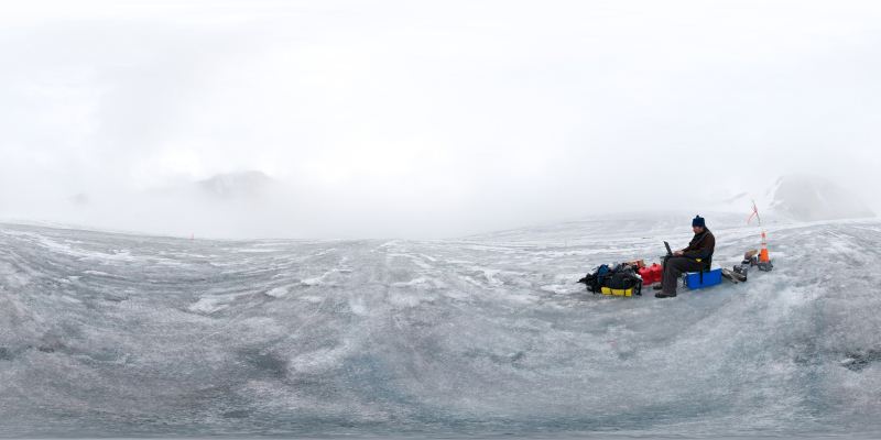
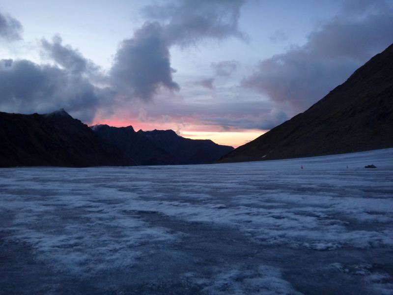
I shuttled a few cones to the winter skyway before putting it to bed. By this time it was about 7PM. As I was walking back to the gear pile, I looked back to see that in the past 10 minutes the lower glacier had become completely choked in fog. I sat down on a cooler and watched how in the next 15 minutes the runway got enveloped and I was now in a white out. I called back to the Bitty camp and learned that Bob had already launched, and about 10 minutes later he flew overhead. I had blue sky above me, but I could not see 400 feet to the sides. So Bob returned to Bitty, and I decided to update this journal. It was quite pleasant despite the lack of visibility, and I took the opportunity to make the first and only spherical panorama of the trip. By the time I set it up however, the fog had begun to roll out. It rolled in and out several times over the next hour. I stayed in touch with the rest of the crew and about 9PM it looked like it might be clearing up for good. I walked down to the camera site at the top of the winter skyway and I could see all the way to the ocean. There was still a broken layer of cloud at about 7000 feet, but at this point it was totally flyable. The fog seemed directly controlled by the tiny breeze going either up or down glacier. It was barely perceptible, but clearly the clouds felt it. As I spoke to the camp, the cloud slowly packed into the lower cirque, leaving more than 500 feet above the lower runway but much less over the one we were using. I stood around there for about an hour, and by 10:30 the down wind had flushed out all of the clouds and the valley was completely clear again. By this time, however, it was getting dark on the coastal plain. I thought it was plenty light enough on the glacier, but the situation is marginal enough that there wasn’t much point in pushing the limits. So I said goodnight to everyone and brought out my sleeping bag, deciding to simply lay out on the ice rather than hike everything back up the hill. In the ten years that we’ve been doing this, this is the first time some one has been stranded unintentionally here alone. It was certainly the only night I’ve been here on my own, and the only time I’ve camped on the ice. It was an interesting feeling, as it felt much more like camping than what we do at camp, which somehow seems much more luxurious and safe. I guess it is, but it was surprising to me how different camping here felt compared to there. I was also surprised how infrequently we camp elsewhere besides our little knoll. Other than in 2008 when we were drilling and later doing stream work, I don’t think we’ve ever not slept on the knoll. I guess its combination of being fairly cush there and a pain to pack up and sleep elsewhere that conspires not to do this more often, but at the moment I think we should plan on doing more of this. We often see footprints of various animals in the snow, but rarely do we see the animal itself, and I think more camping down here would lead to more interesting experiences. In any case. It’s a crystal clear night with almost no wind, and I’m hoping it will stay like that through tomorrow morning.
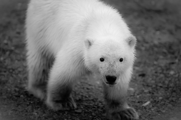
13 January 2013 Fortunately the next morning, the 21st, brought great weather and the tundra crew were successful at rousting Bob fairly early with fresh coffee. The final load out was uneventful and soon we were all reunited at our tundra base at Bitty. Apparently they spent a pleasant evening there, with great sunsets and conversation, and enjoyed their time as much as I did. It also seemed a new plan had hatched during our separation, and the North Face crew expressed an interest in spending a few days in Kaktovik while I did more stream gaging. Though the extra manpower would have spared me some effort, it wasnt a five-person job, so I agreed in principle, but tried to give them some perspective on what they were getting into. The plan was for them to fly out with Bob in Kaktovik (at their expense), spend a night there seeing polar bears and enjoying civilization, and then hike back to us within 2 days. I tried to explain what such a hike would take me a week, but they knew me well enough I guess that this added to their enthusiasm about being able to pull it off. Plus it seemed that Bob had other work he wanted to do before loading up his plane with our excess glacier gear, but promised that either he or Mike would be back before our pull-out by Wrights to take it back, though I did convince him to at least take our garbage so we werent baiting the local fauna. So off they went, leaving the Nolans for another round of stream gaging on our own.
We enjoyed a couple days of good weather and doing by-now familiar gaging and sampling. We also had a bit of time for exploration and antler hunting, and the bugs were at a minimum. I also spent some time hunting for my buried pressure transducers with no luck, but hopefully they are still working and a metal detector next year combined with some further erosion might turn them up.
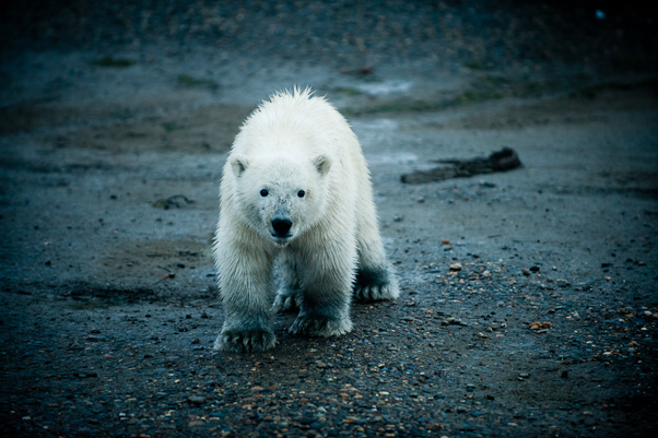
We stayed in touch with the others periodically and sure enough by evening on the second day we heard the familiar sounds of conversation heading our way. It seemed they had the full Kaktovik experience, washing dishes and delivering mail for Walt in exchange for rent, bumming rides with locals to see the polar bear swarm on the beach, conversations with muckity-mucks passing through, crazy boat rides, and getting up close and personal with tussoks. I think all were glad they weren't hiking all the way to the glacier, but the worst was behind them at that point so it probably would only have taken them another two days.
The next day the weather was once again perfect for our take-out. We broke down tents, sorted gear, arranged loads, with minimal input from me as all were experienced with the process. We were done before lunch, and enjoyed a few rousing games of kickball and freeze-tag in the sunshine. By the time Wrights showed up, it was hotter than t-shirt weather and we were glad to take a break from the exercise. Stuffing the two helios full of gear was as usual an interesting process, but it all worked out and soon we were on our way home. Daniel was once again our pilot. He had never landed here before, but oddly had landed at our other strip closer to the glacier, without realizing it was us who pioneered it, and unfortunately now it was gaining use with other hikers and hunters. He was curious about the glacier, so we flew into the valley so he could scope out our landing spots, and expressed an interest in landing there sometime. The trip back was uneventful and scenic. We landed at Arctic Village where we spent a few hours milling about waiting for a Caravan to take us back to Fairbanks, while the Helios headed off for more work north. But soon enough we were back home, heading straight for the sauna and hot tub, and enjoyed a nice meal at Pikes (though it was apparently too cold for them to serve on the deck).
It obviously took me a while to finish this blog. After a few days at home, for some reason I decided to read through all of my old blogs about our McCall Glacier experiences. It's been 10 years that we've been doing this now. Reading the old blogs brought up a lot of old memories and helped me see some trends. I used to complain about having to sort through a few hundred emails on return from a trip, now it's a few thousand. I hadnt realized how often I ended up sick at the start of a trip, I guess the round-the-clock effort and stress of getting these trips going kept catching up to me. I saw too how the nature of the trips changed over the years, and how over the years some of our team mates became good friends and some did not. Hearing the stories of the North Face crew's experiences reminded me how fresh our same experiences used to be and now are not. I think for me some revitalization was needed, and this trip helped. I also realized that every fall I tell myself that this fall I'm going to catch up with the ever-growing mountain of data we gather and every spring I'm shocked that winter is over with so little accomplished but having to put it aside once again to prepare for more field work. I bumped into Will Harrison at some point in fall and we discussed this a bit, how he also thought when he retired he would flush out his lifetime of backlog and yet there still never seemed to be time for it. He estimated average lifetime completion is around 30% for most. This fall didnt work out much differently for me so far. For some reason I decided to learn how to fly, though I never had much desire before, and this soaked up all my free time and diverted me from finishing this blog among other things. Part of the interest in flying was the experience of spending the night alone on the glacier, sleeping on the ice. Listening to the water flow and ice tinkle, watching the stars and clouds, wondering if I would see a wolf or wolverine -- these were experiences that I havent had in decades. On every past trip, I had to work to carve out just a few hours alone to explore or observe without purpose. That night was the longest stretch in 10 years time to myself out there, and without the pressures of waiting on weather so we could get more done, so I could enjoy it. I want more of that, and maybe flying would give it to me. Every day of every expedition was also weather dependent, something that life in town is largely immune to. There's something different about waking up, looking at the weather, and making a plan based on it that's qualitatively different than life at home. Flying is like that too, which is maybe one thing that I've come to like about it. Flying was also a chance to become a student again, but in a different way than usual. I learn a lot of pretty technical subjects on my own, but learning with an instructor is also a qualitatively different experience. I found myself become increasingly stupid in the sense that my brain was not making the same decisions it normally would because I knew that there was someone with more experience than me watching my every move and critiquing it. I started learning in Fairbanks, but as the weather got cold I went down to Texas to buy a Cessna 170B and learn to fly it there. That was also a humbling experience, as flying a taildragger is a much different experience than a typical nose-wheel plane, requiring much more skill and attention. In the end, I now have a new tool in my arsenal for science and giving us more options for our goals together as a family. I also gained a lot of new insight and appreciation for the challenges that Kristin has been facing, both with the flying itself and flying with her family on board. It's of course impossible to tell where any of this will lead, but it's left me optimistic about the future. In re-reading those blogs I came away realizing too that 10 years is an honest effort at something of this magnitude, and if we moved on to something new I could be proud of our accomplishments. But it also reminded me of what our scientific goals out here started as and how much more is still left to do. Funding is always an issue, and this coming year is the last of the funding that we currently have for it, though I have new proposals in review now. To some degree, I guess it's up to the scientific community to decide what the best use of limited federal funding is. Seeing what our friends and acquantances think of all this also gives us some perspective on how the results of our work are making an impact. Our project is just one cog in a large gear of earth science, but with 10 years of effort and data we are now able to add a longer-term temporal dimension to what we've learned so far. But like with flying, only time will tell what the future actually has in store for us. One thing that we've learned is that despite best efforts at planning, new obstacles can emerge from almost any angle, and some of these just have to be lived with rather than fought. In any case, I'd have no reason to complain about another 10 years like the last, as it's been an amazing, privileged ride thus far. Keeping that in mind when facing adversity is the challenge.
|
(c) 2010 Matt Nolan.