
Dr. Matt Nolan
Institute of Northern Engineering
University of Alaska Fairbanks
|
Dr. Matt Nolan
Institute of Northern Engineering |
|
|
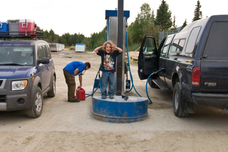
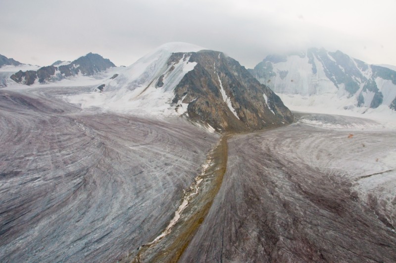
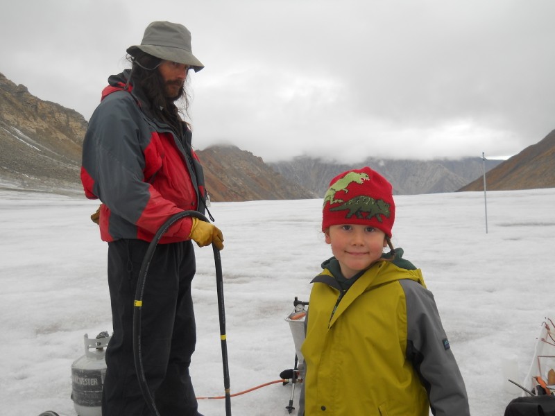
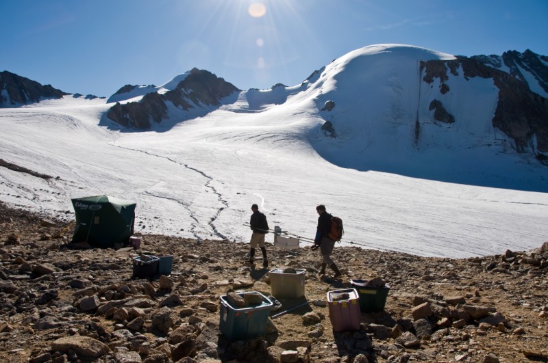
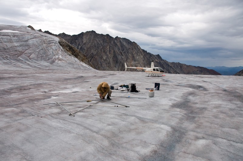
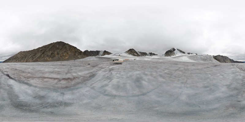
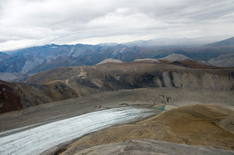
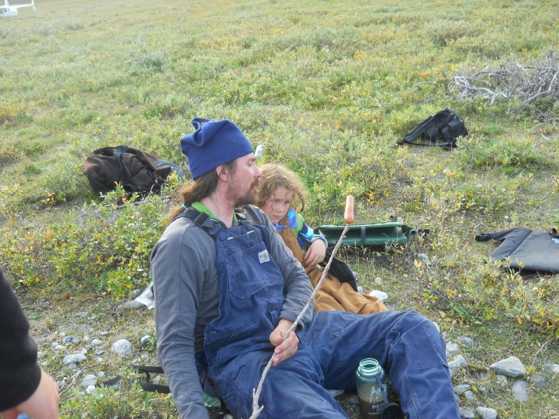
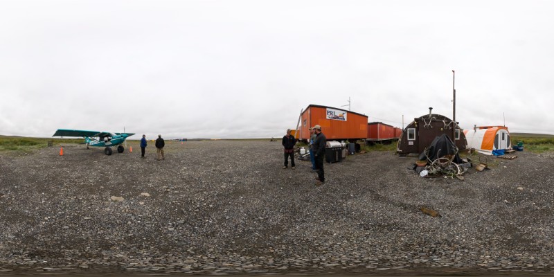
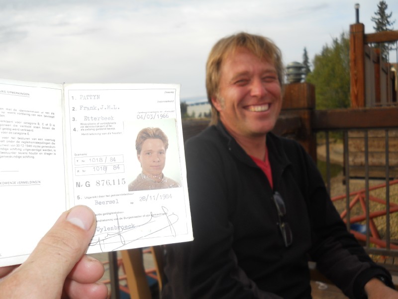
(Thanks to Franken1, Franken2, Kristin and Turner for additional photos) 05 Aug 10 McCall Glacier The trip didnt begin as originally planned, but has been productive so far. Unlike the past few years, this year we decided to use a helicopter for our put in. During our spring trips, ski planes have proven to be a useful, reliable and economical means for getting us in. The only downside is that we have to haul our gear up from the glacier to camp, but this is a minor annoyance compared to many of the things we do here. We have yet attempted to land a wheeled plane on the bare ice in summer, so over the past few years in summer we have landed on the tundra and hiked in. This requires planning ahead such that all one needs to hike with is personal gear and a laptop. For this trip, however, we had too much stuff that was unavailable in spring to stage here, and it was way too much to hike in with. The primary goals of this trip, beyond the baseline measurements, were to use a variety of radar tools to remotely sense the subsurface of McCall Glacier. In particular, we want to 1) map the boundary between warm and cold ice in the ablation area, 2) develop a depth-age relationship for our 2008 ice core by following annual accumulation layers from their source to the core location, and 3) map the spatial continuity of ice lenses within the firn. Each of these three objectives requires a different type of radar. We know from a variety of prior studies that much of the glacier ice is well below freezing, but that most of the bed is at the melting point. We have been making direct measurements of this using three thermistor strings that extend from the surface to the bed, placed in holes we drilled in 2008. Using radar, we now hope to track the boundary between warm ice (at the melting point, about 0C) and cold ice (below the freezing point, like -5C). Such information allows us to improve our 3D ice flow modeling, as ice temperature affects ice deformation rates. It also allows us to hindcast prior climate conditions, as climate influences ice temperatures but takes decades to respond to it completely, so by understanding the current temperature distribution we place another constraint on paleoclimate. Radar can also be used to help interpret our ice core. Because this core was taken on the sloping surface of this valley glacier, we have unique challenges compared to most ice cores, which are typically taken from the summits of ice sheets. Particularly, the ice in our core was not formed at the location that the core was taken, but rather up glacier from it. By tracking layers from the top of the glacier through to the location of the core, we can hopefully better identify the source locations of the layers within the core as well as their age through numerical flow modelling. Another unique aspect of polythermal valley glaciers like this one is that the surface of the glacier melts everywhere in summer, but not all of this meltwater runs off into the tundra. Some of it is drips into older snow layers and refreezes there. In the uppermost regions of the glacier where snow accumulates over time, this subsurface accumulation can be significant and clearly affects the temperature of the ice below due to the release of latent heat upon refreezing. Our hope is that radar will allow us measure the thickness and spatial continuity of these subsurface ice lenses and spatially extrapolate what we are learning from the shallow cores we take each spring to measure this process directly. To accomplish all of this, we need experienced personnel to run the equipment as well as several weeks of time to do it. Frank Pattyn and Charlotte Delcourt are running an ice radar of custom construction, which operates at 5 and 10 MHz. They are both from Belgium, and this is Frank's third (or maybe fourth?) trip to McCall Glacier. This is Charlotte's first trip, though she has been working on the project for 3 years now, largely leading the 3D numerical ice-flow modelling efforts as part of her PhD research. Bernhard Rabus and Frank Linseison are running their ground penetrating radar, a commercial unit adapted for work on glaciers, with frequencies of 50, 100, and 200 MHz. Both are Germans living in Canada. Bernhard worked on McCall Glacier for his PhD thesis in the 1990s and has returned with us at least four times now. This is Frank's first trip to the glacier. This is the first time we've had two people with the same name here, so it gets a bit confusing at times. Turner began calling them Franken-1 and Franken-2, though sometimes he still calls Franken-1 "uncle Frank" as from before. We considered Young Frank and Old Frank, but being only a year apart this didnt help much, as we're all old men now. Often we refer to the Belgian team and the German team, but it lacks some personality except when used to poke fun at wounds from WW2. So mostly we just stay confused. My original idea for the put-in was to use fixed-wing to transport the people and gear to the tundra just below the glacier, then use a helicopter to make the short shuttles from their to our glacier camp. The basic idea was that everyone would arrive internationally on one day, we would all drive up the next day giving some allowance for lost baggage or flight delays, we would fly fixed wing to the tundra the next day, and finally shuttle with the helicopter. A major obstacle to this plan was that most helicopter companies are reluctant to commit to only a one day project in the middle of nowhere, because they make their money most efficiently through long-term contracts of several weeks or months. So it was only a few weeks before the trip that I was able to pin an operator down, and even this was a bit tenuous, as they were squeezing us in between other long-term contracts and their dates were shifting a bit due to a variety of factors outside our control. Another major obstacle is that we are in one of the most (if not the most) remote places in Alaska, where fuel is a major consideration. To accomplish our goals, I had to have fuel staged at our tundra strip before the start of the put-in so that we could safely ensure that we would have enough, as all of the aircraft involved are at the edge of their useful range. This requires permits, containment, complications, etc etc. The final complication was that though this plan left ample time for dealing with unplanned screw-ups, it added a week total to the trip (considering the take-out as well) and this was more time than some people had. So I tried to compress the schedule as hard as possible, noting to everyone beforehand that there was a greatly increased chance of complete project failure. Fortunately everything seemed to be coming together until the day before the expedition was to start. The fuel got staged where it was supposed to be, and we learned that our helicopter was going to originate in Fairbanks, allowing us to send two people up directly with it. The Belgians arrived on the 30th with no complications. Franken-2 was due to arrive on the 31st about 5PM, and the plan was that he and Bernhard would take the helicopter from Fairbanks while the rest of us would begin the 10 hour drive to Happy Valley about noon, such that the Germans might make it straight to the glacier weather permitting. Unfortunately Bernhard had arrived several days earlier, but left no contact information and did not check in with me before we were actually on our way out of town after noon on the 31st. This caused considerable stress on the rest of us, as it was unclear what had happened to him, how he would catch up, etc. I left a note taped to my door with some final instructions in case he might stop by there and hoped for the best. On our way out of town, we stopped by the helicopter hangar to make some final contingency plans when he called. Unfortunately he passed on the information that Franken-2's plane had been delayed and that he would not arrived until 10PM. The helicopter folks were quite stressed about this, as they understandably wanted to take advantage of the good weather to get the helicopter past Atigun Pass onto the north side of the Brooks Range and begin our put-in as soon as possible, as they made it clear that by the evening of the next day they were going to move on to their next contract regardless of our situation. Further, it was unclear whether it would be possible to get fuel along the way so late at night. I was further concerned that if there were some other delays on the German side that it might cause the helicopter to bail completely and jeopardize the entire expedition. So I spent the next few hours arranging a convaluted plan that might allow the Germans to catch up, if they so desired. Meanwhile, Frank and Charlotte hopped on the helicopter and headed north, hoping to make it directly to the glacier within about 6 hours, while the Nolans began the drive up alone, me driving the University truck and Kristin and Turner in our personal car.
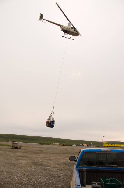
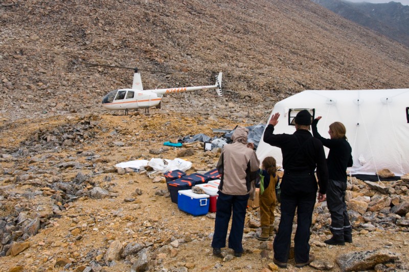
The Nolans arrived in Happy Valley at about 2AM and set up a tent for a few hours sleep. Along the route, we had prearranged some satellite-phone contact-times and I learned that Frank and Charlotte had safely made it to the glacier about 9:30PM. The helicopter was parked in Happy Valley when we arrived, so we had a good feeling about getting ourselves in after a few hours sleep. The glacier crew called in about 7AM to relate that the weather was marginal on the glacier, but still workable. So we began arranging loads. Unfortunately, the fixed wing plane had not yet arrived, and it was unclear why not. So we changed plans once again and decided to sling the bulk of our gear from Happy Valley to the glacier, about 125 miles away. I was somewhat reluctant to do this, as in 2004 an uncontrollable sling load had to be dropped, destroying about $100,000 worth of our gear and putting a serious crimp in our expedition that year. Somewhat ironically, some of that gear was radar equipment intended for the same purpose as our current expedition. The remainder of the destroyed gear was an ice coring drill, and it took 4 more years to recover from that in 2008. So I decided only to sling food, which was the bulk of our weight. By the time the helicopter took off, the airplane arrived, so we loaded it up with the Nolans and some of the remaining equipment. [And, as always, for the sake of would-be trouble-makers I'll mention that the Nolans spent their own personal money on air transportation]. Before leaving I called the company that I had arranged the Germans' transportation with and learned that they had indeed gotten on the plane at 8AM that would take them to Coldfoot, and that the plan was still in place for a van to transport them from their to Toolik Field Station, about 30 miles from Happy Valley. How they were to make that last leg was still unclear.
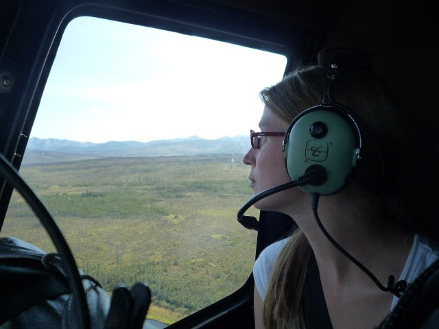
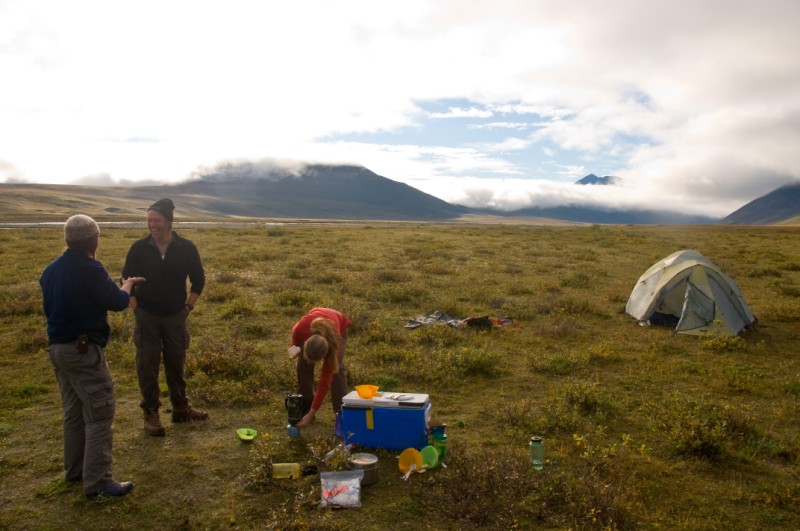
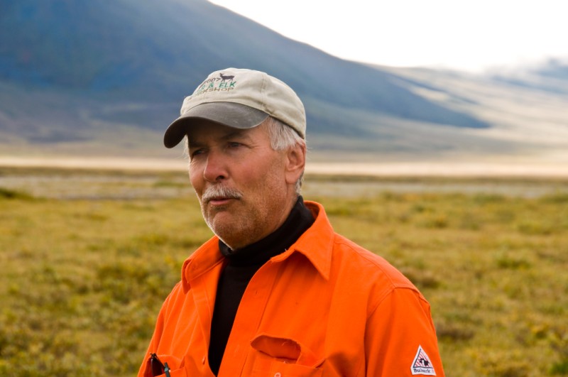
From this point on, the trip went relatively smoothly. Quinton, the helicopter pilot, was able to drop the sling load (gently) directly at our glacier camp, and we arrived with Bob in the fixed wing at the tundra strip at about the same time as Quinton did. From here we began shuttling loads to the glacier. I was very impressed by both aircraft and pilots. The R-44 has become a very popular helicopter because it is simple and cheap to operate. It is, because of this, quite small and can really only haul two people with gear (or three people with minimal gear), especially at these altitudes. The newer version, the Raven 2, is fuel injected, and it seems this boost in efficiency and power is sufficient for what we need to do. The Helio Courier we flew in on is also a great performer for our needs. It hauls quite a bit (three people with gear plus some), and landed in less than 300 feet on our bumpy tundra strip. So, by about 2PM the bulk of the people and gear were on the glacier. At this point we learned that the Germans had indeed made it to Toolik, so we dispatched the Helio to pick them up on its way back. By the time they arrived in Happy Valley, the R-44 had made it back from the glacier, and we repeated the process of one direct flight to the glacier with helicopter and one to the tundra in airplane, and after a few shuttles everything we had hoped for was on the glacier. Quinton made one last shuttle to bring Bob out, and we walked around on the glacier surface assessing the possibilities of landing the Helio there in the future, and all agreed that it seemed feasible. So it was a long few days with a lot of stress and not much sleep, but in the end it was a somewhat remarkable accomplishment to have succeeded in a fairly major put-in within a 24 hour period.
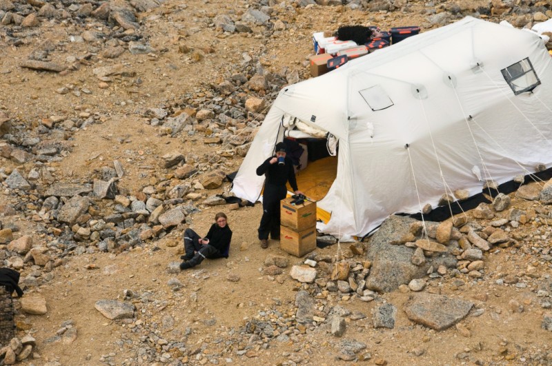
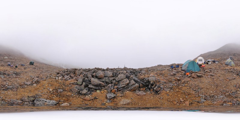
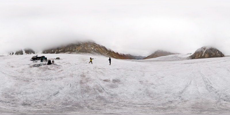
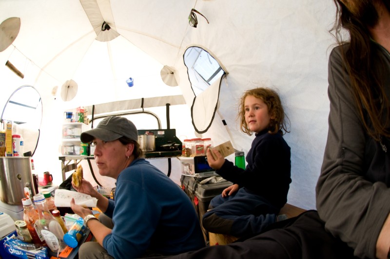
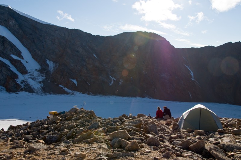
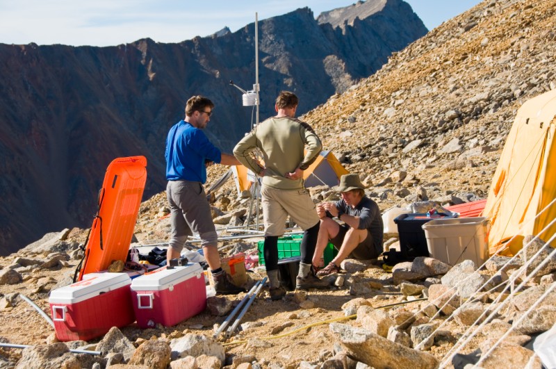
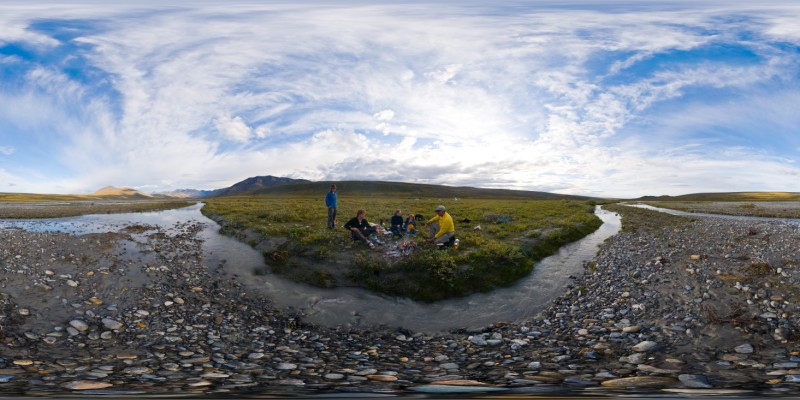
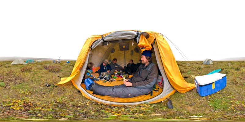
The Belgians had been busy since arriving and had already setup many of the tents. By time the Germans arrived camp was fairly functional and we enjoyed a good meal, including the customary glacier-ice margheritas celebrating our successful arrival. By the end of the next day, camp was at 100%, both radars were tested on the glacier and found more or less functional, and I had made a brief tour of my weather stations and glacier conditions by snow machine and found everything about as well as expected.
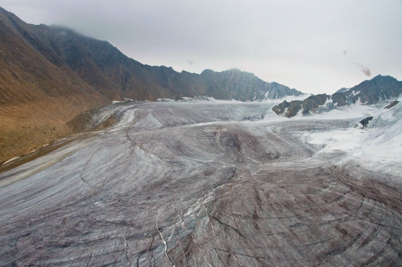
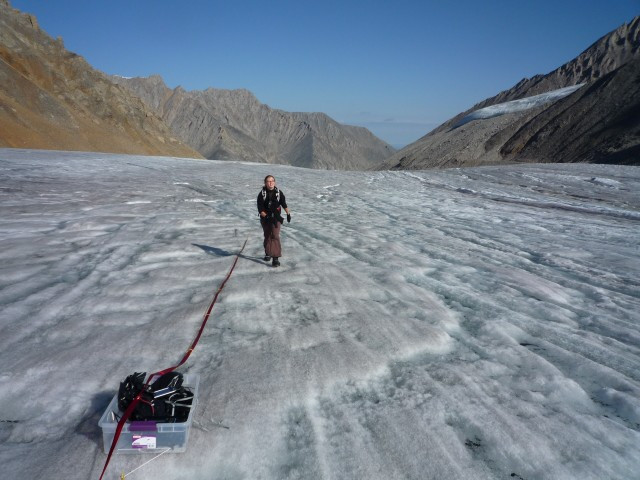
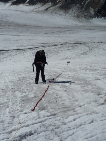
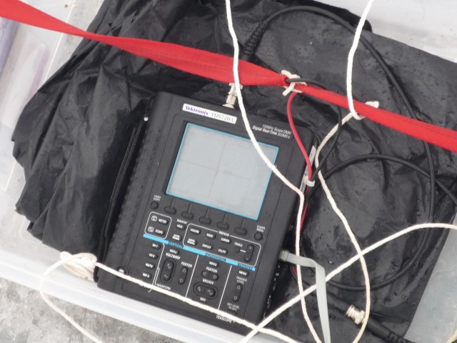
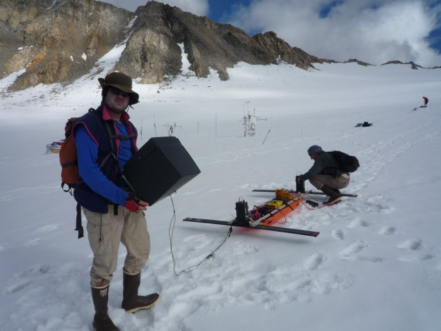
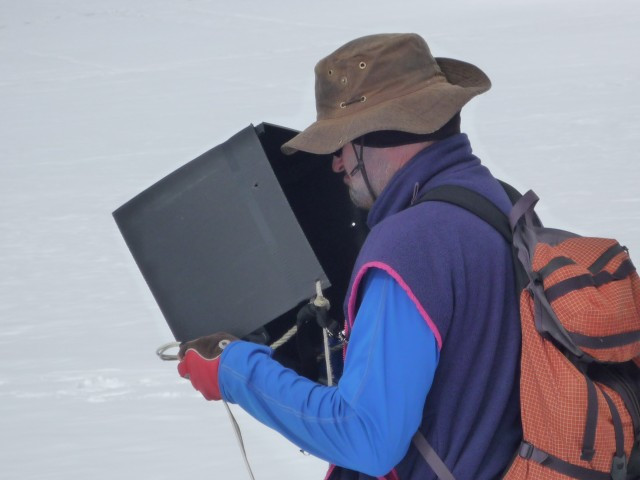
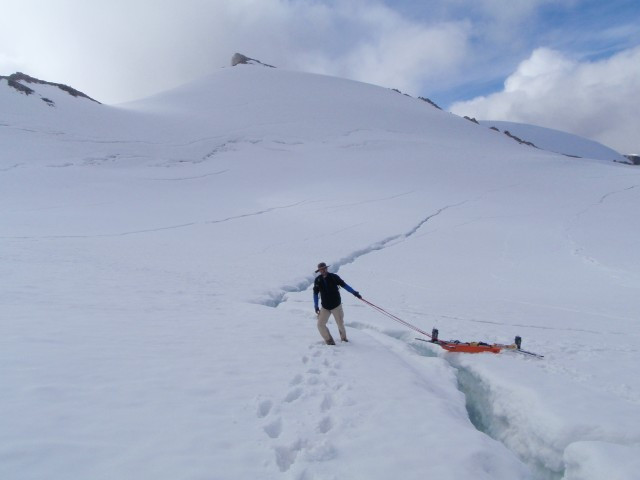
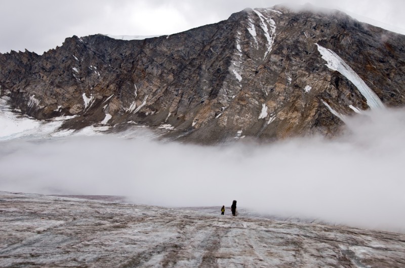
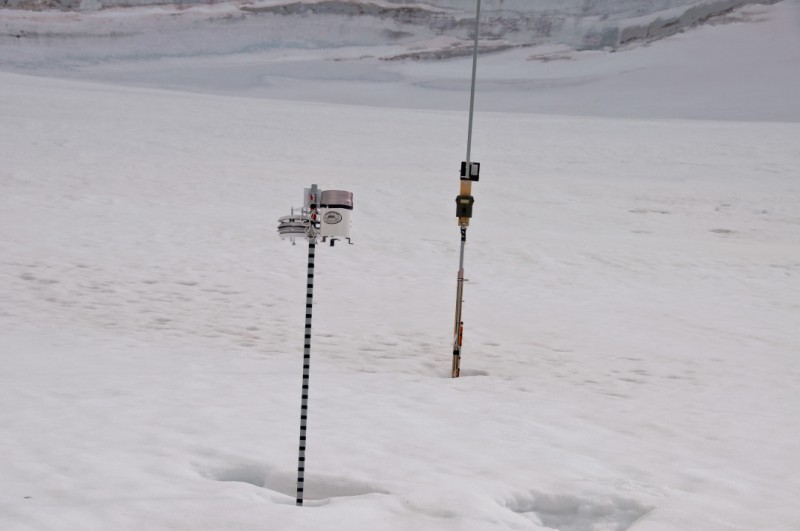
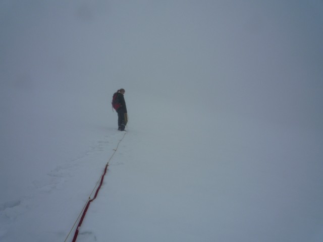
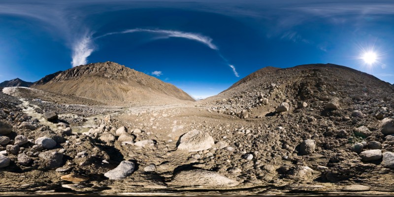
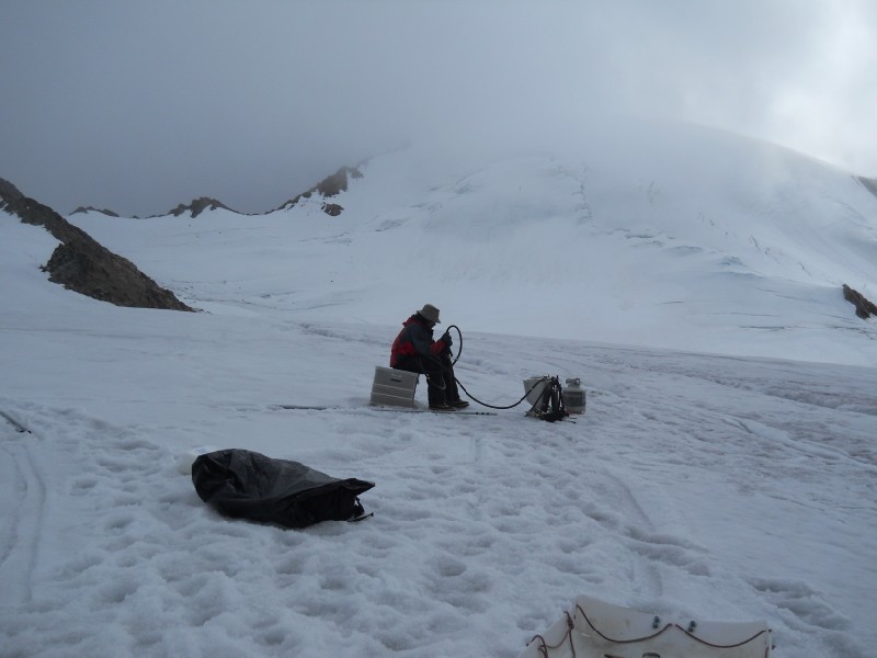
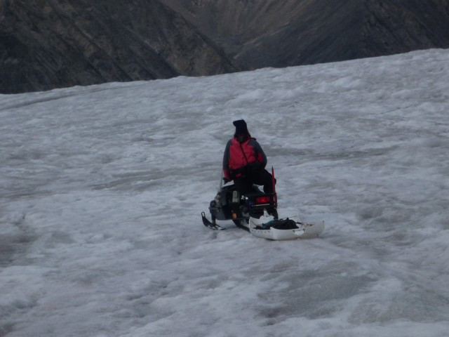
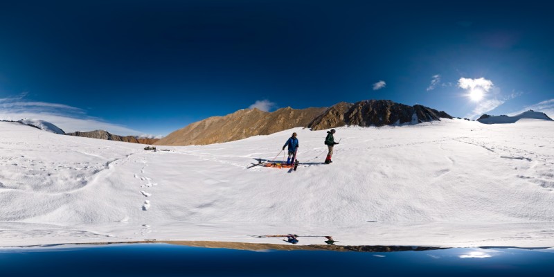
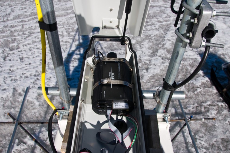
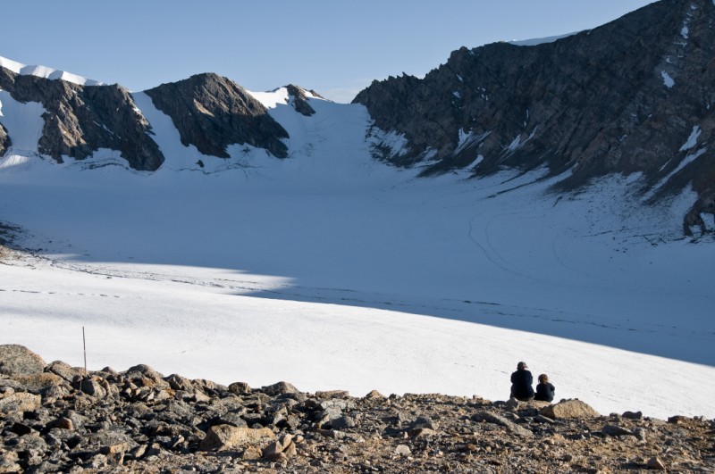
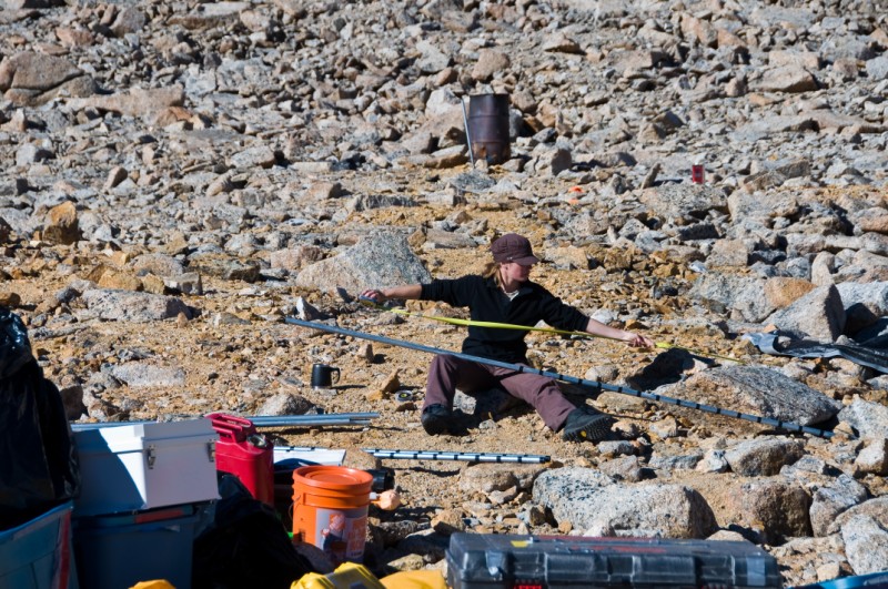
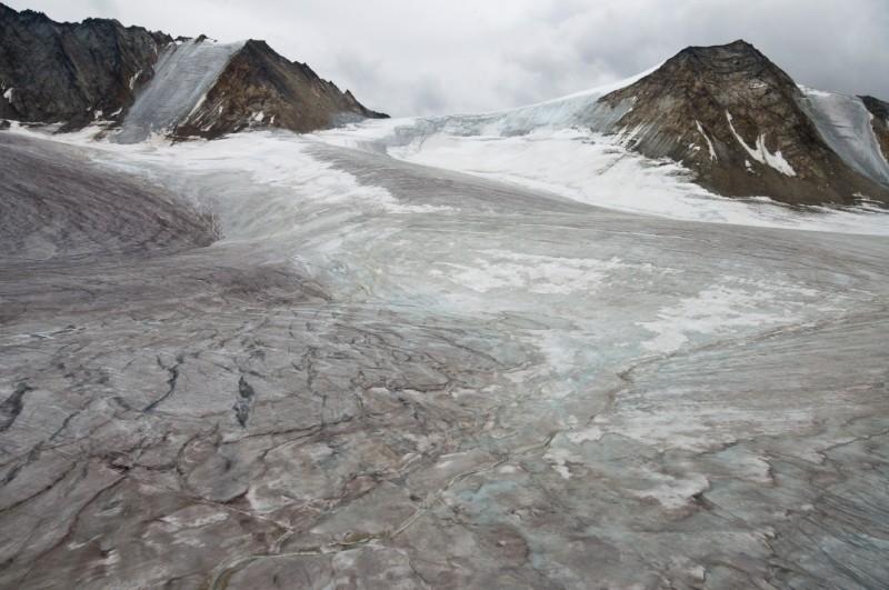
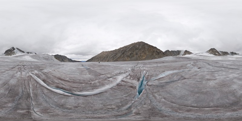
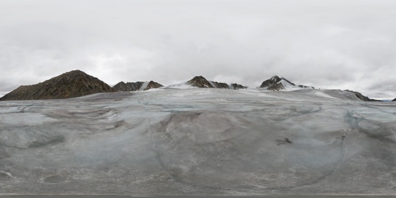
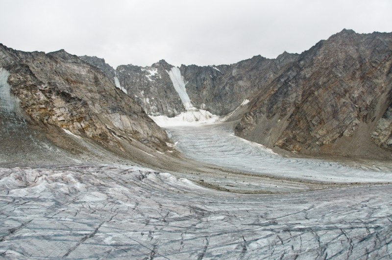
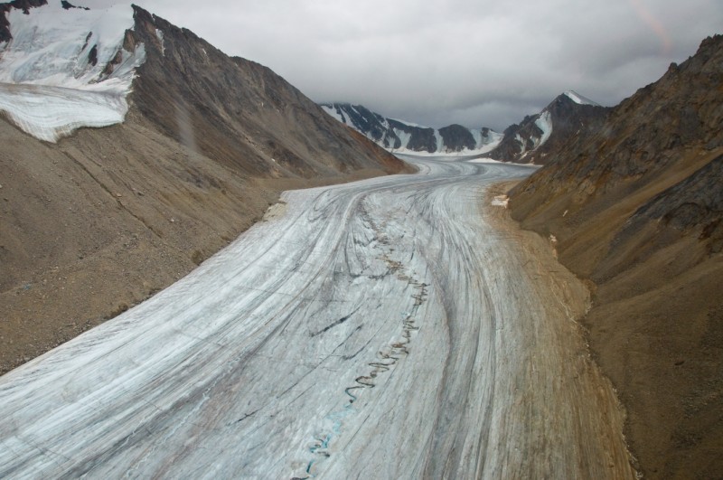
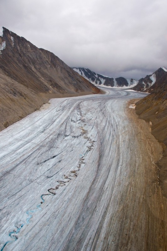
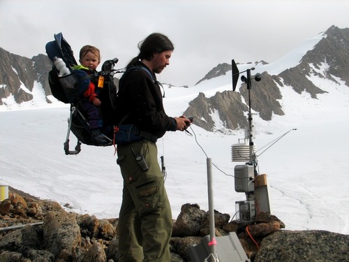
Our first day of real work began on August 3rd. The Belgians headed down to the main weather station in the ablation area, where we also have one of our ice temperature thermistor strings. Here they hoped to map out the boundary of the warm ice layer near the bed. We know from the thermistor string, and other indirect evidence, that this layer is at least 20 meters thick. So they began here and slowly walked up-glacier back towards camp, along a transect that we have used for many other purposes so as to maximize auxilliary information. The Germans worked on the ice in front of camp for while, further testing their equipment, before heading down to follow in the Belgian footsteps. Given the lack of snow, we are fortunate to have GPS. Both teams have a hand-held GPS with the same coordinates for the transect. So one person walks in front navigating and dragging a sled with the radar equipment, and the other walks behind with the equipment ensure it doesnt tip over or get stuck or fall into a stream. Both operate essentially using a hand-operated trigger, such that every few steps a button gets pressed to make a recording. The radar records not only the data, but also a time-stamp for when it was acquired, and afterwards this time-stamp is synchronized with the GPS used in navigation which is also recorded its path, so that each trace ultimately gets a coded with a spatial position. When all of the traces are plotted next to each other in their correct geographic position, they form a two dimensional cross-section of the glacier, including any layers or structures found within it.
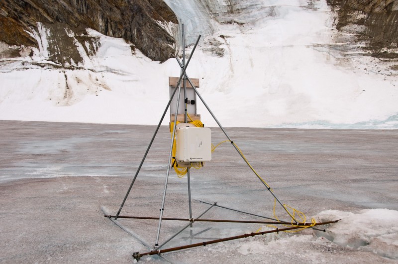
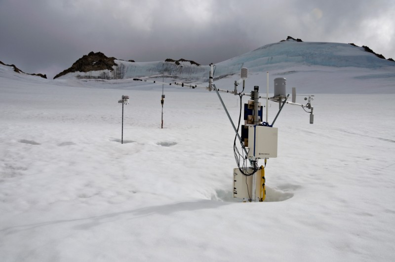
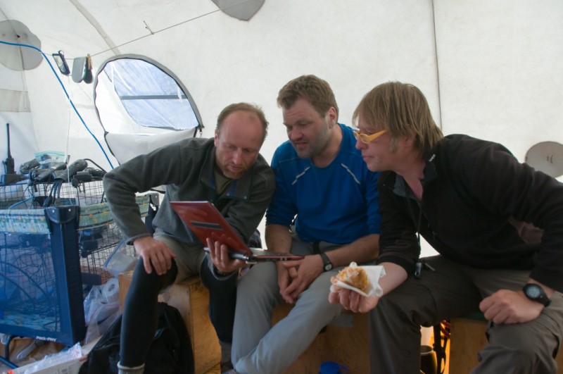
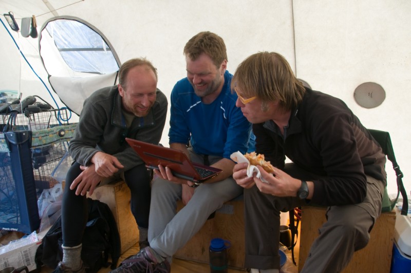
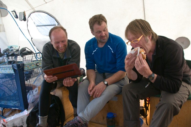
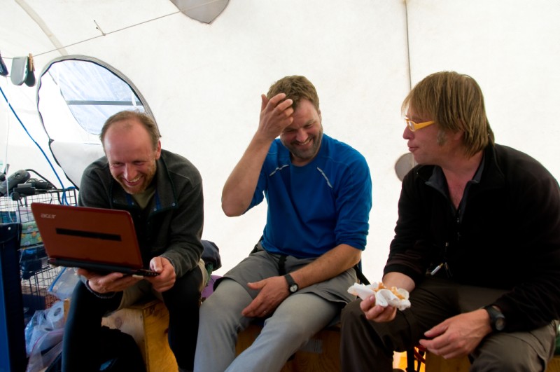
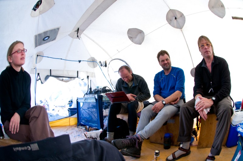
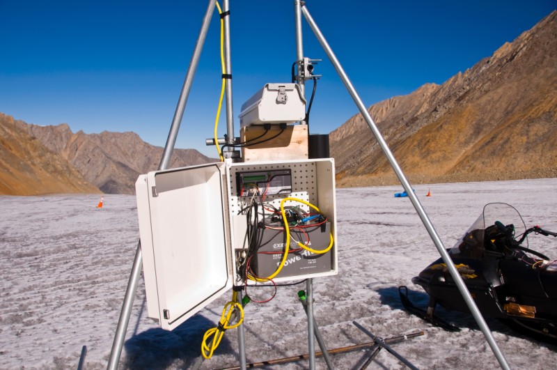
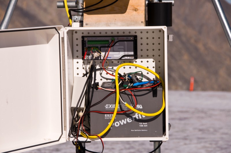
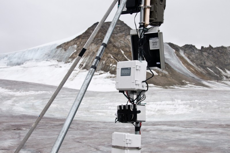
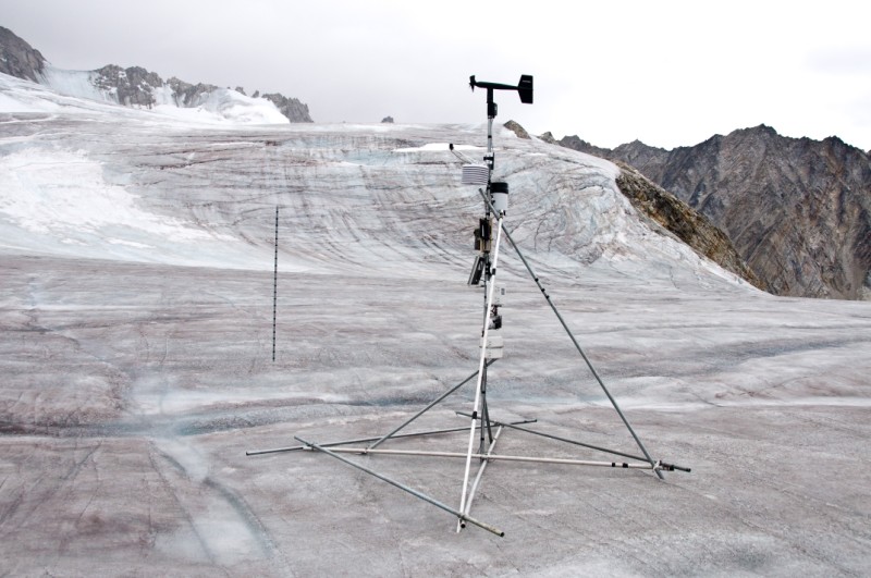
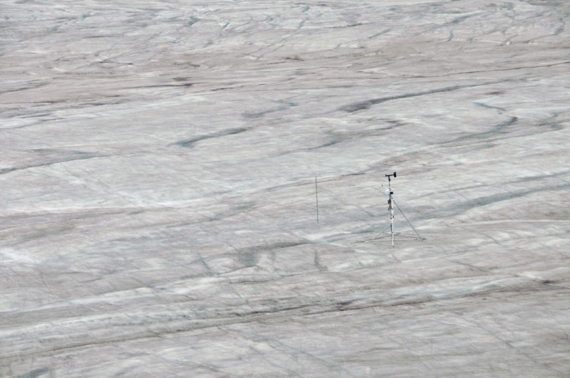
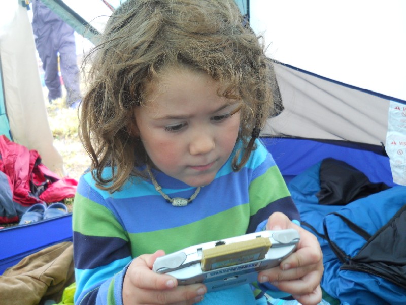
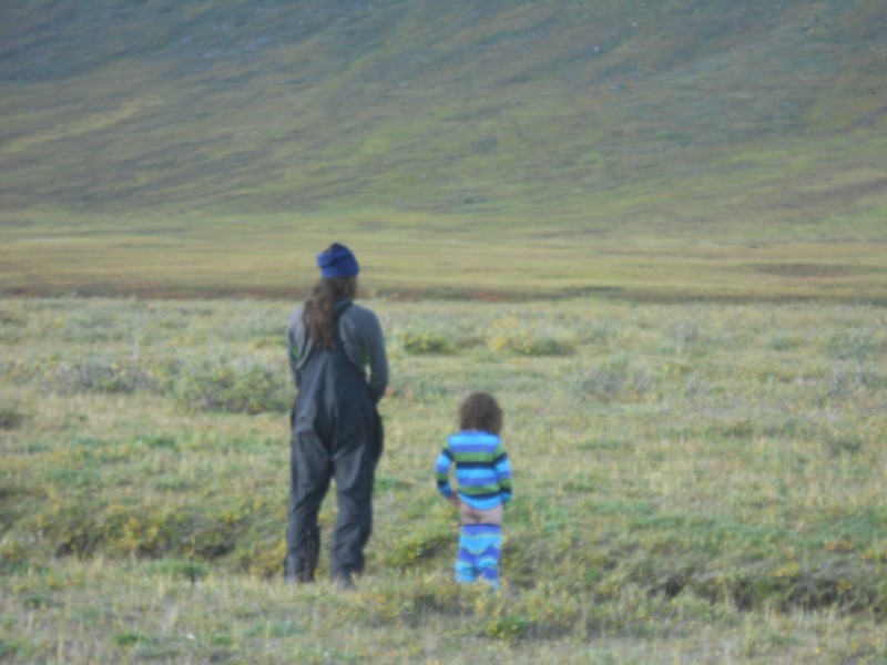
While they were marching on the ice, I visited several of my weather stations. I found that the thermistor string in the lower cirque, the deepest one at 200m, had failed about a month earlier. This was of course unfortunate, though expected, as the ice motion inevitably stretches and breaks the cable (though the manufacturer told me that the unbroken part of the cable should still be functional...). This string also has the most interesting data in that this location has transitioned from an accumulation area to an ablation area, and over the past 30-50 years the ice has been getting colder due to the lack of refreezing meltwater within the snowpack, which no longer exists. In the afternoon, the Nolans visited the upper cirque where there are now 8 weather stations operating. Kristin and Turner played a variety of games, with occasional participation from me, while I wrestled with downloading the stations and some overdue maintenance. Most everything was running fine, though the logger recording the deep thermistor string here had died last winter due to a failed solar charge controller which caused the battery to drain completely, and last spring it was buried under the snow so I had not checked it. But I had another battery handy and was able to get it going again, fortunately learning that the thermistor string itself is still functional. At dinner, both radar teams shared their results by passing around laptops while trying not to spill our food, which in this case was spaghetti with enormous meatballs. Both radars were giving similar results with some interesting findings, so we all went to bed with full stomachs, looking forward to another productive day.
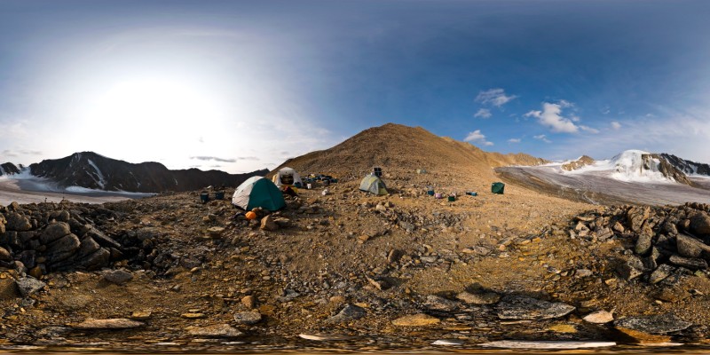
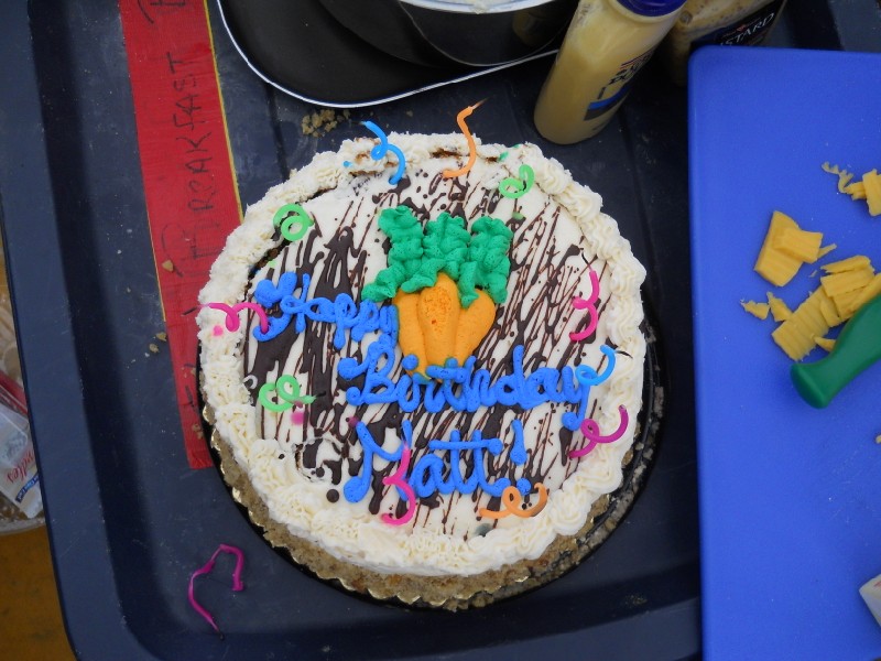
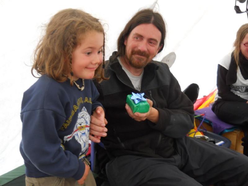
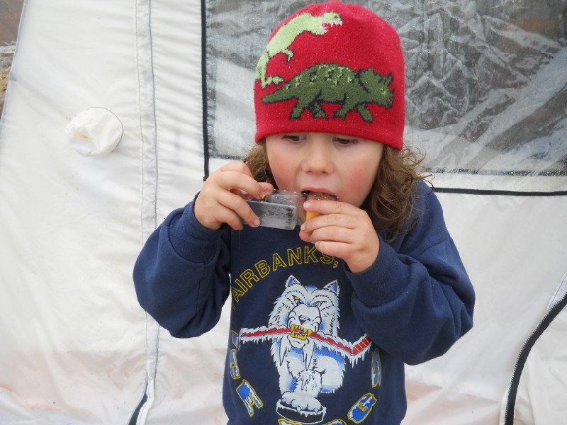
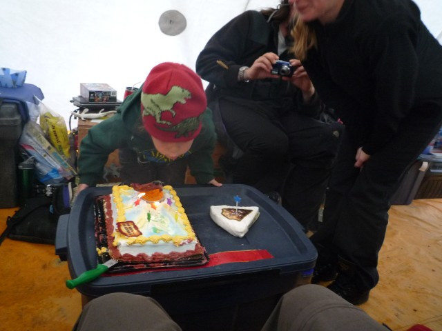
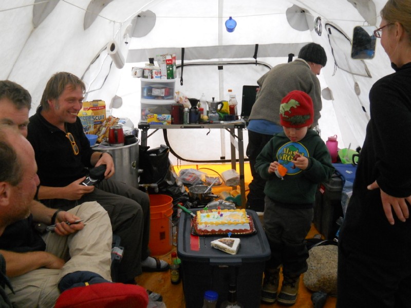
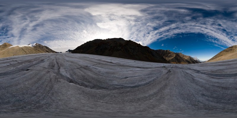
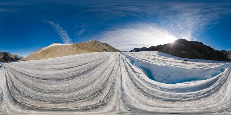
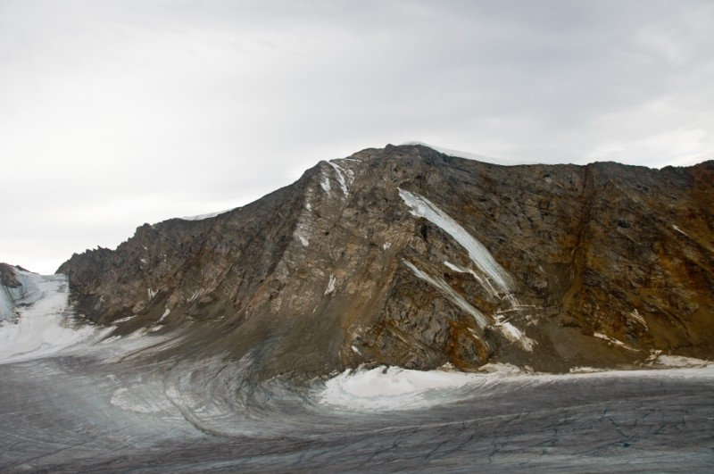
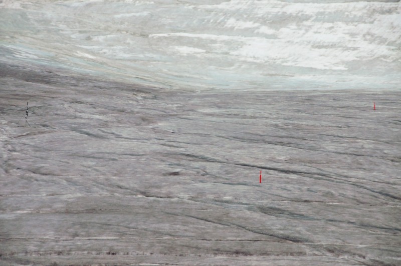
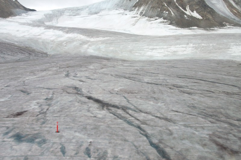
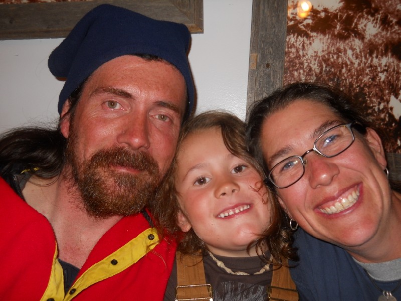
He likes filming the dinosaurs he finds. The plan for August 4th was similar to the previous day, with more radar and more weather station maintenance. I headed down-glacier with the snow machine, hauling the steam drill and a bunch of new survey poles to install. Over the past 8 years I have been gradually simplifying the survey-stake network, and now have a few sites which I install poles every two years, such that there are always at least two poles standing. I put the poles in the same initial spot each time, so as they move downhill forming a line. By having at least two poles spaced several years apart, we can measure ice velocity at a fixed point in space by interpolating between them. That is, as a pole moves downhill, it is moving through a spatial gradient in velocity (for example, it may be speeding up as it enters a zone of faster motion), but by having a pole behind it you can track motion over time at a fixed point because you know the speed on either side of it. It's not such a big deal on a slow-moving glacier like this, but the poles also serve as backups to each other for mass balance measurements so it works out pretty well. Unfortunately, it was a clear night and the ice that was still in the shade was almost too slick to walk on, let alone drive a snow machine towing a heavy sled downhill. So once I stopped doing unintended 360s, I ditched the drill and poles and headed back uphill. It was turning out to be a beautiful day, so I decided to take some gigapixel panoramas from camp. This year, for the first time in several years, the ice structures were clearly visible, rather than obscured by recent snows or superimposed ice. As I was about halfway through the first panorama, I noticed a plane fly overhead. A few minutes later, it flew by again, and I surmised it was Aerometric making lidar measurements for us, creating new topographic maps of McCall Glacier and about 450 of its closest neighbors. Unfortunately for all of us, this is the third year they have been attempting this. A variety of unforeseen problems, including weather, hardware, software, etc, have been plaguing the project. We have a lot of great data so far, but hopefully the third time will be the charm. Last year, on another nice sunny day in August, I was able to include the plane in a gigapixel panorama, capturing it flying a grid pattern directly overhead. I hoped to do the same this time, but I was in the wrong spot to do it. So once I had finished the 400 or so images from here, I ran up the hill with camera and tripod and camera in hand to our repeat-photo location near camp. I dont think I have ever been so winded. Fortunately I got set up in time to see them make another pass, and knew that their next pass would be perfectly in line with the image. Unfortunately they didnt finish the next line, and I suspected that the hot noon sun was lifting moisture from the snow and starting cloud build ups which obscure the surface. So I missed the aerial component, but I think I got a nice image. The mountain we call Snow Dome directly across from camp showed a huge amount of ice loss this year, so I think the time-series of these high-resolution images are going to be quite interesting in terms of documenting change and elucidating mechanisms. I spent another few hours prepping camera gear to be ready for later in the trip, and then headed up to the upper cirque about 4PM to continue with weather station maintenance. In the meantime the radar crews were hard at work towing their sleds and irradiating the bed. The Belgians continued their transect up through the lower cirque, while the Germans continued working around the lower weather station. The Belgians finished first and went for a hike up to our weather station on the mountain above camp, and about 8PM we enjoyed a nice dinner of hamburgers and mac and cheese, while again passing laptops around to share results. GIGAPIXEL PANO HERE Today we woke up to a soggy camp. It had rained fairly hard overnight, but showed signs of improving in the morning and the plan was essentially the same as the previous days. I headed up to the upper cirque to finish up some of the maintenance there. The biggest maintenance task of this season was to raise all of the stations up, as snow was accumulating a bit over the past few years. In May, several of the firn temperature loggers were buried. I had made the decision then not to dig them out, because doing so would affect the measurements of snow temperature that they were making, both through the disturbance and by the subsequent pooling of meltwater within the disturbance. The risk was that they might run out of battery power in the meantime. Fortunately they were all still working, so I took the opportunity now to raise them up a few meters. Because these have thermistor cables running down into the snow, as the snow accumulates the wires effectively become shorter above the surface. So raising the logger boxes up required lengthening the cables. I had come prepared for this and it seems like all went OK. The two main weather stations also need to be raised, and this will take a larger effort and something I will leave towards the end. On one of these, Andy's automated pollen-trap station, I needed to remove the traps to send back to him and install a new trap to catch airborne pollen over the next year. He's had some troubles with this station, and was planning to do some maintenance on them this past spring but caught a nasty flu the day before the trip and had to cancel. I was pleasantly surprised to see that one of his traps was open and collecting pollen, and I'm sure he will be even more so. We just got a new proposal funded to study pollen in the 2008 ice core as well as airborne pollen in the surrounding area (among many other things), so we will be spending a lot of time with traps like these over the next few years. I finished up with the maintenance about 2PM and decided to head back to camp. It had been drizzling all day, and I was a bit overdue with blogging, so it seemed like a good time to catch up. Plus it's my birthday, and it seemed like a good time to start celebrating.
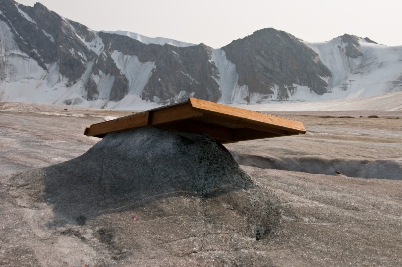
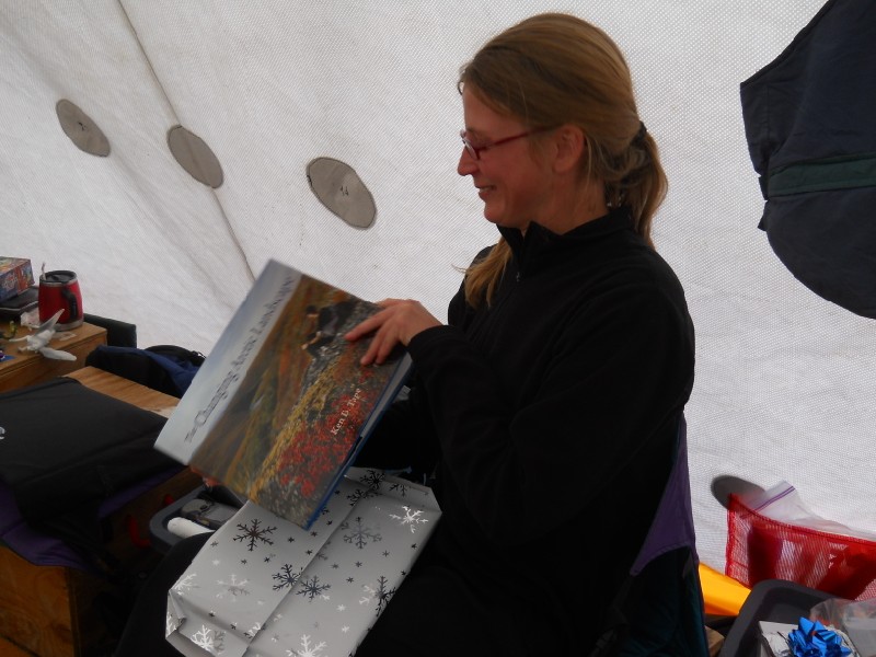
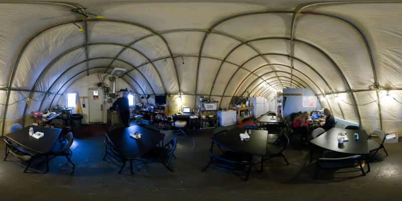
It's been a wet week, but still productive. The rains have continued for the past week. Occasionally we see a bit of blue sky, but for the most part it is either foggy, rainy or snowy. It was a very good thing we got to the glacier when we did, as there would have been little chance of an efficient put-in since the bad weather set in. So it has been a struggle keeping equipment dry and maintaining battery power. Since we get our energy from the sun, a week of bad weather completely drains our system making it difficult to continue working as much of our science this trip is based on electronics. And most electronics do not enjoy getting wet, and once wet it is difficult to dry them in the moist and humid tents. The Germans have had the most difficulties, as their system requires a laptop to be used during acquisition, but a day or two of iterations finally produced a scheme that proved functional. I've given much consideration to building a cabin here in the future. That our equipment continues to function under such conditions is simply a matter of luck, by rights it should all be fried. If we want to maintain a sustainable, long-term research program here, utilizing state-of-the-art equipment, we simply need a safe, dependable, dry place to do some of this work.
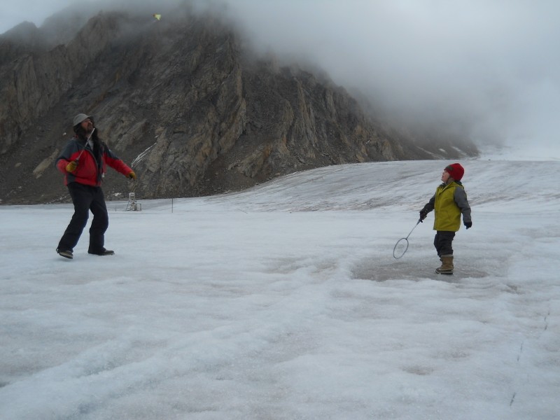
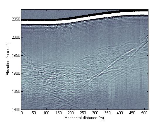
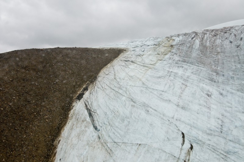
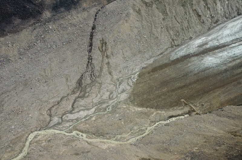
The weather is never too bad for a game of SuperHero Monkey in the Middle. The radar data thus far has proved interesting, if not exactly what we hoped for. The most successful findings have been related to the transitional boundary between the cold ice and warm ice. In the lower cirque, I have a thermistor string extending through the 200 meter thickness of ice which has shown that this location has been substantially cooling over the past 30-40 years. The reason is that the snow line has risen above this cirque and snow no longer accumulates here. Previous to this, the accumulated snow acted like a heated blanket, as surface meltwater dripped into it and released heat as it refroze within older layers, protecting the ice below from the cold winter's air. Sometime about 30 years ago, this warm blanket began melting away and now there is only bare ice there, exposing it completely to winter and cooling it down. Currently this 'cold wave' has propagated about 100 meters down and isstill moving. In terms of radar, the difference bewteen warm ice (at the melting point) and cold ice (below the melting point) is the presence of liquid water. Water has different electrical properties than ice, due largely to the ability for the molecules in water to rotate in the presence of an electric field, and interfaces containing water produce reflections when radar waves are bounced off of them. Thus we have been able to trace this boundary out from the thermistor string and understand its spatial extent. This understanding then can feedback into our numerical ice flow models, as the temperature of ice affects its speed and the ability of a model to accurately predict the location of this transition makes the model more robust and reliable for a variety of other studies. My focus over the past week has been maintaining the mass balance stake network, maintaining weather stations, and maintaining the ice velocity measurement program. That's a lot of maintenance. It's a bit like washing the dishes after dinner, there's nothing particularly glamorous or interesting about it, but it needs to be done and feels good to complete it. It's also work that I have decided to do on my own from now on. Or at least for quite some time. I read a book not long ago called Mastery by George Leonard, and it gave me a number of good ideas about how to approach life that I found useful. Doing the dishes or drilling new poles into the glacier is work that needs to be done, so you might as well make the most of it and not think of it as a distraction from something else or a necessary evil to achieve some final goal. So it's a bit like the 'journey is the reward' philosophy, but perhaps a bit more practical. There's only so many things you can master in your life, and probably one is the most that can be hoped for, and that only if you really work at it consistently. For me and this project, until now I've never felt I've had the opportunity to really dive in fully. My funding until now has allowed me only a few months salary per year, and this gets consumed simply with field work and field work preparations, and this funding has short durations. My strategy has been to focus on data acquisition and hope to entrain others to work on the analysis, but this strategy has had mixed success. I recently got two new projects funded here, and by taking some leave without pay, I should be able to work full time on this project for the next 3 years at least. So a mental shift has taken place in my mind, where I can now visualize building a long-term career around just this project, allowing me to both collect the data and analyze it, year-by-year improving my knowledge of the glacier and its climate drivers and allowing me to identify gaps in my mastery of the subject which I can incrementally fill over time. So a week of downloading data loggers, drilling holes, fixing broken things, and other such tasks has given me a lot of time to reflect on my priorities the next few years in terms of how to achieve this mastery, as well as how to link it with my other passions of photography and family. The day after my birthday, wearing my new present, an Ipod Shuffle, I cut survey poles to the right length and constructed a new weather station that incorporates a camera that can telemeter images back to the internet. My main goal for the camera is to improve logistics and safety. If we can see what's happening on the glacier in terms of fog and snow before launching to get here, we will improve our chances of success, reduce costs, and take less risks. Of course having images of weather also improves our ability to interpret what's recorded on our data loggers (for example, a picture showing that it just snowed let's us know why our solar radiation instrument shows that it's cloudy, rather than just covered with fresh snow), but the images dont have to be telemetered for this. The station will be placed out near our skiway, where it should also have it's own view of Kaktovik, giving us a second direct link for telemetry in case the one on the mountain behind us fails. It seems to be working fine, hopefully tomorrow I can deploy it on the glacier. The next day was probably the wettest of all, especially during the day. The most intense rains have typically been during the night, and not really that hard just consistent. During the day it has mostly been misty and drizzly, hypothermic weather. But on this day it just rained, and not a day to be downloading data loggers. So I puttered around camp getting things ready while the others managed to squeeze out some more radar profiles in between the rain drops. One task I had always wanted to do but never had the time was to find a safe, reliable route from camp down the glacier. The issue is the large amount of large loose rock between here and there. Carrying heavy loads requires sure-footing to be safe, else statistically someone will eventually get hurt, and potentially seriously. Most of rocks along our usual routes were carried there by the glacier, and thus can be quite large and usually are loose, and increasingly so as the glacier is approached as these were the most recently deposited. The rocks at the level of camp have not been mobilized by glacier ice in ten thousand years or more and so have stabilized much more. Thus I chose a route that, while longer, stays largely at the same level as camp, extending towards the upper cirque without dropping into the recent moraines. It largely follows existing sills, and where large or loose rock was above it, I helped the more natural geomorphic processes by trundling. After about 5 hours of this my ipod ran out of gas, along with me. But I had flagged a safe and reliable route which will hopefully serve the project well for many years.
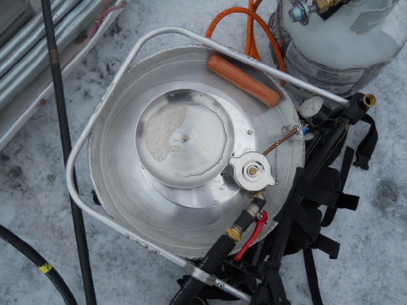
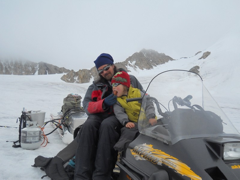
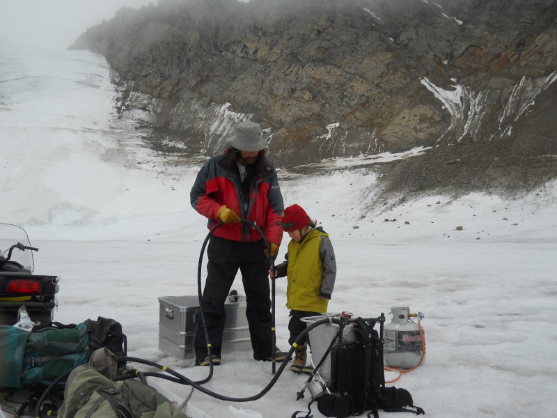
The weather next day was more foggy than rainy, so I headed downglacier to download the dataloggers there and stage the steam drill for pole installations. I had already brought the drill down about halfway on our second or third day, but a night of clear skies had made the glacier so slick that I could not control the snow machine and had to ditch the drill and poles. All of the dataloggers were fortunately working as expected, except the one I expected to fail. I've had trouble with this location for years, replacing the data logger several times. This spring flying over the site on our way home, I discovered what I imagine is the cause -- the ice around the site had a sheen indicative of strong wind, and this sheen could only be seen from the air. So strong winds funnel over this location and likely fry the logger with static. In the afternoon Kristin and Turner joined me on the glacier to drill a few holes for new survey stakes and cook hot dogs on the drill. The drill worked fine and it was enjoyable to work together finally, as previously the rains were just too uncomfortable to do so. So overall it was a productive and satisfying day.
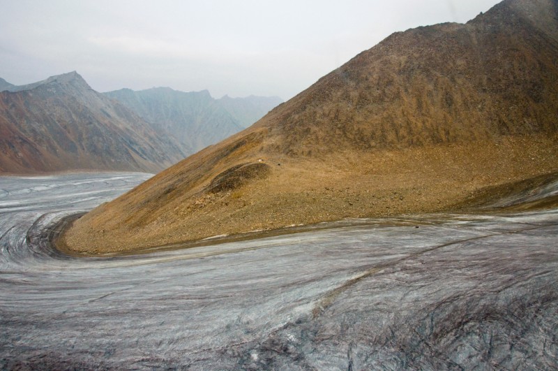
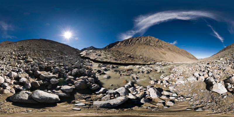
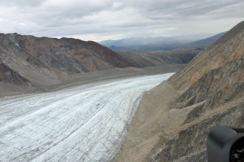
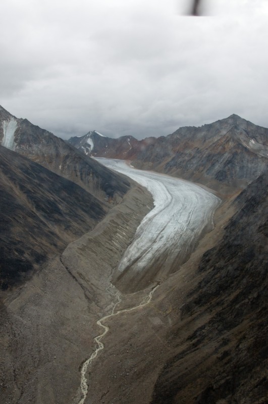
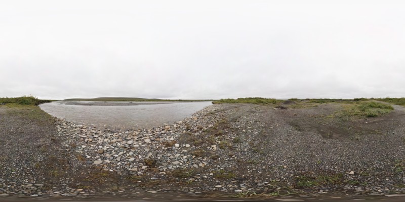
The next day was also more cloudy/foggy than rainy, so I headed out early for a trip to the terminus and to finish up all the work down from our main weather station. The surface of the glacier gets increasingly rough as you head towards the terminus, and using the snow machine there is marginal at best, so I wanted to minimize trips. The use of a snow machine here has really revolutionized our efficiency. What used to take an entire day (like a trip to the terminus) now takes only a few hours (surface conditions permitting) and effectively allows me to work independently for all of our baseline tasks; working with another person would actually decrease efficiency at this point. The stream at the terminus had changed considerably since my visit there last summer, with most of the water now coming from the east side higher up, utilizing new channels above the old ones. The heavy rains had also apparently caused some enormous mud flows from the ice cored moraines which tower over the terminus, covering the easiest access to our stream site. The mud was like quicksand walking over it, and the entire area seemed primed for many more of these. The stream site was in good shape and all of the loggers downloaded fine, though I was a little disappointed to see our stream stage sensor out of the water. Apparently the strong discharge from the glacier had eroded the bed of the stream down another half meter, stranding the gage above the current water level. By now the weather had improved here and was actually sunny for a while, so I was also happy to take a few photos. On the way back, I drilled holes for survey stakes. I have been gradually reducing our stake network to exist primarily along a center line transect to improve efficiency and long-term sustainability. The idea now is to have fewer sites with more poles each, with the poles serving as backups for each other for mass balance and also to serve as index sites for velocity. Index sites differ from just measuring a pole as it move downglacier by measuring two poles that bracket a fixed coordinate such that by interpolating between the poles you can track the long-term velocity changes at that coordinate, avoiding problems associated with poles moving through a spatial gradient in velocity. The work went well, but was time-consuming, especially drilling 9 meter holes. It was after 5PM by the time I got to our weather station, and I had wanted to finish up drilling on the lower glacier today in case the glacier surface caused issues again. So it was 8PM before I got back to camp, where I was just in time for a yummy dinner.
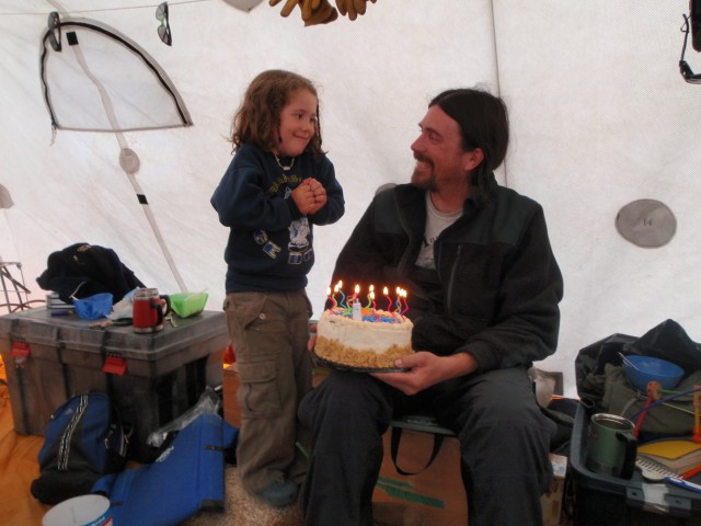
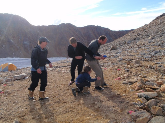
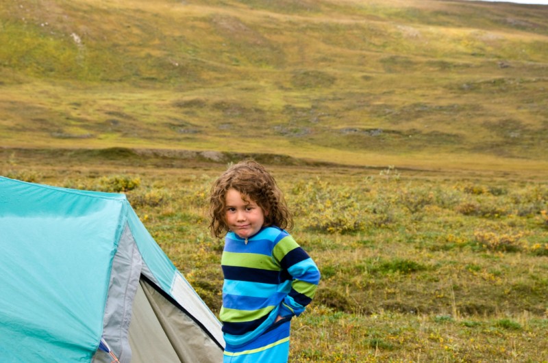
See the meltwater in action over the summer. The next day was Turner's birthday. The weather was again marginal, but workable. I headed downglacier first thing to finish the last hole down-glacier from camp, up from where I was the night before, and the Nolan's spent the early afternoon drilling new poles into the lower cirque. We also played some badminton and football while the drill was heating up, and explored the ice surface for artifacts from prior expeditions. After finishing in the lower cirque we headed back to camp. I had wanted to make the new trail a present for Turner, and so spent a few hours toppling the remaining hazards and marking the new trail with closely spaced cairns, topped with blue rocks, so that it could be followed in any weather. Turner was of course quite excited to turn 5, or at least to open the presents associated with doing so. He was also quite proud of his new trail and his ability to easily walk the entire length as line-leader.
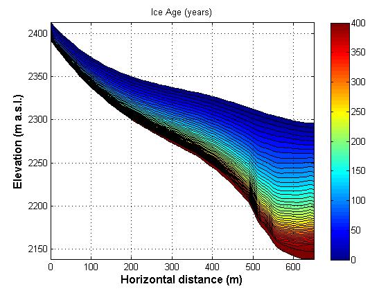
The next morning I slept in a few extra minutes to give my back a chance to recover from the day before and spent the morning prepping the GPS for the upcoming survey. I also had a good conversation with Franken-1 regarding our new core analysis project. This core was taken on a sloping surface, meaning that the ice within the core was formed upglacier of the core site. Exactly how far upglacier was not really clear, though there were only 500 meters to choose from before you get to the top. Frank has done a lot of related modeling so we discussed methods for how to model ice trajectories and lines of constant age within the ice. Such information will not only help us constrain the age of the ice, but also the long term ice accumulation rates and how this relates to paleoclimate. The Nolans then headed uphill to drill the last of the new poles and wrap up some weather station maintenance in the upper cirque. The drilling went well and we stayed fairly dry. We also made a final download of our firn thermistor strings and changed the batteries, prepping them for winter, and reconfigured Andy's pollen station. After talking with him on the satellite phone, we decided to drain the water out of the open trap and reinstall it, which also required me to move the new one I had put in its place. But all went well and by the time we returned to camp Frank had already completed a first set of modelling runs regarding depth-age relationship in our core, and it was exciting to see and think of the experimental designs which could improve this modeling.
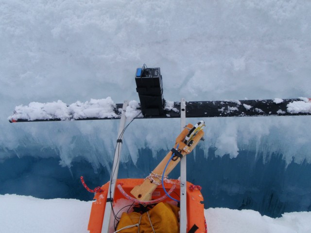
Yesterday was the crux of the trip for me. The weather was probably the worst it had been since shortly after my birthday, but it was fine enough for the mass balance and GPS surveys that needed to be done. My goal since the past few years was to simplify the measurement program such that it could be done in a day but still provide all of the information needed for the long-term program. Last spring I did it in about 4 hours, using the snow machine and with decent snow conditions. I began yesterday just below camp and headed to the lower cirque next, staying in the sunshine and hoping that the warming rocks would lift the fog choking the lower glacier by the time I got there. Unfortunately I spent the rest of the day in the fog and rain, with poor visibility trying to follow a GPS route over rough terrain. One of the ways I've simplified the measurement campaign is to attach the GPS antenna to the snow machine and leave it running continuously as I follow the longitudinal profile I began measuring in 2003, based on a flight line of Keith's from 1994. In the past, we had done this using the RTK method to navigate to within a few centimeter of each point, set the GPS on a rod, and take the measurement. This consumed huge resources in terms of both the GPS setup and the work involved with measurement, for little apparent gain that I could see, considering that surface topography had a natural variation an order of magnitude higher than the accuracy of the measurement. On other glaciers where the RTK system was simply not available, we used a hand-held GPS to navigate to the points and then walked a circle around the spot with the more accurate GPS and then in post-processing pulled out the closest measurement. Now with all of the DEMs we've had created for the glacier, there is simply no compelling need for doing this the time-consuming way. While using the snow machine greatly speeds this up, the new hazards are trying to follow a GPS route over terrain which is pretty lumpy and incised with streams and crevasses. Doing this in the fog adds to the complication, but in the end was manageable, though I think I jumped over a moulin at one point. Fortunately also the satellites cooperated all the way down the terminus, and I was heading back uphill by about 2PM. In the meantime the fog had lifted, but not as high as I had hoped, rather it now enveloped the upper glacier where the rain turned to snow. I met up with Franken-2 and Bernhard in the upper cirque, where they were just finishing up some measurements, and spent another hour or so completing the survey. It was satisfying to finish up just in time for another yummy dinner, both because my highest priority for the trip was completed and validating that my long-term goal of optimizing the survey was possible.
Today I've entered into wrap-up mode for the trip. I have a number of small projects still to complete, and making final to-do lists so as things start to get hectic they'll hopefully still get done. The radar work seems to be drawing to a close as well. Unfortunately it seems the work that I was most interested this year is a bust, as the wet snow created too much interface to track firn layers. But we had done this once already in 2004 during May when the snow was dry, so we still have that to work with. It seems, though, that the ice temperature measurements are going to create an interesting story once it's all put together. For me personally, not having a budget for a summer trip of this magnitude has meant taking about 3 months leave-without-pay to cover costs. I was reluctant to do it of course, but we've got a lot of interesting and useful information out of it, and I have learned a lot from the experience and now have a clearer vision of how to proceed in the future, hopefully avoiding the same mistakes.
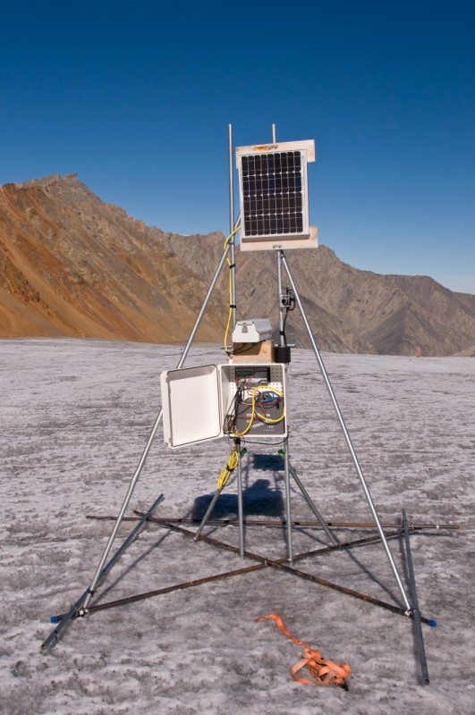
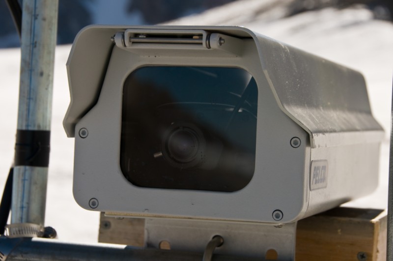
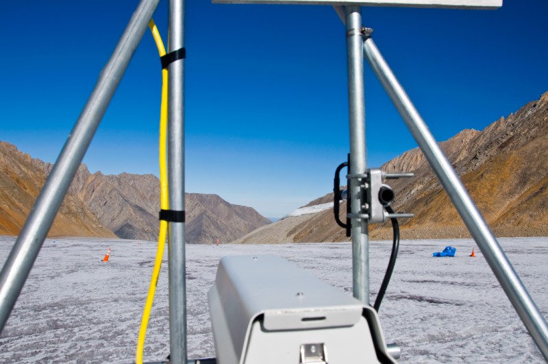
Weather is everything. I had intended to go into the upper cirque that afternoon, but the weather deteriorated that morning and I decided to stay at camp try to get a head start on some of the final tasks. Particularly, I had two new weather stations to deploy and had yet to begin work on them. One station was primarily a weather camera near the skiway. This station would transmit images of surface and weather conditions, primarily to facilitate logistics. One flight to the glacier and back costs about $3500, and the hardware involved with transmitting images costs about the same, so I figure it pays for itself with one missed flight, as given the lack of other infrastructure around here every little bit helps. I had gotten the camera and telemetry system running in the tent about a week ago, with Ken having done the initial programming back in Fairbanks already this was just a matter of plugging everything back together correctly. Now it was just a matter of building a structure to keep it upright and in view of Kaktovik. Last year I had run around with a telemetry radio and determined that the top of the skiway had the view, so in addition to the images this site should also give us a backup repeater connection to all of the other telemetered stations here in case our mountaintop repeater fails. The structures I build are based on a design I learned from Hans Oerlemans from the Netherlands, though mine are much less pretty and more low tech. These are 'floating' stations, which simply ride on the melting ice without any need for drilling anchors. Mine are made from bent or scrap survey poles, hose clamped together into a rigid structure. This station was a bit unique in that the crazy attachment points of the datalogger box and camera required two uprights, so it required a few more poles and a little more thinking, but still pretty straightforward. The other station was a complete weather station to be deployed on Esetuk Glacier as a part of a comparison project with McCall Glacier. The basic idea is to test how representative McCall Glacier is of other glaciers, with a particular focus on Esetuk Glacier because it drains into the Hula Hula River, which is a focus of a joint project between UAF and USFWS. It's a bit convoluted because the Hula Hula River is the obvious choice for a long-term river monitoring site due to the history of research there and the Dolly Varden fishery used by the locals for subsistence fishing and McCall Glacier is the obvious choice for long-term glacier studies, but McCall Glacier doesnt flow into the Hula Hula River. Given that they are only about 10 miles apart I suspect that we will find that McCall's record is an adequate substitute for Hula Hula glaciers, but it's nice to confirm this rigorously. Like the camera system, I had previous built and tested the equipment for this weather station, but it still needed a similar floating structure to be built. So after a few hours of scrounging poles and twisting hose clamps, I had two structures sitting next to our tents, and got all of the instruments more or less hung on them to ensure that when it was all lugged into place that there would be no major surprises. That night after the radar folks returned and had our nightly ritual of passing around laptops to view and discuss results, Franken2 and I found ourselves alone in the cook tent after the others went to bed and we enjoyed a good conversation about life. Frank is not a glaciologist, but has a physics background and was a classmate of Bernhard's in Germany. His primary research these days is in acoustics related to noise cancelling in audio components, which has a lot of cross-over with radar processing, and it seems he is enjoying himself putting his skills to work in something that on the surface is completely out of his normal routine.
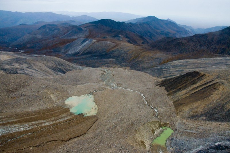
See the weather for the summer. Finally the next morning the weather had broke and we found ourselves in clear sunny skies once again. Though I was tempted to go after some photos on my list, I decided it would be better to finish up the mass balance and weather station maintenance. The mass balance measurements have two basic components. First is to measure the poles, which tells us how the surface has changed, and that I completed the other day. Second is to measure the mass of the snow which has not melted, and what was remaining. Doing this consists largely of digging pits and measuring snow density. The only snow remaining from summer was located in a small section of the upper cirque and this was only about 30 cm deep. One of the interesting things we've learned thus far from our ice core is that the average annual layer thickness is about 50 cm. This is a bit odd in that our measurements rarely show that there is more than 25 cm of water equivalent left at the end of summer. That is, even though the snow thickness may be 50 cm, it's density is usually not more than 50% that of water, so if we melted the layer it would yield about 25 cm of water. This is pretty compelling evidence that substantial internal accumulation of ice has been ongoing here for several hundred years, as the only way this 50 cm of snow can densify without compressing is for meltwater from subsequent years to percolate downwards inot the pore space within the older snow and refreeze there. It also suggests that the primary process for growth of glacier ice here is not compaction like on most glaciers, but rather this internal accumulation process. Thus in the context of our measurement program, it is perhaps more valuable to measure snow thickness than snow density, again unlike most other valley glaciers to the south where this process does not occur. That is, we can predict the amount of internal accumulation in the future simply by knowing the snow thickness now; so I began making transects of snow thickness for this purpose. After this I ran down glacier for some last maintenance on our lower weather station, which consisted primarily of resetting the sonic ranger on to the poles I had drilled a few days earlier and levelling all of the instruments that needed it after moving the station a few meters upglacier. That evening, after the normal rituals, the guys found themselves in the cooktent and we enjoyed another another late night of story telling and comparing life experiences while trying to fulfill our trip-averaged quotas of alcohol consumption. JJMC TIMELAPSE
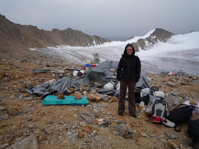
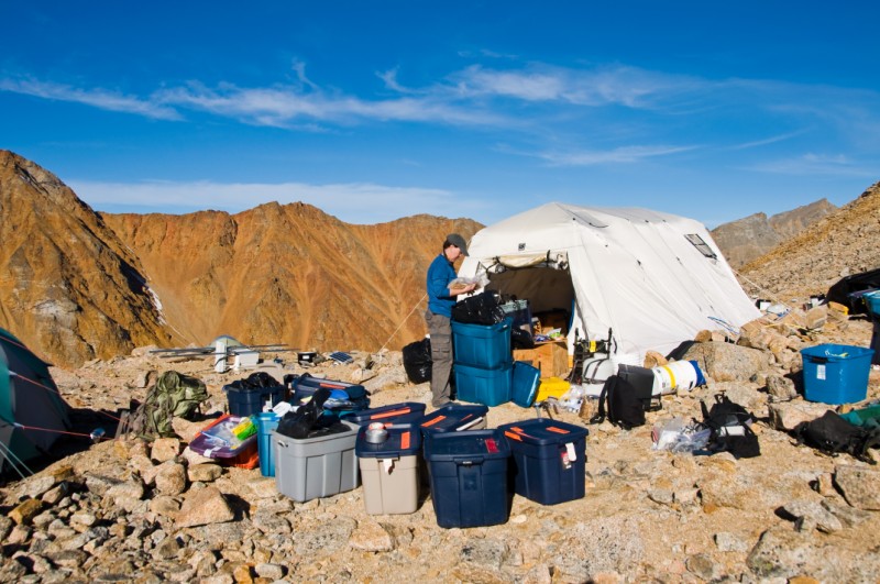
We awoke the next morning to more beautiful weather. This time it held for the whole day, without a cloud in the sky. The take-out being planned for the next day, I resisted the urge to go after some photos I had been interested in taking and tried to get all of the science completed so that I could pack all of that gear away for the winter. So the Germans and I headed down to the skiway to install the camera system, and this went as planned. While I finished that up, they went to do one last transect in the lower cirque, in the pocket around the corner where we had yet to measure anything. Franken1 had found earlier in some cross-profiles lower down that the warm ice from the lower cirque could be tracked side-by-side with colder ice joining it at the confluence of the upper cirque. This upper cirque ice starts warm, but by the time it reaches this confluence it has cooled off. As far as I know, no one has ever measured a contrast in ice temperatures like this in a merged glacier. We finished up about the same time and headed back to camp to assist with the demobilization. As is usual, it looked like we where having a giant garage sale, with the tents emptied out and all of the boxes open, sorting and inventorying gear and sealing it in boxes for the winter. It is almost essential to have great weather for this, especially for such a large group with so much stuff. Once again my thoughts revolved around how much more productive and safer we would be if we had a wooden hut here. This would largely eliminate boxes and tarped-caches, and inventorying could be done inside and streamlined substantially. Similarly, the worries we have drying tents would largely disappear. The issue here in addition to the economic cost of losing tents to mold is that we depend on these tents being here when we return the next time and if they get ruined we would be in trouble. Similarly, an in-place structure would eliminate many of the other risks associated with our put-ins, such as sudden changes in weather or the lack of sufficient personnel or expertise to erect these tents should some people get delayed. And of course the increases in human safety and equipment safety by having a dry, heatable space during our field campaigns are enormous. I had for a long time been against a structure like this as I have seen that in other locations they make it so comfortable that there is a tendency for people to linger there rather than get work done on the glaciers, but I've changed my thinking about this after this trip and the issues associated with working in hypothermic weather in leaky, shaky, fragile tents. While I'm also for supporting wilderness values as much as possible, if we want to maintain a sustainable, long-term project out here, we simply need a place to work that wont blow away in a storm and that can be heated to keep humans and electronics functioning properly, as has been done in all projects here prior to mine. In any case, Kristin had the situation under control as usual and I focused on getting the last weather station ready to go, cleaning up all of my science gear and confirming that the telemetry systems were all operational before we abandoned them. Unfortunately I could not connect with two of the stations, so I had to return to the glacier to solve these issues and the Germans kindly agreed to hike up to our mountaintop station to swap some sensors for me. So by about 8PM, we had all of the weather stations operational and ate a yummy meal of fried bagel sandwiches, calling it an early night in anticipation of our pull-out the next day.
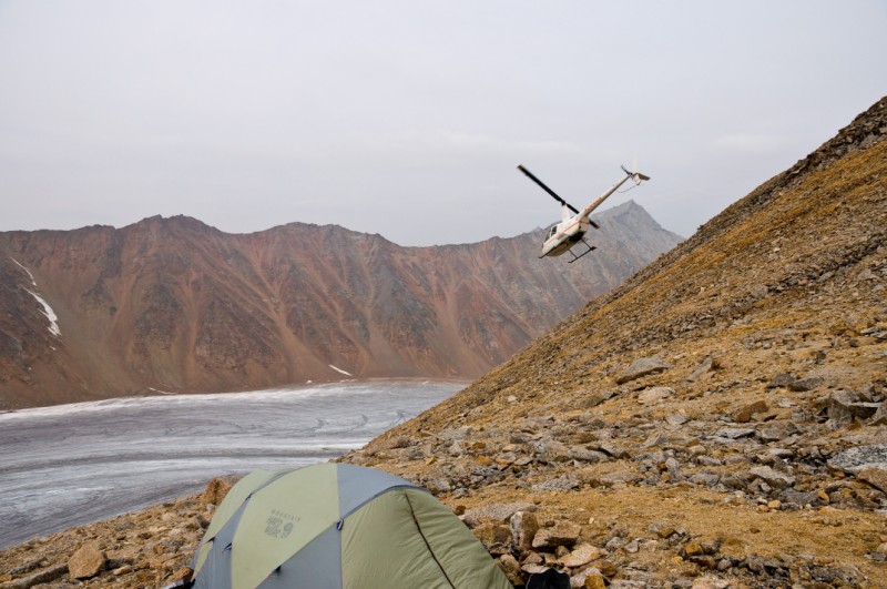
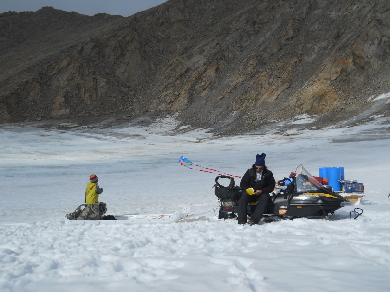
Here's a link to what the camera is seeing today.
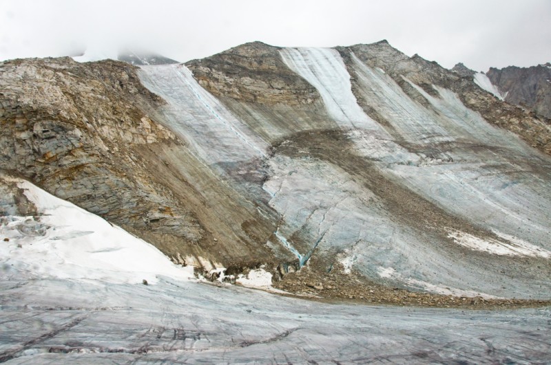
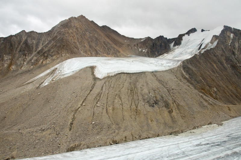
Once again it looked like we were in for another gorgeous clear-sky day. I woke up early to finish the many small tasks I had didnt get to the night before. I also gave Aerometric a call to let them know that the weather here was great for lidar, being a bit disappointed they didnt fly yesterday. This lidar project began in 2008, but due to a variety of reasons is still ongoing. They told me that the plane was already on its way, and sure enough about 10AM we saw it flying over. I had hoped to already be out taking photos by then, and so put aside the final details and grabbed my camera to head out to a site I had been eyeballing for a few years. This site was directly across from our camp, on a nunatak that was covered by ice only 5 years earlier. This mountain, which we call Snow Dome, was completely covered by ice in the 1950s, and even in 2003 was mostly so. Since then, however, the ice has been thinning, exposing the underlying rock. In the current climate, this process accelerates itself, as the exposed rock warms in the sun and helps melt the adjacent ice. As more rock is exposed, it begins to spall and cover the ice below with rock and dirt, which also helps to melt the ice. We have seen some enormous rock avalanches there, and the accumulation of boulders at the base of the mountain is testament to this ongoing process. In 2004 we brought a thermal camera to the glacier and noticed two hot spots on this ice face, and now 6 years later those two hot spots are large outcrops of rock. The lower one looked pretty accessible and an ideal location to take a gigapixel panorama looking back on the mountain that our camp is perched on. Had I been wearing crampons, it would have been a breeze to get there, but the steep ice face I needed to traverse was still in the shade and quite slick, so I had to chop steps to cross it. Never having been one to enjoy such things, I found myself wondering how once again I got myself into such predicaments, but the stretch was not long and after a few stressful minutes I found myself safely on solid rock, with no hazards looming directly above me. The photography went well, and I was able to catch at least one line of the Aerometric flying above the glacier, but the geometry was never ideal for this. GIGAPIXEL PANO So by about 1PM I was back in camp and able to help with the final packing. I called Rick at Quicksilver and confirmed that he was just about to launch, giving us about 5 hours to have everything ready. Kristin was still focused on food, ensuring that we would have something to eat on our take-out and that what got left behind would still be there on our return. The others all had their own gear ready to go, so I went into officer mode and kept the troops busy with all of the non-obvious last minute tasks. Just after we knocked down the large tents and got them dry, the wind picked up and it began to rain. Fortunately most of the loose stuff was already packed, so we quickly threw up a small Arctic Oven as a place to do final sorting and threw tarps over the existing caches, which were more or less ready to go. It was mostly my stuff in disarray, sorting all of our comms gear and chargers into various piles so that once we began leaving here we would safely be able to stay in touch should we get separated due to weather. The rain didnt last and by early evening the wind had died down, and things were in pretty good shape. We headed down to put the snow machine to bed for the winter, and not long after our return Rick showed up in the helicopter and the fun really began. Bernhard and Franken2 left first, as they were hoping to catch planes home as soon as possible. Then we organized a few sling loads of gear, followed by Kristin and Turner, then Franken1 and Charlotte, and finally me. It all worked pretty smoothly and by about 11PM we were all on the tundra. By the time I arrived, a German-Belgium football game had erupted and everyone was in great spirits, especially Turner, who was now able to run with abandon without fear of tumbling face first into a loose boulder. At camp, the only place for running was on the helipad, and this is a pretty small space, and though the glacier is bigger, it's still tough to run around due to the slick and uneven surface. On the tundra, many different games and types of exercise were possible, and being implemented. Not long after I arrived, Bob showed up in the Helio bringing us some gas for the helicopter and taking the Germans away for the last leg of their adventure in the north. It was after midnight by the time we set up tents and got into them, and I think we all slept soundly. Breaking down the cooktent in a wind.
The next morning, yesterday, the weather seemed great for flying, so we packed up and headed for Esetuk Glacier. The Belgians went in first to start their radar profile. I followed behind, after stopping at our glacier camp to pick up the new weather station parts. Once there we ditched the gear on what would be a nice campsite on the side of the glacier and flew around a bit searching for the best place to set it up, such that it could be accessed by skiplane in winter. The choices were pretty limited. The lower glacier was much like McCall Glacier in that it was very lumpy and rough, no doubt caused by the same type of strong winds which sublimate the snow and erode the ice into long flutes and swales. Travelling upglacier, there were numerous crevasses, unlike McCall Glacier, which likely would fill with snow and be landable, but not ideal. Just below the headwalls, however, there was a nice large plateau with smooth, nearly-level ice that looked ideal for landing. The only disadvantage was the altitude, at just below 7000', but only a little higher than our other one on McCall Glacier, so it seems the best and safest location. Rick helped me erect the station and steam drill in a mass balance pole, and by the time I was done with that the Belgians had completed a profile most of the way up the glacier. The weather was still OK, but clearly deteriorating, so with it being late afternoon already we decided to head back to our camp on the Jago River. While a high-overcast remained, it was a beautiful evening here. The bugs were minimal and no one wore headnets. Turner had been looking forward to cooking hot dogs and marshmallows over a bonfire the entire trip, and this seemed like the perfect night for it, so we collected some deadwood along the river banks and settled in. Having spent so much time by now in remote locations, it's easy for me to lose sight of how special such places really are. Frank and Charlotte, for example, had never cooked hot dogs or marshmallows over an open fire using whittled sticks as holders, and so had the finer points of perfectly browning your marshmallow explained to them.
Learning jump rope on the tundra.
It occurred to me then too that one could cook hot dogs and marshmallows nearly anywhere, and there are probably thousands of metal campfire rings in official campgrounds across the country being put to the same use at this same time. But even though the process is the same, there is something different about doing it here. It's not even that this is such a remote place, because I think even in some heavily regulated location like Denali or Yosemite if you had the entire place to yourself due to some lottery system which gave you one night alone, the experience would not be the same. Sitting here, a meter from a babbling brook, in front of a small campfire, talking with friends, cooking a meal -- there was something very primeval about it. This was a ritual that had been done millions of times, perhaps even in this area, and clearly something we have been genetically adapted to enjoy. But the essential ingredient that was different was also something we have been genetically adapted to enjoy -- not being told what to do, and I think the enjoyment of that evening had less to do with the particulars of what we ate or how we ate it, but simply that we felt that, for at least this short time, as far as the eye could see and as far as we knew we could hike, we were free from the stress that comes with proximity to other people, other people who are also genetically adapted to want the freedom were now enjoying and who's only outlet for this typically is trying to control others. There's simply too many people in the world for anything but a tiny fraction of them to be able to experience what our genes have adapted us to really enjoy. In my mind, this feeling is what most people that idolize wilderness are trying to describe, even though they may not know it, and fortunately many of them realize that even though they may never get to experience it, it's worth preserving some regions for that purpose, if only to give them hope. In any case, in those few hours I think we all found some peace, free of the stresses that we just left, and soaking up the experience to steel us against the inevitable upon our return to civilization. The Nolans slept with the fly off our tent that night, but had to put in on at some point as it started raining. We awoke to very low cloud ceilings and drizzle, no conditions for flying. We stood in the rain chatting for a while in the morning, then returned to our tents. I retreated into the helicopter to write this, it being the driest and most comfortable place to sit. The clouds seem thick and I suspect there is little chance of doing any flying today. Given that tomorrow is our last day with the helicopter, I suspect we'll be lucky to get out at all, let alone do any more science. But I feel fine with that. We had a very successful trip, and I think I've turned a corner personally in my approach to working out here. The possibility of working full-time on this project for some long-number of years has really helped me focus on what's important and changed the nature of how I approach things with a lower stress level. Fundamentally its about building towards a real mastery of understanding this environment, and I think 'building' is the key element. What we've learned on this trip, for example, is some great information that can be built upon. It's not necessary to completely settle the questions we arrived with, but rather to arrange the puzzle pieces better and identify the gaps. Until now I feel like I have been primarily building towards a mastery of the logistics of working out here, and now I feel I can spend less time with this and more time on science, and just the prospect of that has freed sufficient mental bandwidth for me to begin thinking much more creatively and freely about the science itself. This process of visualizing how all of the science pieces are fitting into place and the freedom I have to arrange these pieces myself, in my own way, is very refreshing and stimulating. I've put in a huge amount of hard work and a major part of my life into building this research program, perhaps too much, without that clarity of thought or visualization, but now I have that feeling of having turned a corner with a clear purpose and goals in mind, knowing that I have the capability to achieve them if I continue to build towards it. What more could one want professionally? 27 August 2010 Fairbanks Weather really is everything. Weather never improved that day, and we spent most of it in our tents or wandering about in the fog. We gathered for a while in the arctic oven for some dinner, then drifted back to our own realms. The Nolans moved into a Trango, as our little tent had gathered a fair amount of water inside, but other than that it was an uneventful day.
The next morning the weather showed serious signs of improving. This was our last scheduled day with the helicopter. It was tempting to try squeeze in a little more work, but the weather was still marginal at best. We decided to sling a load of gear out to Happy Valley once Mike said it was flyable there. We arranged the load and waited an hour or two, then made a break for it. The weather never really got much better and towards mid-afternoon was actually deteriorating again. After several hours without word from Rick we began suspecting that the weather was pretty marginal in between here and there, and a while later we got a call from him saying that he was in Kavik and wondering whether we'd like to join him. We decided to accept his invitation, and before long Frank and Charlotte were on their way, crammed in between as much gear as possible. Not too long afterwards the Nolans boarded, again jammed with nearly everything else left behind. It was about 8PM by the time we got to Kavik, with the weather steadily deteriorating that afternoon into pure helicopter weather. We found a number of hunters and pilots-for-hunters pacing around there, wishing it were legal to hunt via helicopter. Fortunately we were just in time for dinner, and it was nice to eat a hearty meal in a warm space, and follow that with a hot shower. We hadnt planned on a night in Kavik, but it was a welcomed turn of events.
Kavik is not the kind of place you find on most maps. It's mainly used as a hunting camp, but in the past had been used as a base for various geophysical explorations. It's mainly a bunch of jamesways and trailers sprouting from the tundra, next to a pretty nice gravel airstrip. I suspect the owners are hoping that oil exploration will start up here again soon, and the camp will be a jewel on arctic coastal plain. But for now, it's Susan's place to call home, to the joy of the nearly domesticated sic sics in the surrounding area. I find it refreshing to be in places like this. There's something about being in a frontier town that has always been appealing to me. I think it's simply that in a place like this you can more or less just do what needs to be done without those that came before you laying down a bunch of more or less arbitrary rules, or rules designed to keep you from getting ahead of them too easily. People like things to stay the way things are, particularly if those people are close to the top of the food chain, so in my mind they make rules which, if nothing else, have them believe that their position in this chain will at least stay the same, if not improve. This is built in a bit, as the people who make the rules typically feel they have the power to either change them or ignore them once conditions change which lead to the rules working against them. Building codes, dress codes, manners, country clubs -- these are manifestations of 'civilization', not a frontier, and largely created and enforced by those climbing up a social or political ladder where it becomes increasingly obvious that there isnt enough room for everyone near the top and that even to stay in place takes a fair amount of kicking at those climbing behind you to help with the selection process. So I'm not talking about abuse by The Man, but by our neighbors. Frontiers are often discussed in polite societies with some disdain, but the frontiers of Alaska today aren't those lawless charicatures on TV. These are often populated by a fairly large percentage of well educated people who simply dont like or need their neighbors telling them how to screw in a lightbulb the proper way or which lightbulb they should use, and they arent just in remote places, there are many scattered throughout Fairbanks, for example. Of course there are also plenty of wingnuts, rednecks, hillbillies, meth labs, and jesus freaks, but I'm not sure you can have one without the others or that you'd want to. There's certainly some good in sharing wisdom in the form of guidelines or customs, but in my mind most of what we are presented with, or offer to others, is beyond that -- it's mostly a bunch of rules who's practical usage is largely to maintain the status quo, implemented and enforced by those who benefit most from the status quo, trying to force you to play their game to get ahead. It's not that I blame them, just that I'd rather not deal with it, and the only place to do that is on a frontier, somewhat by definition.
In any case, we all enjoyed a good night's rest in a real bed in a warm space, and spent most of the morning wondering whether the weather was going to break. It never really got great, but it got good enough to fly a helicopter, then good enough to fly a plane into descending terrain, and then it didnt matter because we and all our stuff landed safely in Happy Valley and our trucks are IFR. Here we made our rounds saying hello and goodbye to friends before heading south about 5PM for a 10 hour or more drive. On the way we stopped in Coldfoot for a burger and another social call. The drive was fairly uneventful, though we manage to see (and miss) several large moose, several small moose, a lynx, a fox, and a number of large trucks. But for the most part, we had the road to ourselves. There's probably not many places you can drive for 5 hours without passing a house or a crossroads or another car, but we more or less did it. Frank rode with me, with Kristin taking Charlotte and Turner in her car. I think the others slept there, but I kept Frank awake with questions on differential equations and jazz, and fortunately his answers had the same effect. By the time we arrived in Fairbanks we had our next proposal planned out. We all stumbled into our house about 5AM, to find Bernhard asleep on the futon. We chatted a while then went to sleep. Bernhard left in a taxi about an hour later to catch his plane. The sleep was short-lived for the rest of us too, as Turner was up about 8AM, having slept all night, and it wasnt too much later before it became another day. The weather was beautiful though, and we enjoyed a bottle of wine on the deck rather than unload the trucks. It was nice to simply relax and enjoy being alive, without having a purpose. Afterwards I took a nap while the others unpacked a bit, then once the Belgians got checked into a hotel and had fresh showers, they returned for dinner and some science debriefing. It was nice to look back on what we had accomplished, and tie it in to what we might do in the future.
One growing source of concern as we scrambled to leave the tundra was whether we were going to make it back in time for Turner's second birthday party. We had sent out invitations before we left to a bunch of his friends to come to a party at the local kids gymnastics place, where we had gone to previous parties, on this Sunday (we arrived back in Fairbanks on Saturday morning). Turner had been talking about this for months. Even after arriving back in Fairbanks, it wasnt clear whether it was going to happen as the day before, the place had called wanting to confirm our date, but we werent around to return the call. But in the end everything worked out OK. It was a bit surreal to be having a such a birthday party after such a trip, but in some sense the whole trip was a bit surreal so it was easy to take in stride. We ended the day with dinner on the deck of Pikes with the Belgians, playing some tag in Turner's secret garden in the back, which no one but us ever seems to hang out in. Then we said goodbye, and it was down to just the three of us again.
Fun
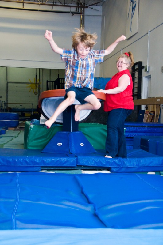
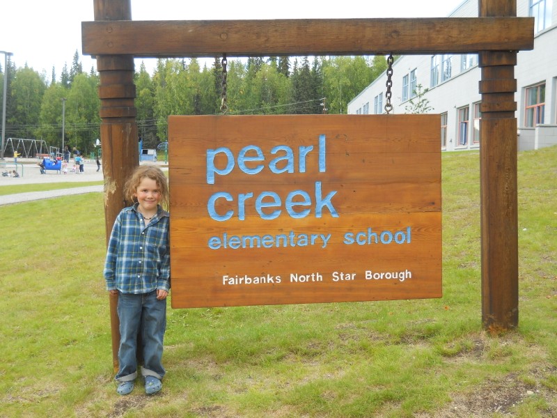
and games in the beer garden. I avoided email for another day or two, spent a day trying to recover images from a damaged camera card (first time that's happened!), and dabbled at catching up a bit, though not very successfully or whole-heartedly. The highlight of the rest of the week was Turner's first day and then week of kindergarten at Pearl Creek Elementary school. He was very excited about it. It is close enough to ride our bikes to, so we've been doing that all week. He's become such a big boy now, both physically and mentally. He's so proud to show us his classroom, and his locker, and his friends, and he's so happy to see some of his friends from pre-school in his class. His class is mostly girls, which I think is great for him as I think he had more girl friends in preschool anyway. I dont know how much our trips have affected him, but he mentions the glacier often and usually with fondness. I think most people give him strange looks about it unless we're there to explain. But if nothing else he's grown pretty sure footed on loose and irregular terrain, and is always looking for someplace scary to walk or climb. I guess we'll see how things with school go. I'm a bit concerned about how our travels might bung up his developing social life, but so far it doesnt seem like too much worry. I couldnt imagine going to the glacier without him at this point, as it seems my recollections of the science are now tied to my recollections of him being there at that time. But like with the glacier, we just have to wait until our next trip to find out how things are changing.
|
(c) 2010 Matt Nolan.
.jpg)


_crop.JPG)