Dr. Matt Nolan
455
Duckering Bldg.
Water
and Environmental Research Center
Institute of Northern Engineering
University of Alaska Fairbanks
matt.nolan@uaf.edu
|
|
Dr. Matt Nolan 455
Duckering Bldg. |
|
|
Sunday, 08 August 03,
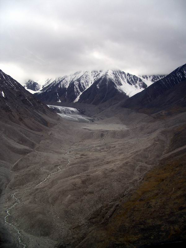
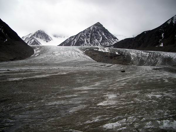
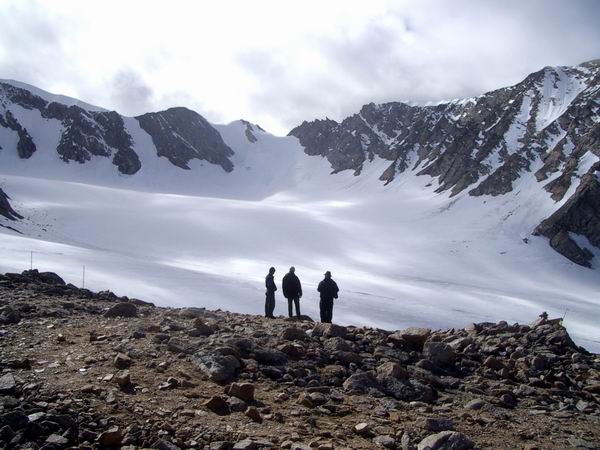
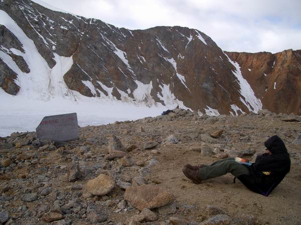
McCall Glacier
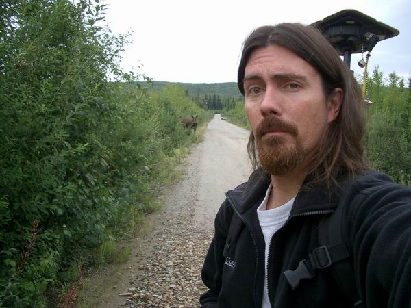
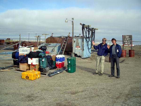
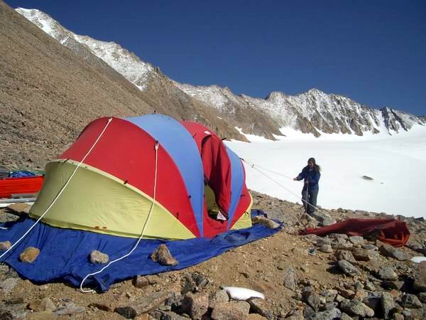
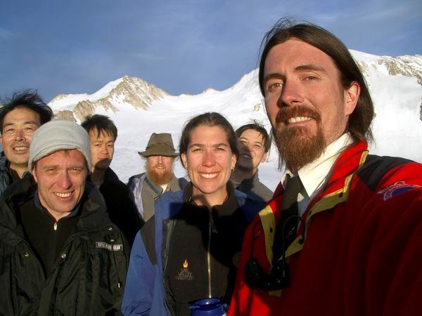
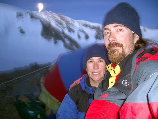
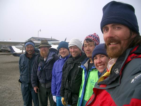
Whew! It’s been a few hectic weeks, as usual for expeditions like this one, and so far that time has been both productive and successful. There are now seven of us on McCall Glacier. In addition to Kristin, Ken, and myself, there are three Japanese and one Belgian. Ken is a technician in our research group at UAF, and has expertise in electronics, dataloggers, radio telemetry, and glacier field work. Kristin is once again our camp manager, field assistant, and sanity checker. Shuhei is leading the Japanese group, and is from an institute in the very northern part of Japan (Kitami Institute of Technology). His interest here, as with the others, is analyzing ice cores for the purpose of understanding climate variations. Makoto is a researcher from the National Institute of Polar Research (NIPR) in Tokyo and Takahiro is a student from the Tokyo Institute of Technology (TIT), and have interests in ice cores and snow biology, respectively. Frank’s main emphasis here is making ice radar measurements so that the ice cores can be better interpreted. It is a diverse and interesting group, and I think everyone is getting along well and looking forward to continued collaboration. Pre-trip preparations consisted of the standard level of chaos, with no major difficulties. I had never met any of the Japanese before, and due to the difficulties of email communications, language differences, funding sources, and mutual ignorance of prior research, it was a little complicated determining how to best interface with each other. The Japanese efforts are very compatible with our goals, basically to better understand the past 50-200 years of variations in regional climate that affect McCall Glacier. Logistically, we were able to work out a contract where NSF continues to provide the general helicopter support for this project, but that the Japanese can pay back NSF for the increased time required for their needs. So far we haven’t been arrested, so I’m assuming that all of the bean counters are satisfied. But then again the bill hasn’t arrived yet either… Kristin and I spent the previous two weeks preparing for the trip, though it was not as frantic as last spring. As it turned out, Kristin’s schedule at Frontier Airlines had her taking three weeks off, centered around our field trip, so it was very convenient for her to join us. I spent much of the week before the trip testing out a new GPS system with moderate success, but our main source of stress was trying to get as much cargo to Frontier early in the week, as it goes on a space available basis. We did all of the food shopping and camp preparations before the Japanese arrived on Wednesday to speed things along. I spoke with the cargo manager at Frontier the week before to let him know of our trip so he could get a sense of how to plan the loads. He said if we got most of our gear to the airport on Wednesday that he would get everything up by Friday. Shuhei, Takahiro, and Makoto arrived Tuesday night, and we met up Wednesday morning at my house. It took several hours to acquaint ourselves and discuss plans, by which time we only had a few hours left to get the cargo to airport. I led the Japanese on some last minute shopping excursions while Kristin packed our food and miscellaneous gear. We met back at the house around 4:30PM, scrambled to seal boxes and load up three vehicles, and gunned it for Frontier. Fortunately we got everything checked in before they closed, but I noticed that there was quite a backlog of cargo ahead of us from other people heading to the same location, giving me that slightly sinking feeling. During this frenzy Frank had arrived, and afterwards we all went out to eat at Pikes on the deck, enjoying the beautiful sunny day that had emerged from the Seattle-like drizzle in the morning.
The next morning I woke early and gave Frontier a call. I had forgotten to prioritize our cargo in case it could not all go at once, and some of it needed to be there on Thursday so that Ken could make use of it, so I left a message describing which items need to go first. Ken was working on another project with the same helicopter before this one, so we planned for him to just travel with it to our project and meet in Kaktovik. One of the main goals of this trip was to establish a telemetry link for our weather stations, and Ken had done this many times. So we hoped that having him in Kaktovik a day early would give him the time to get the base station set up. The difficulty here is that it wasn’t until a few days before that that we had actually received permission for the base-station site, the local school, despite months of lead-time in asking permission. As it turned out, bad weather prevented the helicopter from making it to Kaktovik on Thursday. This was no great loss, since apparently no of our cargo did either. Sometime around noon I was able to talk with the freight department at Frontier and learned that none of our cargo had left on the Thursday plane. This meant that it would all have to go on the Friday flight, the same one we were taking, otherwise we would have to wait a day before we could start our trip. The cargo guy, Dennis, told me that Johnny, the manager, had decided to reduce the number of passenger seats on the Friday plane so that it would all fit. This was a very considerate thing to do, except that it created another problem. Kristin and I can fly essentially free on Frontier. As I learned that day, however, we fly standby and do not have confirmed seats. When Kristin checked the loads, it appeared that 16 people were scheduled to fly on a plane that now had only 14 seats. This meant that our cargo could make it to Kaktovik, along with the four other team members, but that Kristin and I could not. Needless to say, this was a cause for some consternation during our last minute shopping spree. After a few more phone tag messages (making good use of our new cell phones), we learned that Frontier had decided to add a second flight to Kaktovik that day, so that all people and gear could make it. My appetite returned immediately after that phone call. That night we had everyone over to our house for a relaxing dinner, bracketed by frantic packing and pre-trip data preparation that lasted until about 2AM.
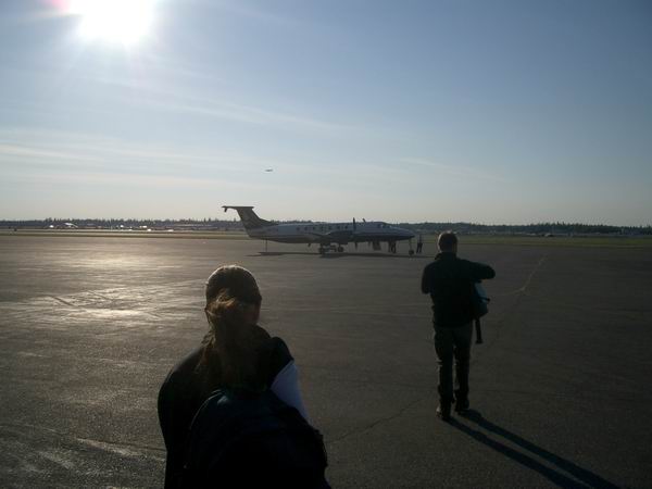
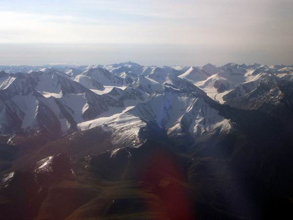
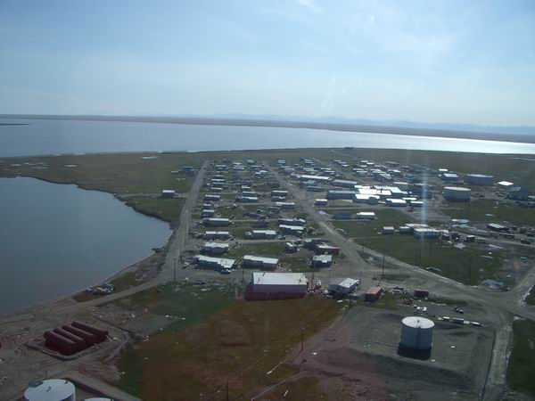
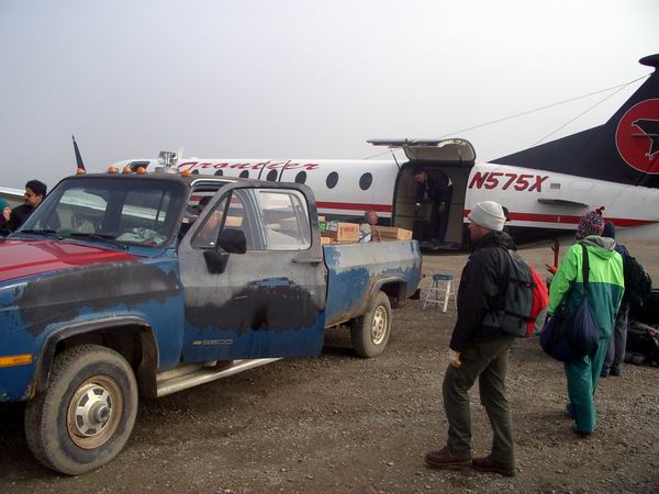
Our trip to Kaktovik was relatively uneventful. On the way to airport, we got a call from the front desk saying that the plane was scheduled to leave a half hour early, and that the other members of our group refused to check in until we arrived. Fortunately we were not far away, and we made it on to the flight. We were treated to clear skies over the Brooks Range, and we were able to see McCall Glacier on the way in. It was a pleasant day in Barter Island, and we landed only a few minutes after Ken and the helicopter. On the tarmac I met a glacial geologists named Alan who works with many of the same people I do, even though we had never met. It was fun discussing some of the science in the area with a non-random stranger. Shortly after our plane took over, the second Frontier flight arrived with the rest of our gear. On this plane was Dan, another scientist from UAF who knew Alan, and we chatted while sorting our gear into various loads. Dan was heading to a later stop of this plane, and Alan was waiting for it to return from those stops and take him back to Fairbanks to catch a plane back to Massachusetts, making the tiny village of Kaktovik temporarily the major nexus of glacial geological expertise for probably several thousand miles in any direction.
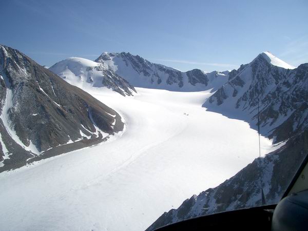
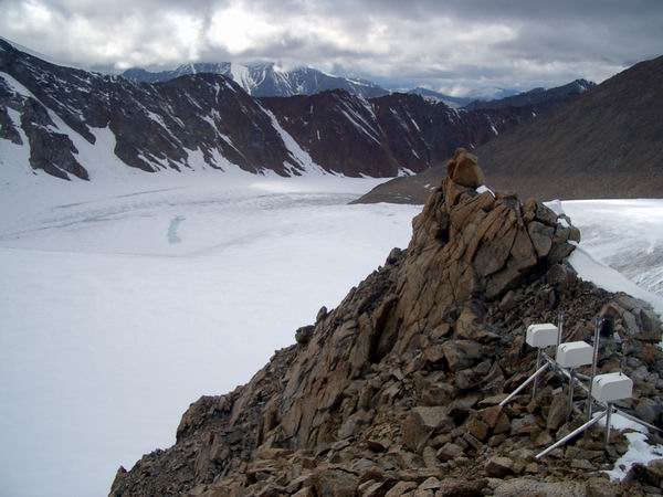
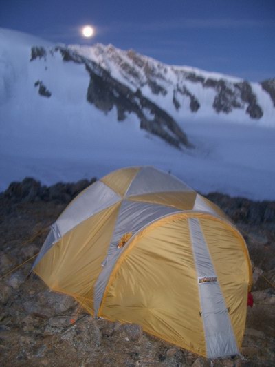
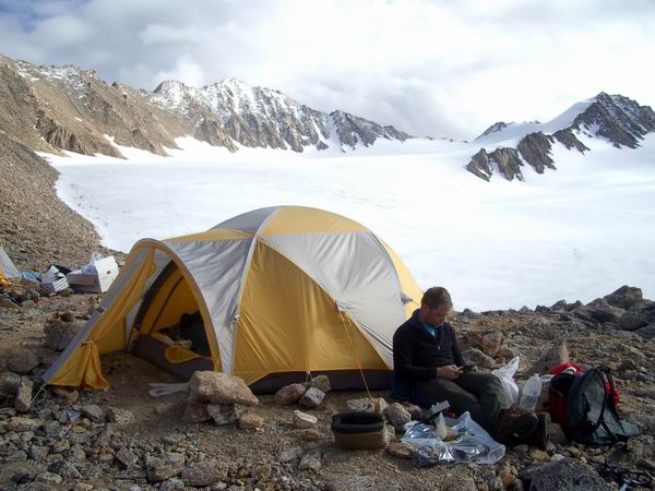
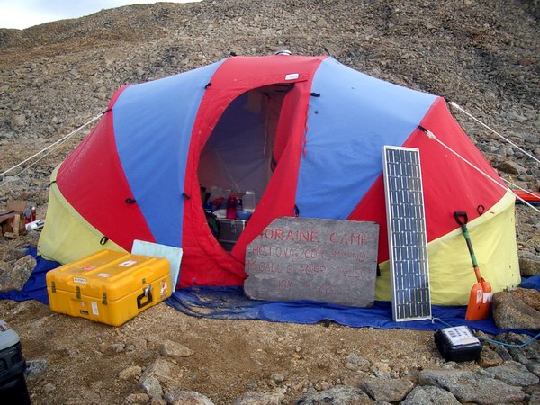
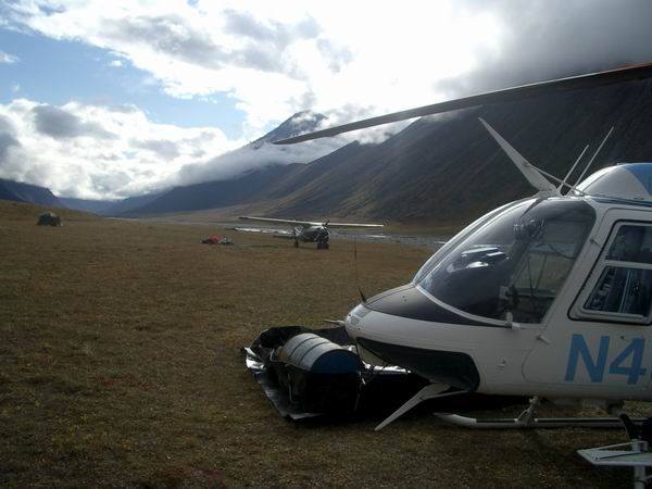
The Kaktovik strip is hoppin'. 1MB MPEG. The general plan for getting from Kaktovik to the glacier was to have Walt fly most of the gear and people to an airstrip on the Jago River near the glacier in his Cessna 206, and have the helicopter shuttle loads from there to the glacier camp. Kristin and I flew in first on the helicopter, a Bell Jet Ranger, so that I could do some work on our weather station telemetry while Ken was still in Kaktovik working on the other end of it, and she could start getting camp organized. Another complication was that due to the cargo delays and bad weather, Walt was unable to fly in the extra fuel needed for the helicopter at the Jago airstrip before we arrived, so that this needed to occur simultaneous with the our gear/personnel transport. Things proceeded remarkably smoothly, however. The first plane flight consisted of a barrel of fuel and about a barrel’s weight worth of gear, the latter of which was conveniently about one helicopter load as well. Walt had some flightseeing work he needed to do, so the helicopter went back to Kaktovik to get another load of people in the meantime, minimizing the chances of people getting stuck at the airstrip. When that flight returned, I was still on top of the nearby mountain working with the radios and taking dozens of pictures. My previous trips up there were all during marginal weather, but this was an outstanding day. The good weather got everything and everyone in to the glacier in a single day, despite the late start and miscellaneous delays. We toasted our success that night at dinner, around 11PM, then passed out.
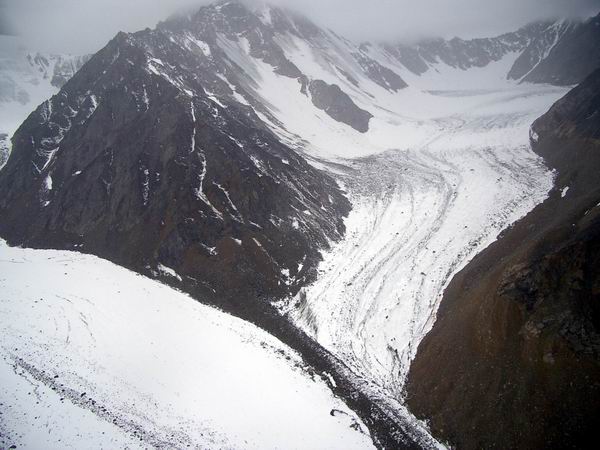
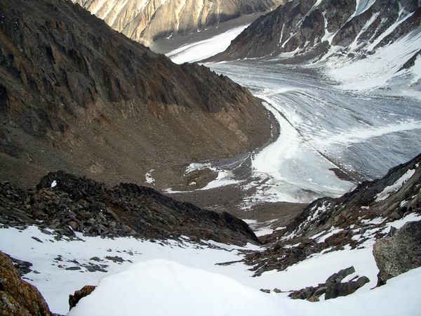
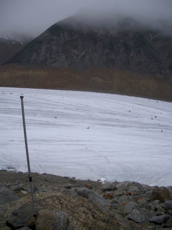
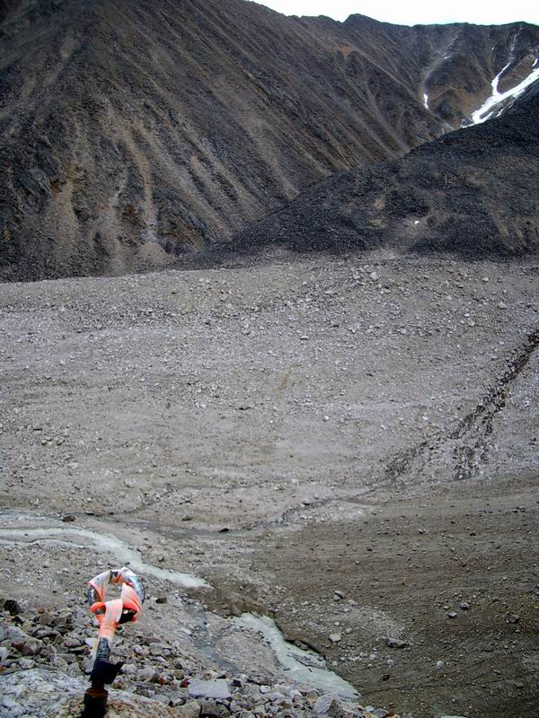
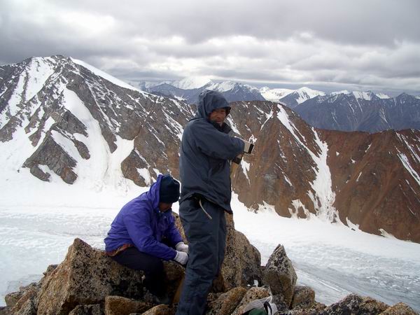
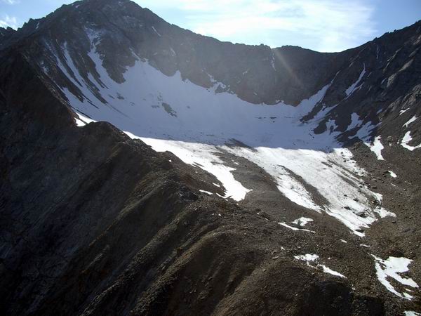
The next morning, Saturday, saw a deterioration of the weather. Clouds and rain had begun to settle in. My original plan had been to survey all of the poles with GPS on the first day and have everyone tag along so that they could get a feel for the glacier, but due the helicopter availability, we had to do our work on other glaciers now rather than at the end of the trip. So Ken and I spent the day hopping around to other glaciers, primarily making GPS measurements of terminus positions, measuring snow lines, and establishing numerous photo stations to document future change. It was not the greatest day for picture taking, further complicated by a recent snowfall that covered the ice surface and made any determination of the late summer snow line impossible. It was a full day, and by our last survey the weather showed signs of leaving of us stranded. Hubley Glacier is separated only by an 8000’ ridge from McCall Glacier, and here we wanted to resurvey some of the points from our survey last spring to confirm that they were done correctly. The freezing rain, combined with general lack of sleep and the poor satellite visibility in this tight bowl, made the work seem to stretch interminably, especially as we watched the clouds get lower and lower, down to the level of the ridge we needed to cross to get back. In the end, we completed the work and had to fly the long way out down the glacier and around the mountains and back up McCall valley, but we made it back in time to get a late dinner. In the meantime, Shuhei and company had gone upglacier and installed many of their instruments. So it was a very successful two days, and we were able to send the helicopter home several days early.
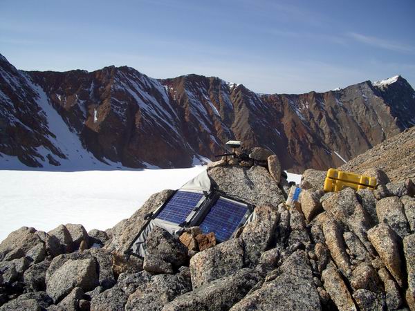
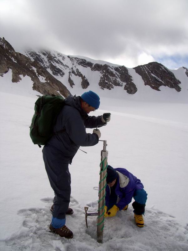
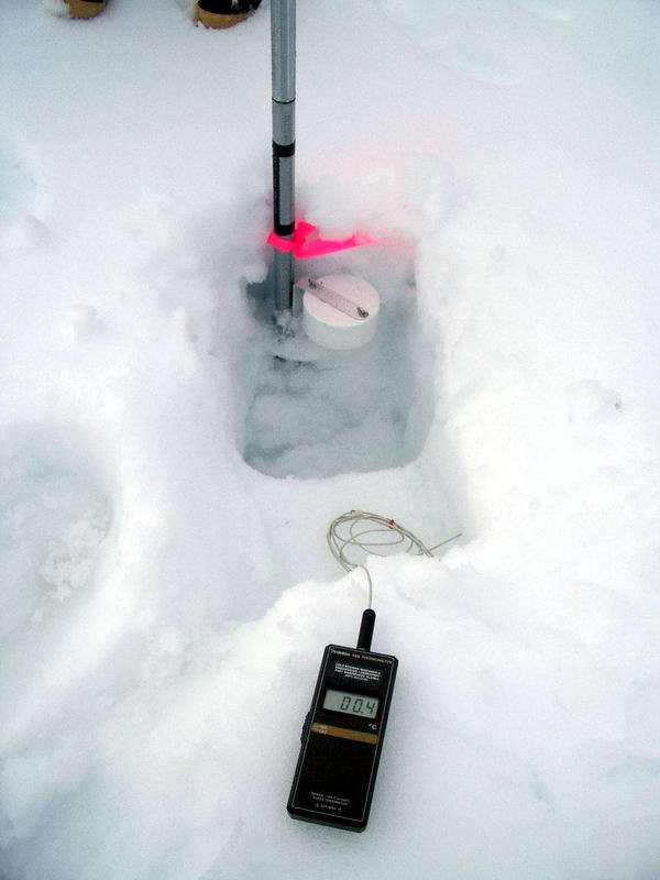
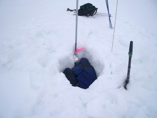
Not the best weather for helicopter work. 770kb AVI Saying goodbye to Ed. 1.8MB AVI This morning, Sunday, I spent some time looking at the data we had collected yesterday. Though I have been around GPS quite a bit, it’s not very often that I am actually in charge of all of it. As this was the first time I used this system, I was a little concerned about whether I was doing it right, which is not as easy to determine as it may sound. After some frustrations, I was able to download all of the data onto my laptop and begin running it through the processing software. All seemed to work OK. Then I resurveyed a nearby monument with known coordinates to confirm that my survey yielded the same coordinates, which it did. So we headed upglacier to survey the poles that we planted last spring. Perhaps my biggest realization of the trip thus far is how many crevasses there are on this glacier. Most of these were not visible in spring because the snow covered them up. Fortunately most of them are quite small, and only big enough to get a foot stuck. But a few were quite large, and slowed travel down going around or over them. We met the Japanese team in the upper cirque, where they were working on radar and digging snow pits. They had already installed a set of thermistors that will get buried by next winter’s snow, as well as a time-lapse camera that takes pictures of a pole getting buried so that accumulation can be measured on a daily basis. It took most of the rest of the day for Kristin and I to survey the poles up there. We made it up to the ridge-line pass that had closed in the night before, and looked down on Hubley Glacier we had stood late the night before. We also visited the sight of a weather station that was in operation in the 1970s. It was quite windy on the ridges, and the clouds could be seen to move very quickly over head (and sometimes throughhead).
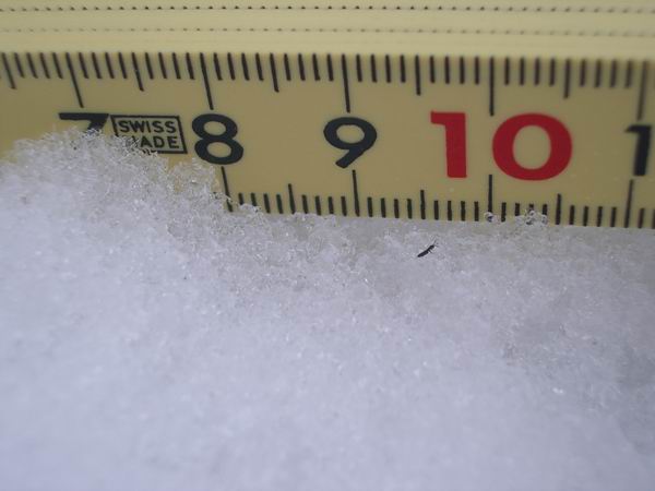
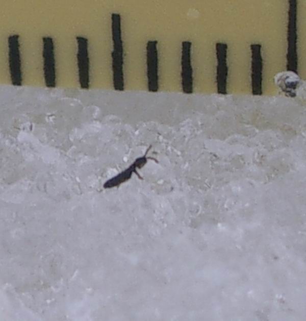
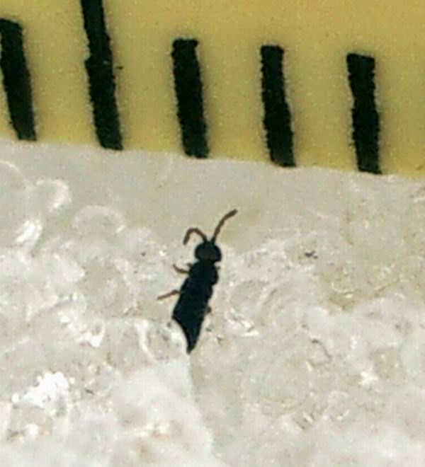
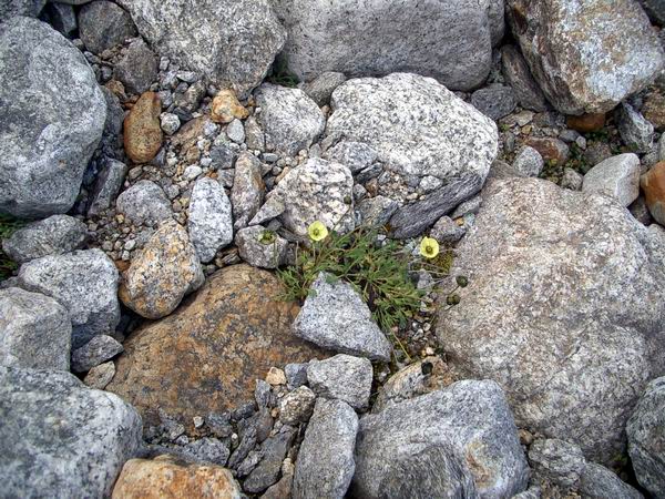
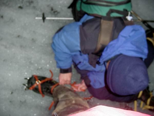
On the way back down, I bumped into Takahiro, who was kneeling in the snow doing something that looked scientific. It turned out that he was looking at bugs that live on the snow surface. They are so small that I would never have noticed them if he hadn’t pointed them out to me, as they just look like specks of dirt from a standing position. But clearly they moved and had little legs and antennae. I took many pictures of them with my new camera, which turns out to have excellent macro capabilities. That night I downloaded pictures and showed everyone else what these little bugs looks like close-up. As Takahiro would say, “Thees is pahfect.”
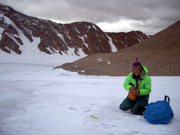
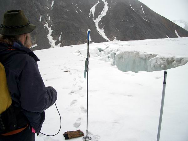
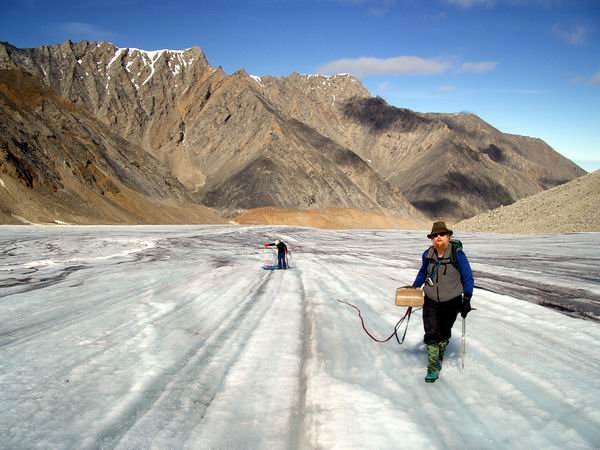
Tomorrow I hope to survey the rest of the poles on the glacier, and everyone else is planning to come along. The weather is fairly dismal now, with wind and rain and temperatures just above freezing. Fortunately most of rain began after we returned to camp. Everyone is in good spirits, and Kristin is keeping us well fed with lots of yummy foods and deserts. Hopefully the weather will improve, but regardless we should be able to get most of our work done before it’s time to pack up and leave. Wednesday, 13 August 03, McCall Glacier Camp The whew! didn’t end until today, at about 3AM. Tuesday Ken and I surveyed the middle and lower cirques. At first at had some hopes of surveying the entire glacier, but decided given the generally poor weather and the amount of work to be done, it might be best to tackle a manageable load and get an early start the next day. Apparently this was a cool summer, as in most years the snow is completely melted from these areas. Because it wasn’t, we used skiis to get around, which also kept us a bit drier as the snow was somewhat slushy. Satellite windows were again a minor annoyance, but we were able to measure all of the poles we intended to. GPS is a really neat thing. The mode of measurement we are using requires the receiver that we carry to be left on while we travel, as in this way the processing software can use the interim time between our poles to improve the accuracy of the solution at the poles. The side benefit of this is that we get thousands of these interim measurements to use for new studies of glacier elevation. In the extreme case, if we strapped one of them to everyone working here, we could map the entire surface of the glacier just by tracking where people walk. The downside is that this additional data tempts us (or rather me) into using it, which requires more time and effort that I really don’t have.
The Japanese team spent the day drilling ice cores from the upper cirque, where the main accumulation area is. The day before they installed a thermistor string that will get buried by snow this winter, so that they can record snow temperatures. Near this location, they also dug a detail snow pit, and drilled through the bottom of that with their coring drill. Apparently they encountered some problems drilling due to the presence of liquid water, which tends to freeze onto the drill and get it stuck. This large amount of liquid water was unexpected by me, and I think the others as well. One problem with studying the mass balance of an Arctic glacier (that is, how much snow accumulates up high vs how much ice melts down low) is that snow melt-water in the accumulation area can travel vertically through the snow and refreeze there, and this is very difficult to measure. The Japanese found that, at least in their location, not much refreezing is going on, or at least a lot more liquid runoff is occurring than is refreezing. It would be interesting to try more cores in the area and see how widespread this runoff is.
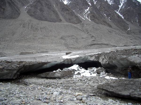
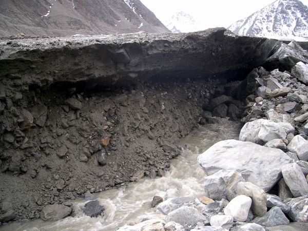
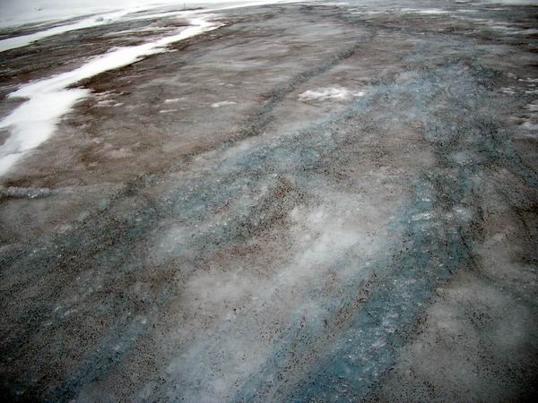
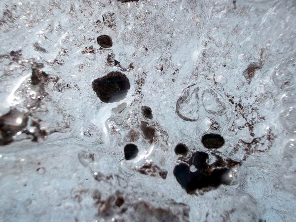
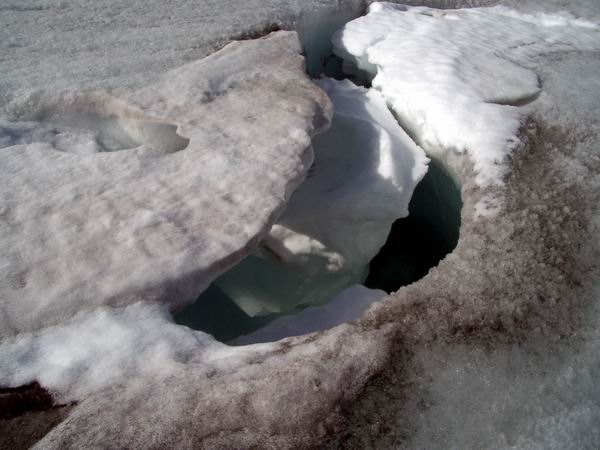
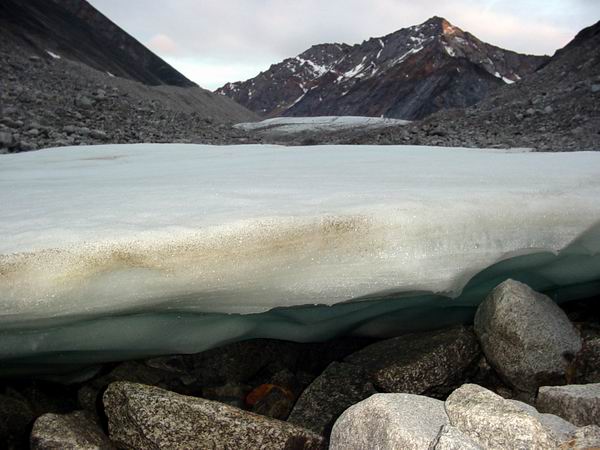
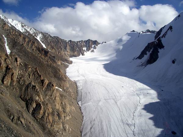
It may take them a while to strike it rich with a broken drill though. 750kb AVI. In any case, it is clear that there is a lot of melting going on. There are now numerous crevasses exposed, most only a few inches wide, in which you can see and hear steams running through even in the higher elevations. In other areas of exposed ice, you can see that some of these crevasses have become completely filled with water and refrozen. There are streams running along the sides of the glacier, particularly lower down, as well as over the surface. Some of these streams of are annual features, and have carved deep channels into the ice, requiring care when crossing them.
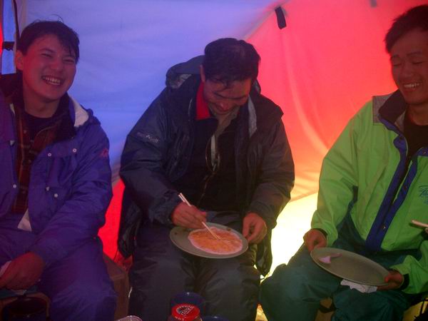
That night we were treated to a yummy Mexican dinner, complete with guacamole and refried beans, as well as margheritas. Unfortunately I have to spend my breakfasts and dinners working to both make sure that the data we collected that day are valid, and plan the surveys for tomorrow. The nice thing about GPS is that one can collect lots of data quickly, but there are numerous ways that that ‘data’ can be made worthless. For example, while measuring poles, we have no way of knowing whether our base station back at camp is still running, or whether it is collecting useful data. Also, downloading the data off of the GPS units onto a laptop is usually a stressful experience. Then recording the appropriate field notes so that in a week you can remember what it was you did is not as easy as it may sound. Finally the base station data and the roving unit data must be processed so that the intended result emerges, and this is pure black magic from my perspective and so worthy of stress. But dinners have nonetheless been a good opportunity for socializing and cultural exchange. Makoto: "Washing washing washing" 1.3MB AVI I’ve never done field work with any Japanese scientists before, so I’ve learned quite a bit about their culture. The funny thing is, I’ve learned most of it from Frank, who is Belgian. He lived in Japan for a year, and has gone on several trips to the Japanese Antarctic station. He has a talent for distilling the essential differences between cultures and explaining them. Either that, or he’s memorized the Lonely Planet guide to Japan. Regardless, the Japanese always nod and agree with his assessments, so either he’s right or they don’t understand a word he’s saying. But what’s really odd is that he speaks with a Belgian accent, but the Japanese understand him better than Kristin or I. Though she mumbles a lot… One obvious difference between our groups that I’ve noticed so far is the use of chopsticks. In Japan, the chopsticks can be used as a knife, more so than even the Ginsu. In fact, it can be used to eat cereal. It seems that that there’s nothing that can’t be eaten with chopsticks. Except rice curries, which must be eaten with a spoon on principle. Or so Frank says. In fact, in skilled hands, chopsticks can be used to slice bagels, catch flies, or screw the lids off of sake bottles. The scary thing is that Ken is as good with chopsticks as anyone in the group. Shuhei: "Chopstick is very good" 2MB AVI
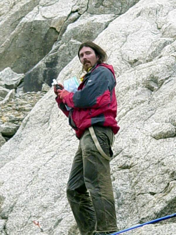
Frank, showing off. 1.7MB AVI
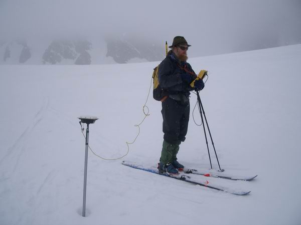
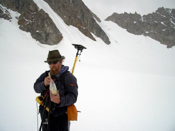
Tuesday I woke up early to get the day’s GPS work planned out, as this can take some time. Because the earth is a sphere but maps are flat, fancy mathematics must be employed to warp the real world to the map world. Even fancier mathematics must be employed to warp one method of warping to another, and of course not every method is as accurate as another. And being able to conduct this warping assumes that you know which warping you started with and which you wanted to end up with. This project is the first to work strictly with GPS on McCall Glacier, so there is something of a learning curve to convert all of the prior measurements to the system that GPS is most comfortable with. There are also lots of little details in making the GPS work properly that are only understood properly though trial and error. That is, I have to cross my fingers that the mistakes I am making now will not make all of our efforts a waste of time. So I woke up early, realized I had no idea what I was doing, and called Bjorn on the satellite phone to help me out. One of the few disappointments from the May expedition was not repeating surface elevation measurements along two transects that had been measured several times in the past. The difficulty here was that the prior measurements were always made with traditional surveying techniques; that is, with optical theodolite measurements. This instrument consists of a small telescope which you focus on your target and a laser range finder which gives you the distance to that target; a fine-scale and delicate ring with markings on it gives you the angle to the target from 0 to 360 degrees in both the horizontal and vertical plans. In this method, one sets up the surveying instrument over a benchmark (usually a bolt drilled into bedrock), then focuses the telescope on a distant monument (a similar bolt) to get a bearing, then measures vertical angles down to the surface of the glacier to someone holding a mirror to which a laser range finder measures distance. In this way, one can measure the elevation of the glacier across a transect, without ever needing to know the actual real-world coordinates of the monuments used – all the surveyor needs to know is where the benchmarks are physically, not their coordinates. With GPS however, one needs to know those real world coordinates, either by measuring the location of the two benchmarks (one at each end of the transect) or by programming them in before the survey. In May, one of the benchmarks was buried by snow, so there was no way to compute the bearing between the two endpoints. Since then, Bernhard was able to find a computer file that he created during his PhD work in which he measured the location of these endpoints. Unfortunately, these measurements were in a coordinate system which is confusing for GPS work, thus necessitating my call to Bjorn. After several calls, and numerous attempts at various software packages, I was able to calculate the desired coordinates that we could use in the field to make repeat measurements of these old transects. Or so I thought. By the time we got going, Shuhei, Takahiro and Makoto were already well on their way towards the terminus. Frank had left a little earlier to make some radar measurements of the glacier’s bed near the area which we believe is sliding. Ken, Kristin and I left around 1PM to finish the GPS work. This was our first trip downglacier since May, and a lot of changes were apparent. For example, a lot of regions that we were able to ski across then were now impassable due either to incised streams or crevasses. Several of the poles we put in last May were in the middle of a crevasse field, which required much more care to cross on foot rather than ski. But in general the lower glacier was fairly safe to cross and required no special attention, as the dangers were all clearly visible. Once we got to the area where we installed a weather station, Kristin left our group and helped Frank with the radar measurements. Ken and I continued on with measuring the new positions of the poles that we planted three months earlier. The poles were arranged to optimize measurements of the transition between normal glacier deformation flow and flow due to sliding along the glacier bed. Frank and Kristin were measuring this same area with radar to see if they could find features within the ice that might better define the region of sliding onset.
On our way towards to the terminus, Ken and I crossed paths with Shuhei and company. They had been taking ice cores along their way back to study for differences in ice chemistry that relate to climate variations. Because different layers (that is, ages) of ice get exposed along the terminus, they hoped that their cores would tell them something of the differences between the layers they sampled. By the time we passed them, it was already after 6PM. Frank and Kristin were on their way back as well, but Ken and I still had a long day ahead of us. I figured that it was best to finish up the GPS in a single day, rather than spread it out over more, because then I could process the data and make sure it was OK, and if not we could repeat the parts that did not have the accuracy we required. I also wanted to save time by reducing the number of times we had to hike downglacier and back. So we kept going downhill while everyone else was heading back to camp. By the time we got the terminus, it was after 9PM, and by the time we started heading back it was nearly 11. I remember after scrambling up several hundred meters of lateral moraine, sitting on a wet rock in the freezing rain, eating a soggy bagel sandwich, looking out over the fog-covered terminus as clouds moved through us, wishing that our radios worked long enough distances so that I could tell Kristin not to worry about us, that this is what field work nearly always boiled down to – pushing the limits of physical endurance in alien landscapes to acquire data of unknown usefulness with people who were as confused as you are. This is the first field work that I’ve done with Ken, though we have worked in the same group for a while. Turns out that in a former life he worked for the same faculty that were my advisors for my PhD, Will and Keith. Variegated Glacier is one of the more famous glaciers to glaciologists because it is perhaps the most well studied surging glacier around. In the early 1980s, a group of researchers began studying and instrumenting the glacier before its next surge, and were able to capture many of the most important dynamics of its surge cycle. Ken had been into climbing and glacier travel prior to that, and spent a season or two on Variegated Glacier working on its instrumentation. On the one hand circumstances like these startle me to thinking it’s a small world, but on the other it begins to make me think that its unreasonable to think that the world is so large in the first place.
In the end, we got nearly all of the data we hoped for and began the long slog uphill back towards camp. We kept the GPS on as long as we could, but eventually it became so dim that we could no longer read the display screen. Both Ken and I had plenty of food, as our packs were filled with half eaten sandwiches and candy bars from the previous few days. As day turned into night, the rain turned into snow, and we traveled in the dim light of the Arctic evening, leaving footprints on the surface whose elevation we could measure to within a few centimeters. It was about 3AM before we got to camp and got to bed, but we slept soundly believing that we had largely finished the major tasks of our expedition. Sunday, 17 August 03, McCall Glacier Camp Time flies when your having fun, but stands still when you’re waiting for a helicopter. Kristin had waited up for us that night, keeping some food and water hot for our return. We slept soundly the next day until about 11AM, in time to see Shuhei, Makoto, and Takahiro depart for some more drilling. Their coring efforts had gone slower than expected. In the accumulation area, the snow was very wet and when the hit the snow ice interface, much liquid water was present, which tends to ice up on the drill and get it stuck. So their new plan was to wait until next winter to drill that area, when there would be little liquid water, and take cores into the ablation area where no snow was present over the next few days. Unfortunately, a small but important piece of their drill was damaged getting it unstuck, so drilling progress was slow. I unfortunately never had the chance to join them drilling as I was always too busy with the GPS work, but it seems that mostly Makoto and Shuhei are doing most of the actual drilling work, giving Takahiro a chance to look for bugs and bacteria on the snow and ice surface. I spent the day in camp, as did Kristin, Ken and Frank. I spent most of the time on the computer, downloading data, processing it, and making sure it was complete. One of the main goals of this trip was to resurvey a transect across the glacier’s lower end, which has a long time-series of measurements. We could not do this the last time because we did not have the coordinates for the monuments that mark the endpoints of the transects, and we could not find them either as they were buried with snow. This trip we had the coordinates, but there was still a lot of confusion with coordinate systems, and the GPS was not functioning properly. Ideally, we could just type the coordinates into the GPS and it would steer us along the line between these coordinates to within a few centimeter’s accuracy. This type of survey requires a radio link between the roving unit attached to us and the base station back at camp. Unfortunately this radio link began acting flaky at my house while testing it, and did not work at all in the field. To circumvent the problem, we leave the roving GPS continuous acquiring data while we walk a drunken line about the intended transect, which we navigate using a lower accuracy mode of GPS. In practice, I would walk ahead of Ken guided by waypoints in my cheap handheld GPS, and Ken would weave up and down glacier on his way towards me, hoping that he would cross this imaginary line in space several times along the way. The reason this might work is that once we process our data, it regains that centimeter level accuracy, and we can then compare our drunken line with the intended imaginary line to see where we crossed over it. So it was this processing that I worked on during the day. Though GPS simplifies many aspects of surveying, it’s not always just a walk in the Refuge. For instance, because the glacier’s surface has been dropping over the past 50 years and the monuments at the endpoints of our transects have not, one now has to scramble up quite high moraines to get to them, whereas before you could just step off the glacier to get to them. Further, while climbing up these large hills of loose rock underlain by ice, the person carrying the GPS has to keep it’s antenna level, otherwise you have to stand still for another 10 minutes until the unit reacquires its fix on the satellites overhead. Ken did an amazing job of this, considering that just getting up these moraines without breaking a leg or starting a rockslide is an accomplishment in itself. Unfortunately it was a rainy, foggy day and we could not even see what we were climbing up towards, so we were not able to make all of the measurements we had hoped for, and due to poor satellite geometries and wobbly rock climbing, not all of the data were of the accuracy we hoped for either. But it was still good enough nonetheless.
See them in motion. 600kb AVI Frank and I were able to spend some time during the day discussing some glaciology and geophysics as well. One of the things that I had been noticing over the past couple of days was that only the north facing mountain walls were covered with ice, and I was finding it harder and harder to believe that this was normal glacier ice. Textbook glaciers form when annual layers of snow accumulate and the weight of this snow begins to compact the lower layers into ice. This ice then begins to flow under its own weight downhill, just like maple syrup on pancakes. The ice on these steep north-facing walls however, is often bare even in winter, because the snow just slides off. It struck me that these ice formations are perhaps more closely related to aufeis than glacier ice. Aufeis is formed at most rivers and springs in Alaska where there is some ground water input. As the relatively warm water reaches the surface, the cold winter air freezes it, but since more bubbles up to the surface it must flow over the ice already there, where it too freezes. So throughout a winter, a large accumulation of ice can occur. In some locations, this ice persists for many years, as the summers are not long enough to melt it. A similar thing could be going on in the mountain slopes, where snow on the ridges melts, dribbles down the mountain, and refreezes into ice patches that persist for many years. These ice patches change the surface albedo and therefore the microclimate. That is, rocks absorb solar energy during the day and release it at night, melting snow or warming the local atmosphere. But put an ice layer over those rocks, and the sunshine during the day just bounces off, keeping the surface cooler and allowing more water to freeze to it. It’s the same principle as wearing white clothes in summer to stay cooler. Frank is the same age as I am and lives in Belgium. He got his PhD about the same time as me and shares a similar interest in glaciology, geophysics, and field work. Unlike me, he also does a lot of computer modeling of glaciers, so I had the chance to learn more about what goes into those. He has been working with various Japanese researchers for quite a while. Apparently the connection comes from his advisor being on the last Belgian expedition to Antarctica about 20 years ago, in a region where the Japanese were interested in working. So he was able to go on several expeditions to Antarctica via the Japanese station, and also spent a year in Japan as a post-doc. He has a lot of insight into their culture and is able to interpret and articulate many of the key differences in style and culture. I was a little disappointed at his lack of knowledge of Japanese swear words, but after liberal use of sake and much arm twisting, we were able to squeeze a few out of Takahiro that night. The next day, Kristin and I went downglacier to repeat a few of the GPS points and find a few of the poles that we missed in the dark the day before. Things started off pretty well. We found the missing poles, one of which had an instrument attached to it. This instrument is called a Hobo, and measures air temperature and the temperature of whatever you place it’s external probe into, in our case snow. We put five of them out last May in hopes to measure the change in air temperature with elevation, called the adiabatic lapse rate. This lapse rate has a great influence on whether glaciers grow or shrink, but there are few measurements on glaciers and it is not really clear how applicable the textbook values are or those measurements made with balloons elsewhere. With the external probes I hope to see a how quickly the snow warms up and whether the melt starts near the terminus and works its way up or whether the whole glacier begins melting at the same time. As we continued downglacier, we passed Ken and Frank, who were continuing with the radar profile up-glacier of the sliding region. Here we discovered the fate of the last missing pole. Apparently it had been set directly into the stream channel that is cut into the ice surface every year. This channel gets clogged with snow in winter, so we did not see it when we set the pole, though some mention was made in the drilling note that something funny was going on at this hole.
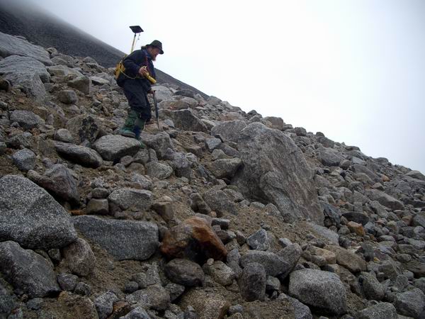
We continued downglacier, surveying poles as we went, until we got to the first transect, where we spent more time. This day was the first nice weather day we had since we arrived. We decided to climb up the other moraine to survey the elusive B2 monument, which Ken and I were unable to do in the fog a few days earlier. The slopes were very unstable, and I gave up trying to keep the GPS level. After a while, we reached the monument and were glad to have to bedrock beneath our feet. We set the GPS antenna up directly over the benchmark, which was just a bolt drilled into the rock, and let it log for about 20 minutes while we ate some lunch and enjoyed the view. Making our own measurements of these benchmarks eliminates the problems associated with converting projections and coordinate systems, because now we have our own measurements made in the GPS’ native format. I found trying to keep the antenna level on the way down another futile effort, and by the time we got back down to the glacier surface the batteries were dead, so there was no way to continue with further measurements. So far we have not been allowed to bring generators to the glacier because we are in an official wilderness area, so we have to rely on solar power. This is fine when its sunny, but four or five days of cloudy whether prevent any recharge of our batteries, putting us out of business. Next trip I will bring more batteries and solar panels, but at some point a generator becomes more in tune with a wilderness area than a massive solar array surrounded by a ton of lead acid batteries, seems to me.
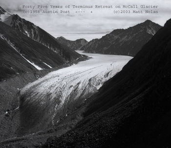
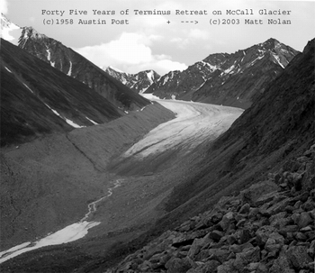
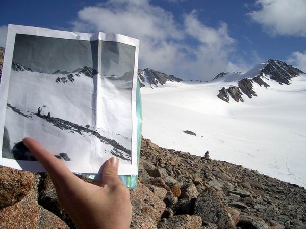
At this point we had to make the decision about whether to continue on to the terminus or return to camp. It was about 5PM, and at the least I wanted to reinstall a Hobo on our lowermost pole about 300 meters from the terminus. I also wanted to repeat a photograph taken in 1958 of the terminus to document the change over time. The picture was taken by Austin Post, who sent me about 100 medium format negatives a few days before we left for this trip. The night we left, about 1AM, I quickly looked through the negatives to select a few that might be easily repeated, then scanned these into my computer and printed out copies to carry around in the field. We decided that since this might be the only day of good weather we get for the rest of the trip, and that since we were already close, that we might as well repeat the photograph now. The process of repeating such a photograph is not as easy as it might seem when making the decision to repeat it. The main problem is that the exact location of the photographer is not known or marked, so one has to try to triangulate the position using the way the various mountain peaks and slopes align and cross one another on the photograph. The second main problem was the photograph was clearly taken from a side moraine, one of these steep slopes covered with large loose rocks. The third main problem is that there are numerous ridges in these moraines, and to get from one to another means either traversing these rocky slopes, or climbing down, walking over, and then scrambling back up. Once we arrived at the right elevation to match the photograph on the first ridge we climbed, we realized that we were not far enough down valley. In retrospect this should have been obvious before we started climbing, but what largely through us off was that the terminus of the glacier had retreated quite a long way, and I was thinking of lining up relative to the current terminus position, not the old one. So we tried traversing across the slopes for a while, and as we began to realize how much farther we had to go, we climbed down and walked on more level ground before ascending again. This process was repeat several times. Kristin, demonstrating the proper way to traverse a moraine -- that is, not falling. 2MB AVI
About 9PM we made the decision to turn around and head back to camp. We were still several ridges away from where we needed to be, but the photos we could take from here did an adequate job of noting changes. I found these changes very dramatic, especially in the way that the huge rock covered slopes that we were climbing up and down were clearly covered nearly entirely by ice 45 years ago. We called back to camp on our cheap walkie-talkies which turn out to have incredible range(at least when high up on the side moraines), and let them know not to expect us for dinner, as were still 4 hours away. As we started to leave, I decided just to check out how difficult it would be to get to the next ridge. As I got closer I realized (or fooled myself into thinking) that I could get to it pretty quickly and called back to Kristin that I would quickly scramble up there and meet her at the bottom. After about an hour I found that I was pretty close to the spot. I was nearly out of memory space in my camera, but took a variety of shots along the slope. I had half-hoped that when backing up to get the perfect alignment that I would trip over some old tin cans or something left behind by Austin or his companions, but no such luck. I found several large flat rocks that made comfortable locations for standing while taking pictures, and hoped for the best. In the end, I can’t say for sure that I found the exactly same position, but the photographs are remarkably aligned and more importantly the changes they document are dramatic and undeniable.
So it was nearly eleven by the time we started back, but we had a very successful day. That photograph alone made the trip a success in my book, so it made the slog back seem not so bad. Unfortunately, we had left our crampons at the weather station on the way down, as the ice was crunchy at that time and easy to walk on, and we had only thought to be an hour or two before getting back to them. As it turned out, it was eight hours later, and in that time the temperature dropped below freezing and the ice had become very slick. Fortunately we had our ski poles, and we used these to brace us against sliding backwards as we inched our way up the glacier. It wasn’t too bad most of the way, but every so often there are steeper sections that must be climbed and these were quite a challenge. The footing was so slippery that you had to search for small crevasses or stream channels such that you could wedge your foot into them to keep from sliding. But eventually we made it back to the weather station, where I had hoped to do a few hours work earlier in the day, and got back to camp without major incident by about 2:30AM, where we were treated to a beautiful moonrise.
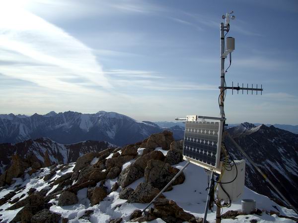
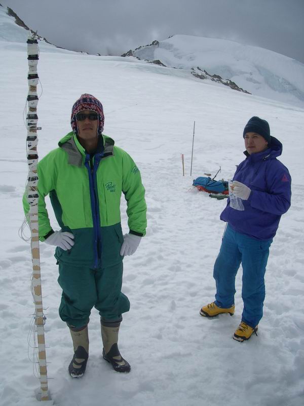
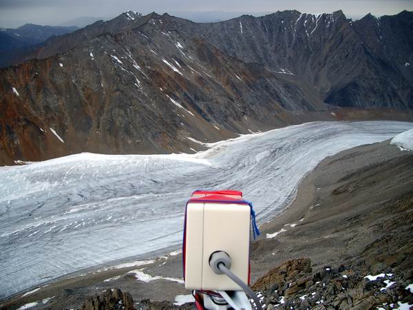
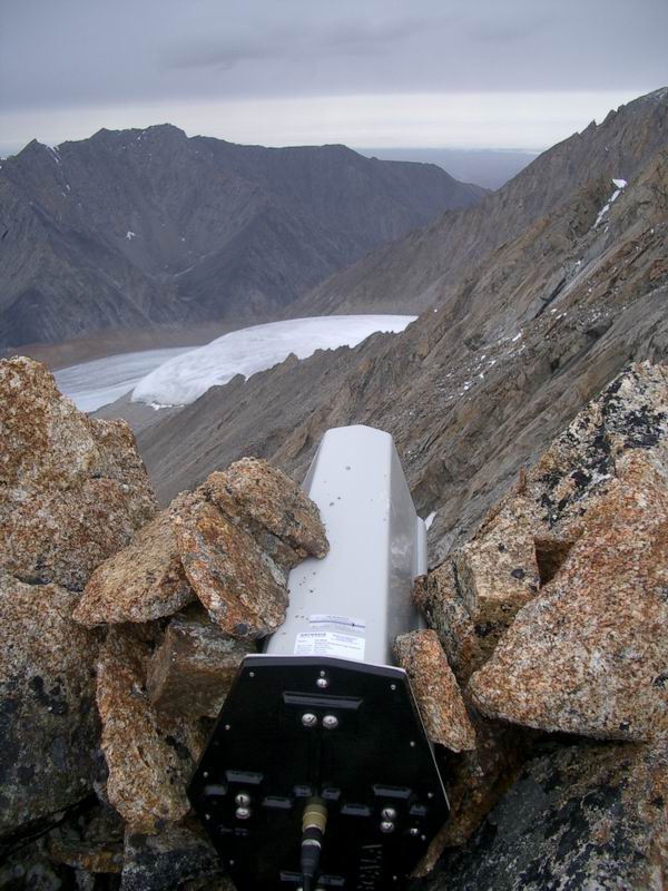
I got up about 9 AM the next day just to get a game plan going with the rest of the group, with the intention of going back to sleep. This was clearly another instance of me kidding myself, as I was quickly swept away into starting another work day. Shuhei had brought two automated digital cameras with him. One of these he set up in the upper cirque, pointed at a pole with a giant ruler on it. In this way, he can measure snow depth over time as this ruler slowly gets buried. The second one I had convinced him to set up on our upper weather station above camp, which has excellent views of the glacier. A camera here, I believed, would document that some parts of the glacier have no snow accumulation in winter because the wind erodes it away. Understanding the spatial patterns and frequency of these events would go a long way to helping us better interpret our mass balance data here. I also needed to change the anemometer and radio antenna on that station, so I decided it would be best if we went at the same time, which was basically as soon as I could get my act together. At the same time, I was also trying to get Ken set up to go down glacier to complete the work I did not the day before, which was adding some structural reinforcement, setting up some moisture probes to get buried by the snow, and changing the anemometer on that one as well. These new anemometers have fresh bearings and so are more accurate, allowing comparisons between stations to be more compelling. It was after 2PM before I got going up the hill. Once I arrived, Shuhei and Makoto had already begun setting up their camera, but on a nearby outcrop which had a better view. One of the reasons for my delay is that Ken and I had decided to change the datalogger programs that control the weather stations, such that the radio could be shut off if the batteries got too low. These are new radios which have a very low power mode that should not require them to be externally powered off, but because we had never used them in this mode before, we decided it would be safer to be able to control them ourselves. But this requires changing the program, which is a little frightening, since the old one seemed to be working and it would be a shame to screw it up without realizing it and lose a winter’s worth of data. By the time I arrived, I had to hurry to install the new program and rewire the system before the 4PM transmission, so that I could check to see that our program’s hourly on/off cycles of the radio were working. As it turned out, the wiring diagram I had made in May had an error in it, and one of the datalogger ports we had intended to use for the radio was already taken. This meant that Ken had to walk me through reprogramming the logger on the fly, rather than with a computer at camp, over the radio. In the end, with Kristin talking with Crane in the real-world via sat phone, we were able to verify that both weather stations turned on as intended at the 5PM cycle. The new antenna I installed also seemed to work, even though I mounted it on the ground rather than the instrument tower, to avoid it catching the wind and racking the tower.
Four people, two radios and a sat phone discuss the weather at 7500 feet. 3MB AVI After we were through with the weather station work, I climbed out onto the exposed ridge that the station is on to get a better view of the glacier. I spent over an hour sitting there, looking at the various patterns in the ice, noting the position of the snow lines superimposed ice, and trying to get a better sense of where the action was going on. I took a bunch of pictures and enjoyed the view, even though the weather had deteriorated substantially from the day before. That night, Friday, we had another nice dinner and enjoyed each other’s company, even though I was pretty run down. Between having a head cold and working long hours with little sleep, my body was beginning to rebel. Nonetheless after dinner I could not resist going in search of another 1958 photo location just a few minutes behind our camp. I was able to get pretty close to the spot, but the light was dim so the picture wasn’t as brilliant as the old one, but still large changes could be observed in the thickness of the ice.
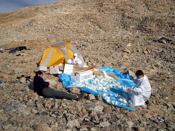
The next morning I woke up feeling like I had been runover by a truck. I had hoped that I could get an early start, go up glacier to install another Hobo and dig some snow pits, then travel downglacier and survey on the Hanging Glacier, but it was not to be. Ken used a test radio at camp to communicate with our weather stations and found that some of the instruments on the lower station were no longer working. It took several hours to pin down the probable cause, and then someone had to go down to fix it. I nominated Ken, who thankfully accepted the nomination. I spent the rest of the morning and early afternoon sorting gear and getting ready to leave the next day. Kristin did the same with the camp gear. Makoto and Takahiro donned chemical suits and began pouring their melted ice samples out of the whirlpack ziplocks into little vials, trying not to contaminate them.
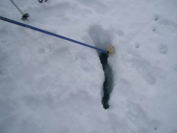
Around 2PM, Kristin and I traveled up glacier to the upper cirque to install two more Hobos and try to find a missing one. It was really odd not to find one where we had left it, because the pole we put it on was still there and it is hard to imagine a way for the attachment mechanism to fail. When we first looked for it a week earlier, I could not imagine that it had gotten buried, so I never thought to dig for it. So this time we dug, and found it. The fact it had gotten buried meant that significant snow fall had occurred after we left in May (that is, in summer), and that this snow did not melt completely. I found that odd. Along the way I measured snow temperatures and dug a few snow pits to measure snow density. There was no cold snow left on the glacier, as far as I could tell; it was all at or above freezing, the latter being a bit odd. In most healthy glaciers, near the top there would be a region where the snow does not melt. Because snow makes glaciers grow, the less there is the more chance it will waste away. By the time we were finished it was after 6PM, and we were in the clouds and rain. On the way down, the snow had softened considerably and we found nearly every crevasse the hard way. Fortunately these were only small ones big enough to catch your foot, which we had found by probing a week earlier so there was no danger, but the snows of the past weeks had covered them over again making them more a source of comedy than danger.
The weather continued to deteriorate with harder rains as we cooked dinner. I think everyone was feeling much relieved about accomplishing most of what they intended to do (or at least I did), and we drank many toasts to our success and talked late into the night. This trip had a much different character than the last one, as most of the people here I had never met before, and they were essentially working independently from me. The fact that it turned out so well went a long way to renew my conviction that the people I bump into doing this type of work are the same people I would enjoy meeting anyway. Despite the language and cultural barriers, I think everyone felt the same way, and our last intended night on the glacier was spent in very good cheer. This morning, Sunday, we woke up to clouds and fog and occasional rain. I called in to Walt’s, and found that the weather there was flyable, and that our 11AM departure was still a viable plan. So we spent the morning packing our personal gear and equipment, inventorying our cache, and trying develop a plan. I felt worse this morning than I had the day before, and while working wished mostly that I could go back to bed. My wish came true as 11AM came and went, second by second, until about 2PM, at which point I crawled into my tent to die. I woke up at about 5PM and called back to Walt’s and found that Ed, the helicopter pilot, had tried several times to get in, but was blocked by bad weather. He said he would try again shortly, as it was flyable both here and there, but given that it’s now 8PM, I take it that in between significant bad weather exists. Even if he had been able to get past it, the clouds dropped here shortly after our phone call and it has been raining pretty steadily since. So now it’s time to unpack the cooking gear and make some dinner, and look forward to the unknown opportunities that tomorrow will bring.
Friday, 22 August 03, Fairbanks The (field) party is over, but the work has just begun. We didn’t make it out on Sunday night. Nor on Monday morning. Nor on Tuesday morning. Sunday night we spent in the cook tent, eating good food, telling stories of weather delays from previous expeditions, and watching DVDs on the laptop. The Simpsons went over pretty well, but I can only imagine it was difficult for the Japanese to grasp much of the humor due to the language difficulties. I tried to compensate by playing an episode where the Simpsons went to Japan, but I’m not sure that helped. For a movie we watched an episode of Mystery Science Theater 3000, which I’m sure the language barrier again filtered out much of the humor. But it was a good opportunity to get out of the rain and fog and do our part to reduce helicopter expenses by lightening our alcohol load. Monday was largely spent milling about, watching the weather, searching for artifacts from prior expeditions, napping, and planning future public works projects for when the oil companies get the wilderness status of the area repealed. The weather at the glacier was not so bad, though with occasional rain, snow or fog it was bad enough to prevent the helicopter from reaching us. Apparently Ed made it all the way to the Jago strip, but all of the valleys leading to the glacier were choked with clouds. Fortunately it was drier than the day before, so it was more comfortable to stay outside. My cold was still dragging on me somewhat, so I made an early night of it. Tuesday we woke up to clear blue skies and crisp fall weather. The snow had frozen hard, as the temperature was about as cold as we saw it the entire trip, and the clear skies allow the ground heat to escape more rapidly. I called in to Walt’s about 7:30AM to let him know our weather, and he said that while there was a fog around Kaktovik, that he thought he would see us shortly. So we once again had a quick breakfast in anticipation of an imminent helicopter sound coming up the valley, but it was not to be. Ken climbed up the ridge to the met station behind camp, and reported via radio that a thick cloud layer existed just out of our sight and seemed to extend all the way to the coast. As he continued to climb further towards the peak, the rest of us began settling in to our new life on McCall Glacier, wondering whether air drops might be possible before Christmas. I fired up the steam drill, which we never had chance to use during our planned time on the glacier, and began contemplating dragging it out to the ice to install a few more poles. Shuhei continued to take infrared pictures from camp, which he had done every morning and every evening since we arrived. And with all of the sunny weather, we were able to get all of our batteries charged. Some sort of strange lethargy develops after a few days of waiting, which counter-intuitively makes wishing to continue waiting more preferably to leaving, at least for me. Perhaps it has something to due to with reducing the energy associated with feeling on edge, waiting to spring into action at the sound of the helicopter arriving.
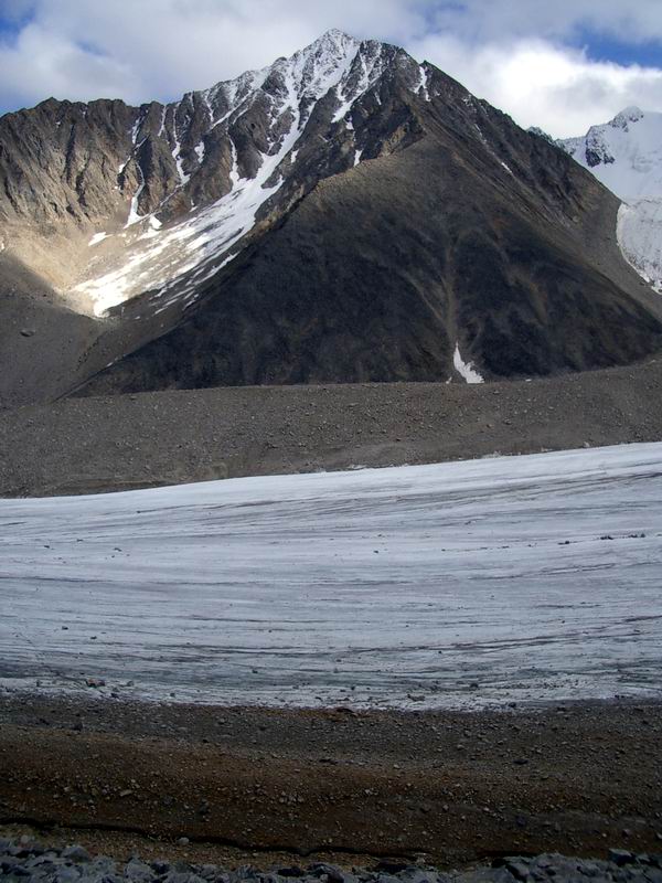
As it turned out, the cloud layer was not as thick as it seemed from above, and Ed was able to make it into our camp around 11AM (1.5MB AVI). Though we were mostly packed, this morning we did not break down our tents because of the several prior false starts. But it did not take long to get Frank and Takahiro loaded onto to the chopper with their gear, a tent, and survival food box. While they were being delivered to the Jago strip, the rest of us began frantically closing up boxes, repacking our bags, and getting ready to go. Ken was still an hour away near the top of the nearby hill, and we could hear small rockslides every so often as he hurried to get back before the last flight out. It took only twenty minutes for Ed to return, and we quickly loaded him up with a bunch of equipment, as well as Makoto. Again, twenty minutes later he was back, but this time he shut down for a while as we prepared the next load. Ken made it down in time to catch this flight along with another load of gear, leaving Kristin, Shuhei and I for the last two trips. Sometime during that frenzy I had called Walt to let him know that Ed had made it in and that people and gear were piling up on the strip, so he soon joined the party with his plane to begin getting it all to Kaktovik. It took another hour to get the cook tent down and the cache packed up for winter, mostly with food, fuel, and some tools. Kristin went out next, taking nearly all of the remaining gear and garbage, leaving Shuhei and I for the last flight out. While on the trip, one of the things that I was struck by was the differences in ice and snow cover on North and South facing slopes. That is, nearly all South facing slopes were devoid of snow and ice, whereas North facing slopes were often covered up to their ridges with ice. East and West facing slopes were somewhat in between, but generally speaking were more similar to South than North slopes. I had also noticed that one of the small West facing cirques in the McCall Glacier valley had lost its glacier sometime in the past fifty years, as had one of the small South-facing cirques in the Hubley Glacier valley. So I wanted to take advantage of the relatively snow-free time of year to survey a number of these small cirques in the region. With the combination of digital photos and Shuhei’s infrared camera, it seemed an ideal opportunity. Unfortunately, the weather was not cooperating. The sky was still relatively clear, but below us many of the valleys were filled with clouds. Still, we did manage to visit a few nearby cirques and get some pictures. I was particularly pleased with one glacier in particular – Bravo Glacier, just on the other side of the pass from the lower cirque of McCall Glacier. This glacier flows East-West, and had a dramatic difference in ice cover on its North and South facing slopes. It almost appeared that the glacier surface was tilted away from the sun, even though it flowed parallel to it (or at least should have based on topography). I think this glacier is a great candidate for further study, as it is a small, simple glacier, similar to Scott Glacier which flows due North.
It was just as well that the weather was not cooperating, as we were running out of time anyway. The last (and only) Frontier flight from Kaktovik leaves at 4:30PM (unless they get in early, in which case they often leave early), and it was already 3:30PM. We swung around to the Jago strip to top off on fuel so that Walt only had to fly out empty barrels, and visited with Kristin, who we found sitting forlornly on a pile of gear. Fortunately Walt made it back about then too, so we were able to load up his plane with Kristin and nearly all of the remaining cargo as Ed fueled the helicopter. We all took off a few minutes later, putting the petal to the metal back to town.
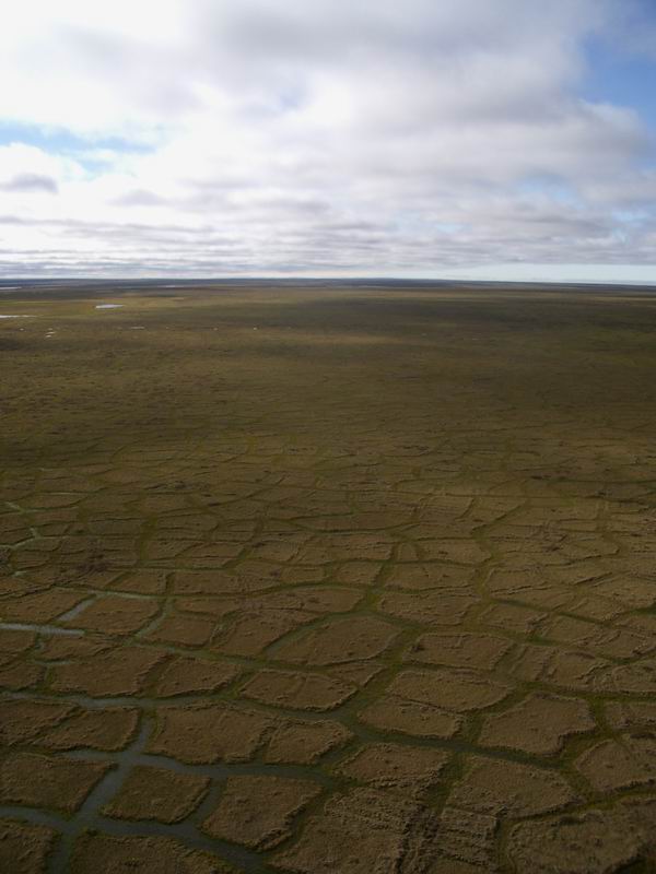
The trip back was uneventful, though pretty. Walt’s plane flies faster than our helicopter, and he was able to fly somewhat above the clouds, so Shuhei and I probably got the better deal for sightseeing as we were lower and slower. The tundra was the characteristic green and brown, covered by the occasional caribou or bear, and often arranged in the polygonal patterns common for flat, permafrost terrain.
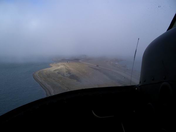
As we approached Kaktovik, the fog was thick and to the ground. We lowered down to just above ground level so as not to lose a ground reference, though we forced a bit higher by some of the power lines running through town. How Walt could land a plane in this was beyond us. As we crawled above some of the local homes, we found the road that led to the airport and followed that in to land. A Frontier Beech1900 was already parked in front of the hangar, and Kristin was chatting with the pilots. Everyone else was involved with weighing our gear on a bathroom scale and making a list for the Frontier cargo agent that works for Walt. Turns out this plane was not the one we expected to leave at 4:30PM, but a VIP charter for some politicians visiting ANWR and the oil fields to the west. If we weren’t so stinky, we might have caught a ride with them, but as it was the pilots let us sneak on most of our cargo since they were so light and heading the same direction. We kept our backpacks in case our plane couldn’t land, which at the time seemed a very real possibility.
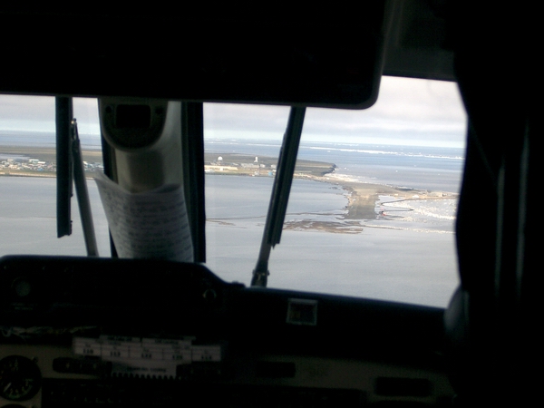
Once the charter took off, we milled about in the fog looking up in the sky for any sign of clearing, but generally just happy to have gotten out so smoothly today. Pull-outs are such a frantic, fast-paced, clusterfuck-waiting-to-happen, that you hardly have a chance to catch your breath until its over. You can do as much planning as you like, but once it’s in motion, it’s pure action-reaction and thinking on-the-fly. That’s why I always make lists of everything I need to do on put-ins or take-outs the day before, because there is too much keeping my brain focused on NOW that there’s no bandwidth or storage space left for mental checklists. And good planning goes a long way to preventing the need for much thinking. Unfortunately it also eliminates much of the possibilities for adventure, which is to me almost by definition what occurs in the field when you haven’t done adequate planning to prevent it. I think I’ve lost my taste for work-related adventures for that reason; that is, it just seems so unprofessional. I think I’ll have to start going on more personal trips for such experiences, as such adventuring can be a lot of fun and certainly makes more exciting stories. It was colder on that airstrip than on the glacier, and we were glad to hear our plane circling in the fog after a short while. Apparently it is not allowed to come in for a landing until the automated equipment at this runway declares that there is a mile visibility. The airstrip here is a gravel runway situated on a narrow spit of land between town and the ocean with water on both sides; the end of the runway actually enters the water, and on stormy days the runway lights get submerged. We could hear them coming in for a final, but didn’t actually see them until they were maybe 150 feet above what they apparently hoped was the runway, at which point they put the power back on and pulled up hard because they were lined up over the ocean, not the runway. We had our scanner turned on and could hear them report back to HQ that they missed and had to come around again, at which point we heard the pilots who had just taken off with our cargo call back “Are we having fun yet boys?”, to which was responded an affirmative but deliberate “Yee. Hah”. By the time they came around again, the fog had cleared a bit, but not so completely that some last second wiggling wasn’t required to get the plane lined up before the end of the runway approached. Once on the ground, we loaded up what was left of our gear, got on board, and began thinking about showers, food and beer.
We landed back in Fairbanks without incident, but here I had no plans prepared and adventure began slowly creeping in. While taking care of things I had some sense of what it must be like for our Russian colleagues dealing with us in Russia. Shuhei, Makoto, and Takahiro can all speak English, but it is slow and pained and very polite. I lost track of them for a while as I was trying to organize some lodging for them, and they returned saying that there were no vans available for rental, but they weren’t sure whether a ‘van’ was what they wanted anyway. I could only imagine the conversation that occurred, and as I walked to counter I ignored formalities and simply asked the kid behind the desk “What’s the biggest vehicle you’ve got ready to rent?”, and in the 10 seconds it took him to find out, I asked across the desks of other agencies whether they had any minivans left. I’m sure it was all too fast for them to follow, and in less than a minute we renting a small SUV. In Russia I saw things like this happening all the time, and it just seemed like “blah blah blah” and “blah blah blah back”. Same with searching for lodging. The first 10 hotels I called were full, and the extent of the conversations was along the lines of “Got any rooms open tonight? … OK, thanks. Click”, a brevity only achieved by native speakers. So it was nice to be able to return the favor of local knowledge and capability, in a cosmic, what-comes-around-goes-around sense of things. Eventually we rounded up the vehicles and arrived at a room by about 8:30PM. Kristin and I took off to get showers at the nearby laundromat, while the others settled in to their rooms to do the same. We had no shampoo, brushes or towels, but still it was enough to get the thickest layer of scum off our bodies. We returned to the rooms with beer and pizza, and celebrated our good fortune. Similar to our brushes and shampoo, most of the others’ clean clothes were left at out house, which we still hadn’t visited yet, but none of us minded. It was good enough to be back, having completed our mission, and little reason to worry about what tomorrow would hold. Kristin and I slept in next morning, Wednesday. I worked on my photo comparisons a little on the computer, so that I could send some nice hardcopies home with the group, as well as bring them to a meeting I was trying to set up with US Fish and Wildlife that afternoon. The trouble here is that the next phase of the Japanese effort requires the use of a generator to power their deep drill, and generators are strongly discouraged within the Designated Wilderness area (that is, never allowed). On McCall Glacier, however, we benefit from the fact that scientific research here, including use of generators and drilling, pre-dates both the Refuge and the Wilderness area designations. So after picking up the bulk of our cargo and spreading it out all of over our house and yard for drying, Shuhei, Makoto and I headed to F&WS to meet with the Refuge managers and make our case. It’s difficult to say what the final outcome will be, but at least we did not get an ‘absolutely not’. Many, if not all, of the generators used on prior expeditions are still out there, relicts of a different way of doing business. Hopefully our efforts at keeping a tidy camp and cleaning up prior camps will help convince persuade the refuge managers that our commitment to preserve the wilderness while trying to understand it better are not just lip service. The managers there seem very supportive of our project, and I think the only reason they’ve allowed it so far is because of its history of research. They are in a very tough spot, though, as they get pressure from those wanting to make use of the area for their own purposes (research, hunting, etc) and from those who want all technology and people kept out of the area. So allowing us to use a generator opens up the door in the minds of many for more widespread use of generators by others. After our meeting we met back up with the rest of the group and ate a nice dinner at the Thai House. Ken and his wife Janlee joined us as well, and it was the last time the whole group was together. We relived a few funny moments of the trip, discussed future plans and left feeling comfortably bloated. The visiting group went back to their hotel to drop off some gear, then returned to our house to finish packing up the stuff left out to dry during the day. They packed up a few Action Packers to leave with us for next year. When they made it into the house, we had arranged a number of Crazy Creek chairs in a circle on the floor, surrounding some sake in a pseudo-Japanese style. Shuhei had given us some nice sake cups earlier, so we had these out. On our way to meeting them to pick up the cargo earlier in the day, Kristin and I had purchased each of them a chair, since each had remarked how comfortable they were in the field and had apparently never used them before. So we sat around late into the night drinking, showing digital pictures, and relaxing. It was Shuhei’s last night in town, so we exchanged many positive words before wishing them good night.
Thursday was the first day that Kristin and I had to ourselves, and we spent the day unpacking and drying our own gear, running errands like picking up our mail and buying some food, and downloading GPS data. I have about $50k worth of GPS gear from Unavco here now, and I’m sure they would like it back. Unfortunately I didn’t have time to download all of our data off of the receivers in the field. The units we left out there over the summer recorded data four times per day for about 10 weeks, and all of these files have the same file name. So each must be downloaded separately and file name changed while doing so. So far I’ve got one receiver finished, and one more to go. Makoto, Takahiro, and Frank spent the day at Chena Hot Springs and sightseeing, ending up with dinner at the Turtle Club. They called that night to say goodbye and wish us well. Kristin and I had a Japanese night, complete with sushi, sake, plum wine, inare, pocky, and we each picked out a Japanese video: “Shall we dance”, revolving around a Japanese man’s struggles with taboos of ballroom dancing, and “Godzilla vs Mothra”, revolving around the struggles of monsters created by U.S. nuclear testing in the Pacific. Next morning, today, I continued downloading GPS data and unpacking before picking up Frank for lunch. His plane left in the afternoon and, since the Makoto and Takahiro had already left early in the morning, he was the last one left. We had a nice lunch on the deck of Pikes and talked mostly about Japanese culture and politics. It’s always interesting learning about the differences in the way things are done, and Frank has many insights that you wont find in the Lonely Planet’s guide. Frank and I are probably the most similar of any in the group in that we both work with geophysical equipment a lot and are roughly the same age and stage in career. These common interests and common struggles led to many interesting conversations on the trip and at lunch. We left him with one of our vehicles so that he could explore town a little bit before leaving and dropping himself off at the airport, and then it was over. Just Kristin and I, and a mountain of wet gear and unreduced data. I didn’t start out this trip by asking a question, but I found some answers anyway. When I joined the research group I’m in now, I had three goals: 1) To broaden my professional understanding and network of colleagues to better understand how glaciers fit into the larger Arctic system, with side benefit of seeing if there was something about glaciers that was inherently special to me, 2) To be part of a different sort of research machine than I had been exposed to previously with an eye towards how to establish my own, and 3) To gain experience as a professor, especially in terms of proposal and paper writing. After four years at it, I know feel like I have met all of these goals. I have found that my interest in glaciers is not due my exposure to them in my PhD work. I had been playing on them and learning about them before coming to UAF, and now that I’ve returned to them after a few years’ break, I find them more captivating than anything else I’ve studied. My work on Lake El’gygytgyn, with SAR and soil moisture, with hydrology, with DEMs, these are all interesting projects and often fun, but I’ve never really felt like sinking my teeth into them like I have with glaciers, especially McCall Glacier. So while working on these other projects has given me the perspective I wanted, it now also allows me to be content to focus on what I really enjoy without doubts about whether something better exists over the horizon. As for the frenetic and adrenaline-filled pace of establishing or maintaining a research machine of multiple projects with multiple field sites and personnel, having seen it first-hand I also now feel confident that I would be much happier working part-time sticking to one or two glacier projects with little support staff, than trying to juggle anything more. I’ve learned that the overhead associated with trying to bring in a full salary is at odds with doing science. For example, I've got three months funding for the McCall Glacier project, but the actual work takes more like 6 months to do an adequate job. If I took that 3 months and the three months base funding for my position (most of which is vacation/holiday leave based on a 12 month work year) and applied for no more grants, I could spend at least 6 months working on this project, and probably more like the 9 or 10 it would take to do a really good job (though only paid for six). However, trying to maintain a 12 month salary has required writing 10 or more proposal per year, which can take a month or two or time in itself (minimum). The catch is that nearly any project I get funded is underfunded for salary (this is a matter of policy for NSF, who believes that the University should pick up the remainder, which in my case they dont). Then each of those budgets must be tracked taking still more time up, and important decisions either on the business or the science must be made in seconds by necessity rather than the time they actually deserve. So the more projects I take on, the more they all suffer, and in the end I cant even spend the original 3 months working on McCall because I need that money to write more proposals or go to more meetings to present half-finished work to try to get more projects funded. Worse, good projects are not always easy to fund, so I get stuck prostituting my abilities whenever the opportunity comes along. It was fun for a while, but now I realize that it's simply poor form. This is not a consulting firm, but a University, and the University system is one of the very few institutions I still believe in, and in my mind it needs to be preserved as the last bastion for reasoning guided by truth (as much as ANWR needs to be preserved for other reasons), and if I am not actively adding vitality to that system then I should leave. That is, if we are to suck up to anyone besides ourselves as professors, it needs to be only the scientific community as a whole, where gaining entry and maintaining membership is determined largely (or hopefully exclusively) by one’s fidelity to the truth, not by the length of your resume, how many meetings you attend, the amount of overhead you have generated, or even prior success. The answer I found, therefore, is that life is too short to continue disrespect my own integrity and that of the scientific community for the sake of 12 months salary. How that will translate into action I can’t say yet, but the McCall Glacier project will hopefully be a major part of it. I think that this trip also gave me a better appreciation for ANWR as a wilderness. I’ve been in remote places often enough and seen enough of them to think them more commonplace than they probably actually are. Many of these places dont have fancy titles or visitor centers, but they are wilderness nonetheless. Perhaps that's why I dont seem to be as impressed by the titles of places as many people seem to be. I'm not convinced that such titles are necessarily a good thing either, as it may tend to make people forget that just because a place doesn’t have an official government designation doesn’t mean it isn’t special enough to respect. For example, the area just outside of Denali Park is just as beautiful to me as the area within it, and the fact that there are not armed guards on the other side of the highway making sure that I’m leaving no trash doesn’t mean I stop packing it out. Yet most people seem to drive past this area without notice because they are rushing to get a good place in line at the Visitor Center. That is, is Denali Park more special to people because it has a name and a Visitor Center? Or is there any rational or spiritual reason why tacky development is allowed just outside the Park boundary, but camping within it is not allowed within sight of the road? I guess I’m not used to thinking that one remote area is more special than another, and to me adding a name to it actually takes away some of its allure, as the name itself seems to me to be as much of a human scar as an abandoned fuel drum, and seems to attract more Princess Tour busses and their ilk to it. Nevertheless, I find something about the McCall Glacier region of Alaska particularly special, whatever its name may be. A more relevant question is perhaps whether the Arctic National Wildlife Refuge and its ‘Designated Wilderness’ is so special and important to people because of what’s there (or not there), or because of what that name stands for to them? I’m about as green as they come in terms of modern American lifestyle, living on solar power, with straw insulation for the house, no running water or septic system, and at times parking my car for months and eating only out of my garden. But I don’t feel any more of the ‘flowery majesty of this remote wilderness’ than I do when walking in the woods behind my house. Which is not to say that I don’t feel that majesty and wilderness, just that I feel it lots of places, even in town. I’ve met a lot of people who are very passionate about ANWR’s wilderness status, and I’ve started reading books on it as well, and often something about green side of it rubs me as much the wrong way as the oil side (though rarely more than the political side). It has something to do with how far the truth is stretched or avoided. There’s usually some statements about how we need to keep some areas ‘wild and free’ and away from oil development and technology, as well as how the natives were here first and deserve to maintain their ‘traditional’ lifestyles. Yet those alledged-greenies visiting this ‘wild and free’ area fly there in gas powered planes and carry high-tech GPS, and those traditional natives are wearing underwear made in the free-trade zones of Jamaica and using skidoos to carry their traditional gas-powered jiffy drills to fish through the ice. It's not these actions that bug me so much as the rhetoric that ignores or makes a mockery of it. One popular book I’m reading accuses the oil fields of having ‘over 1600 oil spills in 3 years, most of them diesel spills’. The author doesn’t explain that diesel doesn’t flow through the pipeline (and I believe deliberately implies that these are pipeline accidents); in reality I believe that most of these spills are related to fueling vehicles, and most are less than a few gallons (but this goes unstated). Stand at a normal gas station for one hour watching normal people fuel, and you will likely find 1600 spills for the hundreds of vehicles up there an unbelievably low number for even one year. The reason is that every vehcile there is fueled with a drip pan beneath it, even at 40 below; I've never seen anyone use a drip pan at a gas station in town. It's not that I think 1600 spills is a reasonable number for the oil fields, but that I dont think it is reasonable anywhere, and that any discussion of prevention there must be part of a discussion of prevention everywhere. That is, again, by singling out ANWR as so bloody special, the preservation movement seems to sell out every place with roads as a lost cause. For example, these books show pictures of the truly tidy installations in the Prudhoe Bay oil fields in a discussion of the ‘industrial sprawl on the North Slope’, and pictures of the trash heap in front of a native’s cabin as if it were quaint and worthy of respect simply by virtue of its owner’s skin color. There’s just too much hypocracy about it all. I’m not a fan of oil development, and I think there are many good reasons to not allow it here that dont require bending the truth. It strikes me, though, that those who are deliberating bending the truth and being deliberately hypocritical are not only discrediting themselves, but also those who have valid, supportable points as well. So if there is a question I’d like to answer for future expeditions and time spent in ANWR, it’s to learn which hype is accurate and arrive at my own solutions. For now, however, it’s McCall Glacier data reduction. Unfortunately, though GPS is a great tool, it produces so much data that one has to spend five times as long reducing it into a useable form than collecting it. I also logged into my email briefly to find nearly 600 unread messages. I’ve been mentally struggling not to begin thinking of other projects until I have at least the preliminary data reduction completed from this trip, which means ignoring my email and not going into the office. But I look forward to the McCall work, as it’s like slowly bringing into focus that perfect photograph you’ve just spent 12 hours hiking to get. In the case of science, however, the first challenge is that one often has to design the lens first, as each project is different and standard solutions don’t always exist. The second challenge, and perhaps more difficult one for me, is not falling into the lens grinder and making a spectacle of yourself…
|
(c) 2003 Matt Nolan. If you find any broken links or other errors, please let me know. Thanks.