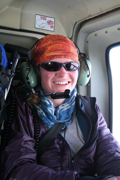
Dr.
Matt Nolan
Water
and Environmental Research Center
Institute of Northern Engineering
University of Alaska Fairbanks
matt.nolan@uaf.edu
|
|
Dr.
Matt Nolan |
|
|
Saturday, 19 May 2007,
McCall Glacier
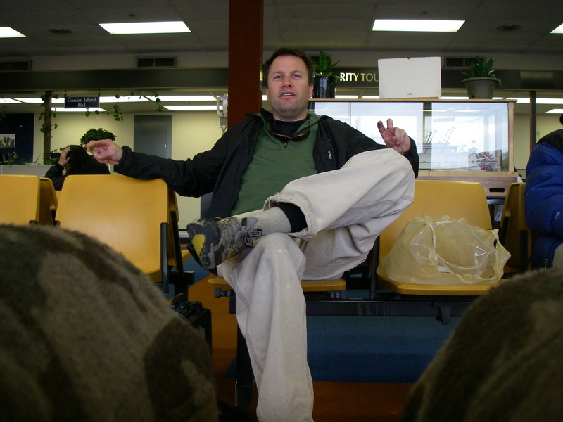
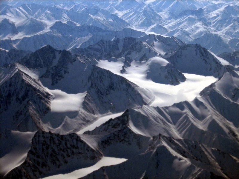
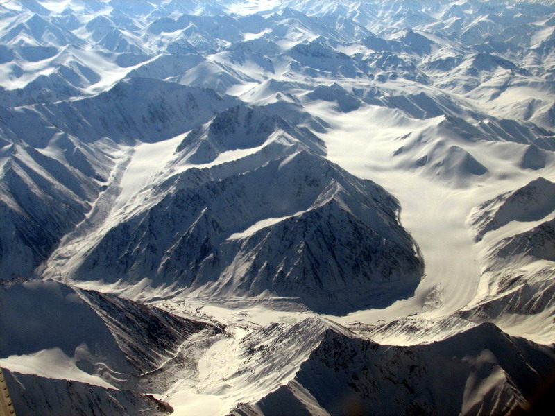
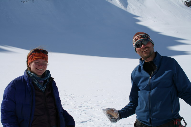
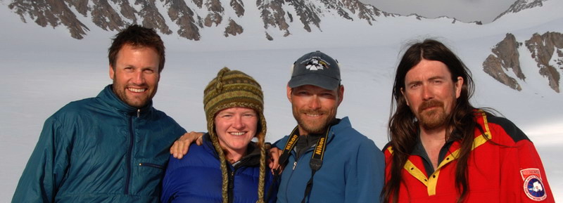
We’ve had five days of sunny weather on the glacier, but I spent most of it in the fog. We left Fairbanks on Tuesday May 15 and arrived to find the mountains and Kaktovik with clear, calm weather. This year everyone on the glacier is a returning veteran of McCall Glacier research, including Thomas Nylen, Erin Pettit, and Jason Geck. The departure from Fairbanks was the normal chaos and confusion. A week ago the flight was empty, but by the day before was overfull, and it seemed likely that Kristin and Turner would not be able to join us for the afternoon. This was confounded further by the need to take on extra fuel in case we needed to divert from Kaktovik due to weather. At the last minute the weight issues were solved by sending some Nuiqsit passengers on the Barrow flight instead of ours, and so both Kristin and Turner were able to join us for the ride up. We got some good views of the glaciers on the way in, and were greeted by the familiar crowd in Kaktovik when we landed.
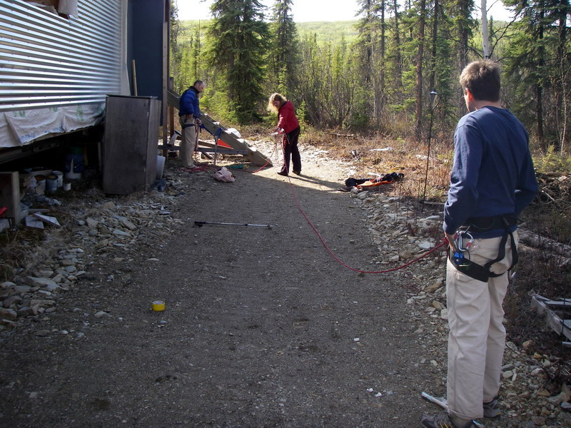
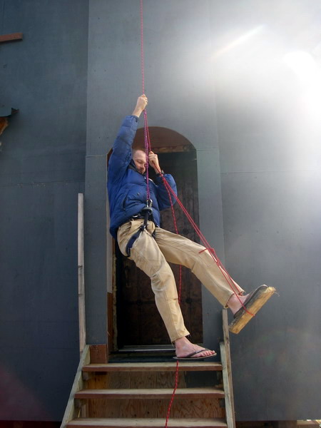
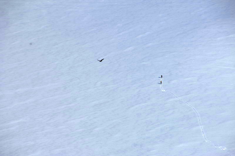
Rampers stop for no woman -- 23 MB But little rampers can get picked up -- 25 MB
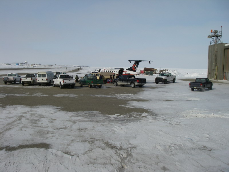
We arrived a day early to avoid some of the last headaches of previous years and give us a day for cargo to catch up if need be, but as it turned out we were at the right place at the right time. After lunch and socializing, Ed arrived in the Air Log helicopter at about 3:30. I had no information on when the helicopter would show up or who the pilot would be, but assumed it would probably be showing up around dinner time or later, after a full day of flying. As it turned out, Ed still had plenty of time left and the weather was beautiful from the coast to the mountains, so we decided to go for it that afternoon.
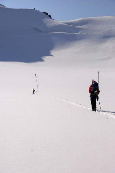
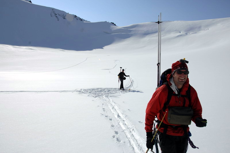
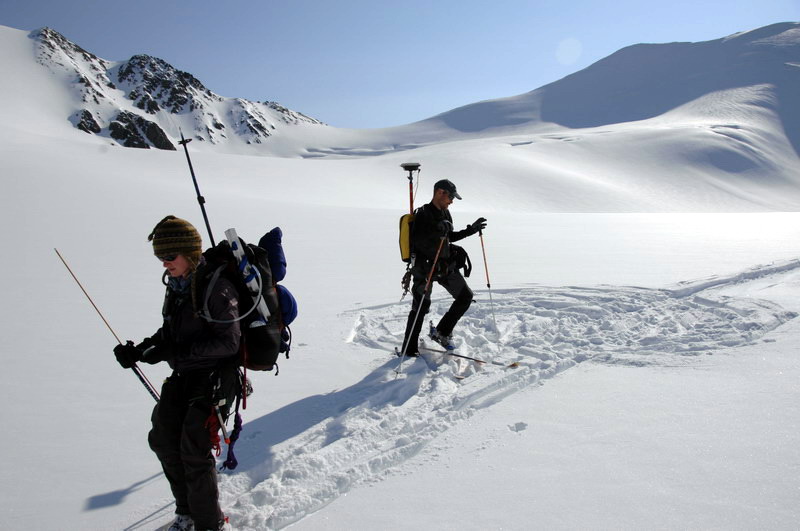
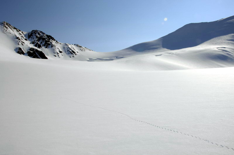
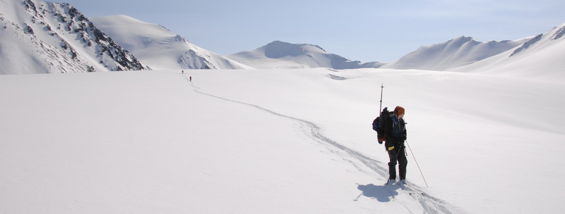
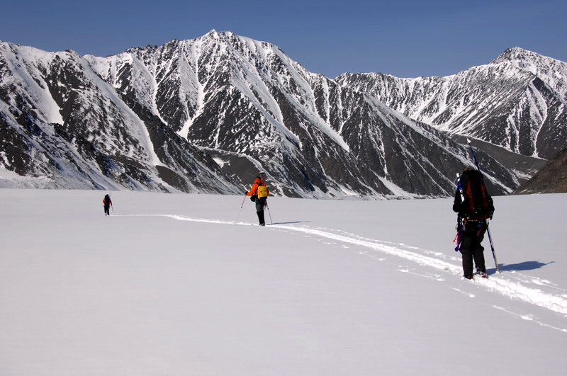
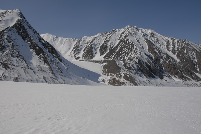
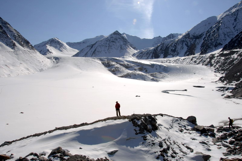
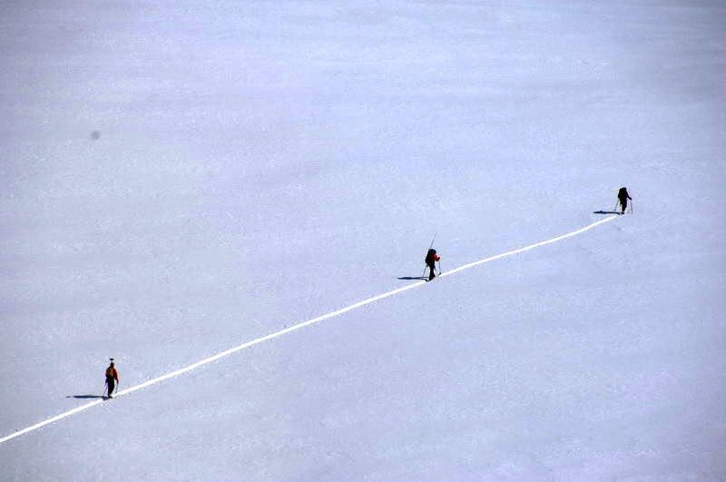
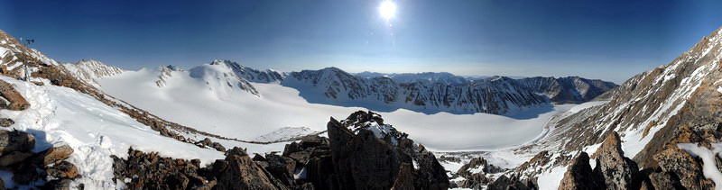
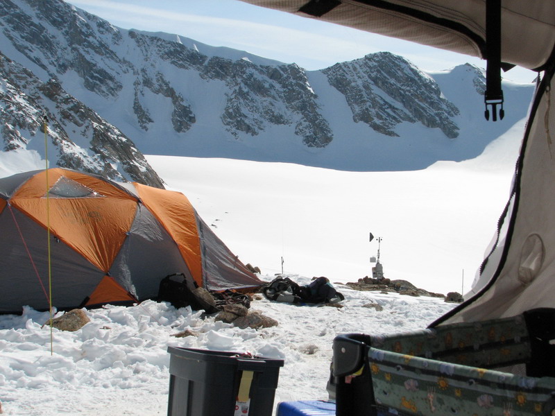
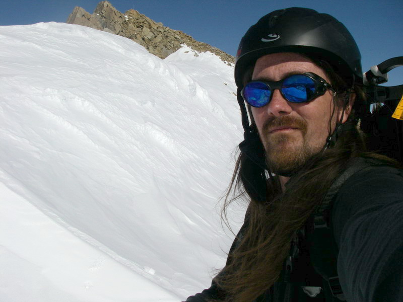
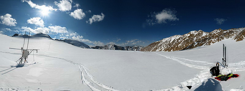
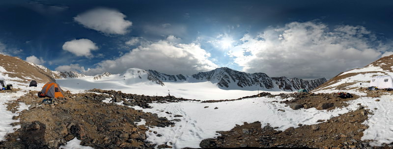
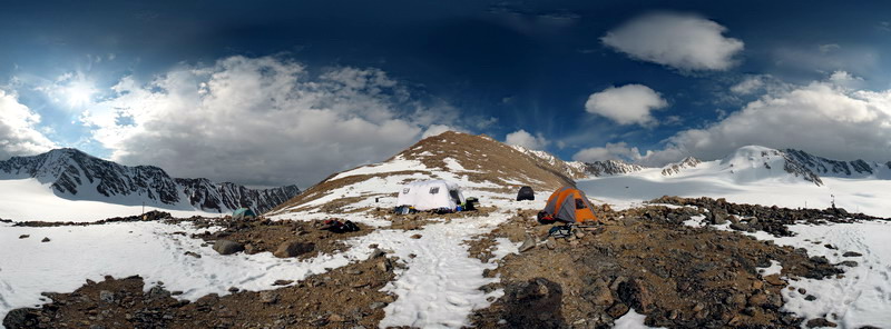
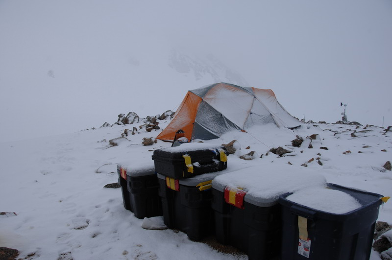
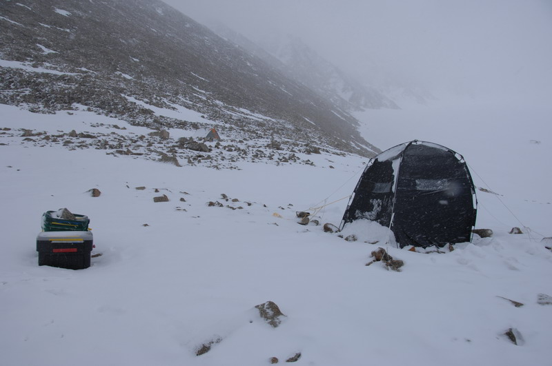
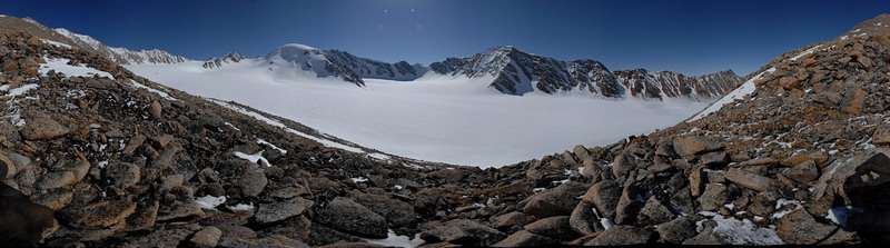
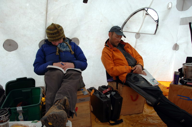
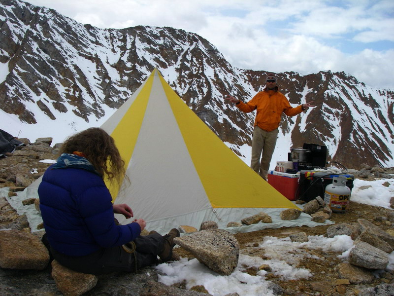
After some frantic gear sorting and tearful goodbyes, Jason and I headed in on the first flight to find the weather on the glacier was calm and warm. As we started unloading, I set up a time lapse camera to watch camp get set up, and soon we watched Ed take off for the next load as we began unpacking. The big cook tent went up much easier this May, without having to deal with the 20 knot winds as in the previous May. We worked without gloves, hat, or coats in the hot sunshine. By the time Thomas and Erin made it in, we had it set up and I had time for a quick panorama of the glacier before it was scarred by ski tracks. Apparently a fox had recently visited camp, as there were tracks all the way from the terminus up to the upper cirque, circling briefly throughout our camp site. By 8PM all the people and much of the gear were at camp, and by midnight we had all the tents set up and a bit of dinner before going to bed. Given how nice the weather was, we decided to survey some other glaciers the next day if it continued to hold, which it did. Ed returned about 11AM with the rest of our gear, as well as Art Smith with HD video camera in hand. Obligatory helicopter landing video -- 37MB
Unfortunately, by late that first evening I began feeling woozy and by the time I went to bed I was feeling downright sick. I barely slept and had chills, and before breakfast I puked up last night’s dinner still undigested. Similarly foul and undigested contents found their way out elsewhere. By the time Ed and Art arrived, I was in no mood to do anything but sleep, so the others all went out and surveyed Schwanda and Krisscott Glaciers, both of which we had surveyed in May 2003, giving us a 4 year repeat measurement. Not exactly the way I had hoped to start the first year of IPY measurements, but fortunately given the experience and commitment of the others the work didn’t slow down any.
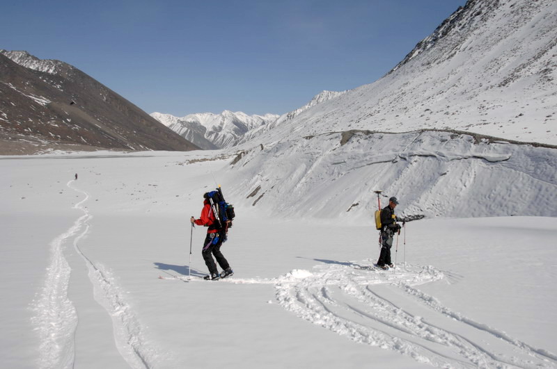
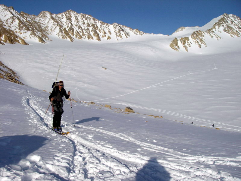
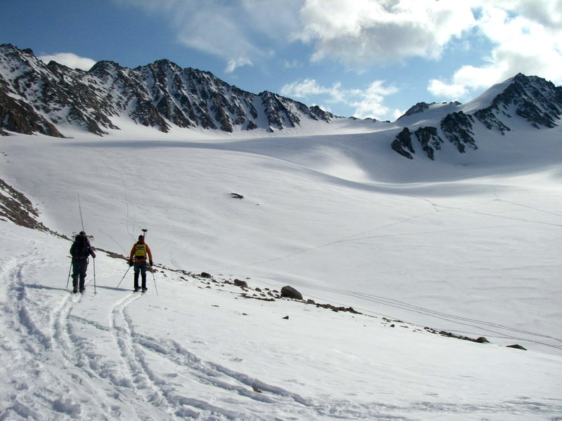
That night we made a similar plan, that if the weather held we would do more glacier surveys the next day. And the weather did hold. I felt marginally better that evening, but still was not able to hold down any food and was becoming weak and dehydrated. By morning I felt better and was able to hang on to my cereal, so I joined the survey team. I was a little torn as to which glaciers to survey, but opted for Okpilak next. The main issue was that I had wanted to repeat some photos of that glacier that are now exactly 100 years old, but unfortunately a heavy snow fall the week before made it impossible to make useful repeat photos because the glacier could not be distinguished from the surroundings. We saw this from the air flying in to Kaktovik. The snow at camp was the thickest its ever been, and we were able to ski from camp onto the glacier, which we have only been able to do in one previous year. This doesn’t mean that there is more snow this winter than previously, just that there was a recent heavy one. Anyway, I figured it was better to get the surveying done on Okpilak now while we could, then return later for the photos once the snow had a chance to melt, which hopefully will occur by the time of our take-out. The surveying went well, and I spent most of my time taking photos of the spectacular scenery and our work there. Ed was itching to get going to his next job, but given the weather we opted to make the same plan for the next day if it continued to hold.
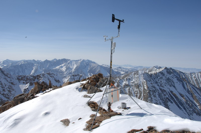
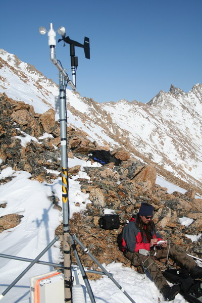
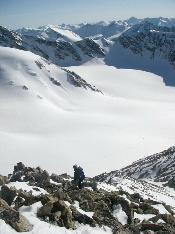
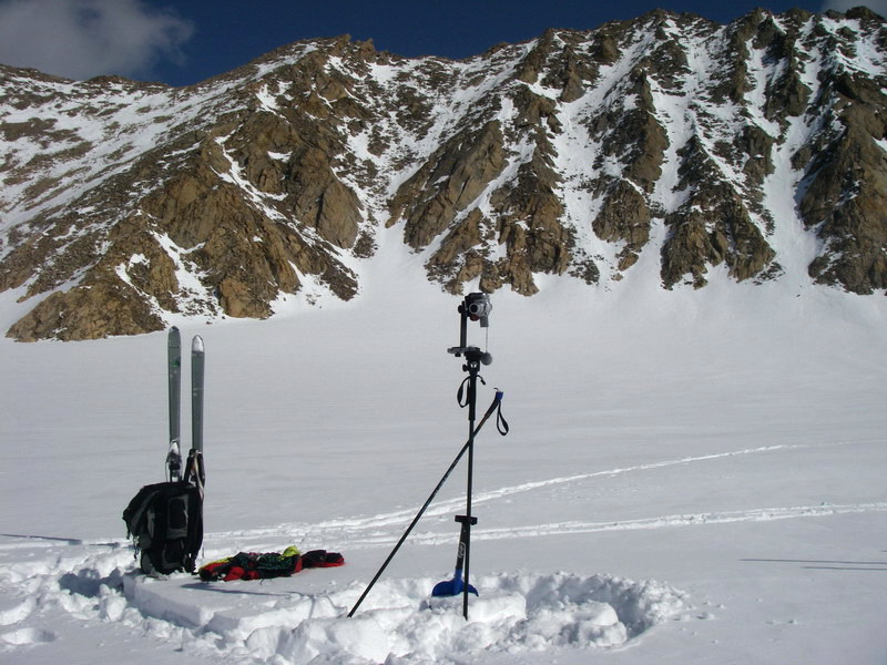
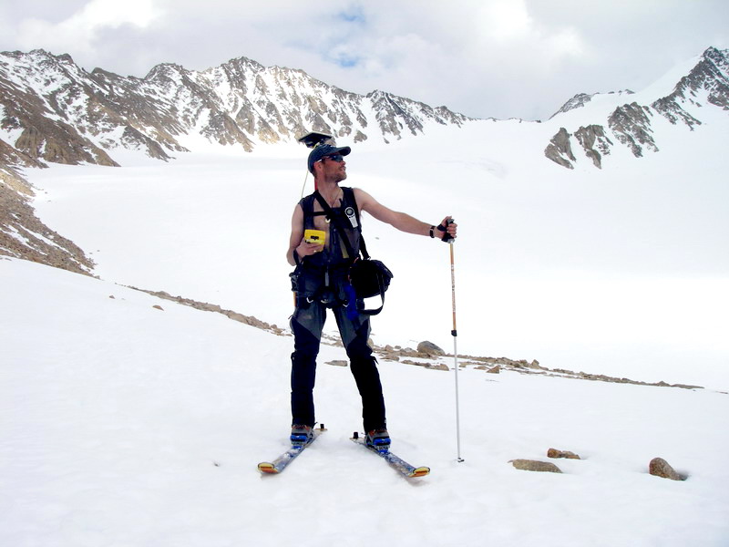
That morning I once again woke up a bit woozy, after not being able to hold onto my dinner from the night before, but the weather was still great on the glacier. Unfortunately it had deteriorated in Kaktovik, and Ed was not able to lift off. We checked in every few hours, but by lunch decided to call it quits and start working on McCall Glacier. By this time I had already puked up my lunch, so I went to take a nap while the others began a shakedown of our GPS gear. By the time they left for the initial surveys, I was feeling better and started to hike up the mountain behind camp to fix the weather station there that had stopped transmitting last fall. By the time I was about two-thirds of the way up the hill, the others returned from the glacier to deal with some technical issues. This was fortunate, as at about that same time I realized I had forgotten to bring my camera tripod, as I had hoped to set up a new IPY panoramic photo site from somewhere near the weather station. Jason volunteered to bring it up, and I vowed not to let him beat me to the top. Considering that I was sick and carrying a heavy pack and he was a champion of arguably the most hardcore wilderness race in the world, I supposed it would not have been too bad if he did beat me, but still… Fortunately for him I didn’t have to send him back down for something else as I arrived a few minutes ahead of him.
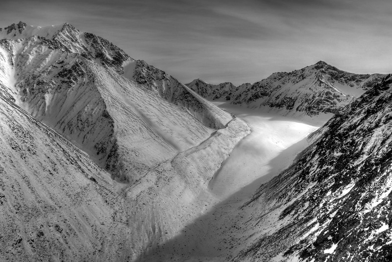
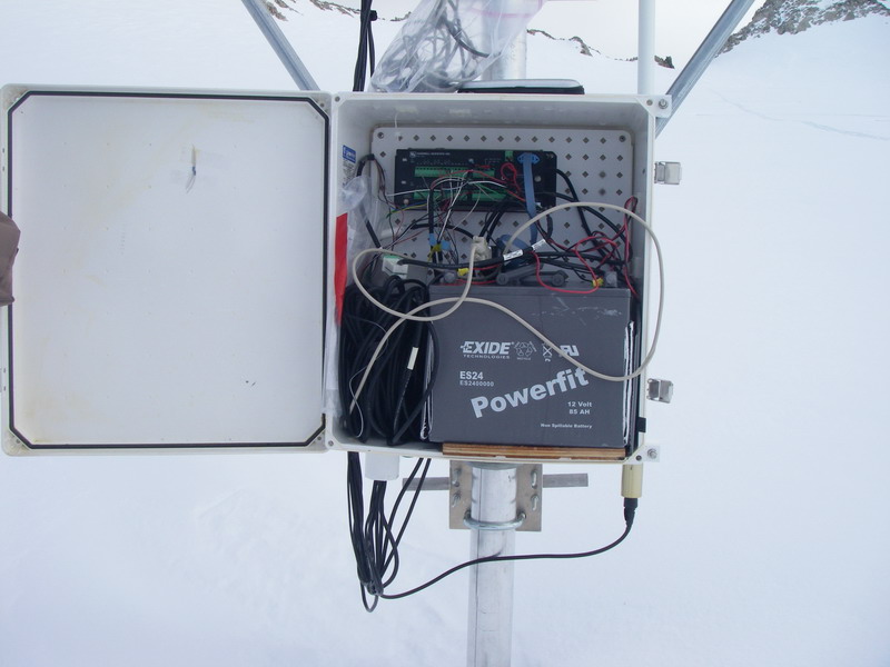
The view from the top was of course spectacular and it was clear that the coastal plain was socked in all the way from the foothills so there was no chance of a helicopter making it here even if it could get off the ground. The weather station turned out to be simple to fix, but unfortunately no data was collected all winter. The issue turned out to be a failed datalogger, something that rarely happens. This site had issues last winter, but I had thought it was a battery problem, so I had fixed that last May, as the datalogger functioned fine all summer long. Hopefully this will solve the problem for the long-term.
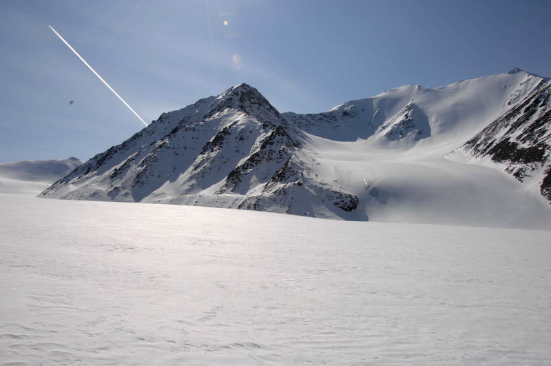
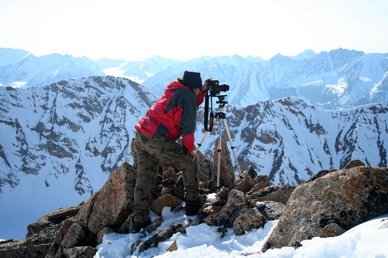
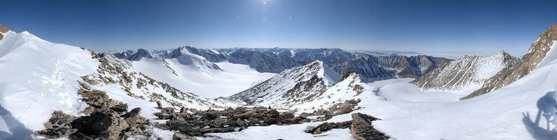
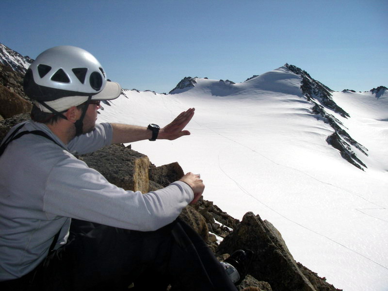
Once we got the station working again, I took a set of panoramic photos using my new fancy camera and panning head. I shot in raw mode and bracketed exposures to increase dynamic range by later merging them together, and quickly filled up about 4GB of memory. My first digital camera in 2000 used to fill up 32MB cards, a factor of 100 difference in 7 years. But the increase in resolution and quality is stunning, and hopefully photos like these can be used for hundreds of years of comparisons. Taking high quality baseline photos like these is one of my highest priorities this year, as a contribution to the International Polar Year which started this spring and occurs once every 50 years.
Jason and I returned to camp a few
minutes ahead of Thomas and Erin, who had returned to the glacier to survey
the Upper Cirque. By about 9PM we had some dinner and a chance to review
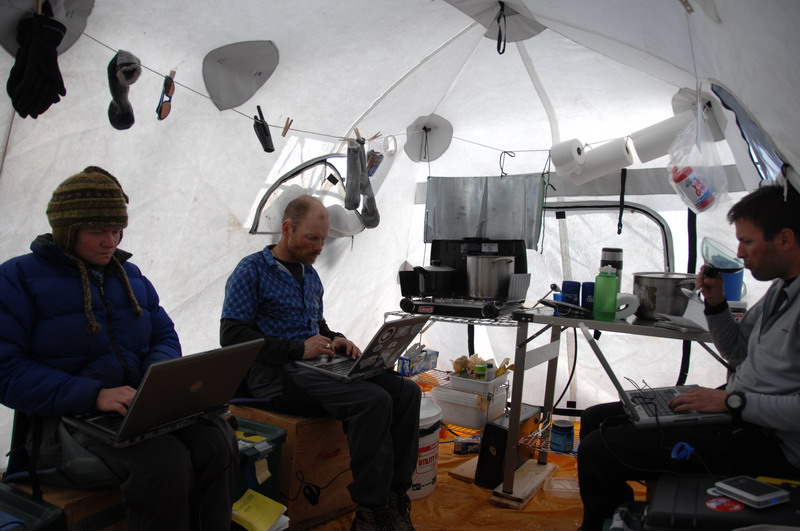
a bunch of the data. I was able to communicate with most of the weather
stations now that the repeater station was fixed. I still haven’t
looked at any of the data yet, but plan to do so today. I feel a lot better,
but figured it would best to try to get a full stomach of digested food
into my system before burning too many more calories. Everyone else is
now on their way to the terminus to measure our centerline transect. If
that gets completed today, the bulk of our most important work will be
completed. If we’re lucky enough to have another nice day tomorrow,
we’ll have finished all of our core mass balance and surveying tasks,
and have another week for other surveying, weather station maintenance,
and photo taking.
Wednesday, 23 May 07, McCall Glacier I spent the rest of that day in camp, and I was glad I did. My appetite returned around noon, and for the rest of the day I was able to eat as much as I liked without fear of tasting it again. Now I felt like I was part of the trip again.
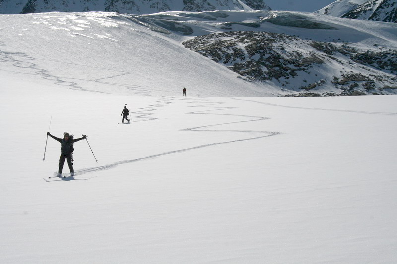
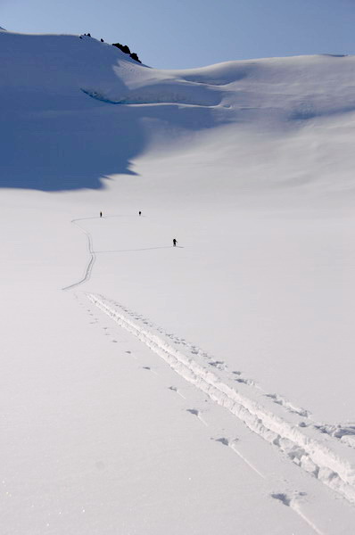
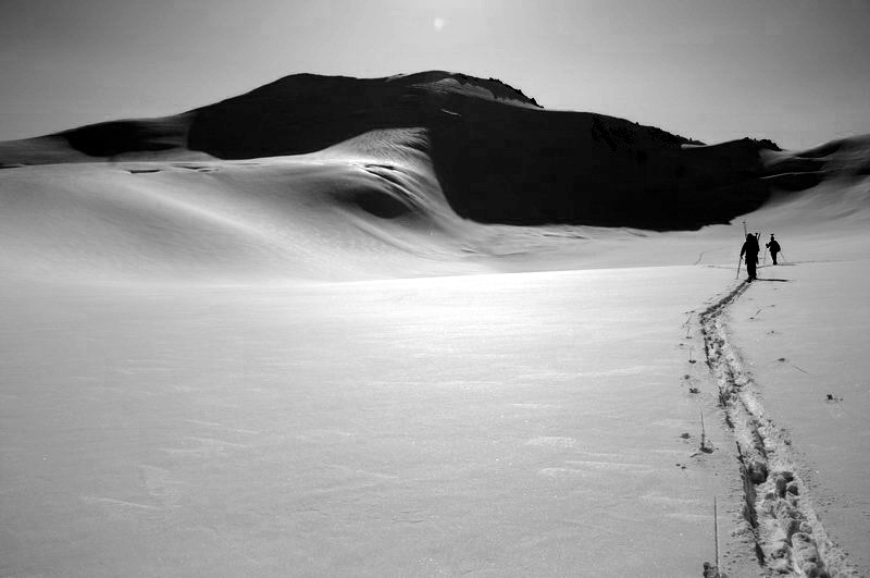
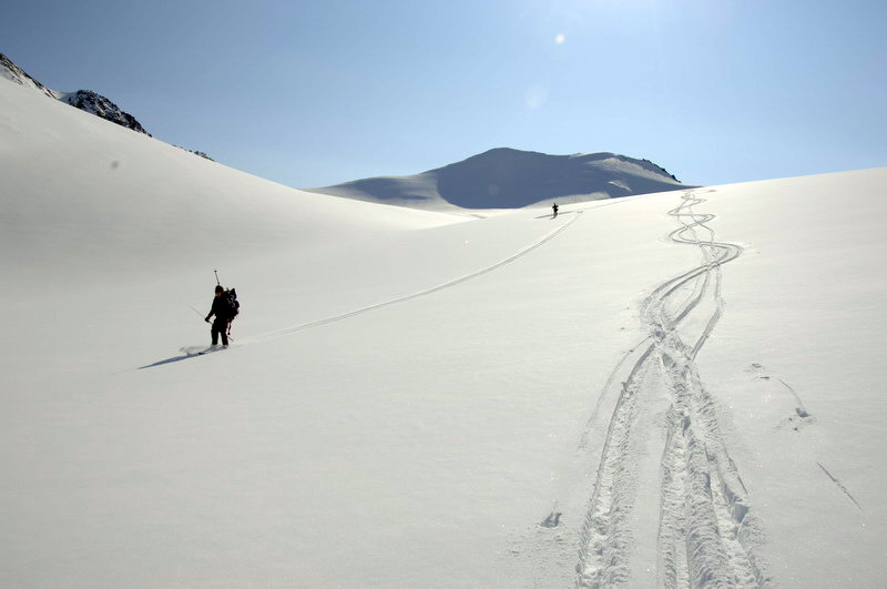
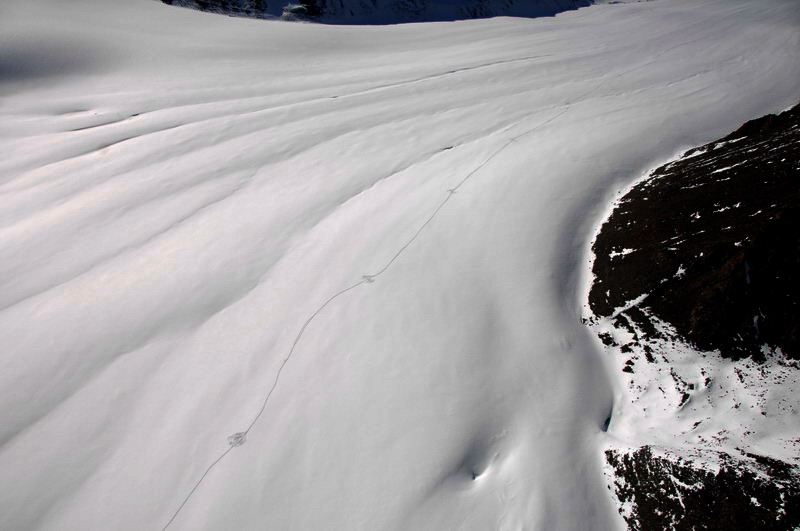
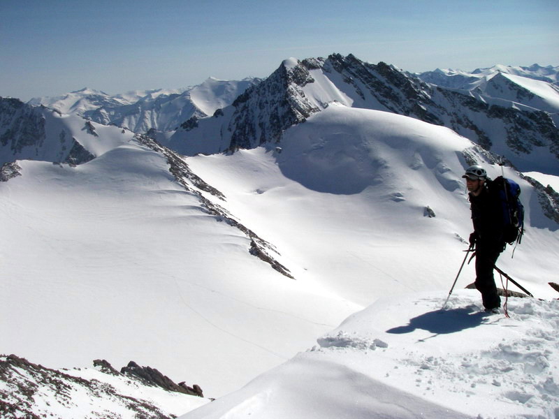
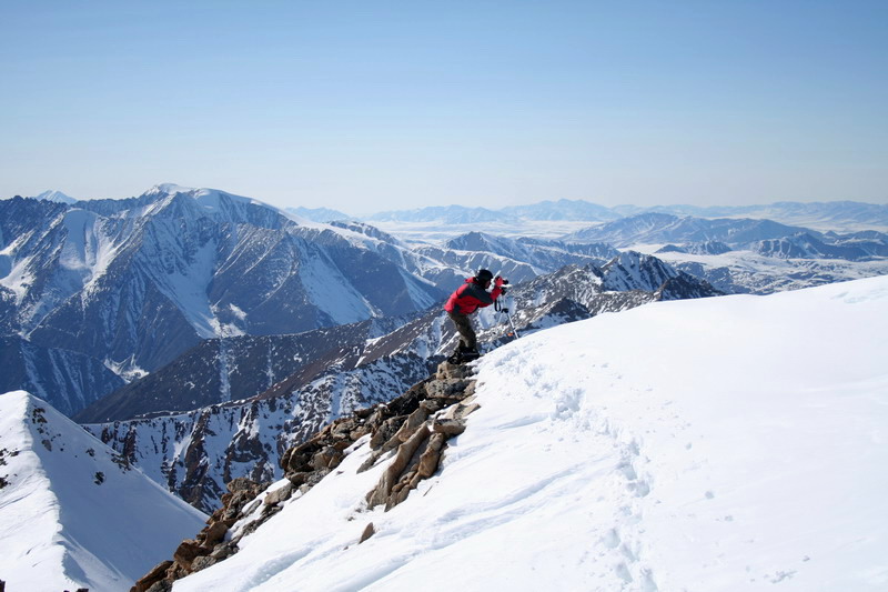
I had two main personal goals for this trip. First was to decide whether expeditions like these were something I wanted to continue doing if it meant being away from my family. This was the first trip that we actually planned to be apart since I went to Antarctica 5 years ago, and after which I decided I was not going to do that again. But with Turner the logistics have gotten more complicated and it seemed worth trying the experiment again. Second was to improve my photography skills and focus on finding and reoccupying a number of photo sites from the IGY trip. My thinking here was because this might be our last winter trip (if my latest proposal doesn’t get funded) that I would take the repeat photos now as backup even though its only 49 years, and that if we did return next year I would have these photos to use as a starting point for making better ones, in addition to knowing exactly where the sites are. So towards the latter goal, my main accomplishment of the day was finding one of Austin Post’s photo sites near camp. It was just below one of their survey locations, and on of the photos you can see a string used as a guy wire for the survey pole. The exact spot was a comfortable reclining position against the rocks below the pole, where he could prop up his elbows to keep the camera steady and shift the camera to created a panorama. Once I found this position, I took a few handheld shot to see how closely I could duplicate his, but then I set the tripod up trying to maintain that same position, so that I could bracket shots to increase the dynamic range of the final photo. A lot of changes have occurred in the past 50 years here. In the foreground, I noticed that a rockslide had occurred only a few feet away, as I could duplicate many of the rock positions in the old photos, but there were simply some new rocks that weren’t in the frame back then. In the middle distance, there was a large rockslide that was just making its way onto the glacier at that time; those same rocks are now on the ice just in front of camp. Across the glacier, the mountain we call snow dome had substantially more ice on it 50 years ago than it does now. It took several hours to create the photos, including a 360x180 panorama I made with my smaller camera. Also during the day I was able to fix up the weather station at camp with a new telemetry system and dig out some of my time lapse cameras to start deploying them. By the time the group returned from the glacier, I was feeling nearly 100% again and glad that I could join in for dinner. Slow going through the sticky snow limited the amount of work that could be done, but with the terminus finished, the remaining work was much closer to camp and easier to accomplish.
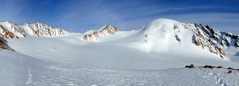
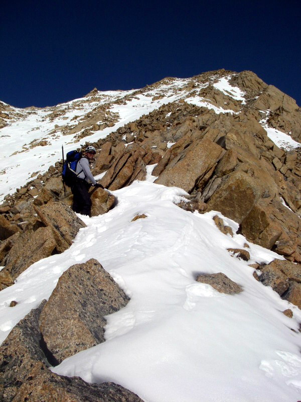
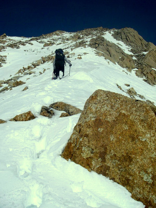
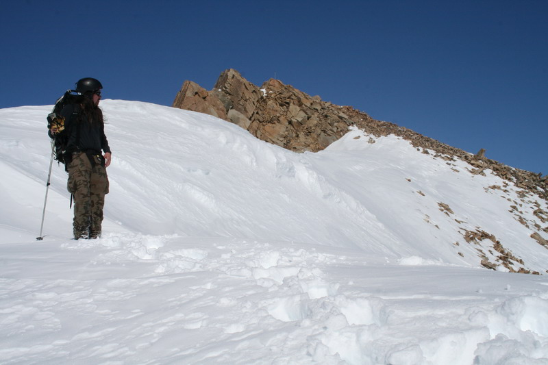
The next morning we once again woke up to cloudless, hot weather. It was getting to be a bit monotonous and annoying, as everyone was looking forward to a bad weather day to catch up on sleep after working hard for the past week. Jason and I decided to take advantage of the weather and climb Mt McVikar, where Austin created a panoramic photo in 1958. This peak is just behind camp, and is ultimately attached to the ridge where our upper weather station is. We began by skiing towards the upper cirque to get to some gullies which could take us straight to the top. There was little danger of avalanches here, as the snow was thin and well anchored to rock, but it was a little unclear which gully to take, though it looked like they all ended up as the same location. We began hiking up on the snow, Jason led the way doing all of the hard work, I just walked up behind in his steps. But soon it became icy and steeper, and harder to kick steps, and we switched to scrambling over the rocks. Unfortunately the rocks here were very large and often very loose, making the scrambling delicate work. Along the way I began remembering all of the reasons I gave up pretending to be a mountaineer and all of the scary experiences I had. This climbing wasn’t really that strenuous or exposed, but it still was not that fun, considering how easy it would be to end up underneath a large boulder. In any case, the rock scrambling went much more slowly than the snow climbing, but soon it was becoming clear that we were nearing the top. Unfortunately, once we were in sight of the survey pole that was still standing at the peak, it became clear that there was a steep, corniced snow gully in between us and the photo site. We deliberately did not bring a rope and related stuff because we did not want to do anything that would require that kind of protection. Not that it’s clear that a rope would have helped here, and I think we probably would have been fine crossing it, but I began thinking about Turner and Kristin and considering my priorities. I made the comment that I wished I was 20 years younger, to which Jason replied that’s probably the reason I’m 20 years older now. In any case neither of us wanted to risk crossing the slope, even though the photo spot was staring us in the face 50 meters away. Apparently the next gully over would have been a better choice for our ascent.
Regardless, it was a beautiful day and we had an outstanding view, so I chose another location for a panoramic photo that still made a nice pretty picture and captured the state of many of the glaciers nicely. Ultimately photos like these should really be done at the end of summer when snow is at its minimum, but Austin took many of his in spring 1958, so I thought it would be good to repeat them in the same snow conditions, but then also create a new baseline during summer for better repeating in the future. Once the photo work was done, we began our descent, which neither of us was looking forward to. We went back mostly the same way, though tried to avoid the largest and loosest rocks by staying on snow patches. Though I still wouldn’t consider it fun, it was not too bad, and I was glad to have Jason leading the way to find the best routes. While we were trying to keep from being pinned beneath rocks, Thomas and Erin went out to finish the surveying in the lower cirque and confluence areas, and we all arrived back at camp about the same time for a nice dinner and some data processing with desert.
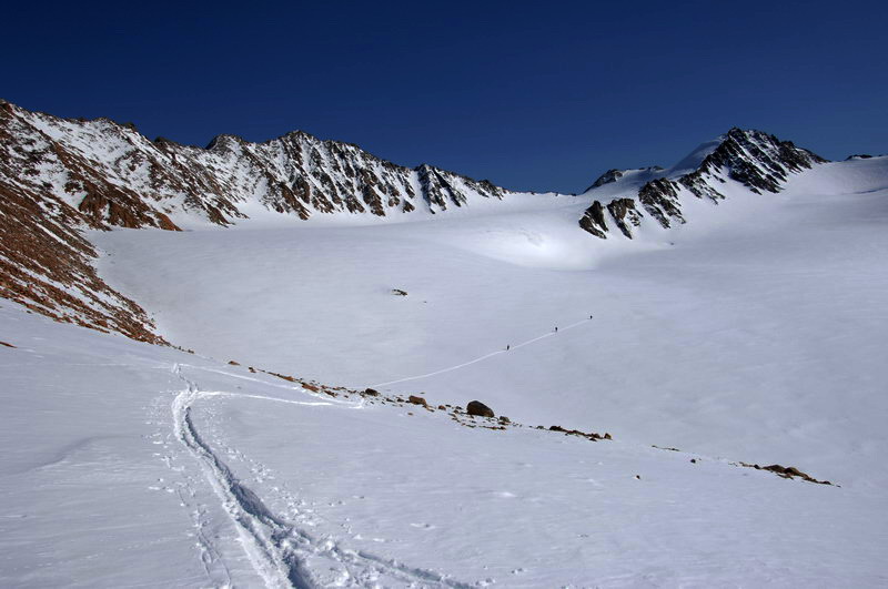
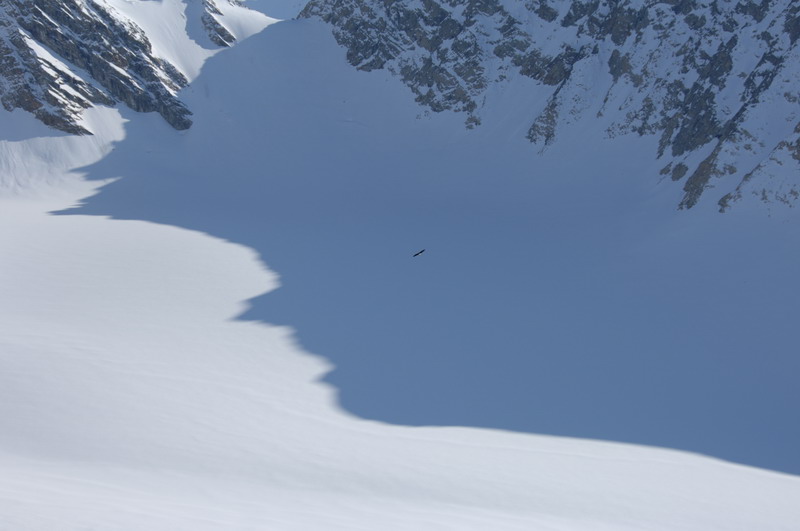
The next day was once again clear and blue, but by mid morning we saw our first clouds and by mid-afternoon actually saw a few snowflakes falling. On this day, Jason and I headed to the upper cirque to download some weather stations, dig a mass balance pit, and survey a few remaining poles. Thomas and Erin headed into the confluence area to begin another surveying project to reoccupy some old pole locations to measure surface elevation change there. Our work went pretty well, though slowly. I took another 360x180 panorama near the CORE station, which took some time. In the future I think I’m going to try one of these devices that automatically swivels the camera around, as that will both speed things up and hopefully make it much easier to do on snow or exposed ridges. The station downloading was tedious, but made more pleasant by use of a new computer I bought just for this, which is the size of a paperback book and easy to read in the sunshine. All of the stations were still functional, but one had stopped over the winter apparently due to a bad battery, which had cracked open but was now still working. By the time we dug the snow pit, the weather was looking marginal and it was getting close to dinner time, so we headed back to camp. I had a look at all of our weather data from this winter while waiting for the survey team to return, and learned that we arrived at just the right time for this trip, as the previous week had been quite cold. The snowfall that put a foot of snow on Kaktovik a few weeks ago had also apparently dumped 40 cm here across the eastern Brooks Range, ruining our repeat-photo opportunities but making it possible to ski from camp to the glacier. That was apparently the only big snow fall of the year here, and things would look much different if it had not happened.
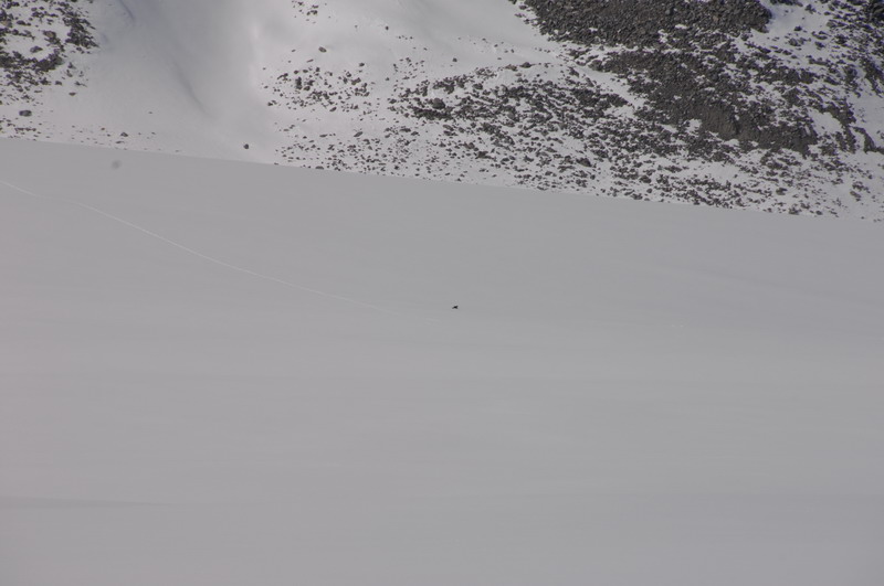
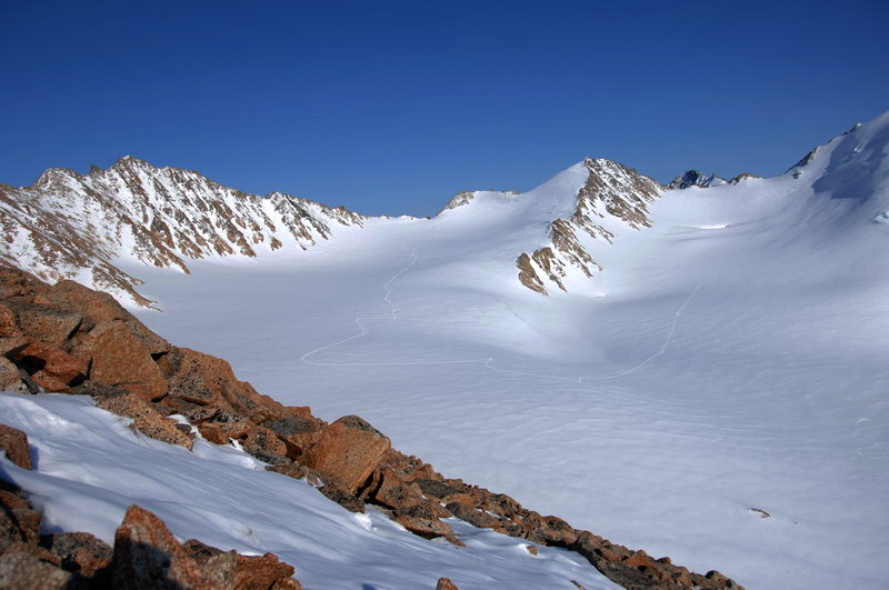
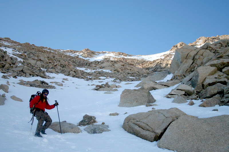
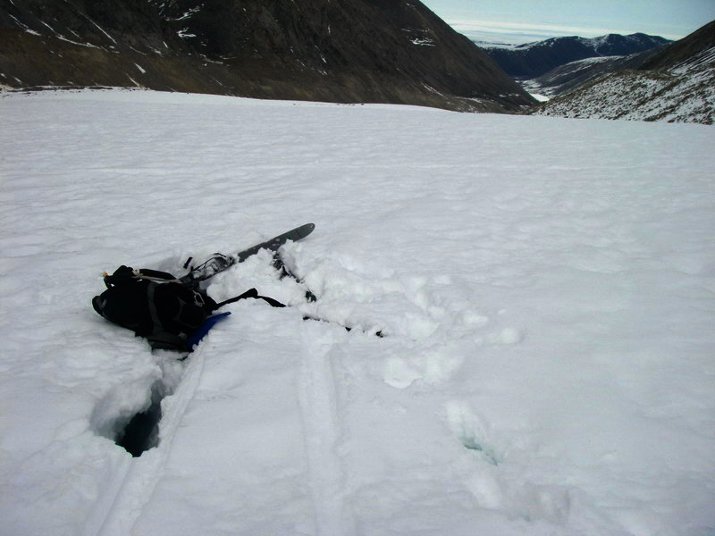
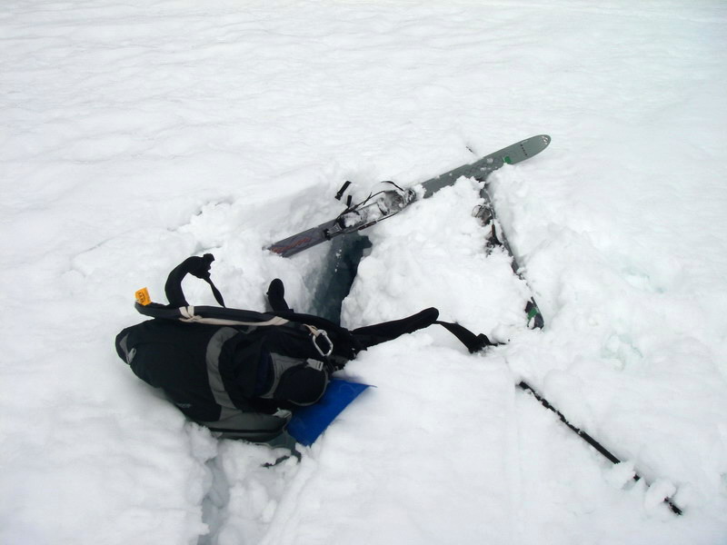
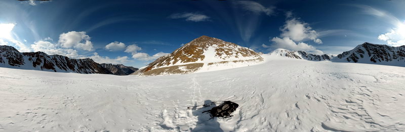
Yesterday we decided to head down to the terminus to do more volume change and DEM-creating surveying, as well as some weather station maintenance and repeat-photos. The snow was actually not too bad for skiing, and I spent a few hours dealing with an ornery station while the others surveyed. By the time I finished and had dug a snow pit for density measurement, they were all down the hill past me towards the terminus. As I skied towards them, I found a strange longitudinal crevasse that I had noticed many time before but never fallen into. It was only just wide enough to drop a ski into, but that was wide enough. I wasn’t going very fast, but the sudden stop and impact of my knee against the ice wall was enough to reconsider continuing on to the terminus. It had been windy all day there, but a small blizzard had also just started which would spoil any repeat photo attempts, so after extracting myself I decided to head back to camp while the other finished down below. Of course once I got going, the weather began improving, and as I got closer to camp it had become a nice day again, albeit still a bit gusty. So I took another 360x180 panorama just down from the confluence area. I hadn’t brought my tripod, but I did have my monopod-skipole onto which I mounted my Panosaurus 2D nodal slide and pivot, and I taped my other ski pole and shovel to this to create a rough-tripod. I had a small bubble level which I eyeballed to keep the whole thing more-or-less in place while taking the 100 or so photos that make the mosaic. I used the same technique in the upper cirque the day before, and it works fine, though slowly. It’s also a bit tough for clouds, which are either moving or not connected between frames, making stitching difficult. By the time I finished with this, I could see the others heading up behind me. Considering that I had a several hour head start on them and I didn’t want to be beaten back to camp, I hurried up the last big hill and got dinner started before they arrived.
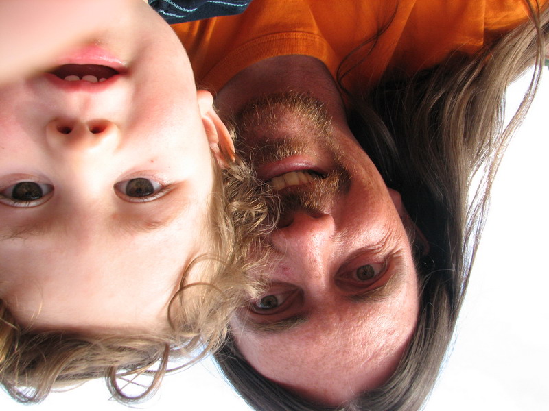
That night we decided that no matter how good the weather was the next day, we were taking the day off, and here I am still in my tent at 11AM. I’ve had a lot of time to think about things during this trip, partly because everyone else is so competent that I can just turn over most of the work to them without much concern. On the way down from Mt McVikar I realized that a future as a mountaineer-photographer is not in my cards. But I do enjoy panoramic photography and especially repeat-photography, but I would just as soon find others to do the ones that I don’t want to do myself. On the way back from the weather stations yesterday I realized that all of the little crevasses that are just annoying to us are actually quite dangerous for Turner, so we will have to take extra care not to let him wander on his own until he is old enough to evaluate these hazards on his own. And of course I’ve thought a lot about being here without Kristin or Turner. This would have been a great winter trip for Turner because its been so warm and nice, unlike the last one which was often fairly desperate. I’m glad I came out here, but I don’t think I want to make a habit of field work without them. I talk to them every night on the satellite phone and miss them very much. I think it must be especially difficult for Turner, who doesn’t really understand why I am away. While he likes picking up the phone or a banana or anything phone-shaped and saying ‘hello’, normally he doesn’t saying anything into the phone when someone’s talking on it. But he has talked to me, and told me about playing with Willow or watching a movie on TV, so I know he knows I’m still around somewhere, albeit perhaps shrunken inside the phone.
I’ve also thought a lot about how it is that we can all work together as a family, rather than let jobs keep us apart. I guess I don’t have any real answers, but I do feel like I’ve been letting myself get too distracted from the things I find most important. Every time I return from the field I feel like I have spent too much time previously inside behind a computer and that I need to focus on my own health and spending more time with my family, but within too short of a time I get sucked into deadlines and meetings and other stuff that just doesn’t seem as a satisfying. A big part of this problem is simply having too many projects to work on. It’s nice to have some diversity, but with each project under-funded and having its own set of deadlines and me having a tendency to commit to non-essential helpful tasks, it all gets a bit overwhelming and out of control. At the start of this project 5 years ago, I seriously considered just working on this project and thus only working part time. I probably should have.
This is the last year of our five year project. It seems hard to believe that so much time has gone by. This place now seems like a part of me, and I know many of its subtle nuances and quirks. I still haven’t spent nearly as much free time here as I would like, but I have had a chance to explore and this trip has been good for that too as I came in with the goal mostly of repeat photography and thinking about new photo spots for the future. I have a new proposal pending for another 3 years of work here, and I have received positive feedback on it thus far, but its far from certain as to funding. If it does get funded, spending a summer or two here will definitely be part of the plan, and of course with Kristin and Turner. Away from the distractions of civilization, I’m sure that I could get much of the backlog of data analyzed, especially with the glacier itself right here as inspiration. If all the proposals I have pending now all get funded, I will have way more work than I can possibly accomplish, which is more than I have already. If I had just been working on this project, I would have a stack of interesting papers published rather than a hard disk full of data that remains unchecked and in risk of being lost. What should I do if the next McCall proposal gets funded? Should I turn down some of the other funded work? With this being the middle of IPY, I feel I should take advantage of that to complete as many arctic field projects as possible now. But perhaps that’s just another excuse to stay overcommitted? For sure I should not take on any new projects outside of the Arctic, and I should not put on so many meetings. This past year I either organized or convened a session for six meetings, plus made presentations in at least 7 more. That’s got to slow down substantially this year, if not end completely. Friday, 25 May 2007,McCall
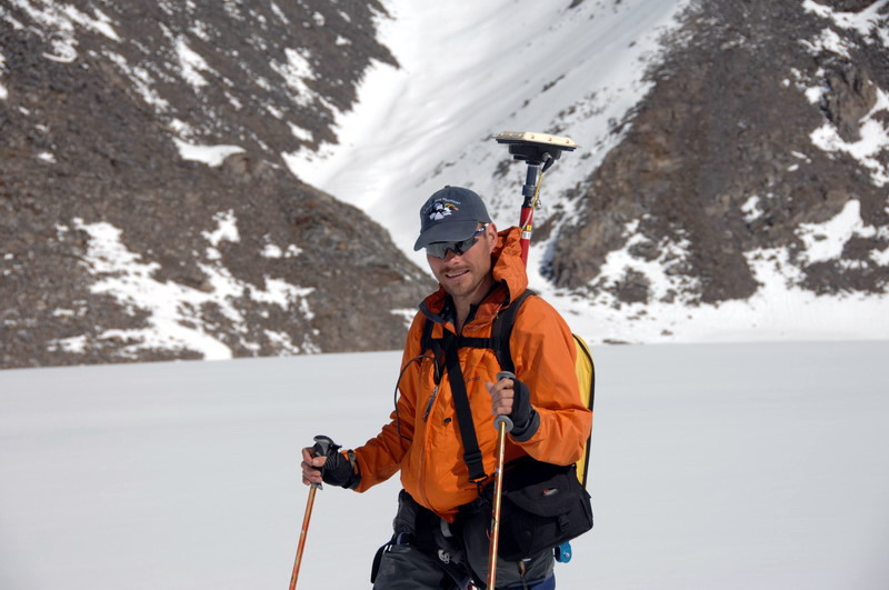
Glacier I talk with Kristin and Turner almost every night. As nice as it is here, I realize that it’s not worth being apart. Saturday, 26 May 2007, McCall Glacier Our work on this glacier is done, now we’re ready to quickly survey a few more and head home. Our main tasks for the next day was to fix up a weather station in the upper cirque and finish some more surveying there. On my first visit to the upper cirque a few days earlier I noticed that the battery powering the main weather station there had cracked over the winter, probably due to freezing when it was low on power. The acid that makes batteries work gradually changes to water when it gets discharged, making it susceptible to freezing at low temperatures; fortunately the acid in these gel-cells doesn’t leak when the case cracks. It’s still not really clear to me why some freeze while others don’t, but in any case this one needed to be replaced before we left. Luckily we had removed a few batteries from a GPS station lower down on the glacier and brought them to camp using the helicopter during our put in. We removed one these from our camp power system to bring to the damaged station. Unfortunately, this station is higher in elevation than our camp, so the battery had to be dragged uphill in a sled. Jason took on this task, while Erin and Thomas surveyed and I brought up the rear. It began as a reasonably nice day, and I had hopes of climbing Mt Suki to repeat a panorama that Austin took 50 years earlier. By the time we switched over the battery, the weather had changed into clouds and a bit of snow. While the others surveyed, I found another old photo site closer to the glacier, one of John Sater surveying from the rock margins. The picture itself was taken from a small tributary glacier which had since retreated substantially, leaving a lot of loose rock where once was ice. So I could not duplicate the perspective exactly, but the survey location was located on stable rock and I was able to take a nice panorama from there. I decided that two sets of long-term photo sites where needed here – one on the peaks which Austin used, and one lower down where access was easier. I also decided that I needed one of those gizmos that robotically swings the camera around to take complete 360x180 panoramas, as trying to do this manually on tiny outcrops barely big enough for a tripod is both tricky and time-consuming. The time consuming part is more than just a pain, a major problem is that the clouds move too quickly to capture in the same location, which is a problem not only for making a pretty picture of the sky but also a problem for the varying shadows they cast on the glacier surface. Being able to press a button then hide behind a rock for a minute while all of the pictures are taken is a much better solution. It ended up a comfortably short day, and we were back in camp by 4PM and able to process our data before dinner and have a relaxing evening watching a movie. It would be nice to have enough time during our field campaigns to have more days like this. At this point we were down to just a few remaining tasks, and looking forward to seeing the helicopter to finish our work and head home.
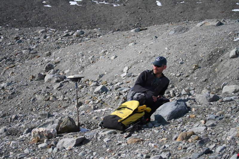
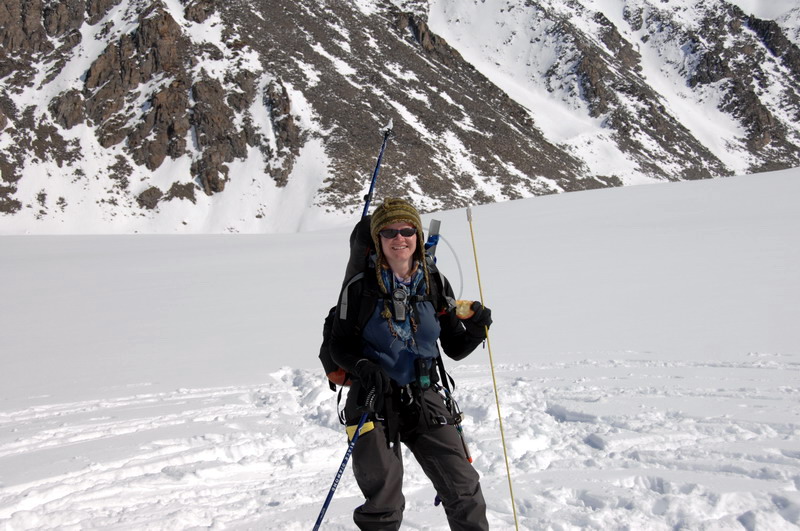
The next day the weather was again warm, though clouds circled around us with the occasional flurry. The light in the morning quite nicely lit up the mountains circling us, and I spent some time taking pictures as it briefly lit up a peak surrounded by backlit clouds. The others headed into the lower cirque to finish some surveying there. Our goal was to gather enough surface elevation points on the glacier to create our own map, should my latest proposal not get funded. Having a decent base map of elevations is critical to a number of scientific analyses we’d like to do here, and without one we are severely hampered in our ability to understand or predict change. Jason and Thomas both wore the uncomfortable yellow GPS backpacks while Erin followed along making snow depth measurements and taking naps in the sun. By the time they returned, most were down to the minimum level of clothing required for modesty in unseasonably hot weather. I stayed behind at camp and fixed up the weather station there and deployed some time lapse cameras to watch snow melt through summer and give us a better understanding of our weather station data. It was another ‘early’ day with nearly all of our work here completed, with dinner at dinner time, and ‘Being Caribou’ as the movie, where a couple spent the summer of 2003 tagging along with the caribou migration that passes by the foothills of the mountains we work in. I think we were all glad to be glaciologists, where Being Glaciers would entail a much more relaxed summer hike, trying to keep up with a glacier moving at about 3 cm per day.
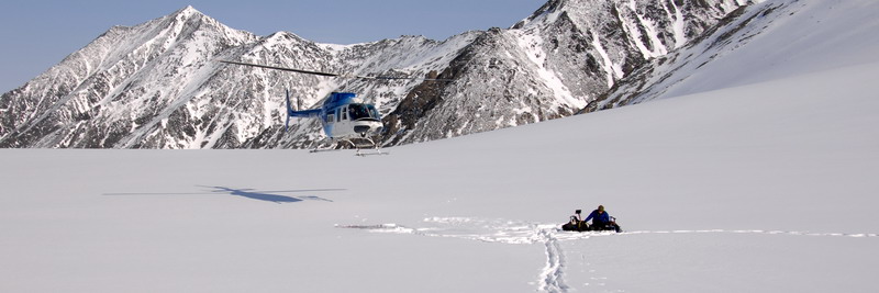
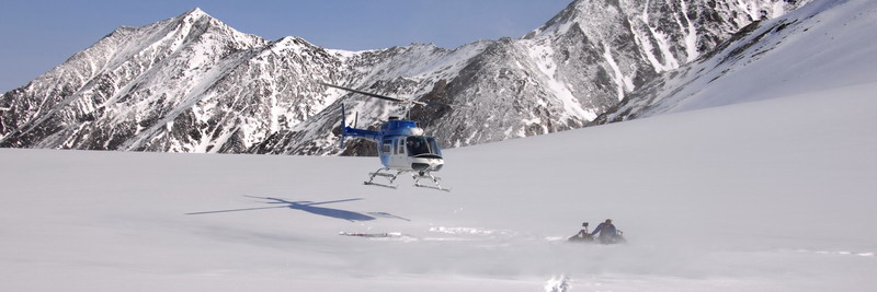
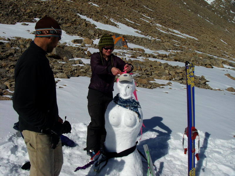
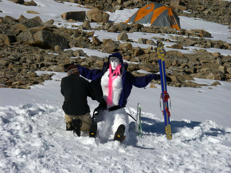
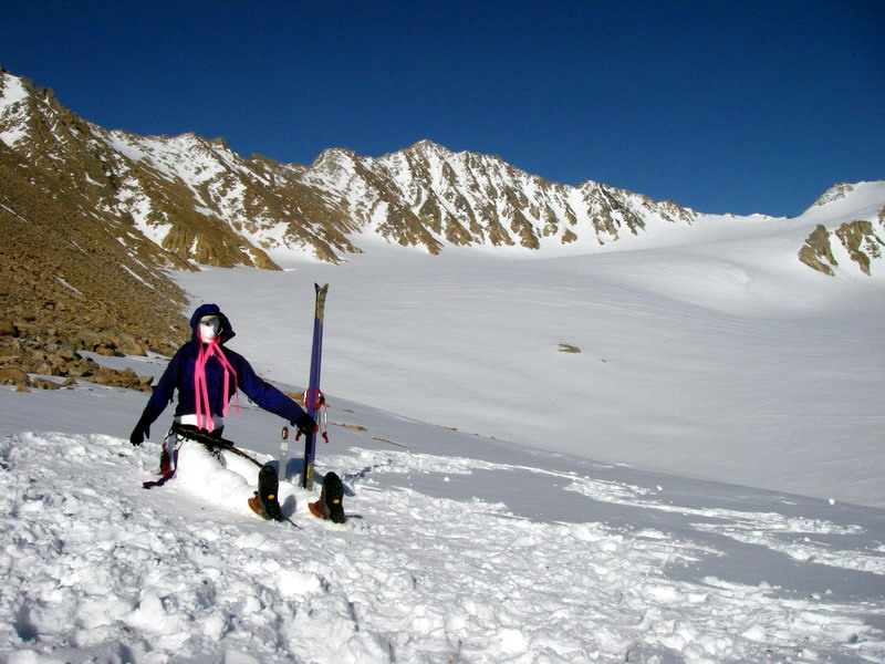
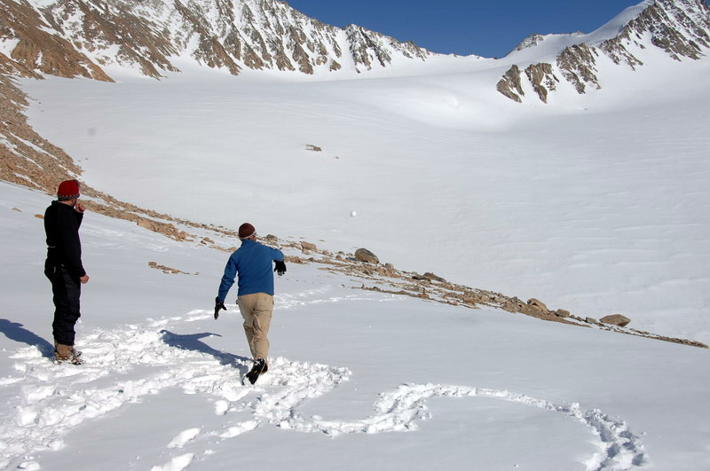
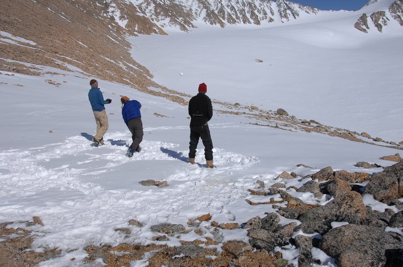
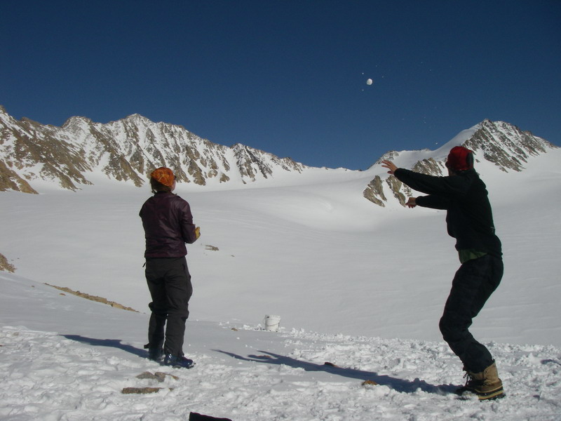
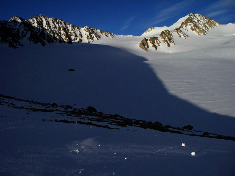
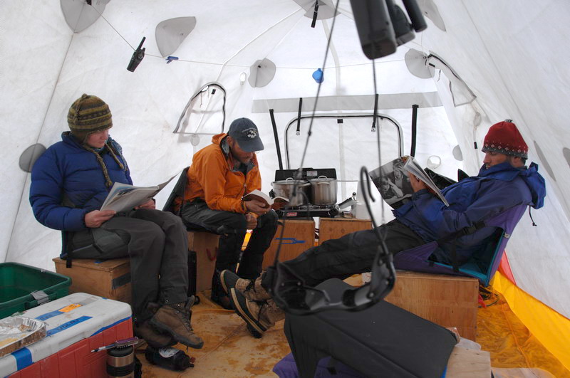
This morning we checked in with Toolik Field Station to see how our helicopter was doing and when it might get here. Apparently the weather on the coast was not so good in the morning, so they were a little behind schedule, so we had some time on our hands. Erin and I spent the morning getting the cache in order and inventorying food and supplies, while Thomas and Jason headed to the upper cirque to dig one last snow pit to measure densities. It began as another nice sunny morning, but by lunch time the clouds had settled in and flurries were regular. Nevertheless it was a still a nice day and we cleaned up the cache and got a bunch of no-longer-needed stuff ready to send out. We checked in with Toolik in the evening and spoke with the helicopter pilot, who was eager to try to get in tomorrow morning. Coastal weather being what it is, there’s a good chance we wont see her until after noon, making it difficult to get a full day’s work in on the other glaciers of interest. We hope to survey one more large glacier in the area, as well as repeat some old photos in the area provided both the weather is good and much of the snow has melted. At camp we have lost a lot of snow over past week, though I still haven’t been able to find the tent spot I usually use. Because the snow was so deep, we set my tent up on top of the snow somewhere near the spot, but as the snow melts underneath it a number of large rocks have emerged, causing me to sleep at an interesting angle. Depending on how things go tomorrow, we may try to all head back to Kaktovik, and return for a day trip for the other surveying, so hopefully I’ll be able to sleep straight before too long. Wednesday, 13 June 07, Fairbanks We spent the next two days waiting for the helicopter to show up. Much of the time it was great weather on the glacier, so we had fun with various forms of snowball Olympics, snow sculptures and time-lapse photography, but it also snowed on us a bit too. The Hubley fog crept back and forth throughout the days, but never reached camp. Of course not really knowing what was happening in Kaktovik between our phones in the morning and evening, we could never stray to far from camp in case the helicopter did arrive, so we were in a mode of hurry up and wait. Predictably, as the days wore on, the group grew less enthusiastic about decathalons, naps became longer, and hikes a bit more random. By the third day, our weather had deteriorated, but was still comfortable. Given that the main tent was now completely dry, I decided to break it down before it got wet again, meaning that we now had no place to hang out comfortably as a group. We set up my little megamid tent as a sad replacement, and just generally milled about with increasingly bad cases of get-home-itis. I knew that Krisin was flying to the North Slope today as a captain, so I was particularly eager to get back to civilization. Fortunately, at just about the time we had set up a new kitchen on the rocks, I heard the buzz of helicopter rotors. At first no one believed me since we had been imagining hearing such noise incessantly for the past three days, but soon enough a helicopter was sitting in our camp.
Plenty of time for watching snow melt too -- 5 MB
At this point it was about 3PM, too late to start more surveying on other glaciers but just enough time to catch the plane in Kaktovik. So I got on and left the others behind. Typically when Kristin is with me, we’re the last to leave, since if we get stuck for a few more days it’s not like we’re stuck apart. Plus I figured that if I could catch the plane tonight, I could always come back up again in the morning, and if I missed the plane tonight I would probably be the most useful of the group to have in Kaktovik, if for nothing else than to keep the helicopter crew motivated. But mostly I wanted to see Kristin. Arriving back in Kaktovik, I met up with Art, Merlin and Walt again, and given some delays with the plane, I had enough time to get a shower. I had really wanted to spend some time there to check out Art’s movie and the footage he shot last August on the glacier, but again I figured I could always come back for that. By the time the plane was about to land, the helicopter had returned with Jason and another load of gear. Turns out that I could have taken a longer shower considering it took the plane nearly 45 minutes to land, as their GPS was having issues and it was required for landing in the marginal weather we had. But soon enough I was on my way back to Fairbanks.
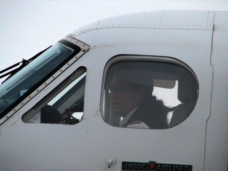
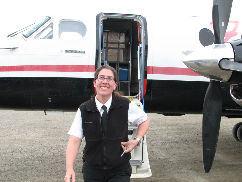
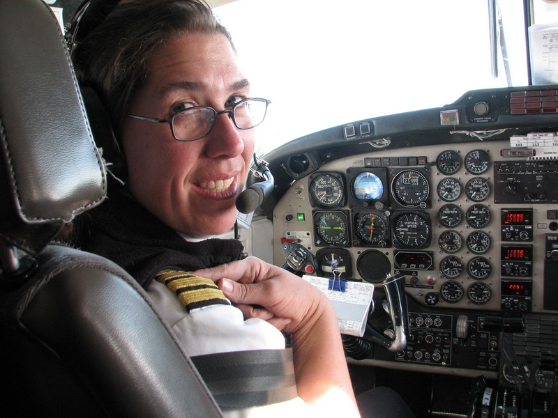
It was nice riding home with Kristin flying the plane. I sat in the seat behind her and wore headphones, so I could keep up with the cockpit conversation. We were able to briefly talk with the remaining glacier crew as we flew past, and it seemed that the clouds had descended further and prevented the helicopter from reaching them as yet. We also discussed the airplane's GPS problems a bit and read through the manual. But of course the nicest part of the flight was the landing in Fairbanks, allowing us to head over to Shawna’s and pick up Turner, who had been there now for nearly 14 hours. I was amazed to see how much bigger he looked and of course greatly relieved that he still recognized me and wanted to hug me. For the rest of the week, any time either of us left the room, he would chase us and make sure that we were coming right back, and whenever someone would stop to talk to him, he would be sure introduce them to his mama and papa. I was glad to be home.
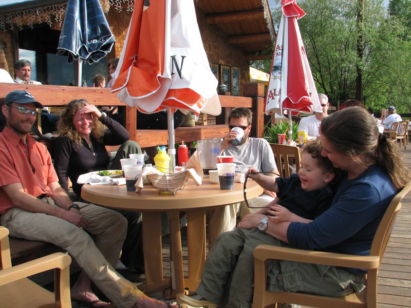
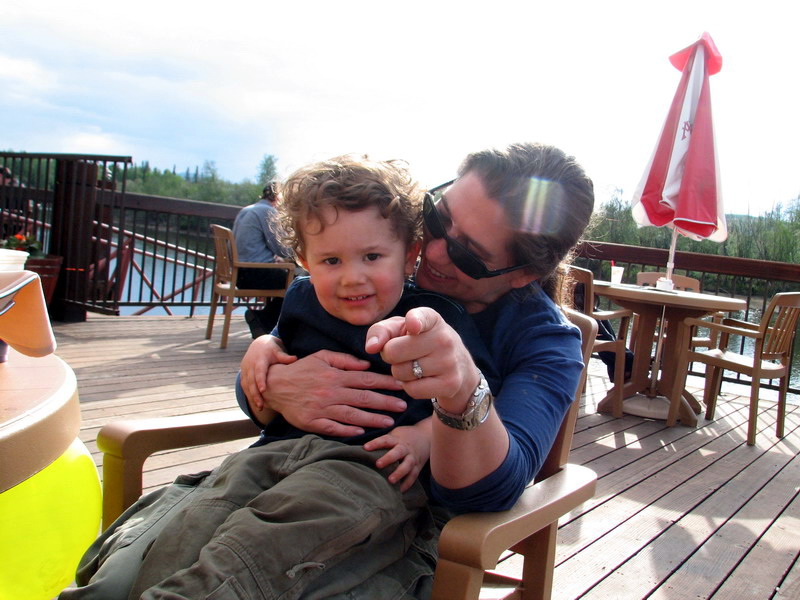
I tried coming back up to Kaktovik the next morning, but when I got to the airport, they said the return flight was full, and I thought it best not to risk going as there was the chance that I would get stuck there and while everyone else made it back to Fairbanks. Erin and Thomas spent that night on the glacier, and after a few more tries in the morning were able to make it out in time for the flight to Fairbanks. As it turns out, there were still a few empty seats on the way back so I would have made it, but I think it was the right move as we could better help with cargo and luggage. So, after just about two weeks, we were all back in Fairbanks and spent a few hours enjoying the sunshine and shades of forest green on the deck of Pikes.
It took more than a week after we returned to finish up this story, as I had to leave for California a day or two later to co-convene the 5th International Symposium of Digital Earth (www.isde5.org). I was a little worried about how it would go and who would show up – often satellite-related meeting are really stuffy and boring, with everyone wearing suits and looking like they just spent 10 years trying to get a satellite launched and failed. Fortunately this meeting was not like that, and I had the opportunity to meet a lot of neat people and have many interesting discussions. It was quite a juxtaposition to travel from the glacier to San Francisco, but I’m glad I went. Of course Kristin and Turner came with me, and I think at that point just about anywhere we went would have been fine as well. I think the others at the meeting enjoyed Turner’s company too, and by the last day he was invited on stage during the last plenary session (while I was moderating), where he enjoyed the attention and babbling into the microphone when no one was using it. In any case, we’re all back at home now and starting to unpack from both trips. Other work has already started to pull me in other directions, as I had already been roped into giving a few talks on campus yesterday and spent the day before going through about 500 emails, but this time I’m committed to trying to not letting all of my time get sucked away by all of the deadlines and pressures that seem to find me. It so refreshing to spend a few weeks doing something completely different with a single-minded focus. Most people might call that a vacation, but I think I’m just as happy working, as long as it’s just on one thing at a time and as long as its within a short hike of my family. So I guess that answers one of my questions for the trip. In terms of photography, I'm pretty happy with the results. I learned a lot, made a lot of mistakes, have plenty of photos to process and play with this summer before returning, and have a good idea about what equipment I still need to buy. So the trip was a great success in those terms, and scientifically we achieved our main goals and more, we had great weather, and I had the chance to work with a great group of people, so I'm glad to have been a part of it.
|
(c) 2003 Matt Nolan. If you find any broken links or other errors, please let me know. Thanks.