Dr. Matt Nolan
455
Duckering Bldg.
Water
and Environmental Research Center
Institute of Northern Engineering
University of Alaska Fairbanks
matt.nolan@uaf.edu
|
|
Dr. Matt Nolan 455
Duckering Bldg. |
|
|
Friday, 26 May 06,
McCall Glacier
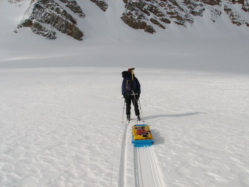
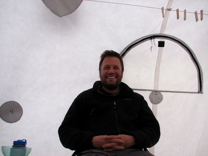
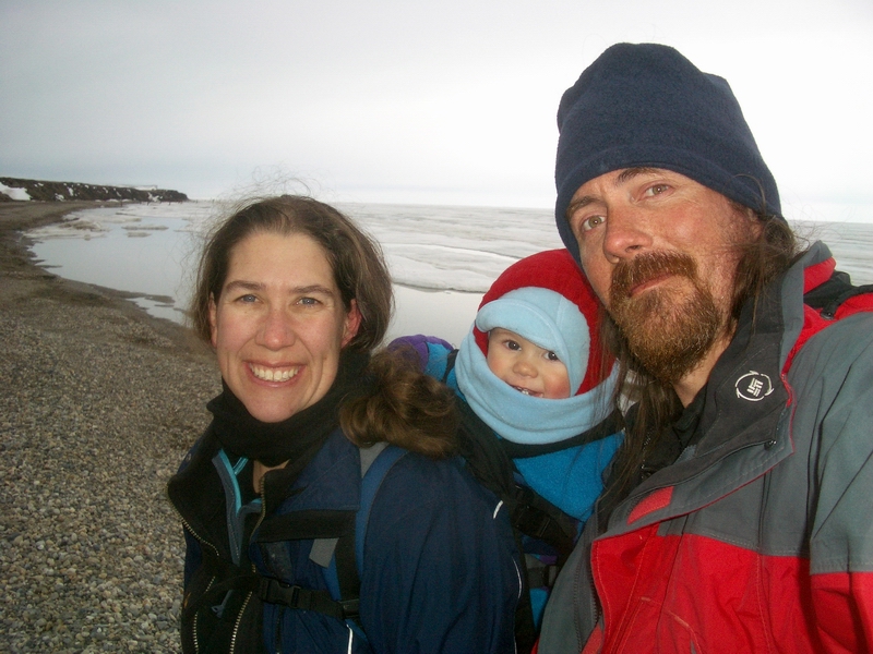
Here I am on McCall Glacier once again, in the tent site that I’ve used for the past 4 years, this time by myself. I think that I used to travel because I had nothing better to do, and then after a while I because didn’t know any better. Now I could take it or leave it, because I have something better to do and know what that is.
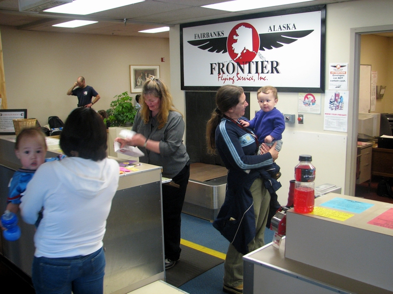
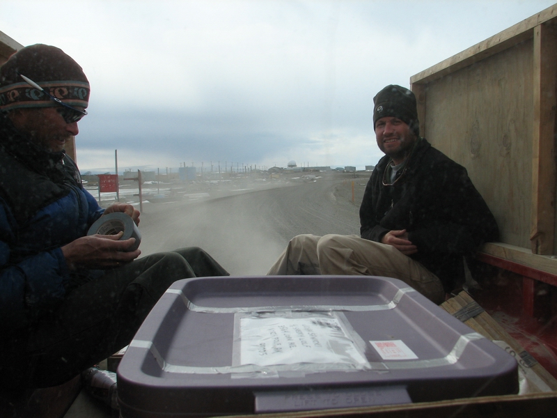
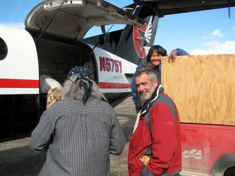
Five of us arrived in Kaktovik yesterday. The previous few weeks were the normal experience of frantic purchasing, testing and packing of equipment, buying, cooking and packing food, and keeping our fingers crossed that it would all arrive at the same time we did. This year I discovered that we could send our cargo through the Post Office faster and cheaper than by regular freight, and that this works reliably and well. Also new this year, we didn’t show up to the counter with 800 pounds of gear, as most of it was already delivered and we took our checked baggage to the hangar the night before. Once we arrived in Kaktovik, we met up with Walt, Merlyn, Ed, LuAnn, and Art. We didn’t have a lot of time to chat, though we wished that we could, as the helicopter was already there and we were anxious to take advantage of the reasonably good weather.
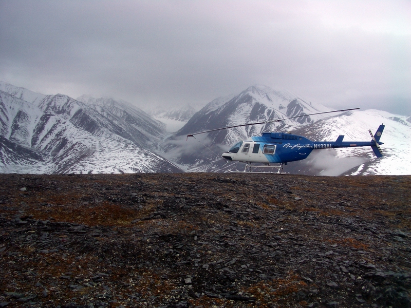
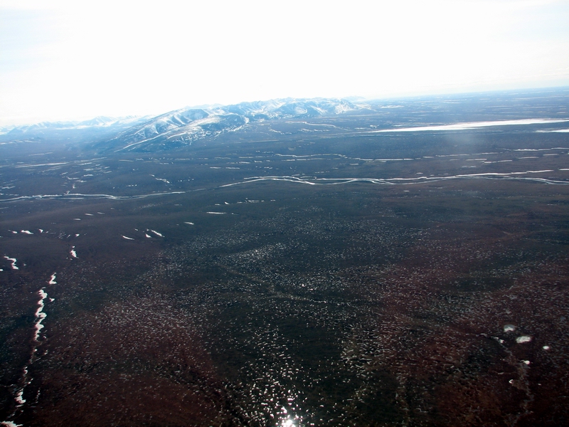
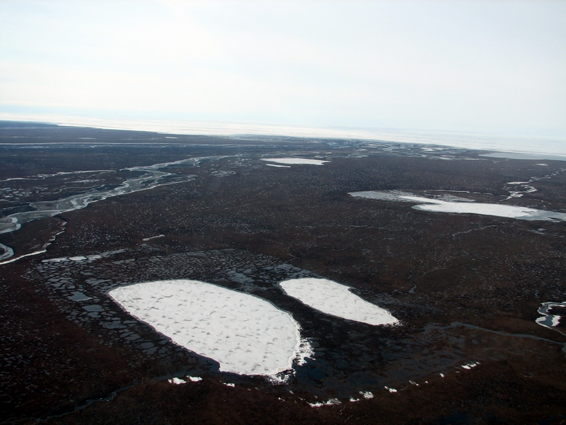
On our flight into Barter Island, most of the State looked clear, except for the mountains that we were trying to get to. But once we flew past them, we could see under the clouds that the mountains were largely still visible, so we were optimistic. After a brief visit to Waldo’s to say hello and pick up our stash of previously-arrived gear, we sorted it all into piles on the runway based on priority. As the pilot Brian had never landed here before, we gave his little 206L a light load, including Thomas and I. Then we said our sad goodbyes and headed off over the tundra towards the mountains beyond.
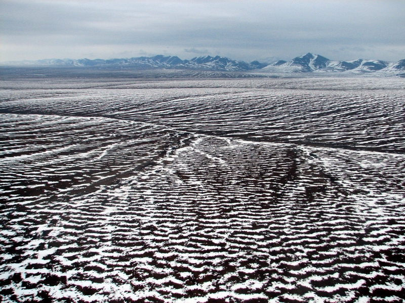
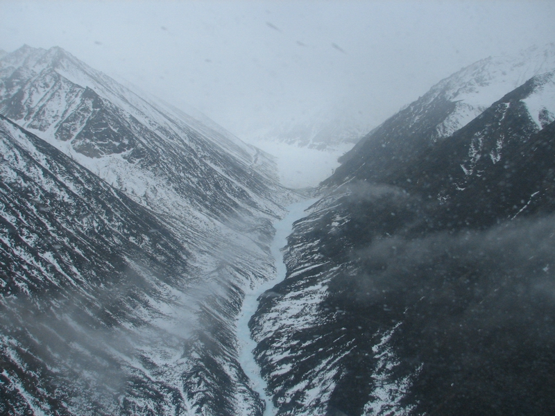
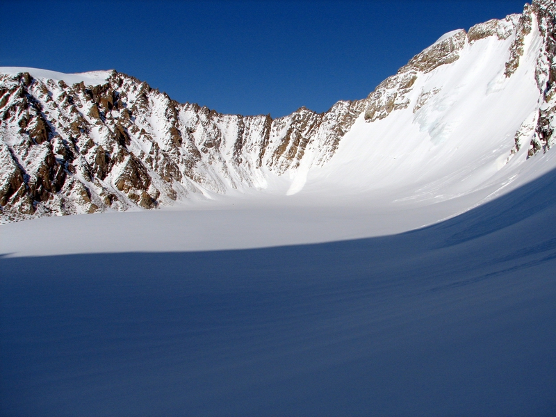
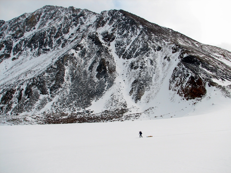
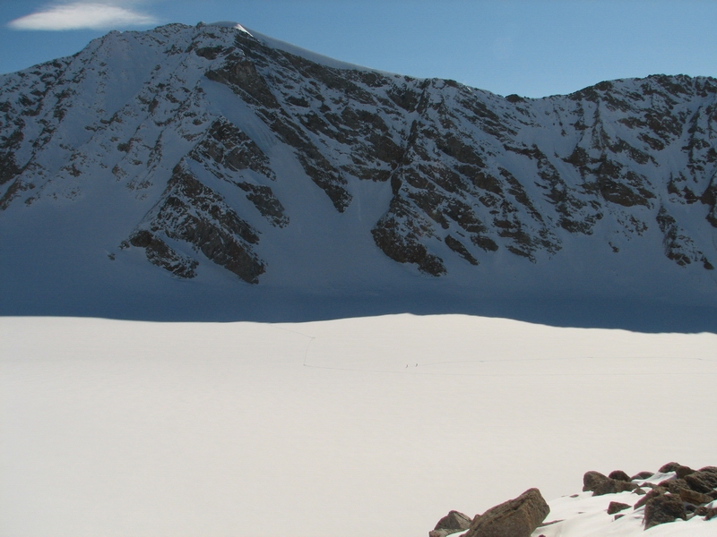
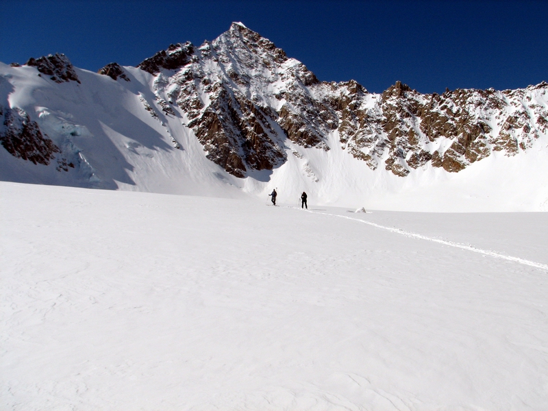
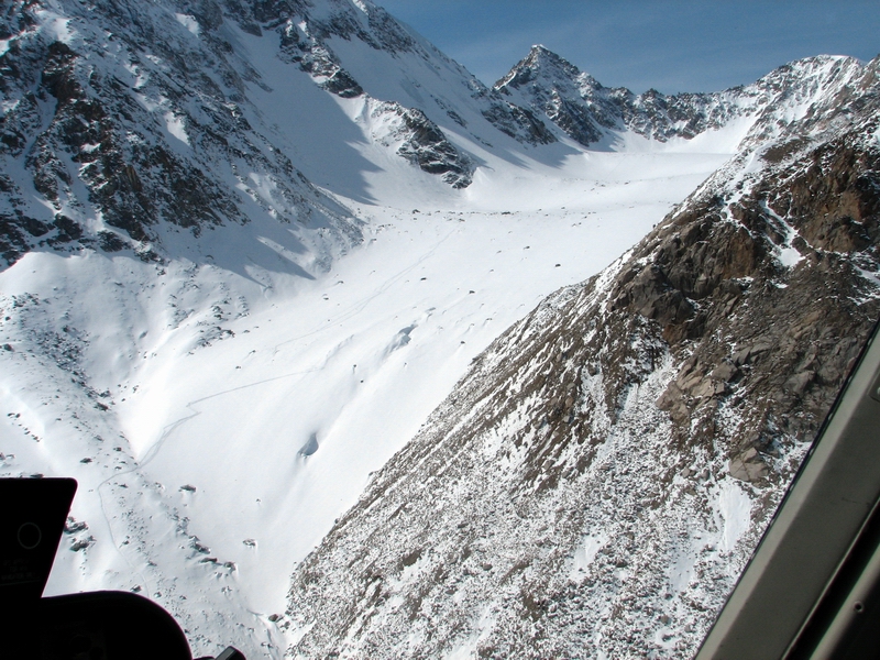
Our trip this spring was about a week later than normal. Last May, the tundra was covered with snow when we flew over, but now the snow was largely gone. It’s not clear to me why, but the locals all believe that this was an exceptionally warm spring. In any case, the continuous snow pack had given way to last remaining tendrils of wind drift remaining over the brownish green vegetation. The sky was still clear all around us, and even over most of the mountains that we could see, except for the few that we wanted to visit. As we approached Krisscott Glacier, we could see clouds within the valleys beneath the overcast. We took the long way around, through the old moraines of the last ice ages and up the McCall Glacier valley. The clouds we saw from a distance mostly clung to the valley walls, so that we had a clear view of the glacier once we turned the corner. It looked sad, framed by overcast and light snow -- a glacier that once proudly stood in sight of the Arctic Ocean, now slowly wasting away within a tiny valley that few ever see, barely distinguishable from its surroundings in the bleak weather.
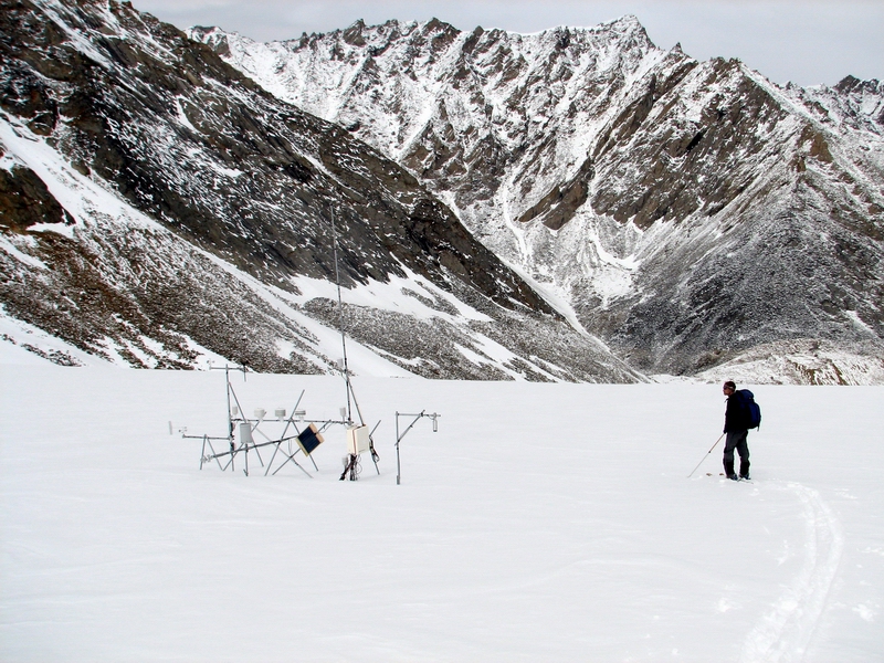
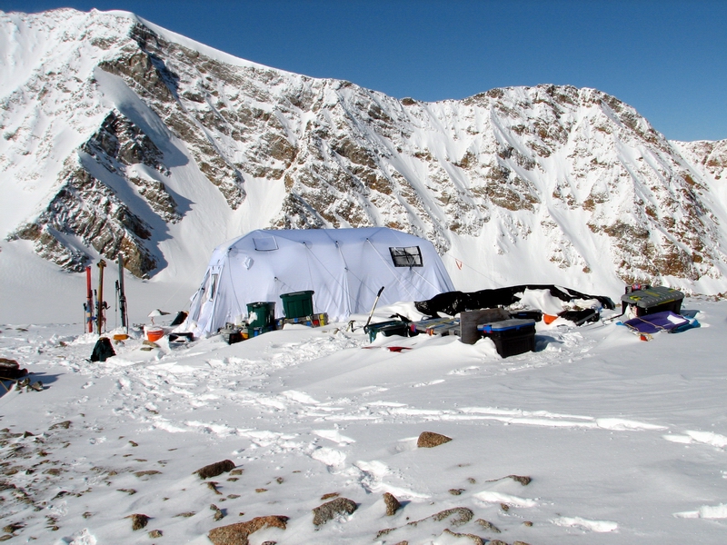
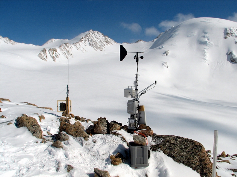
As we flew over the ice, I saw many of our poles and weather stations, and the obnoxiously turquoise walls of the Hut, wracked by decades of neglect on top of the ice-cored moraine that represents the peak of glaciation for the past 10,000 years. This was as far as we got, nearly in sight of our camp, as the rain turned to freezing rain and snow at about 6500’, and the landscape began blending into the clouds. We turned around, and decided to eat some lunch on Jaeger Pass, where we could watch the glacier work to shrug off its unwanted cloudy blanket and bask in the sunshine that ultimately leads to its demise.
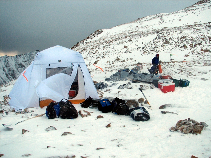
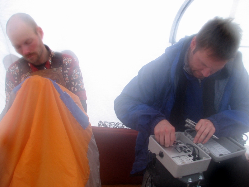
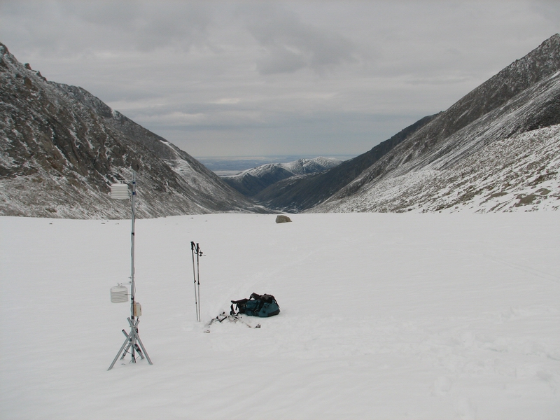
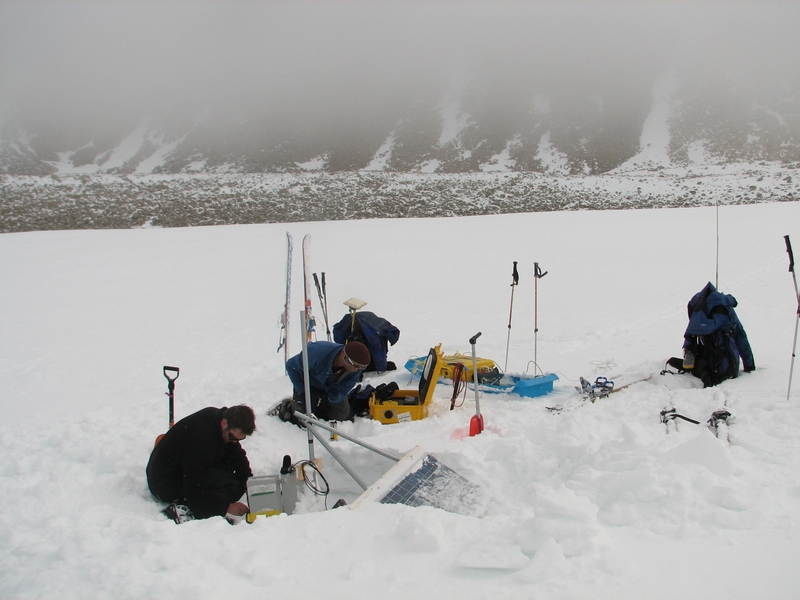
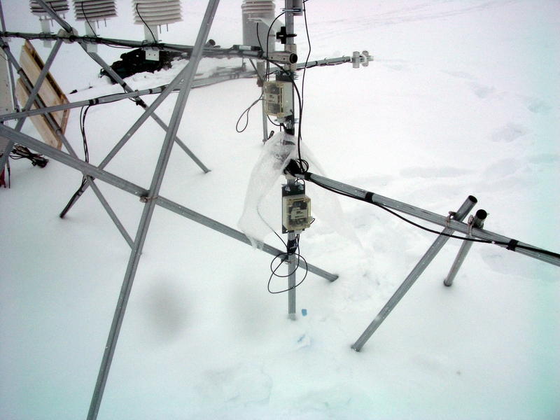
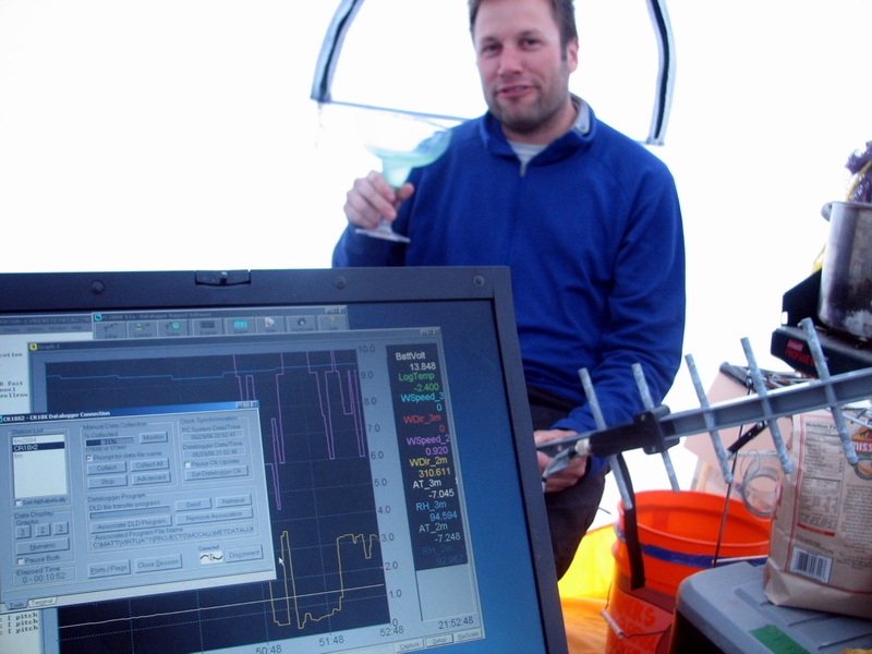
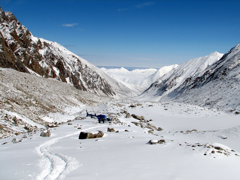
Before leaving Waldo’s, we had a look at the data from the local weather stations on the glacier. We hadn’t been able to do that since October, since our antenna on the roof of the local school had been removed during a remodeling project that involved removing the roof. Ken had come up the day before us to remount the antenna with Ed and re-established our telemetry. Amazingly they were able to do that in a day, and it seemed like all the stations were still up and running. Our off-glacier station was reporting wind speeds of 40 mph and higher, which was a little intimidating and one reason we went in a little light. But the weather at this station is often quite different than down lower on the glacier, so we figured the best option was to go and check it out ourselves. We hiked around a bit on the pass, watching the clouds blow around, and wondering how the rest of the day would turn out. After an hour or so, it seemed noticeably brighter on the upper glacier and we could see a few new peaks emerged beneath the deck. We decided to go have a look, and if we couldn’t get in then we would return to town and make a new plan from there. The terminus smiled as we flew past, and soon we were circling our camp site and deciding on an approach. The winds blew strongly and consistently from the west, which is something I found unusual. But it seemed steady and within a few minutes we were on the ground after our first approach. We shut down, unloaded, zipped up our coats, and watched the helicopter fly off down the valley. See you in an hour or two... -- 5MB The wind was strong. The snow lifted off the ground and pelted us like a sand blaster. We only had the large, new cook tent with us, so we began setting that up despite the somewhat desperate conditions for tent erections. Neither of us had set up this type of tent before, and because it was so large it caught a lot of wind and wanted to visit other regions of the glacier. We held on tight and swore a lot, and eventually had it together enough to weigh it down and tie it to some rocks. There were a number of things that could have been designed better with it, but after a while we felt reasonably comfortable that it was going to stick around. I gave Brian a call on the satellite phone, and he decided that he would wait again at the pass until the weather improved on his next trip in, as our visibility had decreased and the snow was getting thicker. But after a while he made it in, and we decided that he should keep flying as long as he could that night since there were no guarantees that tomorrow’s weather would be any better. It turned out that two more flights were needed, even though the helicopter could have carried a bit more, but there was no sense pushing our luck as the weather was marginal at best. So by about 10PM, Thomas, Jason and I were at camp with all of our stuff.
Keeping it from blowing away -- 6MB Especially when the helicopter takes off -- 28MB At this point, we still only had the large cook tent set up, but we figured that the three of us together could set up the outhouse tent and sleeping tents without losing any. By about 2AM we had a reasonably we established camp, and went off to bed for some well deserved sleep.
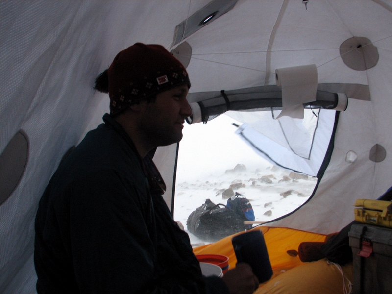
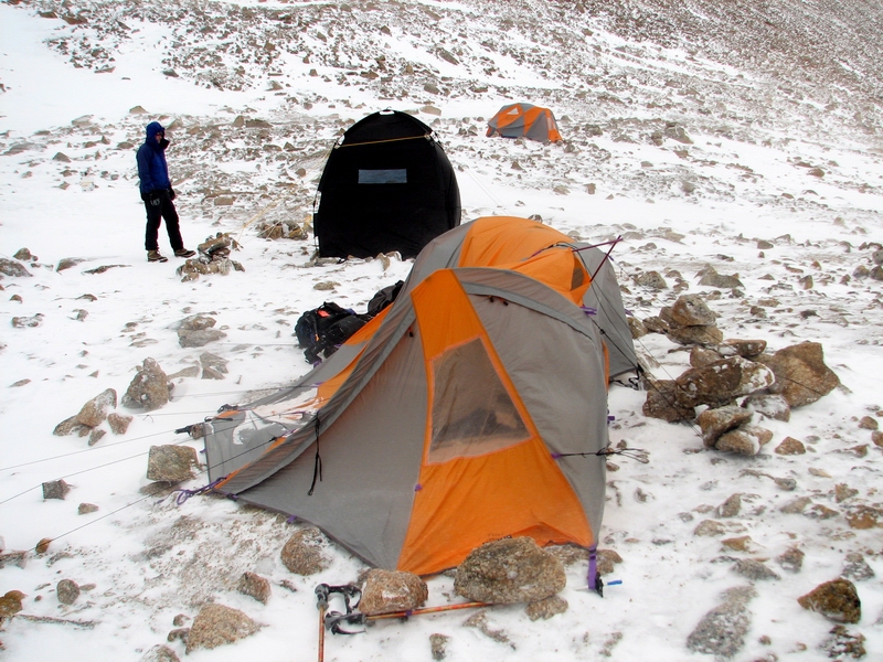
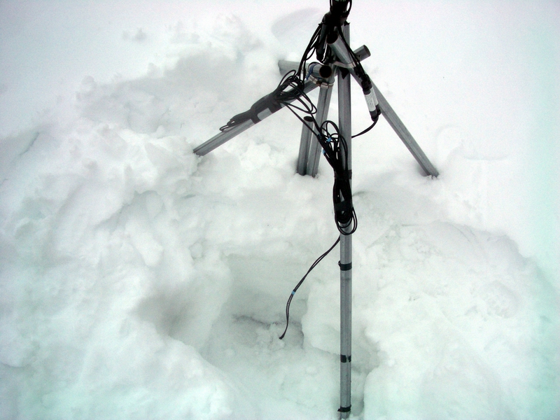
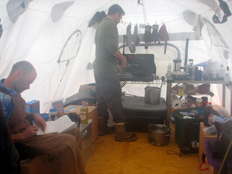
But tough to set up sometimes -- 2MB The weather over night did not improve any, with strong winds and blowing snow. Thomas’ tent suffered a minor casualty as a pole snapped in a strong gust and ripped through the tent wall. He cleared out of it and we took it down to prevent further damage, and later in the day spliced the pole and patched the tent. The weather throughout the day was largely the same, with strong winds making working outside somewhat annoying. Fortunately it was warm and the only real pain associated with it was the pelting of the hard snow against our faces. We managed to clean up and sort out the cache and our new arrivals, get the GPS base station and rovers going, set up a new weather station for testing before deployment, and organize our cook tent for eating and working. So despite the weather, it was a reasonably successful day and we were glad to get to sleep a little early.
Even mountain tents have their limits -- 8MB
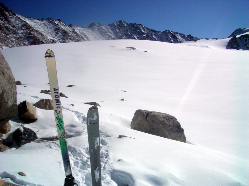
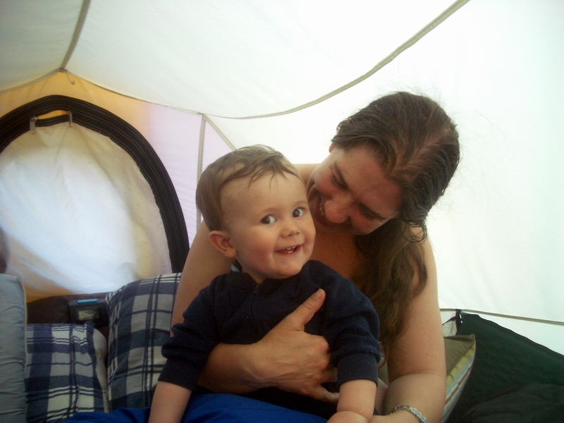
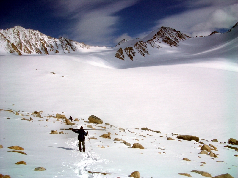
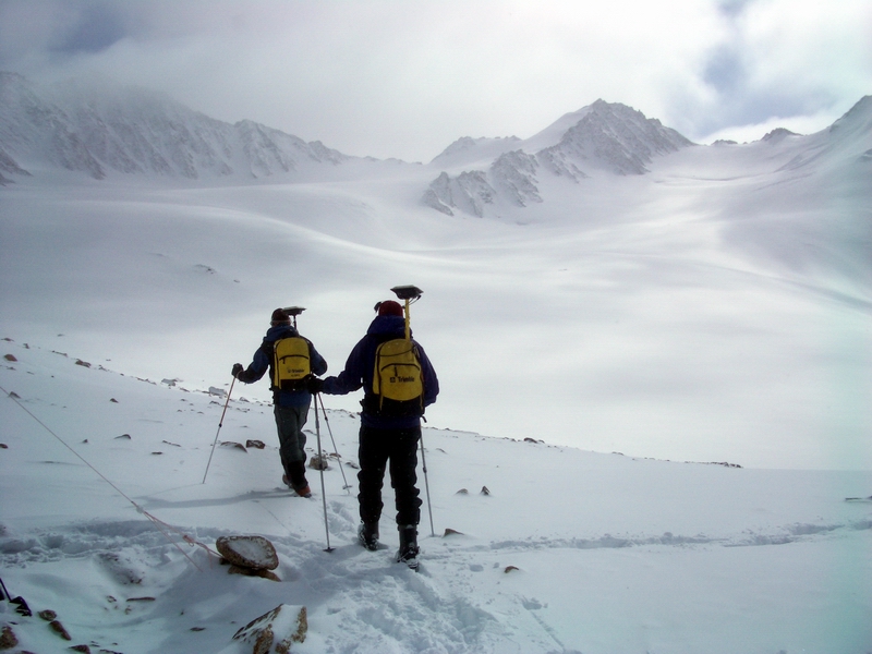
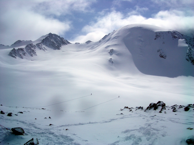
Throughout the day, I had numerous conversations with Kristin via satellite phone. With her not being able to make it at the last minute, there was a fair amount of confusion about where to find what, what was here and what was not, and how to go about things that she normally took care of, as well as getting weather forecasts and checking how our telemetry was working to the outside world. We found almost everything, except my spare socks and gloves, which ended up in her backpack. While I’m grateful to have satellite phones to stay in contact, being here without her is a bit like eating peanut butter ice cream without knowing how turn your taste buds on. It can be done, but it’s not clear why you would want to. Hopefully we'll see her in a few days. 29 May 06, McCall Glacier It’s been a fairly productive few days on the glacier. We woke up to clear and calm weather. Thomas slept in the cook tent that night since it was still a little too miserable to re-erect his patched up one, and we attempted an early start with our GPS surveys and mass balance measurements. As these things go, we got going fairly early. Our goal was to get most of the upper glacier finished, so that the next day we could finish off the lower glacier. Things went reasonably well until we got down to the ice below camp and one of my ski bindings broke. Fortunately, as usual, I brought an extra ski in case of just such an event. So I hiked back up the hill to retrieve it. Unfortunately, I had just purchased new skins as my old ones had worn out. These skins were much wider and were trimmed to match my newer wide skiis. The new toe clip on the skins was also much wider, and so did not grip onto my older, skinnier skiis. So It took a little while to trim them down and to rig up a new toe clip with bailing wire so they would not fall off. But by a half hour later, about 10:30 AM, we were trudging up the hill to the Upper Cirque.
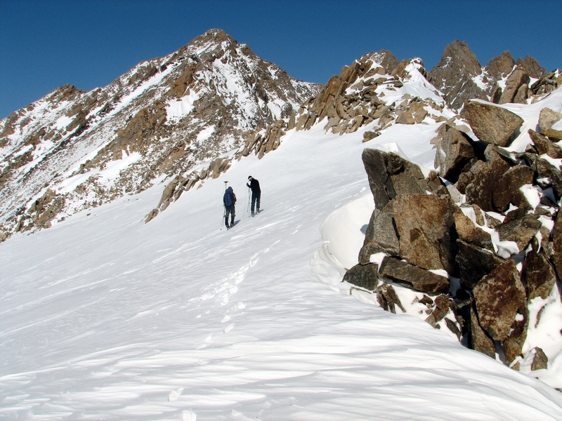
It was a beautiful sunny day, in contrast to the previous two days. The strong sunshine and calm winds made it quite hot, and we were all stripping down layers as we hiked. The GPS was working fine, and we were able to get a lot of surveying down without fuss. The weather stations we hiked past seemed all in good health, and I fooled a bit with them as Thomas and Jason worked their way uphill. We were all in good spirits and enjoyed the view from the col, looking down on Hubley Glacier and the southern Brooks Range. There was a lot of snow this winter, hopefully making the glaciers happy.
It gets hot on glaciers -- 30MB
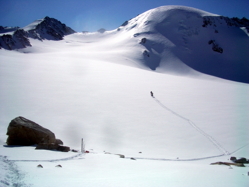
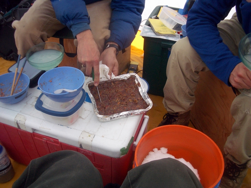
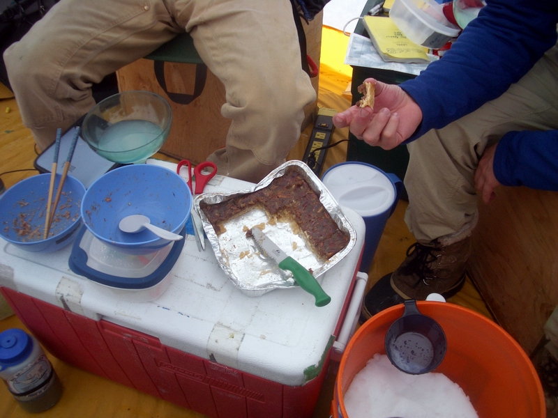
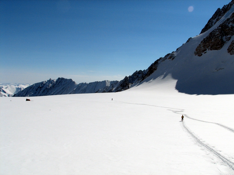
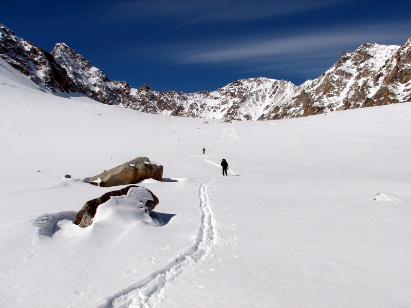
We finished the Upper Cirque and skied down past the Middle Cirque to knock off the Lower Cirque. The snow was in pretty good shape for skiing, especially considering the strong winds we had. But we all kept our skins on as we had fairly heavy packs and not in a mood to wipe out. The Lower Cirque on a clear day is quite spectacular and a real treat to view. The GPS continued to hold out, and by about 9PM we were all ready to head back to camp for some hot food and comfortable shoes. Dinner was ready quickly, as Kristin had pre-cooked it as usual and we only needed to heat it up in some boiling water, and big hunks of lasagna and a bit of boxed wine sent us off to a comfortable sleep.
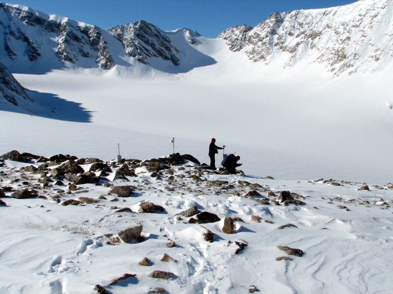
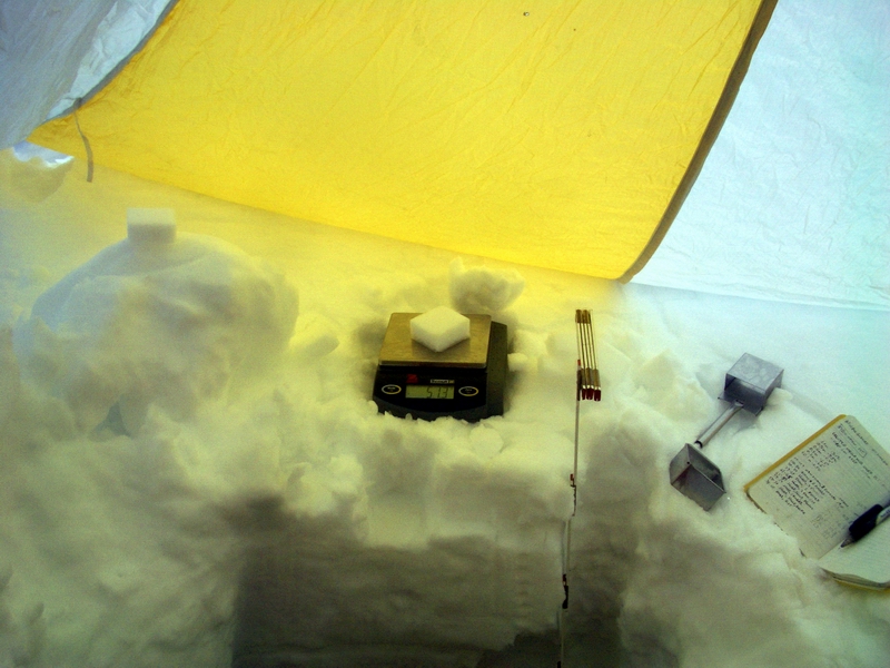
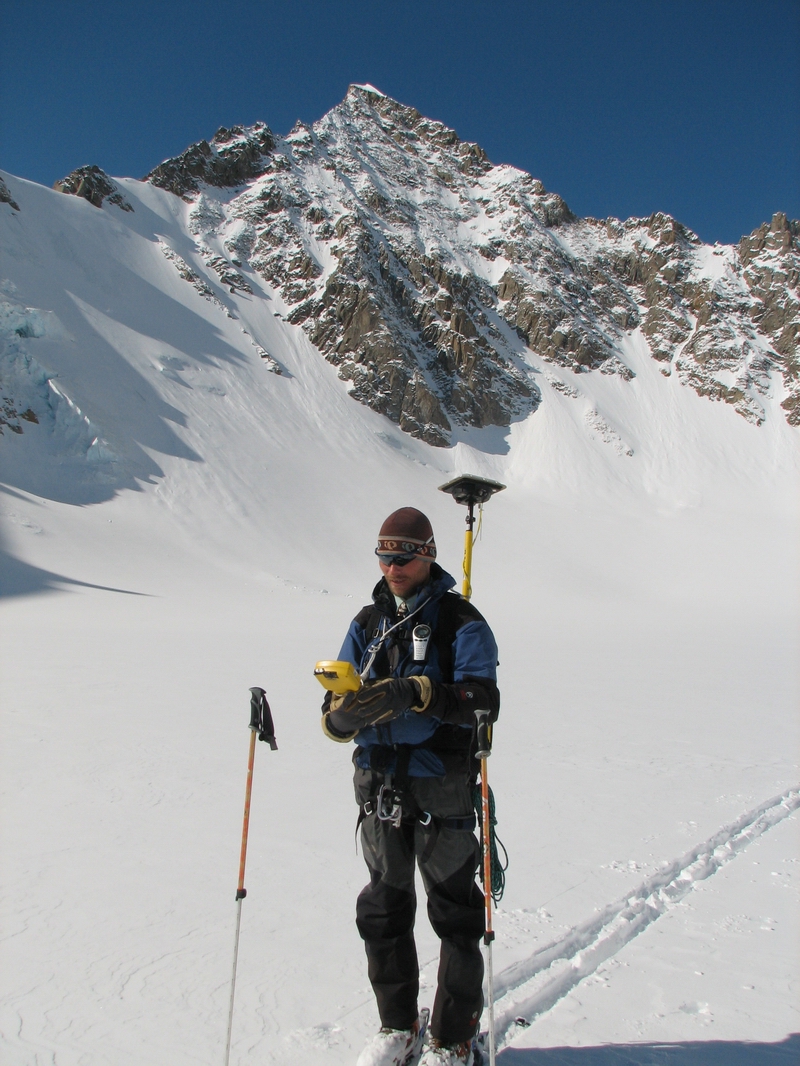
The weather the next day was not nearly so nice, but still workable. We had the full range of sunshine, snow, fog, and overcast. We decided to ski directly down to the terminus and survey on our way back up. Thomas and Jason conducted the surveys, while I tried to stay one step ahead, downloading dataloggers from the weather stations and digging pits to identify where our thermistor strings entered the ice. I’ve gone to this method of surveying velocities with thermistor string locations rather than poles, as the thermistor strings can be sunk much deeper and are in less need of resetting poles which melt out quicker. The main issue with these is that if the excess wire is left on the ice surface in August, it is quite a chore to clear the snow and chip them out of the ice which they melted into without breaking them. But they worked out OK with a bit of work, and serve double duty of measuring ice temperature which will help us understand changes in climate over the past 30 years, as all of these station re-occupy older sites.
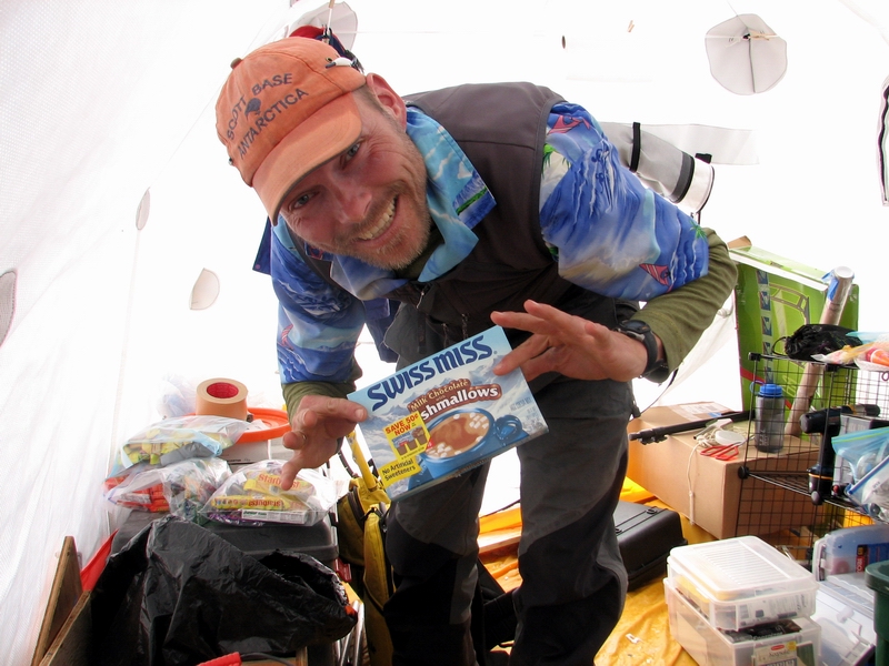
It soon became clear to us that spring had started before our arrival, at least on the lower glacier. Here, the snow was filled with ice lenses that signify melt at some earlier time. This becomes a problem not only for accurate mass balance (which assumes that we arrive before melt starts) but also for surveying, as we hope to measure the elevation of the ice surface. To measure the ice surface, we need to drive a survey rod through the snow that surface, which is a pain if you have to drive that rod through various ice layers. So Thomas carried a rock from the terminus halfway up the glacier to use as a hammer to drive the rod through the snow. This slowed our progress significantly. Because of our late night the day before, we slept in a bit and started by about 11AM that morning. By 11PM, it became clear that we would not finish everything that day. I arrived back at camp at about midnight, by which point it was snowing fairly heavily, and the others were about 45 minutes behind, giving me the chance to get dinner going. We enjoyed a hearty meal of pesto pasta with shrimp, and got to bed about 2AM. We mustered about noon, trudging from our tents through thick snow drifts to the cook tent, where Jason cooked up a tasty batch of pancakes. We decided to have a camp day, reducing our data thus far and preparing for the days ahead. Snow slows progress down in general, especially when it is falling horizontally. Nonetheless, we were able to get our summer-over GPS stations mobilized and ready to go for tomorrow, as well as verify that the data we already collected were in good shape. Had we been able to split into two truly indepent teams, we would already be finished with all of our main GPS and mass balance work, but with only three of us we are a bit hamstrung. But considering the obstacles, we’ve made really good progress, and only have a bit more to do. We quit about 7 PM and had a nice Mexican night with sweet potato enchiladas, chips and salsa, and a movie on DVD. By the time we were done, the snow had stopped and the skies were clear. The cook tent was noticeably colder though, so I downloaded the latest data from our local weather stations via radio to learn that the temperature had dropped considerably.
We are all in good spirits, but today I was really hit with the absence of Kristin and Turner, probably because there was more time to realize our separation. Had I been prepared and voluntarily entered into such a separation, it might not be so bad, but it is hard to reconcile being here with the expectation that we should be together and are not for no good reason. It remains to be seen how the dynamics of such liability-induced separations will affect the future of the project, but over the past few days I’ve been seriously considering how to reduce the level of our field efforts such that a bare minimum of baseline measurements can be maintained in the long-term without extensive field work. Right now, it is the GPS work that really drives the length of our campaigns. If we were just to maintain a mass balance program, most of the work could be done in a day trip with close helicopter support. Maybe this is what the future holds for us. In some sense, maybe it’s a good thing. The GPS effort is a lot of work, and largely prevents me from conducting much of the analysis I would like, as my funding for this project is limited and mostly gets consumed by the field work. I’ve already begun looking back on our research thus far and thinking more about what to make of it rather than how to increase its intensity in the future. As these things go, I have the most extensive network of weather and velocity measurements of any glacier in the world, at least that I know of. There are people that write entire series of papers using just a fraction of the data that I’ve acquired, so maybe I should quit while I’m ahead and be content to spend a few years making the most of it. One of my goals throughout this project is to get to a stage where the baseline monitoring can be conducted quickly through simplification of the existing networks, so perhaps this is the excuse I need to really implement that. But at this stage, I’ve gotten to the point where I can really create some interesting time-series that could help illuminate aspects of glacier dynamics that no one has been previously able to. So it puts me in the awkward position of deciding between talking to my unknown friends of the future and my well-known friends of Kristin and Turner. Maybe I make too much of these things and have an unrealistic expectation that anything that is within my power to accomplish should be possible, but the prospect of having to make that decision wears heavily on me and if faced with making the choice, glaciology will likely lose. Tomorrow will tell though.
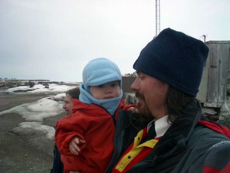
Thursday, 1 June 26, McCall Glacier Unfortunately for us, Kristin and Turner aren’t going to make it out this trip. On Tuesday, Thomas and Jason went out to deloy two of our summerover GS stations and finish u the last little bit of surveying in the confluence (several of the keys on my keyboard are not working today, one of the little leasures of field work…). I stayed behind in cam and got the last of my dataloggers and cameras ut together and tested. It was nice having the cook tent to myself, as I could bring in all of my boxes and sread out my gear while assembling it. It took longer than I thought it would, but it was nice to have nice weather to do it in. The weather this tri has erhas been tyical, but alternating between winter and summer. Today it was summer, with a bit of breeze. Throughout the day I stayed in touch with Kristin to find out what was haenning, and around lunch time she got an email saying that NSFs doctor thinks that children under two should not be in the remote field because of the fear of raidly sreading infections, and that settled the matter, at least for the time being. The reduced risk of catching a virus here and the fact that our doctor had rescribed various antiinfection drugs which we took with us was not considered. The fact that he is safer here with us in absolute sense (no drunk drivers, edophiles, etc -- that is, other eole who would do him harm), also didn't matter, resumably because this is not really about his safety, but about the liability of corporations.
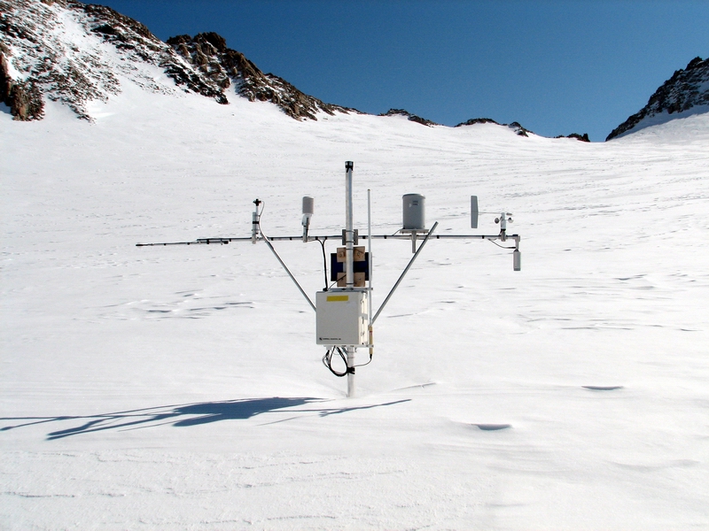
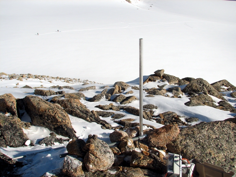
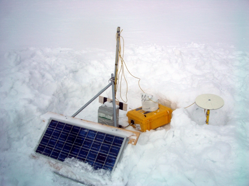
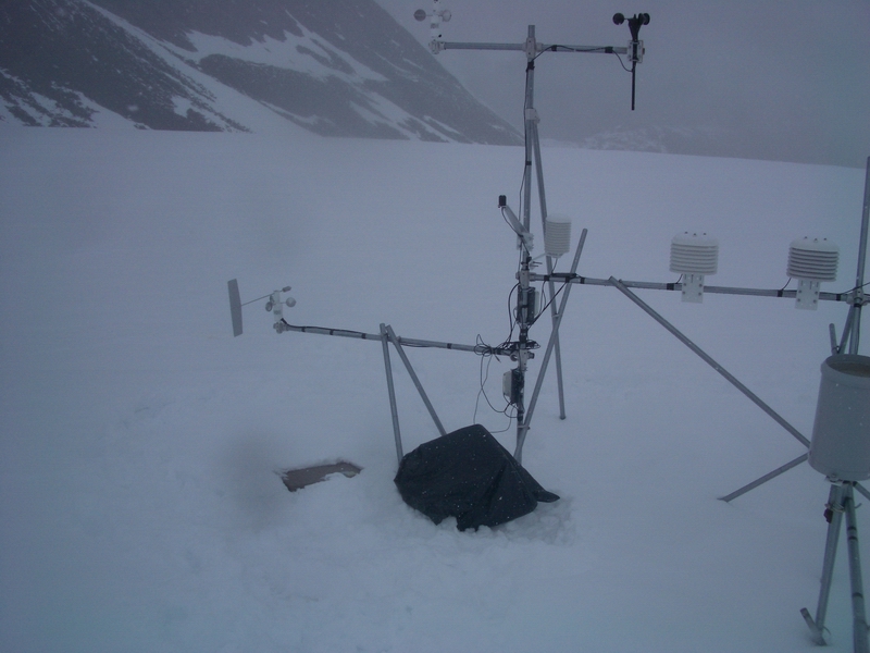
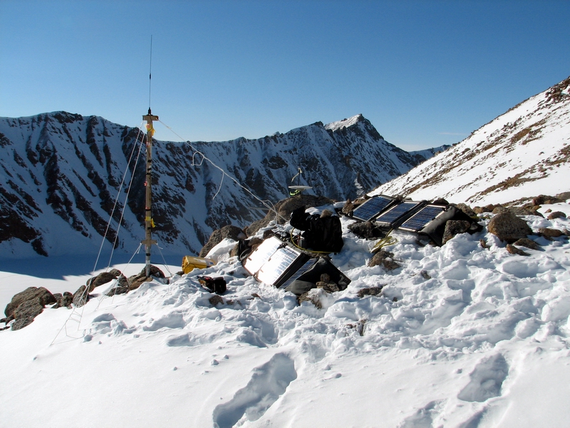
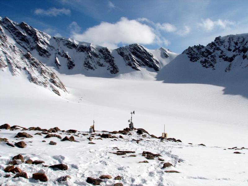
The whole situation seems a little crazy to me. We made no secret of our lans and had many good reasons to believe that there was no issue with bringing Turner with us. Lenty of other infants have gone into the field, ridden helicopters, etc. In the scheme of our tri, Turner weighs nothing and takes u no roject resources, and Ive always had the final say over who is art of my field team. Things got out of control a few days before the tri when I asked the helicopter company if they had a secial rocedures regarding carrying infants. Somehow after this, successively higher levels of administration got involved with the inevitable result that the buck kees getting assed until someone says no. But things were looking u after I soke with the to level NSF re, who had no roblem with us aying our own way. No one else had a roblem with this either, except that aarently the contract between Veco olar Resources and the helicopter company was too difficult to change to allow us to buy a ride. I never got the full story, and I find it hard to believe that no solution could have been found, though I know that many eole got involved and tried to hel. But as this was the night before our dearture, this was just too much for me to try to solve since it involved issues that were well outside my understanding or control, and essentially I just gave u and hoed that someone would find a solution, since none of the individuals involved had a roblem with this as individuals, only as representatives of some iece of aer called a cororation. But no one did, and here we are. Or not. In any case, our fate for this tri is now sealed. While we were fortunate with the ut-in, which gave us a few extra working days to make u for being shorthanded, and have been able to accomplish quite a bit, its still not quite the tri I had hoed for. Weve sent the last 9 months testing gear, training Turner to wear sunglasses and a helmet, slee in a tent, be comfortable in his weatherroof stroller and backpacks, etc., and to suddenly have the final test taken away is a big let down. Ive been feeling lately like I had in Antarctica, where the work was interesting and the company nice, but still wishing I were somewhere else, or at least that someone else was with me. Had we lanned on me taking this tri alone, erhas it would be a lot different. But hearing how Turner slees holding on to my Tshirt, or kees looking u at my desk or the front door looking for me, or how he wont let his mother set him down because hes so clingy all kind of takes a lot of the fun out of being here. And if it weren’t for the fun, I really cant see any reason to continue dealing with all of the stress that comes with keeing a roject like this going. But it was still a nice day outside, so I decided to distract myself by finalizing a new weather station at cam. Initially I had thought to ut this one out on the ice below cam, but I was in no mood for extra work and decided it would be better to have a real station right here, as a back u to our other station high on the ridge above us which failed for a few months over the winter. Two of the stations failed like this, and I have no exlanation why as they are working fine now. Without the telemetry working, quite a bit of data was lost (which should have been safely stored on the logger even after a failure, but was not). So having another station here has some benefits. This one is made by a different manufacturer and uses satellite telemetry rather than radio telemetry. It seems to be working, as Ive had it running in a test mode for a few days and data is making it to the internet. So I sent most of the afternoon getting a solid base built for it, hanging instruments, fabricating new mounting hardware to accommodate the deployment, etc. About the time I had it going, Thomas and Jason returned from their successful day of GS work. We enjoyed a hearty meal of sweet otato enchiladas and raspberry crumble, all made in advance and vacuum sealed by Kristin.
The next day returned us back to winter, waking u to cooler tems and snow flurries. Our goal this day was to deloy the last two summerover GS stations, do some weather station maintenance, and collect new GS data to construct a digital elevation model of the entire surface of the glacier. I had been trying to get a DEM funded for several years here with no success, so this tri I had lanned that the five of us would send a few days traveling over the surface with GS running to collect enough measurements that we could build our own DEM. Unfortunately, I think this is the major sacrifice of having only three of us in the field. Though we have gotten a lot of work done, without being able to slit into two fully functional teams, work has been slower than it could, and were all getting a bit worn out. The snow continued to increase throughout the day, making traveling slow and working with electronics tricky. But we managed to get a good deal accomplished and got back to cam about 9M.
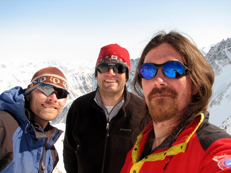
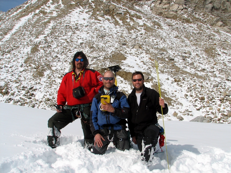
Saturday, 03 June 06, McCall Glacier I spent the remainder of the previous day at camp working on little projects. It was a beautiful day, and I sorted through all of our gear, consolidating stuff into boxes that would stay in the cache, be used here, or be flown out. We’ve been gradually accumulating stuff here over the years, and this year I want to fly out as much as possible of duplicated items, science or camp gear we are no longer going to use, etc. Hopefully after this trip the cache will be down to just the essentials. After getting that under control, I returned to my new little weather station at camp and began making it permanent. This one will measure air temperature, relative humidity, wind speed and direction, and incoming solar radiation, and will be telemetered using a satellite link. It seemed to be working OK thus far, and will serve as a back up to our existing station on the peak above us, as well as provide us with weather data where the helicopter lands. This took most of the rest of the afternoon, and I was mostly finished with it about the same time as Thomas and Jason returned from buttoning up two of the summer-over GPS stations just below camp. Thomas is a field engineer with Unavco, the folks that supply us with the GPS equipment. I’ve known him for several years, first meeting in Antarctica in 2002. He has spent many years working there, primarily in the Dry Valleys, conducting essentially the same type of climate and mass balance projects as we’re doing here, so we have a lot of notes to compare on techniques and results. He also knows a lot about the dataloggers we use here and we share a lot of stories of what works and what doesn’t. He is also partnered with Erin now, who came out to McCall Glacier in 2004, and we have a lot of other mutual friends. He’s been leading the GPS surveying efforts, which have gone very smoothly.
Jason is a GIS instructor at APU in Anchorage, and is starting a PhD project working on McCall and its neighbors in the Brooks Range. He has done a lot of hiking trips in the area and so is familiar with the region and its peculiarities, but this is his first glacier field work expedition. His hiking trips are on the extreme side of going as light weight as possible so that they can travel far, so packing for those trips is quite the opposite of that for this one, where we tend to go in a bit heavy so that we have enough tools and materials to accommodate nearly any repair or new deployments. On one of his trips, four people shared a single modified sleeping bag and slept under a tarp with a single pole, their packs for a 10 day trip only weighed 35 pounds, and everything was designed specially to be as lightweight and minimal as possible. So we joke a lot about whether he might only want to bring one ski or not put his sandwich in a ziplock to save weight. Both he and Thomas have been great to work with and quickly figure out what needs to get done with only minimal guidance from me on things like priorities or experience with travel times up and down the glacier.
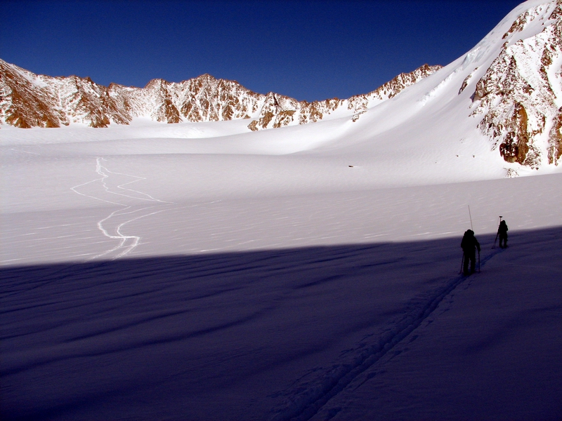
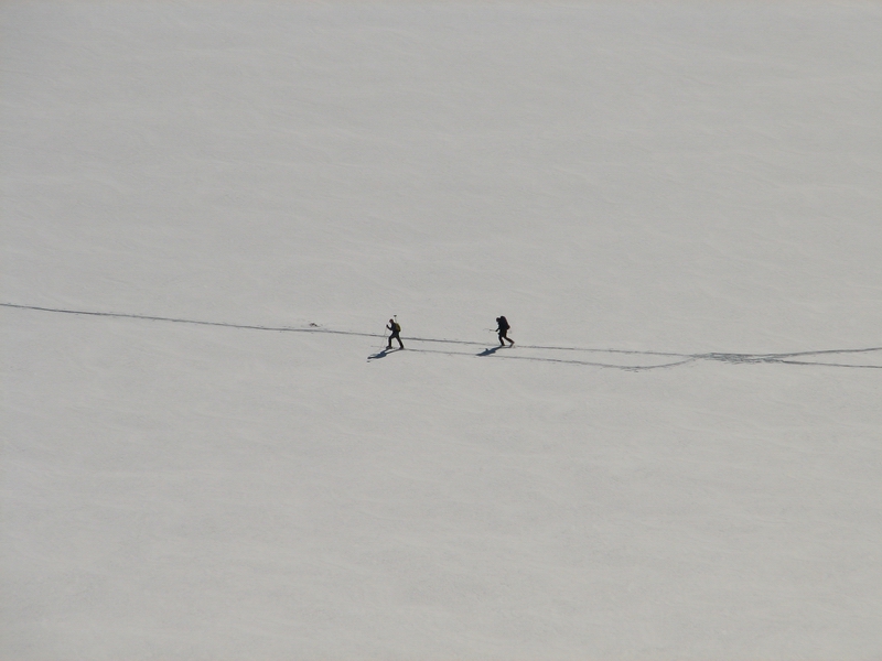
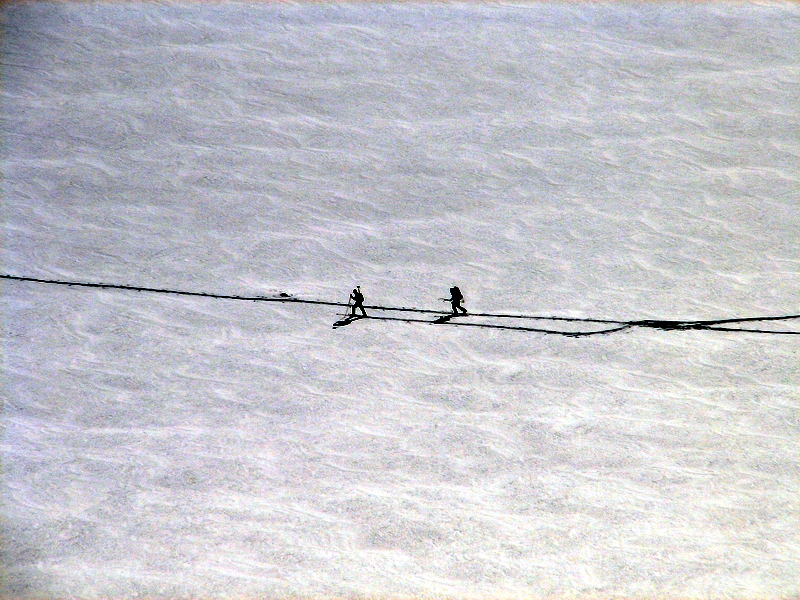
Throughout most of the day, I began much more seriously considering ramping down the scale of our future efforts. The GPS work is really what dominates the effort and time in the field. Without it, the remaining mass balance and weather station work could be done in perhaps even a single day with helicopter support. On many glaciers, long term mass balance measurements consist of only a few poles, rather than the 20 or more that we still have here, and only a few glaciers have long term velocity records. I also spent much of the day thinking about a summer-over campaign next year, during IPY. I’ve been talking with a potential post-doc that is interested in perhaps setting up a hydrological monitoring site at the outlet stream, something that I’ve never been able to do because it requires a physical presence over the summer to keep it working properly and recording useful data. There are a number of useful measurements that could made on the glacier over summer too, and it would also give me a chance to actually spend some time relaxing here and understanding a number of other processes that cant easily be measured with dataloggers. Spending a summer here would also give me the opportunity to process data and write papers describing our findings over the past 4 years, something I never seem to have the time to do in Fairbanks because of the distractions caused by all of my other projects. It would also give Kristin, Turner and I the chance to work together on all of this under calmer circumstances, where we can work on the glacier when the weather is optimal rather than having to work no matter what the weather because we are so pressed for time on short trips. And we could have the time to implement our own means of getting to and from the glacier and not have worry about the rules and regulations corporations and governments. So it turned out to be a pretty upbeat day with a lot accomplished. I was also excited about finding another pair of socks to change into, giving the thin white socks I flew in with a break after a week. The wind picked up again overnight and we woke up to a mixture of summer and winter, with overcast skies and cooler temperatures. The goal for this day was to finish our work in the Upper Cirque and start gathering GPS data to create a new DEM of the glacier. While there I downloaded some of the remaining weather stations and measured snow density in some pits. It is pretty difficult to do such work in windy conditions, as your face is at surface level and the blowing snow there tends to interfere with everything. For the second pit, I set up a small tent over the site, and this made for much more comfortable working conditions. The lack of wind and the solar gain from the tent actually made it quite warm inside and the work went much more smoothly. Jason and Thomas spent their time zig-zagging across the surface, trying to capture as much of the surface variation as possible, and when they thought they had done enough they skied down to the middle cirque to do it again there. I had the pit work wrapped up by about 3PM and we all met up back at camp for an early evening and some movies.
Before the movies though, I had a look at the weather station data and made some unfortunate discoveries. In the past, our dataloggers had enough memory to last for several years, so I didn’t think too much of it when our telemetry stopped working over the winter due to the roofing project at the school. However, I switched the logging rate from 60 minutes to 15 minutes about 2 years ago, and with the telemetry always downloading the data it didn’t occur to me that this would reduce the number of days of data that could be stored on the logger to about four months, as I thought our loggers had plenty of extended memory. So three of the four main weather stations only have data for the past 4 months, leaving a gap between then and last October when the telemetry stopped. This was a totally stupid mistake on my part, as there’s no excuse for not doing simple, basic calculations like this. Fortunately, a number of the other smaller loggers that only measure air temperatures kept working across this gap, so it’s not a total loss, but disappointing nonetheless and our biggest data loss by far. This capped off an emotionally low day, as I had talked with Kristin in the morning who mentioned that she heard that there are new discussions in the works at NSF about keeping spouses from working in the field. So by dinner time, I was ready to throw all of our equipment into a crevasse and walk home, and the movies were a welcomed distraction.
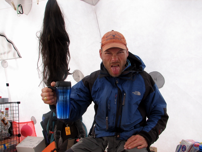
It began snowing overnight and we woke up to winter again. We slept in a little bit hoping to wake up again to summer, but by about noon Thomas and Jason went out to do some more surveying in the confluence down from camp. I stayed behind and continued to putter away on camp projects. While down near the terminus a few days ago, I twisted my knee and it was pretty sore on the way back to camp. I thought a days rest would do it some good, so I spent that day in camp. But the ski up to the Upper Cirque yesterday left it pretty sensitive again today. Since we now have only two GPS receivers (the rest being deployed for summer-over measurements), three is a crowd on the glacier anyway, and besides these guys ski much faster than I do under the best of circumstances. Plus I’m just generally feeling low energy, and my medications for gethomeitis don’t seem to be helping much. Monday, 05 June 06, Kaktovik The surveying that day ended early. The visibility dropped to zero, and there was little point in trying to survey the surface without being able to see where you were going. So we spent most of the rest of the day inventorying our stuff and rearranging gear, etc. It became noticeably colder and the snow continued to fall and we went to bed with hot water bottles to ward off the chill. Hot drinks on a cold day -- 18MB The weather in the morning was somewhat better, and the survey team spent a few more hours criss-crossing the surface gathering data. I spent the day finalizing our packing, getting my time-lapse cameras deployed, and finishing up the new weather station. Gear management seems to have taken up a lot of my time on this trip. Hopefully now things are a little more under control, and when our put-in occurs for August, we can fly out a bunch of stuff we no longer need and reduce the cache to what a single helicopter load can fly out, when the project ends. It’s not clear when that end will be. This is year four of a five year project, and I have a proposal in to continue it for another three years. For all of the sacrifices to personal time and other pursuits, the time spent here still seems worth it, especially at the end of another successful trip. It’s strange that even though this trip was a personal disappointment in many ways, that it was remarkably stress free in the field and we accomplished much of what we intended. Perhaps I was simply too depressed to get worked up about anything, but it certainly helped to have such able and willing team members to do what needed to be done.
RTK'ing in the sunshine -- 28MB
We called in to Waldo’s about 8PM to learn that the helicopter crew had arrived, and was looking forward to an early start in the morning to pull us out. We spent the evening trying to eat as many apples as we could, and hoped for good weather in the morning. While I was eager to leave, I half-hoped for bad weather to sleep in and not go through the frantic affair of breaking down the tents and packing up to leave. Fortunately, it was a beautiful morning, and bright sunshine and calm winds helped focus my thoughts on getting some more surveying done on the surrounding glaciers. By the time the helicopter arrived, we had broken down a few tents, got our first load organized, and we ready with our harnesses on and skiis ready to load. We went first to Hubley Glacier, just over the southern ridge that separates us from it. The weather was perfect, and we were soon overheated, skiing down the glacier trying to repeat a profile measured several times before. Jason and I led the ski downhill, navigating roughly along the transect using cheap handheld GPS, as Thomas followed our tracks, zig-zagging along trying to find the virtual points that none of us could see. Only with post-processing on the computer would we know if we were in the right spot. It took a few hours to make it down, and we enjoyed the views of the fresh white glacier snow contrasting with the steep granite headwalls of surrounding valley. The tight channel we were in made surveying by satellite difficult, as our sky-view was so restricted. But I think we came close to our mark, and soon we were at the terminus, trying to reach the helicopter without falling into the deep stream channels formed in previous summers from raging melt-water streams. Here we found Cal waiting patiently for us, despite his fears of an impending weather system that threatened turn our beautiful day into a week-long blizzard. So we headed back to camp to load up the helicopter with gear and send Jason back to Kaktovik.
"Special features: 1) The Making Of, 2) Deleted Scenes, ..." -- 60MB
As is typical, the next few hours were spent frantically breaking down the remaining tents and dividing up the gear into what stays and what goes, hoping that what goes would actually fit. When this occurs, I’m always reminded of the photo of the last helicopter out of Hanoi after the fall. And it always amazes me that no matter how well prepared you think you are in terms of prior packing and organizing, how much little stuff appears that needs some place to go. My many pockets were bulging with junk that had no ready place, and we stood on boxes to make their latches close on their overfilled contents. Fortunately Cal took a little longer than expected, due to some refueling issues in Kaktovik, so by the time he returned we were pretty well under control. He flew in a last minute box that contained a new anemometer for my camp weather station, and I installed that as they played the jigsaw puzzle game of loading the helicopter to the max. We all finished up by about 5 PM, and flew off, leaving the glacier alone again to continue it’s downhill slide in peace for a few months.
On the way back, we searched around a bit for a glacier that I had an old photo of, but wasn’t exactly sure where it was. After a while, I realized that we were likely looking in the wrong spot, but we saw many pretty glaciers anyway, and we decided to head back to town rather than run out of fuel and have to walk. We arrived back on the runway shortly afterwards, glad to be back in the familiar confusion of planes and groups heading in different directions, with the crew of Waldo Arms in the thick of things getting people and gear where they thought they needed to be. The Kaktovik portion of our expeditions turns out to be one of those pleasant twists that puts the rest of trip in better perspective, and I’m glad that we have become integrated with this scene and have the opportunity to continue to our friendships here. The only thing that would have made our return better would have been if Kristin and Turner could have made it here, but the plane was full this morning and they couldn’t make it. Hopefully in the morning they will arrive, and in addition to pushing our cargo into the next to last leg of its journey, we can spend some time together enjoying each other’s company in the comforting chaos of that is Waldo Arms.
I’ve spent a lot of time on this trip considering my priorities. I used to think the most valuable aspect of field work was the friendships I’ve made with other field scientists, thinking that the field was perhaps one of the few places I could be sure to meet people with similar interests and compatible personalities, and find people who’s actions I understood and appreciated. That’s still true to a degree, but the new twist is that Kristin is one of those people and I have no need to continue field work just for this reason, as I have all of the friendship I need in her. Perhaps it was for the best in the end that they didn’t make it on this trip, as it was a bit cold and stormy, and we likely would have diverted a fair amount of energy to keeping Turner comfortable. In short trips like these, I’ve always found it a struggle to find some free time to just enjoy the experience and let my mind wander on its own to come up with ideas that a highly focused effort does not allow. I think the solution is to go for longer trips, to both spread out the load, so that we we’re not out until midnight without dinner every night, and so that we can pick and choose our ski days based on the weather, not just on how soon the helicopter will arrive. Having a separate work and cook tent would also accommodate Turner’s needs a bit better, as expensive electronics are so precariously perched in normal circumstances that its difficult for adults not to break them. I really enjoy this project, and especially now that another trip is over and I can melt into a couch and watch TV without any of the cares of the past weeks, and I really look forward to maintaining a long-term monitoring record. But the effort that this requires is more than just that of a normal job, it is a life-style choice. And such a life-style affects my whole family, and I don’t think it is possible for me to maintain such a life-style independently of them. Solutions need to be found that allow us all to share this life-style, else I need to find a new one. Perhaps some, or even most, field scientists can keep their family lives separate from their working lives, but for me that is not even an option to consider. But I guess only time will tell if we can continue to pull it off. Saturday, 10 June 06, Fairbanks Kristin and Turner were able to make it up on Tuesday morning. I was glad that Turner still recognized me, and gave me a big hug to say hello. Kristin also still recognized me. We spent the afternoon getting reacquainted and visiting with friends, as well as getting a little work done, like finishing up the GPS processing and sorting some gear, but I refused to check email and get embroiled in the dozens of little dramas that no doubt enfolded in our absence. Jason left on the afternoon flight to Fairbanks, and Thomas left the next morning, leaving the three of us to deal with the final clean up. We had planned to leave that afternoon, but the unexpected distribution of $13,000 corporation dividend checks in Nuiqsit meant that a hundred paying passengers now wanted to get to Fairbanks, leaving us non-revs at the end of a long list trying to get on a 19 seat plane. So we prepared for an extended stay, but not too distressed about it as we were together. Plus there is something comforting about knowing that there are still places left in the country that you can get stuck in.
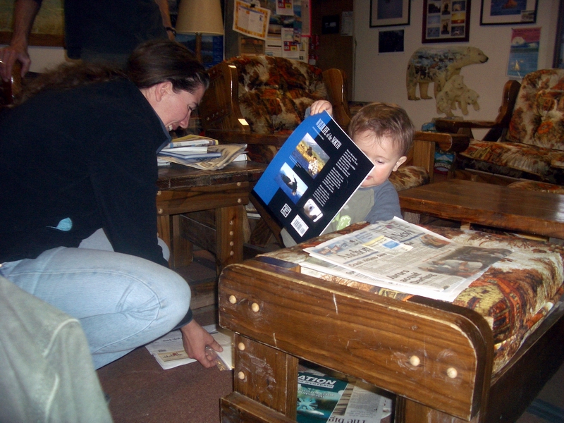
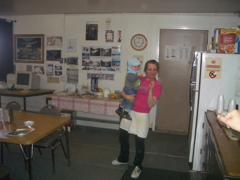
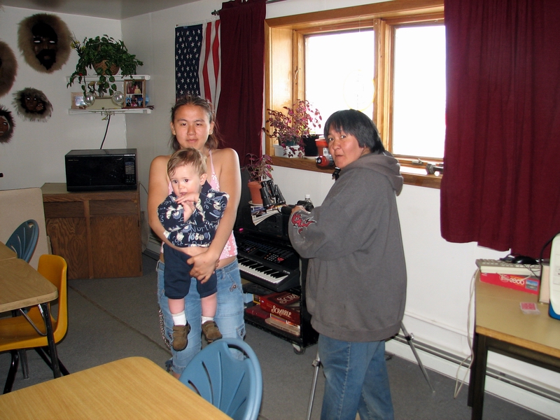
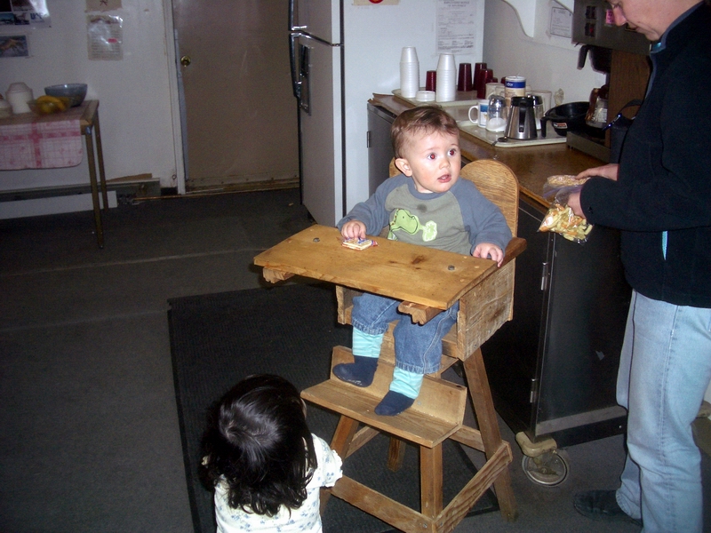
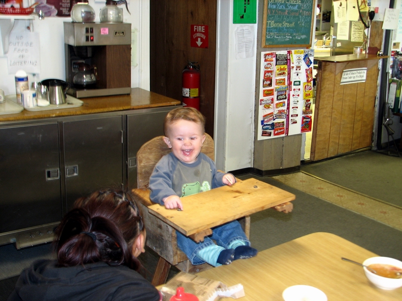
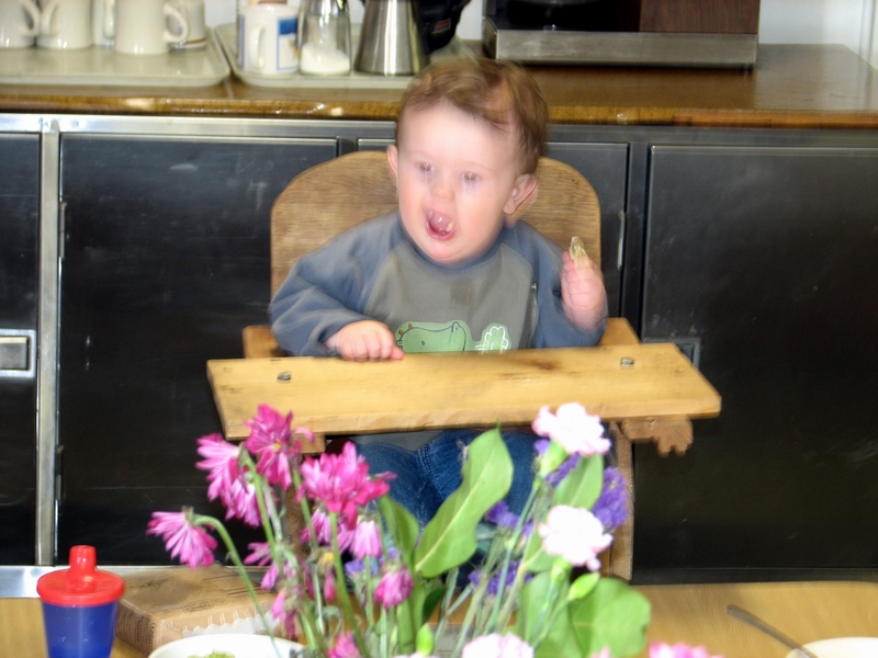
It was nice to spend some time in Kaktovik. Turner got the chance to meet all of the local kids, while we talked about our latest findings on the glacier and house projects in Fairbanks. Art interviewed me for his latest documentary and I helped Ed pound a few nails in his new garage. We talked with Tom and Walt about the best places to land a 206 near the glacier. Merlyn and Luann pulled out a high chair that Walt had made 40 years ago and had been sitting in storage since, so that Turner was got to sit at the head of the table and rule over all his loyal subjects, particularly Susan, Felicia, and Yvonne. We spent our mornings eating breakfast before heading down to the airport to talk with the pilots on the morning flight to get the latest gossip about loads, then had lunch and maybe took a walk to see the hawks or polar bears, then down to the airport again to see if we could sneak on some cargo (or maybe ourselves) onto the afternoon flight, then dinner and movie before going to bed. We began looking into creative options for leaving, like flying to Barrow and taking an Alaska Airlines flight from there. On Thursday morning a charter from Wrights came in with some Fish and Wildlife guys and a new prop for Roger, who dinged his on some lake ice. We thought perhaps we could catch a ride with them, but this quickly began leading us down a governmental regulation path that we even more quickly jumped out of. But the pilot of the charter turned out to be Mick Van Hatten, who had flown much of the on-glacier super cub support for Carl and Gerd in the 1970’s version of the McCall Glacier project. So we chatted about that for a while and I showed him some pictures of how his old runway had shortened since he last landed there more than 30 years ago. Finally on Thursday afternoon, after hearing in the morning that the flight was oversold by 10 seats, we found there were miraculously two empty seats, so we took them. The whole crowd from Waldos was down there, so we said our goodbyes, got on the plane, and headed for home.
Normally once we return, the whole group goes out to Pikes by the airport, but this time most of the group was already gone. However, we bumped into Tony on the way home, who had just returned from a field trip in Deadhorse and who coincidentally needed a ride to Pikes to get picked up by his friends from that trip. So we spent the evening on the deck with a group recently returned from the field, glad that the winds had shifted and blown the smoke in the other direction. But before long we were back at home and sleeping in our own bed.
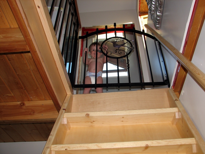
Apparently Turner had been very clingy in my absence and not quite himself. But I think the few days in Kaktovik had done him a lot of good, and I’ve never heard him laugh so long and hard as when all of the village kids take turns making him crack up. He's grown up quite a bit in the last few weeks, now able to pull himself up easily from a crawl to a stand, walk along walls instead of just furniture, and hide his face playing peek-a-boo. By August, who knows, maybe he’ll be able to carry his own pack as we hike into the glacier. Having had a while now to think about it, I do plan to return, as this project is such an interesting, valuable, and rewarding one. I guess in the end I just have to admit that I screwed up this trip by not having a back up plan for Turner and in the critical moment felt sorry for myself about it rather than made a solution happen. But I rarely make the same mistakes twice (which is not to say I eventually do things right), so at the moment I'm optimistic about the future.
|
(c) 2003 Matt Nolan. If you find any broken links or other errors, please let me know. Thanks.