Dr. Matt Nolan
455
Duckering Bldg.
Water
and Environmental Research Center
Institute of Northern Engineering
University of Alaska Fairbanks
matt.nolan@uaf.edu
|
|
Dr. Matt Nolan 455
Duckering Bldg. |
|
|
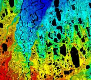
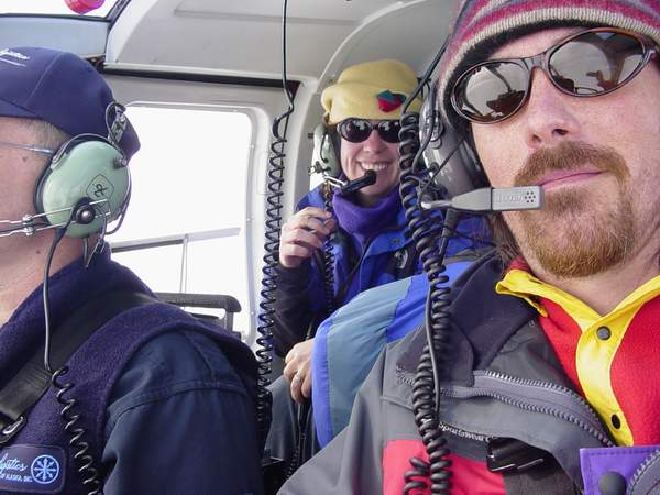
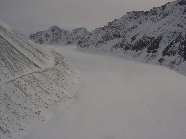
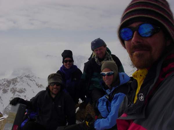
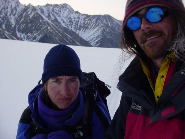
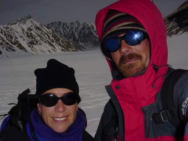
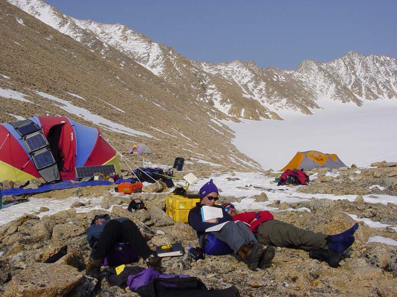
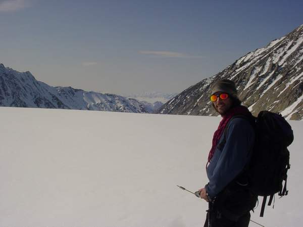
McCall Glacier Travelogue (16 May 03 - 02 June 03) Sunday, 18 May 2003, McCall Glacier After weeks of intense preparation, we are finally on the glacier and have started our research. Our main goal is to use McCall Glacier as an index of climate change over the past 50 years. To do this, we are continuing a mass balance record begun over 30 years ago and are making measurements of volume change. We also plan to install several weather stations, measure deep ice temperature, and study velocity variations. It’s been a hectic few weeks, with planning, purchasing, negotiating, building, packing and coordinating keeping my full attention for most of my waking hours. Most of the individual problems encountered so far could not be anticipated, but the amount of problems were perhaps not unusual. The largest of them included have to shop around for a new helicopter company shortly before the put-in because the original contractor backed out. This complication caused a ripple effect that led to several new ones. When I left for Antarctica last fall, I remember thinking that a goal of mine was to learn whether I could enjoy field work as much while being away from Kristin. The answer I learned was no. This trip I want to learn whether I can enjoy it as much with her. There is now a University policy that excludes spouses from being volunteers on projects, which I did not learn about until a few weeks before our departure date. This policy led to a lot of favor calling and a lot of sleepless nights. The initial solution was to have her be a volunteer for Unavco, a partner on the trip, but this fell through when the helicopter plans changed and I had to purchase her a ticket to Kaktovik. Solving that became much more complicated and in the end I wish I had done some things differently, but having now arrived at the glacier and no longer having to deal with the outside world, I can put all that behind me and concentrate on the research. There are five us here now. Bernhard did his PhD research on this glacier and is our resident expert on the prior research here. He has proved invaluable already, as so many critical details get left out of research papers that it would be virtually impossible to accomplish our goals without him to fill in the gaps. Bjorn works for Unavco, an organization that provides GPS support to NSF projects. As nearly all of our research on this trip requires GPS, he is also critical to the success of the project. The GPS system we are using is fairly complicated, and his expertise and commitment has already gotten us to the point of making measurement on our first day of work. Andy is a fellow Fairbanks cabin-dweller who mushes dogs and guides mountaineering trips when not studying to be a medical doctor. It’s been a great help to me to have someone to bounce safety questions off of or ask to take care of camp maintenance problems, as he has not only led many large expeditions but runs a solar system at home similar to what we use here. Kristin has years of experience planning expeditions and facilitating research. She planned our food for the trip as well, and has already got us gaining weight.
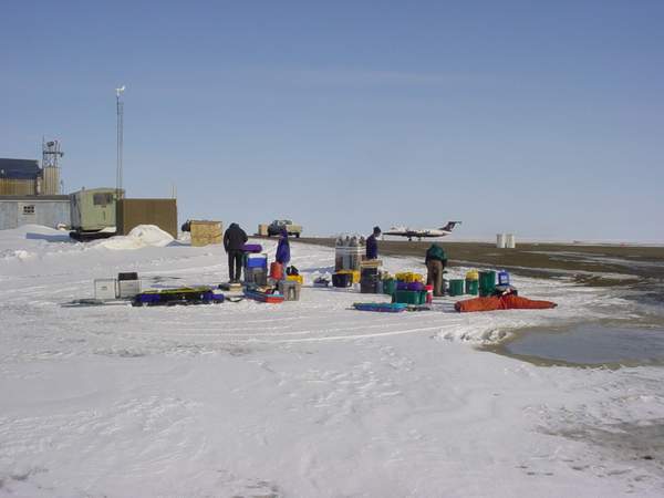
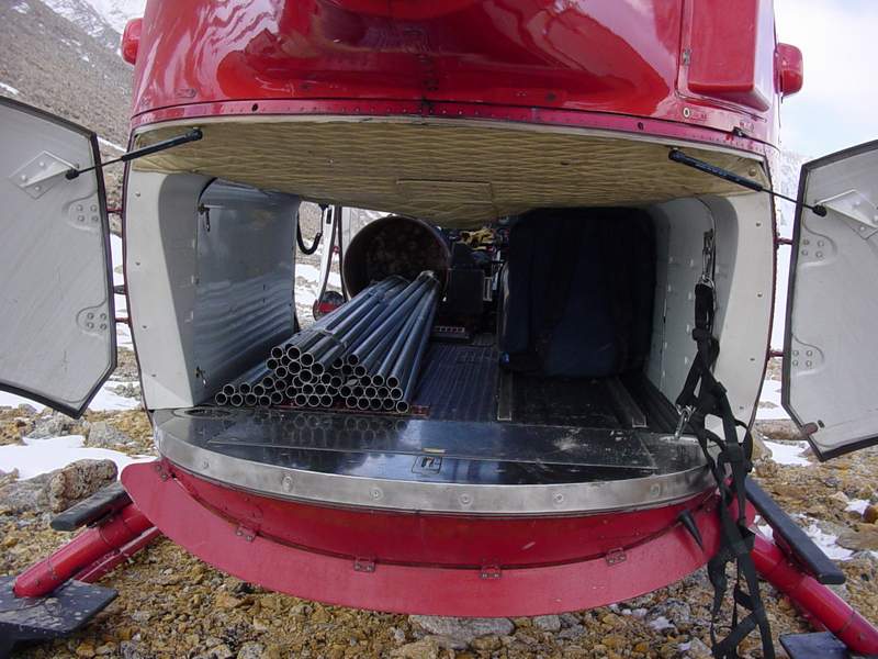
We arrived in Kaktovik on Friday afternoon. That week we spent mostly preparing loads to get to get to Frontier airlines so that they would have time to ship it before we arrived. The planes that come up here are not all that large, so they could not handle all of our gear on the day of our departure. We totaled about 3500 pounds of gear for this trip, not including body weights. Once in Kaktovik we were pleasantly surprised by the pleasant weather. It was only slightly below freezing, with little wind and lots of sun. We found that our gear from the past week had been piled on the side of the runway with no apparent security. Fortunately everything was in good shape, and began the process of figuring out what to do next.
I had never been to Kaktovik before, and had little time to give much thought to spending a few days there. I had somewhat arranged with the US Fish and Wildlife Service to stay at a bunkhouse they had there, but was unable to get in touch with the local contact they gave me. Turns out that he was out of town and no one had ever heard of us. The only alternate accommodations charged $150 per night, and only took cash. Camping seemed out of the question, as both brown bears and polar bears had been spotted in town frequently over the past few days. Fortunately we were befriended by AJ who gave us a ride into town and Walt was able to contact the wife of our FWS contact who let us into the bunkhouse, which turned out to be pretty deluxe. We spent most of the afternoon repacking gear and prioritizing loads. We decided to send Bernhard and Bjorn in first, along with enough food and equipment to keep them busy for a week or so in case the weather changed and the rest of the group was unable to make it in. We learned from the helicopter pilots that we should expect to only be able to get about 600 pounds of gear (including people) into a helicopter load. This was quite a difference from the 1000 pound load we were led to expect by the company’s management for the BO105, which cost considerably more the 205 we initially planned on. Fortunately, we explained more about the flight circumstances and some calculations showed that 800 pounds might be possible. The weather in Kaktovik remained fairly nice throughout the day, but did show signs of deterioration. We sent Andy in next with a load that filled up the entire rear of the helicopter, which included most of the food and much of the camp gear. Our plan was to send a person per load with me on the last trip, but as we began sorting the gear it became clear that Kristin and I could take the next flight and only leave some of the heaviest items in two manageable loads that would not require one of us to direct. In the end we were able to squeeze in all five loads into a single day, and we pretty happy for that. That night we ate a good dinner and planned out the next day. It was already late and we decided to sleep in and start the day well rested. It was the first full night’s sleep I had in a few weeks.
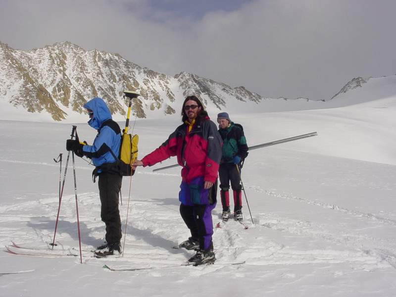
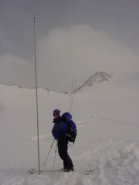
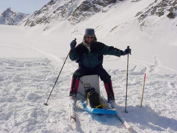
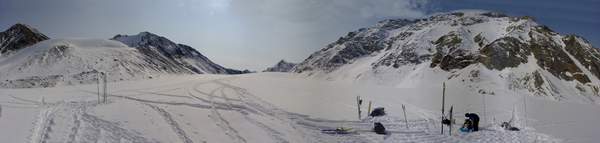
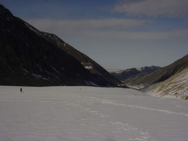
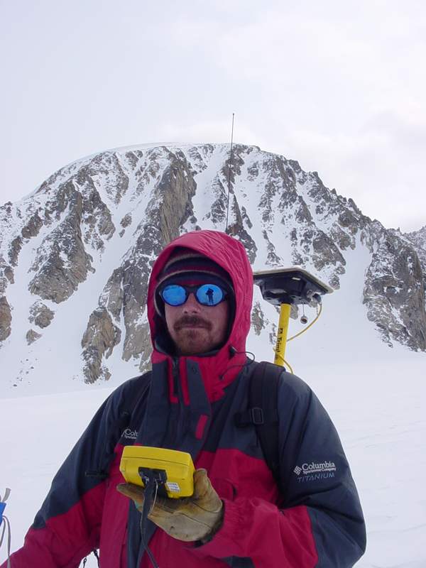
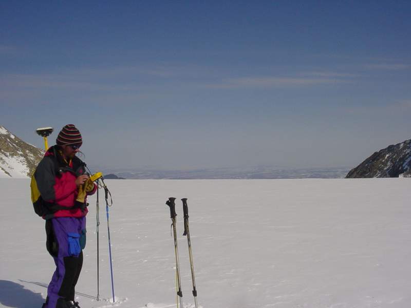
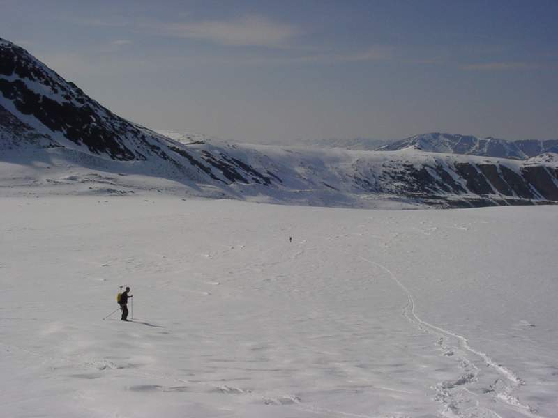
This morning we had leisurely breakfast and started working by about 11AM. Bjorn continued to set up the new GPS base station he had begun the night before and did a few test surveys. Andy and Kristin began organizing camp and working on minor projects that never got finished in Fairbanks. Bernhard began shuttling equipment around on the glacier, while I sorted gear and got our equipment organized. By the time we ate lunch it was about 3PM, and we decided to do a short survey to shakedown our techniques so that we could hit the ground running next day. We began by heading up the upper cirque to survey in several poles. The idea here is that we have a list of coordinates where vertical elevations have been measured in the past and we need to reoccupy those locations and repeat the elevation measurements. With differential GPS running in real-time with a radio base station, we can find those locations with a few centimeters, then all we need to do is measure the depth of snow to determine the glacier surface elevation. We manage to do several points and work many of the kinks out of the technique, then headed back for a not-too-late dinner and another full night’s sleep. The trick here is not be tempted to work too late, because then it makes starting early the next day difficult and then schedules continue to shift later and later and you end up losing a day or creating a cranky group of researchers.
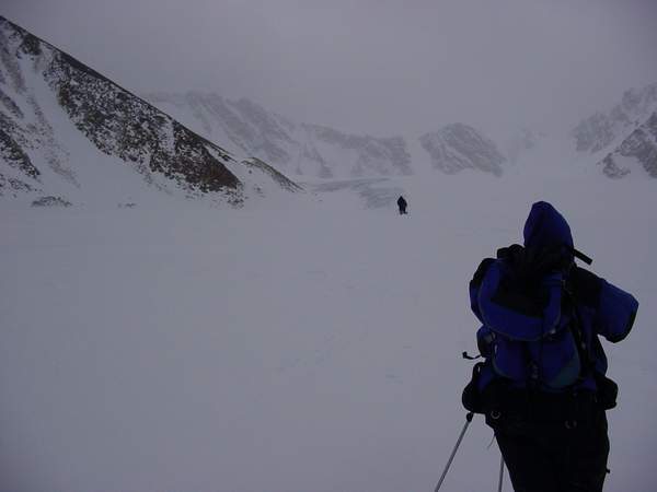
At the same moment, Kristin's first
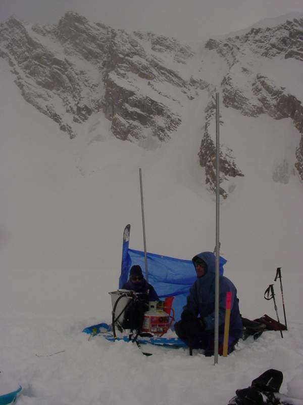
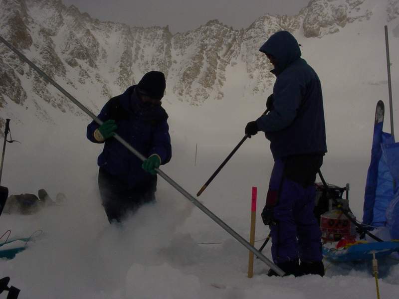
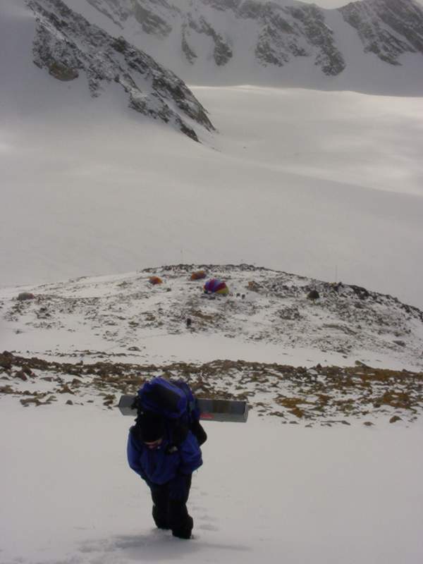
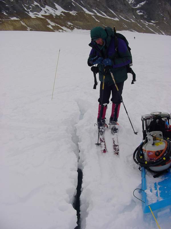
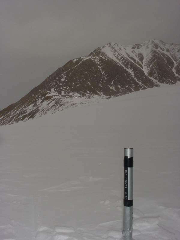
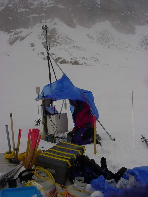
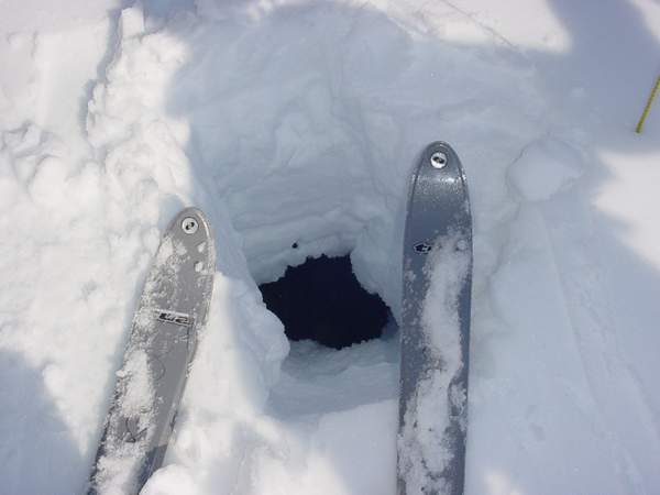
experience with the Hubley fog back at camp (note tent on ridge at right): So things have really gone great so far. Everyone gets along well, the equipment seems to be working fine so far, and the weather really has not held us back much at all. If all goes really well tomorrow, we finish the main surveying, and get many of the poles we need to install at those locations in place. That drilling effort will likely last several days. Wednesday, 21 May 03, McCall Glacier, 2:15PM GPS surveys in a blizzard aren’t the most fun, but they work. Monday was our first attempt at a full day’s actual work. As could be expected, it took several hours to get all the necessary equipment sorted, packed and ready to go. Bernhard and Bjorn got going earliest, returning to the upper cirque to finish the surveying there. We decided to add an additional transect here where we measure surface elevation every 50 meters. This survey will be repeated in future years using the real-time differential GPS, such that all we have to do is find the points again in the same manner as we are now doing for the 1970’s locations. This form of GPS is incredibly powerful, and I figure we may as well exploit it by creating new transects while we have the equipment here. Meanwhile, Kristin, Andy and I got the steam drill organized and working. We sledded it and the propane tanks up the glacier and began drilling holes to place our mass balance poles. At these poles, we measure the depth of snow in spring and fall, and we get a measure of whether the snow is gaining or losing snow there. The drilling went reasonably well, but we did not need to drag it all the way up the glacier into the accumulation areas, as snow from the previous year does not melt completely and several years worth of snow accumulates above the ice. In this region, the poles can simply be pounded in with a small sledgehammer. Putting in these poles took most of the day after our noon start, but Bernhard and Bjorn were able to make it into the middle and lower cirques for more surveying. They leave small pieces of wood with red tops at each site, which we either put a pole at or take away with us.
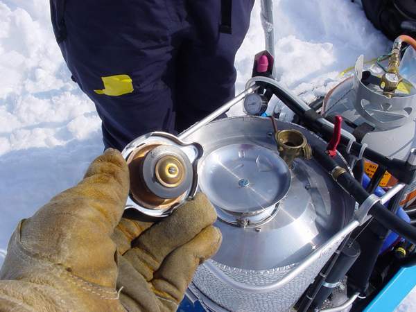
When we began packing the steam drill for the night, we discovered a major design flaw with it. The unit uses a radiator cap for a safety release valve, and this cap had frozen to the unit. Without using much force, the cap came apart at a press fitting, rendering it and the drill useless. Fortunately we had a spare drill with us, and tried the cap from that unit on the first. This worked well enough to use the drill, but it’s performance suffered because a different pressure setting was used. The next morning we awoke to a pretty decent blizzard. Air temperatures were fairly warm, but falling snow and gusty winds reduced visibility to zero at times. This was often followed by ten minutes of sunshine and calm. We ate a leisurely breakfast hoping that the storm might settle, but eventually we just went for it anyway. During breakfast I took the radiator cap apart and was able to use some spare bolts to reassemble it in a way that might make it useful again. We tested it at our cache near camp and it seemed to hold, so we set out for the lower cirque.
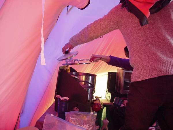
The weather really did not improve during the day, but we were all able to get quite a bit done. Several inches of fresh snow slowed our travel down dragging the drill and the poles, and the wind required us to set up a wind break at most sites, but in the end we finished all of the upper cirque drilling. Meanwhile Bernhard and Bjorn made it all the way to the terminus, completing nearly all of the 1970s comparisons. The GPS base station’s radio maintained contact all the way down there, so this was a major time savings in not having to move the base to work down there. Kristin had left us an hour early to get dinner going, and the rest of us reached camp at the same time, sometime around 8PM. Cooking dinners thus far have proved to be a somewhat frustrating experience. We have two Coleman double burner stoves, which run on white gas. For some as yet unknown reason, one or both of them emit a noxious fume that makes staying within the tent almost unbearable. The first few nights it was pretty clear that this had something to do with various labels and tape beginning to melt, but later the smells got worse for no identifiable reasons. It seemed for a while that it might be a bad batch of fuel, but who knows. When Kristin returned last night, one of the stove generators was flaring up, so she switched it with the other stove to continue cooking. This combination of equipment seemed to eliminate the fumes, but slowed down cooking with only one stove going. So in the end we got to bed after midnight, but it was a very successful day.
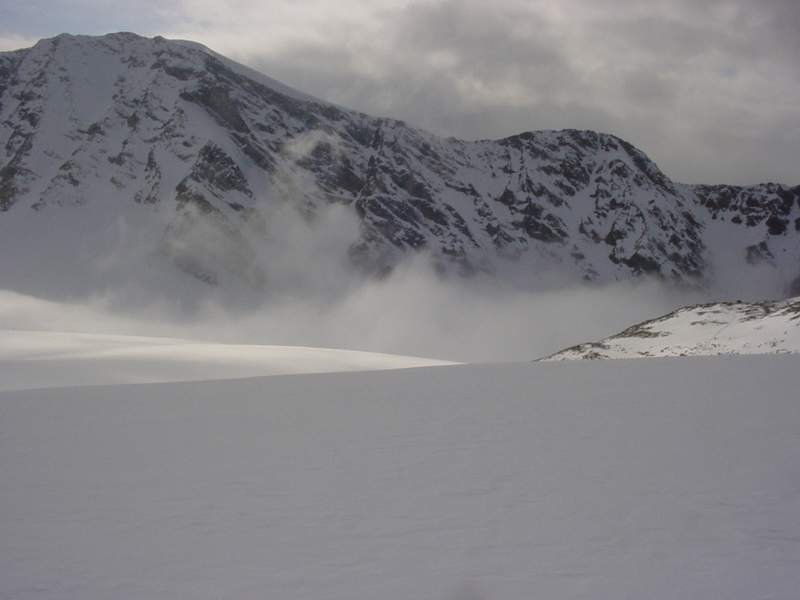
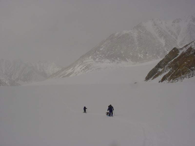
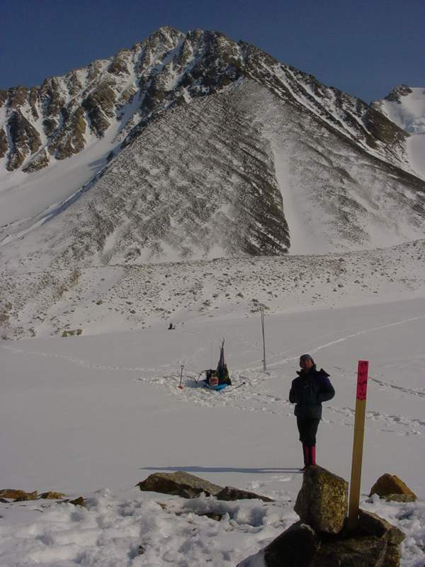
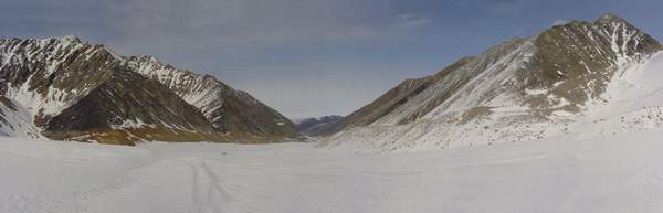
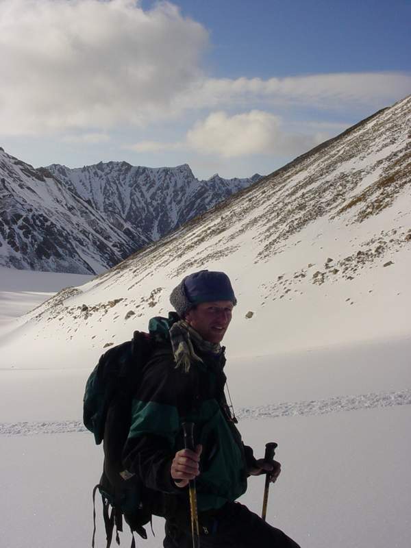
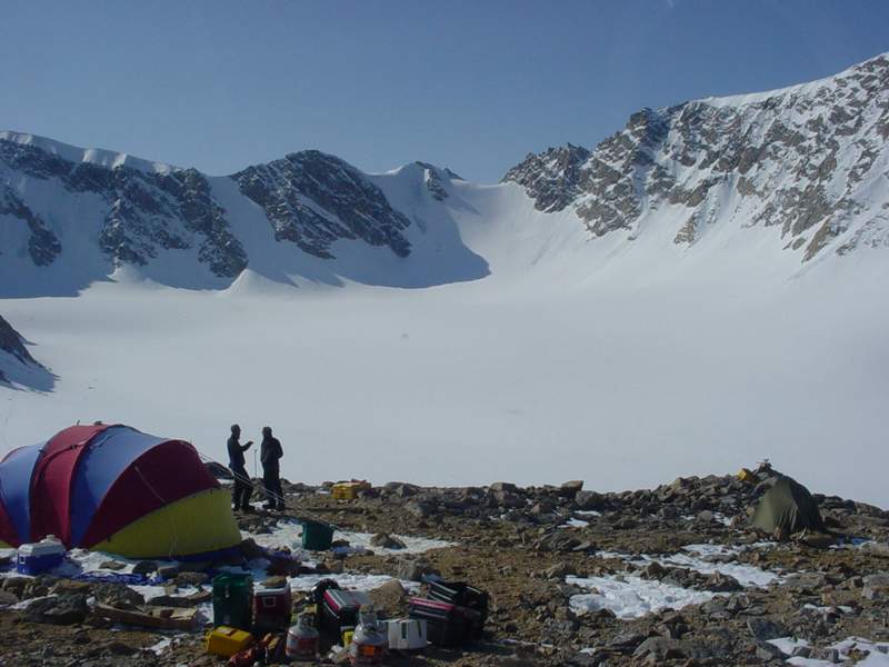
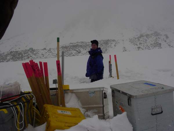
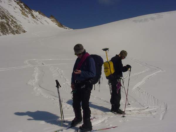
We’re basically taking the day off today from on-glacier studies to catch up on data archiving and housekeeping. The snows stopped sometime during the night, but the wind has continued. At times one wonders whether the tents are anchored securely enough as they shake violently during gusts, but so far everything has fared well. Collecting GPS goes very quickly compared to optical surveys, but the trade off is that it is easy to get overwhelmed by the amount of data collected and overlook key details in note-taking. So it seems that with every two to three days of data collection, we need a day of making sure that we have saved the data with enough information to find it useful later. I spent the morning strategizing the next week’s work, coordinating some of our take-out scheduling via sat-phone, and writing a program to reduce some prior GPS data. In addition the optical surveys on McCall Glacier starting in the 1970s, Bernhard and Keith flew some airborne laser profiles in 1993. This work consists of Keith flying his plane with a laser altimeter giving him height above ground and a GPS giving him position, similar to the way we walk around on the glacier with the GPS. The laser acquires a surface elevation every meter or so, which is more dense that we need to repeat here. So this program extracts data points every 100 meters so that we can more manageably ski between the points and hit them exactly. *** It’s evening now, and we’ve spent most of the day trying to sort out pole positions and coordinates. The earth is roughly spherical but maps are flat, and unfortunately there is no straightforward way to convert between the two so there are hundreds of systems for doing so that optimize the errors for different purposes. The coordinates we are dealing with are only in a few such projections, but nevertheless it causes hours of confusion, often repeating the same issues that we thought we had solved already. On top of this, we don’t have access to all of the field notes from prior expeditions, such that when discrepancies arise between what we thought should be the case and what seems to be the actual case, we often have to try to put ourselves in the position of those who made the previous measurements to guess at the correct solution. So far we haven’t come across anything that we cannot find a solution to, but sometimes those solutions can be pretty convoluted. It really goes to show me that you can never take enough field notes or put too much detail into a paper. In any case, we should be ready to finish nearly all of the McCall Glacier surveying tomorrow. We did some spot checks today, and it seems that McCall Glacier is continuing its mass wastage at roughly the same rate as was measured in 1993. By the end of this trip, we should have more than enough data to be conclusive about those rates and their spatial variability. The winds have died out over the past few hours, but the snow has continued. It feels somewhat surreal walking around on these snow-covered rocks, overlooking the steep cliffs that confine the glacier. One gets the impression of having landed on another planet, sleeping on an outcrop loaded with high tech gear, trying to make some sense of this seemingly pristine environment and its dynamics. It really is a special place. Saturday, 24 May 2003, McCall Glacier, 11:30PM Everything takes longer than you think it should, but progress is steady and spirits are high. We set out Thursday morning hoping to complete the GPS surveys. Several of us took sleds filled with 3 meter long pieces of 1” diameter EMT downglacier, in anticipation of steam drilling them at our survey points. The sleds we use are the $10 plastic variety that you can get at the supermarket, but they are remarkably versatile. It takes some fiddling to get the poles balanced right on them, and some overturning is inevitable (and frustrating), but in the end it is easier than carrying them. We travel on skiis everywhere. With the fresh powder, it slows progress down, especially with sleds, but it makes for easy turning in the steeper sections of the glacier. Bjorn and I were able to survey down to the old hut in the ablation area, but unfortunately we lost contact with enough satellites to complete the survey. The problem is that we are within a steep valley which cuts off our view of the sky towards the horizons, so we can only use those satellites that are directly above us. Because we are so high in the Arctic, we don’t have as many satellites to start with, so windows open up where no surveying can be done. In this case, we lost contact around 3PM, cutting short our work day. We skied back towards camp and met up with Kristin and Andy, who were drilling in poles at locations we had already marked. One of the reasons we have not yet finished the surveying here is that we have decided to do more surveying than originally planned. GPS is pretty cool, and I am hoping to take good advantage of it here by implementing new transects for study in the future. Also I am trying to confirm some analyses made by Bernhard for his thesis that suggests that part of the glacier is sliding across its bed. This is unusual for an Arctic valley glacier, which tend to be somewhat stuck to their beds. At least it seems unusual, but because there are many glaciers that have never been studied it is difficult to generalize. In any case, we are installing several profiles of stakes across the glacier above, within, and below this region to detect differences in flow patterns. Poles in areas where sliding is occurring tend to move more or less at the same rate, whereas in non-sliding areas poles in the center of the glacier tend to move faster than those at the sides. Our transverse and longitudinal profiles should show whether such differences occur here. We got back to camp reasonably early and decided to get an early start in the morning to beat the GPS outage and stay down-glacier until the drilling was finished. The day started off great, with clear blue skies highlighting every snowflake that had fallen over the past few days. After so long working in a blizzard or whiteout, it was fun looking at all of our tracks in the snow and seeing the spatial relationships between our poles and the layout of the glacier (on something besides a map). All seemed to go well during the day, but things just take longer than one would like. Bernhard skied ahead to try to find a survey monument that we did not have a coordinate for, while Bjorn and I continued the survey and Kristin and Andy continued the drilling. We managed to survey about 30 locations before we decided to ski to the terminus and work our way up, such that if we lost GPS coverage we would not have to ski so far the next day. The terminus was only several kilometers away, but by the time we got down there we could only survey a few points before we lost coverage, which happened at 2PM. Bernhard was unable to find the monument we were looking for, which prevents us from resurveying a transect that has been measured from the 1970s, but it was still a pretty successful day. With such perfect weather and spectacular views, it is hard to be unsatisfied. Kristin and Andy had finished the transect we surveyed the day before and we already starting on the second by the time we made our way back up to them. It takes about four hours to ski from the terminus to camp, at the rate I travel anyway, and with digging snow pits and discussing things along the way it takes much longer.
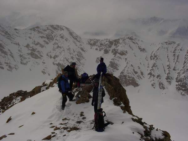
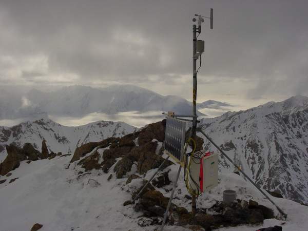
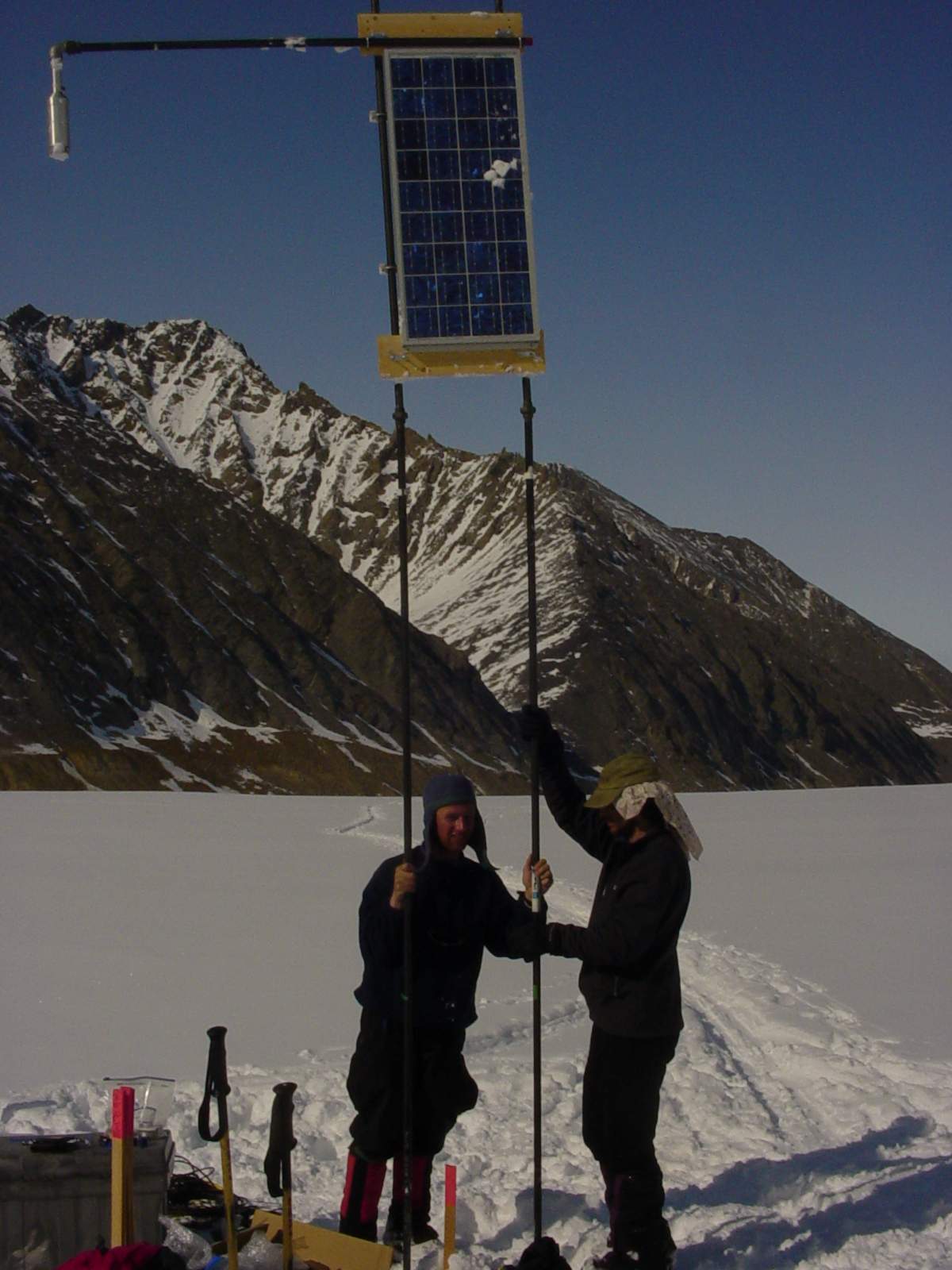
We had several choices to discuss that night regarding the next several days work. One option would be to go downglacier early again and try to finish everything up. Another choice would be to finish up the remaining surveying up glacier and install the met station near camp. Another choice was to survey the Hanging Glacier that overlooks McCall Glacier. The general consensus was to spend the next day upglacier for a little variety. We caught up on sleep last night and awoke to strong winds this morning. There was no snow, but the tents shook pretty hard as we ate breakfast. This kind of weather makes everyone move a little slower. As I was motivating myself to get out of bed, I was trying to think of things to do besides what we had discussed the night before. Installing the met station with these high winds would have been a frustrating and potentially dangerous experience. My initial plan was to install the station right at camp, which would have been no problem. But in seeing the lay of the land, I decided to install it on a ridge about 1500 feet above camp, as it seemed more representative of the Brooks Range here, and less affected by the microclimate of the valley. Unfortunately this meant lugging heavy batteries, solar panels, tripods, instruments, etc up this ridge on snow covered rocks getting whipped by the wind, then having to erect it all on that ridge which is only several meters wide. Fortunately, by the time we finished breakfast, the winds had completely died and we began the process of hauling the equipment up the hill. Bernhard, Andy, and Bjorn got started first, and had actually reach the spot before Kristin and I started. We had still to finish fabricating a few parts and make sure that we had all of the tools and hardware we needed, so that we would not have to reclimb the hill. It took those guys about an hour to reach the location, but us somewhat longer. Rather than come down right away, the first three dropped their bundles and continued climbing the rocky ridge to its peak to get a better view of the area. By the time they returned, Kristin and I had reached the spot and begun unpacking. Andy and Bjorn then went down to camp to finish surveying the upper glacier, while Bernhard stayed behind to help us erect the met station.
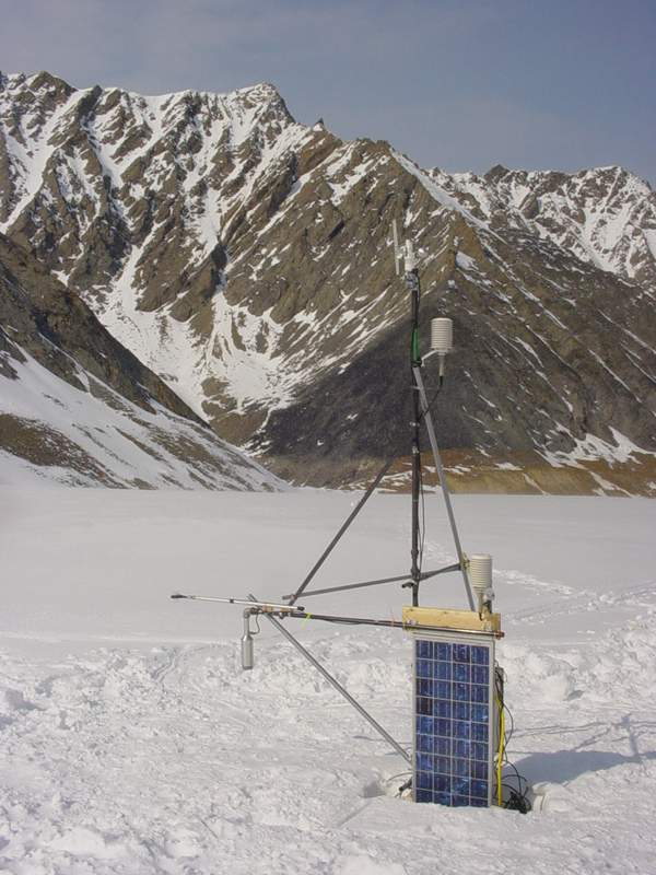
The view from this spot is really stunning. It was somewhat overcast and snowy today, but from this high you could see the Arctic Ocean and the neighboring valleys. That was actually one reason for choosing this location – so that we could send our met data to Kaktovik via radio, where it can be downloaded hourly from the internet. This location is also ideal for a web cam or two, so that one can watch the progression of melt on the glacier throughout the summer, and visually correlate it with weather variables. Construction went well and in a few hours we had a pretty nice weather station set up. It can probably use some improvements over the years, but it will still yield us with lots of interesting and otherwise unavailable data in the meantime.
Tuesday, 27 May 03, McCall Glacier, 5PM We nailed the glacier then got nuked. We woke up Monday to a beautiful view of the glacier. Bjorn and Bernhard left earliest to try to finish the surveying before the GPS window closed. It took me several hours to get everything ready for the second met station to take down glacier. The worst thing is to get down there and realize that you forgot a nut or bolt that holds up progress. The site of this station is about four kilometers away, and a several hour slog back up hill. We ended up with pretty full packs and large sled loads to get everything there. By the time we were just getting set up at the site, Bernhard and Bjorn called back to announce that the GPS window had closed, but fortunately they had finished the survey. This was a major accomplishment and a great relief.
Bernhard in
motion #1. The sunny, calm weather was perfect for drilling and work went well. When the other two showed up, we were able to get two teams of drillers going while I worked on the met station. The drilling was slower than hoped for due to the normal breakdowns, but we were able to finish the velocity stakes and erect the met station and GPS base station. The structure for these two instruments consists of two poles placed vertically into the ice on which the instruments are attached, then some form of cross bracing like a tripod with more poles drilled at an angle. The tricky part here is that the surface in which we are mounting the instruments will melt by as much as two meters this summer, and we need to make sure that the entire structure will not topple over. By the time we had finished drilling the poles, however, the sun went behind the mountains and it quickly became cold. It is still early enough in the year that the sun does not heat the air much, only things in the sunshine. So we are warmed directly by the sun, not by the air, and when the sun disappears it is very noticeable. In what time was remaining in the day, I had everyone working on getting the structural parts of the stations complete, so that when we left we would know whether there were items we had forgotten at camp. As this was stationary work, to stay warm people would go for a quick ski or walk and go back to work. By the time we got to the point where we could clearly visualize the remaining work it was fairly late, and we didn’t finish dinner until midnight.
Perhaps the most frustrating part of this research has been work in the lower part of the glacier. The problem is that it always seems like it should only take one more day to finish, but it doesn’t. Because of this, every trip down there chews up several hours to slog back to camp, and begins making for late days and late mornings. This rotating schedule, compounded with the GPS blackout in the afternoon, ends up creating even more lost time. I can hardly complain though, as we are making steady progress every day and getting some very interesting results already, with the potential to get many more.
The next morning was another calm and clear view, and I hoped once again would lead to finishing all of our work down glacier. We had still more loads to haul down there, and I think everyone enjoyed devising their own ways of hauling them while still enjoying the skiing. Bjorn stayed back at camp to organize the GPS data collected so far, while we finished the remaining drilling at the hut profile. This profile is where the met station and the GPS station are located, and where surveying has been done since the 1970s. The GPS station will be left for the summer to continuously record ice velocity there. A huge accomplishment was installing a 13 m long thermistor string at the same location as one had been placed in 1972 and 1993. This was the deepest hole that we had to drill, and I had little reason to believe it would work given how temperamental the drills have been. About half way through the drilling, the weather took a severe turn for the worse and high winds developed, with angry looking clouds whipping across the valley above our heads. Fortunately the drill held out and even more fortunately, we were able to drop the thermistor string all the way down the whole without it getting jammed, as commonly happens.
Once the thermistor string was completed, we again broke into two drilling teams to try to complete the remaining transects. The winds had died down by the time we began moving down glacier, and all looked on track. It was already late in the day by the time we started these new holes, but the air temperature was still warm. By about 7 PM we had most of the holes complete, and Bjorn had come down to re-survey many of them. Because most of these poles will measure velocity, we want to know where we planted them more accurately than the mass balance poles. By this time, however, the winds began picking up again and growing quite strong. We all met back at the hut profile by about 9, and cached our drills and as much junk as we could to begin the slog back to camp. Within half an hour, winds became extreme and blowing directly against our path. Fortunately they brought warm air with them, so that you hardly needed to cover your face. Had the air temperature been –5 or –10C as it had the night before, we would likely have had to bivuouc that night. The winds continued to worsen on our ski back, and showed no signs of lessening. Average wind speed recorded at my met station before we left were 20 meters per second, which about 40 mph. Andy had a handheld wind meter that we used about half way back that showed consistent winds of 60 mph. This wind is strong enough to push you downhill against the resistance of the climbing skins on your skiis. The four of us met up again at the helicopter cache, about 1 km from camp, to regroup. As Kristin and I approached where Andy and Bernhard were waiting, we made some jokes about the weather during a brief calm moment. The really weird thing about it was even though it was brutal wind, it felt almost benign because it was not chilly. As I brought up the rear, I began walking towards the group again, bracing to kept from getting blown backwards while the others stood upright and talked. At just this moment, a gust came through that likely exceed 90 mph and lifted the others into the air and knocked them flat to the ground. Everyone got back up laughing and we continued on our way.
Kristin getting nuked on the way back.
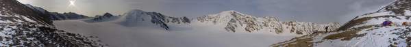
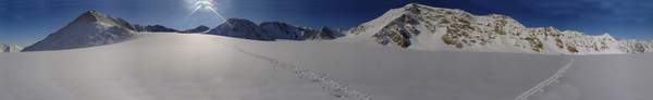
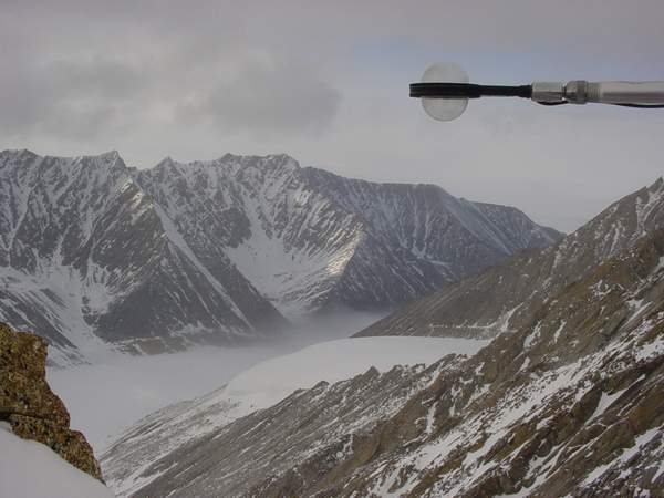
As we were within sight of camp (at in between ground blizzards), we all traveled back at our own pace. Camp sits high up on a moraine that takes about 45 minutes to get to from this part of the glacier. Earlier in the day, I had tweaked both my back and one of my knees, and with every step up glacier they both began hurting more. By the time I was within sight of camp, I was nauseas from the pain and as soon as I got there I puked my guts out. Fortunately I hadn’t eaten since lunch and it was now nearly midnight, so I didn’t make much of a mess. Liberal doses of ibuprofen, alcohol and laughter made me forget about the pain and helped me sleep soundly through the night even though the tents went nearly airborne several times. This morning we all slept in late. The wind died down considerably, but strong gusts regularly reminded us all of the night before. I spent most of the day fiddling on the computer trying to compile data. Kristin tried to put some order to the cook tent and sort our supplies. Bernhard went for a ski to the middle cirque to install a pole and check on snow conditions at the pass. Andy and Bjorn left about 4 PM to go back down glacier to finish installing the GPS station and measure a few more points that had to be abandoned during the wind storm yesterday. When they left, winds were reasonably calm, but have since grown strong again. If all goes well, we should all be back here by 9PM for an early dinner. Saturday, 31 May 03, McCall Glacier It’s beginning to feel like working in Siberia: hurry up and wait. Kristin and I got an early start on Wednesday to finish up the GPS surveying on McCall. It was an overcast morning with occasional snow flurries, but it was good enough working weather. The only work left was to finish surveying an old laser profile from Bravo Pass to the confluence nearby camp. The lower cirque, starts at Bravo Pass, is one of the more spectacular spots on the glacier, because it is enclosed on three sides by steep-sided and tall granite cliffs. I took several panoramic photos once we finished the survey.
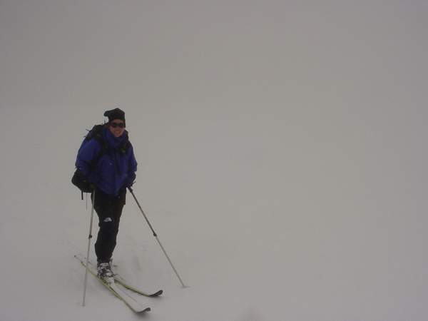
Once done with the pictures, we skiid down-glacier to finish up the lower met station. Just below camp, the infamous Hubley fog was thick and inpenentrable. This fog often blows up-valley from the tundra and gives the place an eerie feeling. Once we had skiid into it, we were in a complete white-out, like being inside a ping-pong ball. It’s a bit like being in complete darkness, except that it’s white. You cant make out the difference between ground and sky, and it makes skiing on lumpy, hard sastrugi fairly difficult. Fortunately it was difficult to get lost, as all we had to do was keep going downhill, and we had plenty of poles along the way to use as road signs.
There wasn’t much to do on the met station except make sure it was working. We dug out the solar panels which had been buried, tied up some loose cables, checked the data logger, then packed it all up for the duration.
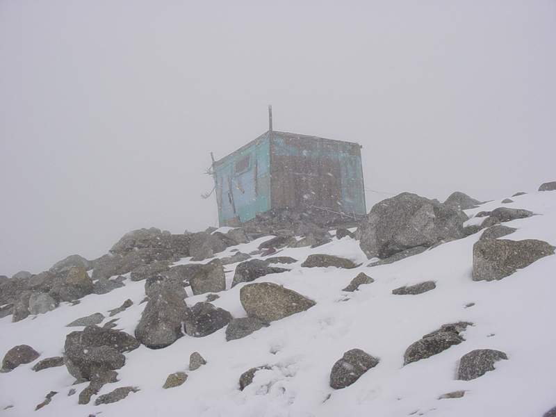
Once we finished, we dragged some extra poles and gear over to the hut. This hut was initially built in the 1950s, but rebuilt in the early 70s, and has since been falling apart every since. Now it is has fallen off its foundation and been wracked pretty hard. It sits up on a moraine across from the met station. When it was built, one could just walk from the glacier to the hut, but because the ice has melted so much, one now has to walk up about 30 meters of rock covered ice. There is also a lot of junk left up here from prior expeditions, which hopefully we can get out of here one day.
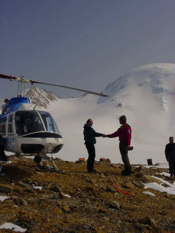
The rest of the group slept in a bit and had an easy morning, as they had been out late the night before. Andy and Bernhard got going for a survey on the Hanging Glacier, which overlooks the hut, about 4PM. This is about the earliest that the GPS works after the morning window. Bjorn came down and met us at the met station, where he finished up the GPS base station located next to the met station. This GPS station will measure ice motion continuously throughout the summer and complement our spring and fall pole position surveys, which only give an average speed between May and August. The three of us skiid back in the snow and fog, while Andy and Bernhard worked high above us. Several times during the ski back, they had equipment problems, and so used the radios to call tech support (aka Bjorn). It was a somewhat surreal experience, standing the there with zero visibility talking with people on a mountain-top about how to troubleshoot a $30,000 equipment package. Fortunately the winds were not too strong. That night we had a goodbye party for Bernhard. The helicopter was due to show up the next morning and take him out, and take us over to some other glaciers for more GPS work. Everyone made it back to camp around 11PM, and we ate a good Mexican dinner, drank Tequila, and watched a movie on DVD. I toasted the group for all of their hard work and to celebrate finishing the work in the McCall basin, and we had a good night. The skies were clear in the morning as we anticipated the arrival of the helicopter. Unfortunately, bad weather was lingering elsewhere, slowing things down. The fog was so thick on Barter Island that the commercial plane flights had to be turned around, and the helicopter was stuck just north of the Brooks Range. By late afternoon, the flying was better along the coast, but we were experiencing our heaviest snows yet. It was a wet, sloppy snow, which made working outside kind of yucky. We made use of the time to reorganize gear, getting loads ready to take out when the helicopter arrived. We also spent a fair amount of time discussing the differences between NAD83 and NAD27 and getting our next several surveys planned out. The trouble with all of these coordinate systems is that they are all slightly different and overlooking minor details (which mostly have to be second-guessed because we have no notes on them) can make the surveying efforts somewhat wasted. The snow did not let up during the evening, and we gave up on any helicopter work that day. Next morning I called in to Waldo’s at 7AM to tell the helicopter pilot that the weather was fantastic up here. Unfortunately, the helicopter was broken and awaiting parts to be flown in. Their estimate was that they could fix the machine and be here by about 1PM. This would still leave us plenty of time to pull the gear we had cached by the met station up to camp, repack it with Bernhard and get him out in time to catch the 4:30PM flight to Fairbanks on Frontier. We spent the morning organizing for the surveys, repacking gear, and basking in the sunshine. This was the warmest day we had yet, with temperatures above freezing and bright sunshine. Though it may not sound it, it was actually hot to stand around with more than a sweater on. One o’clock came and went with no helicopter, and it did not show up until about 3:15. We quickly unloaded the gear he had brought in (mostly more survey poles and some radios), and got Bernhard on board with his gear and anything else we could send out. Once they lifted off, I called the Frontier office on Barter Island and told them that a passenger would be arriving there by 4:30PM and asked them to hold the plane until he showed up, which they did. As it turned out, there was plenty of time for him to catch it, as they taxied a bit off of the end of the runway and got stuck in the soft mud for about an hour, having to get pulled out with a pickup truck.
We did not see the helicopter again until after 6PM. Apparently he went to go check on the fuel cache that had been put in when we initially arrived in town, and had to do some maintenance on it. In the meantime, Bjorn worked on trying to program the radios which had hoped to use for telemetering our weather data back to the internet once we leave. This turned out to be a difficult problem, as not all of the cabling had arrived, or at least we couldn't find it. Once the helicopter returned, we stopped work on that and Andy and Bjorn hopped on to survey several glaciers not far away. After they got dropped off, Dennis returned to carry me down to the met station to pick up the steam drills and propane we had left down there. He seems like a really competent pilot and eager to get the job done. Once we dropped that load off at camp, he returned to Bjorn and Andy to relocate them to another glacier, and waited there until they were done. Everyone returned to camp around 11PM to report that the surveying had been very successful and began discussing plans for the next day. This morning greeted us to another warm and sunny day. I called in to Dennis about 10:30AM to find out the weather on Barter Island and when he might be able to make it back here. The FAA has fairly strict rules on making sure pilots get enough sleep, and since he did not make it back to Kaktovik until after midnight, he could not start until after 11AM. Apparently some clouds and fog were lingering around the coast, but it seemed like it might clear off. We made plans for him to arrive about 1PM here, and take a few loads back to Kaktovic before the GPS window opened up again at about 4PM. It’s now after 3PM, and we have seen no sign of him. Communications are awkward, as we do not have the power to leave our satellite phones on, and we have to call the hotel where the pilot is staying, Waldo’s, to pass messages. The airport is about a mile outside of town, and there is no phone there (or at least none that we have access to). So at this point, Dennis is probably sitting on the runway waiting for the weather to clear. Things are still beautiful here, but at this point we are going to have to start rethinking our plans. If he shows up now, do we send a load out or do we have him wait here for an hour so we can start surveying the other glaciers? The tricky part is that we do not want to send out stuff that we may still need, and we don’t want to break down camp until we are sure that we are going to get out. I think that today is likely our last opportunity for working, as tomorrow is our last scheduled day for use of the helicopter, and even in good weather it will take at least three flights to get us out, which will take at least 6 hours, probably more. There is some possibility that if it were a nice day that two of us could then leave Kaktovic (after pulling everything out of camp) to then survey one more glacier and return to Kaktovic. But at this point it’s all guess work, though not quite as bad as the guess work and hurry-up-and-wait that we have to do in Siberia. Tuesday, 03 June 03, Fairbanks, 11AM It’s the end of the beginning. Dennis never showed up that day. We talked about 6PM and learned that he had been trying, but the fog was just too thick over the tundra and was forming ice on the helicopter. Though helicopters have the ability to hover, single engine models like this one are not allowed to fly over fog because if the engine goes out they will have to land down through it. There being no real sign that the weather was going to break, we decided to let Dennis get some sleep and shoot for an 8AM start for work on the glacier the next day. We had spent the day basically on hold. Bjorn went for a ski and checked out a pole that my notes were confusing on. Andy took a nap in the sun. Kristin studied her flight training manuals. I did a little computer work, then lied down outside in the sun. This was the first really warm day we’ve had, and it was nice to just lie down on the rocks and enjoy the view. Waiting for aircraft is not as easy as it sounds, as there is a lot of mental energy being spent analyzing possibilities and you cant really commit to some other task because it has to be dropped at a moments notice. Once we called it off for the day, I think everyone was relieved and we spontaneously decided to celebrate what was hopefully our last night on the glacier.
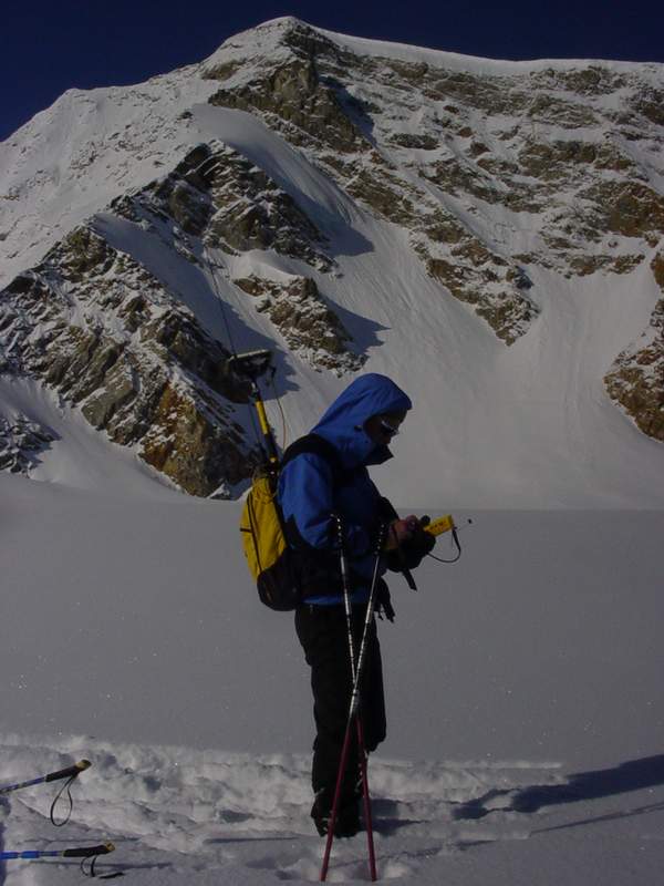
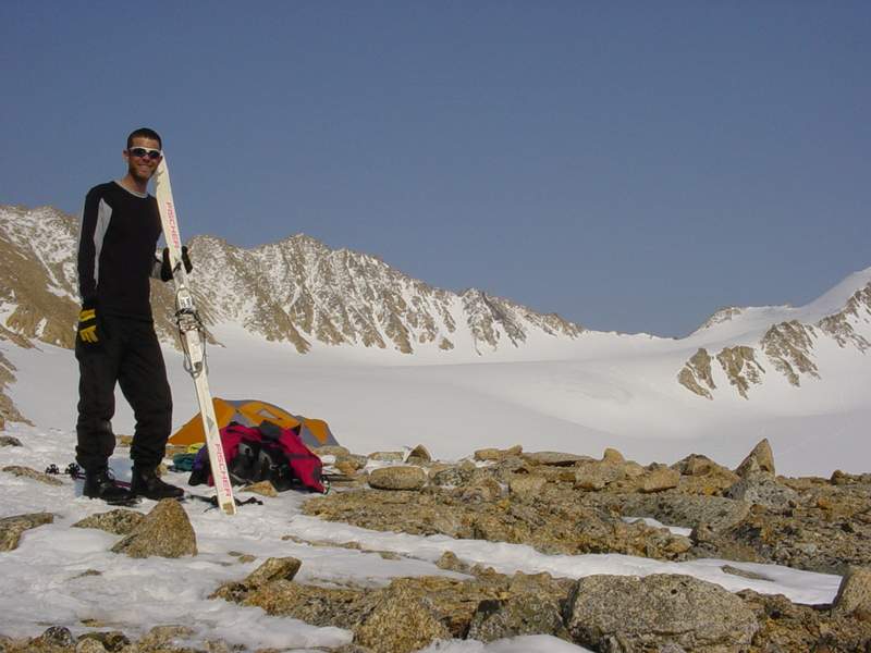
The next morning we woke early in anticipation of an 8AM lift-off. The weather was once again stunning. Eight AM came and went, then 9, then 10, and still no helicopter. We have all kinds of tricks to bring the helicopter in, like making a fresh pot of coffee, sitting down on the outhouse, taking a nap, but none of these seemed to work. About 10:30 I was getting ready to call in, but in no rush to do so as I knew that the problem was likely fog down low again. Then just as we contemplated skiing out, we heard the unmistakable sounds of rotor wash reverberating through the valley. A new plan had to be devised. The central problem with our work schedule over the past two weeks had been the GPS windows. Between about 1 and 4PM, there were not enough satellites visible to get the accuracy we needed for the research. Now it was almost 11, and there was not enough time for multiple glaciers before we lost lock. So we decided to do a small glacier not far away that had never been studied before. This glacier faces due north with no twists or turns, so makes a really nice case study for how climate affects ice facing north. This glacier had no name, so I named it Scott Glacier to honor my favorite field assistant. Scott Glacier turns out to be a beautiful little glacier that looks over the tundra out towards the ocean. It has very steep sides and a series of rolling ice hills that end in a steep-faced terminus. Rather than just do a centerline transect, Kristin and I began our survey at the top and made a series of zig-zags across the width of the glacier with the GPS. We also made a complete perpendicular transect at a constriction where I was able to go from rock to rock, at about where I guessed the equilibrium line might be, such that we will be able to repeat this transect in the future as a visual metric of volume loss. Towards the bottom we stuck to the centerline just to minimize time. The snow had softened so much in the hot sun that it was sticking to our skiis while we walking, so skiing down the centerline gave us more glide and the breeze helped to cool us off.
By the time we finished we were beginning to lose satellites, so we went on a brief reconnaissance mission. We flew over the Okpilak valley and into the Hula Hula where Esetuk Glacier drains. It was still a spectacular day, with barely a cloud in the sky, and perfect for picture taking. Esetuk Glacier is one that Keith and Bernhard had studied in 1993 and was one that I really wanted to study on this trip. My idea for this trip was to at least develop and test the techniques that I would use on the rest of the project. On McCall Glacier, we had the radio-linked GPS that could get us to within a few centimeters of our intended repeat-locations, so that was one method. On Hubley Glacier, we had discrete points to relocate, but no radio link, so we used hand-held GPS to get rough location (5 meter) then skiid back and forth over the spot within a 5 meter radius to ensure that at least one point would be within a few centimeters. On Schwanda and Scott Glaciers, we tried both centerline and zig-zag techniques on ice that had never before been measured. On Esetuk Glacier, we wanted to try to repeat a laser profile that had continuous points but without a radio link. Here, we would have one or two people ski ahead to points subsampled to 100 meter apart, then have the precision GPS make turns over their tracks so as to increase the number of crossing points for comparison. When we returned to the camp, we therefore had to make some further decisions. The weather showed no signs of deteriorating and the forecast was more of the same, but we wanted to make sure that we could still get out. Ideally we would have sent Dennis out with a gear load during the GPS outage, but the main problem here was that the tundra was still foggy, and there was no guarantee that he could make it back. So we decided to send Andy and Bjorn over to Esetuk and have them try to work even during the poor GPS coverage and make the best of it. The reason this might have worked in this case is that by using the kinematic feature of the GPS, a continuous recording starting during poor coverage and ending in good coverage can actually be post-processed to be nearly as good as if it was all acquired during good coverage. Once they were dropped off, Dennis would return to get more fuel from their cache and take me over there, while Kristin continued breaking down our camp. We calculated the time it would take for three runs to town, and worked backwards from when Dennis was required to stop flying to figure out when we need to finish the Esetuk suvey by, then took off. The snow was nearly perfect on Esetuk Glacier and work proceeded very quickly. By the time I got there, Andy and Bjorn were set up and starting to head downhill. We began by relocating points every 200 meters instead of 100, to save time. Andy and I would leap-frog each other to locate these points with our handhelds, while Bjorn would ski down with the main GPS, making turns over our snow-plowed straight tracks. We had to deviate from the original laser profile to avoid an ice fall where we found some pretty large cracks, but other than that, we were able to cruise down-glacier. It remains to be seen how close we came to the intended track, but I believe the technique worked pretty well.
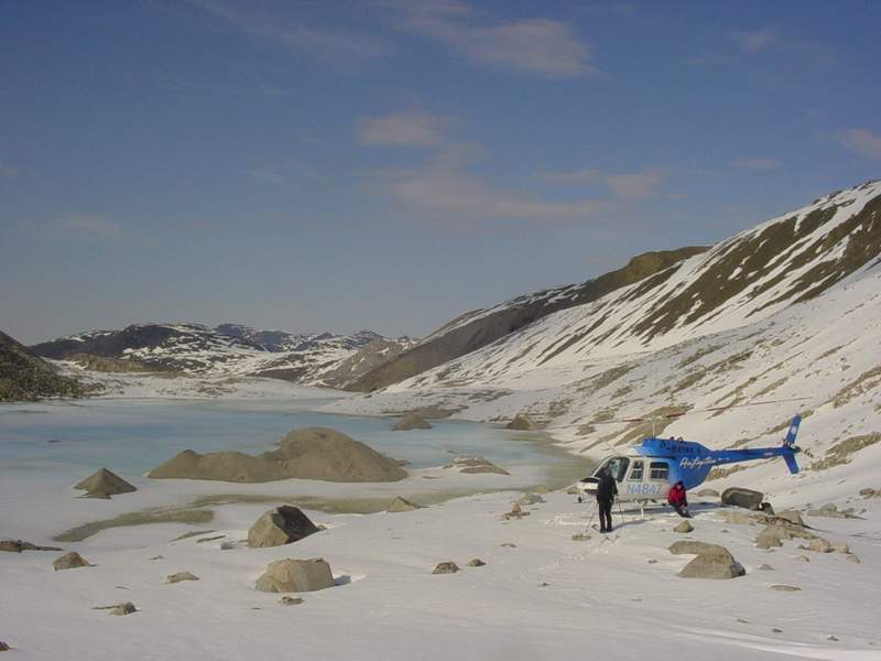
We met Dennis at the bottom not too long after our intended rendezvous time. The past few days of warm weather had clearly taken their toll on the snow, as a large lake had formed within the old terminal moraine of the glacier, with turquoise-colored water that was similar in color to the helicopter. Our plan was for Dennis to take the three of us out at once, but with the fuel he had just added, this turned out to be a little heavy for the tiny chopper, so I waited behind while the others headed back for camp. It was quite pleasant to stand at the terminus overlooking the lake, looking at the moraines and wondering what it must have looked like several hundreds years ago when the ice was at its most recent maximum. I used the time to give a quick call home to wish my mother happy birthday.
During our work on Esetuk Glacier, a storm had quickly moved in from the south. Just in the ten minute ride from Esetuk back to McCall Glacier, the clouds were noticeably heading our way. I sent Andy and Bjorn out first, as they both had other work scheduled immediately after this trip, and I wanted to be sure that they would make it. A few minutes after they took off for town, it began snowing at camp, and we wondered whether we would see them before they got on the plane the next day. In good conditions, we could expect Dennis to return within an hour and a half, and we still had a lot of work to do to break down camp. We began by emptying out the cook tent, then dividing things into cached and return piles, then boxing everything up before it blew away in the wind, which was steadily increasing. Fortunately most of the work had already been completed, but it was all of the little things that were left. We hustled about and before too long, we had the tent down and packed up. An hour and half came and went, giving us more time to organize the cache and rock it down so that it would not blow away over the summer.
Dennis returned to report that conditions on the tundra were marginal and that he almost didn’t make it back. By this time, it had stopped snowing where we were and visibility was good, but it was clear that a third trip to town with cargo would not be possible, so Kristin and I hopped on with our personal gear, and waved goodbye to our home of the past two weeks. Conditions on the tundra had worsened in the meantime, and we were forced to follow the Jago River pretty closely to find our way out. We set down several times to wait for conditions to improve to the legal minimums, wondering whether we would spending the night out here, which wouldn’t have been too much of a hardship as we had all of our gear with us, but a hot shower in Kaktovik sounded pretty good too. Fortunately we made it back to town without incident, found our prior cargo in the familiar pile on the side of the runway, and met up with our crew at Waldo’s. Dennis, wishing he had stayed in Kaktovik. That night we relaxed in the Fish and Wildlife bunkhouse, had hot showers, watched a movie, and reveled in our success. While various situations conspired to reduce the amount of work we could have otherwise accomplished, it was a very successful expedition. We completed everything we intended to on McCall Glacier, surveyed a good selection of other glaciers, had the full range of fantastic to horrible weather, and just generally had a great time. We joked a bit about wanting to have a good meal in town when we returned, but the joke was that we ate so well on the glacier that anything else was a let down. The next morning, Sunday, I was awakened by a phone call at 8AM. It turned out to be Marin checking in with us about how things went. Bjorn was already up, thinking that he might catch the 10:30AM flight to Deadhorse, so that he could do some work at Toolik Lake, but had by this time decided to come with us back to Fairbanks on the 4:30PM flight. I was exhausted and went back to bed for a few hours. It felt like exhaustion from the previous month, rather than just the previous day, that had caught up to me, and it felt pretty good to get another nap in. At this point, as long as we didn’t lose the data, it was all downhill and just a matter of getting our gear back to Fairbanks, and I was in no rush to begin dealing with either the hundreds of emails no doubt waiting for me or the demands of other projects. As for our gear still on the glacier, Dennis was having a pretty bad time of it. He had made it all the way to the hut, but there was a wall of white cloud and ice preventing him from making it to our camp. He went back down to the tundra to wait for a while then tried again, but there was no way in and he came back to town. Rather than try again, he switched gears to fly some Fish and Wildlife people around near the coast. I contemplated staying in town for another day to try so that I could make sure our cargo got on the plane, but decided against it as it could be a week before the weather cleared sufficiently. In the meantime we learned that our Frontier Airlines flight would be delayed. Apparently the prop had been damaged on take-off during the morning flight to Deadhorse, and a new prop needed to be flown in, and our cargo weight needed to be limited. Getting cargo out of Kaktovik is an interesting process. Walt is the Frontier agent in Kaktovik, and he also runs the local hotel. Baggage check happens here, and consists of hauling the gear into the hallway, weighing it, and hauling it out the same hallway, trying not to knock over the people coming the other way with their bags. So for us, we had to get our gear from the airport runway, take it to the hotel, then back out to the runway. By the time we were finished, the plane had landed, and we backed the pickup right to the cargo hatch of plane. The security scene in Kaktovik really makes me think about the reasons for security in general. Why is no one concerned about terrorists here? How do such people pick their targets? If every one lived in small towns like this, rather than cities with mass populations and symbols of wealth, could such methods have the same impact? On the flip side, the rules that the FAA and governments set up are not designed for places like Kaktovik, but places where one can be completely anonymous and where security agents have to screen thousands quickly. In Kaktovik, Walt may not be going through people bags or patting them down, but I’ve no doubt he can size up wackos at a glance, and with less than 10 travelers per day, he’s got the chance for that. Same with Dennis the helicopter pilot – I showed him my 357 before boarding and rather than be freaked out he showed me his 44. Similar with the Frontier pilot. So it seems to me to be something to do with the fear of the unknown more than fear of the known, and that those with the responsibility do not have the time or interest to get to know individuals, so they resort to lowering the bar to treat everyone as a potential threat as a time management tool. I dont know what the solution is but it seems clear that the larger our population gets the worse the problem will be and the more freedoms we are going to lose. In any case, the four of us arrived in Fairbanks with a bunch of our stuff without incident. Andy had a plane to catch in a few hours, taking him eventually to Yellowknife by the late the next day, and he had to do some laundry before leaving. So after dropping off the gear at my house we all went for dinner at the Greek place next to the laundrymat. It was nice to relax, drink a few beers, and talk about future plans. Bjorn stayed with us that night, and left in the morning for some work on campus then a trip to Barrow. But now its over. Professionally, it was an outstanding trip. We accomplished all of our major goals and many of our minor ones. Personally, it was also excellent. I enjoyed the company of a great group of people, had many fulfilling scientific discussions, received a great introduction to a unique and spectacular region of the Arctic that few get to see, and have four more years of research here to look forward to. I also experienced that clarity of purpose that I have only found in the past through field work (or weddings). It is an addictive feeling that displaces worries of age, ego, or economics with that nymph-like quality of waking up each day with no memory of the past and an imperative to learn and explore in the future. Perhaps most importantly, however, I was able to share this experience with my wife, and learn that we can successfully work together on serious, long-duration expeditions involving many individuals. I hope this will only be one of many such expeditions together in the future.
|
(c) 2003 Matt Nolan. If you find any broken links or other errors, please let me know. Thanks.
 .
.