Dr. Matt Nolan
Institute of Northern Engineering
University of Alaska Fairbanks
|
Dr. Matt Nolan
Institute of Northern Engineering |
|
|
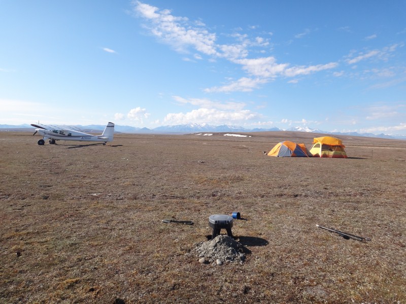
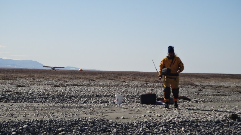
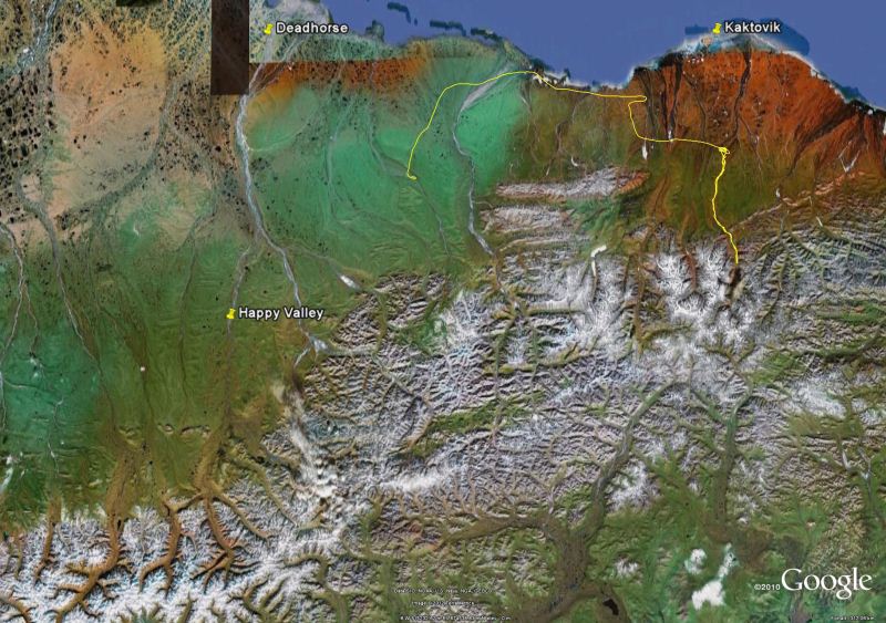
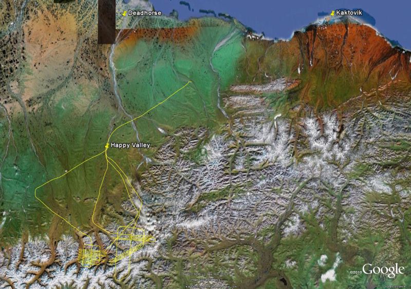
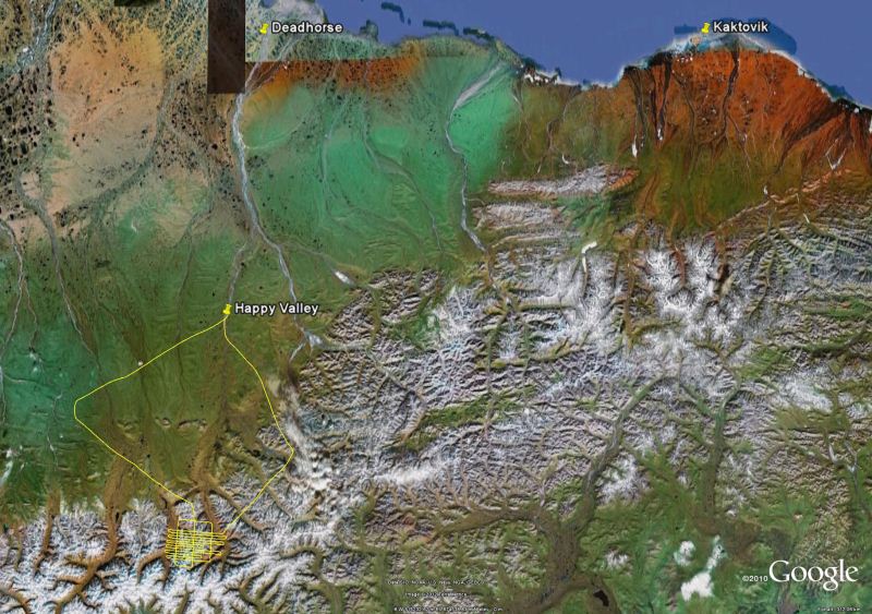
The Bravest Boy in the Arctic 7 June 2012 -- Happy Valley We left Fairbanks about 9AM this morning for the Arctic. Our general plan was to make it to Deadhorse, but weather there was marginal at best, as it had been for the past several weeks. So our alternate destination was Happy Valley, about 100 miles south of the coast and outside of the coastal weather. Our primary objective for the trip was to conduct vertical aerial photography and lidar of a variety of arctic terrain using a system I developed over the past several years but hadnt yet used operationally. The general idea is that this system allows us to make topographic maps of large areas from nearly any altitude by two independent means, such that we are collecting our own ground control in the air and can assess our own errors. So, for example, we can track ice melt on a glacier throughout a year or decade, or measure river erosion, or permafrost melt, or pothole growth in a road, etc. I built this system from largely off-the-shelf components that weren't particularly designed for this task, to save costs. So there was a lot of integration necessary, as well as a lot of post-processing details to sort out. Slowing things down was the fact that I never had funding for this development, the $75k worth of hardware came from various slush funds and creative financing over a period of years, mostly converting 'excess' salary into equipment by overcommitting my time, creating a double overload of having too much work to do in addition to this development work. But I knew that the only way we could afford to make the measurements required here -- that is, to understand the impacts of climate change on the landscape -- was to operate such a system on our own. Though I've been fairly successful with funding in general, I could read the tea leaves well enough to know that it would be more efficient to just to build the system than it would be to convince someone to buy me a real one at $500k. Of course, to operate this airborne equipment we also needed an airplane to operate in, and this was a whole 'nother level of complication and effort. So this trip was in many ways the culmination of many years of hard work, both with the airborne equipment and airborne operations. But practically speaking it was largely an unfunded shake-down, a chance to demonstrate what we were capable of in the arctic and use this to generate operational costs in the future. The trip was relatively uneventful, with reasonably clear skies and smooth air. Turner watched some movies while I dozed off and Kristin flew. As we crested the continental divide, we could see nearly to the coast and heard some familiar voices on the radio. Chris and Paul were flying around in Paul's 185 doing some lidar around the Toolik Lake area. Shortly after we landed about noon in Happy Valley, they stopped by to say hi and chat a bit before continuing on. We decided to hang out here for the afternoon to see if the weather would improve in Deadhorse.
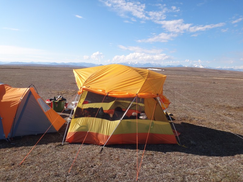
The camp at Happy Valley consists of one loggish-cabin, a few ATCO units, and a some random other moveable buildings. This season it was being run by Mark and Lori who had spent most of their adult lives living on a homestead on the Kandik River, north of Eagle, and this is the first time in 30 years that they have spent a summer anywhere other than there. They seemed to fit right in and enjoyed their new digs, trying to decide whether this might be a long-term option for them. Their children and grandchildren were visting for a few days too, and it was a quite the homey, comfortable atmosphere there so we decided to stay the night and base here.
I spent the late afternoon installing my camera/lidar system in the plane. It was something that should have taken an hour, but due to a variety of reasons it took close to four. I've got five pieces that all need to talk to each other in some way, including a high-accuracy GPS, an IMU, a camera, a laser, and a laptop. For reasons still unclear to me, the camera, which was always the most reliable part of the system, refused to be controlled by the software from the laptop. Then the IMU started acting flaky, then the GPS refused to log data, and finally the laser stopped communicating. After several hours of mainly restarting everything, eventually it all starting working again and by the time dinner was ready, everything was again functional, and I shut it all down hoping for the best in the morning. We enjoyed a home cooked meal in the cabin with the entire family and slept well on some cots in an atco mostly being used as a tool shed.
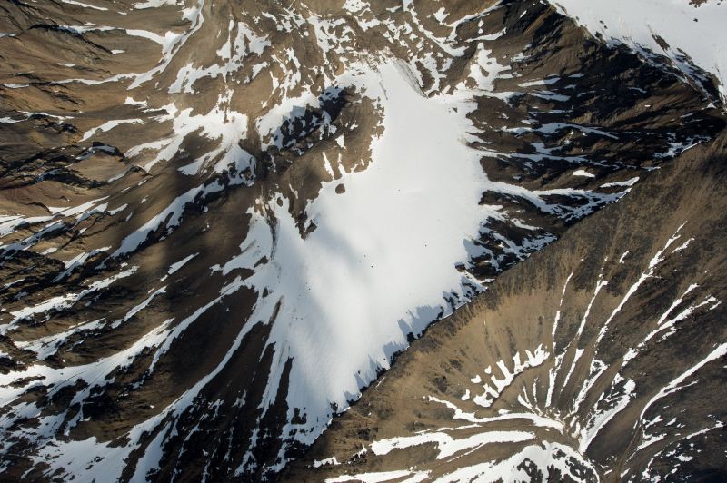
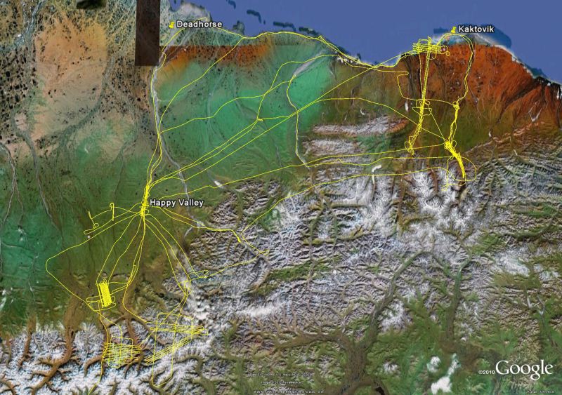
8 June 2012 -- Happy Valley In many ways, Happy Valley was a more convenient location to base from, being closer to our scientific objectives and located in generally better weather than Deadhorse. Deadhorse was still down solid in the morning, so we organized ourselves for a test mission around Toolik Lake. The general idea here was to create new topographic maps of some of the Kuparuk River watershed where numerous water tracks exist. Water tracks are ubiquitos yet seldom-studied drainage features in arctic terrain. They run straight down the slopes of the low, rolling hills found here, expressing very little topographic change but clearly visible by the difference in vegetation found there. The ground underneath them is permafrost, and the conventional wisdom is that the watersheds here do not form the typical branching structures found elsewhere because there is not enough erosional force during summer to dent the permafrost when it is at its warmest and cause branches to coalesce. But there have only been a few studies looking at this, so much of their nature is yet undiscovered. A secondary reason for acquiring this area was that Chris acquired lidar here a few days before, so it gives us a good means of comparing results and assessing the accuracy of our somewhat different methods. In any case, there was fog and low clouds in the morning, as apparently had been typical of the past few days, so we leisurely pursued breakfast and then lunch, before launching about 1:15PM in the clearing skies. There was still an overcast, but much higher than our intended flying height, and soon we were over the study area. The flying went fine, but the camera system was still having some trouble. The general idea is that I plan our missions using specialized software before the flight, such that we have flight lines planned out that Kristin can follow using a small monitor near the dash. On these flight lines are photo centers, which trigger the camera to take a photo as we fly over them. The problem was that the computer was not triggering the camera reliably. Fortunately the troubles missed our key sites so we did not refly anything, but considering the size of the grid we flew, creating a single mosaic will show a lot of gaps. The good news was that this was a just a test flight and it was exactly these sort of issues that I wanted to shake out and fix. We flew for about 3.5 hours total and landed back at Happy Valley in time for dinner.
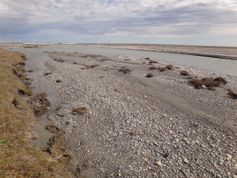
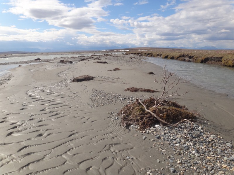
9 June 2012 -- Happy Valley The next morning the weather seemed to break at Deadhorse, at least in terms of visibility, so we decided to head down to the ocean, then follow the coastline to the Hulahula and Jago Rivers, and based on the weather decide what to do once there. We began the morning with a low-elevation grid pattern over Happy Valley, trying to further debug the system. It worked essentially flawlessly, with no clear explanation for what was different from the day before, though I did change out a few cables and peripherals. As we got to Deadhorse, we experienced winds on the order of 40-50mph coming from the east. At ground level, while it would be no problem to land, it would be nearly impossible to taxi without one or two people walking beside the tail to keep it pointed in the right direction. So we headed towards Kaktovik, flying directly above the coastline along the way to measure the topography here. Coastlines here, like nearly everywhere else, are constantly changing shape. The arctic coastline is unusual in that the ground is underlain by ice, which is easily erodable in strong waves. And the waves here have been getting stronger, since the ocean's fetch is no longer limited as much by sea ice as it has been in the recent past. In 2008, we watched 10s of meters of coastline fall into the ocean near Kaktovik in a single storm. So our goal here was to assess how well we can measure coastal topography such that in the future we can pursue measurements more systematically (and with funding), but for now were just testing methods on our way to our primary goals.
We began making maps of the Jago and Hulahula Rivers in 2008 using commercial lidar, and began doing it ourselves in 2011. The trouble we've had in the past with commercial vendors is one of the main reasons we decided to do this on our own, not to mention the more than 10x difference in price. The general idea is that we want good maps of these rivers to understand their physical hydrology and fish habitat, as well as to assess rates of river geomorphological process like bank erosion. These rivers are primarily fed by glaciers, and I have the sense that they are different in many ways from most arctic rivers for this reason. For example, my suspicion is that because more and more water is coming from glacier ice storage in this warming climate, that erosion here is higher than nearby unglaciated rivers, and further that this erosion limits the rate of vegetation growth and therefore food for browsing animals like moose, hares, and ptarmigan. Another reason for our flights here at this time of year was to assess the size and volume of aufeis. Aufeis forms anytime there is liquid water coming to the surface in winter, such as when springs continue to bubble up from beneath the surface. The subsequent ice patches can be huge, as the water spreads out laterally and freezes. My hope was that by measuring the volume of these ice patches now (by comparing the topography to late summer when they have melted) we could get a sense of the total volume of spring flow, which on the Hulahula River is likely to be a substantial part of the total discharge.
Flying against the strong headwind, we made slow time, but eventually reached the Hulahula River. In the past, Kristin had perfected flying at nearly a constant height above the river while following its twisting course. However, the single strip of photos that resulted from this method has a poor geometry for photogrammetry, meaning that it has some warps within it that cannot be resolved without a lot of ground control to constrain it. So this time we planned the flights in small blocks of usually 3 straight lines, with the blocks overlapping to get complete coverage of the river. This requires a lot more flying and a lot more data to process, but hopefully will yield a better result. It may not be necessary to do each time, as future datasets of only single-strips of photos may be able to make use of these blocks for pseudo-ground control, but we'll see. In any case, we made our way gradually up to the mountains, where our clear skies turned to partly cloudy and a bit bumpy, making photography challenging. So we focussed on the lower river and then moved over to the Jago. By now we had been flying quite a long time and before fuel became a serious issue we decided to start making our way back. So after completing some blocks downstream of McCall Creek, we scouted out new stream gaging locations before following the river out to the ocean, collecting a single strip of images as in the past along the way. We followed the coastline back, this time with a tailwind, and at a higher elevation and with some zig-zags to help improve the photogrammetric solution of the topography of the coastline. About 8.5 hours and 2500 photos after launching, we were back at Happy Valley in time for dinner.
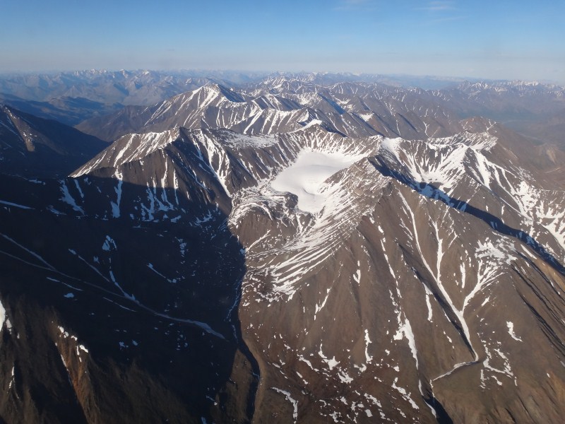
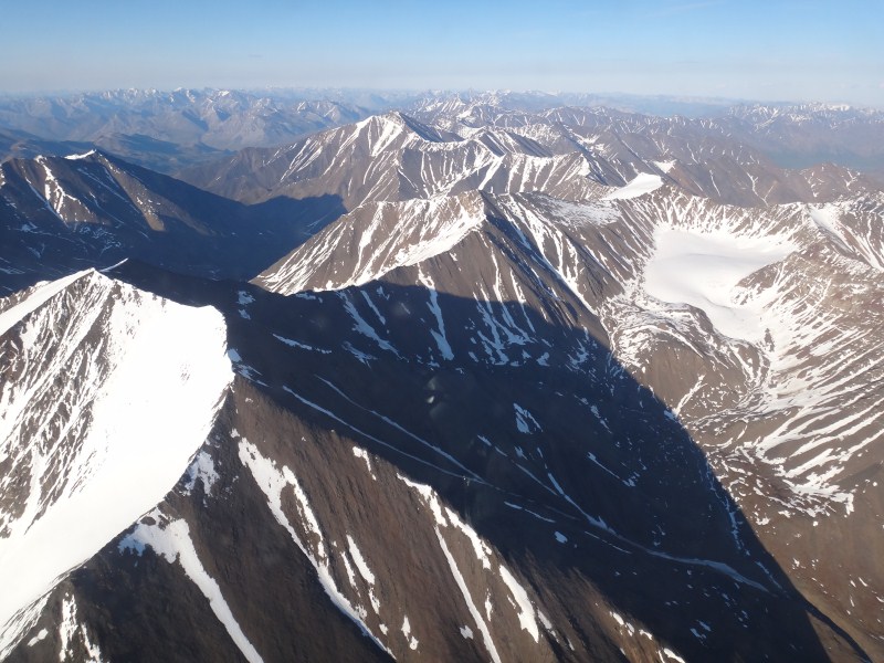
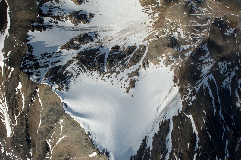
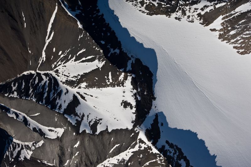
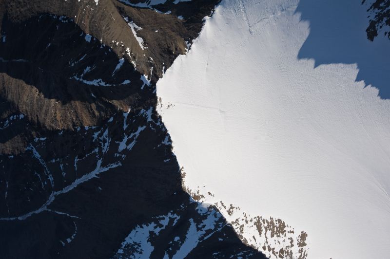
10 June 2012 -- Happy Valley We awoke to another beautiful day, and could see the mountains shining in the sun to our south. By the time we geared up and launched at about 10:30AM, however, significant cloud build-ups were occurring. We headed straight for the mountains trying to gain altitude and fly some lines before they got much bigger, but the warm air, fuel-laden plane, and convective down-drafts slowed our climb significantly after we reached 8000' and soon it became clear that our flightlines were above cloud level and that it would be impossible get any work done here. The general idea is that I had hoped to create new topographic maps of all of the arctic glaciers this year. Over the past 10 years, I had mapped nearly all of them at least once through commercial airborne vendors, but with another round this year I could capture the missing ones (about 20%) and get a repeat measurement on the rest to give me updated rates of change. Flying in the mountains has the challenges of terrain avoidance and weather. I designed the camera/laser system we were using specifically such that we could fly above terrain, but the trouble is that the glaciers here create their own weather on most days, as their moisture gets sucked into the atmosphere and creates clouds. I have often watched (and photographed) this process on the ground at McCall Glacier, where the sun beats down on a valley wall, lifting moisture up to create clouds, but only on those faces directly exposed to the sun. So, as the sun swings around the sky during the day, so does the location of the clouds, which often leave the valley bottoms in sun but the valley walls in cloud. In any case, we stayed high and flew east towards McCall Glacier, hoping that maybe there was a break in the clouds.
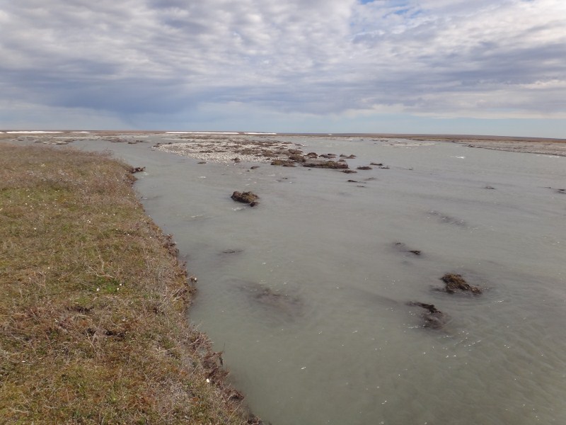
Finding no breaks we decided to stay high and re-acquire the Jago and Hulahula Rivers from this altitude, again hoping to improve the photogrammetric solution. I also wanted to acquire a broader swath along the Hulahula River. Here I had noticed that a much larger region of the delta was active with runoff, just after the aufeis field at Fish Hole 1. Here a spring bubbles up throughout the year, freezing in winter and creating an enormous plain of ice. In spring, as the snow in the mountains melts, the river is diverted by this ice and apparently runs over the surface of the tundra. From there air we could see this clearly, as well as huge shallow ponds forming where there was no clear drainage paths for the water to follow. I remember floating down this river last year and noticing how little bank there was even at such low stage and wondering where the water goes at higher stage. From the air, we had our answer.
Once we had flown the river channels, we focussed on the mudflats. Last year we measured that the mudflats at the ends of these rivers are larger than any others on the arctic coast in Alaska, yet these watersheds are among the smallest. The difference is that these rivers are the most heavily glaciated, and these glaciers put out a tremendous amount of silt. It is this silt that forms these mudflats. The mudflats in turn host a robust and stable community of freshwater invertebrates, which tens of thousands of migratory birds find tasty and fattening. So one of our scientific questions is what will happen to these birds once the glaciers and thus mudflats dissapear. One of the ways we are trying to address this question is to measure the flux of sediments from the glaciers by taking direct measurements in the streams and by measuring topographic change on the mudflats. So we flew a large grid over the Hulahula River's mudflats today to assess how well we could measure the topography there. Likely the changes over time are small, on the order of centimeters or maybe even less, so this is potentially a challenging project.
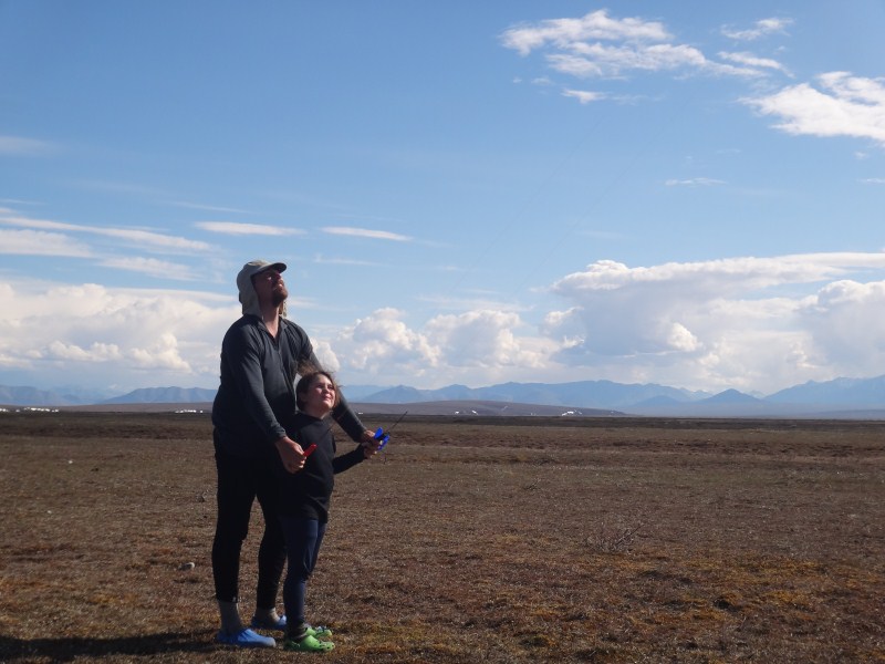
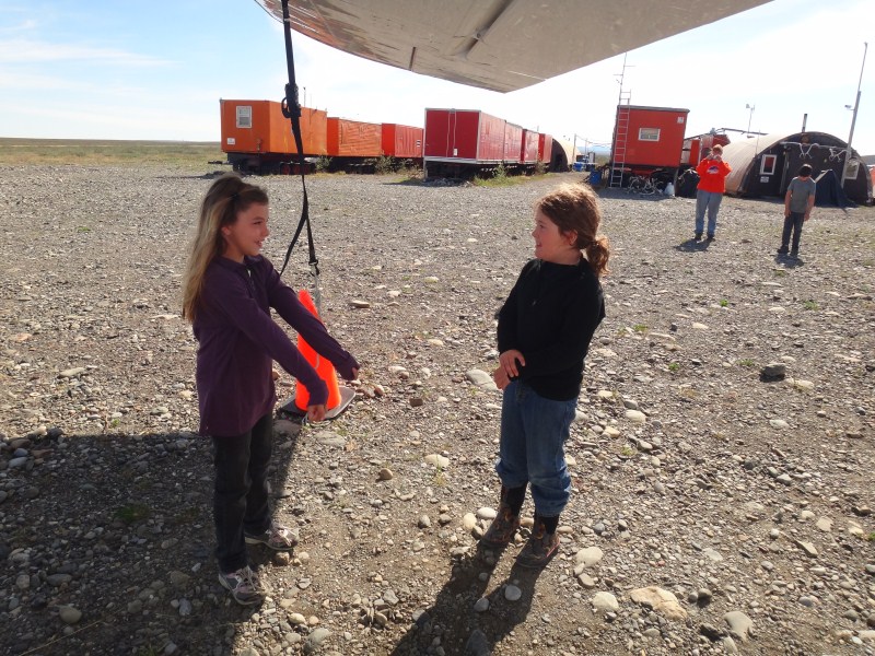
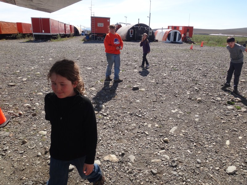
The winds remained strong all day, coming from the east. When we had finished the grid, we played around a little bit by hovering into the wind. That is, by pointing the nose directly into the wind and slowing the engine, we could actually have a zero or negative ground speed, while maintain a constant height. In this case, the wings dont really care whether the air washing over them is created by the propellor or by synoptic-scale pressure gradients. One of the remarkable features of Helio Couriers is their ability to stay maneuverable at low speeds without risk of stalling and spinning out of control, and it was a neat demonstration to fly backwards in winds 40-50mph strong. But it was already a long day, so we headed back for Happy Valley, ending a seven hour flight with over 2500 images, once again in time for dinner, but finding the mood substantially different at camp. New personnel had arrived to work at the camp and tensions were high. Gone was the family atmosphere of the previous few days, meals were now served in the dining atco, and we seriously wondered whether Mark and Lori were going to finish out the week based on the way they were being treated. We had promised Turner we would spend some time on the gravel piles behind the camp, so we took this opportunity to escape until dinner time and allow him to play some king of the mountain. It's a remarkable thing that he's able to spend so much time in a cramped airplane and that he is so content with such simple pleasures as scrambling up a gravel pile in exchange for his patience.
11 June 2012 This morning the mountains were socked in, as was much of the sky to the south. So we spent a lazy morning in our toolshed, backing up data, watching Gilligans Island, charging batteries, and laying low. The weather to the south didnt show much sign of improvement throughout the day, so we decided to head west towards the Itkillik River where there was thermokarst activity we could map. I'm not exactly sure how pervasive it is, but I know there is a fair amount of glacial ice buried around here from the last major ice age over 10,000 years ago. When this ice gets exposed, for whatever reason, it melts and exposes more, causing a chain reaction that can cause substantial subsidence of the land surface, creating cliffs 30m high or more and dumping tons of sediment into local waterways. Apparently there were a lot of these slumps to the west of us, and I thought it would be a good test of the system to see how well we could map these and assess their dynamics over time. Unfortunately the site was also a little to the south, and the clouds here were too low to allow us to follow the flight lines. So we tooled around a little and found some interesting patches of aufeis to map, and then headed towards the road. One useful application I thought we could test out was mapping road and runway surfaces to assess change over time. So we picked a fairly straight stretch of the haul road to follow at low elevation and collected a strip there. Then we flew a grid over Happy Valley again, this time a bit higher than the last, but also flying some crossing lines to help improve the photogrammetric solution. In all, it was our shortest flight of the week, at just under two hours, and again back in time for dinner.
12 June 2012 -- Happy Valley Another of our goals for this trip was to create an opportunity for Kristin to get some advanced flight training. The plane we were flying was operated by 70N, but given their commitment to understanding climate change in the arctic it is essentially dedicated to my research as long as I continue to bring in enough funding to support it. All of the work we do in this plane is either non-commercial or aerial photography, so it falls under a less stringent set of FAA rules (FAR Part 91, hence the name) than commercial air taxi work (FAR Part 135) which is required for nearly all commercial work except aerial photography and surveying. But even though these are all Part 91 flights, because several of these photo flights are commercial in the sense that my grants at UAF pay an hourly rate for them (unlike most flights we take that are not reimbursed), the pilot needs a commercial pilot license, which Kristin has had for 10 years now. But because UAF considers itself bound to all of the rules of State agencies, Kristin donates all of her time flying me to avoid financial conflicts of interest that apply to State contracts. As a means to offset this pro bono work, Kristin was planning to fly commercially for 70N for work other than mine, and this required some ground school and flight training to meet the Part 135 requirements. Plus, to maintain a commercial license requires the pilot to get a periodic flight review from an instructor or the FAA, and Kristin's time was up this month so she was going to get her check ride from Bob. So our initial plan was to base in Deadhorse and do the ground school when the weather was bad and do the aerial photography when the weather was good and some flight training and testing in between. But the weather in Deadhorse never really improved much -- though the visibility was good the winds were still quite strong, plus there was a lot of construction going on there that further complicated taxiing. Further complicating matters was that Bob was out of town for a few days, leaving Mike to hold down the fort on his own. But now Bob was back and came down to Happy Valley to help get Kristin going. After a morning of ground school, they headed out flying. Turner and I stayed back at camp.
Even though I was not on the flight, I found it quite stressful. We use a small device for flight following called Spidertracks. It's basically a GPS combined with a satellite phone, that transmits a position to the internet every 2 minutes. In this way, if the plane unexepectedly lands and/or kills power to the unit, you know where it is at least within a two minute flight radius. I was insistent on buying one of these after I realized on one of our flights last year that even at 10,000' there are large sections of the state where you cant hit an FAA radio to call for help. These units work great, but are not FAA approved for flight following. Rather, one must have an ELT installed, which is supposed to broadcast a radio signal should a crash landing occur. From what I've read 3 out of 4 of these fail to do so, and most of the remaining ones that actually do work are not actually useful in a search because either no one is close enough to pick up the signal or because the signal is ignored as the vast majority of ELTs are set off by accident. The 'breadcrumb' method, however, avoids all of these problems and should the unit lose power before being shut-off properly (such as in a crash), the web-system automatically sends emails and texts with position reports out to people pre-assigned to watch out for them, such as co-workers or family, so there is no reliance on the unit in the plane to have power in order to broadcast emergency signals. One problem, however, is that to actually follow the flight, one needs internet or cell phone, and here in the remote arctic this can be problematic. But in any case, we were able to make it work well enough and track their flight of several hours. We were also able to make use of the latest Iridium wifi gimic, that allows one to use a smart phone to send emails through it.
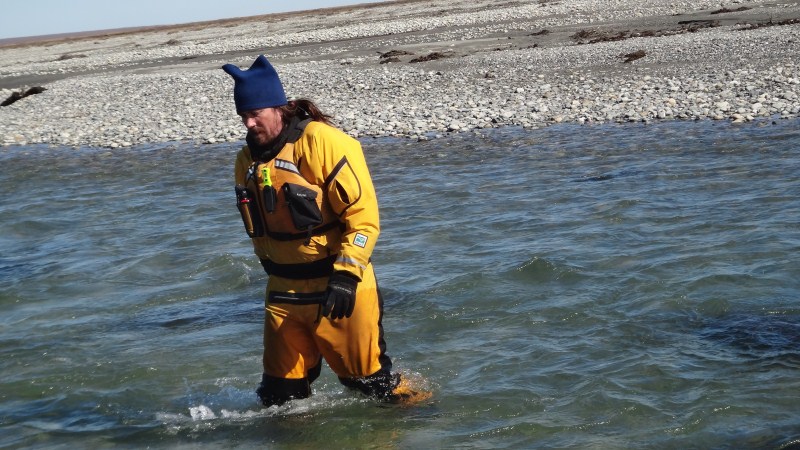
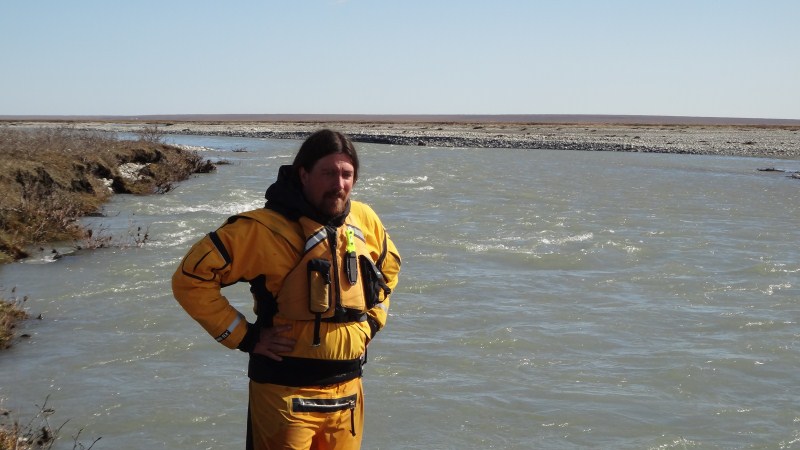
13 June 2012 -- Happy Valley -- Bitty Today began another phase of the trip. After another few hours of flight training in the morning, we took both Helios out to the Jago River to do some stream gaging. Because this was a commercial flight, Bob took me and the gear in, but Kristin tagged along in our plane to get some more practice. We flew first to the strip we had been using the past few years. Kristin loitered up high while Bob checked it out at ground level. There was a strong crosswind and it was aligned such that landing was best approached from the opposite direction as usual, flying over Jago Lake and descending down to it. Bob shot a few approaches but couldn't stay on course at ground level with full rudder. So we swung out of the way and let Kristin have a few passes at it and she agreed this was not a good idea. So we flew downstream to Bitty and regrouped there, with both pilots landing on their first pass and in less than 100 feet into the stiff wind. We had meant to find a new strip to use on this trip for this very reason. However, nothing really looked that promising between here and our current strip, or upriver from that to McCall Creek. Bitty is really nice because it's reasonably long and aligned straight into the prevailing winds. However, it's not the greatest for stream gaging as the river is braided here. Ideally what we want is a place to land east-west where the river is formed into a single channel for a mile or so. But despite a lot of looking, we have been unable to find such a spot. In any case, I explored around a bit and decided that we would just make due with Bitty. Just off the end of the runway the river necks down into only two channels, separated by an isthmus only a few meters wide, and I would just have to treat these two channels as separate rivers. The water was low enough that I could jump across the first channel without getting wet by choosing my spot carefully, and the larger channel looked easily wadeable. So we unpacked and said goodbye to Bob, while setting up a tent in the stiff wind. By now it was dinner time, so we piled up some gear to make a wind break and ate a dehy meal in evening sun, glad to be on our own again on the tundra.
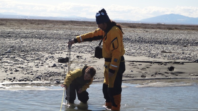
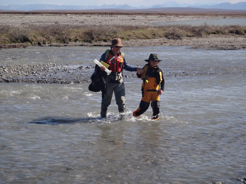
Our first day on the tundra was a long one. I headed out early to scout for locations to install our gear. The purpose of the stream gaging is to get a better handle on water and sediment flow so that we can better understand the magnitude importance of glacier inputs. We're measuring glacial melt in the mountains, so by measuring the amount of water in the rivers, we can get a sense of how much of the river water is coming from glaciers. With this information, we can then begin predicting impacts of glacier loss on the downstream ecosystems and river geomorphology, and then disentangle these impacts from any other changes occurring here, such as oil development. The general idea is that we install pressure transducers to measure how high the water is, because this is a relatively easy measurement to make continuously using dataloggers designed for this purpose. Then we manually measure water discharge at various water heights, determining the relationship between water height and discharge, such that we can convert the continuous record of height into a continuous record of discharge. We can then use this discharge record to compare to other meausured inputs to the system, such as glacier melt, rainfall, and spring discharge to better understand what drives water flow here. We do something similar to measure sediment discharge, by installing an instrument that measures turbidity continuously and comparing this with manual measurements of sediment load. Turbidity alone is insufficient, as this really only tells us the color or darkness of the water, so tea might have the same turbidity measurement as glacial silt, since both let about the same amount of light pass through them. By running known volumes of river water through filters that trap sediment and then measuring the mass of sediment caught in the filters, we can build a relationship between turbidity and sediment discharge that will give us some sense of total sediment discharge for the summer.
It was well after lunch by the time we got the instrumentation installed and finished tidying up camp. We started our first gaging about 3:30PM. My plan was to gage by two different methods. First was by wading across with a meter that directly measures water speed. This works well enough, but is problematic during high flows when the water is too strong to stand in without getting washed away. So I also planned to use the dye-dilution method, in which a known mass of dye is thrown into the river and then the concentration of the dye is measured downstream. As long as the dye is completely mixed in the channel, by measuring the concentration (in parts per billion in this case) we can figure out how much water that mass of dye mixed with to create that concentration. The dye I used is called uranine, and I chose it because it is not toxic and quickly fades away. Of course I had to have it's use approved beforehand by the Refuge management, and this paper went a long way towards that. However, I had never actually used this method before, so there was a learning curve. It was 7:30 or so by the time we had gaged both channels by both methods.
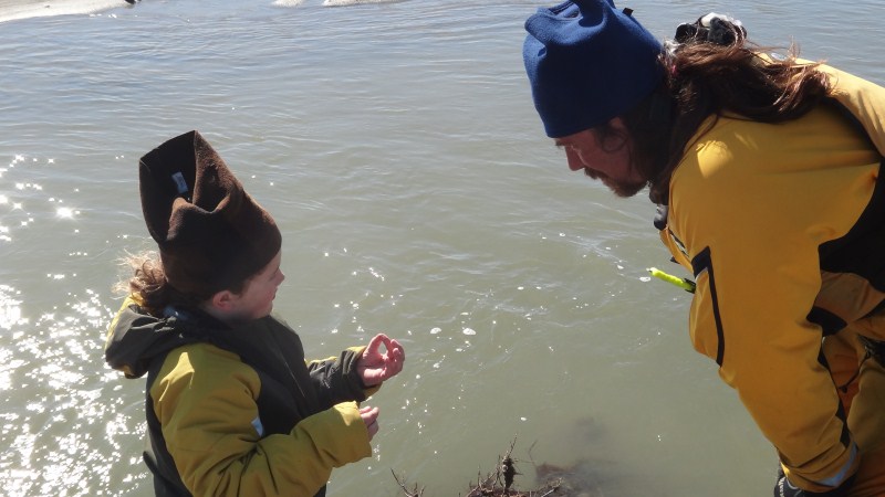
Then we had to do the water sampling. Here we are taking water samples for chemical analysis and filtering water to measure suspended sediment load. Last year we did this with a hand operated pump, which required at least four hands to pump water and hold bottles. This year we went with a battery operated pump to make things more manageable with fewer people. It worked pretty slick. We just set a hose in the river, turned the pump on, and filled bottles as needed. Turner's job was turning the pump on and off, which he enjoyed very much. He enjoyed it so much that we had to tell him to take his hands off the switch during some of the measurements as he would 'accidentally' turn it on at inopportune moments. It was late by the time we got back to camp and ate some dinner, but we looked forward to easier days now that we had a routine established.
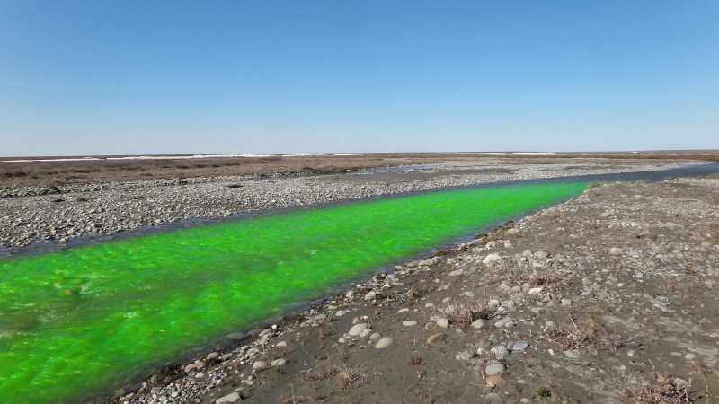
15 June 2012 -- Bitty I woke up this morning cranky for no good reason, and headed out to the do the morning gaging before the others were ready. Fortunately the water was still low, so I could wade and take notes without too much trouble. I spent most of the afternoon in the tent, trying to sleep off my mood. After dinner we all went out again to gage and take samples. This time I only used the dye method, as my previous two comparisons were nearly identical. Turner liked to mix the dye and see it thrown in, as it turns the river bright green before it disperses. As were packing up the last of the water samples, Kristin noticed something moving around our tents, which were several hundred meters away near the runway. It turned out to be a bear nosing around. We headed back, watching him circle the tents, but we were too far to see what was really going on. We lost sight of him for a while, as he was on the opposite side of the tents than us. We had been pretty careful with our food, storing it all in small metal barrels, but we were cooking and eating in the cook tent so even if there was nothing for him to actually eat it may well have smelled like there was. By the time we got to the tents, he had already sauntered off, and we could see him lying down on the tundra not far away. As it turned out, our small bear fence had done its job and he never breached its perimeter, though he did manage to get hold of some of our sneakers left near the edge and chew on them a bit. That was the first test I know of our fencing system. Kristin and I had taken a bear safety class a few weeks earlier, and the instructors had told us we were wasting our time with this system (but they old sold their own systems...). So I had ordered a different kind from them that was alledgely more robust than this one, but there were some complications in shipping and it did not arrive in time. But clearly this one does the job, so we spent a little time anchoring the poles more solidly before heading to bed about 11PM, and slept soundly knowing that we were well protected.
16 June 2012 -- Bitty The winds had died down the day before, and we had been enjoying the best possible weather without any mosquitos. In the mountains, it was clear that it was raining and maybe even hailing. Water levels had been steadily rising, and on this morning it took all of my muscle to wade across the second channel and make measurements. Fortunately this was the last time I needed to do it. The dye method was working well and was much easier, though it did require several kilometers of hiking to throw the dye in sufficiently far upstream so that it would be mixed completely by the time it reached the fluorometer.
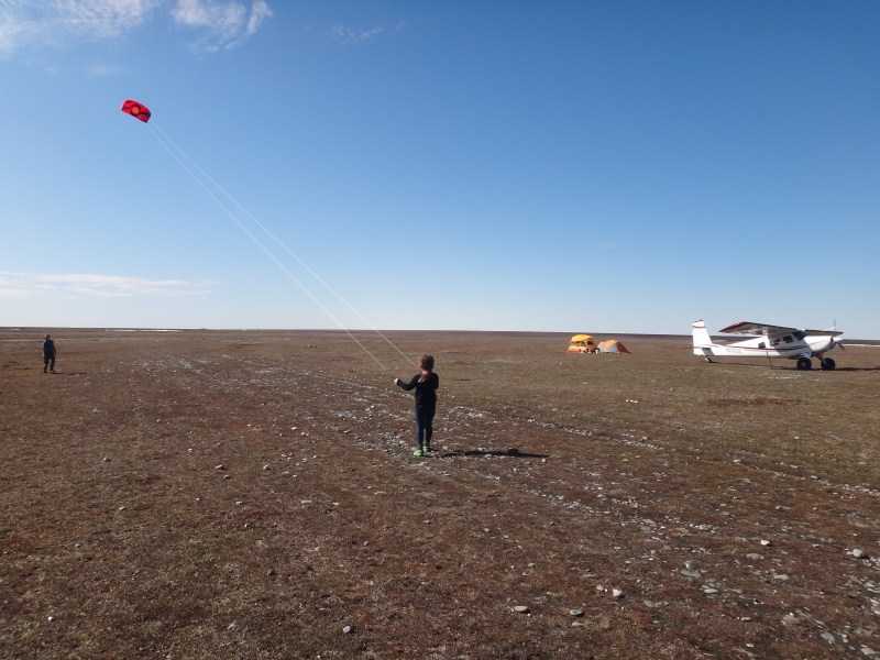
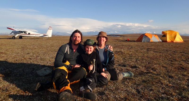
In the afternoon the wind had picked up a little and came from the west, but it was still quite comfortable, so we spent some time flying kites and enjoying our time in between measurements. We gaged and sampled once more after dinner, and on the way back stopped to take a group photo. This trip had in many ways been the culmination of many years of effort, to get to the point where we were nearly self-sufficient for field work in terms of both science and logistics. We had been eyeing this goal since the early years, when funding was even more unsure than now, as a means of continuing the project despite funding gaps, and we started actively pursuing it after our 2008 field season, which was plagued by air taxi operators flaking out on us and leaving us stranded. In the intervening years, we spent a lot of blood, sweat and tears getting to the point where we could safely get us into the field and do the job we felt we needed to do, all on our own, and it finally felt like we had arrived at that point.
17 June 2012 -- Bitty -- Kavik We began packing this morning. I had only enough dye left for one more measurement and due to the rising water levels we had already covered the most important section of the stage-discharge curve. The general plan was that Bob would come to pull us out, satisfying the FAA commercial requirements of the trip, but before doing so he and Kristin would go out on some more training flights and in particular scope out new landing sites for next year. I headed out early to do the stream gaging on my own, since it only consisted of turning the fluorometer on and throwing in dye upstream. However, as I began hiking upstream, I noticed that the water level was much higher and that it seemed that there were mutliple crossing-channels between the two main channels that I was considering independent. So I decided to hike far enough upstream where the water joined into a single channel again. I knew it did, but I hadnt looked on a map recently so I wasnt sure how far away it was. I hiked a few miles in my dry suit, which is a bit annoying as the feet of the suit always get sucked into my boots where it bunches up and causes blisters. But by now it was after noon, and I knew that Bob would be on his way, so I never actually found the site and instead used my old sites. But I paid closer attention to the interconnections between the channels on the way down and realized that I had been confused and there the connections were actually quite small and inconsequential.
By the time I got back to camp, Bob was landing. So he and Kristin headed off to explore, while Turner and I finsihed packing up camp. Well, mostly I finished packing while Turner played digital games. After an hour and a half or so, they returned, and we began shuttling loads to the plane. Bob and I watched as Kristin took off nearly empty, while we took off with the gear in the 206. Our great weather had deteriorated, and as we flew west the clouds lowered and we headed for the coast which was uncharacteristically clear by comparison. After passing the Canning, we headed south again to stop at Kavik for fuel and a cup of coffee. Kristin taking off, in half the runway.
We had flown over Kavik and said hello about a week earlier on one of our photo flights. Susan was there with her two grandkids, and we wanted to stop by so that the 3 kids in this end of the world could say hi to each other and enjoy the company of others under 4 foot tall. Turner and Drew hit it off instantly, sharing their digital game players and discussing tundra politics. In the meantime, by the time we refueled and chatted, the weather had come down to the ground and it became clear that we were spending the night. Fortunately dinner had not yet been served and Susan had made plenty of lasagna. It was a real treat after dehydrated food, plus the unlimited supply of snacks, including fresh baked cookies. We chatted late into the night about all topics, letting the kids play well past their normal bed times, and I think we were all glad for the unplanned sleepover.
We slept in that morning, unaware that Susan had taken Bob's early morning launch comment seriously from the night before. So by the time we got up breakfast had long since been ready. Bob was up about as early as I had ever seen him, however. Our initial plan was to for Kristin to do some training the in 206 in Happy Valley, but as it turned out other priorities called and there was real work to do, so we parted ways and hung out at Kavik for most of the morning to give the kids maximum time together, leaving about 11:30, thinking we had nothing to do until the afternoon when Bob was free again. It was a bit unfortunate in some ways, as by the time we got to Happy Valley it was clear that the weather had changed and the mountains were crystal clear, beckoning for aerial photography, and as it turned out the 206 developed a mechanical problem on return to Deadhorse which put it out of action for a few days.
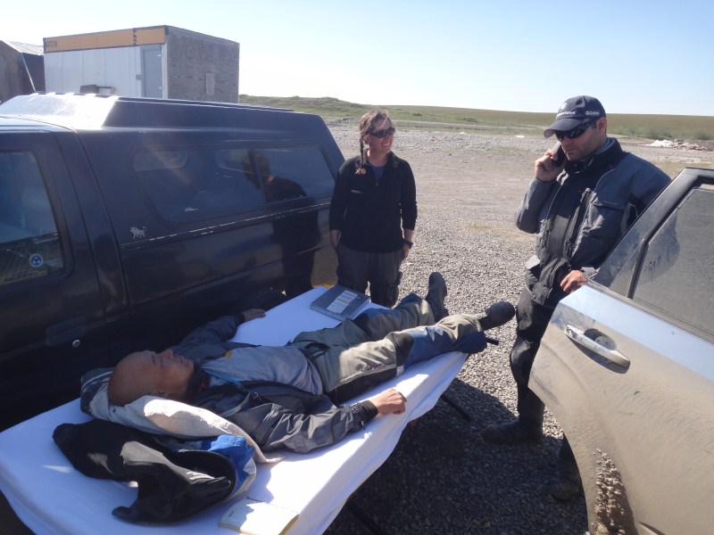
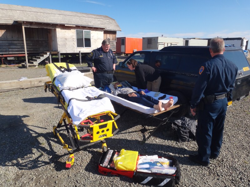
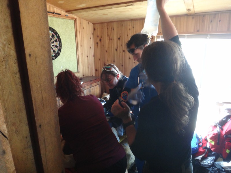
Once at Happy Valley, we unloaded the plane and began reconfiguring it for photography, planning to launch by 3PM. Unfortunately, not long after lunch a car came by carrying a guy who had been injured in a motorcycle accident. He had been part of a caravan of bikers, but he was second to last so most of his group didnt realize what had happened. Apparently his back tire began swerving in some dirt, and it tipped over, causing him and it to slide. Worse, there was a pole marking the edge of the road which caught him and doubled him over around his belly while the bike continued off the edge of the road. He was unconcious for a while while his friend held on to him, and eventually this car passed by and took him here. Kristin and I had just taken a wilderness first aid class, so were pretty up on emergency response. Kristin had written a checklist into her field book and began going down the list, checking off the most vital items first. Mark and Lori pulled out a cot for him to lie down on in the shade. He was in a lot of pain, but there didnt appear to be anything broken or outwardly bleeding, and he was lucid. We lent a satellite phone to his friend and gave him the number for the Troopers. They apparently bounced him around quite a bit and he eventually ended up coordinating with the clinic in Deadhorse run by the oil companies, who dispatched an ambulance. It's nearly a 2 hour drive to get there, and I didnt look forward to his ride back over the bumpy road. In the meantime, some EMTs showed up from the nearby pump stations and basically went through the same steps we did in evaluating him, but with a lot more experience and understanding. From them we also learned more about the emergency handling process, in terms of how things work within the oil fields, and they gave us some direct line numbers to use in the future to streamline things, which would later come in handy for us.
So, by the time the ambulance left it was after 6PM by the time we were ready to go. By now we had also realized that we left Turner's coat in Kavik. So our plan was to do a block of flying in the mountains then swing by Kavik for the coat and a short playdate and head back to Happy Valley. The weather in the mountains was great, with no clouds and stable air. We climbed easily and flew parts of two large blocks east of Atigun Pass. By now it was after 9PM. Turner was asleep and it seemed too late to go to Kavik. In retrospect we should have kept flying, to take advantage of the great weather, but it had been a long day already, with many changes of plans, and it seemed like getting a decent night's sleep and starting early in the morning would be the best plan, so that's what we did.
19 June 2012 -- Happy Valley We were airborne before 10AM today, trying to get some more mountain flying done before the weather changed. There were significantly more clouds today than yesterday, though fortunately higher than our flight lines. However it was much bumpier, especially nearest the highest peaks where the glaciers were. For whatever reason, this mild turbulence caused glitches in the airborne system, which had been working reasonably well until now (perhaps because there was not much turbulence). My impression is that the turbulence causes brief changes in heading as the plane gets bounced around, and this causes the software to think a lot and lock up briefly, just enough to cause an image center to get flown over without triggering the camera. So it was a bit frustrating, both for the chop itself and for its impact on the equipment. I probably could have taken a little more of it, but it was clear that conditions were not going to improve and Turner was also not feeling so well. He had developed a cough over the past few days and was looking a little green around the gills. So we headed north back towards the Itkillik River to see if we could acquire the few lines around the slumps. I thought descending 6000' and flying over tundra would decrease the choppiness we were experiencing, but this was not the case. The wind was coming from the west at some elevations and from the north at others, and causing a lot of burbles. Just about the time we were starting the first line, Turner puked and we immediately called it a day. I cleaned him up as best I could but it was another half an hour before we landed, by which point he felt fine again. It was only 1PM, but we decided to pull the plug on the aerial photography for this trip, as the mountains were now our main objective and it seemed like our window was now over. Plus camp was continuing to get less homey and there were increased problems with power and internet, so we decided that we would either do some more training or head home. Considering that the 206 was still down and that work in Deadhorse had picked up, it seemed likely we would be heading home the next day. So I packed up the equipment and we spent the afternoon having a family playdate.
20 June 2012 -- Happy Valley -- Deadhorse -- Anchorage This day did not go as planned. We pretty much figured by early morning that going to Deadhorse would be a lost cause, as the plane was still down for repairs and everyone was too busy for ground school. The weather in Happy Valley was ok, but the winds were still coming from the west, creating a crosswind on the main airstrip. Happy Valley was home to a lot of activity during pipeline construction when a mile long gravel runway was in constant use. The runway has since not had much maintenance, and the river is beginning to eat into it. But there is still a good 2000' and a usable 4000' left, but it runs North-South, counter to the prevailing winds. We called over to Kavik and Susan said there was also quite a strong crosswind there and it was probably not a good idea to land. So we lazily packed, took showers, and were in no hurry as we seemed to be on weather hold.
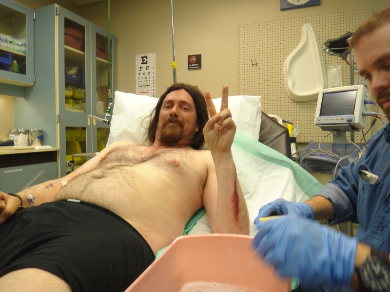
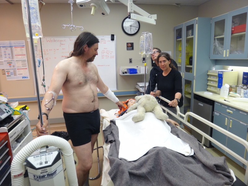
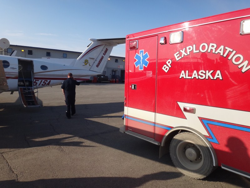
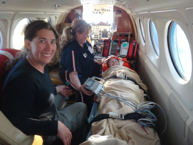
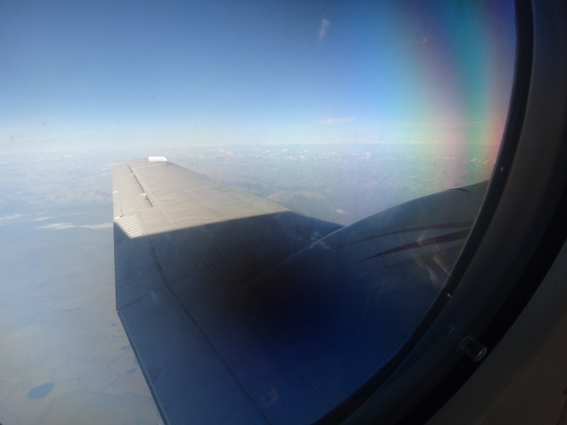
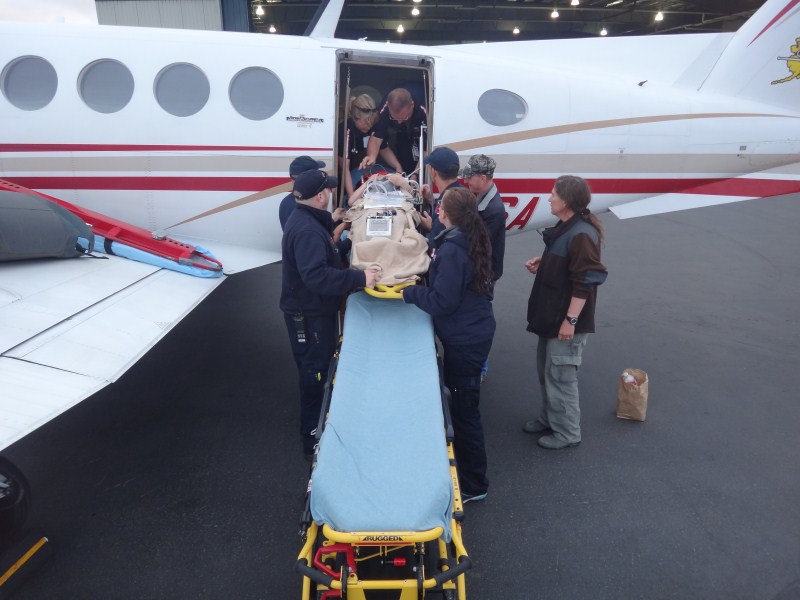
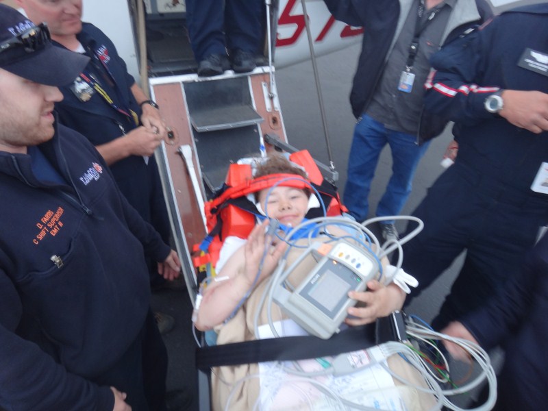
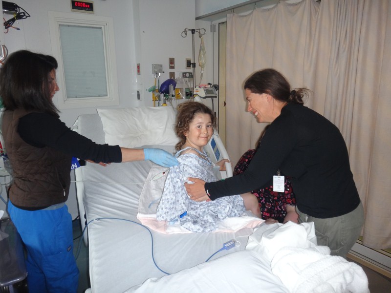
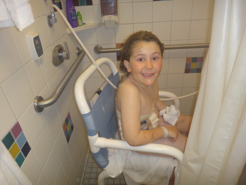
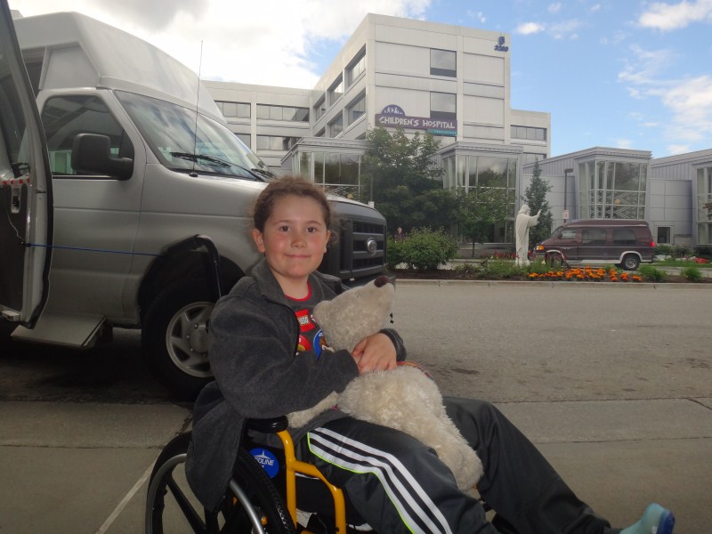
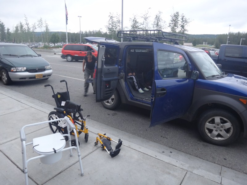
Turner training Jesus to fetch. After lunch, Kristin went and walked the cross wind take-off route. We hadnt used it yet this year, but it was clear that at least for the time being that the longer runway couldnt be used because the winds across it were too strong. The winds were coming from the west, such that we would take off from the river heading towards the road. The only real issue associated with this were the potential for someone driving a car across the strip and some obstacles at the far end. Here is the text of what happened, cut and paste from the report Kristin submitted to NTSB: ============== My husband, son and I intended to depart Happy Valley for Fairbanks on a Part 91 non-commercial flight on June 19th at about 2PM. Prior to take off I paced out my intended take-off path directly into the steady 15 knot wind and measured about 1200 feet long, with about 100 feet on either side free of obstructions, on a hard-packed gravel surface with no large rocks or pot holes. At 1200 feet, there were obstacles on either side about 100 feet apart, with another 400 feet of gravel road about 50 feet wide extending beyond these obstacles before terrain began to rise (about 10 feet) and another several thousand feet before terrain rose more than 50 feet. There was a traffic cone at about 800 feet down my take-off roll on my left side, which I used as my abort point, giving me at least 400 feet to brake before the obstructions, and another 400 feet I could use beyond that. Based on my prior experience on numerous take-offs here over the past 2 weeks and previous several years, in this wind I should have not needed more than 600 feet to become airborne or more than 200 feet to come to a full stop on landing, so I considered my margins to be adequate During preflight I found no mechanical issues and my CG was at the forward limit. During the take off roll I felt some weight come off the main wheels, but 800 feet I passed the cone and the tail wheel had still not lifted, so I chopped the power and applied full brakes. At this point the tail came up due to the forward momentum shift and our trajectory was such that we were headed directly towards the obstacle to left of our intended route, a concrete loading ramp about 4 feet high. I continued to apply full brakes and added full right rudder to turn us away from the ramp. I pulled off left brake just before impact to try and turn away but instead swung the tail into it, which probably added force into the ramp. The point of impact was to the cargo door directly behind the pilot seat. My only explanation for the unexpected performance of the aircraft was a change in wind direction and speed, which may have either delayed my rotation, caused me to be airborne without the normal tail rise, or caused me to bounce or fly during braking. We immediately evacuated the airplane and called for medical support. I was uninjured, but it was clear my husband and son had injuries. All of us were taken by helicopter to Deadhorse, then by airplane to Anchorage. We had no chance to inspect the wreckage after the accident and have not even seen pictures at this point. There are no weather reporting locations near Happy Valley, but I had been checking weather via the internet and duats and knew it to be VFR at our location and all along our route of flight. ============== I dont remember much about the initial take-off roll, but once I heard the power come off and Kristin start swearing, I wrapped my arms around Turner and the back of his seat, trapping him against it in case of a forward impact or an endo, burying my face against his seat back. I didnt really expect to hit anything and couldnt see what was going on, so it wasnt particularly scary. As it turned out, we hit the concrete pony wall of the ramp against our side just at his seat position, which, as I surmised later, drove his seat back into my ribs, breaking one of them, and ripped him out of my arms despite my best efforts. For the first few seconds after impact, for me it was kind of like one of those movie moments, where everything goes quiet and my mind turns inward to determine if I was still alive and functional, and then all of a sudden the volume gets cranked up and I'm assessing my external situation. I could hear Turner screaming in surprise and pain and thought instantly that this was a good sign, but I didnt see him and hopped out of the plane. I turned to look back into the plane, and I saw Kristin climbing over her seat and realized that Turner was still belted into his seat, but his seat been torqued sideways and he was halfway out of the plane, which was missing the door on his side. I hopped back in and we found his seatbelt release, and by this time someone else had come around on his side and we got him clear of wreckage. One of the few intelligent things a mechanic we once had said to me was 'you have to plan for emergencies, just dont schedule them'. We invest a lot of effort in planning for all kinds of things, whether through taking medical or bear training classes or using common sense and beyond, or learning from prior experiences and those of others. Kristin has 500 hours of time in this plane, training 2-3 hours per week in all aspects of flying, and hundreds of hours of ground school through all of her commercial work, much of which is geared to what to do when things go wrong. I insist that everyone wear flame-proof clothing when we fly, and I religiously carry a sat phone in my pocket and wear leather gloves on take-offs and landings, just in case I need to move sharp metal or burning debris in a hurry. Fortunately in this case there was no fire and no one was trapped, but within seconds of the accident we were on the phone. Of course at this moment I wasnt patting ourselves on the back, but focussed on Turner, just to say that by planning for emergencies (and read that carefully, I mean actually planning as if you were certain it was going to occur) you minimize their surprise factors and are better able to deal with them, such as in this case where we were his initial primary medical care providers. He was still quite upset and in pain and we quickly got him inside out of the wind on a makeshift stretcher. He had a lot of scrapes and bruises but nothing bleeding, and we were able to assess that he likely had no spinal injuries or indications of shock or broken bones other than extreme sensitivity in his hips. In the meantime, Mark had already called the medical hotline we discovered a few days earlier, and apparently a helicopter had been dispatched from Deadhorse, as well as medics from the nearby Pump stations. So we began a log of his vital signs and waited for the cavalry to arrive. My major concern was whether he had any internal injuries in his belly, which are difficult to assess. Once he was resting in the cabin, he calmed down quite a bit. I had someone grab my backpack out of the plane and I pulled out his Ipad and got an episode of Gilligans Island going for him, which distracted him quite a bit and eased his fear and pain. It wasnt long before the EMTs showed up on the ground from the pump station and they reassessed him, rigged a real stretcher with a hip splint and spinal brace, and got some fluids into him intravenously. By now, except for when anyone touched his hips or tried to move him, he was calm and responsive and almost downright cheerful. The helicopter showed up probably a little over an hour after the accident. Some creative rigging had to be done to secure Turner inside of it and to the stretcher, as nothing was sized appropriately for a six year old, even one his size. I went on with him, as it was still not clear what was causing the pain in my ribs, and Kristin was going to follow by car. However once on board I saw there was an extra seat and I made them go get Kristin so that we could all stay together for the rest of our journey. The flight to Deadhorse was uneventful, and even though he couldnt hear it, Gilligans Island kept Turner occupied for much of the trip. We landed just outside the door of the clinic and were shuttled inside by ambulance. After checking to make sure everyone was still stable, they X-rayed both Turner and I and found that I had a broken rib and Turner had a fractured pelvis, and we both had some scrapes and bruises. Had I stayed straight in my seat, likely I would have been fine, but it's not clear what impact my bear hug on Turner had so I had no qualms about it. Kristin made it through without any injuries, as she was forward of impact. Though anything was still possible, it seemed likely that Turner did not have any major organ injuries, and the mood in the clinic was relaxed as we waited for Guardian's King Air to show up and return us to civilization. While the airplane was en route to Deadhorse, we made the decision to take Turner directly to Anchorage's Providence Hospital, as they have the best pediatric care in the state and it seemed likely if we landed in Fairbanks the hospital there was just forward us on anyway. In general, I was very pleasantly surprised at the level of professionalism and quality of the care we received and we really couldnt ask for better. It is a tremendous resource to have both helicopter evacuation and a clinic in Deadhorse. I have to admit that based on my experiences with the motorcycle accident a few days earlier, I had a dim view of the medical services here based largely on the snarky comments I got from whoever answered the phone in Deadhorse on that day. I understand there is some tension between the State and the oil companies about providing care to random citizens injured in the area, which seems reasonable enough. Personally I would prefer if there were a state-leased helicopter and perhaps state or private physician based here, but I also think the oil companies dont pay enough in taxes back to the State, so one way or another they should end up paying for it and the current system is probably the most efficient way to do it. In any case I got no sense of bad attitude from anyone involved and we were soon on our way. The only nit-pick about the entire process I could offer is that because the plane didnt show up with enough fuel to fly all the way to Anchorage (because it had been dispatched to go only to Fairbanks) we had to wait nearly an hour for the fuel truck, which was simply fueling in the order that it received calls. The ride to Anchorage was uneventful and pleasant. Kristin was already friends with everyone on board as she works part time for the company and trains in the Helio several times per week with her friend Tad, who is the chief pilot for the company. Turner was again in amazingly good spirits. I think every picture I have of him he is smiling and seemingly taking everything in stride, again complaining only when someone moves his legs, which rarely happened now that he was strapped to the stretcher. There was little to do but take drugs and nap on the way back, at least for Turner and I. Once we arrived in Anchorage, an ambulance was waiting to take us to the hospital. We went straight into the emergency room, where a large team of doctors and nurses was waiting for him, as they had assigned him highest priority in their triage process. Analee from Guardian gave everyone an overview of the situation and status, and then everyone got to work scrambling around and doing their thing. I was due to be admitted as well, but I preferred to stay and learn status as it became available. After the initial assessments, they took Turner to get a CT scan and Xray, and used that opportunity to check myself in, thinking that it would just be a few minutes. After 15 minutes of waiting around for a doctor, I called Kristin and learned that the radiology was done and the initial reports were being made. So I walked out of my room and asked them to call me when the doctor arrived, which they were a bit grumpy about, and tried to find Turner's room and got hopelessly lost in an abandoned part of the hospital until I found someone with scrubs that led me to his room. He was in the pediatric ICU and the intern there showed us the scans and said that though his pelvis was indeed broken, it was just a simple hairline crack with no displacements and that there were no other internal injuries, so after a few weeks of rest he would be fine. So after hanging out a bit, I headed back down to the ER, where this time they just sat me on a chair in the hallway and before long a doctor came by and said that there wasnt much to be done for a broken rip except take deep breaths to avoid pneumonia and take some drugs for the pain. By now it was after midnight, and we were all reasonably well exhausted from the day's adventures, but still in good spirits and glad that the outcome was as good as it was, compared to what could have been.
21 June 2012 -- Anchorage We slept a few minutes at a time, though comfortably enough. One really nice thing about the hospital is that they were encouraging of parental input, or at least not discouraging of us sleeping in Turner's room. We had a couch and a recliner that we traded off on, while Turner had a motorized hospital bed. Someone was in checking on him nearly constantly through the night. It wasnt long into the morning before we started receiving phone calls and then presents. It was quite a surprise to us, as we hadnt told anyone, but apparently there was a brief article in the paper: ================ Plane Crash Near Happy Valley Airstrip
Leaves 3 Seriously Injured NTSB spokesperson Clint Johnson says the agency was informed shortly after 3 p.m. that a Helio Courier, a small plane capable of short takeoffs and landings, crashed on takeoff from an airstrip near a haul road in the area. North Slope Borough Search and Rescue personnel responded to the crash and medevaced the plane’s occupants, who Johnson said were headed to Fairbanks or Anchorage as of Wednesday evening. North Slope Borough Search and Rescue
officials were not available for comment Wednesday evening, and Johnson
did not immediately have a tail number for the aircraft in the crash. ================ Just goes to show you how much you can trust the NTSB or the papers for accuracy I guess, as they got both the injuries and rescue organization wrong. I didnt look this up until we were back in Fairbanks, but I did find it interesting that articles by other papers were more accurate and balanced, so I suspect this had more to do with the reporter than the NTSB, who he apparently had never heard of THE haul road before. Why this is considered news or something of value to report that would do anything but cause more harm than good eludes me, but in any case it was nice to hear from people, and to let them know that everything was more or less OK. We spent the day talking with various doctors and nurses. I lost count of how many people were involved, but it was well over a dozen and we were starting to get pretty confused about who was responsible for what. Through a convoluted set of circumstances we eventually got hooked up with a doctor specializing in pelvic injury, and he gave us the straight scoop directly. As it turns out, the pelvis is a pretty complicated bone structure. As we had heard many times in the past 18 hours, the pelvis is like a Lifesaver candy, it's hard to break in just one spot. Fortunately Turner's fractures were non-displaced, which meant that everything was still lined up the right way, it was just cracked. This meant no surgery or casts, just rest. The doctor told me that in 3 weeks he would be fully recovered, whereas the same injury for me would take 3 months to get back to normal, largely because his body is still set up for growing bone but mine would have to spin up those mechanisms again. So we were quite relieved. That night Andy stopped by too, which was an unexpected surprise. He had recently completed his medical training and was now a full-fledged doctor in the ER, and it was only by chance that we missed him the night before. Though Turner was still in a lot of pain when moving his legs or coughing, he was in great spirits and was eager to sit up on the edge of his bed and get into the wheelchair during the day. While in general I found the hospital experience here great and filled with competent and committed professionals, my only real gripe was with the X-ray technicians that came to do some additional X-rays with a portable unit for the pelvic doctor that evening. This technician was a cowboy and simply told Turner to suck up the pain as he jerked him around and his expressionless assistant was worse than useless, nearly knocking over his IV stand twice with the X-ray device. I had to order them to stop work until I could get a nurse in there to keep them under control, and I let the doctor know in no uncertain terms that they were not allowed back in Turner's room ever for any reason. I think this experience set back Turner's physical therapy back several days, as afterwards he was terrified by anyone coming into his room and asking him to move around, and he no longer wanted to get into the wheelchair or move around. But other than that experience, all of the other issues we had were minor and largely understandable as part of the complications of high tech medical care for the masses.
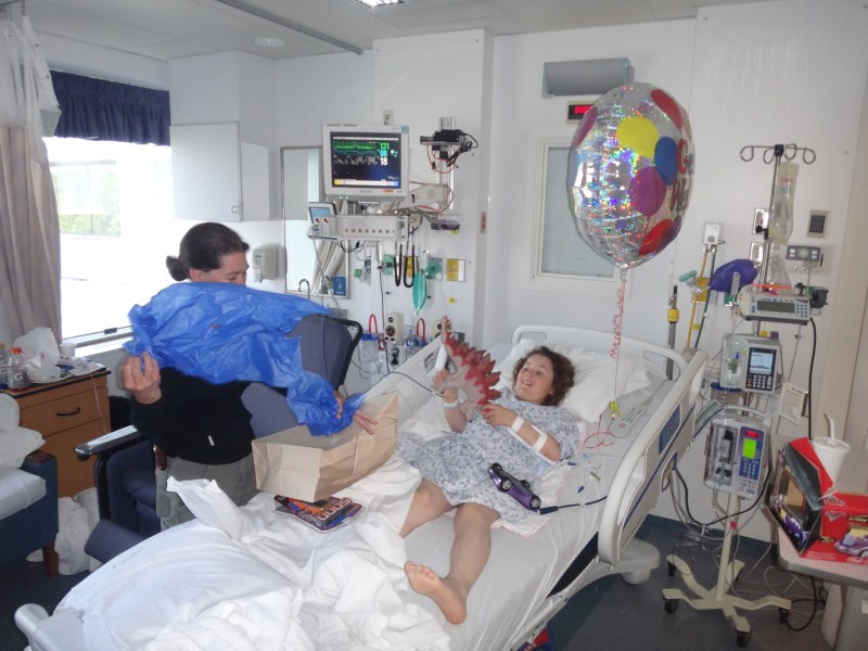
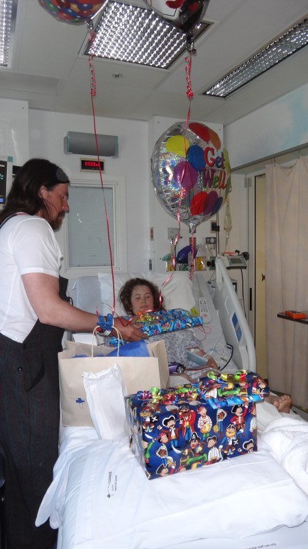
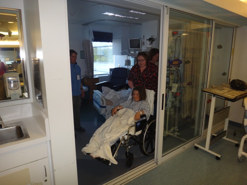
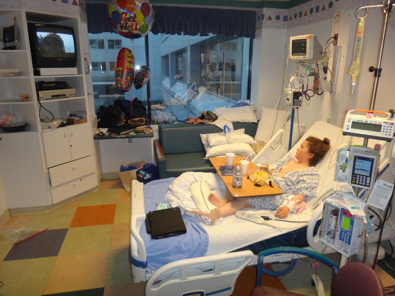
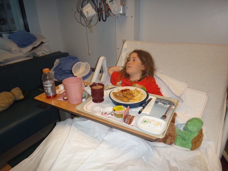
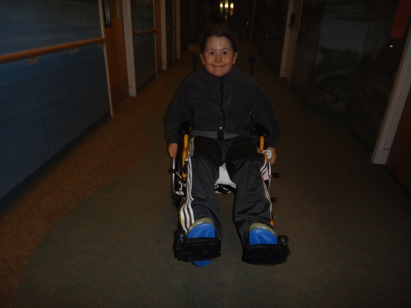
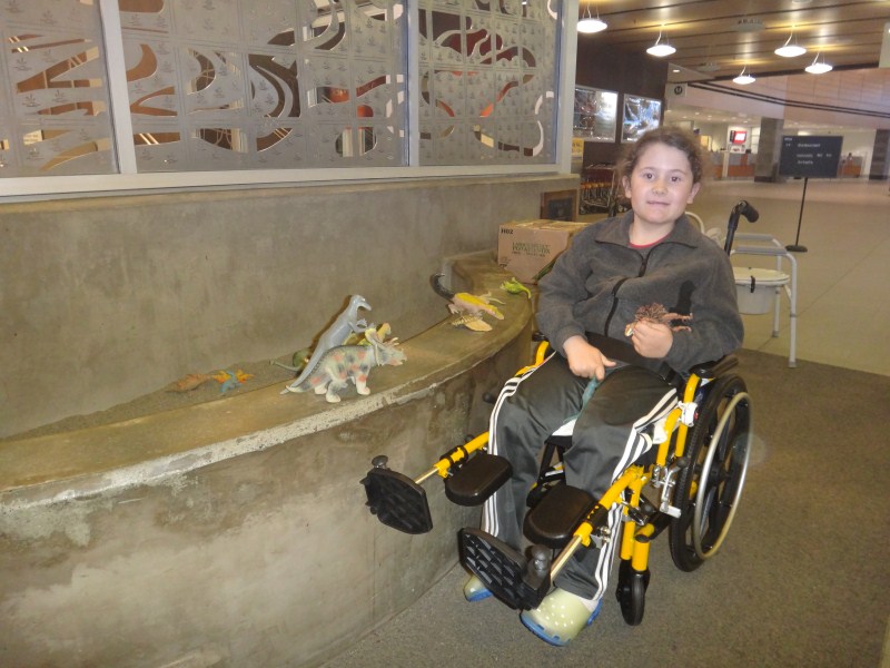
22 June 2012 -- Anchorage We began settling into hospital life. We knew that we would be here for several more days, at least until the point where Turner was eating and pooping regularly and that he had migrated from IV pain killers to tablets. I was still wearing my field clothes and likely looked pretty odd walking around in wool overalls, especially with the T-shirt I had bought in the gift store, which was cut for women and said something about breast cancer. Fortunately I had showered just before leaving Happy Valley, as it had been a week or more since the previous one. Mostly we just hung out, and it felt very much like we were stuck in a tent during a storm, except here we had room service and didnt have to worry about the room blowing away. The pediatric ward was set up for such things, and had a DVD library and digital game consoles, as well as numerous volunteers who bought their dogs, or played music, or set up arts and crafts activities. I dont imagine any of this came cheaply, but they also had staff who did nothing but manage insurance, procure wheelchairs, etc, so really it was like being in a 5 star hotel. Turner's physical therapy had backslid a bit since the X-ray fiasco, but as the doctor told me, there was really no need for him be on his feet and it was even better if he just stayed in bed, so we never pushed it. And fortunately the combination of pain medication and IV foods slowed down his digestive system, so there was no need to move him at all. And by now he was moving well enough on his own, skootching around on his bed to get his toys or whatever.
23 June 2012 -- Anchorage By now Turner was settled into hospital life nicely and was healing rapidly. We went for our first long wheelchair ride, going down to the gift shop, and outside to get some fresh air. Along the way we bumped into Billy Wong, the motorcyclist we had helped in Happy Valley the week before, who was also out for his first walk since his accident. Turner and I hung out with him, while Kristin got a lift to the local Fred Meyer with Evan and Michelle who had come to visit. We discussed life, sitting in the sunshine, and in general felt happy to be alive before heading back to our rooms. That night, about 72 hours after the accident, Turner had his IVs removed, which he was very happy about, and was now on oral pain medications and eating mostly regularly. Shad came to visit that night and reminded me that the IGS conference on glaciers was starting in a few days in Fairbanks, where he was headed tomorrow.
24 June 2012 -- Anchorage This morning I took my first shower in the hospital and put on some of the clothes Kristin bought, heading down to the ER about 6AM to catch it during its slow period and try to get some more drugs. It was almost empty and I saw a doctor right away, who basically said there wasnt much to do except try not to cough and take deep breaths. He gave me a new pill prescription, as my initial bottle was now empty. What I didnt realize at the time was that the pharmacy was closed on Sundays, so even though I had the prescription I had no means of filling it, despite being in a hospital filled with drugs. As I came down off my narcotic high, the pain and stress of lifting Turner way more than I probably should have over the past few days began to set in, and I spent most of the morning curled on the recliner taking a passive role in what was going on around us. We still hadnt discussed anything about the accident itself, and I know Kristin was feeling pretty poorly. Maybe there is something wrong with me, but I never felt any strong emotions during the entire process, perhaps because I didnt actually see the crash, so the scary part was over before I knew it happened. And in those first few instants when I heard Turner crying I knew that his pain was a good sign that probably no major damage had occurred. In any case I think one of the reasons I largely succeed in science is that the worse things get the more clearly and less emotionally I think; I'm always reminded by something Maynard Miller told me once, that the sign of a 'good expedition man' is someone who can keep his mouth shut during an emergency. Or maybe I'm just a narcissistic prick who doesnt really care about others except as it relates to my own self-image, not sure. In any case, risk can never be eliminated, at best it can only be reduced through mitigation. But despite the huge amount of effort we put into risk identification and mitigation, in the end its a matter of statistics, whether we like it or not. The way I looked at it, we had more of a car accident than an airplane accident in terms of the impact dynamics, and in this context what happened to us is much more common that we'd like to believe. Over 100 people a day die in car accidents in the US, affecting thousands of family members and friends each day, as part of over 6 million auto accidents per year in total, and this is taken as a matter of course by most people and certainly by society that largely regulates that we work and live in different locations. More than half of these accidents result in injuries and have no fault assigned to them, meaning that they were caused by people not paying attention well enough, and these days means likely playing with their cell phones rather than watching the road. I think about this every time we get into a car, and its a big reason why I work from home. Though it was little consolation, this enormous hospital was not built for or filled with patients suffering from small plane crashes in the arctic, but rather the accidents and illness we have come to accept as an invetible part of modern urban life. So even though it was tempting to believe that our accident was avoidable or preventable because it somehow seems more optional than 'normal' risks, it wasnt caused by negligence or frivolity or lack of preparation, and as things go I still believe we are much safer in the remote arctic than we are in civilization. And I know that the hundreds of flight hours of training that Kristin has put in over the past several years prevented things from being worse, both then and in dozens of similar circumstances previously, and I have never seen a pilot take off without his or her full concentration on the job at hand, whereas you can stop at any traffic light and see drivers concentrating on the wrong things. And at the risk of being fatalistic, there is really no telling whether something much worse might have happened to us later in the day had we taken off without incident from Happy Valley, whether in the plane or on the drive home from the airport. So all we could really do is treat it statistically, reassess the risks, add new mitigation protocols to our list to help keep us that much safer in the future, and focus on the job at hand.
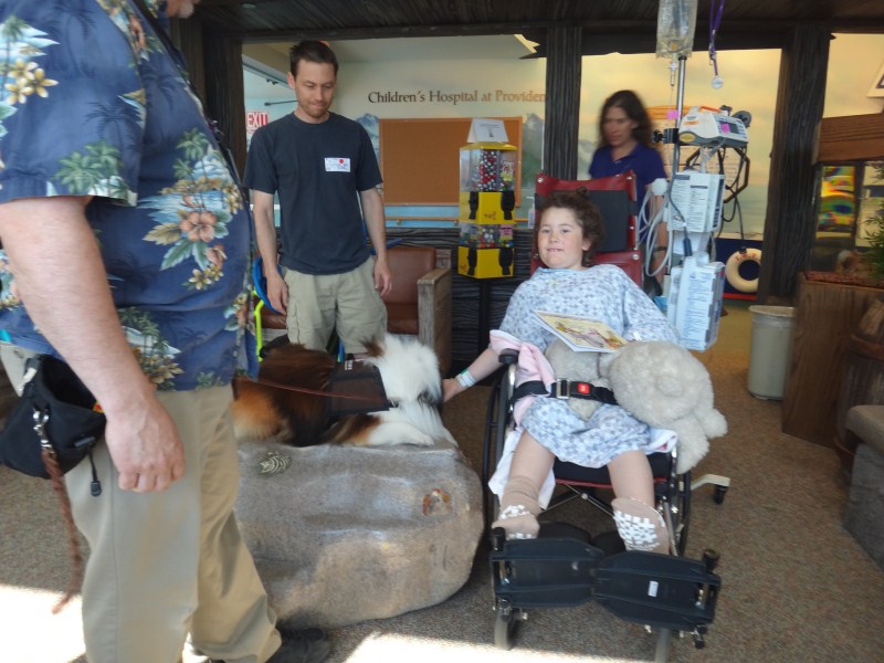
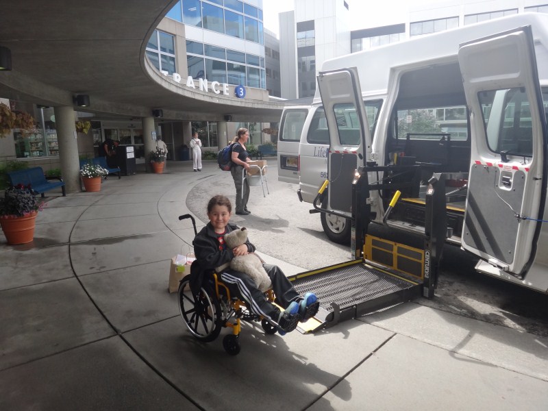
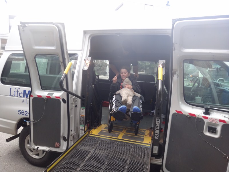
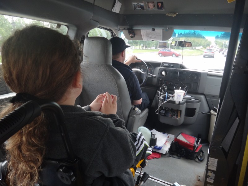
25 June 2012 -- Anchorage Today it became clear we were in the end game for our stay here. The doctors were fine with us leaving as soon as we were ready, which largely was a function at this point of our ability to move Turner from place to place on our own. Given how well thought-out most of the pediatric center was, one thing that was out of place was that the beds could not be lowered enough such that a child could step off of them. So a small footstool was required, and this was awkward for transfers to wheelchairs, walkers and potties, which were at different levels, both from the patient and parent perspective. But by now we had given up trying to get Turner to stand on his own, as it was clear that he was comfortable enough physically to do it as he was doing gymnastics in bed, we worked on simply carrying him from bed to chairs, and this was going smoothly. We lined him up with a kid-sized wheelchair which we could take with us back to Fairbanks, as well as a walker. We also had to deal with the logistics of actually getting back home. It seemed that commercial air was the simplest way, and I found a flight the next evening that still had 3 first class seats available for only $30 more, so we planned on that. The hospital discharge technician lined up a wheelchair van to take us to the airport, such that Turner would not have to leave his chair until we were boarding the plane and we also lined up something similar on the Fairbanks side. So five days later we were all feeling ready to go home. 26 June 2012 -- Anchorage We spent today preparing to leave. The final blood tests were in and we had the OK to go. There were many loose ends to attend to, it was good that our flight was in the evening. Turner was still in great spirits, as usual, as we checked out and headed into the van. He never mentioned anything about the accident itself or what caused it, so we never brought it up, but once while I was talking about it to someone else he asked that we not talk about it in front of him, and that was the only indication we had that he really even remembered it. I'm biased of course, but I have to say that he must be the bravest boy in the arctic. He is so incredibly trusting and easy to please, and we got numerous remarks from the emergency response personnel about his calm and cool demeanor. Even when he was obviously stressed and scared about moving, he tried to choke back his tears as he asked us politely to please stop what we were doing and let him do it at his own pace. And literally within seconds of these scary moments ending, he was back to his happy self and joking about this or that. I couldnt imagine anyone having a better attitude than Turner, whether to do with this incident or in general. It sometimes caught me off-guard seeing him hug his stuffies, reminding me that he is only six years old. In any case, all of this is just to say that our first real indication that Turner had some emotional scarring from the accident was when we started driving away in the van, he crossed all of his fingers and was clearly concerned about a car crash, though he put on a brave face and tried to keep all of this to himself.
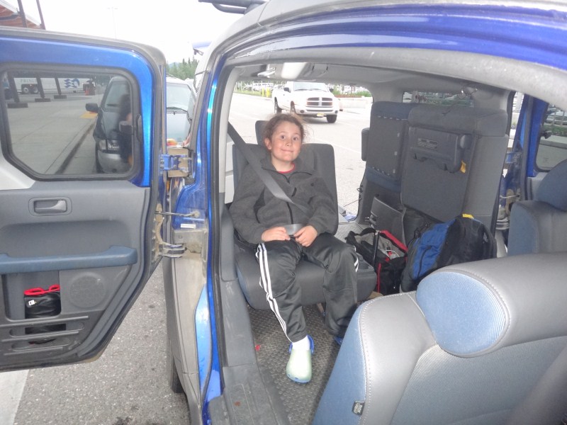
In any case, we arrived at the airport without incident and made it through security without a Turner having to do naked jumping jacks. But once at the gate we found that our plane had been delayed by more than an hour, which was problematic because the wheel-chair van that we had lined up would not be available by the time we arrived. So we had to make the decision whether to find a new way from the airport or postpone our departure until the next day. We decided to line up an alternative in Fairbanks, and Tad graciously agreed to meet us at the airport to provide some additional muscle should we need it; he is an early riser and is normally in bed by 6PM. As it turned out, it was pretty easy to get Turner into the Element in a two stage process, first by getting him sitting on the floor and then lifting him into the seat. Tad and his dog followed us home and got us inside about midnight. Here we quickly learned that the inverter/charger had died, causing the DC refrigerator to drain the batteries dead, causing the food to rot. Since most of the living room and kitchen was still being run through the inverter, no power worked here either. So I spent an hour or more rewiring the house so that we could get lights, TV, and internet functional, only to find that the phone was also dead. But by this time it was too late to deal with, so I spent a few hours in the morning dealing with rewiring the DC refrigerator and water pump to work off the AC power and then getting the phone and internet working again. It was noon before we were somewhat functional, and I checked my email for the first time in a few weeks to find over 2000 emails waiting, most of which were junk even after 5000 other spam messages had automatically been filtered out.
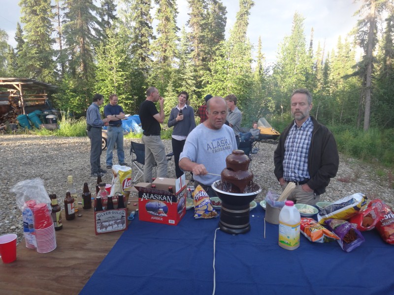
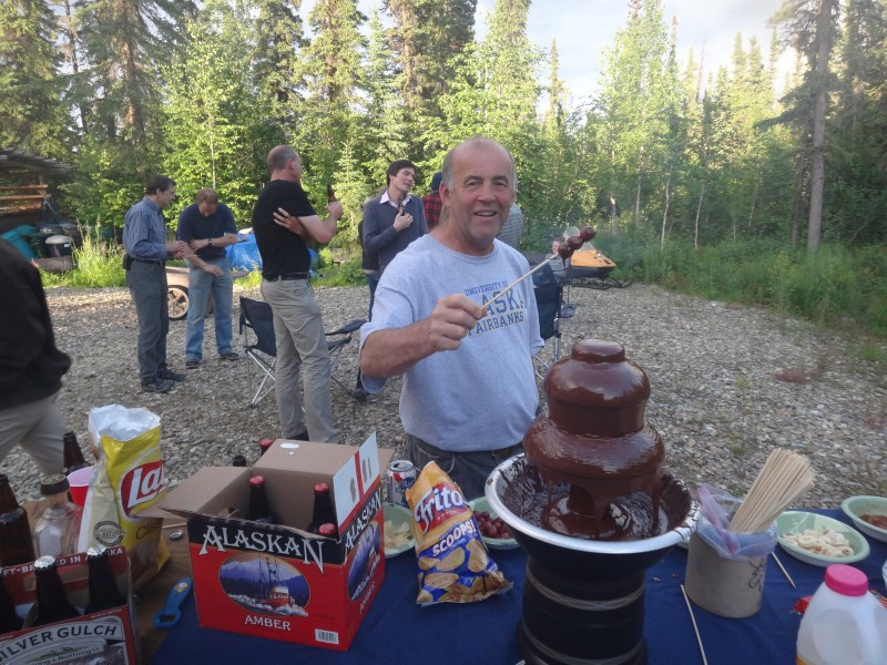
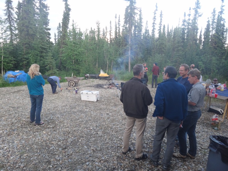
04 July 2012 -- Fairbanks So now it's a week after our return from the hospital and two weeks after the accident. Turner is walking fine without pain, though we are still taking it easy. We had a meeting with Kevin the insurance guy, with whom we had become friends after our accidents in 2009. He came to house and showed us some photos of the plane he had taken when he drove up to Happy Valley to check it out and bring it back. It had suffered extensive damage. Even parts of the plane that had not directly contacted anything, like the wings, had taken some shock. It was the first time we had seen pictures, and while in Happy Valley we had no time to check out the scene. We discussed some of the possibilities for what happened, but nothing conclusive came up. The general impression we all had was that the winds likely changed during our take-off roll. My non-pilot suspicion is that we were essentially airborne when Kristin decided to abort, and this was masked by the tail not coming up in the way it normally would, so likely being lighter on our wheels than we thought during the take-off roll conspired to lengthen the distance needed to come to a complete stop while shortening the actual distance available. The skid marks leading to the ramp showed that we were skewed and trying to turn when we hit it along side, and likely our turning ability was reduced by braking hard, lightening the steerable tailwheel, and by killing power, reducing rudder control. It was clear that had we been only a foot over or several feet further along, we might have avoided the impact altogether, and all kinds of minor things could have easily happened differently to give us that room, but luck was against us. And given that something was odd, there's really no telling what might have happened if we didnt abort at the planned spot, as hitting something while airborne at full power is bound to end poorly. I dont remember where I first heard this, but it has always stuck with me, where the experienced doctor says to the student "I can teach you how to remove an appendix in a day, but it will take me four years to teach you what to do if something goes wrong". There are no guarantees in life, the best we can do is identify risk and attempt to mitigate them to an acceptable level through experience, training, common sense and skill. I'm fortunate that in my research, most of the mistakes I make are caught by me before anyone else notices, and in any case do not lead to any physical harm. I would guess that probably more than 1 in 10 landings or takeoffs I've had with even more experienced pilots have had something unexpected occurring that could have resulted in damage, but due to luck and skill usually did not, though I think I'm in double digits now in terms of aircraft accidents over the past 20 years. So this wasnt my first rodeo and I doubt it will be my last, but I'll take my chances flying in the arctic over driving to the supermarket any day. Flying an airplane, just like driving a car, is like pulling the pin from a hand grenade and only constant vigilance to keep your hand from releasing the timing mechanism keeps it from going off, and even then the risk of dropping it can never be fully mitigated. What I do know is that those flying small aircraft in the arctic are paying much more attention to keeping their grenades from detonoting than most people driving cars to the supermarket, and any sane person examining the statistics would be justifiably terrified about picking up their next gallon of milk. That is, from my warped view, driving to the supermarket is like someone else playing russian roulette with your brain, where you have no way to mitigate the primary risk -- your fellow drivers, whereas flying in the arctic is more like shooting a rifle at a target -- things can go wrong, but most of these things you have a lot of control over, including not loading the rifle or not pulling the trigger. In any case, after getting the house more or less functional, I joined the glacier conference that was going on all week in Fairbanks. I felt a little Mark Twain saying that rumors of my demise were premature, as everyone there was aware that something had gone wrong with our field work but clarity was highly variable. It was nice seeing everyone again and thinking about the latest developments in glacier study. I only made it the last two days and was not planning on joining any of the excursions or social events just to catch up on sleep, but I did make an open offer for a bonfire and fireworks at our house on Friday night, which also gave us a good excuse to clean up the house, as it was strewn with debris leftover from our packing up for the last trip. This also gave us a good excuse to start the chocolate fountain, which was a big hit as usual.
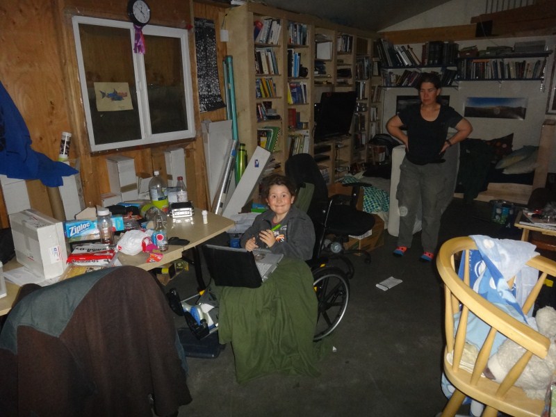
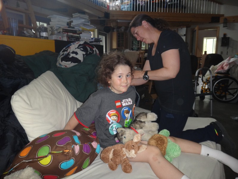
Kristin's sister Kelly spent a few days with us, but now its just us, and we have been lying low and enjoying our own company the past few days. The neighbors are largely all away and its nice to just hang out. We've been out to the movies, watched a lot of DVDs, played games and solved puzzles, eaten a lot of ice cream, and are in general delaying any thoughts of preparations for the future. In two weeks we're due to leave for a family reunion in the states, for which we havent yet bought tickets, and after we return we'll have at least 3 weeks back at the glacier and stream gaging, plus trying to finish up what remains of the aerial photography.
I think another success of the trip was Turner really becoming part of the team rather than along for the ride. It's certainly a disadvantage for him being six to make a meaningful contribution to the science we're doing, though he is increasingly eager to do so or find something similar to do on his own. But he is old enough now to know his own mind and make his own decisions about his interests, and he is certainly capable enough of derailing our efforts even if he cant contribute towards them directly. I've always felt that it's not mistakes that demonstrate people's character but rather what they do next. Turner never gave any sense of recrimination or anger or really even frustration at his injuries, which were clearly out of his control to prevent. Rather, he never lost stride, almost as if this was an expected or normal situation, accepting his current limitations without complaint. He was so upbeat that it is tempting to think he wasnt aware of what happened or that he was blocking it, but spend enough time with him and it is clear that this is not the case, as his near-encyclopedic memory of everything reveals itself regularly, often when he's telling stories to others or correcting his parents about details. Rather, like his mother, he is simply tough emotionally, able to accept what cant be changed and look forward to what can be. In the past two weeks Turner made clear to us, through conversation and action, that he is a part of this team, and willing to make necessary sacrifices for the team, whether that's occupying himself for 8 hours in a plane day after day or recovering in a hospital room, and that he wants to keep it that way. And I think at this point his commitment and courage has earned him the right to begin making meaningful contributions to our team's future direction. What happens next in terms of our interests
in aerial photography and airplane operations is unclear. Initially, our
interest in flying our own aircraft was stimulated by a need to both control
access to an aircraft and to reduce costs, especially should funding run
dry. I found funding for the plane from a generous friend, who wanted
to donate the money or the plane to the University, but the University
didnt want to own an aircraft, so we formed an LLC to own it and found
another friend to own most of that LLC, such that our family fraction
of the company (5%) was below the ethics rules governing conflicts of
interest in University (that is, State) contracts. Then we have to lease
the aircraft to yet another company that will then in turn let us use
it how we want provided we personally underwrite all of the substantial
expenses, such as insurance, maintenance and operating costs. It's all
a convoluted, time consuming, and expensive process, not to mention all
of the time and money spent training, upgrading the aircraft for science,
etc etc. The emotional investment is high too, as Kristin has had to quit
several jobs in her career, making as much as I do, to get the time to
work for free for us. At the moment I cant say that all this blood, sweat,
and tears has yielded a positive return on our scientific productivity,
but we're probably close to breaking even. For example, we flew about
40 hours on this trip, but only charged 16 hours to a project. Or in 2009,
when we spent the summer living in Kaktovik, and Kristin flew the supercub,
we could afford to make frequent day trips to the tundra or glacier throughout
the summer rather than one trip from Fairbanks. In terms of economics,
we could have bought a second home with what we have personally invested
in this research. The real question is whether we're still doing all this
for the right reasons, something we revisit regularly but havent reassessed
since the accident. Is this an opportunity to bail from a sinking ship?
Or is this an opportunity to renew our commitment to the process? I guess
its both. But I guess in some sense it doesnt matter either. I think what
we have proven to ourselves is that our family is willing enough to both
ask and answer such questions in an informed and intelligent way, that
we are courageous enough to stick with the resulting plans even through
the darkest moments, and that while our interests in arctic science are
sincere they are not larger than our interests in pursuing our own path
in life with integrity and cohesiveness. So while it's hard to predict
what we'll be doing five years from now, I think it's clear that our experiences
together have strengthened us and brought us closer to seeing how the
world really is, rather than how other's would have us see it, and I have
to believe that this is a good thing for us, as well as perhaps for others.
|
(c) 2010 Matt Nolan.
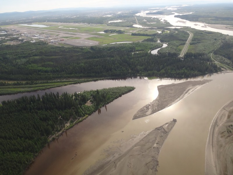
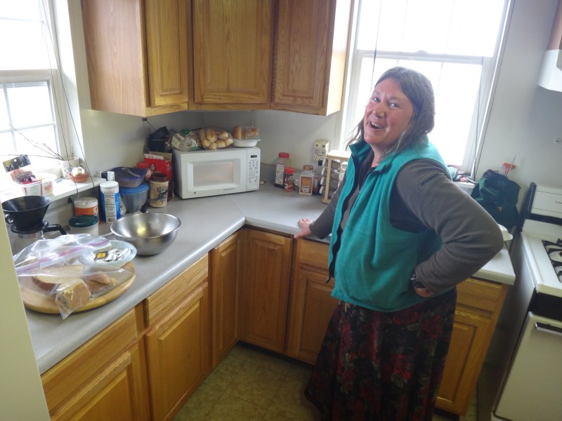
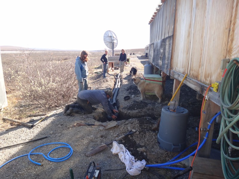
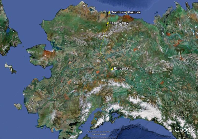
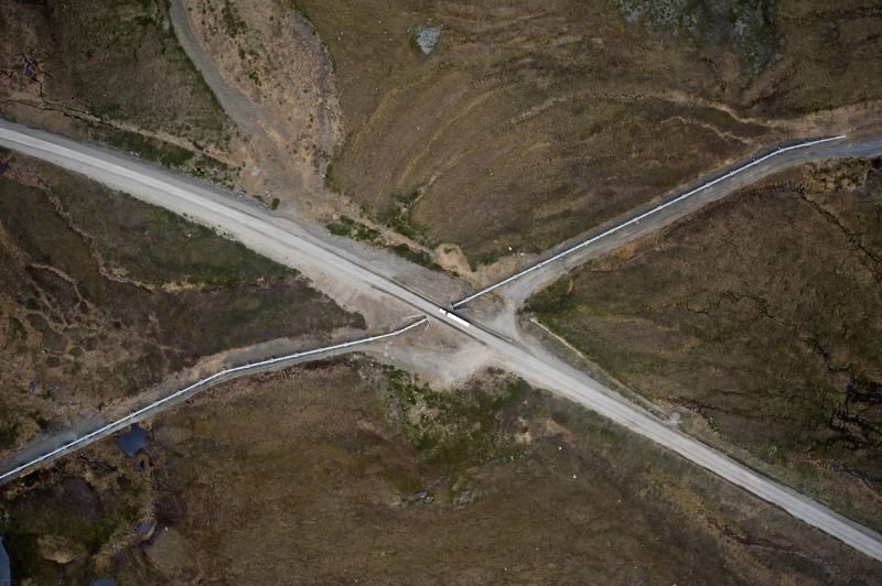
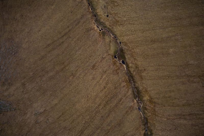
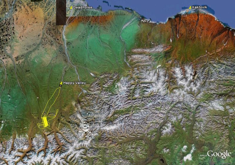
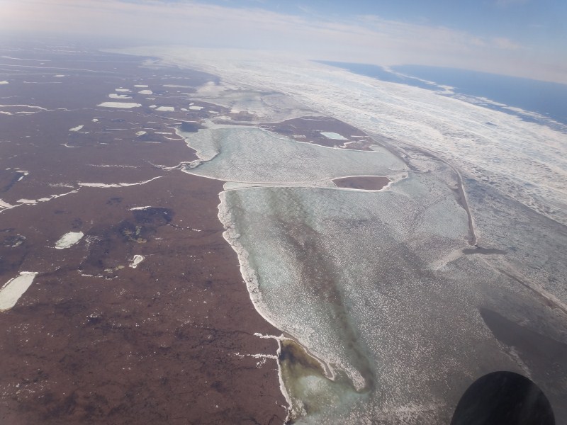
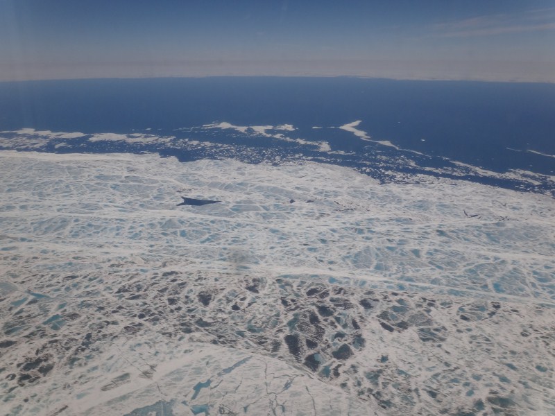
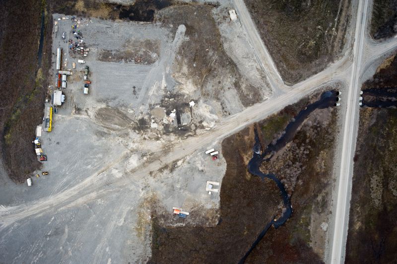
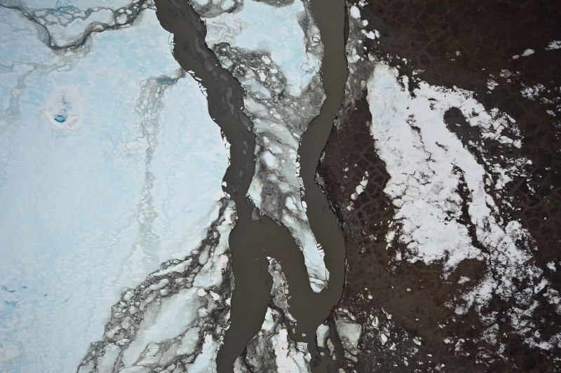
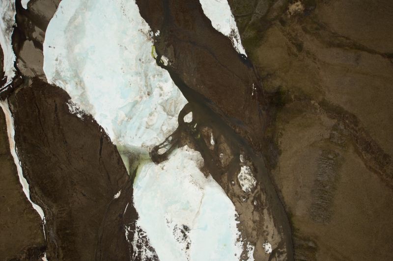
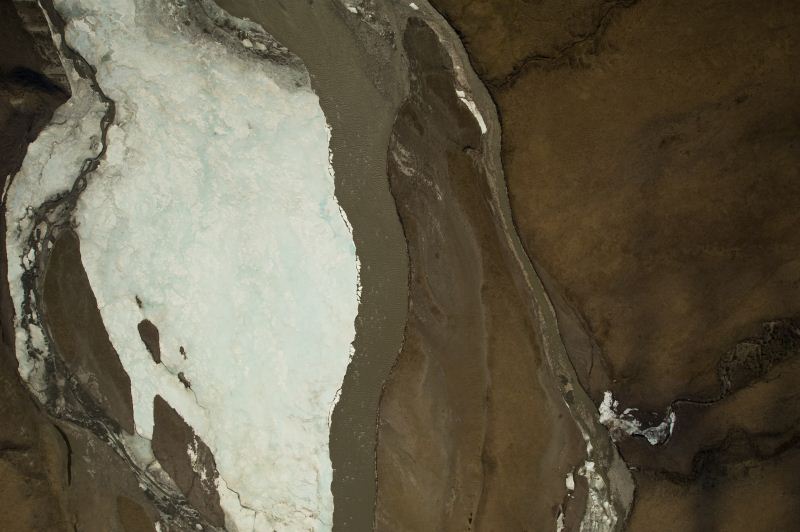
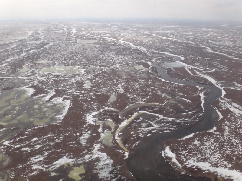
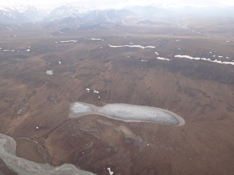
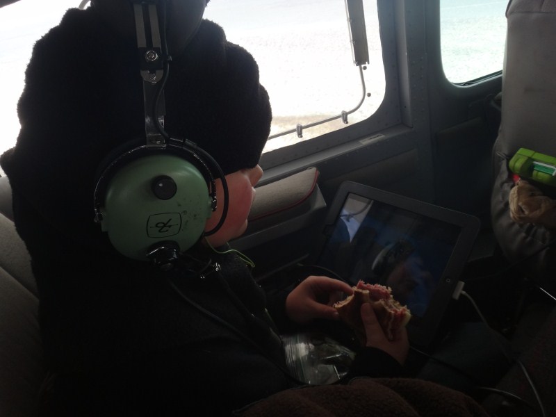
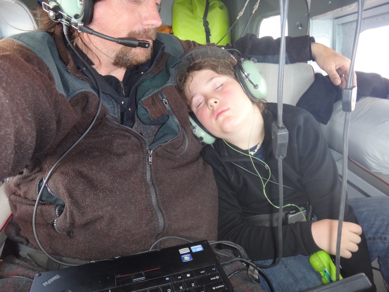

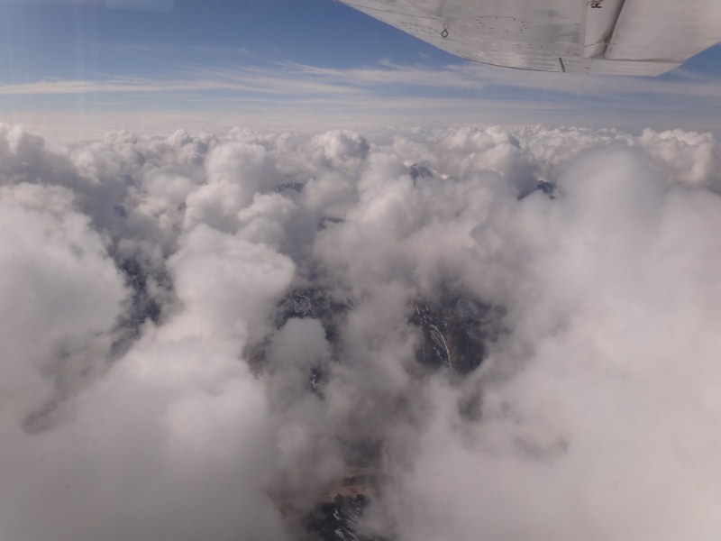
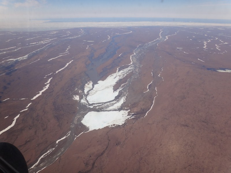
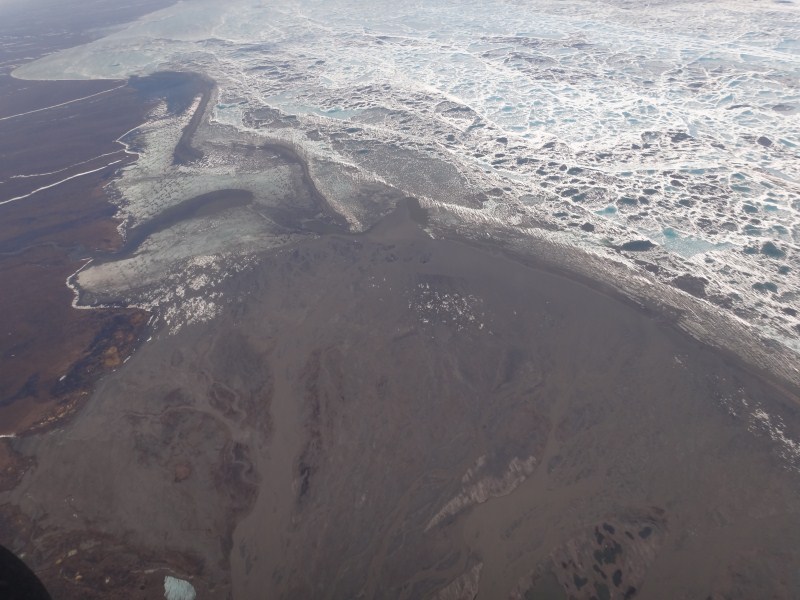
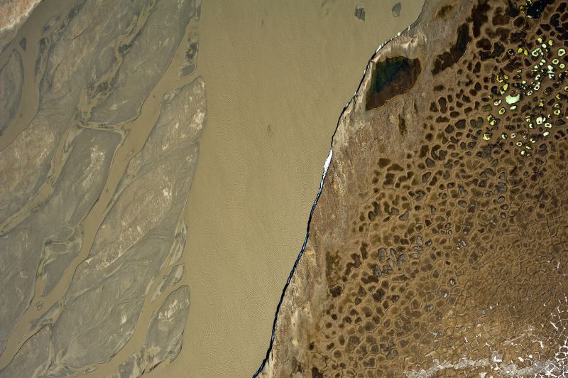
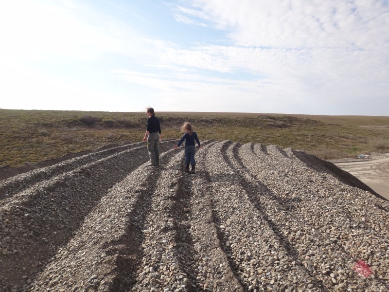
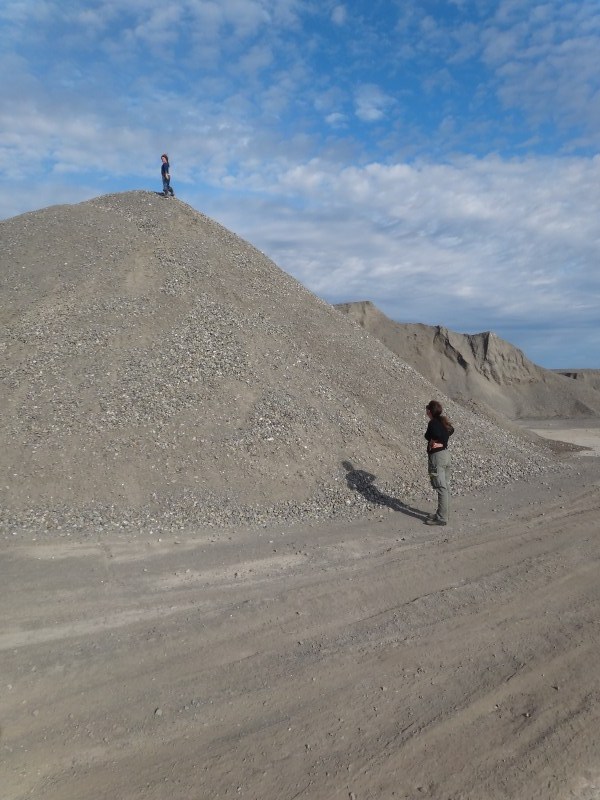
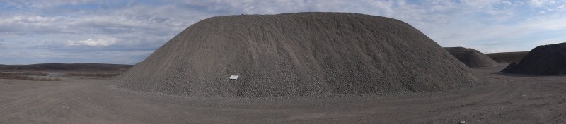
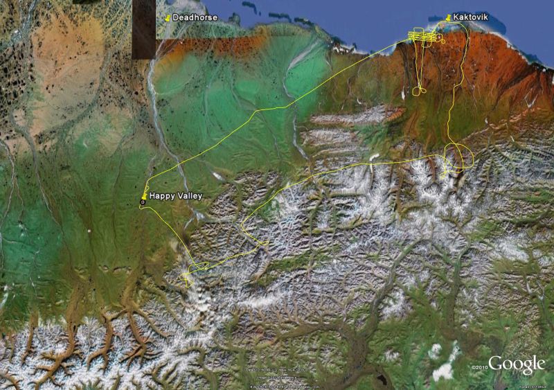
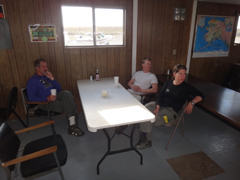
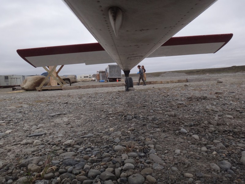
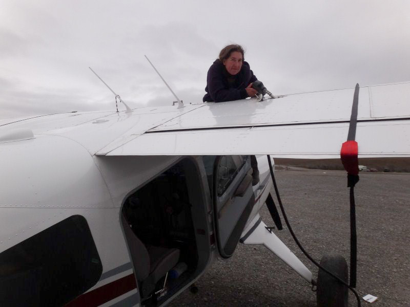
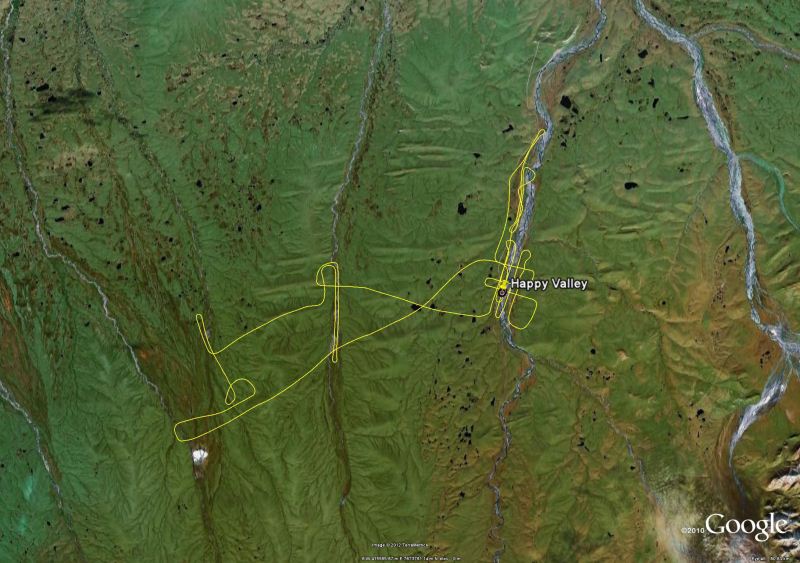
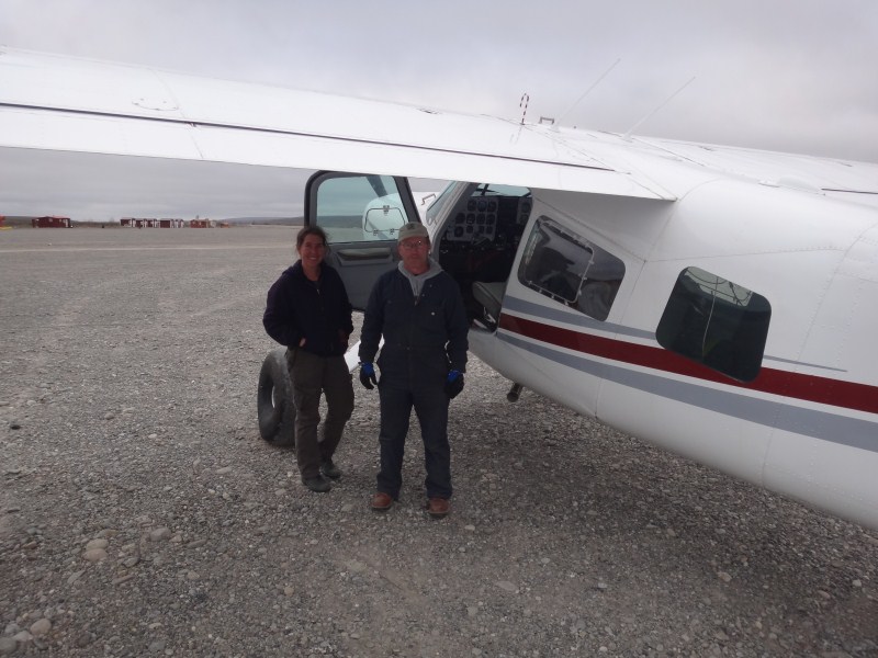
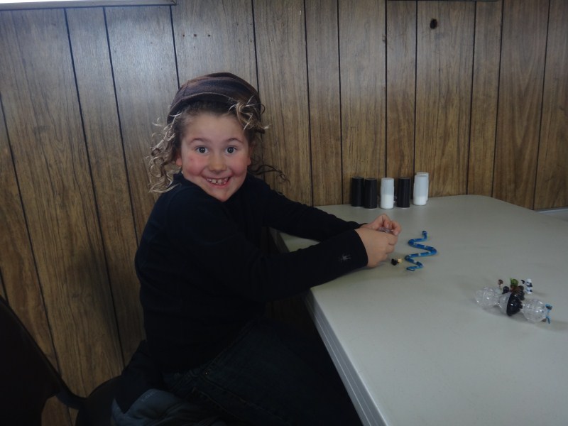
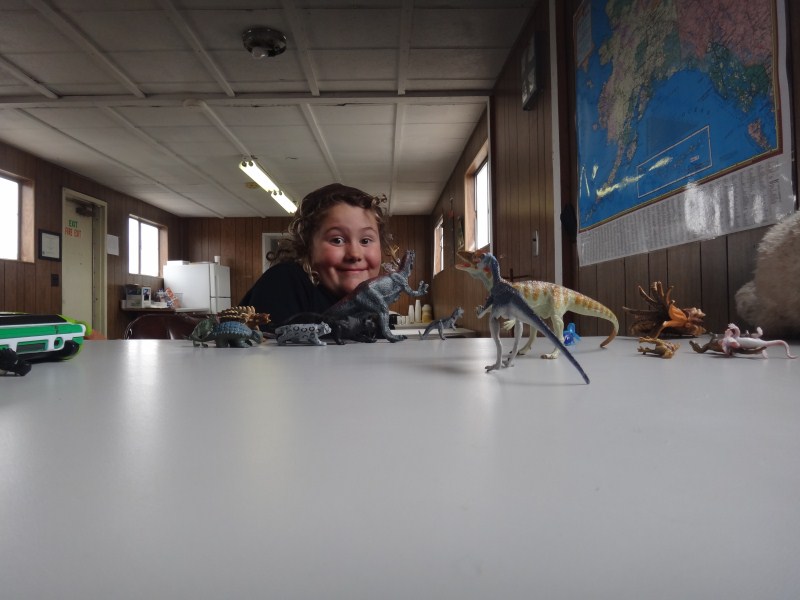
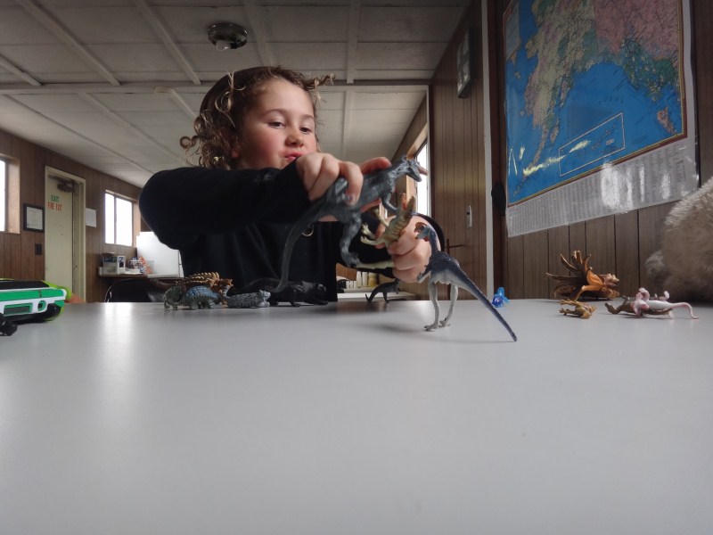
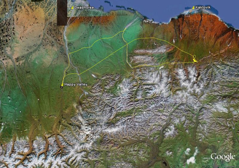
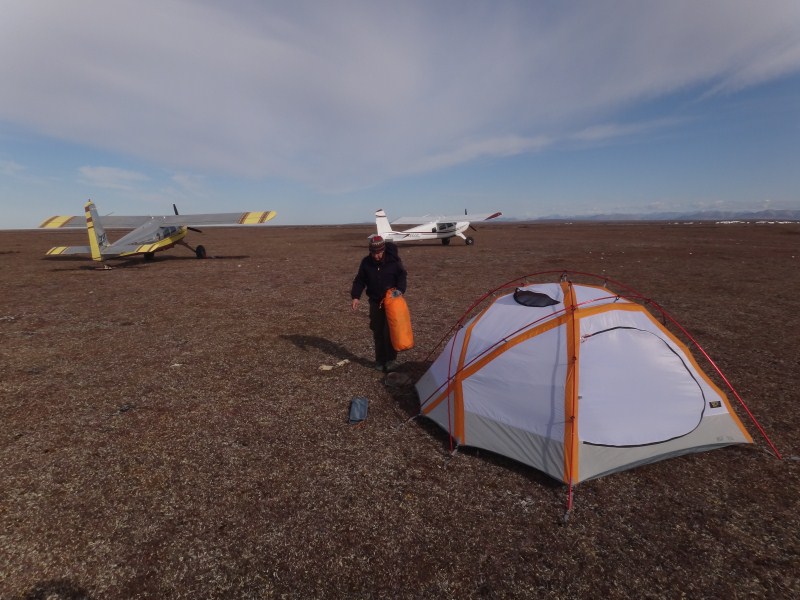
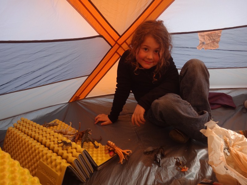
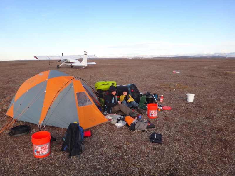
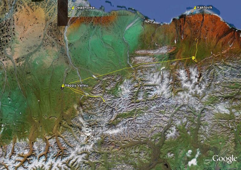
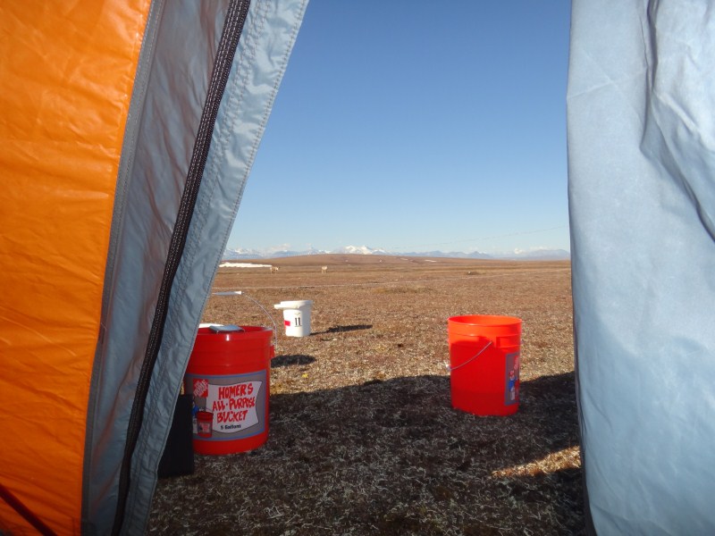
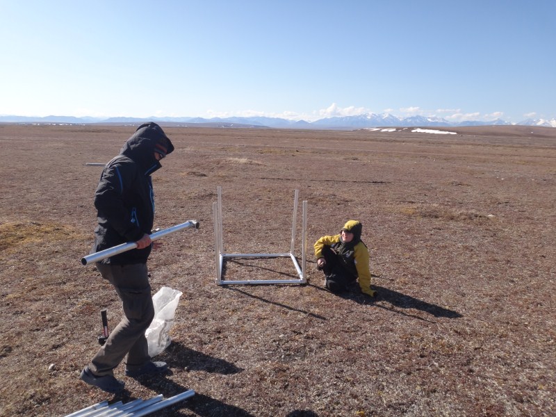
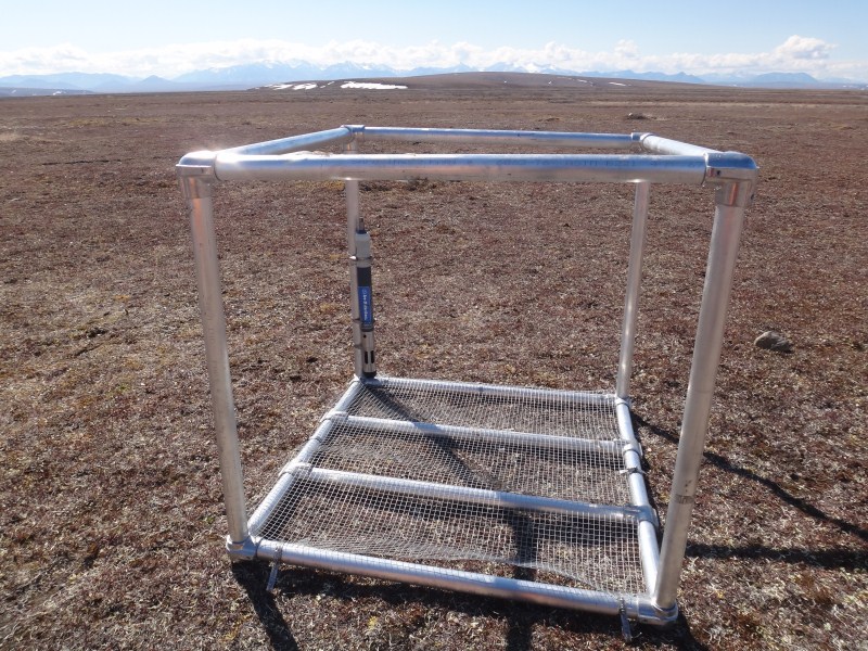
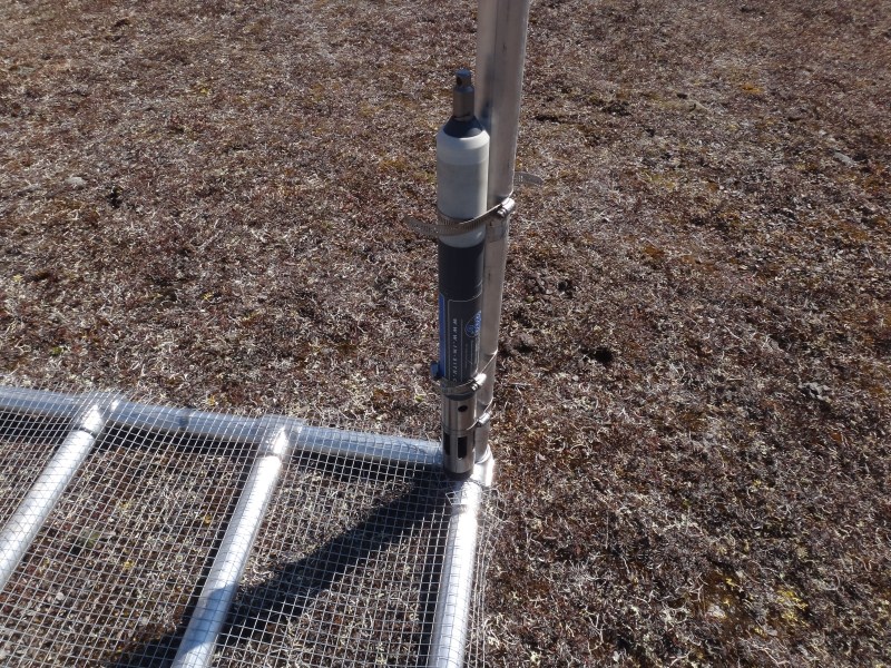
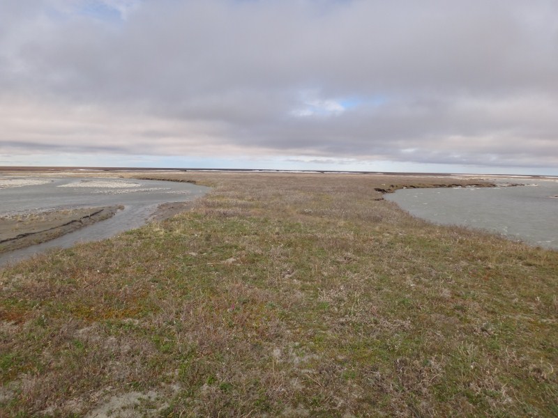
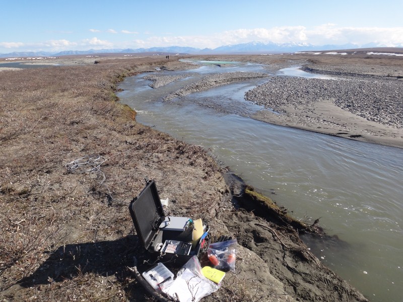
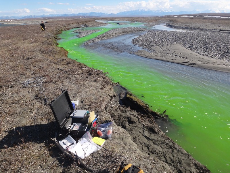
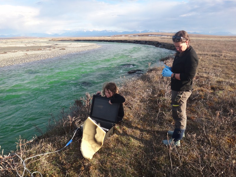
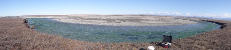
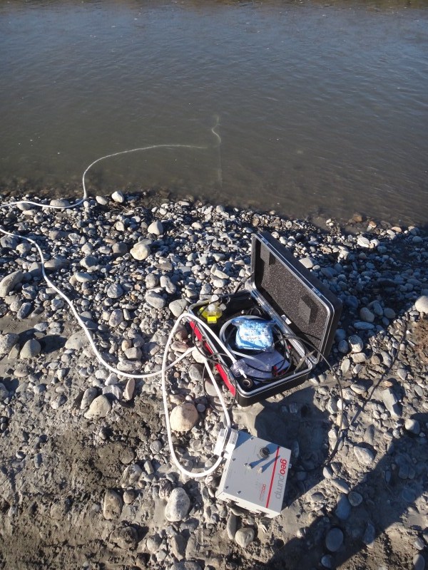
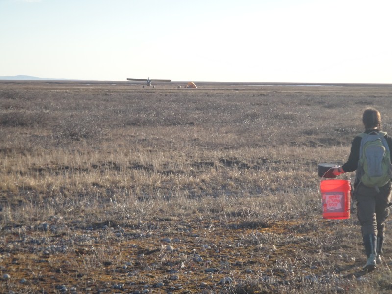
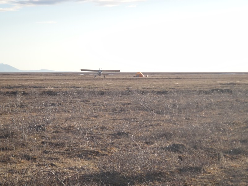
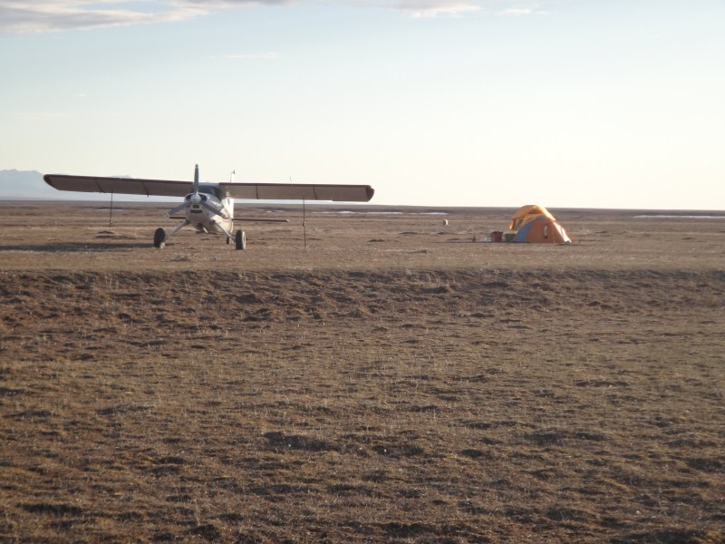
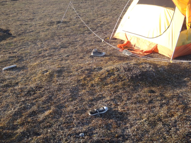
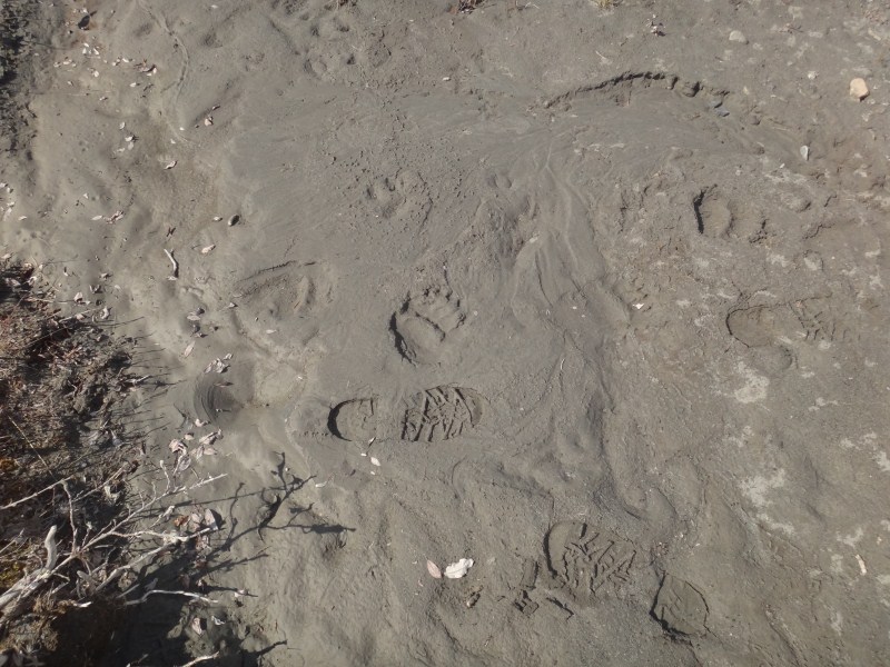

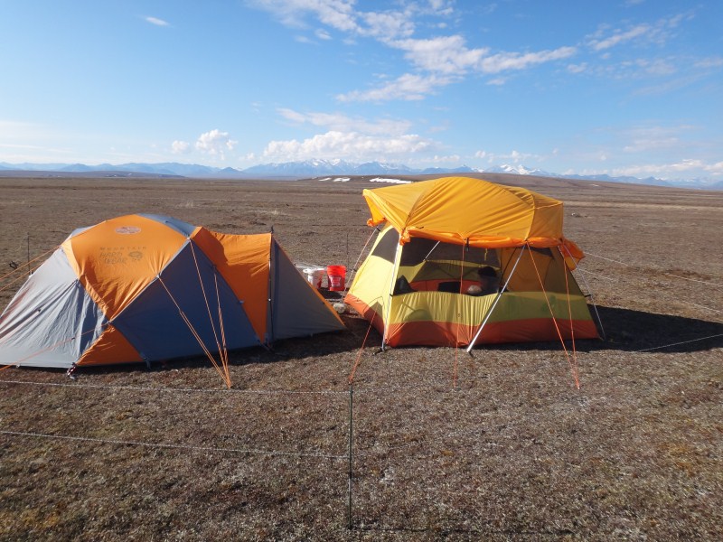 I
bought this tent because I like looking outside, and this tent was designed
to accommodate that. We nearly lost it in the strong wind of the last
day, but this was more due to the tent stakes we were using than the design,
though it does catch some air.
I
bought this tent because I like looking outside, and this tent was designed
to accommodate that. We nearly lost it in the strong wind of the last
day, but this was more due to the tent stakes we were using than the design,
though it does catch some air.